A Softer Ride
OS Landranger 177
Another glorious morning in north London when I woke up with a call to arms. Some weeks had passed since the last sortie to the coast with the bike. I hadn’t woken with any specific intention in mind, but within a few minutes I’d formulated a plan that wasn’t going to involve navigating across London to a central railway terminal, and then an hour or more on a train. I wasn’t that organised and the thought of preparing some interesting sandwiches, and then mapping out a route before 10am, didn’t much appeal.
So, ad lib. Some months earlier I had cycled through north-east London from Stratford to Woolwich and then on the south side of the Thames to Erith. It’s worth mentioning, for the benefit of other cyclists or walkers, that the Greenway path from Stratford to Beckton that allowed me to undertake this ride is just waiting to be exploited. Running for several miles above the route of the big old Victorian sewer that cleaned (and still does) the waste of millions, and rising above the roof tops, not only is it an almost direct link between two very different parts of London, but also gives views in all directions that you don’t get anywhere else.
I figured that in the time available I’d aim to get beyond the Queen Elizabeth Bridge at Dartford before seeking out a train back to London. To achieve that I decided not to start with the Greenway but instead cycle the odd mile to my nearby station, take the Overground round to Barking, and then cycle what I estimated was just a mile or so to the Woolwich ferry.
The train arrived on time and 30 minutes or so later pulled into Barking station. Slightly unfamiliar with my surroundings I set off in a vaguely southerly direction, but after some time turning the wheels I began to worry that I was heading blindly in a completely random direction. And, on checking the phone map, it seemed apparent that I was! Some navigational changes and after some further progress on hideously busy roads I found the connecting one that runs past the Beckton Alps (ha!) and then the site of the old, and now obliterated, Beckton Gas works (where famously Oliver Stone convincingly recreated the Battle of Hue in “Full Metal Jacket” and Oasis asked us if we knew what they meant – which of course we didn’t). Then, on through to the bridges over the waterways of the Royal Albert Docks, where London City Airport provides a relatively new form of transport in and out of the Smoke, and finally into North Woolwich. It’s all exotica around here – believe me!
Shortly I arrived at the slip road running up to the north bank ferry entrance, with some three or four extra and unpredicted miles behind me, and at around 11am. All good, and just a few minutes or so before a ferry would arrive and take me and the others the short hop over to Woolwich on the south bank.

I once used the ferry on a random ride and was standing at the opposite terminal entrance waiting for the barrier to go up. Some sort of hold up on embarkation. A family were parked up in an adjacent car with the windows open and conversation flowing, excitement in the air at the prospect of the crossing. The adult female in the front passenger seat turned to the male and asked if there would be a restaurant on board. The man gave a moments thought, and then answered slowly, slightly unsure, that he didn’t think there would be. I nearly burst out laughing, but then had a slight shudder at the thought that maybe the first time I used the service I may have had the same hope.
Back in the present and gazing east and west then east again and suddenly from around the sweeping bend of the Thames something vast, beyond immediate comprehension, was edging into view. My initial thought was, what I, (and the guy next to me who was quickly pulling out his phone camera), were witnessing, was a new multi-storey block of flats being pulled up the river and intended for bank-side insertion somewhere upstream in a new aspiring part of central London. It would at least explain how some of these new developments quite literally seem to be sprouting out of the ground in many areas of the Capital.
Actually, that’s not really what I thought. It was obviously a huge cruise ship heading towards town, and was making rapid progress towards the two small vehicle ferries which continued to hip hop across the river, until it was clear that any further hops would result in the immediate long-term closure of the service. The vast structure of the Viking Sun, with its infinity pool at the stern, loomed above us as it glided between the north and south terminals, being pulled and pushed by two large, and obviously very powerful, tugs, and then on west and towards the Thames Barrier. Even at a distance it dominated the landscape.
The event was magnificent, unexpected and in many respects quite surreal, although I rationalised that only half a century ago, and in my lifetime, similarly large, and possibly even larger vessels, would have been a daily, maybe even hourly, sight along this stretch. Well – no one was throwing out the confetti and raising the bunting here, and once it was safe the little open decked ferry loaded up and set off south, completing its neat mid-channel pirouette, before docking on the other side. This is a free service but I have rarely seen other cyclists using it. Why this is I don’t know, but as a satisfactory means of getting across the Thames, a good few miles east of Tower Bridge, or the Greenwich foot tunnel, it scores highly. But a warning, in case you are on a long journey and have factored in refreshments and a lite bite on the crossing, don’t. There really is no restaurant or café and it only takes about four minutes.

Once I had disembarked on the south Woolwich side, I set off on the days journey. And just a reminder of the optional rules. Staying as close to the coast (or tidal limits of a river) is the first rule. There aren’t any other rules, but I already knew from my earlier journey to Erith, that the first section would allow complete compliance to the first and only rule. That said, and not forgetting the other ambition (not a rule), which was to carry out a visual assessment of residential retirement opportunities and associated communities, this section had already been discounted. Escaping the Capital a necessity.
Which of course just begs the question – why bother with this bit at all? Good question – no logical answer. Because it’s there?
The route from the south terminal to the river is short, but a bit confusing if it’s the first time. There are signs, but the little wiggle through a small industrial/office area can be off putting. Once the river path is achieved you pass an area of major residential redevelopment (on-going at the time), and very soon you’re at the old Royal Arsenal barracks, no longer used for military purposes, but an attractive and historical point on the journey (even if there is a lingering, and some might suggest, unsatisfactory association with a north London football club).
Proceeding further east, and past areas that have clearly undergone significant new residential development in recent decades, you notice the Thames widening bit by bit, foot by foot. Whilst the tide still ebbs and flows, this is where the river begins its ending, and the sea starts to exert its dominance. This is the start of an enormous bend that heads north, then east and then south towards Erith. Throughout, the cycle path hugs the bank of the river (or coast depending on the definition) and works as well as any coastal cycle path can. Flat, wide, pretty straight and well maintained. What this means is that you can cycle yard after yard without giving a seconds thought to the sort of things that can catch you unawares and unaccountably pitch you into thorns, nettles, or in the worst case, the nearest water source. And instead, depending on your confidence, you can ride, hands free if you wish, lengthy distances with eyes right or left, and taking in the sort of things and events that otherwise might be missed.
To be entirely honest, on this particular day not a great deal of interest was observed, either to the left where Gallions Park, and extended scrubby land, stretched for a mile or so, or to the right on the water where, on the previous foray, two or three freighters had passed by, and then the rather surreal sight of a highly decorated (red and gold) barge, of Tudor antecedence, being rowed up the river and towards London. So nothing like that today but making the most of the conditions I rode on past housing estates at Thamesmead before coming to the huge sewerage works at Crossness, fronted up by a Victorian building erected in the time of the great Joseph Bazalgette, without whom it would be impossible to imagine what London, and our lives, would be like now (you can surmise here that nothing of note actually occurred as I add in some gratuitous historical padding to the narrative).
After the sewage works the bend in the river starts to turn south-east. On the Essex side of the river to the north, evidence showing of where some sort of old landfill site or quarry has been reclaimed and a significant landscaped hill rises. In front, on the banks of the river, stands the Tilda factory. In case this isn’t a universally known product, the specialism is rice. I cycled that stretch of the river two or three years ago, and nearby, where the water meets the land, a number of Second World War concrete barges are tied up, rotting away slowly with each season and every tide. If you are interested in this sort of thing, and don’t know already, these small boats were used on the beach heads during the Normandy landings. A curiosity across the water, and what with Tilda’s association with sub-continent cooking, you could say that when in Rainham, don’t miss out on the Onion Barges (or is that Concrete Bhaji’s?). Okay, I can’t tell, never mind write, a good joke, and this one (no I know it’s not) was cooked up when riding past the Tilda factory, clearly in some sort of hallucinatory state, and left, neatly filed away until now. So, just to be on the safe side, I go to Google to double check how to spell Bhaji and for the hell of it, type in “Concrete Bhaji.” I am now deeply troubled because these two disparate words take you to a page called “Images for Concrete Bhaji.” I’ll just leave it at that because I really can’t explain, and can’t be bothered to even understand how that works.
Back to a sort of reality, and I continued south, now with industrial estates to the right, and the strong smells of industrial processing playing with my senses. The river view here is impressive as the sweep of the next bend down towards Erith comes into view and then beyond to the first peek of the Queen Elizabeth bridge. Whilst the path was still in good condition here, there was a need to keep a closer focus. There was an increase in the detritus of petty hooliganism and crime. Broken glass that can shred a tyre, bits and pieces of things that might, or might not, have been parts of redundant (sorry – stolen) mopeds, and the small sites of where things like tyres, trolleys and stuff had been set fire to. At one point the path climbs severally over some sort of conveyor that leads from a factory to a large river side concrete facility (which probably has a rather stark beauty if you’ve just drunk 10 cans of Special Brew).

Erith to QE II Bridge – with Diversion
Once past the industrial zone, the path continued into Erith and along the sides of old slipways and small harbour sites, with quite a lot of residential development, some of it new, land-side. The view towards the Dartford Crossing develops and widens dramatically here. Quite photogenic when the sun peeked through the clouds, which kept the temperature down to a more tolerable level compared to the days before. A small park with what looked like the remains of an old fort leads towards the pier! That, I hadn’t expected. Not the sort of pier you’d associate with the Victorian or Edwardian age, certainly not. Modern, functional and leading straight out into the river, and then a 90 degree turn to the right and a similar distance stretching downriver. I cycled to the point where the pier branched to the right and stopped for ten minutes to take in the view and general ambience.
Kids, and some adults, were fishing from the sides and a few dog walkers stretched their legs. Hard to date the construction but the supports were concrete and so probably not much before, or soon after the War. At the end there was a small weather boarded hut, which I’m sure anywhere else would have been a place serving posh coffee and 20 varieties of tea, but for the moment, whatever function it once served, the doors were closed. The pier was a place where the number of functions performed are few, but almost certainly rewarding, even if that’s just to watch ships and boats passing up and down the channel.
Beyond the pier the route took me inland a bit, and then along a short stretch of main road with industry to the north, and then back to the river, some fields and then, past another industrial outcrop, to the mouth of the River Darent. A minor encounter occurred at the point where the end of the town met the fields by the river. The road here wrapped round the back of an industrial site of some sort, and led to a gate that kept out vehicles from the river path. Sometime before, and thinking a bit about how the day might pan out, I’d considered the possibility that some of the locations on this section might just come with the prospect of teenagers with a bit of old fashioned attitude. Sad to even think I could have had such a thought but it was there nonetheless. As if to prove some dreams do actually come true, there, in front of the gate, were two teenage lads, lurking with indifferent intent with moped, bike and a drifting whiff of dope. A slight sinking in the heart as I mused momentarily on how vulnerable I might have looked, but it was what it was and they were between me and the restricted point that led to the fields. I cruised to the pinch point and dismounted just to the right of the pair. Immediately the one with the moped, spotting the opportunity and demanded with intent (unfair, he asked), if I had a smoke? Fortunately, I didn’t, and so was able to state the truth and with purpose shoved and scrapped the bike through the concrete and metal barrier and muttered something like “thanks boys for sparing my pathetic life.” As I cycled away on the raised path I was enriched by the reality that no crime had been committed, that it’s far too easy to stereotype and that once upon a time I’d stood at dodgy locations with others and may have appeared intimidating too. I was nevertheless grateful for the fact that if the lad had changed his mind, and realised that there was more to be gained than a cigarette, there was no way the moped was going to get through the restriction barrier.
The first thing of note at this point, apart from getting a full-on view of the Dartford Crossing Bridge, is a concrete structure that acts as a tidal barrier to the estuary. The distance between the west bank, where I was, and the east bank, where I wanted to be, was probably 30-40 yards. The hope was that the barrier structure would provide a footpath of some sort to bridge the gap. The reality was that it didn’t, and so ready for what was to follow, I cycled inland, following the sweeps of the river, and past a couple out on a midday walk.

Once I had cleared the industrial zone, and a series of tracks that showed evidence of persistent fly-tipping, the route started through marsh land, on dry paths raised above the levels. Reasonable for cycling but as the meters past the undergrowth increased in density and spread across the path. Did I say I was wearing shorts? Certainly not. With the increased foliage, came the incremental increase in minor leg lacerations. Nothing too severe, unless the aggressor was the commonly thorn’ed bramble. As small trickles of blood opened up on my shins and thighs, at least the fluid loss was being compensated by the increasing intake of blackberries. Of which, it must be said, were large and juicy, and a crop that had been giving in abundance alarmingly early this year.
After a further lashing on a particularly narrow stretch the path reached a point where it began to swing round. Unfortunately, it was swinging round back to the west and in the opposite direction to where I was heading. But this was no longer the Darent. That meandered away south and eastwards. I was now on the River Cray! Who knew at this stage where this might end up. I hoped not the source.
The Cray, which is a tributary of the Darent and meeting it very close to the Thames, along with other small, but historically important rivers in south London (such as the Wandle and Mole), all rise a few miles to the south where water held in the chalk of the North Downs meets impenetrable clay formations. When I say “rise,” I should be clear, we are not exactly talking about the Zambezi, or Amazon. These are short and narrow streams that would barely be noticed from space, but which have in their time been major forces for change – good and bad. Travelling north and into the Thames basin, they have powered industry, been sewers, and formed the early arteries of residential growth away from the centre. At many points they are invisible. Covered over by parks, housing, roads, car-parks, railways and shopping malls. But at Hall House, just a few miles south of where I now was, the Cray, only a few meters wide, snakes gracefully through delightful parkland, forming a decorative tree lined waterway in the meadow beyond the exceptionally well-preserved Tudor House (which I believe had significant connections to the Royals of the day). On a wander through this municipally run, and completely free park a month or so before, I had stood and watched small squadrons of Rainbow Trout gracefully fighting the current in the shallows of the chalk stream. Walking on, and still tracking the river, a small information board explained the wild life to be seen. I scanned but then stopped. Did it really say that salmon were using the river again and spawning further up stream? Yes, confirmed my associate family member. We were both staggered.
A second, more studied read, and the fact was confirmed. Looking again at what could only be described as an enlarged stream, the blatantly obvious was that it was neither the Esk, the Tweed, the Dee, the Don, nor the Deveron. It is true that salmon have returned to the Thames and so why wouldn’t they also try to make inroads to the rivers denied to them for maybe 200 or more years. The fact that these old highways of filth, even in living memory, have been rejuvenated is just a small glimmer that if the will is there it is possible to make a difference on the bigger scale.
Around 44 years ago, along with a load of scallies from south-east London, one of the earliest efforts in the environmentalist revolution took place – and along with others I helped preform a minor civic duty.
I’m guessing it must have been towards the end of a term when the whole of our year, not big, about a bus load, piled onto a hired double-decker bus outside our south-east London school, and set off on a diesel fuelled slow ride up unknown streets and towards the city centre. A bit like being let loose on a film set, and replicating the sort of childish antics seen at Saturday morning cinema, such as St Trinian’s, Please Sir, or other pre-Grange Hill caper type Children’s Film Foundation movies of that ilk (but not to be confused with the the TV Double-Deckers of the early 1970’s), the bus took as up towards the river. With pandemonium breaking out on the top deck, and passers-by being victims of minor taunting and the occasional lump of chewing gum aimed and directed from a top window – all in all probably an unedifying experience, never mind spectacle, but those were the times and we were on a progressive mission, even if that was far from obvious.
Decanted somewhere near Blackfriars, on the south bank, our task was to get down on the banks of the old Thames, during the few hours when the tide was out, locate, find and collect as much garbage as our little paws could grab, and pile the whole lot up for a boat that would come along later in the day and relieve the river of it’s detritus.
If you were to ask me know to pinpoint where the action took place, I’d make no effort. I know that there was a bridge (road or rail uncertain), just to our west, and huge, bleak, semi abandoned Victorian warehouses behind us, running as far as the eye could see. I’ve walked these areas countless times over the last five decades and haven’t yet made a firm discovery. I’m certain that the warehouses remain, but not as they would have looked then, and now performing a completely different, though less productive, civilising function.
The one thing that dominated the vista, and justifying the tatty clothes we’d been told to bring along, was mud. The silts and clay of the Thames basin, laid down over millennia and ready to suck our boots off. Huge swathes of the stuff that had to be traversed in the hunt for humanities waste. Almost certainly it was the mud that led to our main man, and protector, taking off immediately and without permission, and as rumour later had it, seeking out and destroying any wandering Millwall supporters innocently strolling their home turf along the Old Kent Road, completely unprepared for a one-person Palace boy assault on their territory. There were other rumours but I’d prefer to stick with this one.
The efforts to gather the crop were at times nothing less than heroic. Sorry, I mean idiotic. At one point an enormous log started to float by, going downriver. Undeterred, and now on a mission to excel at something over and above anything that could be achieved back at school, several lads threw off shoes and shirts and waded, and then partly swam, to grab the beast and then haul it ashore. Pulling it onto the temporarily dry muddy land it was if they’d wrestled and then tamed an urban crocodile and brought back the trophy. Screams and shouts of joy went up amongst the happy mud larks whilst at the same time the supervising teachers, no doubt having managed to sneak in a quick pint and smoke whilst we were dodging death with the vagaries of the tide and quick mud, made it clear that such risky behaviour wasn’t to be repeated. Yawn!
The afternoon continued to allow for further accruals to a pile of waste that was now towering over everyone’s heads. But the initial fun was waning and the efforts were tailing off. The discovery of an aerosol can was the last major highlight. The can became an imaginary rattle snake and the game was to pelt it with stones. This was an easy game and the target was achieved on many occasions as it was dispatched a few inches one way or another on each hit. Until, hit for the umpteenth time, the thin aluminium gave up the fight, and in a final exhilarating explosion, it exploded!!! A massive release of pressure from within, and like an uncontrolled whizz-bang, the can did a brief, but potentially lethal chlorofluorocarbon fuelled dance between our feet and then collapsed, defeated and promptly discarded onto the pile, but not without a nod of respect from the assembled hunters.
The Ozone, like the Thames rivers, was eventually saved, and maybe the destruction of that can on that day was a metaphor for what was to come. Sadly, and despite our heroic, though probably puny efforts on that odd day in the early 1970’s, the tide eventually came back in, and we watched in despair as each and every can, crisp packet, bottle, sanitary towel, plastic object (it’s not a new problem), condom, dumped TV, and more, slowly found its way back into the flow. The barge with the big scoop never arrived.
And then we had to go back home. The fun had gone. We were alone. It’s not hard to see, perhaps, how dissolution might set in.
Looking back now, and as disheartening as it was to know that all the efforts on that day literally went to waste, there is a certain irony in knowing now that even if the barge had arrived in time and collected the pile of garbage, the likelihood is that it would have been carried on down the river a few miles and then either dumped into a bank-side landfill site somewhere either in Kent or Essex, or sailed on further and tipped out at sea – just kicking the problem down the line.
Anyway, back to the present and just a reminder that in fact the story of the River Cray is a good news story, but just in case you really want to get to the heart of our current waste issues, and offering some options around change, set aside an hour or so and watch the BBC’s “The Secret Life of Landfill – A Rubbish History.”
And just to add that at an individual level, we should do what we can, but don’t beat ourselves up if we can’t, or feel crushed by the scale of it all. In the end, it’s economics, ideology and the commitment of the people we elect that counts.
Reaching a point where the river Cray ran under a railway bridge I pushed the bike through overgrown brambles and then onto a path and road out of an industrial estate which led to the main A206. This moment lasted only a few seconds. Crossing the river there was a road to the left leading to another industrial zone and where a path began to retrace the flow of the Cray in the other direction. The path, not that easy to traverse, continued around the back of a large distribution centre, and then back onto marshland that led to the point where the Cray met the Darent. Pretty green but pretty bleak too. The track then took along the west side of the Darent and to a gate and complicated circular pedestrian access point, too small to accommodate the bike. To that end I had to assume that bikes were not welcome here, but with the necessary effort required, I threw the single pannier over the vehicle access gate and then dispatched the bike too.
I remounted and cycled another 100 yards or so on the A206 before arriving at another gate with an identical pedestrian access point to the other side of the Darent. I may not have mentioned earlier that it was another hot day and I was a bit flugged by now. Repeating the actions of a few moments before I tossed the pannier over the gate, only to see it land and then topple down a dry slope and coming to a final stop on a cow pat. Great! The bike then went over the main gate as before. I was beginning to lose interest in this particular exploit but managed to rationalise that now I was on the east side of the Darent, it was only to be a short hop to get down to Gravesend. Perhaps I should have mentioned earlier too that when I’d started out earlier in the day, my plan had been to reach Rochester. But with the mile or so diversion inland, to wherever it was that the Cray had taken me, and now equipped with the knowledge that there was at least another mile or two cross country slog to get back to the Thames, that could also hold further man-made obstacle’s, and that it was oppressively hot, I’d revised the plan. Gravesend would have to do.
The path towards the Thames hugged the river. On the marshes a number of dilapidated buildings whose purpose in the past was unclear. Possibly military, or related to agriculture or gravel extraction. At one point the path was diverted and signs indicated a planning application by the landowner to allow for expansion of old gravel workings. That seemed to be a shame as this appeared to be the only oasis of wildlife in the immediate surrounding area. I’m certain that there would have been local protests, but my money was on the landowner getting their wish.
After some more time I reached the Darent Creek Barrier. To get there I had to dismount again and lift the bike over a concrete structure designed to prevent vehicle access to the marshes. What a pain? 40 yards or so across the water, and to the west, was the spot on the other bank where I had begun the expedition to find the source of the Darent. That had come to an abrupt end on reaching the A206. And it had been over an hour earlier. Urrrrggggg…
The path along the Thames, and towards the Dartford Crossing bridge, was much wider here than it had been on the Darent. The marshes continued to the right, and some gun fire inland indicated that clay pigeons or perhaps ducks, were being downed. Ahead stood the bridge crossing the Thames at its lowest point, and a huge chimney from an energy power source of some sort. What I didn’t know at the time, but do now, is that the area of marsh, now a haven for birds and other wildlife (not being shot at), was some hundred years ago or more, the site of a hospital that was built to replace three hulks (two disused naval ships and a bizarre twin hulled Dover to Calais passenger ferry that failed the Channel test), that took the smallpox sufferers of London to convalesce.

This was a grand development that even had its own tram system, made to bring the patients from the boats that brought them from the city directly into the hospital. The tram lines have now gone, replaced by a metalled path which ironically runs along the side of a modern sewerage works. Other uses were subsequently found for the hospital once smallpox fell out of fashion, but the evidence on the ground today has almost gone, though it might have explained the structures seen earlier on the Darent path.

Site of the Joyce Green and Orchard Hospitals – Maybe?
Take a look at a bit of history almost no-one will know about: http://www.workhouses.org.uk/MAB-Orchard/
After all the excitement of the Darent estuary it was time to crack on to see the further delights of the coast/river bank (whichever suits) heading eastwards. Past the sewage works and the big chimney expelling whatever it has to deal with from the bank-side power station and almost immediately I’m directly under the southern approach to the QE II bridge at Stone.
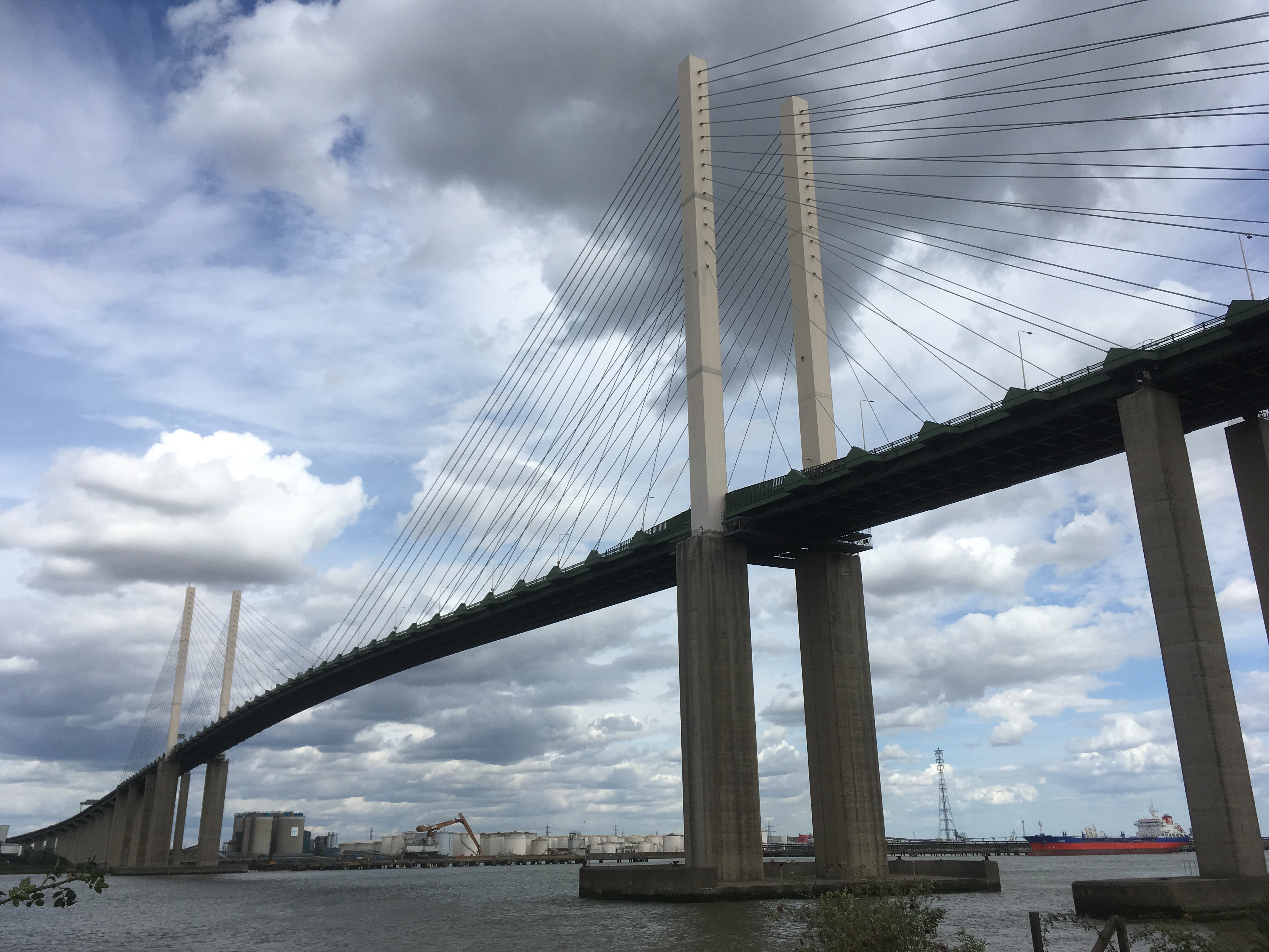
It’s impressive, but perhaps not that impressive. Your jaw doesn’t drop. It’s functional. Perhaps that’s the best I can do to describe the structure. To the north and on the other side is Essex. Jetties and large ships, and petrochemical sites. Not too enticing and no doubt if you were in Essex looking to the south the view would be similar.

What you get a sense of here is of still being attached in some way to London, but that London wouldn’t want to be attached or associated with this zone. The entire infrastructure here relates directly to what London needs, and also what it needs but which either it can’t contain (the petrochemicals perhaps), or what it doesn’t want (waste obviously but also the lorries and cars just going round and round on the road to nowhere). A bit like the smallpox ships and hospitals from a century before! \
You’re not allowed to cycle across the bridge. There are probably very sensible reasons for this, although it feels like a lost tourist opportunity. Other more impressive bridges here and abroad don’t have such limitations (dig the big one at the mouth of the Seine near Le Harve for instance). But, and this is a useful hint to any cyclists who, for whatever good reason find themselves at this spot, north or south, and then have an insatiable desire to get to the other side, there is a small bus service through the associated tunnel which you can throw the bike on. Just a warning. You first have to find the pick-up points although frankly they are at fairly desperate locations. Anyway – I didn’t need the bus service today so carried on.
Okay, now issuing a “trigger warning.” The following paragraphs contain sensitive topics and observation that may cause a reaction in the reader ranging from mild irritation through to outright violence. If you are of a sensitive disposition you might want to skip the following four paragraphs. If you are of a sensitive disposition but you still want to read on, but then feel that a violent reaction coming on, take a deep breathe, count to fifty and make a cup of tea. Alternative, if these approaches don’t work, just post an offensive message – it seems to be the order of the day.
We currently live in the second Elizabethan age. And don’t we just know it? You’d think by now our monarch would have had enough of all things bright and infrastructure being named after her. The bridge that I was fast approaching was opened in 1991 and, probably due to some key event in the royal calendar, imaginatively named after the present incumbent. Okay, fair enough, though a wide range of other options were, I am sure, available – say Herbert or Shirley, or any other person who may have contributed to its construction perhaps? Or just a nearby location (you can fill in the blanks).
However, not content with donating the Royal title to a huge bridge, people who should know better, or are desperate for some return in kind, have felt it necessary to gift the trademark to, and amongst other things (not including an Olympic Park and stadium, a cruise liner – no longer in use -and various hospitals, footpaths and duck ponds), a new underground line in London (the betting is that it’s nip and tuck whether it will be open before Her final State departure), and the biggest pile of floating metal (with nobs and guns on) that we’ve ever sent to sea. It is the biggest object I have ever seen. If you don’t believe me go to Portsmouth, where it is semi-permanently moored, and check it out for yourself. Never-mind the “Viking Sun” with it’s invisibility pool and poop deck, if our new aircraft carrier ever sails up the Thames in the future, as it casts it’s shadow across the East End it’s likely to cause mass hysteria from Silvertown to Rotherhithe. The betting here of course is whether or not it will be fully ship-shape and ready to take an active part in our military threat before Mam’s appointment with the ceremonial box at St Paul’s or Westminster Abbey, or wherever it is that they have these sort of send off’s (it’s been so long now that the Establishments probably forgotten – I know I have). I understand that there are excellent odds on her staying on the throne through and beyond the aircraft carrier (and her sister ship the Charles of Wales the Last) being sold to the Sudan as scrap.
Above are just a tiny fraction of the things and places in the UK baring the signature. If you look more widely, the list is substantially longer where old colonial nations (in particular, but not exclusively) have embraced the homages beyond any rationale. Australia and Canada have excelled, and there’s even a part of the Antarctic, claimed, but in dispute, by Australia, called Princess Elizabeth Land! It’s the coldest place on earth. The fact that it is claimed by a country at all feels completely wrong, but in the fine tradition of exploration, guess who it’s called after? It doesn’t feel as if we are approaching this naming of public spaces, utilities, or big floaty things in a very mature way. It seems a bit cultist – overly fawning. The UK isn’t Tinseltown after all. Or, maybe it is and I just haven’t noticed.
Time perhaps to leave this subject and head on east (“and keep on going to Russia you pinko b……..d,” I hear them shout). End of “trigger warning.”
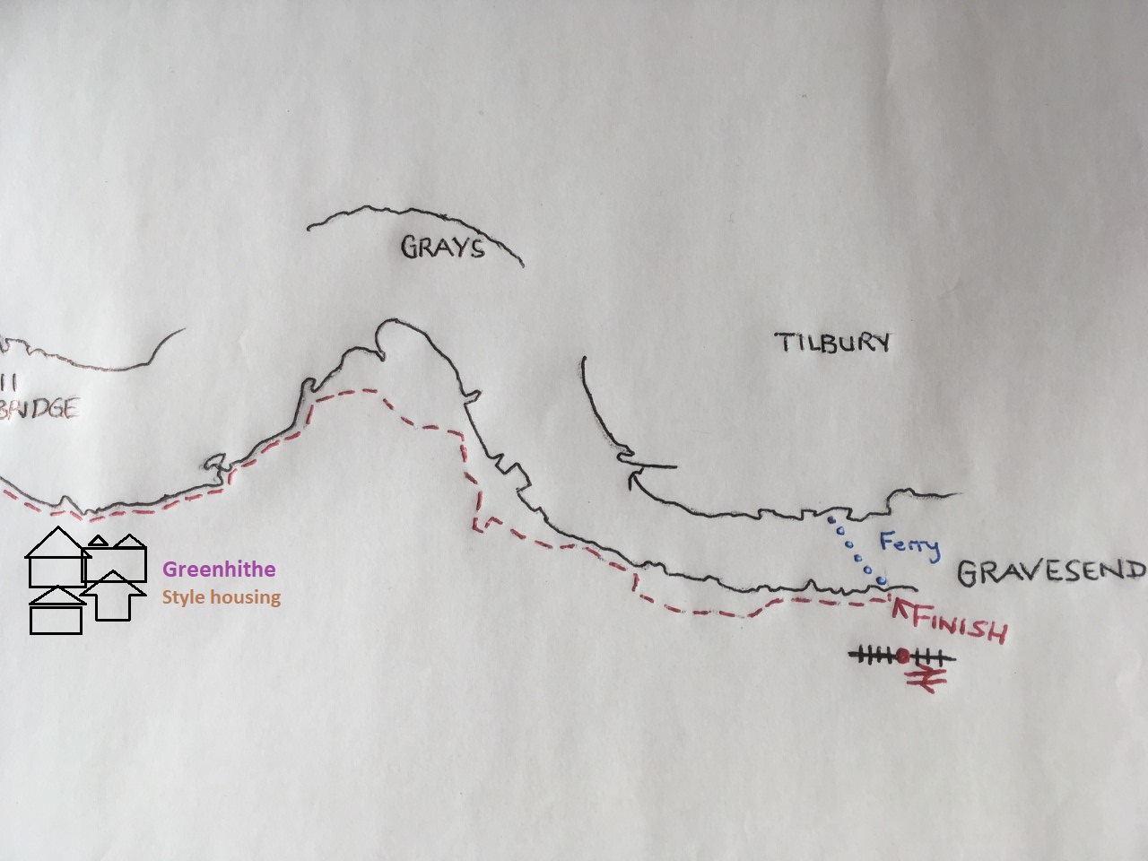
Next stop Greenhithe, and a slight diversion inland at an ASDA superstore, and then through a thoroughly decent new area of residential development, where a solitary concrete barge rests up (in case you never get the chance to check out the gaggle of similar barges in Essex – see above) and ending at the Pier Hotel. Here the road turned back inland before returning again to the front and another modern housing scheme with interesting historically based styles that seemed to work. Beyond another area of marshland heading north-east and towards a vast pylon with cables that stretched away across the Thames. I don’t have any historical ditties on this area, which was of little interest other than it wasn’t built on, but underneath runs the high speed railway line that leads north to St Pancras International and to the south, the rest of the world.
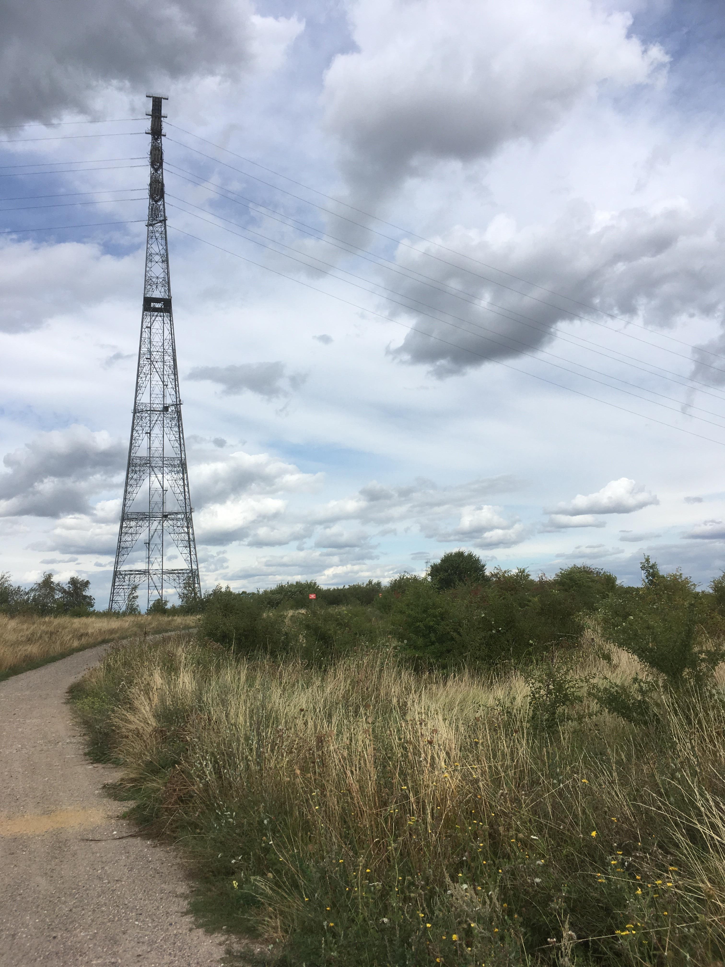
Due to the enormous pylon, and associated signage that indicated further progress would be a capital offence, the path didn’t entirely follow the river and eventually led to a dusty road reserved for lorries that headed south and eventually to a main road that then met with a roundabout. Turning left at the roundabout, and immediately to the left, was the red rust coloured corrugated iron clad stadium of Ebbsfleet United Football Club: a relatively large ground compared to the status perhaps of the club (no offence).
Worth taking a quick look at if you are interested in the non-league version of the game, but a strange sign on the outside of the east stand was issuing a message that didn’t appear to be compatible with the ethos. I’m guessing, but if you were passing and wanted to know what was happening inside the structure, you’d never guess that the entertainment on offer could involve association football:-

Of course I may have been missing something here but it struck me at the time that there might have been some infringement of the Trades Description Act, or if not, at the very least, a new interpretation of the off-side laws.
Pushing on and past the ground, a small road led back towards the river, although there was little to get excited about. After a minute or so it came to something of a dead end. Walls, in disrepair, fencing and evidence of industry (dead or alive unclear). All a bit messy and desperate. Some of the walls were high and obviously old, but they had no context. This was definitely a classic ANOB – Area of No Outstanding Beauty. Acquired by corporations, industry and government to exploit natural resources or for strategic functions. Examples include quarries, power stations and military training facilities. Often a scar on the landscape but not always, and some have a rare beauty or are the home of a rare species. Not always inaccessible.
Frankly there was no “rare beauty” about this spot. A sign on one of the fences. A plea to whoever might pass this point but I couldn’t comprehend who that would be? The notice, a laminated flyer on A4 paper, explained that what was in sight were the remains of the Northfleet harbour at Robins Creek. An historic site that the campaigner/s (I’m not entirely sure that more than one person went into the production of this literature) was urging someone undefined to grasp the nettle and restore the harbour and docks, and seize the initiative to create a new residential, boat-based community here before all was lost. The area by the river was called Northfleet Hope. I suspected that there was more hope here than realism in the authors demands. No doubt, at some point in the distant future, there will be possibilities, and when eventually the industry disappears there will be speculators keen to create a new seafaring Shangri-La, but from the evidence on the ground it didn’t appear to be something that was going to happen in mine, or the authors time.
Concluding that there was no prospect of further progress here, I set on up College Road that led to the High Street. A sign to the station. I was sorely tempted but Gravesend was only a couple of miles on and a plan is a plan for a’ that. The High Street soon ran out of housing and shops. To the left now a substantial area dedicated to the extraction of aggregates for, I’m guessing, the purpose of cement manufacture. On the intriguingly named Crete Hall Road and where, just beyond, and near the Red Lion (a pub that seemed to have let the modern world pass it by) a directional sign on a post* indicated that National Bike route 1 led up a path towards the river and would take you along the shore east and west. Something worried me about this sign but obeying orders I proceeded along the track by the east side of the quarry, which was in full swing. On reaching the river it was pretty obvious that the possibility of heading west towards Dartford, as indicated, would be mission impossible, even for Tom Cruise, and that the route east was going to be a challenge at the very least. To be fair though, despite the envelope of industry that surrounded this point, there was a small sandy beach where a blue one person tent was pitched, and from where a set of mysterious footprints led along the sand to a ladder attached to the sea wall.
A number of thoughts. A homeless person perhaps? The evidence was there but if so, it was a risky location to pitch up, particularly when the tide came in. Someone’s fishing tent? Yes, a possibility, but no evidence of fishing equipment, and the set of tracks leading away from the tent lent a degree of intrigue. A migrant worker? The tracks indicating the start of a trek to a point of employment for the day perhaps? A person, hiding away, from authority, seeking a distance. Other possibilities, slightly less savoury perhaps? Maybe best not to speculate too hard, or too long. The photo below shows the scene and it feels to me that someone with a fertile imagination could use this image as the start of a short story or a novel (just putting it out there?). If that happens, and I find someone has – fear not, I won’t sue….well – I might!

Surprisingly it was possible to continue east along The Shore as Northfleet blended into Gravesend. Into Gravesend and onto West Street and the road took me through to the short pier next to the Three Daws pub, a fine white weather-boarded institution that has clearly had a footprint here for centuries.
I hooked up the bike and entered. A generous range of real ales was on display, and despite being very tempted, I took the soft option and went for a coffee. I’m not convinced that I’ve fully entered into the spirit of this venture so apologies to any bike and beer nuts out there – there won’t be any real ale reviews here. Sitting on the generous terrace and looking east down the river, past a bright red pained light ship that was moored next to a small park, it dawned on me that to fill the gap between Gravesend and Herne Bay was going to be more than a single days work. That was cool. The coffee was excellent and soon after I had found the station and was off back to London.
Back at London Bridge, and in theory just a 30 minute ride home, but on exiting the station a storm of stupendous proportions was lashing Tooley Street. The hot day was coming to a traditional London summer day’s end. I stood under the new awning, that along with other major work has transformed the London Bridge station experience, and watched in awe as tons of water lashed this way and that. Like a Hollywood film hundreds of people, dressed more for Rome than London, ran trying to find cover as sheets of rain drenched, and washed the streets and pavements. The few who had thought to bring umbrellas instantly regretted opening them to the elements and watched as they turned themselves inside out. Many simply gave up and trudged on soaked to the bone, but no doubt refreshed. Looking at the handful of brave cyclists trying to make a fist of it, I decided to wait it out. Twenty minutes later and a gap appeared. I took my chances and set off towards the bridge. By the time I was in the city, another band of heavy rain had landed and kept up the pressure for the rest of the journey. Ecstasy.
* Back at base, and with a bit of time on my hands, I pinged off an email to Sustrans about the misleading sign at Northfleet. Within a day there was a reply directing me to Kent County Council, and provided a lot of mind-boggling information on who was responsible for this, that and the other. It didn’t sound too promising. I found the website for Kent County Council and entered details. I wasn’t hopeful. The following morning my mobile rang. Unless I recognise the number, I don’t answer calls to the mobile, so I didn’t. There was a message though. From a man in the Highways Department at Kent County Council. I rang back and spoke to the caller. He knew the spot and said they’d get it sorted.
I probably won’t get the chance to check if it was done, or not, but sometimes you just know from the response you get, and the manner of the person that you are talking to, that some things will get done. Hat’s off to that public servant. He knew his roads. Someone has to.
