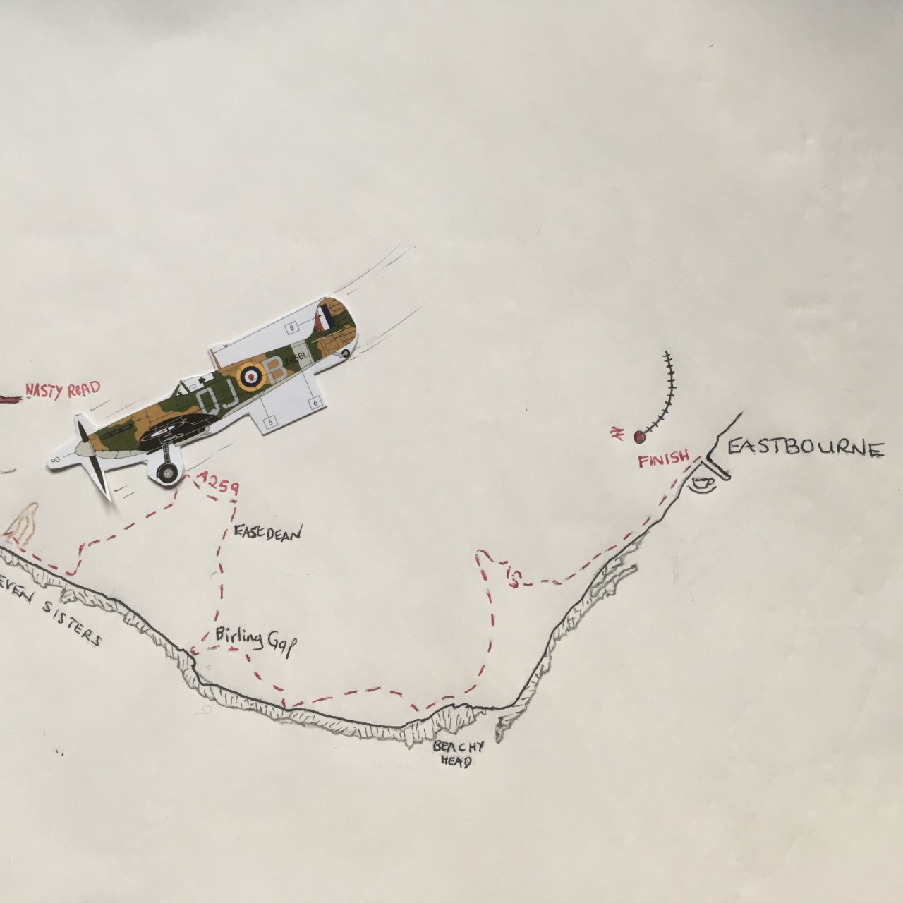
A Day of Two Halves
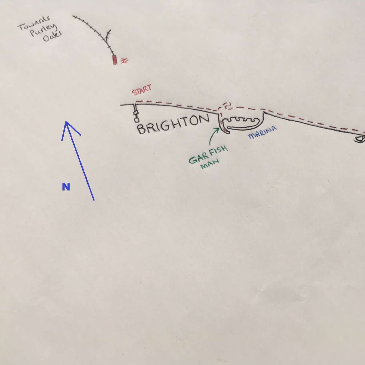
OS Landrangers 198 and 199
34 Miles
I stir. Clock says 9am. Creaking back noises as I retreat under the duvet. I am destroyed. I awoke yesterday with an autumnal step (if such a thing can exist?) and, with some unexpected gusto, went on line and booked an outward-bounder ticket to Brighton, leaving St Pancras International in just over an hour, and a return from Eastbourne to Victoria for 5:24 the same day. Hastily throwing together a few essentials and two corned beef and pickle rolls and I was off. St Pancras with time to spare but on the platform no obvious indication on the digital display of the 10:35 train with the big discount. There was one though, at the same time, to Gatwick – but that wasn’t in the script.
Never mind, as I read the display there was an earlier Brighton train arriving on the below ground Thameslink platform and hey ho here we go. Except as soon as it set off south, I was uncomfortably aware that the ticket man (I think they call them train Stewards now, and why not?) was standing a few feet from me, making sure the train navigated successfully through the busy central London stations. A nagging worry began to envelop me. If I could just hang on in for the next 20 minutes or so I decided to alight at East Croydon and take my chances on whatever came through from the north.
At East Croydon I push the bike up and down platform 3 gazing at all the displays and trying to make some sense of the numerous and conflicting messages about incoming trains; delayed (all) it seemed by train breakdowns and emergency track repairs near Gatwick. The delay times varied by the second so who knew what was going on but the 11:11 Brighton service was showing as the third arrival……and then it wasn’t; relegated out of the top three and on the main departure board now 10 minutes delayed. It was the 11:11 that was going for. A closer check on the email that confirmed my booking explained that the 10:35 Gatwick train was the one I should have taken and then changed at East Croydon (are you keeping up?). The delay times continued to go up and down. It was chilly but the sun was shining and I lurked in my shorts at the north end of the platform where is cast its warmth. There were trains arriving on platform 3 every minute or so, all subject to delay. It’s a wonder how the people in control are able to safely tolerate this level of activity. It was a small sample of the chaos that had blighted the lives of thousands, if not millions, of people living and visiting this area over the last few months and, not for the first time, I felt grateful that 40 odd years ago I escaped suburbia zone, even if the memory of stepping out of a train from Charing Cross on platform 2, but on the wrong, side still haunts (and amuses) me. The aghast expressions on the faces of the elderly couple as I walked across the tracks and climbed onto platform 3, as if I did it every day, still tickles.
The 11:11 eventually arrived some 11 minutes late (nice symmetry there) and soon we were scooting south under the North Downs, through the Weald and shortly after under the South Downs too.
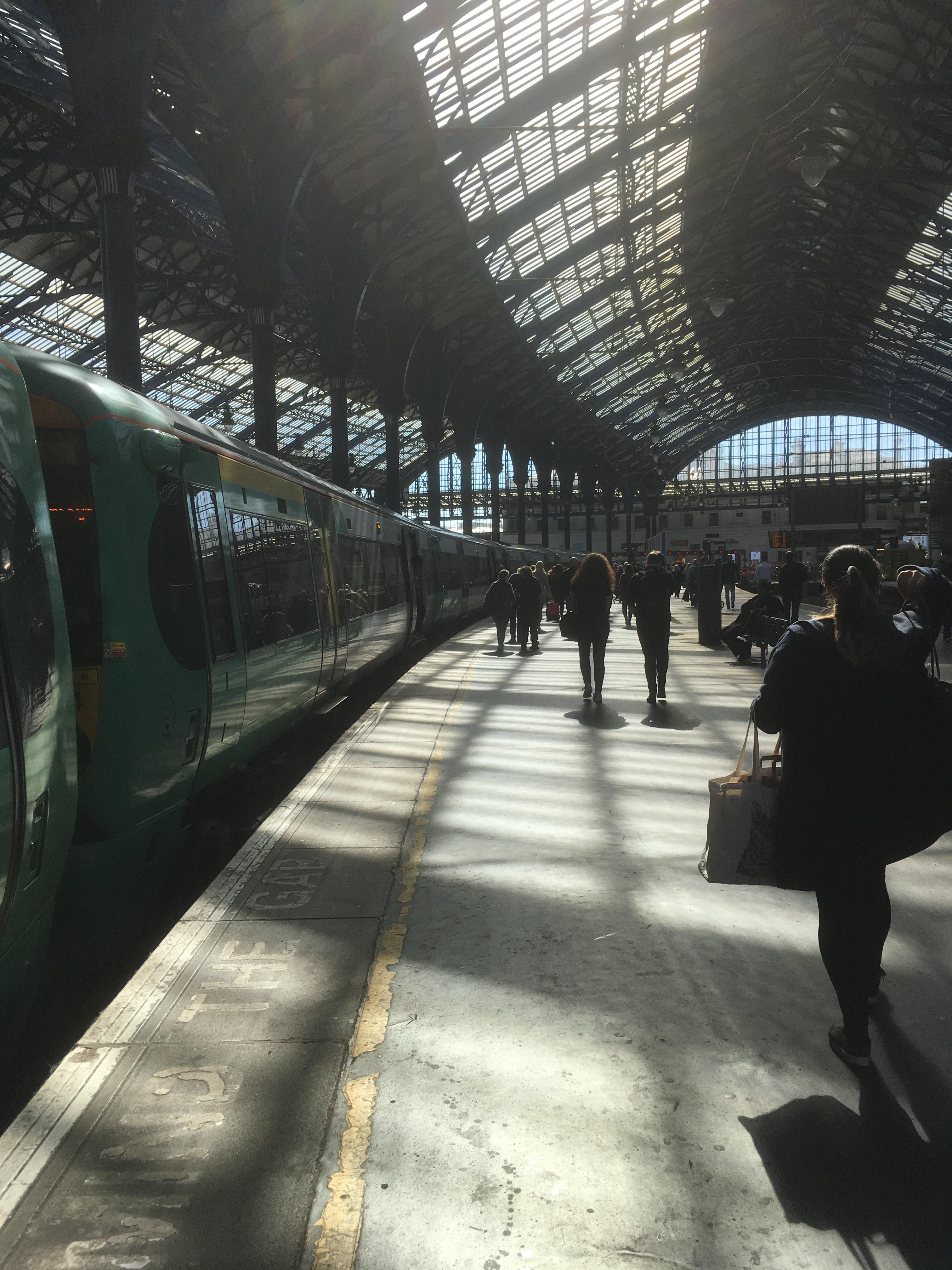
The train pulled into Brighton Station only 15 minutes late and I alight. The delay seemed minor but could impact further down the day. The platform is bathed in shafts of white light streaming in through the glass lattice above. It’s evocative. I rarely visit Brighton but there’s something about the station that makes you feel that you’ve reached a true destination. It’s the end of the line but also the gateway to an unlikely cosmopolitan. There’s an energy to the people swarming out into the daylight and the whole of the world is here. It is also the gateway to the beach, the pier and possibly the sun. Other than maybe the beach (previously reviewed), Brighton no longer holds anything for me. Long-gone the far-ranging missions to the coast on train, or by banged up motor, to get smashed on the rocks. I can rule it out for the future – it’s just so young.
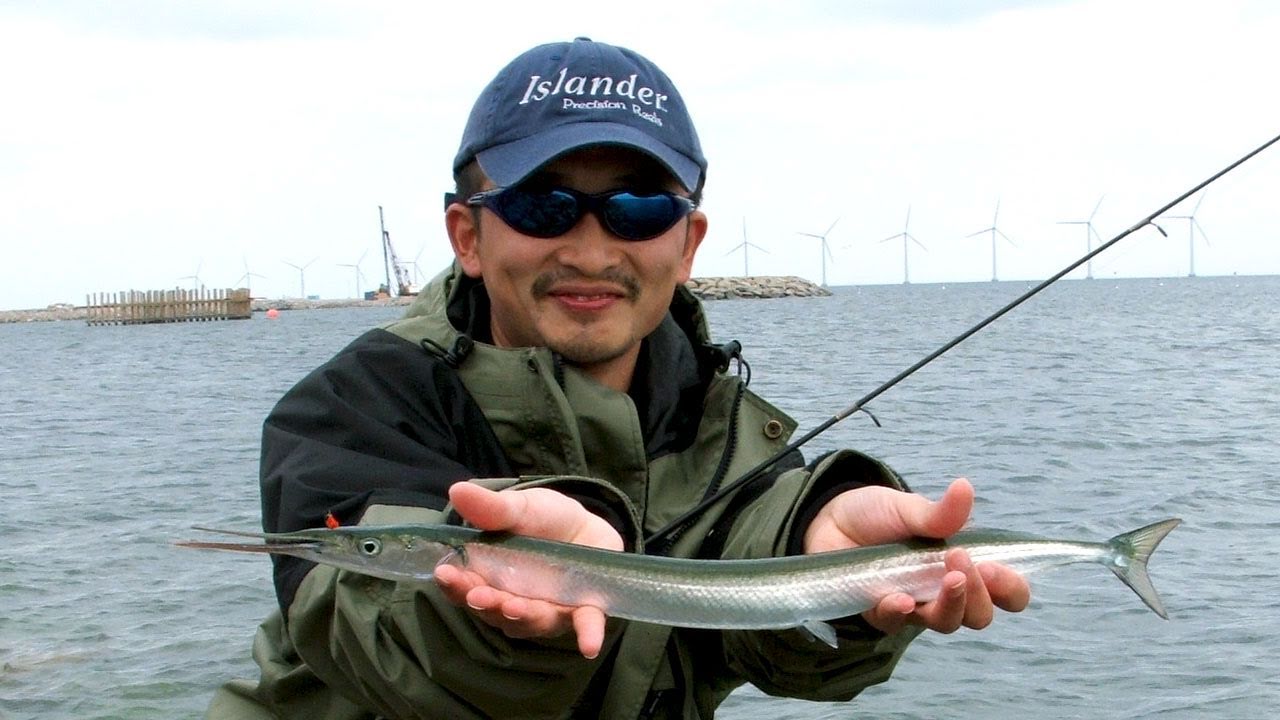
Hopping on the bike, and with the extra weight of the panniers to assist, gravity alone pulled me down the Queens Road and West Street to the front. Glorious. I start east immediately, past the pier and then along Marine Parade with the old Volk’s Electric railway to my right. Reaching the Marina and I was already thinking about heading up onto the road at the top of the low cliff when I saw the long western Marina breakwater and opt to have a look from the end. The view back to Brighton from here is as good as it can get, although the Marina itself seemed, surprisingly, to specialise in common brand retailing (McDonalds, Asda, Pizza Hut) rather than the unaffordable outlets in places such as Portsmouth (it’s true!). Heading back, and the breakwater was lined with anglers chancing their arms and poles. One pulls a thrashing silver object from the docile sea. I stop and see the man reaching out and clutching a beautiful, two foot long fish type thing. What struck me most was the shape and colouring’s. Something of a cross between a sword fish, eel, pike and small marlin. “What have you got?” I asked.
He tells me that it’s a Garfish, that its bones and flesh are green, but the flesh turns white when cooked. Apparently it’s not a hit with the general public but nonetheless is a good eat. I’m transfixed. I want to stay and watch but instead wished the man good luck and headed off for the main road. I climb the ramp to the road and look back down on the Marina. There’s a wide path heading east and there are many walkers, and a cyclist? This was not what I was expecting and on checking the OS map it wasn’t clear that a cycle path existed along the coast at all, but if it did how could I not take it? Back down the ramp and I take it.
To the south the Marina sprawled eastwards far further than expected. Brownie-red brick, two and three-story flats, some with small gardens, all hugging a man-made series of coves where a wide range of new, second hand and washed up boats bobbed and lurked at their moorings. A not so little community that has detached itself from the mainland hulk. There’s a certain appeal but I can’t see any sign of an Indian Restaurant. If there was I’d definitely go for the Garfish Dhansak.
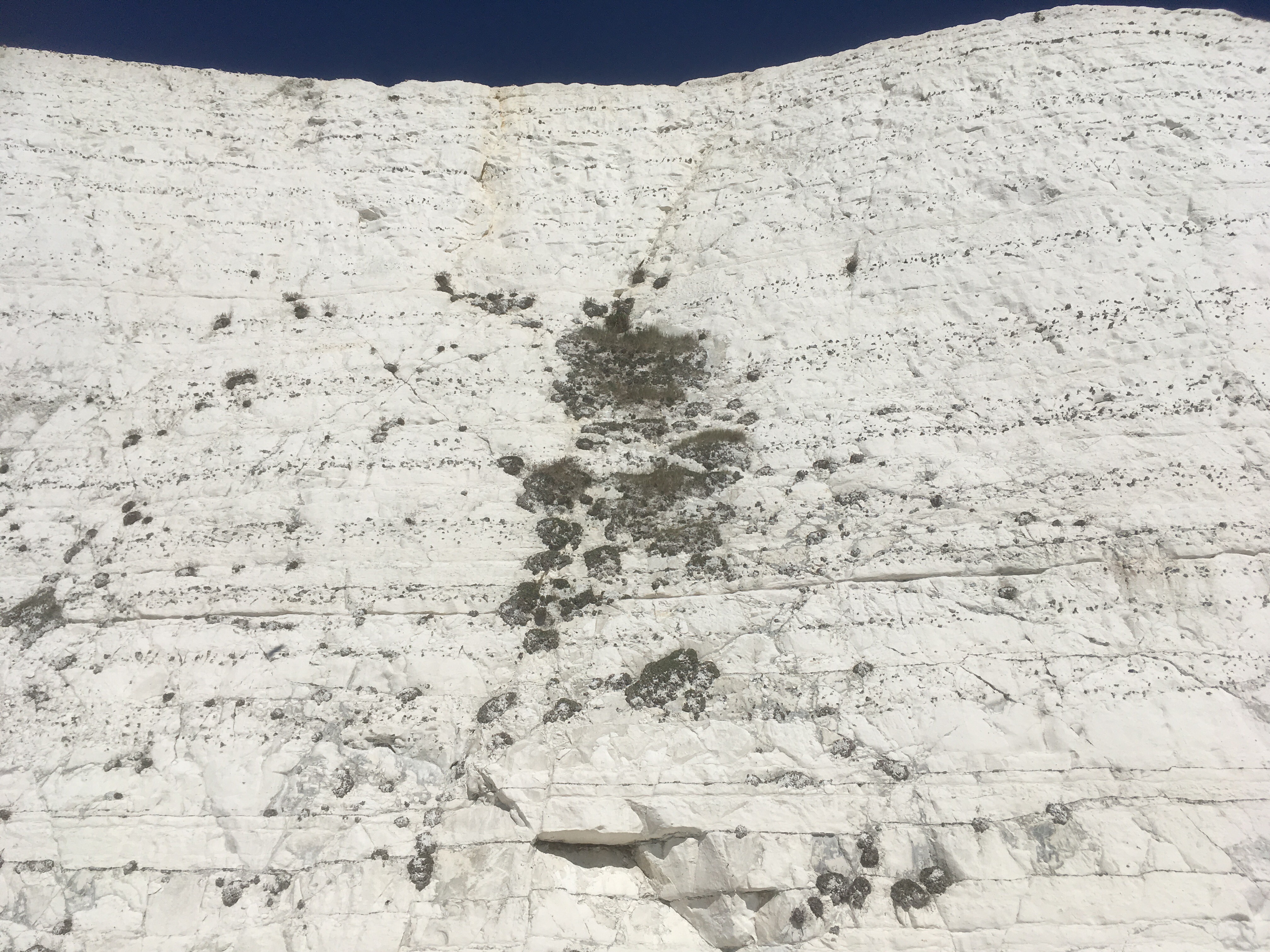
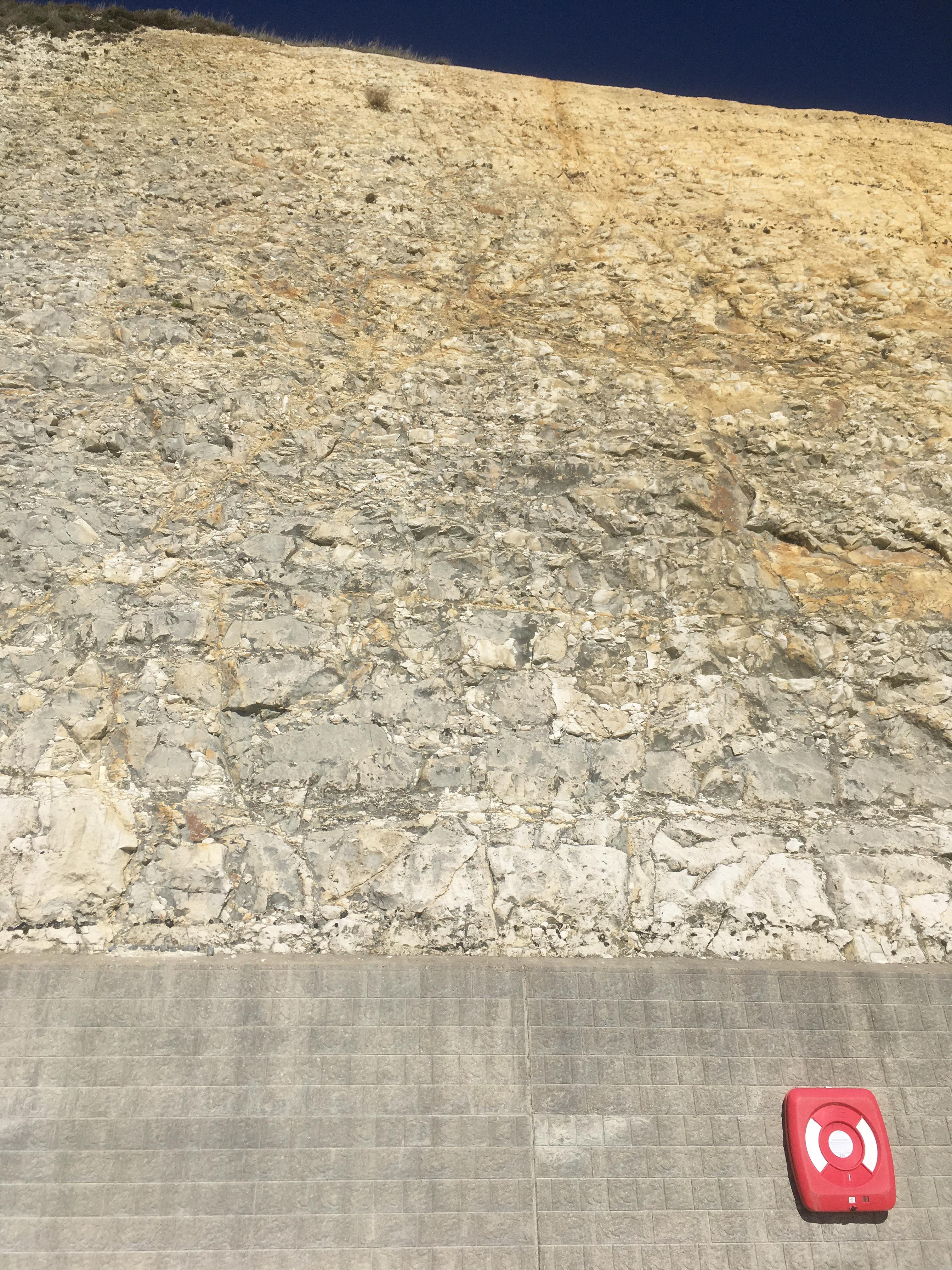
To my left, and immediately imposing, the Newhaven formation chalk cliffs force themselves into your consciousness. This is the first point east of Dorset, on this section of coast, where the white sedimentary rock that defines the South really makes its presence felt. Brighton hides its Cretaceous underbelly behind bricks, stone and concrete, but it lets its grip go from the Marina and onward east. The strong afternoon sun bleached the rock an almost pure white. Through the stratified bands, sharp metallic flints probed outwards, announcing each nugget to the elements and the slow pull of gravity before their inevitable liberation from the bedrock and the fall into the catchment nets below. Or worse – beyond to the concrete path where, like a minefield, each knife edged sliver could rip the crap out of the tyres of unwary cyclists.
Somewhere above was Rottingdean. It’s an attraction but I’ve seen it before. Despite the gap in the cliffs, allowing easy access to the town, I decide to tilt and stopped for a tea and comfort break at Ovingdean Cafe. The tide was high so any evidence of an alluring beach was somewhat illusive but yes, just maybe where the shingle meets the water – that could be sand? I finish up and asked the woman at the counter how far I could get if I carried on along Undercliff Path. “Saltdean.” There were some instructions, although they seemed a bit unnecessary given what I could see ahead. Cliffs, concrete path and sea. “Thanks, nice tea.” For indeed it was.

Cutting on between the sea and the cliffs it wasn’t long before I reached the end of this section of path. An abrupt stop at a cliff under Saltdean that commanded respect, and a short break to take in the views east, and west back to Brighton. Up to the top and then along the bike lane by the A259 (hello again). The first feature to greet you as you approach Telscombe is the Smugglers Rest. A sprawling pub, probably Victorian in origin but with new, well disguised extensions and a large terrace facing seaward which was well stocked with midday drinkers and feasters, and given the weather and the time of year, why not? Onto the cliff edge grass path and just a short distance on and there’s another. The Tavern. Hmmm…and if memory served correctly from a drive through a year or two back, there might also be an Indian takeaway within the mix. So, let’s not get too excited. There’s a whole lot more to see, but keep reviewing “purpose” as “right first time” principles dictate. The homes, built back from the cliffs along the esplanade, lacked a lot in architectural merit but commanded impressive views over the Channel. If tracking the progress of weather fronts, storms, or just the shipping on the horizon as you tuck into a Friday evening coconut naan, is the purpose and desire, then this is the spot.
Peacehaven is next, though it’s really just an extension of Telscombe, or vice versa depending on which direction your coming from (Telscombe sounds as if it has more heritage so let’s keep to the first option). A short stretch of heavily rutted tarmac that would be made more hazardous after heavy rain and then a road that wound down to a further section of coastal path. It was far from clear from the OS map that there was going to be a ramp up to the top again further along the coast and so I hailed a man and his dog to seek further guidance. Yes, he confirmed, there was a route up but don’t go past the old lido (a warning for sure!). He added that you could go further, but after a quick assessment of my age, overall bearing and bike, carried out a rapid mental health check and clarified that there were a lot of steps at the very end and that I would probably want to avoid that (another warning I noted). I had no immediate plans to re-enact a scene from a Greek tragedy so heeded his warnings and further along, where the cliff structure was less stratified, and the chalk a murkier sandy colour, reached a point where a road snaked back up to the top. That said I wasn’t convinced. There was no obvious sign of an old lido but I sensed this was the spot and so avoiding the invisible steps of Hades, lurking to claim me somewhere further east, I climbed back up and to a grassed headland along what remained of Peacehaven.
Lined more closely by houses and bungalows, where the last 1930’s house was being renovated and added to, and where a well dressed woman in her 40’s, who may have been Russian, was smoking a long white cigarette and instructing builders, who may have been Polish. The house was only a few meters from the edge of the cliff and I wondered what the long, and short-term life expectancy might be. The last close took me back to the A259. But only for a minute. To the right there was another battered track of tarmac and then up and along the Hwy which flanked the Rushey Hill caravan park to the south. Past the park it might have been possible to get back to the cliff tops but I couldn’t afford to take the risk and there was no obvious official path.
The track wound away from the cliffs and headed inland, then downhill, and then with a turn to the right and across a patch of grass and I was at the top of a residential road with a fine view down to Newhaven and then across the bay towards Seaford. Letting the brakes off the bike I freewheeled down Gibbon Road, through a large, well maintained council estate, and then reached the west side of the River Ouse estuary at the Gun Club. It was possible that I had missed a couple of side streets that could have taken me closer to the coast but there was a need to be practical and take the most direct option.
The Gun Club is next to a Scuba centre, implying perhaps an area of outstanding outdoor activity. Tracing the river south along Fort Road and eventually I passed the Hope Inn located under the old fort, and then the long west harbour wall and beach. The cliffs behind are messy, with layers where human activity, entirely military it would seem, can be picked out and traced back to times when the country was at war or where conflict loomed. Vast fences, barbed wire and defensive structures clarified that the breakwater wall was closed to all. That was a shame. A man in his 70’s with his shirt off was a singular angler at the end of the harbour, just under the breakwater. Casting and reeling with what appeared to be a large metal object at the end of the line it wasn’t clear what he was after, but there were no bites here. A man walked off the beach with his mobile phone in hand. His language was florid and there was no let up on his social commentary, despite the three-year-old son he had in hand.
Back along Fort Road and then along the paths by the marina where new flats are creating the sort of quarter that you’ll now find in most south coast resorts (although it’s perhaps erroneous to imply that Newhaven is a resort). It was pleasant enough and shortly I was back on the A259 as it crossed the Ouse on the swing bridge. I stopped at the centre and looked down river towards the sea. New flats and town to the right, and the industrial quarter, with buildings associated with the cross channel ferry to the left, and in the middle of the river, some 30 meters or so from the bridge, and erected on an old wooden structure, a cormorant, wings splayed out but motionless. Made of metal and convincing enough but no threat to the fishing industry.
On the east bank everything was a bit of a mess. A car-park on the right and a club house of some sort, possibly associated with a railway club. I cycled around without a clue for a bit, occasionally finding a section that clung to the river bank – but not for long. I gave up and decided to press on and arrived at the railway crossing next to Newhaven Town station with the gates down and a queue of cars increasing on both sides whilst pedestrians also waited for the train to pass. Minutes ticked away and I ran out of things to look at. Even the old wooden signal box, seemingly abandoned but full of character and wedged under a flyover, had only so many interesting features to take in. Eventually the train at the station moved out across the road and north, but the gates stayed down. It was getting very hot and I was now regretting faffing around by the bridge when by now I could have been beyond the line and a couple of miles further along.
But I wasn’t, and when eventually the gates did open, after the down train had passed through, instead of going directly to the Seaford road, I found myself on Railway Road, and tracking down the east side of the railway and towards, and then past the harbour and ferry port (no ferry in view). The road continued through some industrial areas but then ran out of steam. A pedestrian bridge led over the railway, and although tempted, I was doubtful that lugging the bike over to the other side was going to be productive in the long-term, and so turned round and legged it back to the main road, passing many attractive Victorian terraced houses that, if the outlook hadn’t been the port wastelands, and what appeared to be an endless stream of dusty lorries, would have made me take a closer look.
I joined the road out of Newhaven (unsurprisingly the familiar A259) that sweeps to the south east, and with a bike lane to separate the traffic from the cyclists, weaved through a large marshland area where small birds leapt from branch to branch, and where there was a good view of the hills inland and the sea wall about half a mile to the right. A huge flock of gulls, many crows, and a couple of birds of prey, rose and circled above the fields. Maybe, if I’d been bothered to heave the bike over that footbridge back near the ferry, I may have been able to make it down the coast but I wasn’t going back now to find out. Always compromising.
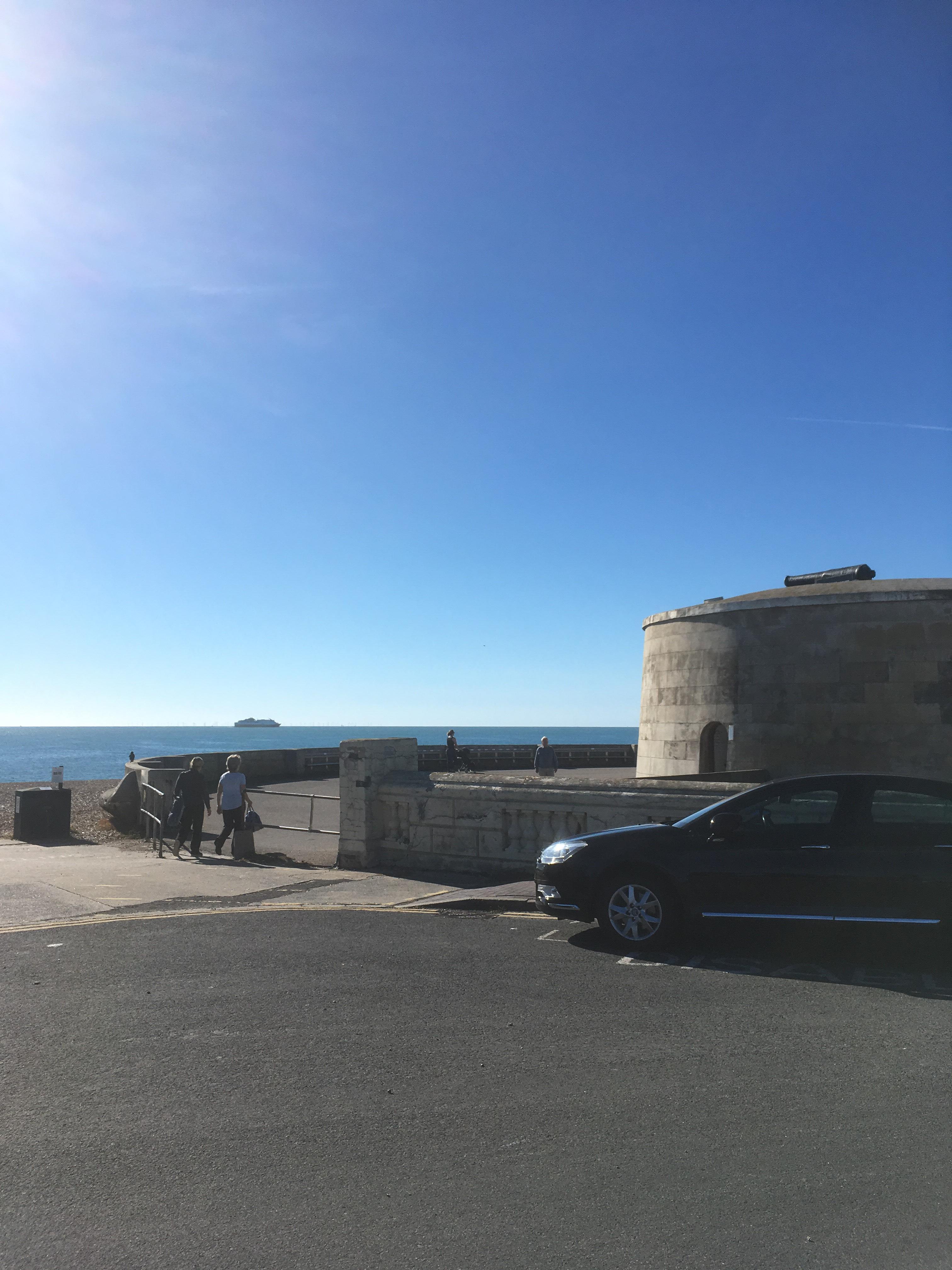
Eventually arriving at Seaford, and turning right onto a road that led under the railway, I was at the front. Seaford is a sleepy Sussex town that gently slips away from the coast and up into the surrounding chalk hills. The beach here is about a mile long and facing south-west across the wide bay with Newhaven just a few miles away. Unsurprisingly it is a shingle beach. Where Seaford differs to other south coast towns is that there is no sense of being in a resort. No seafront hotels, B and B’s, fish and chip shops, amusement arcades, pubs, ethically minded coffee outlets. Behind the long seawall there is a road, and retiring (like perhaps the occupants) behind the road, there are flats and houses and greens. The town centre is set back and away from the sea. Maybe, when storms hit from the west, it would be impossible to sustain an active and economically viable sea frontage, but the sun sets here must be spectacular? Seaford is more like the sort of provincial town you can find anywhere in a 30-mile radius of London. And that’s just fine, and if it’s peace and quiet you are after then I don’t think you need to look further than Seaford. And, in a way, I’m tempted. I can’t put my finger on it but I wouldn’t rule it out. But back to the now and reality. It was getting very hot and I sat on the seafront, near the well-preserved Martello tower, with an old cannon resting somewhat precariously on the top, licking an ice-cream and taking in the unblemished view out to sea and down to the south-east and the chalk cliffs of the Seaford Head Nature reserve. Definitely not a bike friendly zone but from previous experience a magnificent walk over the point that takes you to Cuckmere Haven (and the small, picturesque cottages which you will have seen hundreds of times on TV and in magazines, completely unaware of where they are). An inward bound ferry slipped across the horizon and towards Newhaven.
Having ruled out the coastal path, and having completely demolished the ice-cream, I remounted the bike and set off inland and along roads that flanked the golf-course, the “greens” flowing like grass and sand glaciers off the chalk headlands beyond. Onto Chyngton Way, past neat detached houses which ended at some fields, then a left and flanking farm buildings (with well-proportioned old houses on the right) to a footpath that headed east across parched fields, where flocks of sheep grazed and the view towards the Cuckmere and the Haven enticed. The path, rock hard and rutted by farm vehicles, quickly dipped down into the valley. The bike took the hint and with little or no control over the outcome together we pitched forth and down at breakneck speed to a possible Armageddon. Mercifully (for it has to be said, even a minor spill at this age can have the most disappointingly painful and long-term outcomes), the bike came to an abrupt stop at the foot of the hill and another path that offered left and right options. Despite, on this occasion, having an Ordnance Survey map to assist navigation, it was copyrighted to 1992 and lacked any meaningful information about national cycle routes (more on this map at another time perhaps), but the plastic sliver of what remained of a bike route indicator held fast to a nearby fence post. The one thing this indicated to me was that at least I was on an official bike path, and not abusing any footpath country codes (see on), but lacking the important directional element of the sign made determining my next move completely impossible. Going right would take me to the Coastguard cottages on the west side of the Cuckmere and where Luther sought some refuge in, I think, series 3. It didn’t work out for him there as I recall and I rather doubted it would for me either, so I went left and followed the river up to the main road and stopped outside the Cuckmere Inn which rises above the curve in the road before the bridge. With its numerous terraces, the pub has commanding views over the valley and towards the sea. I could have killed for a 30 minute break and a coke on one of the terraces but time was ticking and I’d only just had the ice-cream. Too much decadence to be justified.
The Exceat Bridge spans the tidal river and is a pinch point on the busy A259 – previously encountered if you’ve noticed. Traffic was queuing up on both sides. I walked across, then mounted up on the east side and started across the flood plane and towards the hills ahead. Some years before I had cycled this section – circumstances lost now – and knew what was coming next. The A259 runs from east Kent through to West Sussex, close to the coast and through the towns. There is a blog or website thing that eulogises its wonders. That’s fair enough, it is an interesting route, but the eulogising is from a motorist’s perspective. If you want to avoid serious harm as a cyclist, avoid it at all costs. The traffic flow is remorseless on any of the sections I’ve been forced to take. Being little more than a modernised coaching route, the verge gives nothing comforting in terms of protection, and the width is not much more than when the first tarmac spread. To a degree that’s okay on the straights, although with vehicles (including big bloody vans and lorries) overtaking at speed, it’s a hold onto your bowels and sanity experience on the slopes, and in particular the steep one that was now fast approaching. It’s a complete bastard. I’d been thinking about it on and off since Brighton and now I had arrived. At the foot of the hill a car-park signals the entrance to the Seven Sisters Country Park, with a wide footpath that leads down the river to the coast. Out of bounds to cyclists as I recalled. Everything about this area is outstanding, with the exception of the A259. I slipped down the gears and started the slow slog up, aware that a stream of cars was quickly catching me from the valley below following a change of lights back at the bridge. I am not a great climber. I can usually get there in the end, but I’m always in the smallest gear and at times going less than walking pace. The climb was predictably slow, and the sun wasn’t assisting. Cars started to whizz past – too close. Yeah, I hated this road, but I was now half way up and so far hadn’t been wiped out – yet. With a small gap in the traffic behind (at least I couldn’t hear anything coming) I took a quick peek to the right and down to the floodplain and the silver glistening of the river snaking its way to the sea. “What the…..?”
It wasn’t entirely clear but I thought I’d just seen a couple of bikes on the trail from the car-park. Jolted by the sight I stopped turning the peddles and pulled over to the side, put my left foot on the nettled sloped verge and turned to have a closer look, at exactly the moment when a woman on a racing bike powered on past me and confidently headed on up. I think helloes might have been exchanged but in truth as little interaction/distraction as possible was the order of the day at this spot. At least, because I had stopped, she hadn’t had to suffer the dangers of trying to overtake me. I starred back to the path, now some two hundred or so feet below, and sure enough started to pick out more and more cyclists tootling along in both directions. “Bugger!” I thought. Now there had to be a decision. Crack on up (crack being the operative word), or lose the height gained in seconds and take pot luck on the park route. I located the OS map to see if it would shed a clue. It didn’t and I cursed at the waste of time and loss of energy required in the process.
A steam of traffic continued to wind up from the valley below….too many with high powered engines that were no respecters of sympathetic space sharing. I looked up the hill. Despite her greater energy and determination, the woman was still in sight and with a way to go before safety. Seconds later I was back at the bottom and pushing the bike through the gate to the park. Hmm……
The path towards the coast was rammed. People heading to and from the sea, and not just on foot. Numerous bikers, although it seemed that quite a few, nearly all perhaps, were on what appeared to be hire bikes. And as the wide surfaced path wound south, hugging close to the steep chalk Downland that rose to the east, the dawning reality that the vast majority of the visitors here were tourists from overseas. Not just near neighbours either. Everywhere. And all with wide, satisfied smiles. Given that it was a late September weekday, albeit sweltering still, this was something of a heartening revelation. I have visited this spot a few times in the past, and popular as it has been the previously, this felt very different. Many were in pairs or small groups who had no doubt made their own way here, but there were also much larger groups who can only have been bussed in from urban hubs. I wondered if they would still be here if it had been 14C and light drizzle? No moral high ground issue here I should add – if it had been, I certainly wouldn’t have.
Just after halfway the road branched off to the left, and a rougher track led on over dried up marshland and towards the beach. Through a gate and a bit more progress before eventually reaching the wide expanse of shingle. It was time to stop and pause for breath and some thoughtfulness.
I propped the bike up on its stand, strolled further across the pebbles and sat down with the bottle of water and my box containing two rolls. The river flowed at speed, cutting a swathe through the shingle with a wide sweep to the left and then straightening up slightly, ditching into the almost motionless and sparkling sea. Hard to imagine that within a few hours the sea would be rushing inland at a similar speed and seeking out every nook and cranny in the reed beds and creeks of the river flood plain, and then beyond the bridges at Alfriston.
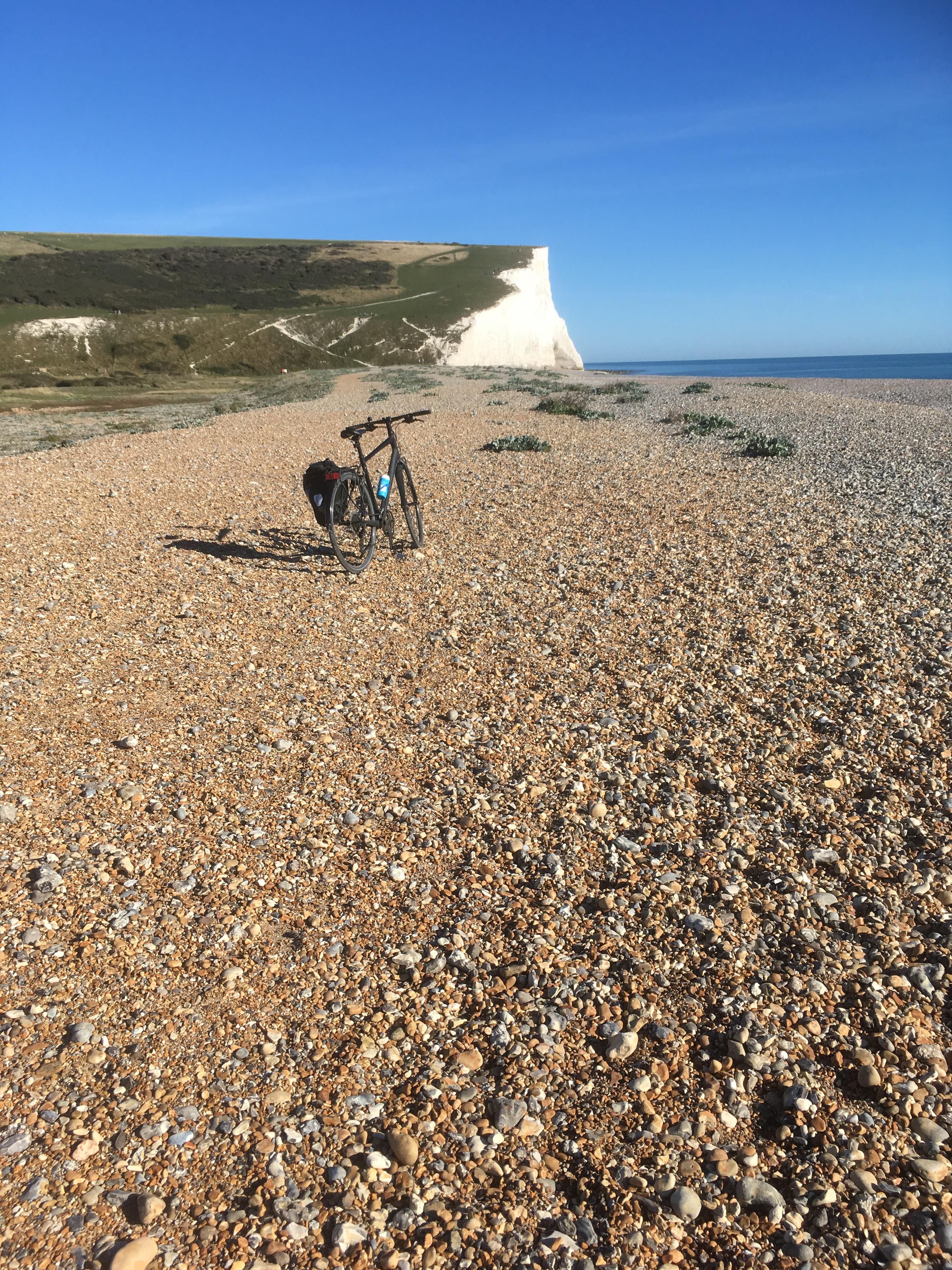
Well, you can lose some hours thinking on “stuff,” and at that moment I didn’t have those hours. Maybe another day? The most immediate challenge was to decide what needed to happen next. Looking east, and the Seven Sisters massif loomed over the beach and bay. The OS map showed a footpath, and the evidence of a well-used track on the landscape was clear. Chalk has that sort of effect. And, despite failing eyesight, up on the first ridge I was sure I was able to pick out two small figures peddling slowly away. What was the alternative? Cycle back to the main road, and then have a second go at the hill on the A259? The sight of the two people on their bikes (thought or imagined, it mattered not) on the summit beyond was the decider. I finished off one of the rolls and saddled up (oh dear….!).

Despite the shingle I managed to ride the bike on compacted, and sometimes moving land, for most of the quarter of a mile or so from the river to the end of the beach. The east end of the beach stopped abruptly at the foot of the hills, and a track led inland. A notice board said a bit about the location and the walks ahead. As I was about to find out, “walks” was about to become the operative word, but there was nothing on the sign to indicate that bikes weren’t welcome.
Ok – I acknowledge that it has been thin gruel so far. Apart from the Garfish moment (so long ago now you scream) nothing to get excited about (although I did think the description of the housing scheme in Peacehaven had some literary merit). So, sorry, but be patient.
Did I mention that the sun was banging down? It was approaching 4pm and I had something like an hour and thirty minutes to get my skinny arse from here to Eastbourne station for the budget fare back to London. It felt like a fair challenge, but as I looked at the two paths that eked their way up the side of the first hill there was a long moment of self-doubt. An elderly couple (about my age) strolled past as I continued to assess the options, giving me looks that said it all.
Eventually I settled on the route slightly further inland, on the basis that it was surely going to be less demanding. I approached, took a deep intake of air, and started the big push. Off we went, bike first and me pushing with right arm on the handlebar and left holding the back of the saddle with body at a 45-degree angle. New leg muscles now working hard on the dry chalk and grassy tufts underfoot. For about 30 seconds I felt good. For about another 30 seconds I felt okay. For the next 30 seconds, with sweat now running off my forehead, I felt like the old fool I most certainly was. Stopping, I took in deep gasps and disguised my predicament by taking a long, and supposedly interested, look back at the beach and the bay. Magnificent ….uurgggghhh!
Even if I’d wanted to, the idea of somehow turning the bike around and going back down to take the road route just wasn’t an option now. The mere act of trying to turn the bike round at this point would have been impossible. The track ran at an angle up the side of the hill, which dropped away drastically. If I’d tried to turn the bike, which, with the panniers and all their superfluous content, now weighed half a ton, the chances were that I’d lose a footing, or my grasp on the frame, and the old workhorse would have clattered off back down under its own momentum – with me rolling somewhere behind. The only thing to do was to carry on. The pattern of ascent continued in the same vein. A minute or so of intense pushing and heaving, footings being lost, hands adjusting and sweat oozing out of every pore and then when the heart was beating at such a rate that an attack seemed imminent a stop, and then huge intakes of breath.
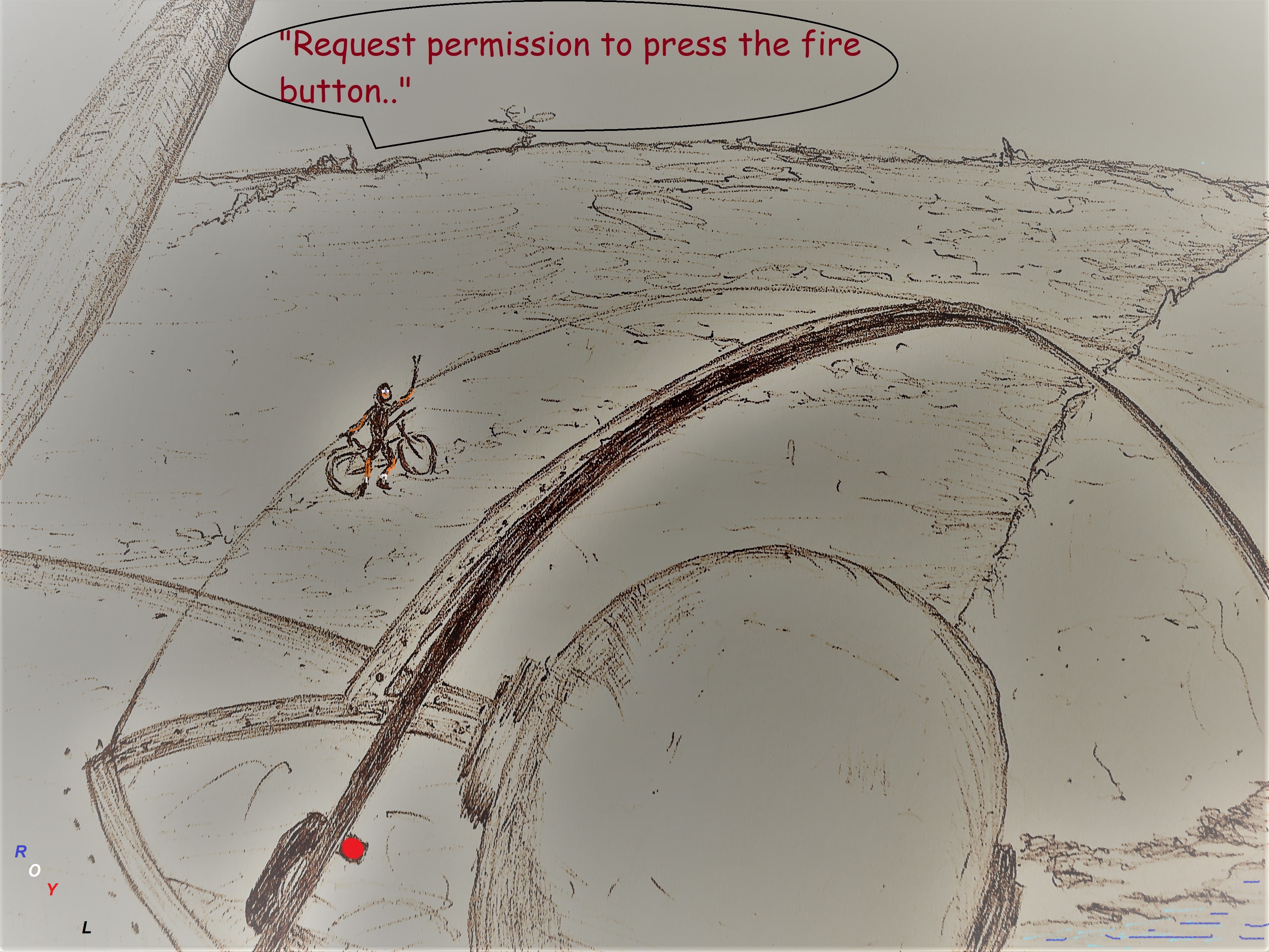
On about the fifth leg I heard an engine noise somewhere in the ether (or was it just in my oxygen starved head?). I recognised the combustion and piston frequency straight away but for once I was too screwed to be interested. As the distinctive sound of the Merlin engine slowly receded I glanced to my right and saw the outline of the Spitfire as it disappeared out to sea and beyond the cliffs. Whenever I see a Spitfire, or a Hurricane or (the) Wellington in flight, I think that it will be the last time. So..if this was going to be the last time, it was a disappointing affair. By now progress was so dire that I was just about managing a few seconds before heaving to a stop and finding foot holds where I could stop and rest up long enough to recover something, or anything, of life. It felt like the north face of the Eiger and the Ho Chi Min trail all wrapped and packaged together. Impossibly steep and bleeding scorching it was too guv!
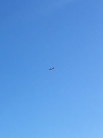
Some further exhausting progress and then that noise again, coming from the south. I stopped, now completely destroyed, on a slightly less steep section. I might just have been breaking the back of the foothill. Suddenly the volume increased and out of the blue, literally, and almost directly above, the Spitfire again. Awesome. Quite how, but I managed to whip out the phone and with shacking hands and sweat everywhere, found the camera mode and started clicking. The wing tilted slightly to the left and I could just make out the head of the pilot. I felt a connection and a second later, and the man at the controls pulled back and to the right and completed a victory roll. This magnificent moment of airborne ballet happened in a few seconds, and I don’t care what anyone says, that roll was mine. I had been that close to cracking, but now, instead, I knew I’d cracked it. Two Japanese tourists, just a bit ahead, and who had witnessed the performance, looked in my direction and smiled. I knew all was now good.
I can’t say that the next section was that much easier. It was certainly less steep but I’d already used up too much and just getting to the top of the first rise felt hideous. I edged towards the top of the cliff, threw the bike down and sat for a few minutes, again disguising my exhaustion by looking out to sea and down the coast as if in admiration of the view, whilst gasping erratically for life and trying to moderate the heart rate.
After a couple of minutes, during which many happy people trotted by, smugly enjoying the experience, I rose and continued the long push to the top. As the slope flattened out a fence came into view that ran at 90 degrees from the cliff edge. Closing in and an increase in exposed chalk and rutting indicated path funnelling towards a gate. The gate was designed for walkers only. The two Japanese women had reached it first and were taking photos of each other and giggling – I assumed at me as I pulled off the panniers, threw them over the gate and then went through the tedious, and potentially harmful, process of lifting the bike over to the other side. Well, at least I’d broken the back of it.
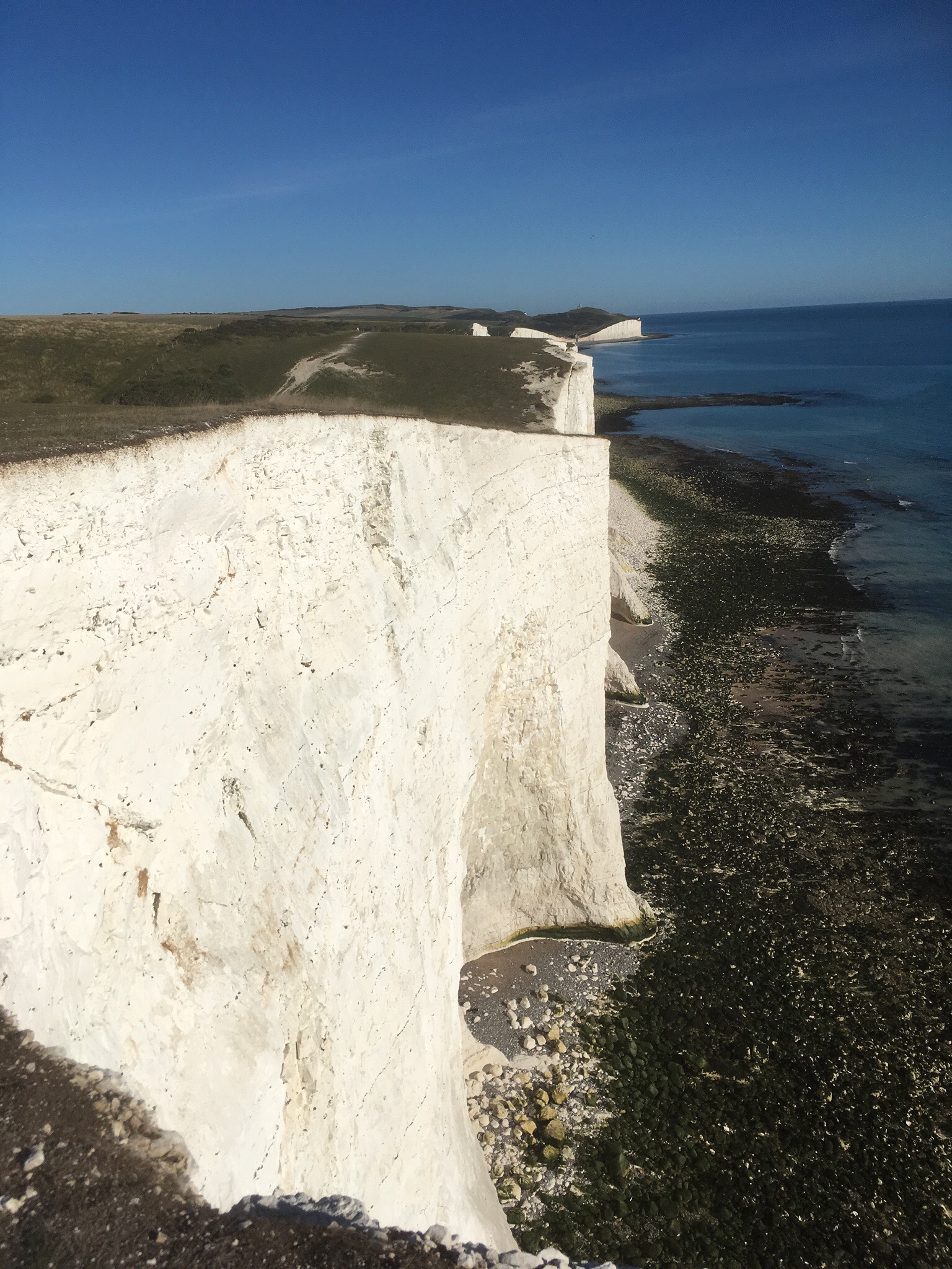
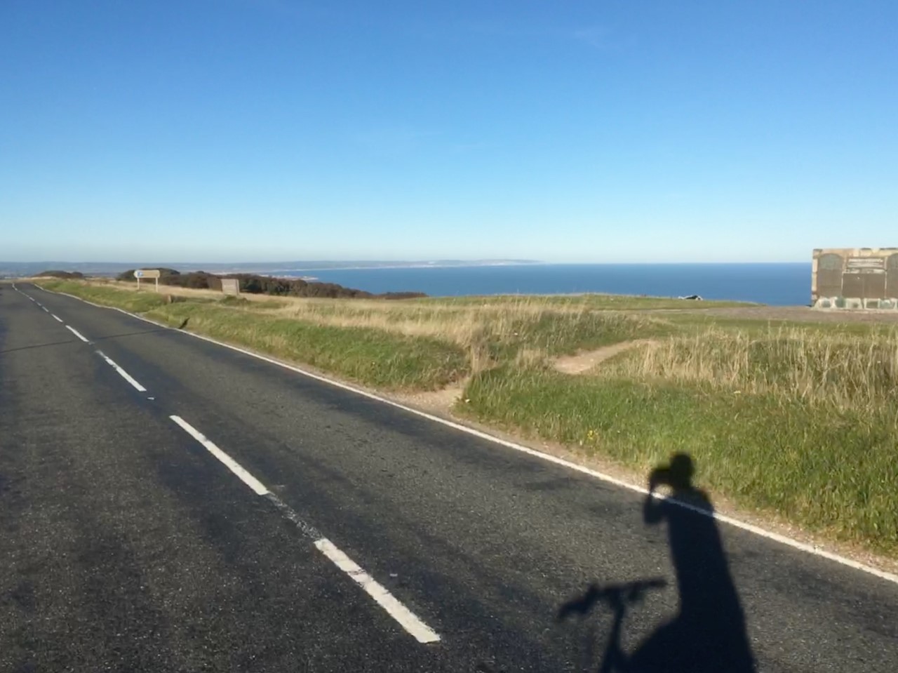
It was then downhill for a bit and that involved some cautious cycling. Which of course only lasted a few seconds before coming to a shaky end at the foot of the slope, despite a somewhat pathetic effort to peddle on up the other side as far as possible. Which in reality was probably no more than 20 meters before the legs objected and the land beneath the tyres became impossible. So back to the push and gasp technic and up the second Sister, now keeping close to the cliff edge. Another fence and gate at the top of this one, and a repeat of the previous procedure. Doubt was creeping in. Another brief rest, ever mindful of the pressure of time and the appointment with the train at Eastbourne station, and a quick photo opportunity. Spectacular views east and west of the Newhaven chalk formation cliffs and with shaky hands a couple of quick snaps that lack any merit but one included below just to prove I got there.
Another sweep on the bike down the next slope and then back on the push for the third “Sister.” Despite getting into a rhythm, pushing the bike up another 200 odd meters of rutted Downland was taking a mighty toll, and this one was steeper than the last. At least on reaching the top there was no gate to clear but the next dry valley was steeper than the previous two and the push up to the fourth summit sapped almost everything left. Finally, at the top, hidden until late on by the steep angle of the slope, another fence and gate. Here, a symbol. No Bikes. No shit Sherlock! As I approached from the west, heaving and wheezing, a middle-aged walking couple were doing likewise but from the other direction. I had already thrown over the first pannier when I noticed they were looking at me, not in horror, but in what was humane sympathy. “Can we help?” If I’d had time to think about it enough, I am sure the answer would have been yes, but in truth I was in robot mode and just grinned, slightly manically as the second pannier, and then the bike, went over the top and I said it was okay but acknowledged too the madness. No point in injuring anyone else today.
The next downhill section was a gentler camber and I was able to cycle at a reasonable speed without thinking I was about to be pitched off at any stage. Looking ahead, the reality was that so far I’d probably only managed to get half way along the cliff path that I knew would eventually reach Birling Gap. I was exhausted, the sun still banged down and time was ticking on the train departure. The overdue bike ban here also tinkered with my brain. I had to weigh up some important options. Try to keep going on the path, not knowing for sure what other obstacles were ahead, and also whether there would be more ascents like the one I had just done. At the foot of the slope I made my decision. A gate and a reasonably good looking path, come track, led away inland. I knew that this would mean a climb out of the valley that could get tough, but if so, at least I would be back on a road and would stand a fighting chance of reaching the terminal. The three remaining “Sisters” would remain bike free.
Beyond the gate (I was able to open the gate and lead the bike through without the need for dangerous physicality), and approaching, were two women with healthy looking dogs. As I wasn’t entirely sure where I was or where the path led, I asked them. Yes I could get to the main road but it was up a very steep, long hill. “Oh, whoopie doos!” I thought, but just being grateful to know I was on track I smiled, thanked them kindly and with a spring in the legs, pushed on and up.
The track wound up the dry valley and eventually to a field where dismounting was the only option. Through the field and then onto a private road surrounded by buildings and houses that seemed to form part of an old estate. Red brick in a limestone landscape. The road continued on up with a fine dry-stone wall to the left and impressive views over the valley below…and then, WHAAM…. duck and quiver as the first of what I think was an RAF Tornado, slammed overhead, and then a second a moment later that drilled me into the solid earth. Sod that for a game of soldiers. As the two fighter bombers disappeared over the low horizon, I shock myself down in an attempt to equalise the sole, bones and general malaise. There had been no victory roll or wing tipping on this occasion and I assumed that I probably hadn’t even registered on the HUDs up screen. Maybe just as well. Earlier in the summer, and towards the end of a 50 miler on the old and utterly outstanding railway paths across the Peak District north of Ashbourne, I found a spot on the shore of Carsington Water where I could finish off a packet of crisps. It seemed to be the appropriate spot, with a sign that stated promisingly “Quiet Area.” A few crisps in, and completely without warning, the Red Arrows had twatted full tilt and throttle over my little spot of late afternoon tranquillity. Birds fell from trees and fish lay stunned and motionless on the waters surface. Magnificent my arse!
After eventually finding some inner balance I reached the top of the lane that emptied into a car-park that gave access to the country park and shortly an attractive church to the right and the A259 again. No messing, downhill to East Dean, no traffic trying to squeeze past now. Through East Dean, a pleasant looking community set within a dry valley, and then right and down the road to Birling Gap, a mile or so to the south. Legs working again (maybe 80% efficiency) with good progress made down the distinctive valley, and I soon pulled up at the café above the cliffs. The eastern end of the Seven Sisters chain and a low point between them and the slightly higher Beachy Head section to come.
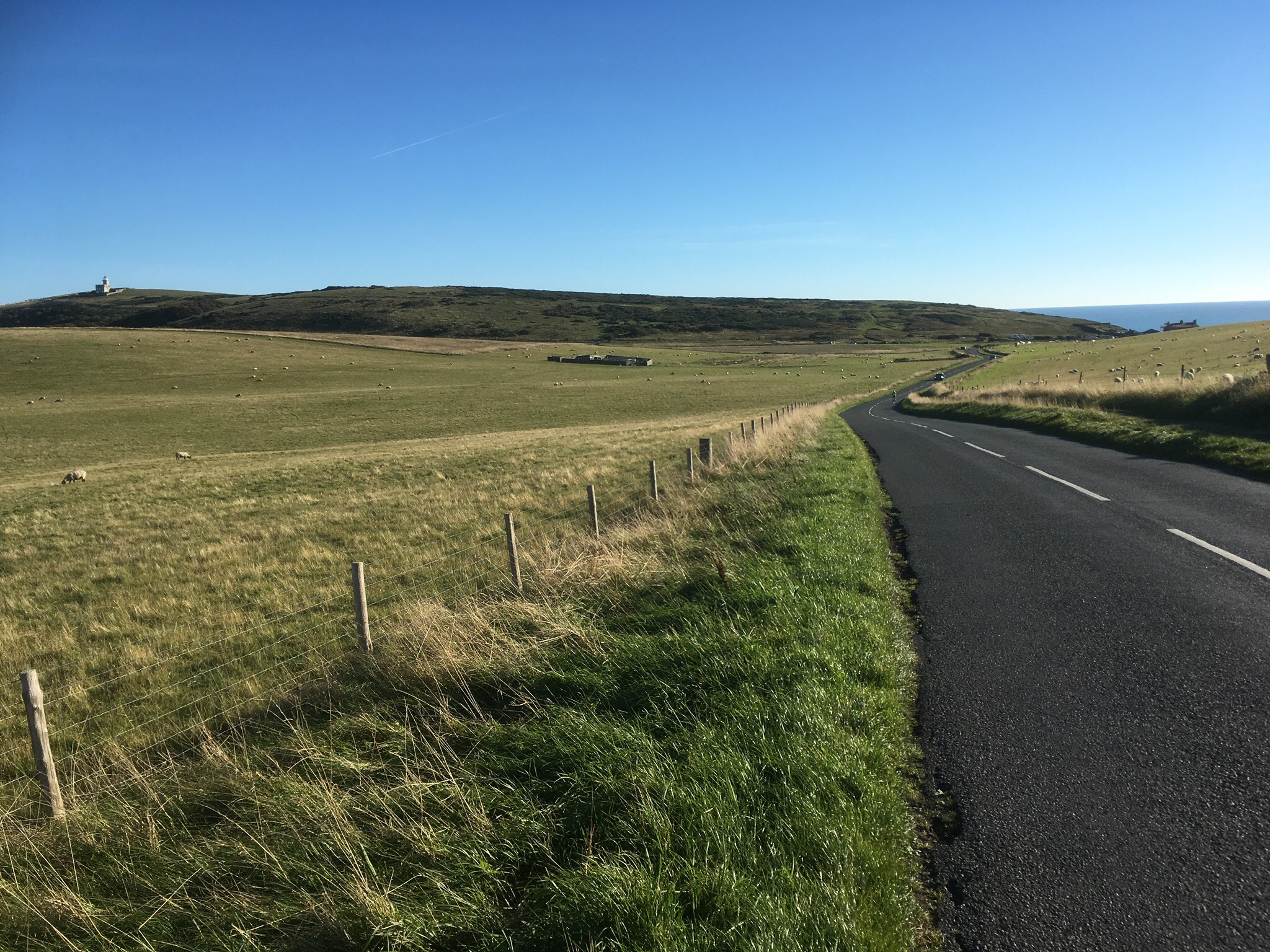
Against the odds I seemed to have made up some time; well, at least enough time to think and hope I’d get to Eastbourne in time for the train. With that in mind I didn’t linger at this iconic location long (perhaps I should have), though many other understandably were.
The road to the east slowly wound up another valley with the headlands rising to the south. I remembered being here on a different bike (nicked of course), some years ago, and hearing familiar noises in the air, witnessed a formation above. A Spitfire, a Hurricane and in the middle the Lancaster bomber circling around the Gap and then heading away towards Eastbourne. Not today, and to be honest I’d had my fill for one year of the rip-roaring antics of those jolly chaps in the skies and plodded on, head down, land-based objective in focus.
I’d forgotten one thing. The road was much longer than I’d remembered it as being. This was probably due to the then welcome distraction above on the previous occasion. I’d also forgotten that as the road found its way towards the top of the valley behind Beachy Head, it got steeper and steeper. Not by any means Mont Ventoux, but a mini East Sussex equivalent, not welcomed at this late hour. Plod on, plod on, plod on, and eventually the incline was less and started to undulate and flatten out. Good for speed. Good for the London train? The Beachy Head pub appeared on the left, and a memorial on the right to Bomber Command but no time to stop and digest. The road had straightened and though slightly uphill I had picked up the pace, found my phone and with hands free pushed on with views of Eastbourne and the bays heading east towards Hastings, the camera clicking.
At the end of the headland road, a junction, a right and then a rapid and exhilarating descent down the steep and winding Upper Dukes Drive that cups the outer limits of Eastbourne’s residential spread, and at the foot of the hill, with a turn to the left, and it was the seafront and a long stretch toward the pier. A quick look at the time and with less than ten minutes left before departure I knew I’d cooked my goose. It had been a brave attempt but in truth it was never going to be. Still, if I bashed on, maybe, maybe?
Maybe not.
Sitting on the deck outside the café just to the west of the pier, and putting off the short cycle to the station, I sipped coffee and mulled over the events of the day. The near-death climbs up the cliffs and the leg numbing pushes that accompanied, the victory roll and then the blast of high-octane energy smashed out above me on the little road were still very fresh, but the first part of the day, leading to the Cuckmere, were almost erased. As if the morning and early afternoon hadn’t happened at all.
Half a mile to the station, through a street with vintage and modern high-powered motorbikes parked, and being ridden by men at least my age, and beyond and then through the main streets and to the station. A London train was due to leave in 15 minutes. I was beyond caring about any fare penalty. Just get me home.
Slumping on a seat facing towards the front, the train pulled away from the sea, and then inland and hugging the South Downs and the part conquered cliff formations from earlier to the south. A sporty looking cyclist had boarded the train and we chatted for a bit about our respective journey’s. He, I should say, was younger, and had come from Littlehampton. There was no indication that he’d done any pushing so he’d obviously had more faith than me in the old A259. The sun was dipping away, and the scene all glorious and essential. Although, in the scheme of things, perhaps more glorious and more immediately essential, was the corned beef and pickle roll that I fished out of one of the panniers, and gobbled down. My occasional attempts at vegetarianism over the years have usually fallen on the sword with the smell of frying sausage or bacon. A pathetic and almost cliched weakness that many suffer. Never again will that weakness catch me out. But, just to be clear……when it comes to tinned corned beef and Branston (other less addictive brands are available) pickle rolls, I’m just a repeat victim waiting to happen.
The sun continued to fall away to the west. It would be dark by the time I got home. No-one seemed to be bothered about my illegal ticket, and there was a cold beer in the fridge far up the line. London was Calling.
