Unintended Consequences – Beyond the Swale
Landranger 178 (just one map!)
31 Miles
Back in October of last year, at the point when I crossed over a small bridge spanning a small expanse of water just north of the historic Chatham dockyards, I hadn’t immediately appreciated that by this minimal act I had also crossed a sort of imaginary Rubicon. I wasn’t about to cause panic in the Republic or on the streets of Carlisle, but arriving in the newly emerging housing schemes of St Mary’s Island I had inadvertently set a precedent. I could cloak it up as much as I liked, (old JC himself did a lot of cloak, daggering and spinning up when he crossed over the actual Rubicon River, ensuring that his ends justified the means), but the reality was that once I reached the other side of the bridge, I was on an island.
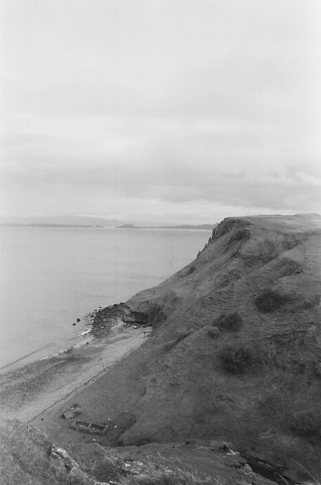
On that same day, and some miles on, I passed under the rail and road bridges that carry you o’er the sea to……eerrrr…….Sheppey! Add a “k” and a bonny wee boy, and you have the makings of a cryptic crossword clue. An aside, but on the same theme, a few years ago I did manage to cycle around the northern coastline of Skye. Here’s a photo to prove it.
Maybe I need to go back and do the south bit whilst there’s still time left? But, (I know, so sorry, lost in mental contortions already), back in the nearer present, having passed under, rather than over, the bridges to Sheppey (I had to pass under them again 15 minutes later after being sold a dummy by the Saxon Shore path), I had made a statement of intent. Drawn a line in the marshes so to speak. I wasn’t going to get diverted by an island. That just wasn’t going to happen. It wasn’t in the thinking back in the early summer of 2018 when I had decided to try and cycle around the coast of Kent and Sussex.
So why, on the morning of 23rd April 2019, I am cycling through Holborn towards Victoria Station in the late rush hour I cannot explain. And I can’t explain either the complete coincident when, at the junction of Theobalds Road and Gray’s Inn Road, I looked up at the lights and there was my younger brother ambling purposefully to work. I nearly ignored him. Why would he want to know that I was on a day out on a pleasant spring day while he was about to face a new Monday morning at work? But I overcame that negative thought, mounted the pavement and squealed to a halt just before crushing his toes. We had a quick chat, though I could tell he was still in that deep, dark thought state which comes just an hour or so after waking up, and a few minutes before entering the work place. I left him with a wave and a smile, and got back to purpose.
The train left Victoria and headed through south-east London on a line I am sure I had never been on before, though I may have said that before. I had to change trains at Bromley South for the connecting train to my destination – Sheerness. Or did I? Yeah – for sure!
At Bromley South I alighted. I knew there were a few minutes before the connecting train but after the mad dash between platforms here on the previous trip, I was immediately alert to seeking out the information screens. The first train showing was one that further down the line stopped at Sittingbourne. “Sittingbourne?” “Hmmmm…Sittingbourne?” I mused. More Hmmmmm………and the doors to the train I had just stepped out of closed at the very moment it dawned on me that it was the train to Sittingbourne, and it was Sittingbourne that had the connecting train to Sheerness. Too late the idiot.
I shook my head from side to side and waited for the next train to Sittingbourne, which arrived about 15 minutes later but then stopped at every town, village, hamlet and halt, which inevitably meant I missed the scheduled connecting train at Sittingbourne. Half an hour later and I was on the next one.
Now this is a tad annoying. Sometime on Friday (it’s now a Monday in July), I set aside half an hour and managed to crack on with this account. In fact – I distinctly recall getting quite far down the line. And, yes, it seems it didn’t save! What a right royal pain! I’ll need to give it another go. Hardly The Seven Pillars of Wisdom I know, but we’ve all experienced this at some time or other and I am certain that many a PC has met a violent and untimely end in such circumstances. There are probably a few laptops sinking slowly into the silt in the Swale, dispatched violently from the train in a moment of individual melt-down. So – here we go – what can I remember now? Repeat.
As the two-carriage electrical multiple unit crossed over the Kingsferry Bridge, and at the point when the wooden sleepers were laid back on land, I knew that there was no turning back. I was now, metaphorically, beyond the pale.
The train trundled north-west across a marsh before entering the small town of Queenborough. Even in the sunlight it looked and felt a bit bleak, and it struck me that this was likely to be one of the last places I came through at the end of the day. That was slightly depressing. A number of people boarded, sat down, and instantly pulled out mobiles and made calls stating condition, location and likely time of arrival at Sheerness, which was just a few minutes up the line. My own mobile hadn’t made an appearance. Only my brother had a clue where I was and I guessed he didn’t care that much.

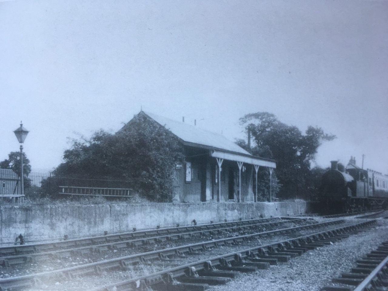
On through areas of industry and Victorian housing and finally arriving at the only operational platform at the terminal at Sheerness; a pleasing white panelled Victorian station that must have once welcomed more activity.
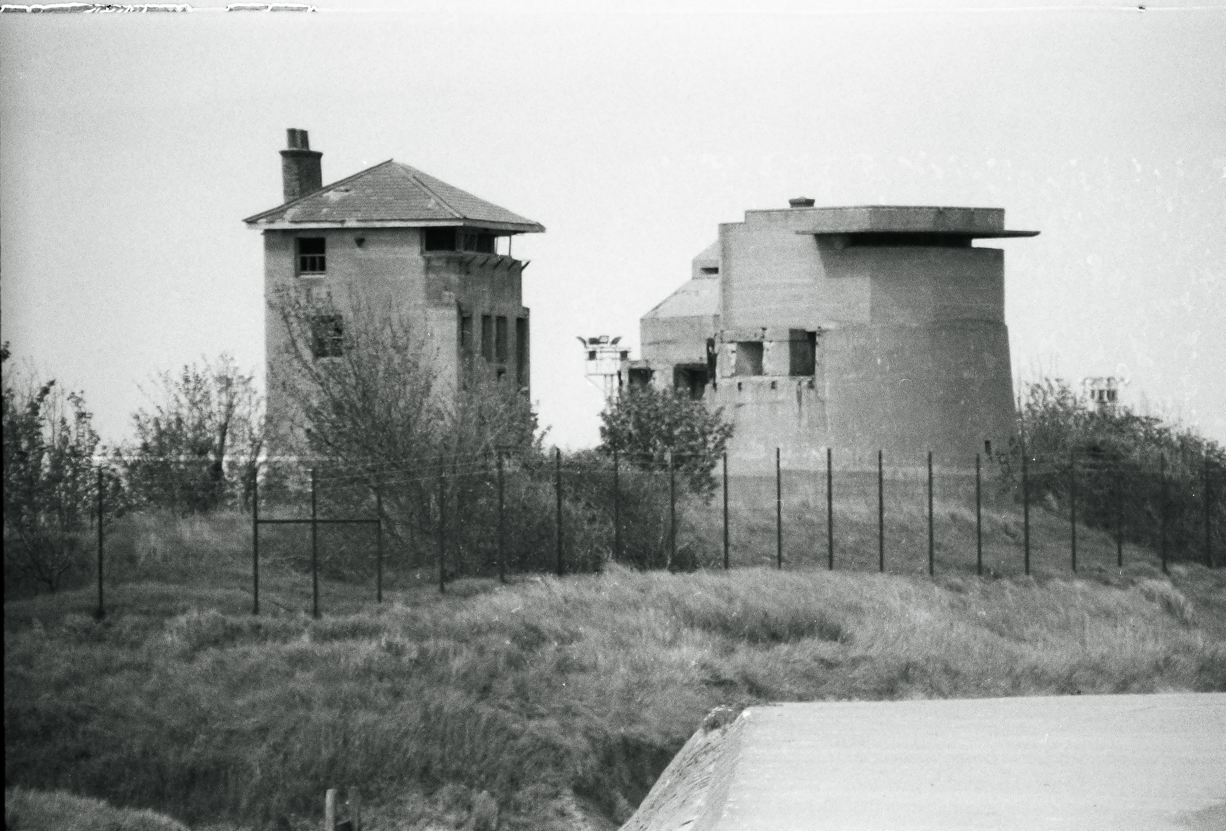
Outside I looked around to figure out the best direction of travel, and then did some loops trying to find a route to the seafront; eventually finding a path between a creek and a large Tesco’s. The seawall was wide, and to the west, at the end of the path, a tall concrete bastion of a building that clearly had WW2 associations commanded the channel of the River Medway. I headed east along a wide path on the top of the sea wall that kept the North Sea from reclaiming the town. I don’t know if there is anything to say about the Islands main town because I barely glimpsed it.
Passing out of Sheerness a marsh lay inland, between and before the next town; Minster. The path clung to the beach and so there was no diversion into the town. At Minster the path continued along the front. At this point low, grassed cliffs started to rise gently and the town sat above. Looking down the long seafront it seemed that a local business was doing very good business selling plastic flowers. Numerous memorial benches stretched towards the horizon and, without exception, each had been heavily decorated with the things, most now losing the deep and evocative colours that they would have once displayed when they had left the factory. Not an unusual sight perhaps, but not on this scale. It seemed to have become a local ritual.
Towards the end of the path, and where the benches petered out, a small harrier hawk appeared, hovering just a few meters from me over the grassy slopes. As close as I had ever been. Blundering away I searched out the camera from the bag, went through the routine of removing the cap, turning it on, and was about to point when of course, it gave up on the morsel it might have spotted and wheeled away towards the town. More time wasted.
The path was about to run out as the cliff slowly climbed and a set of wooden, recently installed steps, led to the top. I set off up the bank, pushing and shoving. It was higher than I’d expected but I reached the top without completely running out of steam and collapsing in a heap. A field and a path ran along the top of the cliffs and eventually I was at a small gate that led into a static home caravan site. I climbed to the top of the site, and to a small lane that had a left and right option. The left option headed down, and back to towards the sea, but I wasn’t prepared to take the risk so instead headed up hill and eventually to a junction with a bigger road. A sign indicated that I was at Pigtail Corner, and one of the old buildings opposite looked like it might have once been a public house that may have been the origin of the location. If it had been, it wasn’t a pub anymore!
Ok – I think I’m all caught up now? Wonder how much I’ve forgotten/embroidered/remembered and lied about?*
The road went east and then a left at an angled junction into Plough Road. After a mile or two, and surrounded by fields, another junction. The left would have taken me directly to the coast, but fancying a small diversion, and heading inland instead, I ended up at the hill town of Eastchurch. I stopped outside the church and at a memorial commemorating the history of the very earliest manned flights made in the UK, which happened at an airfield nearby (I image the use of the word “airfield” here may not reflect our current understanding of the term). Seemed to be quite significant and not something I knew about. There were a few shops, and the village was busy. Quite a few vehicles pulling up, people getting out and back in, and clutching fast food and soft drinks. Some in uniform. I knew that there was a prison lurking ominously near here, and that explained a lot.

It’s not a thing I knew at the time, but it seems that Sheppey has had something of a dissenting past, and activities at Eastchurch centuries ago, were no exception. The execution order for Charles the 1st was signed by the local vicar and one of the local bigwigs. Once the monarchy had been re-instated (imposed – chose your position?), nearly all those involved were hunted down and executed. Hey – that’s the way those things worked, but this local bigwig was fortunate enough (?) to kept his head and instead was sold into slavery!! How about that? And who would have had him? I wish there was more I could say about this, but I found this nugget on some website a few weeks ago and which now I can’t trace, so some caution needs to be taken before relating this tale further.
After a short while I set off back down the hill and back to the junction where Warden Road would take me further east and to Leysdown-on-Sea. Not too far along this road, and on the left, was the entrance to Shurland Dale Holiday Park. There was no reason to enter, other than a large sign stating there was a cycle short cut avoiding Warden Road. Given that Warden Road was quite narrow, and that some of the motorists around these parts were happy to whiz along without too much thought given to the consequences, I opted to take the by-pass opportunity. Soon I was winding up the concrete roads that serviced this static home megalopolis. Perhaps in honour of the grid pattern streets that, minus skyscrapers, mimicked New York, the roads were handily named, First, Second, Third etc Avenues. On reaching Second and Third, the main site ended and a private road continued for a short while. Clearly going nowhere other than over the cliff.
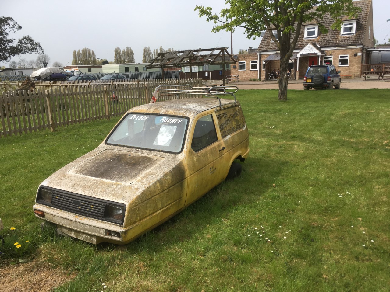
Turning back downhill I picked up on the cycle path directional sign (Second and Fourth, just in case anyone else out there makes it). This took me east again and I was at a junction with Warden Road, and slightly confused. “What the Dickens?” I may have said whilst trying to get my bearings and deciding whether to turn left or right, but I didn’t say that. I did note though a modern pub called the Dickens which lay at this spot, and in the big garden and by the road, a grubby and abandoned yellow Reliant Robin, suitably made up to look one that one might have been seen on the roads of Peckham back in the day. A nice touch Dave.
I turned left. A sharp right a bit further on and then a sharp left as the road climbed through fields and then through a small farming settlement where on the left another pub. Actually, it’s about now I ought to say that in the last few weeks my eyesight seems to have deteriorated drastically. My own theory on this is that it’s a side effect of taking Statins. These are drugs that the NHS award you when you reach 60 and after you attend the free health check-up. They then send you on your way in the knowledge that a percentage of the people taking these drugs will live a bit longer than they otherwise would have done by not having, or delaying, a stroke or heart attack. Box ticked and targets met. Just to be clear, the NHS is obviously the best thing ever invented in the whole world (except possibly the railways). But for a year I didn’t take up the option of the repeat prescription, rationalising that having slightly high cholesterol was, in itself, not a good enough reason to waste the public purse and take a leap into the unknown. So, a year passed, but inevitably some minor ailment that lasted a few too many weeks, and I was reluctantly back at the GP’s in December.
“I see that you haven’t taken up the repeat prescription for the Statins you were given last year. Is there any reason?” asked the GP as she reviewed my notes at the end of the 10 minutes.
Well, yes there was, but after some pathetic blustering about not being fully informed, and were there other things could I do instead, I gave in to the weight of institutional pressure. The prospect of a few more months on this mortal coil perhaps? So I said I would stop being a silly boy and take up the daily habit instead. Perhaps if I were to address one or two other daily habits I may not have been having the conversation at all, but that’s another strand.
Just a reminder, I’m outside a pub on Sheppey, but back to the drugs. I kept to the daily dose nearly every day for the next few months, but sometime in May I looked at the packet of 30 tablets, and for no particular reason I can think of now, decided to get on with the life job without them.
Some days later, and you’ll remember that I indicated that my eyesight has been taking a bashing too, I took the liberty of looking at the side-effects of Statins for some people. And, bingo, a small percentage of users do suffer blurred and double vision, caused by a weakening of the brow muscles. I had no idea at all if there was a linkage, but given that I had also noted that in recent weeks my eyebrows were increasingly, and annoyingly, getting in my eyes when wearing glasses (in medical terms this is known as Denishealeytosis), I put all the two’s and two’s together and came up with my own self-diagnosis.
In the interest of editorial balance, I should make it clear that I have absolutely no medical knowledge whatsoever, other than my gut feeling. At some stage I should probably contact the doctor and explain why I haven’t picked up the repeat prescription but I am slightly worried that this will kick off a new campaign to try and extend my life.
And so, with some level of double vision hindsight, my medical condition, as relatively minor as it clearly is, may have been the reason why, when I glanced at the pub on the left, there was profound confusion because immediately adjacent, and what appeared to be an identikit building, was, another pub! I stopped to take in this bizarre phenomenon. It was true, and I wasn’t even pissed! On the left stood the Walnut Tree and, on the right, The Wheatsheaf. They both seemed to serve pretty much the same sort of services, and they both looked like they would be pretty good. Given that pubs are closing at an historic rate, these two survivors, seemingly in open competition with each other (who knows?), and in the middle of nowhere, were minor miracles.

But there was no time to sample the pies and pints and it was onward and eastwards on Warden Road until a turn to the right and I was now on Thorn Hill Road. I felt like I hadn’t seen the sea for a while and so at the entrance to another holiday park I entered and cycled down the road to the end where low cliffs overlooked the channel. It was obvious that there was no chance of progress here and that I would need to return to the road, but my desire to spend a few minutes having a brief rest was cut short by a really annoying small dog that was on the balcony of the nearest holiday home; scampering back and forth and barking at the top of its irritating abilities. A middle-aged woman popped out onto the balcony a couple of times but made almost no attempt to stop the dog from pissing off everyone else on the site. She occasionally shouted, whether at the dog, or me, it wasn’t clear. I obviously wasn’t welcome, despite the public path that ran along this part, and so in order to spare others on the site any further nerve damage I wound back up to the top with the sound of madness echoing up the valley.
To make further progress I needed to start heading south-east, but it wasn’t clear from the road that any sort of public access was possible. Indeed, a quick check on the phone map-app stated I needed to return the way I had come for a couple of miles, and frankly that wasn’t going to happen. Despite some reservations I took the unmarked road, which went steeply uphill, and was the most rutted and unfriendly combination of rubble, clay and silted puddles I had ever ridden. I had a concern that something bad would happen at any moment (a nasty encounter with a skip vehicle was one of the scenarios playing out in my head), but eventually I reached the top without incident. The road spilled out into a small estate of bungalows and detached houses where the roads were nearly as bad as the one I had just been on.
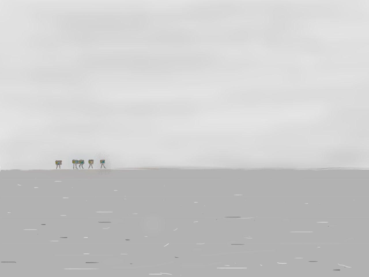
I bumped down Cliff Drive, which seemed to be the most obvious thing to do, but it petered out near the edge of the cliffs and became nothing much more than a glorified path. I was able to continue with some care and a bit further down a sign erected by the Council stated that the road was closed and liable to cliff erosion. I stopped again, and looked out to sea. On the horizon, and for the first time that I can recall, I could see the slightly unreal Maunsell fort structures that had been erected in the Thames estuary in the War to protect the channel and spot in-coming air raids. I got the camera with the long lens out and clicked in the hope that something would come out. Well, it did, but rather as expected (the sun had stopped shining by this time and it was somewhat gloomy), the developed result was a tad disappointing and not worthy of inclusion, but here’s a surrealistic representation instead.
There are occasions in all lives when events begin to unfold in front of you which don’t necessarily make immediate sense and your initial response is not entirely adequate. As I started to put the camera away some ascending sounds began to drift up from the sea below. I searched out the source and just down to the right, about 40 or 50 meters out to sea was an inflatable canoe with two males, late teens, early twenties. The day had started off brightly, and it was just a day or so after the hottest April bank holiday on record. But it had been clouding over for the last hour, and despite relatively calm conditions, a bit of a swell had developed near to the beach.
From my position I couldn’t tell whether the two lads were either having the best time of their lives, or that something was beginning to go disastrously wrong. There was a lot of shouting and hollering, but whether it was laddish banter or sheer panic I couldn’t tell. Whatever I was thinking, something didn’t feel right, but the think gorse and mixed vegetation hid to much from me. Jumping back on the bike I threw it downhill along the treacherous path. About 300 meters further on the path met up with another road, and a small car-park with a better view of the beach. A single car was parked and the couple who accompanied it were moving towards the edge, alerted I’m sure by the continued shouting and laughter which clearly added to the confusion.
I joined the couple at the edge of the cliff and stared down at the unfolding scene. In the short time I had transferred from the top to the bottom of the path, the vessel had edged closer to the beach, but by now the larger of the two men had somehow exited the craft, was flapping around in the water and making a series of wholly unsuccessful attempts to get back in.
“Do you think they are all right?” the woman said, turning both to me and the man she was with.
“I don’t know,” I replied. “It doesn’t look good.”
And it didn’t. I had my phone out and was looking to see if there was a number for the Coast Guard handy. I think there was but I’d decided that if I needed to I would phone 999 instead. Despite the hot weather of the previous week, the temperature in the water was still going to be perishing at this time of year. Both men wore only t-shirts and shorts, and neither had a life-jacket.
At last, the one in the water somehow managed to lug himself back into the canoe. This was a big relief, but despite what still felt like contradictory laughter, along with copious swearing, it continued to drift along the shore rather than towards it. At what point exactly was I supposed to make the call that would result in the massed response of emergency services? I wasn’t so sure. If you see someone being attacked in the street, or involved in a serious vehicle accident, you aren’t going to hesitate. So, just because you have in the back of your head that a call to an incident at sea will bring out the police and ambulance, but also possibly a boat and a bloody helicopter, probably isn’t a good enough reason not to do it. And from the body language of the nearby couple I didn’t get the sense that they were going to commit themselves. If anyone was going to have to do it…
In what was a change of luck (maybe the current), or that both men were now giving everything they had to get to land, the canoe eventually rocked and rolled with the waves and washed up onto the beach. With a splash and a few yells, the men threw themselves out and then collapsed on the shingle. There was still some laughter; or was it just hysterics?
If the sudden turn of events hadn’t changed for the better (as they did), and another 30 seconds had passed, I would have made the call and sod the consequences. Wet, cold, and probably a couple of unhelpful beers at lunch, they were very lucky bastards indeed.
The days excitement over it was time for a coffee and a bite to eat. The road away headed directly south and inland, but a view along the coast hinted at a beach towards the town of Leysdown-On-Sea. After a mile the road turned directly east, and another mile or so and I was heading down the short strand of amusement arcades, that on a drab early afternoon in the middle of the week, felt charmless and pointless. A handful of people, and one or two youths in hoods and on bikes who no longer saw a point in going to school.
At the front I stopped and looked along the deserted beach. It was hard to tell but surprisingly it looked a bit sandy in places.
A seafront shop, in what seemed to be a warehouse of sorts, advertised food and drinks, and given that nothing else shouted out for attention I entered and ordered a coffee and a hot-dog (any vegetarian aspirations defeated for the moment). As it seemed I was the only customer for a while the whole cooking process had to start from the start. I took the opportunity to speak with the owner, just to pass the time. Despite the glorious bank holiday weather it hadn’t been any busier than usual. He didn’t seem to be bothered but given that small towns like these survive on the margins, it had probably been a disappointment. I took the coffee outside and consumed the drink before the food arrived. Once it arrived the enormous offering was hard going but satisfying.
It felt to me that what the town needed was a railway. And, just because I knew this already (having recently discovered the endeavours of Colonel Holman Stephens and his plethora of light railways), a railway did indeed wind its way across the centre of the island from Queenborough to where I now was. Heroically, it must have been a bit of a failure because it managed to survive the Beeching cuts by closing 15 years before the brutal axe, in 1950. Lifespan – just over 50 years, and in the 70 odd years since, any evidence on the ground of its existence seemed to have been liquidated. I finished off and headed back out of town, passing again the row of amusement arcades, little knowing at the time (but having subsequently checked on Google Earth), are built on the foundations of the old station. The car-park at the rear almost a post-industrial insult.
Heading south past fields with the sea wall to the east, and soon the tarmac surface gave way to something less constructed. A roadside sign warned “Access Only. Remote Areas Ahead.” Eyes light up! The sun had returned and I set off along the straight and slightly rutted earth track. Almost immediately, about 300 meters away and shrouded in a cloud of swirling dust, a vehicle was heading towards me. As it neared I made preparations to pull over and take cover. Like a scene from a wildlife documentary filmed on the Serengeti the 4 x 4 swept past, probably not even aware of my presence as the driver concentrated intensely on tunnelling his vision through the sand storm. The car passed but moments later I could hear another throaty engine and turning around a powerful motorbike was coming up fast. I let it go and then continued on, watching the two-wheeler disappearing into the distance as it threw up enough dust and rubble to replicate the desert section of the Paris Dakar rally.
After a mile or so, and just past a row of small beach shacks and houses which looked like they needed some care and attention, a rutted path to the left took the bike up to the top of the beach. On the basis of probability, the path through the low coastal vegetation should have been compacted sand or lose shingle, but instead it was made almost entirely of crushed oyster shells. With Whitstable just a few miles across the water to the east, and the strong tidal powers of the Thames and the Swale to assist, in the end it wasn’t such a surprise. Otherwise, there was nothing here at all, although some housing could be seen further down the beach. Perhaps the lack of anything, and the beaches remoteness, was why a white sign welcomed the visitor to Swale Naturist Beach and that “beyond this notice clothing need not be worn for bathing, sun bathing and general recreation.”
As there was entirely no-one in sight, perhaps I should have grabbed the opportunity to disrobe in the open for the first time. But, being me, and putting up the usual mind-barriers, I was troubled by the specifics of the notice and whether or not naked cycling fell under the “general recreation” rule or whether it was prosecutable under Indecency Laws (which may or may not still exist?). In truth it would have hardly been worth the painful effort of stripping and cycling the stretch of shell path that stood above the naturist beach because within no time at all (about 100 yards) another sign, in black writing and on shouty orange backing, made it clear that the fun was over and that “Clothing MUST be worn beyond this point.” It seemed that this specialist retreat was particularly small beer, but looking out towards the sea I could see the appeal.

Very soon afterwards and the path came to an end at a fence and a gate. The dusty road that had continued behind the beach ended at a small car-park and then the gate. Signs made it clear that it was private property. Beyond the gate the road continued on to maybe 20 to 30 modest houses. Just beyond the gate was a grass mound, and at the top of a cluster of metal poles, what amounted to a version of the Shell oil sign, with the words “Hamlet of Shellness” written underneath, and presumably avoiding any trademark infringements. In the distance, and beyond the community, a solitary fort lay low on the edge of the marsh.

There’s nothing here to indicate it now, but it was in 1688 when the fishermen of Shellness (what evidence there is of an old fishing port appears to have been washed away), intercepted and captured King James II as he attempted to flee the realm for France after he was declared unwelcome by his government. What makes this more interesting is that (whether the fishermen were genuinely ignorant or not), they stole his watch, ring and money, not believing him to be the King. Subsequently he was taken to Faversham for a few days, where, by all accounts, he was badly mistreated (think this translates as “roughed up.”) until being returned to London. Probably a long-term mistake by those in the area as Royalists have apparently never fully forgiven the people of these parts.
A gated community at the edge of the earth. Maybe intended to keep out any local Royalists. It seemed a bit out of place. Almost Monty Pythonesque! But it was what it was. English with hints of eccentric. In France it would be considered “chic,” but more conveniently located on the sandy Atlantic coast a few miles west of Bordeaux.
The direction of travel was about to change as the return to Sheerness was westwards. Here the area was marsh and flat. A raised path stretched out across the marshes and made for fairly reasonable cycling. The Swale lay around 500 meters to the south and beyond mud flats studded with dark pools where ducks, Little Egrets and Herons could be seen. To the north of the path a vast area of marsh, meadow and waterways covered in a huge variety of bird life, some easy to identify – many not.
At a point about half way across the marsh I stopped to take a couple of photos, but instead just sat and listened to the silence that dominated between the bird calls. This was a special location and one that probably benefits from a minimum of human intervention. The Isle of Harty. Whilst not obvious on the ground, an island on/in an island, if that makes sense? Seems that there are four sub-islands at Sheppey, with Harty and Elmley being the biggest.

The tranquillity here was profound, and if there had been time had I could have stopped here far longer. As I climbed back onto the bike, a feeling in the air, and then a deep boom somewhere far away. A controlled explosion at some distant quarry – you hear these things occasionally depending on where you might find yourself in some parts of the land. But that brief moment in time, when the air pressure changed just a fraction and a second before the boom, was something I had only felt once before, and perhaps it reflected the remoteness of the place. The only other time was sometime in the early 1990’s when living in a flat in Holborn. A still, warm evening with the widows slightly open and the curtains drawn. A brief moment when that same sensation teased the ears and a moment later the curtains sucked a few inches into the room before relaxing back to their original position. We knew that somewhere to the east many others were affected far more profoundly. No sound but some things you don’t forget. Later that night the IRA also took out the M1 bridge at Staples Corner. Another triumph for negative energy.
Slightly unsettled by the detonation, but relieved that there hadn’t been a subsequent firestorm, and that for the time being at least the world had survived, I carried on across the marsh; coming alive in Spring. Eventually we (the bike and I) reached a field that was fenced off, and a gate and a stile that led to a dusty road heading back inland. My experience with stiles over the last few months had become something of a personal nemesis, and this latest barrier to progress brought on a minor state of depression. As before, I threw the pannier over to the other side, and was about to grab the bike in the usual way before stepping over the wooden obstacle, when it dawned on me that maybe there was another option. Bollocks! So, instead, I grabbed the two central parts of the frame, lifted the bike as high as possible, extended arms forward by a foot or so, and then simply plonked the bike down on the other side of the metal gate. Done and bloody dusted.
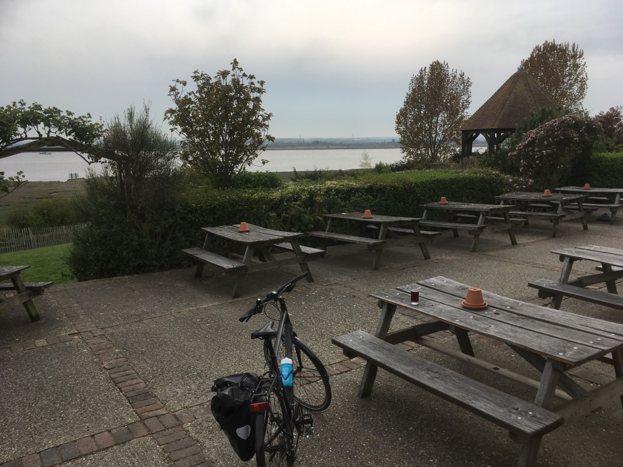
The track led gradually uphill with a large field to the right and tall, evenly spaced Poplar trees in a line to the left. As I climbed steadily a view opened up behind me and down to the Swale, across the channel and towards Whitstable on the mainland. At the end of the track a left turn and past a charming group of old farm buildings with a small church that looked ancient. The road continued west through fields and then a further left and downhill on the Harty Ferry Road towards the Swale and the Ferry House Inn (duly signposted).
I decided to stop there for a bit. And I decided that, for once, I would treat myself to a half pint of the facility’s best ale. You didn’t need to be a historical detective to work out why the pub was called the Ferry House. Presumably, for many centuries, a ferry would have been the lifeline between this part of the island and mainland Kent (with Faversham just 2-3 miles directly south). I entered the pub and was immediately struck by the indicators of exclusivity. This was no longer a refuge for farmers, fishermen and shepherds to spend their hard earned here after trading trips to and from the wider world (that would have been Faversham again), or indeed flogging the king’s personal possessions for a shilling.
Dogs were very welcome by all accounts, and on the evidence of the few people already there they were not far short of a majority. A catalogue displayed the Ferry House’s main features, and it all looked very good indeed. I had half a thought about checking out the price of a night’s stay, but then decided I probably ought not to bother, and so purchased my small brew and headed out into the large decked garden area with views across the Swale and beyond. A few minutes later a mini bus sort of thing drew up in the car-park, followed by some activity with one or two people getting out. I paid little attention, but there was a commotion of sorts going on, and sure enough the female driver was talking to an older man and urging him to get on with it in no uncertain terms. What he was getting on with was openly urinating against a fence post, and taking a long-time over it. There was almost certainly a logical explanation for this unlikely display of continental rural practice, but given that there was a fully functioning toilet in the pub, just 10 yards from where the man stood, it did seem slightly undignified. Maybe he was a local elderly bad boy, previously banned?
With the half of the Whitstable Best in the garden and a hazy sun, I studied the OS map in search of possible routes across the south western marshes. There were paths but having had my fingers, shins, arms and ankles scared over similar terrain on the Hoo I settled on the roads.
The clock was ticking, so I supped up, and after a quick relief (in the pubs toilet facility – although the car-park was clearly another option), I set off back up the hedge lined hill. At the top the road headed west for a bit, then north for a while, then back east. There were some good views in every direction but by the time I reached a junction where the road headed back north, and towards Eastchurch, I realised that I had fallen just short of completing a large loop that had nearly taken me back to the track with the poplar trees. But no worries, it was all part of the day.
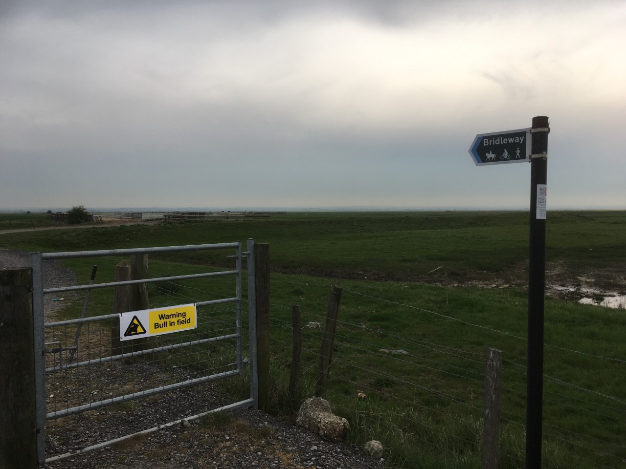
A long stretch of pleasant cycling followed as the road arced north-west, and then across the Harty marshes with a river channel to the right. I stopped at a point in the road where a sign indicated a bridle path which seemed to be heading back towards the coast and across the next set of marshes. I took out the map to see if there were any clues, but perhaps because I was too lazy to take out my glasses, I wasn’t able to make head nor tail of the options on offer. I rationalised that I wasn’t about to get into another hurdle race over the stiles. I had skin tissue to preserve. Besides, there was a sign on the gate, in bold black letters on a yellow background, that pretty much swung the decision. “Warning – Bull In Field.” I was still just a little tempted but I’m beginning to get wise to these country bum steers, and so with the risk assessment duly completed I took off up another hill and the high road beyond. A scattering of farms, one with a large cohort of geese running around in a field, and eventually I came to a junction where the main road provided a Leysdown-On-Sea option to the right, and Eastchurch to the left. Oh….I have some pictures of the geese, but if you want to see them you’ll need to subscribe to my paywall site (more details available by email and a cheque for £5).
I won’t trouble any reader too much with the next few miles. Although a main road, it wasn’t particularly wide. In parts it was probably built on the footprint of the old railway, had no concession at all for the possibility that some mad cyclists might want to use it, and had a speed limit of 50 miles an hour, which of course in reality meant the traffic was travelling at 60 miles an hour and was pretty scary at all times. I just wanted off it as soon as possible, but that wasn’t going to be an option. The road flanked to the south of Eastchurch, and then a newer, slightly wider section, still with no consideration given to cyclists but on a ridge that had good views to the south and across more marshes (Elmley Island). The fields on the slopes leading down to the marshes were swathed in oil-seed rape and presented a patchwork pillow of intense yellow broken by the occasional hedges and small coppices.

In the far distance the curve of the road bridge across the Swale that connected the island to the mainland. From what I could see I had made the right decision to take the road option rather than what would have been a much longer slog over hostile and uncertain terrain. Whilst this was all very pretty and life affirming, due to an exponential increase in traffic hurtling in both directions (mainly east, and presumably commuters returning to homes around Eastchurch and Leysdown), there was little chance to check the scenic action as the very act of staying alive had become the significant imperative. There was another three or four miles of this torture before eventually I arrived at a roundabout south of Minster, where all the traffic on the island converged. To my relief a small side road offered itself up as a quiet route down to Queenborough.
This short section of road, that shadowed the much busier duel-carriageway, ended at a junction where a large public house (built between the wars) called the Aviator stood guard. The sort of pub that back in the 50’s, 60’s and 70’s, and before being by-passed, would have sat on the main road and pulled in the day-trippers who had made it after a two-hour drive from London. Offering alcoholic refreshments, pickled eggs, and bags of crisps with the little blue pouches of salt, the weary travellers could be re-energised before heading on to complete the final few miles, no doubt through endless traffic jams winding into Minster or Leysdown-On-Sea.
I crossed over the duel-carriageway and then entered Queenborough. Unremarkable, until crossing over the railway and entering the older part of town along the High Street, and where older Georgian and Victorian houses and buildings offered more contrast and interest. The High Street continued towards the harbour. There wasn’t anything about this place that lacked interest and was quite pleasing on the eye. A modest Town Hall building on the right with pillars, large leaded windows and beautiful Flemish bond brickwork gave in indication of historical events. Then finally the harbour area with pubs, parks and yacht clubs. Not a huge area, and certainly not biscuit tin Cornish fishing village pretty, but despite my initial concerns when passing through on the train earlier in the day, I was surprised to find that I liked it.
I should say at this point that Daniel Defoe, passing through here some 300 years ago – had a very different opinion. In fact, it was yet another settlement that he fumed over because of its “rotten” electoral status. Very honourable indeed, but by any stretch, when I read his account, it was obvious that whilst staying there someone had caused him so much upset that, with the benefit of distance, he decided to meat out maximum payback. This is how he saw it:
“At the south-west point on the Isle of Shepey, where the East-Swayle parts with the West, and passes on, as above, stands a town memorable for nothing, but that which is rather a dishonour to our country than otherwise; namely, Queenborough, a miserable, dirty, decayed, poor, pitiful, fishing town; yet vested with corporation privileges, has a mayor, alderman, &c, and his worship the mayor has his mace carried before him to church, and attended in as much state and ceremony as the mayor of a town twenty times as good. I remember when I was there, Mr Mayor was a butcher, and brought us a shoulder of mutton to our inn himself in person, which we bespoke for our dinner, and afterwards he sat down and drank a bottle of wine with us. But that which is still worse, and which I meant in what I said before, is, that this town sends two burgesses to Parliament, as many as the borough of Southwark, or the city of Westminster: though it may be presumed all the inhabitants are not possessed of estates answerable to the rent of one good house in either of those places I last mentioned. The chief business of this town as I could understand, consists in ale-houses, and oyster-catchers.” Danny D c1720
Now, on my travels I may occasionally across a community which has left me a bit cold, or deflated or a bit depressed, but it has never crossed my mind to indulge in a crucifixion of the place. Everywhere has some merit, otherwise it couldn’t exist. As interesting a writer as Defoe was, and of course leaving an important historical account for us all, he was certainly no Bill Bryson. As much as every aspect of this town seems to have stuck in his craw, and that the issue of “Rotten” boroughs was a total scandal which he was right to highlight, Queenborough was originally created in honour of Edward the Thirds wife, had seen far better days, and by Defoe’s time was on its total uppers. For whatever his short-comings, the mayor, just a bloody butcher f’sakes, offered up a whole shoulder of mutton (being the Isle of Sheep there was a lot of that available), and sat and drank wine with him. You have to wonder if the poor man ever got around to reading the almost barbaric literary slaughter of his small town? And if he had, what means of recourse did he have? Certainly not the internet, and almost certainly that was a blessing.
I hadn’t intended to use these accounts as a guide to local history but sometimes you discover things that can’t go without comment. Two hundred years before King Henry VIII started erecting the revolutionary circular, squat and thoroughly modern coastal forts along the south coast (Deal and Walmer are perhaps the best examples), a similar structure was built at Queenborough. It was so effective as a defensive structure that it hardly saw any action. Sadly, it didn’t survive long enough to make it through to the Ancient Monuments Protection Act of 1882, or being listed under the Town and Country Planning Act of 1947, and so Queenborough lost out on the possibility of subsequent commercial exploitation through tourism. Judged so successful at its job, and hence perversely a waste of space and money, it was pulled down in 1650. And that’s slightly ironic, because, as I revealed in the account of the Rochester to Herne Bay ride back in May, in 1667, the Dutch made full use of the hopelessly useless state of Kent’s defences and were able to seize the fort at Sheerness, then sail up to Chatham and cause as much havoc in one day as the Japanese did at Pearl Harbour. Nothing remains, and you have to wonder whether its deconstruction, and the subsequent post military importance, might have led to the woeful state that Defoe found the town when he came a calling. Many a town and city around our coast have experienced similar declines and without adequate safety-net.

In recent years Queenborough has held an annual Independence Day. It’s a bit complicated but it seems that after the Dutch invaded back in 1667 (an extended weekend break by all accounts, not dissimilar to the Mods and Rockers turning up at the coast for a bit of a bundle back in the 1960’s), they never actually gave it back (in a diplomatic sense), and continued to consider Sheppey as one of their own. I’m guessing that this will be coming as a bit of a surprise to everyone, but you’ll recall that this area was pretty ungovernable and had a dissenting tradition that didn’t seem to think much of the monarchy. In 1967, and in a magnanimous gesture that everyone else in the UK either didn’t notice or have forgotten about, the Dutch came to Queensborough and handed Sheppey back to the English (I use the word very carefully). The recent Independence Day celebrations seem to be very popular events, so much so that in 2017, the then mayor, Cllr Mike Constable (good to know that some order had been restored by then), was keen to get on with a full twinning arrangement with the Dutch town of Brielle, and that returning to Dutch rule could not be ruled out! Consider that!!!! But the best bit of all was that the mayor of Brielle, who attended the occasion, apologised for the invasion 300 years earlier but added that “there were a lot of invasions going on at the time.” Priceless.
There seems to be a very specific form of Brexit emerging here that probably doesn’t equate with our wider understanding of Kent’s historic voting trends. And it’s seems to be in an alternative direction of travel. Perhaps Nigel should be told? Maybe there is still hope?
I sat at the jetty for a while and looked out across the wide estuary which had been witness to so much. A swallow, the first I had seen this year, flashed by just above the still water. A dad stood with his son and was demonstrating some of the basics of fishing with rod and line. A very peaceful spot.
A few minutes later and I was cycling north on the concrete path above the sea defences. At the end the path diverted inland and along an alley, with high metal fencing to the left. Beyond the fence, acres of flat land with endless ranks of spanking new cars of all brands, set out in formation like Roman legions ready for battle. In previous times this area would have been a bustling dock, with hundreds of ships of all types coming and going with whatever products were important at the time. Those days have clearly gone and the sole commodity being traded here is high value personal chariots that need protecting from the elements with blue plastic strip-tape, much of which, when removed had blown onto the path outside the fence. And, you can conclude from that that a lot more ends up in the Thames.
After about half a mile the path left the fence line and I was now cycling next to the main road into Sheerness. I could have continued on this road, but beyond the gigantic car pound a road to the left appeared just after I had crossed over some tracks that were evidence of a train line which once served the docks. The smaller road led into the old town, and a slightly edgy environment. A huge dark brick wall to the left screamed military and the old houses, pubs and shops opposite told of bustling times that will never be seen again. This was Blue Town. Who knows the derivation of the name but it was in a state of decay – yet to be discovered perhaps by the likes of…….well me if I’m honest?
The road headed north and then tracked round to the right and back towards town. The wall that defended, and hid the old garrison, extended for hundreds of metres. Tall lamp posts with period fittings lined the road. The bits of Blue Town what had survived either the Blitz, or the planners (there would be a line of buildings and then large open bits of waste ground that had never seen redevelopment – like a set of teeth with half of them missing), were largely Georgian, Victorian and Edwardian in character. From what I could see there must have been numerous pubs along this stretch, and once there would have been an almost endless demand for ale from the soldiers, sailors, dock workers and all the others who made a living out of the neighbourhood. Also, from what I could see, not many of these pubs had survived into the present and the bottom of the market had finally fallen out. Maybe something changes after dark when the evocative lights come on? Maybe the adult bookshop, that stood out like a sore thumb half way down the street, gave a clue to what happens later. Blue Town, Red Town, dead town. It will rise again I’m sure.

The station was a short hop away and I reached it at 17:18. The train for Sittingbourne was waiting and left at 17:21. Two hours later I was home. And that was that.

*TS Lawrence is said to have lost his original manuscript of The Seven Pillars of Wisdom at Reading Station and then had to write it all again. It might be an urban myth. Either way, when I came to read over the twaddle above, I found that the section that I thought I had lost was in fact still there, but in the wrong place. So, it was interesting to see how different the five or six paragraphs were when comparing the original to the re-write (about an hours’ worth of effort). The chronology was pretty much the same, which perhaps was no surprise, but the sentence structure and terms used were significantly different. I don’t know that this says about anything but it took another hour or so to settle on which sections to use or discard and sync. Shucks!
