First things first. The route I am about to describe is not recommended. Not all of it, but certainly the first two miles. It has no merit and is frankly very dangerous. Betsom’s Hill is located close to where the Ultra Low Emission Zone cameras of southeast London, kiss the invisible boundary with northwest Kent, and by all accounts, including the Guinness book of records (according to the helpful local I spoke to for directions), is the highest point in Kent.
Surely that’s already enough to get you excited. I decided to take this mammoth on after a welfare trip to Croydon to run errands and look after the elderly and infirm. Ironic really given that I am quickly becoming one myself. But, hey, it had been a glorious Spring day, and in the late afternoon, a short walk to victory on the way home was an opportunity too obvious to miss.
I parked up on an estate just at the northern tip of Westerham. I figured this was one of the lowest points locally so it would at least involve a climb of some sort, rather than a park up at the top and a quick peek. Returning to my opening comments, this was a mistake. If I had parked up in South Street, just to the north of Betsom’s Hill, the risks would have been low, but the approach would have been from another county. You can see the dilemma.
Once out of the car I immediately headed directly north and within a couple of minutes was crossing over the M25, a river of glittering metal heading both east and west, and partly on the route of the old railway that served Westerham. It was gratifying to know that for today at least I wasn’t part of the scrum.
The road continued north and I hugged an overgrown footpath between field hedges and the tarmac, clearly a conduit rarely used by other pedestrians or cyclists. A mile in and I pass the Velo Cafe. New one to me but clearly a mega hub for the explosion in cycling in recent years, particularly in these hilly parts just beyond the metropolis. Fifty years ago, me and my school mates would cycle out of Croydon and reach these parts before regretting our actions, and then have to slog it up the scarp face of the North Downs to reach Botley Hill (the highest point on the North Downs) before a downhill breeze took us back home. Martin’s Raleigh Chopper was no match for it then, but he never complained and is now a full-on practitioner.
I started on the main ascent with the busy A233 to my right. The footpath continued for another quarter of a mile before vanishing without cause. Private land appears to be the theme round here so no doubt the will to improve the lives of non-vehicle users was dashed against the interests of the landed. What this meant, in effect, was that I had to walk with purpose on the road itself. I was less than happy but the options were, well, non-existent. I crossed over as there seemed to be more room to step off the road and of course it’s usually best to walk against the traffic. This may seem obvious, but it is not always clear cut. Waves of cars, vans and the occasional lorry hurtled down towards Westerham. Each time I’d retreat carefully into the bushes before seizing a moment and then gaining another twenty metres or so of tarmac, and a bit more elevation. This process continued for much longer than I had anticipated and liked. A blue van passed, and the horn was blasted and some words shouted through an open window. I had no idea what the significance was, but based on historical experience I think an accurate interpretation would have been something along the lines of “What the f…, you crazy b……., take a load of this, t…t.” Naturally I was grateful to the occasional driver who moved out a bit, but the truth was this was no place for a human, and every so often the evidence of Spring roadkill was quite apparent.
Towards the top, the steep gradient gave way to a gentler climb, but I had to cross over to the other side because the escape zones had disappeared on the right. As I approached the top I had to cross over again, and then again back to the left side of the road. Despite having my wits about me this had become tedious. Eventually, on the left, a small road, and a building. I crossed back over, recognising proximity to a safer future.
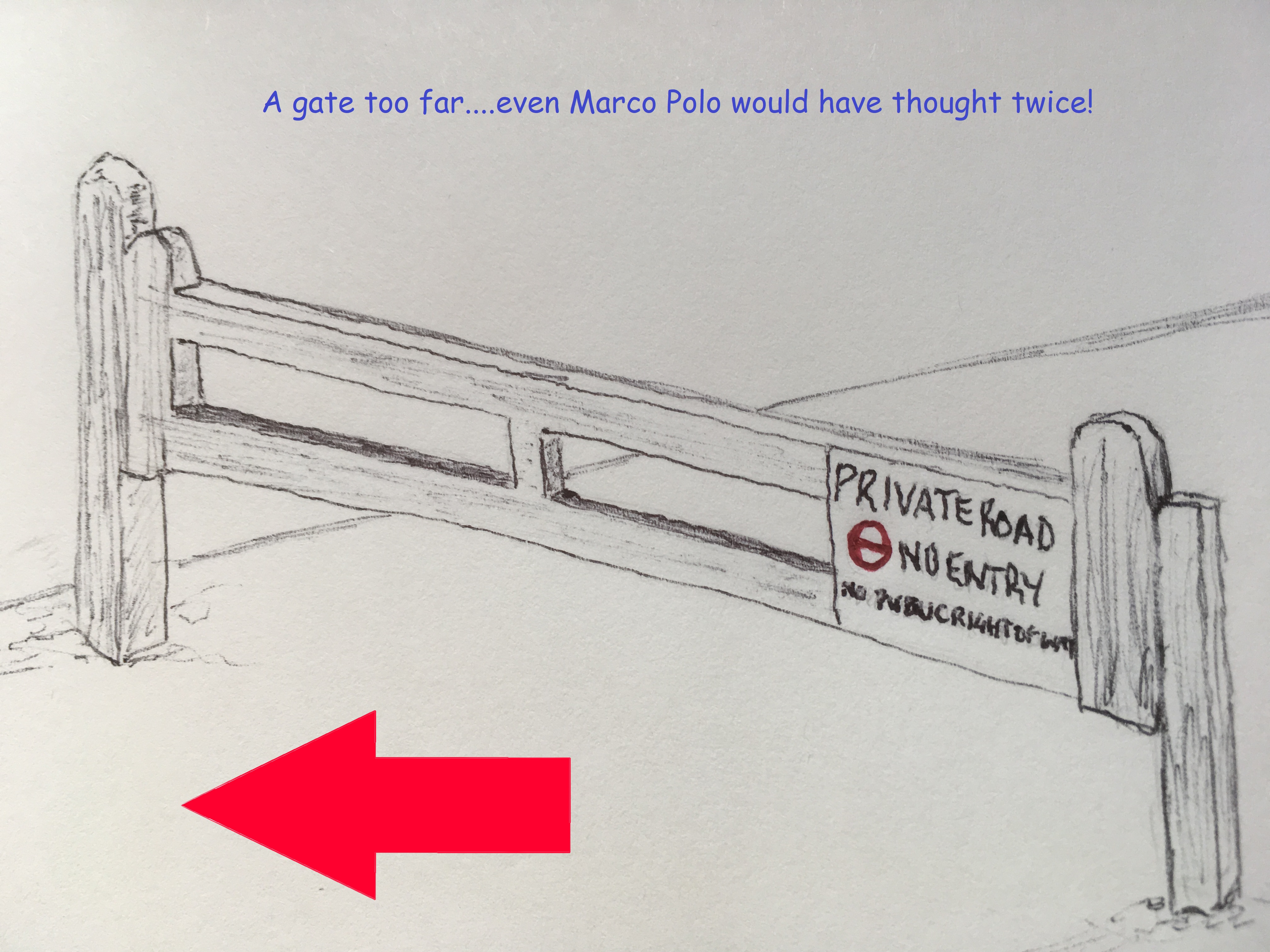
As I arrived at the other side of the road a man in a car pulled into the track and then parked up next to a large house. I guessed this was part of the wider Betsom’s Hill Farm complex and recognised that being a lonely pedestrian at this location might have been raising some small alarm amongst the Neighbourhood Watch teams. Walking up the track that led west, and I believed towards my goal, now felt a bit awkward, and so instead I leant on a field gate, took a shot south, releasing this might be the closest I was going get to the rearing summit and then trotted off along the A233 and to the next small track to the left.
As close as I got.
Another house, and this time a man in his garden emptying the waste. It was hot and I was completely undecided on my next steps, which seemed likely to involve heading back down the bloody main road, and a reasonable chance of calamity. I took a gamble and said hello, and could he tell me where the top of Betsom’s Hill might be.
He’s friendly and very willing to talk. I explain that I’m not a threat, or a council officer inspecting is bin rotation regime, and that I’m trying to get to the top. It’s in a field just up and past the building I had just passed, he explains, but it’s on private land so I can’t reach it. He agrees it’s a shame and adds that there’s an old fort on the site. I ask if it was Victorian. No, earlier. Georgian perhaps (actually, it is Victorian and built, along with several others, as a go to defensive position to protect London should a hostile force seek to invade). He goes on to explain that if I carry on a bit further and past the Garden Centre (did I know it? No!) and turn left, there was a rough road I should take past Little Bensom’s Hill farm and then a track south to get back to the bottom and The Avenue (did I know it? Yes). This was a very positive interaction and one I am sure he has every err ……. decade?
I half wondered if heading on north an unknown distance, just to be a bit safer, was a wise decision, but given his generously given advice, I thought it would be rude to ignore it and instead take the daft option, which could lead to emergency vehicles and a lengthy road closure. I clung again to hedges until eventually I got to the garden centre. A sign at the road junction pointed to Biggin Hill and Bromley. Greater London. Fortunately, the promised unmade road was on the left and took me along an avenue of old trees, past Little Betsom’s Hill farm, and to the footpath that headed south and back down the scarp face of the North Downs.
Little Betsom’s Farm. So close!!!!
After a quarter mile or so the path met a six-foot-high wooden fence and then skirted it. I peeked over to see if there was any sort of view at all but immediately realised that I was peering into a very rich person’s grounds, and towards a huge, covered swimming pool that you’d be hard pressed to find bettered on the Costa del Plenty. Voices and some laughter told me that people were at home, and I very quickly ducked my head and carried on down the hill. The fence continued to form a barrier to my right for at least two to three hundred metres, which told its own story, and eventually I pitched out onto another unmade road. This was obviously the Avenue. I recalled passing it on my slog up the A233 and now wished I had done a bit more research before setting out so I could have used this track to ascend. Maybe a sign at the road junction indicating a footpath further down would have been helpful, but I guess that’s just too much to expect and in truth if you lived in one of these exclusive hidey-holes you really wouldn’t want the riff raff passing on a regular basis.
The footpath continued down the slope, through pleasant woods and then ended abruptly on the banks of the Pilgrims Way. Ha! If that’s not a deception I don’t know what is. What was once a long-distance track that allowed people to make their pious way to Canterbury from all points west, is now a pathless road, the purpose of which seemed to exist entirely for the benefit of the super-rich dudes and who own the handful of uber mansions along the northern side of the asphalt. As I headed east and back towards the A233 I was slightly taken aback by the size of some of these pre and post war status symbols. Even the Beatles in their Virgina Water heyday may have been a bit jealous. To the south and beyond high hedges, fields had been given over to growing grapes. I walked the entire half mile back to the A233, hedge hopping again as cars and home delivery vans passed east and west. Not as hair-raising as the earlier experience. Not a single footpath across the fields beyond to be found, but plenty of signs warning of dire consequences if you were to stray off the highway.
Down from the top
I reached the A233 and the Velo Cafe. It was closed. I turned right and at last, now back on a path, I hot legged it back to the car. A beautiful evening spoiled only by the tonked up low riders of the local south London boy racers associations heading south to unknown destinations and unreliable outcomes. I hadn’t quite made it to the top of the topper most point in Kent, but the point I had reached was only a hundred or so metres short, and just a few feet lower in terms of height, and I’d have had to break the law and been prepared to receive buckshot to acquire the prize. It seemed I wasn’t that committed.
At the time of writing there are only four reviews on Google maps. Two are simple star ratings (why bother?). One, from three years ago, just says “Snow, Snow, Snow” with a photo of a kid playing in what looks more like slush and could quite literally be anywhere on the planet where it slushes from time to time. And the fourth and most detailed, a one-star rating from rich80wba saying “Maybe you can get to it via the bottom, but not at the top. It’s effectively someone’s garden and private land. Poor for the highest point of Kent.” He makes some very valid points in just a few words, and as it happens Betsom’s Hill appears to be the only county high point that cannot be accessed by the public.
Back home, and a few hours later I stepped out into the back garden. I noticed in the black night that a whitish haze was gravitating from the north and ending in a sharp point above my head. Probably a high cloud of vapour, I rationalised. I stepped further into the garden and there were more of these hazy apparitions. Like a crown with very long and sharp points. I’d never seen anything like this before and then one of these strands of whatever, began to turn a light shade of purple and I suddenly realised what I was looking at. And it was something I never thought I’d see. At that moment, being at the top of Betsom’s Hill might well have been the ideal spot to witness the aurora. So it goes!
Back in October of last year, at the point when I crossed over a small bridge spanning a small expanse of water just north of the historic Chatham dockyards, I hadn’t immediately appreciated that by this minimal act I had also crossed a sort of imaginary Rubicon. I wasn’t about to cause panic in the Republic or on the streets of Carlisle, but arriving in the newly emerging housing schemes of St Mary’s Island I had inadvertently set a precedent. I could cloak it up as much as I liked, (old JC himself did a lot of cloak, daggering and spinning up when he crossed over the actual Rubicon River, ensuring that his ends justified the means), but the reality was that once I reached the other side of the bridge, I was on an island.
On that same day, and some miles on, I passed under the rail and road bridges that carry you o’er the sea to……eerrrr…….Sheppey! Add a “k” and a bonny wee boy, and you have the makings of a cryptic crossword clue. An aside, but on the same theme, a few years ago I did manage to cycle around the northern coastline of Skye. Here’s a photo to prove it.
Lealt Falls – Skye 2015
Maybe I need to go back and do the south bit whilst there’s still time left? But, (I know, so sorry, lost in mental contortions already), back in the nearer present, having passed under, rather than over, the bridges to Sheppey (I had to pass under them again 15 minutes later after being sold a dummy by the Saxon Shore path), I had made a statement of intent. Drawn a line in the marshes so to speak. I wasn’t going to get diverted by an island. That just wasn’t going to happen. It wasn’t in the thinking back in the early summer of 2018 when I had decided to try and cycle around the coast of Kent and Sussex.
So why, on the morning of 23rd April 2019, I am cycling through Holborn towards Victoria Station in the late rush hour I cannot explain. And I can’t explain either the complete coincident when, at the junction of Theobalds Road and Gray’s Inn Road, I looked up at the lights and there was my younger brother ambling purposefully to work. I nearly ignored him. Why would he want to know that I was on a day out on a pleasant spring day while he was about to face a new Monday morning at work? But I overcame that negative thought, mounted the pavement and squealed to a halt just before crushing his toes. We had a quick chat, though I could tell he was still in that deep, dark thought state which comes just an hour or so after waking up, and a few minutes before entering the work place. I left him with a wave and a smile, and got back to purpose.
The train left Victoria and headed through south-east London on a line I am sure I had never been on before, though I may have said that before. I had to change trains at Bromley South for the connecting train to my destination – Sheerness. Or did I? Yeah – for sure!
At Bromley South I alighted. I knew there were a few minutes before the connecting train but after the mad dash between platforms here on the previous trip, I was immediately alert to seeking out the information screens. The first train showing was one that further down the line stopped at Sittingbourne. “Sittingbourne?” “Hmmmm…Sittingbourne?” I mused. More Hmmmmm………and the doors to the train I had just stepped out of closed at the very moment it dawned on me that it was the train to Sittingbourne, and it was Sittingbourne that had the connecting train to Sheerness. Too late the idiot.
I shook my head from side to side and waited for the next train to Sittingbourne, which arrived about 15 minutes later but then stopped at every town, village, hamlet and halt, which inevitably meant I missed the scheduled connecting train at Sittingbourne. Half an hour later and I was on the next one.
Now this is a tad annoying. Sometime on Friday (it’s now a Monday in July), I set aside half an hour and managed to crack on with this account. In fact – I distinctly recall getting quite far down the line. And, yes, it seems it didn’t save! What a right royal pain! I’ll need to give it another go. Hardly The Seven Pillars of Wisdom I know, but we’ve all experienced this at some time or other and I am certain that many a PC has met a violent and untimely end in such circumstances. There are probably a few laptops sinking slowly into the silt in the Swale, dispatched violently from the train in a moment of individual melt-down. So – here we go – what can I remember now? Repeat.
As the two-carriage electrical multiple unit crossed over the Kingsferry Bridge, and at the point when the wooden sleepers were laid back on land, I knew that there was no turning back. I was now, metaphorically, beyond the pale.
The train trundled north-west across a marsh before entering the small town of Queenborough. Even in the sunlight it looked and felt a bit bleak, and it struck me that this was likely to be one of the last places I came through at the end of the day. That was slightly depressing. A number of people boarded, sat down, and instantly pulled out mobiles and made calls stating condition, location and likely time of arrival at Sheerness, which was just a few minutes up the line. My own mobile hadn’t made an appearance. Only my brother had a clue where I was and I guessed he didn’t care that much.
The Isle of Sheep – Just one view today
On through areas of industry and Victorian housing and finally arriving at the only operational platform at the terminal at Sheerness; a pleasing white panelled Victorian station that must have once welcomed more activity.
Outside I looked around to figure out the best direction of travel, and then did some loops trying to find a route to the seafront; eventually finding a path between a creek and a large Tesco’s. The seawall was wide, and to the west, at the end of the path, a tall concrete bastion of a building that clearly had WW2 associations commanded the channel of the River Medway. I headed east along a wide path on the top of the sea wall that kept the North Sea from reclaiming the town. I don’t know if there is anything to say about the Islands main town because I barely glimpsed it.
Garrison Point – Sheerness
Passing out of Sheerness a marsh lay inland, between and before the next town; Minster. The path clung to the beach and so there was no diversion into the town. At Minster the path continued along the front. At this point low, grassed cliffs started to rise gently and the town sat above. Looking down the long seafront it seemed that a local business was doing very good business selling plastic flowers. Numerous memorial benches stretched towards the horizon and, without exception, each had been heavily decorated with the things, most now losing the deep and evocative colours that they would have once displayed when they had left the factory. Not an unusual sight perhaps, but not on this scale. It seemed to have become a local ritual.
Towards the end of the path, and where the benches petered out, a small harrier hawk appeared, hovering just a few meters from me over the grassy slopes. As close as I had ever been. Blundering away I searched out the camera from the bag, went through the routine of removing the cap, turning it on, and was about to point when of course, it gave up on the morsel it might have spotted and wheeled away towards the town. More time wasted.
The path was about to run out as the cliff slowly climbed and a set of wooden, recently installed steps, led to the top. I set off up the bank, pushing and shoving. It was higher than I’d expected but I reached the top without completely running out of steam and collapsing in a heap. A field and a path ran along the top of the cliffs and eventually I was at a small gate that led into a static home caravan site. I climbed to the top of the site, and to a small lane that had a left and right option. The left option headed down, and back to towards the sea, but I wasn’t prepared to take the risk so instead headed up hill and eventually to a junction with a bigger road. A sign indicated that I was at Pigtail Corner, and one of the old buildings opposite looked like it might have once been a public house that may have been the origin of the location. If it had been, it wasn’t a pub anymore!
Ok – I think I’m all caught up now? Wonder how much I’ve forgotten/embroidered/remembered and lied about?*
The road went east and then a left at an angled junction into Plough Road. After a mile or two, and surrounded by fields, another junction. The left would have taken me directly to the coast, but fancying a small diversion, and heading inland instead, I ended up at the hill town of Eastchurch. I stopped outside the church and at a memorial commemorating the history of the very earliest manned flights made in the UK, which happened at an airfield nearby (I image the use of the word “airfield” here may not reflect our current understanding of the term). Seemed to be quite significant and not something I knew about. There were a few shops, and the village was busy. Quite a few vehicles pulling up, people getting out and back in, and clutching fast food and soft drinks. Some in uniform. I knew that there was a prison lurking ominously near here, and that explained a lot.
It wasn’t clear to me what Poseidon’s role was but he seemed to have had a hand in aviation history too
It’s not a thing I knew at the time, but it seems that Sheppey has had something of a dissenting past, and activities at Eastchurch centuries ago, were no exception. The execution order for Charles the 1st was signed by the local vicar and one of the local bigwigs. Once the monarchy had been re-instated (imposed – chose your position?), nearly all those involved were hunted down and executed. Hey – that’s the way those things worked, but this local bigwig was fortunate enough (?) to kept his head and instead was sold into slavery!! How about that? And who would have had him? I wish there was more I could say about this, but I found this nugget on some website a few weeks ago and which now I can’t trace, so some caution needs to be taken before relating this tale further.
After a short while I set off back down the hill and back to the junction where Warden Road would take me further east and to Leysdown-on-Sea. Not too far along this road, and on the left, was the entrance to Shurland Dale Holiday Park. There was no reason to enter, other than a large sign stating there was a cycle short cut avoiding Warden Road. Given that Warden Road was quite narrow, and that some of the motorists around these parts were happy to whiz along without too much thought given to the consequences, I opted to take the by-pass opportunity. Soon I was winding up the concrete roads that serviced this static home megalopolis. Perhaps in honour of the grid pattern streets that, minus skyscrapers, mimicked New York, the roads were handily named, First, Second, Third etc Avenues. On reaching Second and Third, the main site ended and a private road continued for a short while. Clearly going nowhere other than over the cliff.
Turning back downhill I picked up on the cycle path directional sign (Second and Fourth, just in case anyone else out there makes it). This took me east again and I was at a junction with Warden Road, and slightly confused. “What the Dickens?” I may have said whilst trying to get my bearings and deciding whether to turn left or right, but I didn’t say that. I did note though a modern pub called the Dickens which lay at this spot, and in the big garden and by the road, a grubby and abandoned yellow Reliant Robin, suitably made up to look one that one might have been seen on the roads of Peckham back in the day. A nice touch Dave.
Reliant? Perhaps not
I turned left. A sharp right a bit further on and then a sharp left as the road climbed through fields and then through a small farming settlement where on the left another pub. Actually, it’s about now I ought to say that in the last few weeks my eyesight seems to have deteriorated drastically. My own theory on this is that it’s a side effect of taking Statins. These are drugs that the NHS award you when you reach 60 and after you attend the free health check-up. They then send you on your way in the knowledge that a percentage of the people taking these drugs will live a bit longer than they otherwise would have done by not having, or delaying, a stroke or heart attack. Box ticked and targets met. Just to be clear, the NHS is obviously the best thing ever invented in the whole world (except possibly the railways). But for a year I didn’t take up the option of the repeat prescription, rationalising that having slightly high cholesterol was, in itself, not a good enough reason to waste the public purse and take a leap into the unknown. So, a year passed, but inevitably some minor ailment that lasted a few too many weeks, and I was reluctantly back at the GP’s in December.
“I see that you haven’t taken up the repeat prescription for the Statins you were given last year. Is there any reason?” asked the GP as she reviewed my notes at the end of the 10 minutes.
Well, yes there was, but after some pathetic blustering about not being fully informed, and were there other things could I do instead, I gave in to the weight of institutional pressure. The prospect of a few more months on this mortal coil perhaps? So I said I would stop being a silly boy and take up the daily habit instead. Perhaps if I were to address one or two other daily habits I may not have been having the conversation at all, but that’s another strand.
Just a reminder, I’m outside a pub on Sheppey, but back to the drugs. I kept to the daily dose nearly every day for the next few months, but sometime in May I looked at the packet of 30 tablets, and for no particular reason I can think of now, decided to get on with the life job without them.
Some days later, and you’ll remember that I indicated that my eyesight has been taking a bashing too, I took the liberty of looking at the side-effects of Statins for some people. And, bingo, a small percentage of users do suffer blurred and double vision, caused by a weakening of the brow muscles. I had no idea at all if there was a linkage, but given that I had also noted that in recent weeks my eyebrows were increasingly, and annoyingly, getting in my eyes when wearing glasses (in medical terms this is known as Denishealeytosis), I put all the two’s and two’s together and came up with my own self-diagnosis.
In the interest of editorial balance, I should make it clear that I have absolutely no medical knowledge whatsoever, other than my gut feeling. At some stage I should probably contact the doctor and explain why I haven’t picked up the repeat prescription but I am slightly worried that this will kick off a new campaign to try and extend my life.
And so, with some level of double vision hindsight, my medical condition, as relatively minor as it clearly is, may have been the reason why, when I glanced at the pub on the left, there was profound confusion because immediately adjacent, and what appeared to be an identikit building, was, another pub! I stopped to take in this bizarre phenomenon. It was true, and I wasn’t even pissed! On the left stood the Walnut Tree and, on the right, The Wheatsheaf. They both seemed to serve pretty much the same sort of services, and they both looked like they would be pretty good. Given that pubs are closing at an historic rate, these two survivors, seemingly in open competition with each other (who knows?), and in the middle of nowhere, were minor miracles.
The Two-pub trick
But there was no time to sample the pies and pints and it was onward and eastwards on Warden Road until a turn to the right and I was now on Thorn Hill Road. I felt like I hadn’t seen the sea for a while and so at the entrance to another holiday park I entered and cycled down the road to the end where low cliffs overlooked the channel. It was obvious that there was no chance of progress here and that I would need to return to the road, but my desire to spend a few minutes having a brief rest was cut short by a really annoying small dog that was on the balcony of the nearest holiday home; scampering back and forth and barking at the top of its irritating abilities. A middle-aged woman popped out onto the balcony a couple of times but made almost no attempt to stop the dog from pissing off everyone else on the site. She occasionally shouted, whether at the dog, or me, it wasn’t clear. I obviously wasn’t welcome, despite the public path that ran along this part, and so in order to spare others on the site any further nerve damage I wound back up to the top with the sound of madness echoing up the valley.
To make further progress I needed to start heading south-east, but it wasn’t clear from the road that any sort of public access was possible. Indeed, a quick check on the phone map-app stated I needed to return the way I had come for a couple of miles, and frankly that wasn’t going to happen. Despite some reservations I took the unmarked road, which went steeply uphill, and was the most rutted and unfriendly combination of rubble, clay and silted puddles I had ever ridden. I had a concern that something bad would happen at any moment (a nasty encounter with a skip vehicle was one of the scenarios playing out in my head), but eventually I reached the top without incident. The road spilled out into a small estate of bungalows and detached houses where the roads were nearly as bad as the one I had just been on.
I bumped down Cliff Drive, which seemed to be the most obvious thing to do, but it petered out near the edge of the cliffs and became nothing much more than a glorified path. I was able to continue with some care and a bit further down a sign erected by the Council stated that the road was closed and liable to cliff erosion. I stopped again, and looked out to sea. On the horizon, and for the first time that I can recall, I could see the slightly unreal Maunsell fort structures that had been erected in the Thames estuary in the War to protect the channel and spot in-coming air raids. I got the camera with the long lens out and clicked in the hope that something would come out. Well, it did, but rather as expected (the sun had stopped shining by this time and it was somewhat gloomy), the developed result was a tad disappointing and not worthy of inclusion, but here’s a surrealistic representation instead.
Red Sands Army Fort – Maybe one of the most uninviting postings during the War
There are occasions in all lives when events begin to unfold in front of you which don’t necessarily make immediate sense and your initial response is not entirely adequate. As I started to put the camera away some ascending sounds began to drift up from the sea below. I searched out the source and just down to the right, about 40 or 50 meters out to sea was an inflatable canoe with two males, late teens, early twenties. The day had started off brightly, and it was just a day or so after the hottest April bank holiday on record. But it had been clouding over for the last hour, and despite relatively calm conditions, a bit of a swell had developed near to the beach.
From my position I couldn’t tell whether the two lads were either having the best time of their lives, or that something was beginning to go disastrously wrong. There was a lot of shouting and hollering, but whether it was laddish banter or sheer panic I couldn’t tell. Whatever I was thinking, something didn’t feel right, but the think gorse and mixed vegetation hid to much from me. Jumping back on the bike I threw it downhill along the treacherous path. About 300 meters further on the path met up with another road, and a small car-park with a better view of the beach. A single car was parked and the couple who accompanied it were moving towards the edge, alerted I’m sure by the continued shouting and laughter which clearly added to the confusion.
I joined the couple at the edge of the cliff and stared down at the unfolding scene. In the short time I had transferred from the top to the bottom of the path, the vessel had edged closer to the beach, but by now the larger of the two men had somehow exited the craft, was flapping around in the water and making a series of wholly unsuccessful attempts to get back in.
“Do you think they are all right?” the woman said, turning both to me and the man she was with.
“I don’t know,” I replied. “It doesn’t look good.”
And it didn’t. I had my phone out and was looking to see if there was a number for the Coast Guard handy. I think there was but I’d decided that if I needed to I would phone 999 instead. Despite the hot weather of the previous week, the temperature in the water was still going to be perishing at this time of year. Both men wore only t-shirts and shorts, and neither had a life-jacket.
At last, the one in the water somehow managed to lug himself back into the canoe. This was a big relief, but despite what still felt like contradictory laughter, along with copious swearing, it continued to drift along the shore rather than towards it. At what point exactly was I supposed to make the call that would result in the massed response of emergency services? I wasn’t so sure. If you see someone being attacked in the street, or involved in a serious vehicle accident, you aren’t going to hesitate. So, just because you have in the back of your head that a call to an incident at sea will bring out the police and ambulance, but also possibly a boat and a bloody helicopter, probably isn’t a good enough reason not to do it. And from the body language of the nearby couple I didn’t get the sense that they were going to commit themselves. If anyone was going to have to do it…
In what was a change of luck (maybe the current), or that both men were now giving everything they had to get to land, the canoe eventually rocked and rolled with the waves and washed up onto the beach. With a splash and a few yells, the men threw themselves out and then collapsed on the shingle. There was still some laughter; or was it just hysterics?
If the sudden turn of events hadn’t changed for the better (as they did), and another 30 seconds had passed, I would have made the call and sod the consequences. Wet, cold, and probably a couple of unhelpful beers at lunch, they were very lucky bastards indeed.
The days excitement over it was time for a coffee and a bite to eat. The road away headed directly south and inland, but a view along the coast hinted at a beach towards the town of Leysdown-On-Sea. After a mile the road turned directly east, and another mile or so and I was heading down the short strand of amusement arcades, that on a drab early afternoon in the middle of the week, felt charmless and pointless. A handful of people, and one or two youths in hoods and on bikes who no longer saw a point in going to school.
At the front I stopped and looked along the deserted beach. It was hard to tell but surprisingly it looked a bit sandy in places.
A seafront shop, in what seemed to be a warehouse of sorts, advertised food and drinks, and given that nothing else shouted out for attention I entered and ordered a coffee and a hot-dog (any vegetarian aspirations defeated for the moment). As it seemed I was the only customer for a while the whole cooking process had to start from the start. I took the opportunity to speak with the owner, just to pass the time. Despite the glorious bank holiday weather it hadn’t been any busier than usual. He didn’t seem to be bothered but given that small towns like these survive on the margins, it had probably been a disappointment. I took the coffee outside and consumed the drink before the food arrived. Once it arrived the enormous offering was hard going but satisfying.
It felt to me that what the town needed was a railway. And, just because I knew this already (having recently discovered the endeavours of Colonel Holman Stephens and his plethora of light railways), a railway did indeed wind its way across the centre of the island from Queenborough to where I now was. Heroically, it must have been a bit of a failure because it managed to survive the Beeching cuts by closing 15 years before the brutal axe, in 1950. Lifespan – just over 50 years, and in the 70 odd years since, any evidence on the ground of its existence seemed to have been liquidated. I finished off and headed back out of town, passing again the row of amusement arcades, little knowing at the time (but having subsequently checked on Google Earth), are built on the foundations of the old station. The car-park at the rear almost a post-industrial insult.
Eastchurch Station – I should add I didn’t take this picture
Heading south past fields with the sea wall to the east, and soon the tarmac surface gave way to something less constructed. A roadside sign warned “Access Only. Remote Areas Ahead.” Eyes light up! The sun had returned and I set off along the straight and slightly rutted earth track. Almost immediately, about 300 meters away and shrouded in a cloud of swirling dust, a vehicle was heading towards me. As it neared I made preparations to pull over and take cover. Like a scene from a wildlife documentary filmed on the Serengeti the 4 x 4 swept past, probably not even aware of my presence as the driver concentrated intensely on tunnelling his vision through the sand storm. The car passed but moments later I could hear another throaty engine and turning around a powerful motorbike was coming up fast. I let it go and then continued on, watching the two-wheeler disappearing into the distance as it threw up enough dust and rubble to replicate the desert section of the Paris Dakar rally.
After a mile or so, and just past a row of small beach shacks and houses which looked like they needed some care and attention, a rutted path to the left took the bike up to the top of the beach. On the basis of probability, the path through the low coastal vegetation should have been compacted sand or lose shingle, but instead it was made almost entirely of crushed oyster shells. With Whitstable just a few miles across the water to the east, and the strong tidal powers of the Thames and the Swale to assist, in the end it wasn’t such a surprise. Otherwise, there was nothing here at all, although some housing could be seen further down the beach. Perhaps the lack of anything, and the beaches remoteness, was why a white sign welcomed the visitor to Swale Naturist Beach and that “beyond this notice clothing need not be worn for bathing, sun bathing and general recreation.”
As there was entirely no-one in sight, perhaps I should have grabbed the opportunity to disrobe in the open for the first time. But, being me, and putting up the usual mind-barriers, I was troubled by the specifics of the notice and whether or not naked cycling fell under the “general recreation” rule or whether it was prosecutable under Indecency Laws (which may or may not still exist?). In truth it would have hardly been worth the painful effort of stripping and cycling the stretch of shell path that stood above the naturist beach because within no time at all (about 100 yards) another sign, in black writing and on shouty orange backing, made it clear that the fun was over and that “Clothing MUST be worn beyond this point.” It seemed that this specialist retreat was particularly small beer, but looking out towards the sea I could see the appeal.
The fun starts, and stops…………………here!
Very soon afterwards and the path came to an end at a fence and a gate. The dusty road that had continued behind the beach ended at a small car-park and then the gate. Signs made it clear that it was private property. Beyond the gate the road continued on to maybe 20 to 30 modest houses. Just beyond the gate was a grass mound, and at the top of a cluster of metal poles, what amounted to a version of the Shell oil sign, with the words “Hamlet of Shellness” written underneath, and presumably avoiding any trademark infringements. In the distance, and beyond the community, a solitary fort lay low on the edge of the marsh.
Last fuel stop – ever!
There’s nothing here to indicate it now, but it was in 1688 when the fishermen of Shellness (what evidence there is of an old fishing port appears to have been washed away), intercepted and captured King James II as he attempted to flee the realm for France after he was declared unwelcome by his government. What makes this more interesting is that (whether the fishermen were genuinely ignorant or not), they stole his watch, ring and money, not believing him to be the King. Subsequently he was taken to Faversham for a few days, where, by all accounts, he was badly mistreated (think this translates as “roughed up.”) until being returned to London. Probably a long-term mistake by those in the area as Royalists have apparently never fully forgiven the people of these parts.
A gated community at the edge of the earth. Maybe intended to keep out any local Royalists. It seemed a bit out of place. Almost Monty Pythonesque! But it was what it was. English with hints of eccentric. In France it would be considered “chic,” but more conveniently located on the sandy Atlantic coast a few miles west of Bordeaux.
The direction of travel was about to change as the return to Sheerness was westwards. Here the area was marsh and flat. A raised path stretched out across the marshes and made for fairly reasonable cycling. The Swale lay around 500 meters to the south and beyond mud flats studded with dark pools where ducks, Little Egrets and Herons could be seen. To the north of the path a vast area of marsh, meadow and waterways covered in a huge variety of bird life, some easy to identify – many not.
At a point about half way across the marsh I stopped to take a couple of photos, but instead just sat and listened to the silence that dominated between the bird calls. This was a special location and one that probably benefits from a minimum of human intervention. The Isle of Harty. Whilst not obvious on the ground, an island on/in an island, if that makes sense? Seems that there are four sub-islands at Sheppey, with Harty and Elmley being the biggest.
The Isle of Harty – just before the bang
The tranquillity here was profound, and if there had been time had I could have stopped here far longer. As I climbed back onto the bike, a feeling in the air, and then a deep boom somewhere far away. A controlled explosion at some distant quarry – you hear these things occasionally depending on where you might find yourself in some parts of the land. But that brief moment in time, when the air pressure changed just a fraction and a second before the boom, was something I had only felt once before, and perhaps it reflected the remoteness of the place. The only other time was sometime in the early 1990’s when living in a flat in Holborn. A still, warm evening with the widows slightly open and the curtains drawn. A brief moment when that same sensation teased the ears and a moment later the curtains sucked a few inches into the room before relaxing back to their original position. We knew that somewhere to the east many others were affected far more profoundly. No sound but some things you don’t forget. Later that night the IRA also took out the M1 bridge at Staples Corner. Another triumph for negative energy.
Slightly unsettled by the detonation, but relieved that there hadn’t been a subsequent firestorm, and that for the time being at least the world had survived, I carried on across the marsh; coming alive in Spring. Eventually we (the bike and I) reached a field that was fenced off, and a gate and a stile that led to a dusty road heading back inland. My experience with stiles over the last few months had become something of a personal nemesis, and this latest barrier to progress brought on a minor state of depression. As before, I threw the pannier over to the other side, and was about to grab the bike in the usual way before stepping over the wooden obstacle, when it dawned on me that maybe there was another option. Bollocks! So, instead, I grabbed the two central parts of the frame, lifted the bike as high as possible, extended arms forward by a foot or so, and then simply plonked the bike down on the other side of the metal gate. Done and bloody dusted.
The track led gradually uphill with a large field to the right and tall, evenly spaced Poplar trees in a line to the left. As I climbed steadily a view opened up behind me and down to the Swale, across the channel and towards Whitstable on the mainland. At the end of the track a left turn and past a charming group of old farm buildings with a small church that looked ancient. The road continued west through fields and then a further left and downhill on the Harty Ferry Road towards the Swale and the Ferry House Inn (duly signposted).
I decided to stop there for a bit. And I decided that, for once, I would treat myself to a half pint of the facility’s best ale. You didn’t need to be a historical detective to work out why the pub was called the Ferry House. Presumably, for many centuries, a ferry would have been the lifeline between this part of the island and mainland Kent (with Faversham just 2-3 miles directly south). I entered the pub and was immediately struck by the indicators of exclusivity. This was no longer a refuge for farmers, fishermen and shepherds to spend their hard earned here after trading trips to and from the wider world (that would have been Faversham again), or indeed flogging the king’s personal possessions for a shilling.
Dogs were very welcome by all accounts, and on the evidence of the few people already there they were not far short of a majority. A catalogue displayed the Ferry House’s main features, and it all looked very good indeed. I had half a thought about checking out the price of a night’s stay, but then decided I probably ought not to bother, and so purchased my small brew and headed out into the large decked garden area with views across the Swale and beyond. A few minutes later a mini bus sort of thing drew up in the car-park, followed by some activity with one or two people getting out. I paid little attention, but there was a commotion of sorts going on, and sure enough the female driver was talking to an older man and urging him to get on with it in no uncertain terms. What he was getting on with was openly urinating against a fence post, and taking a long-time over it. There was almost certainly a logical explanation for this unlikely display of continental rural practice, but given that there was a fully functioning toilet in the pub, just 10 yards from where the man stood, it did seem slightly undignified. Maybe he was a local elderly bad boy, previously banned?
With the half of the Whitstable Best in the garden and a hazy sun, I studied the OS map in search of possible routes across the south western marshes. There were paths but having had my fingers, shins, arms and ankles scared over similar terrain on the Hoo I settled on the roads.
A place to contemplate your own nothingness – or just enjoy a beer if that’s not your calling
The clock was ticking, so I supped up, and after a quick relief (in the pubs toilet facility – although the car-park was clearly another option), I set off back up the hedge lined hill. At the top the road headed west for a bit, then north for a while, then back east. There were some good views in every direction but by the time I reached a junction where the road headed back north, and towards Eastchurch, I realised that I had fallen just short of completing a large loop that had nearly taken me back to the track with the poplar trees. But no worries, it was all part of the day.
A long stretch of pleasant cycling followed as the road arced north-west, and then across the Harty marshes with a river channel to the right. I stopped at a point in the road where a sign indicated a bridle path which seemed to be heading back towards the coast and across the next set of marshes. I took out the map to see if there were any clues, but perhaps because I was too lazy to take out my glasses, I wasn’t able to make head nor tail of the options on offer. I rationalised that I wasn’t about to get into another hurdle race over the stiles. I had skin tissue to preserve. Besides, there was a sign on the gate, in bold black letters on a yellow background, that pretty much swung the decision. “Warning – Bull In Field.” I was still just a little tempted but I’m beginning to get wise to these country bum steers, and so with the risk assessment duly completed I took off up another hill and the high road beyond. A scattering of farms, one with a large cohort of geese running around in a field, and eventually I came to a junction where the main road provided a Leysdown-On-Sea option to the right, and Eastchurch to the left. Oh….I have some pictures of the geese, but if you want to see them you’ll need to subscribe to my paywall site (more details available by email and a cheque for £5).
Choices, choices…..hey, I’m no big brave motorcyclist!
I won’t trouble any reader too much with the next few miles. Although a main road, it wasn’t particularly wide. In parts it was probably built on the footprint of the old railway, had no concession at all for the possibility that some mad cyclists might want to use it, and had a speed limit of 50 miles an hour, which of course in reality meant the traffic was travelling at 60 miles an hour and was pretty scary at all times. I just wanted off it as soon as possible, but that wasn’t going to be an option. The road flanked to the south of Eastchurch, and then a newer, slightly wider section, still with no consideration given to cyclists but on a ridge that had good views to the south and across more marshes (Elmley Island). The fields on the slopes leading down to the marshes were swathed in oil-seed rape and presented a patchwork pillow of intense yellow broken by the occasional hedges and small coppices.
Elmley Isle from the ridge looking south
In the far distance the curve of the road bridge across the Swale that connected the island to the mainland. From what I could see I had made the right decision to take the road option rather than what would have been a much longer slog over hostile and uncertain terrain. Whilst this was all very pretty and life affirming, due to an exponential increase in traffic hurtling in both directions (mainly east, and presumably commuters returning to homes around Eastchurch and Leysdown), there was little chance to check the scenic action as the very act of staying alive had become the significant imperative. There was another three or four miles of this torture before eventually I arrived at a roundabout south of Minster, where all the traffic on the island converged. To my relief a small side road offered itself up as a quiet route down to Queenborough.
This short section of road, that shadowed the much busier duel-carriageway, ended at a junction where a large public house (built between the wars) called the Aviator stood guard. The sort of pub that back in the 50’s, 60’s and 70’s, and before being by-passed, would have sat on the main road and pulled in the day-trippers who had made it after a two-hour drive from London. Offering alcoholic refreshments, pickled eggs, and bags of crisps with the little blue pouches of salt, the weary travellers could be re-energised before heading on to complete the final few miles, no doubt through endless traffic jams winding into Minster or Leysdown-On-Sea.
I crossed over the duel-carriageway and then entered Queenborough. Unremarkable, until crossing over the railway and entering the older part of town along the High Street, and where older Georgian and Victorian houses and buildings offered more contrast and interest. The High Street continued towards the harbour. There wasn’t anything about this place that lacked interest and was quite pleasing on the eye. A modest Town Hall building on the right with pillars, large leaded windows and beautiful Flemish bond brickwork gave in indication of historical events. Then finally the harbour area with pubs, parks and yacht clubs. Not a huge area, and certainly not biscuit tin Cornish fishing village pretty, but despite my initial concerns when passing through on the train earlier in the day, I was surprised to find that I liked it.
I should say at this point that Daniel Defoe, passing through here some 300 years ago – had a very different opinion. In fact, it was yet another settlement that he fumed over because of its “rotten” electoral status. Very honourable indeed, but by any stretch, when I read his account, it was obvious that whilst staying there someone had caused him so much upset that, with the benefit of distance, he decided to meat out maximum payback. This is how he saw it:
“At the south-west point on the Isle of Shepey, where the East-Swayle parts with the West, and passes on, as above, stands a town memorable for nothing, but that which is rather a dishonour to our country than otherwise; namely, Queenborough, a miserable, dirty, decayed, poor, pitiful, fishing town; yet vested with corporation privileges, has a mayor, alderman, &c, and his worship the mayor has his mace carried before him to church, and attended in as much state and ceremony as the mayor of a town twenty times as good. I remember when I was there, Mr Mayor was a butcher, and brought us a shoulder of mutton to our inn himself in person, which we bespoke for our dinner, and afterwards he sat down and drank a bottle of wine with us. But that which is still worse, and which I meant in what I said before, is, that this town sends two burgesses to Parliament, as many as the borough of Southwark, or the city of Westminster: though it may be presumed all the inhabitants are not possessed of estates answerable to the rent of one good house in either of those places I last mentioned. The chief business of this town as I could understand, consists in ale-houses, and oyster-catchers.”Danny D c1720
Now, on my travels I may occasionally across a community which has left me a bit cold, or deflated or a bit depressed, but it has never crossed my mind to indulge in a crucifixion of the place. Everywhere has some merit, otherwise it couldn’t exist. As interesting a writer as Defoe was, and of course leaving an important historical account for us all, he was certainly no Bill Bryson. As much as every aspect of this town seems to have stuck in his craw, and that the issue of “Rotten” boroughs was a total scandal which he was right to highlight, Queenborough was originally created in honour of Edward the Thirds wife, had seen far better days, and by Defoe’s time was on its total uppers. For whatever his short-comings, the mayor, just a bloody butcher f’sakes, offered up a whole shoulder of mutton (being the Isle of Sheep there was a lot of that available), and sat and drank wine with him. You have to wonder if the poor man ever got around to reading the almost barbaric literary slaughter of his small town? And if he had, what means of recourse did he have? Certainly not the internet, and almost certainly that was a blessing.
I hadn’t intended to use these accounts as a guide to local history but sometimes you discover things that can’t go without comment. Two hundred years before King Henry VIII started erecting the revolutionary circular, squat and thoroughly modern coastal forts along the south coast (Deal and Walmer are perhaps the best examples), a similar structure was built at Queenborough. It was so effective as a defensive structure that it hardly saw any action. Sadly, it didn’t survive long enough to make it through to the Ancient Monuments Protection Act of 1882, or being listed under the Town and Country Planning Act of 1947, and so Queenborough lost out on the possibility of subsequent commercial exploitation through tourism. Judged so successful at its job, and hence perversely a waste of space and money, it was pulled down in 1650. And that’s slightly ironic, because, as I revealed in the account of the Rochester to Herne Bay ride back in May, in 1667, the Dutch made full use of the hopelessly useless state of Kent’s defences and were able to seize the fort at Sheerness, then sail up to Chatham and cause as much havoc in one day as the Japanese did at Pearl Harbour. Nothing remains, and you have to wonder whether its deconstruction, and the subsequent post military importance, might have led to the woeful state that Defoe found the town when he came a calling. Many a town and city around our coast have experienced similar declines and without adequate safety-net.
Queenborough Castle – An artist’s impression with a flock of mutton in the foreground
In recent years Queenborough has held an annual Independence Day. It’s a bit complicated but it seems that after the Dutch invaded back in 1667 (an extended weekend break by all accounts, not dissimilar to the Mods and Rockers turning up at the coast for a bit of a bundle back in the 1960’s), they never actually gave it back (in a diplomatic sense), and continued to consider Sheppey as one of their own. I’m guessing that this will be coming as a bit of a surprise to everyone, but you’ll recall that this area was pretty ungovernable and had a dissenting tradition that didn’t seem to think much of the monarchy. In 1967, and in a magnanimous gesture that everyone else in the UK either didn’t notice or have forgotten about, the Dutch came to Queensborough and handed Sheppey back to the English (I use the word very carefully). The recent Independence Day celebrations seem to be very popular events, so much so that in 2017, the then mayor, Cllr Mike Constable (good to know that some order had been restored by then), was keen to get on with a full twinning arrangement with the Dutch town of Brielle, and that returning to Dutch rule could not be ruled out! Consider that!!!! But the best bit of all was that the mayor of Brielle, who attended the occasion, apologised for the invasion 300 years earlier but added that “there were a lot of invasions going on at the time.” Priceless.
There seems to be a very specific form of Brexit emerging here that probably doesn’t equate with our wider understanding of Kent’s historic voting trends. And it’s seems to be in an alternative direction of travel. Perhaps Nigel should be told? Maybe there is still hope?
I sat at the jetty for a while and looked out across the
wide estuary which had been witness to so much. A swallow, the first I had seen
this year, flashed by just above the still water. A dad stood with his son and
was demonstrating some of the basics of fishing with rod and line. A very peaceful
spot.
A few minutes later and I was cycling north on the concrete path above the sea defences. At the end the path diverted inland and along an alley, with high metal fencing to the left. Beyond the fence, acres of flat land with endless ranks of spanking new cars of all brands, set out in formation like Roman legions ready for battle. In previous times this area would have been a bustling dock, with hundreds of ships of all types coming and going with whatever products were important at the time. Those days have clearly gone and the sole commodity being traded here is high value personal chariots that need protecting from the elements with blue plastic strip-tape, much of which, when removed had blown onto the path outside the fence. And, you can conclude from that that a lot more ends up in the Thames.
After about half a mile the path left the fence line and I was now cycling next to the main road into Sheerness. I could have continued on this road, but beyond the gigantic car pound a road to the left appeared just after I had crossed over some tracks that were evidence of a train line which once served the docks. The smaller road led into the old town, and a slightly edgy environment. A huge dark brick wall to the left screamed military and the old houses, pubs and shops opposite told of bustling times that will never be seen again. This was Blue Town. Who knows the derivation of the name but it was in a state of decay – yet to be discovered perhaps by the likes of…….well me if I’m honest?
The road headed north and then tracked round to the right and back towards town. The wall that defended, and hid the old garrison, extended for hundreds of metres. Tall lamp posts with period fittings lined the road. The bits of Blue Town what had survived either the Blitz, or the planners (there would be a line of buildings and then large open bits of waste ground that had never seen redevelopment – like a set of teeth with half of them missing), were largely Georgian, Victorian and Edwardian in character. From what I could see there must have been numerous pubs along this stretch, and once there would have been an almost endless demand for ale from the soldiers, sailors, dock workers and all the others who made a living out of the neighbourhood. Also, from what I could see, not many of these pubs had survived into the present and the bottom of the market had finally fallen out. Maybe something changes after dark when the evocative lights come on? Maybe the adult bookshop, that stood out like a sore thumb half way down the street, gave a clue to what happens later. Blue Town, Red Town, dead town. It will rise again I’m sure.
Grey Blue Town
The station was a short hop away and I reached it at 17:18. The train for Sittingbourne was waiting and left at 17:21. Two hours later I was home. And that was that.
466008 – The last train home
*TS Lawrence is said to have lost his original manuscript of The Seven Pillars of Wisdom at Reading Station and then had to write it all again. It might be an urban myth. Either way, when I came to read over the twaddle above, I found that the section that I thought I had lost was in fact still there, but in the wrong place. So, it was interesting to see how different the five or six paragraphs were when comparing the original to the re-write (about an hours’ worth of effort). The chronology was pretty much the same, which perhaps was no surprise, but the sentence structure and terms used were significantly different. I don’t know that this says about anything but it took another hour or so to settle on which sections to use or discard and sync. Shucks!
The hot, memorable, record-breaking summer was slowly ebbing into autumn. Was it as good as 1976? Debate. An exceptional one certainly, but in ‘76 I remember two weeks on a campsite in Denmark with a mate where not a cloud stained the blue. As the sun rose and tasered in through the thin canvas it was up and out at 6 am every morning, regardless of the hangover.
On a day back then, when the sun burnt through to the earth’s core, we ventured out from the campsite on two hired bikes and headed west. Two hours later we arrived, exhausted, at the coast. Huge sand dunes, over which the bikes were pushed, pulled, and thrown down in something close to hatred, defended the sandy beach where the concrete evidence of past conflict abounded. Immediately stripping down to pants, and then flinging ourselves into the North Sea, it was only three seconds before the shockingly cold water, supplemented by icy currents from the Arctic, had us back on dry land where, through refreshed eyes, we quickly realised that we were the only people still wearing any clothes. Despite considering ourselves open minded, out of sight, and largely in a groove, the truth was that our coy suburban English upbringings held us back from joining in the fun. Whilst we may have missed the summers of love, undaunted, we’d retained our pants.
The Danish Front – 1976. For reasons of potential litigation my pals identity cannot be revealed
Forty-two years on and the days were definitely getting shorter. Four weeks after the “north Kent debacle” (as it will now always be known), the scab on the left shin still clung on. A symptom of age – I guess? And I’m back at Rochester. One last piece in the coastal puzzle (the missing link) to complete, if you exempt Sheppey on the grounds that it is indeed an island (despite the bridges), and the little bit of West Sussex between Littlehampton and wherever which will need to wait for another year.
It was a cold morning and I wasn’t feeling particularly well, but the reality was that the windows of opportunity were slipping away by the day. Not in any way similar to say an Apollo moon launch, or an attempt at a particularly difficult mountain summit, but as I have said before, in every way I am nothing if not a fair-weather cyclist. I don’t do hardcore, self-inflicted weather pain.
Despite the sense that the whole project was not a million miles from being an exercise in flogging a very dead horse there was still an ounce of motivation in the system, and at some time around 9:30 I was back at Victoria station with the e-ticket I had procured on the internet the previous evening. Boarding the near empty train, I found a seat, this time nowhere near a toilet. The train left and then arced through south London on a section of track I had no recollection of ever taking before. At Bromley South I had to change trains. The transfer time between the two trains was just a few minutes so, when the train had stopped some miles short of Bromley, and then failed to progress further for what felt like an aeon, I knew that if I managed to make it to Bromley in time, it would, to use that new Brexit term that none of us had heard of until three years ago, be a “just in time” dash to the Rochester connection.
And so it proved. Running down the platform and lugging the beast up the stairs and then down again, with just seconds to jump on the connecting train.
At Rochester station I started to head east, crossing the A2 and then along the old High Street which seemed to be in Chatham, or alternatively, could still have been in Rochester. Daniel Defoe had very little to say on Rochester. “There’s little remarkable in Rochester, except the ruins of a very old castle, and an ancient but not extraordinary cathedral…” I don’t know if the remains of the cathedral are still there, but despite the size and reputation of the ruined castle, somehow it too is not extraordinary and barely registered. Unlike other medieval offerings of the same type and era (Conwy and Dunnottar come to mind), it seems diminished by the clutter of centuries of random development which has grown up and surrounded it. I’m certain it pulls in sufficient numbers to justify its continued existence as a ruined timepiece, but a bit of me thinks that a Battersea power station type renovation and upgrade might not go amiss. Just putting it out there?
The Third Raid on the Medway – 23rd October 2018
Meeting the River Medway at a newish housing estate, I was then shunted back onto the High Street and eventually back onto the river bank at a small park area with a jetty. There a man was dispensing about two hundred weight of white bread to sea birds and pigeons that must have thought all their Christmases had arrived in several huge plastic bags. The hideous sight nearly had me retching, which certainly is what the birds would be doing later after they’d had their fill.
Of course it was far too early to enjoy a drink, but just a little further on and I stopped for a few minutes outside an imposing and beautifully constructed Georgian pub called the Command House. The building fronted west across the river and I wondered what historic moments would have occurred within its snugs over the centuries; and more recently on lager fuelled Saturday nights. A superb spot to enjoy the sunset over a late pint, gin, porter or rum, before flicking your used clay pipe into the river at closing time. Disappointingly, having researched this further, although first documented in 1719 (nearly happy 300th birthday), it was a store house for the Admiralty, and only became a public house in 1978 (happy fortieth)! It appears to have had a lively licensing existence since then, which could account for the missing D. Not everything is what it seems!
The importance of the missing D!
A river path continued for a short while, and then diverted back to the main road which wound up-hill towards one of the entrances to the historic dockyards, with its high brick walls. Shortly afterwards I was crossing a bridge over some water between two basins. I was now on St Mary’s Island, and tracking through modern low-rise housing where construction was on-going and which Google Earth doesn’t seem to have caught up with yet. At the time I hadn’t appreciated that this really was an island, bridged at several points to connect it with Chatham’s historic dock yards, but by being there I had breached a fundamental rule of the mission. As small an area of land as it was, it wasn’t the mainland, and the whole evil spectre of Sheppey (my personal Banquo) reared its head again, not least because at some point soon I would be looking at it directly across The Swale.
Cycling between the new-build, where I got a bit disorientated, I was kindly redirected (I gathered on the grounds of health and safety, and for not wearing a hard hat) by a builder with the broadest Geordie accent south of the Angel of the North. I reached a path by the river facing west, and towards Upnor which I had travelled through just a few weeks earlier. A nice spot, with a decent view and new homes that looked liveable in. The wide new path headed north, but first there was an important information board that had to be read and digested. Lots of the information that I read I completely failed to digest, and so took a photo instead.
St Mary’s Island – Currently malaria free
The gist of it was that St Mary’s Island is a very historic place. Once a hellish marsh only fit for mosquito’s, and burying French soldiers captured in the Napoleonic wars and who had died (almost certainly mercifully) on one of the old hulk prison ships laid up nearby. Maybe a memorial to those poor desperate souls wouldn’t go amiss, but what country honours the defeated?
No small irony then that the reclamation of the marshes, and their incorporation into the huge Chatham dockyard network, was, oh err…..done by prisoners! Our own this time. It was such a jolly old era in the days of forced labour that inevitably perhaps there was a convict’s riot. I don’t know what the score was in the end because I’ve forgotten, but I’m guessing the Admiralty won. It usually did.
Now you’d think, wouldn’t you, that this was more than enough history for a few acres of inhospitable marshland. But fear not, there’s a lot more to it than that, and perhaps the most interesting historical detail reminds us of the important truth that if you fail to invest in the infrastructure of State, the best laid plans can still, and often do, go pear shaped. In this case the plan was very actually laid across the river, from St Mary’s Island to Upnor Castle on the Hoo peninsular opposite.
An enormous metal chain was attached to a winch at the Castle, then lain across the river bed and anchored to the St Mary’s side sometime in the 16th century. The idea, brilliant when you think about it, was that if any Johnny foreigner types thought they’d try and sail their men ‘o war up the channel, they’d come a cropper on the chain, which could be raised above the waterline in times of danger. Just in case, there were also a shit loud of forts and castles built on either bank and any acre of land above sea level in the estuary, with hundreds of guns trained on the channel all the way from Upnor and then north to Sheerness and beyond.
And so, in 1667, when a Dutch fleet, sent to cause a bit of mayhem in the estuary following some sort of endless war with the Crown that the Dutch were getting very pissed about, actions stations were sounded….but…..Ahh! Due largely to austerity measures caused by both the war and the great fire of London, no-one was around to respond! Not only was there no-one around (which meant that the handful of remaining guns lay silent and the ships stayed in their docks), the resultant panic led to decisions being taken that in hindsight were probably at the least rash, and at best, hopelessly inadequate. After shooting up a few things in the estuary over the first couple of days, and taking the fort at Sheerness (which was manned by the cook, the rat-catcher and the candlestick maker), the Dutch did the thing that no-one thought possible. They sailed into the Medway, made their way to the main docks, sank a loud of ships of the line, and incredibly made off with the flagship of the fleet, the HMS Royal George. In the build-up to the attack, and in a complete panic, the local naval top guy, perhaps understandably, scuttled a load of the older and less useful ships in the channel with the aim of preventing the Dutch making further progress. Good idea? Except he wasn’t able to sink enough of them in time and the Dutch, with a Johan Cruyff like shimmy round the sunken defences, glided by and on towards the main goal. But of course, there was still hope. Wasn’t there? The old Gillingham Chain, ready to rise from the depths like an old leviathan. Hmmm….so not sure what 100 years of rust and disrepair does to iron, but it’s safe to say it failed to bother the flying Dutchmen one iota as they managed to pull off the raid to maximum effect. Not too long after, the British agreed a peace with the Dutch, which I’m guessing was probably for the best. There was no sign of the chain now.
For the Brits this must have been like an earlier version of Pearl Harbour. Unlike the Americans, who very quickly went into full fast forward mode and within weeks was giving it all back at the Battle of Midway and then beyond, we took this setback on the chin and made peace. There were to be no further skirmishes on the polders or the marshes. As far as I know, until the emergence of football violence in the 1970’s, neither the Dutch, or anyone else, came to fight a third Battle of the Medway. Unlike Rochester, Defoe pours lashings of love on Chatham, which, by the time he arrived, was once again the powerhouse of Britain’s naval power and industry. He too reflected on the Dutch adventure, describing it as a “dull story in itself.” Given that it sounds anything but a “dull” story, I assume he meant in a “sobering” sort of way, rather than a Dutch version, where, no doubt, there still is an annual national day of celebration on or around the 6th June. Although we have one too on that date it’s for something else completely.
As much as the history of St Mary’s was fodder for more thought (did I mention the Romans and the first Battle of the Medway?), Herne Bay seemed a million miles away, and onward progress got me back on the wheels and the path that arched round the bend in the river.
There was nothing not to like about this place, unless your French or criminal ancestors were buried here. Oh…unless some key requirements include a pub and a tandoori, of which neither were in evidence. At the northern point I could make out the place on the Saxon Shore on the Hoo peninsular opposite where, some weeks earlier, I had abandoned the coastline due to a high tide, and had headed inland to achieve Rochester before dark. A bit further on and I stopped again. Just down the bank was a boat, shimmering at its lashings and not of our era. A small paddle steamer of some sort, no doubt in the long, slow process of restoration (or advanced corrosion), and in the watery light a memory of oil paints and Turner.
In his famous painting, The Fighting Temeraire, Turner paints a scene in which a modern steam powered paddle tug boat pulls the old and distinguished ship of the line up the Thames from Sheerness to Rotherhithe to be broken up. It is thought to represent naval decline. A recurring theme it would seem, but probably a bit wide of the mark given its continued world dominance over the following 100 years. Well, he wasn’t to know. As I stood at the sea wall and gazed at the pile of rust moored just along the shore Sheerness was in view to the north. So, nearly 200 years ago, you could have stood at this point (as a prisoner of one sort or other) and maybe seen the Temeraire being pulled out of Sheerness by something not unlike the small vessel now before me. What you wouldn’t have seen was the sun setting in the east as Turner represents the moment, because of course, that’s impossible.
Impressions of dereliction – The Aline at rest
I wove back through the newly formed streets on the Island, through a small landscaped park, crossed back over the basins, got a bit lost for a minute or so, and then onto the busy Pier Road, set back from the water by a few hundred yards and with new housing developments rising out of the old industrial zones. At some point Chatham became Gillingham. It wasn’t clear where this was, but taking a turn to the left and I was then in a riverside park with a lido and The Strand, which ran along the bank and off to the east. A number of concrete barges (don’t worry I won’t be recycling that dreadful joke from before) lay like recumbent seals on the mud.
A fleet of concrete barges doing the Strand and at ease near Gillingham
Some zig-zagging and then eventually I was on a path with fields and parkland to the right, and an expanding view of the Medway estuary to the north. Then a large bay, with the wrecks of a number of small boats and an isthmus that led to a body of land, hovering above the waterline, called Horrid Hill. I cycled along the man-made road that led to the “hill” but stopped before venturing into the trees. For completeness I should have continued. It wasn’t far but something held me back and I carried on through the Riverside Country park that seemed to be a great asset for the area. I have no idea why it was called “horrid” but maybe it was the unknown that held me back.
A mile or so on, and another bay. The concrete remains of what appeared to be some sort of dock, that would have served some sort of industry at some point in time, was a suitable point to stop for a minute and gaze out at more boats and barges that had ended their days in the creek, where now they were slowly being consumed by barnacles, salt and silt.
No, I can’t explain this Google image either…
I followed the coast road at a point called Motney Hill (no, sorry, don’t know the origin of this one either), where large flocks of wading birds filled the air above the water, and where more dazzlingly white Little Egrets than I had ever seen before in one place, stalked the foreshore spying out their lunch. Up the hill and the road ran out at the entrance to a water treatment works (aka sewage farm). At this point I could see that I had arrived on another, much larger isthmus and with a creek to the east. I could have just gone back down the road. But, temptingly, there was a metal gate type stile, trying hard to hide from the masses and set into an overgrown hedge. Without further thought I was mashing the bike through the complicated and clearly unused access point, before carefully peddling along the rutted path with nettles threatening, and where, inevitably, one or two of the critters planted their barbs on my exposed flesh.
Coming out of the short, albeit annoying nettle zone, the path led into a field and then along the side of Otterham Creek, with an excellent expanse of water and fine countryside beyond. This won’t mean anything to anyone other than a very small minority, but for the whole time I cycled along this section, and for a good part of the day thereafter, I hummed the Fall’s Cruisers Creek. At that moment it seemed so appropriate.
The path eventually looped around the back of some warehouses and then to the entrance of a boatyard with a row of council type semi’s that were in the process of being renovated; I think for private sale. The path then met up with a road which continued north east. There might have been a coastal path here but I didn’t seek it out, content to be back on asphalt and making progress again.
Up past fields on either side and soon I was at the village of Upchurch. As I passed the said church (St Mary’s the Virgin), a quick glance to the left and I noticed a small green sign indicating Commonwealth War Graves. With the sun high, and a good few miles under the belt, it seemed to be a good time to stop and have a short wander. An attractive flint building with a four-sided spire which seemed to have been concussed by the implantation above of a wooden spire structure with eight sides. The graveyard led past the entrance and then on down the slope of a hill, where more recent burials had extended the land. The handful of war graves, in various spots, were easy to pick out by their common design and well-maintained white marble plots.
The Flying Hats game that went askew
There was a Private H Thurley of the East Kent Regiment (The Buffs), killed on the 1st February 1917. Stoker (1st Class) William David Baker died on the 20th October 1918 whilst serving on the HMS Valentine, a new destroyer that went on to play a part in the Second war but which took too much incoming from some Germans Stukas off the Dutch coast and lies there still. Stoker Baker seems to have been unlucky. Just 22 days short of the end. Corporal A V Stapleton of the Royal Engineers was just 9 days short of the Armistice; 2nd November 1918. There seemed to be an emerging pattern. The only other grave to be found was Stoker 2nd Class S W A Mercer, who was serving on the HMS Dominion on 28th November 1918; just 17 days after the peace. By that time the HMS Dominion was an accommodation ship berthed at Chatham. Who knows how Stuart William Arthur Mercer died, but he was 28. Possibly of his wounds? He was born at Rainham, but by 1901 was living in Upchurch and married at this church in 1914, just four months after the war started. You can find this on-line, along with a comprehensive family tree going back to the late 18th Century. There were a lot of Fishers and Mercers in the family line, agricultural labourers mainly, but also a couple of policemen (M) and a school teacher (F). Someone had gone to some lengths to put this together, and as a portrait of what a mainly rural life must have been like leading up to the 1st World War, it makes for an interesting read.
I have seen similar census details for a small fishing village on the Scottish coast south of Aberdeen where once there were family links. A small number of extended families housed in small, peat roofed cottages, running down a dusty street that ended at the cliffs above the bay, where below a breakwater provided safety for the boat, or boats, that allowed an existence. The difference was, that whereas everyone to a man and women in Stoker Mercer’s family was born, bred and died in Kent, every so often in the Scottish village, perhaps because the nearby sea opened to a wider world, an interloper is recorded. One or two from other parts of Scotland, someone from the north-east of England, and someone from Ireland. A modicum of diversity that in other similar communities could have included people from across the sea and Scandinavia.
Stoker Mercer survived the war, but wasn’t able to enjoy more than a few days of the peace. It was the most poignant. I once knew someone who shared a similar fate in a place 8000 miles from here many years ago.
I cycled on and out of the village heading north. The map showed that a road looped round what was quite a significant peninsular. The lane was surrounded by fields and for the first time I noticed orchards. A butterfly (a Peacock I think) skipped out of a hedge and fluttered by. I don’t know when butterflies stop fluttering around in the UK, but given the time of year it felt like a very late outing, and I assumed reflective of the extraordinary summer.
This was an area that felt like it hadn’t changed very much over the centuries. A scattering of road side housing which all seemed to have had agricultural heritage. I shot past one on the right. A distinctive light-yellow painted house which looked at least 200 years old. Maybe it was the colour or the style that must have held my attention for a brief moment, but was enough to allowed me to spot a round blue plaque mounted above a ground-floor window. Curious, and in truth staggered that there might have been someone of note living in this house at some point in history, I circled back to get a closer look. In my mind I suspected a novelist, or maybe some old sea Captain or other old cove who plied his business out of Chatham or Sheerness. So, and once I had managed to focus the deteriorating lenses accordingly, I was astonished to see that at some point in time, the characteristic frame of James Robertson Justice would have once graced the doorsteps and environs of this modest pile.
James Roberson Justice – Actor
For those of you too young to know, said JRJ, was a character actor who appeared in numerous films in the 40’s, 50’s and 60’s. I say “character” actor, but the truth was that he only every played one character – himself! That is to say, a large bearded man who played a larger than life post war bore. Okay, I’ve said it, and I know that will upset some, but basically he was in the films what he was in life (except a doctor from memory). To be fair, some of those films do stand the test of time, and his character was apt for the parts. Examples include perhaps, Storm Over the Nile, in which he plays a crushingly gregarious old soldier of Empire who just can’t stop hammering on over Port and roast beef, about the number of foreigner’s he’d put into the ground. Or as the narrator (he did quite a lot of that), and the part of Commodore Jensen, in the literally iconic and uber star studded, Guns of Navarone (I can’t believe that I have managed to slip this reference into an account of a cycle round the Kent coast so big thanks big man).
Of course (keep up children), he is probably best known for his role as a doctor in the “Dr in the House, Dr in Distress…” (the list goes painfully on) series of films in which he starred with many other great luminaries of the British innuendo and carry on scene. Don’t get me wrong. I was brought up on this stuff, and whilst I can’t see any reason at all why I would ever watch any of them again, I’m not knocking them. That said I think I always did have some sort of aversion to the JRJ doctor type character that he played in these and other films where a truculent, arrogant, self-opinionated bullying brute was required.
I was born with a small deformity (turns to camera and whispers “..look, shush, there’s no innuendo happening here!”). The second toe on my left foot to be precise. It’s a monster! Twice as big as it should be and probably either the result of too much strontium 90 in the air (my mum’s theory), a certain pill that was being prescribed to pregnant women at that time (my mum’s other theory) or just a genetic accident. In the womb I had six toes on the left foot, and at some point, two merged together to produce one mega-toe, that in life would go on to be a right royal pain in the left shoe. And not enhanced, I have to say, by the early 70’s fashion for black leather, pointed toe, three-inch stack heeled zip up boots in which I staggered in agony to and from school each day, and to the occasional Sunday night gigs in town. As the fashions changed, presumably for the better, I became less aware of what I can only say was a very minor disability.
But, sometime into my early thirties, and for no reason I can recall, the toe began to re-assert its authority on my pain threshold, and after months of putting it off, I sought some advice from my GP. I probably just needed the attention. The GP (male or female, I can’t recall), scratched his or her head and understandably, just to get me out of the consultation room, wrote out a referral to the University College Hospital (UCH). With the ticket in hand, and a few days later, I entered this great medical institution (which had also, rather noisily, brought my daughter into this world), and waited on a bed for the person who would come and offer me hope. What I thought the options on offer would be is anyone’s guess. So, when a large, bearded man in a white coat, and oozing imperial authority, strode towards my position, rattled my toe for a few seconds and then announced in a booming, superior Edinburgh voice that there was nothing to be done other than lopping the critter off, I knew I had just been JRJ’ed. As his honour turned to seek more important victims to inflict his wit, justice and scalpel on, he turned back to me, tweaked the end of his beard, and added in a tone not to be ignored, “Off courses, there is always “Makepeace” of Bond Street. Handmade mind! Always found ’em very accommodating. Be able to knock you up an odd size pair or two I’m sure. Take my word for it old man.”
My monthly contributions to the NHS were, in the end, not to bring me relief. The prospect of decapitating my lifelong appendage did not appeal. Neither did the thought of a life scrimping away in order to procure odd sized shoes from a well-established firm in Bond street. So, I just put up, shut up and laced up.
How and why JRJ ended up on Poot Lane, in the middle of nowhere, is anyone’s guess. I can’t find any references, but judging by on-line biographies, he may have been the sort of chap who needed to keep on his feet; moving on from town to town as he romanced his way through the women of whichever parish he had landed. But there you go. At some point he ended up here. Maybe to escape? I took a photo which I won’t share. It’s a lovely house, but given that it’s in the middle of nowhere I’m guessing the current owners value their privacy and aren’t particularly keen on having busloads of 60 plusers gawping through their front windows. And, just in case you thought you could cheat and look the place up on Google maps, forget it. I’ve just spent two hours (not in one go) trying and failing. Nearly losing my mind in the thought that I may have made it all up, it was only after a lot of double checking that I at last found it. And, the reason why you won’t find it (I don’t know who I think I’m addressing this to because no one is going to be reading this) is simple. The picture on Google is some years old. Along with some other details, the paint job is now different. So, when that small smart car with the camera on the roof passed by (whenever it was), the blue plaque club had yet to get around to erecting the memorial. So there!
As much as I would love to continue this nostalgia diversion – let’s not! The day was no longer young. I continued doing the rounds on Poot Lane, through the communities of Wetham and Ham Green’s, and only seeing two other people; one a man on a tractor going between fields who looked like he wasn’t from around these parts, and one, an older man at the end of a lane who was pottering in his garden and gave me a look as if to say “turn back sonny, I’m just a speed dial away from calling Neighbourhood Watch.” And then I was off the peninsular and onto Twinney Lane. A brief diversion down Susan’s Lane that led to the next creek and then back again after finding the route blocked by the local dust cart. The next community, Lower Halstow, was small, but comparatively on a vastly bigger scale than either Wetham or Ham’s Green, and the streets through the residential fringe took me down to another small creek where a well restored Thames barge lay at the mouth of the small river that drained the land around.
Old Lower Halstow and a stable steeple
To the north of the village, a country park had emerged out of an old brick works and I noticed that I must have missed some coastal path alternative at some point, because it emerged here from the park. Was I upset? Not really. This had evidently once been a very small community, which from perhaps the 1950’s onwards, had expanded considerably. There seemed to be three distinct growth phases. Next to, and around the much earlier handful of scattered houses and an old pub that would have housed and refreshed farm workers and brick makers, a string of corporation type, and private semi’s, from around the 50’s, 60’s and 70’s. To the south of the pub, another area of newer buildings that could have been from the 80’s or 90’s. Finally, to the north-west, and perhaps in part on the site of the old brick-fields, a far more recent quarter. As a village that might be well placed to tell the story of rural development in the country over the last 100 years, I sensed that Lower Halstow could probably do a good job.
For the record, a correction is necessary. Lacking the skills to correct the error, “Cruisers Creek,” as indicated on the map, should have been on the previous map, just past the point where 1st Wks is indicated. These things are important – Just saying right? It was a long time ago now!
Over the river, and then past the attractive church (which lacked a second spire), the lane passed out and beyond the village to a wider road that headed back in land. Another low peninsular stretched to the north. Almost certainly I was missing out on more coastal walk action, but I really had had my fill. The view between the hedges provided the occasional glimpse of the water that lay between the mainland and the Isle of Sheppey. Then along the shore of a bay before crossing more land and low hills that eventually provided a much better view east and towards the road and train bridges that crossed the Swale (the expanse of water dividing the island from the land. The land here was flat; reclaimed and although still full of late summer green, desolate. At the bridges a path did lead to the riverbank. A police 4×4 sat idle at the end of the path. Presumably a late lunch before another shift on the Kent highways.
Avoiding Sheppey
Under the bridges on the track, and on along the marsh wall. Well, I was on it now (the Saxon Shore Way), and had resolved to get back to basic principles whether it killed me or not. The map indicated that the path continued through to Sittingbourne. But after about half a mile of rutted and awkward cycling, the path didn’t continue to Sittingbourne, and instead came to an abrupt end at an industrial complex. The facility may or may not have been there when the map was drawn, but one way or the other, in the spirit of expansion, it had severed the link. I wearily rode back a bit and saw a path running along the side of the works. Flanking the high fence, on an even less even track, and soon I was on the dusty road that serviced the facility, and heading back to the west. Shucks! This was no fun. And it became even less so when I realised that I’d been snared into a dead-end trap, eventually emerging from it by going back under the bridges, and then heading south-west on a straight road that soon arrived at the large village (or small town, take your pick) of Iwade. A town (or large village) that I had never ever heard of before, but which, like Lower Halstow, seemed to have expanded at an exponential rate in a very small number of years. In fact the reason I may never have heard of it is almost certainly because, with the exception of a small number of Victorian buildings in the centre, which included an old pub, the “town” of Iwade almost certainly didn’t exist until the last ten years or so. At least three times the size of Lower Halstow, this was a new community, risen from the marshes, and putting its footprint very much on the Earth. Not too bad either, though naturally the name had left an indelible imprint on my mind, which, when cycling, can loop ideas over and over again as the peddles and wheels turn monotonously on, banishing any deeper considerations of the meaning of life and all that. And so, as I progressed on, the Fall’s Cruisers Creek was replaced immediately by Under the Moon Above. If you’re struggling with this concept and the connection I do understand, but think Leicester 70’s, throwback rock and roll band, and you too could be just Three Steps from Heaven.
Cycling resolutely south through the new community, and then a left on a minor road that led downhill to a complex junction that crossed over the A249 main road to Sheppey. Beyond the A249 and along Swale Way with industry to the north and more evidence of residential development to the south. A good mile or so on, and through a series of small roundabouts then across a tributary of the Swale, through more industry and finally, this obviously new road, petered out as it led into another new housing scheme on the eastern edge of Sittingbourne. A new community that was still in that limbo state where many of the houses were completed and being lived in, whilst large muddy plots were still being dug out and where many more new homes would rise up over the coming months.
Back in 1970 I was transported, as a 12-year-old, onto a new estate that was in a similar state of development. In truth, and I am not sure I have ever quite got over it, I felt as if I had been wrenched from a place of stability and relative contentment, and dumped, without any thought for my mental well-being, into an alien environment where I then spent years trying to adjust to an awkward and new reality. You’ll be pleased to know that despite an urge to burden you further with the teenage woes that were inflicted by this trauma, I’m over it! Really, I am! Honestly.
I was now definitely a bit lost. None of these buildings were on my OS map and all I could do was guess at whether or not each next turn would, like a maze, lead me onto the next curved street, or loop me back into a cul-de-sac.
After being lured into one of these cul-de-sacs, and running out of hope, I found a young couple outside their house and sought directions. They were happy to oblige and within 2-3 minutes I had been given all the information I needed to complete the puzzle and reach the next level, which meant escape from Sittingbourne, or whatever this area now was. I was very grateful. Setting off I gave a thumbs up, and only a turn or two later, was completely and utterly lost – again!
Fortunately (not), and returning to the theme of my own displaced youth, I fell upon a group of boys, possibly aged between 10 and 14 who, on bikes, and many with hoods up to protect them from the searing sun, and in something of a pack, were circling posse-like at the end of the road I was now heading up. I recalled those wonderful early 1970’s days when, after spending a few weeks with the local skinheads in an effort to fit in, I moved on quickly, and became a fringe member of the local puppy greaser push-bike gang, which, I’ll be honest, was a bit of a damp squib when it came to matching up to the other local, and more energetic, friendship groups. We were simply no match for their untamed violence.
But, here and now, and having just watched a wildlife documentary on a pack of African Wild Dogs, and also having spent too many years professionally observing the cycle of life on inner London estates, I instantly recognised some of the key behavioural traits of this aspiring group of highway robbers. How that manifested itself was that in the space of a slit second, and as if through some sort of kinetically transmitted connection, they all clocked my weary progress, and with all heads turned in my direction, changed the direction of their bikes, and began in unison, to wheel in mesmeric formation towards me. I think I pretty much knew where this was heading. I certainly didn’t think that violence was going to form part of the estate introductory package, but some sort of humiliation was no doubt on the cards. And so, like the old, lame and vulnerable antelope that I had become, I heaved on up the slope and towards a section of road that looked like a territorial border between this groups patch, and what could have been a sort of safety beyond.
There’s always a leader, or if not the leader, one who is prepared to go beyond the norm and into the reckless zone. And so it was no surprise when one of the boys, aged about 13, suddenly reared his bike up on its back wheel and peddling furiously in my direction and challenged me to do likewise. I suppose I could have got off the bike at this point and tried to engage him and his pals in a theoretical discussion about basic health, safety and sensible lifestyle choices. Or I could have complimented him on his sensational abilities, and suggested to him that a life in the circus was going to be his calling after his first two spells in borstal. But the reality was I just had a depressing sense of inevitability about his future. That positivism kept me going on through the group whilst he continued to perform his attention seeking wheelies, all the time trying to comprehend why the bald old bastard wasn’t meeting his not unreasonable territorial challenge.
I reached the next section of road, and sure enough the pack fell away and returned to their postcode (assuming the area had been allocated one yet?). Soon I had searched out a small road that headed back east, and with the mainline train track to my right, pressed on steadfastly and in the rather disquieting knowledge that there was at least half the distance required still to go. Lomas Road led into countryside and then an abrupt left on to Church Road and I was then winding down early autumn lanes. The countryside was pretty much what you’d expect in these parts. Gently rolling with a lot of greenery still in evidence, but with a subtle difference. Many of the fields contained small trees in lines, and the smell of late season fruits, mainly large red apples and on the turn sweet green pears, filled the air. At Blacketts Lane I picked up again on National Cycle Route 1, which I had somehow lost contact with somewhere between Iwade and the end of Sittingbourne. I wasn’t wedded to it, but it now made some sense to keep to it where possible until Herne Bay.
More fields and then a track beyond a large farm and then quite unexpectedly, I was on a path cycling south along the banks of another creek. This was a very attractive spot. On the opposite bank, as the river narrowed, a quay, what looked like a pub and a line of expensive and well-proportioned houses. At the southern end of the creek the path followed round a large marina and then into the village of Conyer. Very much a boating community, but if that was your thing, then certainly why not?
Out of the village and the route headed back inland, and then, just beyond the small village of Teynham Street, a thin cloud covering, and light rain! Not in the forecast that I’d heard about in the morning, but it didn’t last and only enhanced the sweet smells of the orchards that continued to line the road which then passed under the mainline. A left, now tracking the rails from the south side, and another mile where fields with lines of hops now dominated, and ended at a level crossing with the barriers down. After the train passed it was back over the line again and then grinding on narrow, tree-lined lanes that felt more like deep Surrey and which eventually wound into the suburbs of Faversham.
I couldn’t tell you now the route I took into Faversham but eventually I was cycling along what must have been the medieval market street backbone of the town. I was impressed. A wide street, with many architectural styles and periods represented. This was a town with character that had avoided a post-war mauling. Past the centre and down towards the town’s river, and there on the right, almost missed, was the old brewery. Not just any old brewery, but that of Shepherd and Neame. These days, their crisp, tasty and well-crafted bitters and ales are sold the length and breadth of the country. Even the tiny corner shop next to my flat does at least two or three of their products in pleasingly styled clear bottles (for only £1.99 too). But it wasn’t always so.
Back in the Dark Ages (that would be the 1970’s again), and over a frighteningly short period of time, a handful of huge multinational brewing giants had come to dominate the drinking industry, and in the process smashing the smaller independent breweries. In the south-east you would have to travel miles and miles to find a pub that wasn’t owned or managed through either Truman’s, Courage or Watney’s. And what you got for grog in these institutions was nothing short of tap water with some flavouring, that quite often, and if you were really lucky, smelt and tasted like chemicals that had gone unnaturally past their half-life date.
And so in order to avoid death by the most ordinary, intrepid journeys would be made out of south-east London and deep into the heart of Kent and Sussex, passing numerous pubs bearing the signs of the new power in town, but where the names of the old local provider could still be seen over the door. But, with persistence, or maybe it was just a blind optimism that overcame the dystopian state of affairs, occasionally there could be found smalls outpost that had avoided the all-seeing antennae of the conglomerates. If you wanted something really special, something that was so rare that you would be prepared to travel to the edge of the land and to pay very good money for the experience, you might have landed on a Shephard and Neame pub, and you would had found Nirvana.
Forget this nostalgia trip and lessons from history. The changes since then (with the caveat that if pubs continue to close at their current rate then this era will be looked back on as an age of mass extinction), have been so profoundly positive for the brewing industry that there probably hasn’t ever been a more diverse range of options and outlets, which of course includes my little corner shop. 😊
Extinctions Rebellion – Survival of the tastiest
After gazing longingly at the old brewery building for a few minutes I then carried on, and followed some signs that helped me navigate out of Faversham and along a narrow road which the map showed as being part of the cycle route. Fields on either side and with the river further to the west. Defoe definitely did not go this way 300 years ago. Instead he headed south east and to Maidstone. From how I have read his account he had nothing positive at all to say about this area (in fact nothing at all from what I can recall), and after his inland diversion, re-emerged at Margate. That wasn’t in my plan and heading off in the completely opposite direction I eventually reached what on the map was referred to as a “Wks.” “Wks” covers a very wide range of industrial facility, but on this occasion, it was my second water treatment plant (aka sewage works) of the day. At the edge of the facility the track went into a field. I looked at the map, identified where I was and could see that National Route 1 continued through the field and then to a road beyond some trees. Venturing into the field, and trying to hold my breath, I only managed about 200 yards before, with memories of past misadventures on the banks of the Thames in remote places swirling through my brain, my nerve broke and I turned around and made my way back into the eastern fringe of Faversham, then eventually reaching a road leading out of town and back into the country.
Back to Basics – Just getting on with it
So, let’s see if we can kill this saga off without too much more pain. Maybe in the time it will take to listen to Hunky Dory (look out you rock n rollers).
Through more fields and soon the lane came to a junction. I took the left option and down through Goodnestone and then to Graveney (don’t fear you pretty things, I won’t digress into 70’s cricket). Past Graveney the road descended towards the coast again and down into lowland marshes. Looked like a great spot for some solar farms I mused. Ah….it seems to have already been spotted and the locals are on high alert. Posters on various mountings telling the tale and pleas for mercy. I could feel the concern. The prospect of large areas of the marsh being turned into a layer cake of glass panels facing the sun would almost certainly galvanise any of us. But, maybe in the bigger scheme of things, and on the merry-cast orchard brow, it’s probably a god-awful small affair, and none of my business (or perhaps it is?).
The road eventually reached the edge of the land, and I stopped at the sea wall for a few minutes, mainly to take the pressure off my, by now, pained arse. I could see Whitstable to the east and so bite the bullet and got on with it. Time was pressing.
I know that Whitstable holds a special place for many people. I have to say I’m not sure I quite get it. Having been there once or twice, and aware of the Dickensian associations, I didn’t take any time out to inspect it further on this occasion. No obvious blue plaques here, but to be fair he has a shed load of them back in north London. My favourite is a sign on a 1950’s institutional building somewhere near Tavistock Square, that states that Dicken’s once lived in a building “near” the site. Many moons ago, some Kook had written next to it “So What?” It made me smile every time I saw it. It’s long gone, but the sign remains. The writings on the wall, and sometimes can be kind and gentle.
On from Whitstable and towards Herne Bay I don’t remember much. The sun was going down and the estuary was bathed in a subtle light where the groynes and the pebble beaches spoke of oncoming winter and stormy times ahead.
The last coast
Through Swalecliffe, and at a point where Herne Bay effectively starts, one final brief stop to take a snap of a pub on the front which, unusually for these parts, had views both north and west, back along the beaches. Twilight time.
The end was near, and within another 5 minutes I had reached the point near the pier where I had been at on the morning of the 1st August at the start of the section between here and Deal. No time to dwell on any sense of achievement and so with a zigzag into the town, and then up to the station with three minutes to spare before the Javelin train (“David Weir” this time), pulled into the platform and then took me home.
Home was another couple of hours away, including the five further miles of peddling from St Pancras. Maybe it was time to reflect and acknowledge having completed the task. I opened the fridge, and there it was. Not planned as I rarely buy in ale. I lent in, and there in my hand a bottle of Shephard and Neame – Whitstable Bay pale ale. Just one. I sat outside and looked at the darkened sky. Just for a moment I was the King of Oblivion. Away, just for the day. Away.
And then it was time for Andy to take a little snooze.
41 minutes and 39 seconds (made it).
No money has exchanged hands in this blatant piece of product placement
A week to the day after the north Kent debacle, during which I found out as much as I will ever need to know about stiles. The left shin still carried a significant crusty scar which required careful sock fitting to avoid a painful scrape and reopening the wound, but undeterred I had bought an online ticket the previous night and was then on my way from Victoria to Eastbourne. I had opted not to take the proffered option of a toilet seat. I was pretty sure that I was going to end up there anyway and certainly had no intention of paying a bit extra for the privilege. (There’s a very poor pun lurking here, but despite a number of reworkings, editorial control has kicked in and the reader has been spared).
I wasn’t too sure how far the intended route would be but had spent a few minutes on Google checking out the options and shockingly, and to my disbelief, the number of miles thrown up seemed so unlikely I instantly dismissed them. In hindsight, maybe I should have paid more attention. Along with the 8 miles from home to Victoria this was about to be the longest day. Fortunately, for any reader, it maybe some consolation to know in advance that due to a relative absence of excitement this may end up as the shortest account. Assuming, of course, that my brain avoids too many tangential hijacks.
With some unexpected foresight I’d had a root around some book-shelves and dug out an old Landranger OS map that covered the first part of the journey between Eastbourne and Hastings – Crown Copyright 1992 – a time when I was in my mid 30’s. Reason for original purchase completely unknown. The cover has an image of four modes of transport, a car, a camper van, a jogger and, encouragingly, a cyclist. So, (perhaps with the emergence of Chris Boardman and others) some sort of early recognition, that cycling was maybe a funky thing – worthy of some iconography. Regrettably the map must have pre-dated Sustran and the national bike routes, because despite the teaser on the cover, any suggestion that the map-makers were in possession of any information useful to cyclists ranged from scant to zero.
But, hey ho, this wasn’t going to be an exercise in navigational expertise. The route looked pretty straight forward. West to east, mainly along the coast roads and proms, with some minor diversions inland, but nothing to be alarmed about.
After leaving the station, having completed the pleasant trip from Victoria, it was as simple as down to the pier, and left along the Royal Parade with Eastbourne’s own Napoleonic Redoubt guarding the coast. Naturally, and despite the drift into autumn, the sun was blazing, and a gentle breeze came up from the south-west. As I set off, behind me Beachy Head and the Seven Sisters chalk massif, where some weeks earlier I had heaved, dragged and pushed the bike up and down the combes and clines. The Channel a millpond. Having carried out a brief recce of the maps on the train (I also had a much more up to date Landranger map for the second part of the journey), I knew that after a mile or two I would come to an epic expanse of wasteland called the “Crumbles” where I would need to head inland and then circumnavigate. When I say wasteland, what I actually mean is an area of rough terrain predominated by shingle. No doubt in my mind an area of outstanding wildlife importance which would include almost extinct coastal flora, insects and reptiles clinging on at the margins.
Mais Non!!!! Zut alors!!! What was this? Like a scene from a sci-fi film set on another world, where no atmosphere exists, but humankind has raised its flag, rising high and as far as the eye could see, vast, apparently empty, blocks of flats. Marine, or more precisely, dock-land architecture set around a new yachting basin, and then marching on, Great Wall like, along the seafront for maybe half a mile before it abruptly ended. Any rare species that might have been lurking here at the time my map was produced would be long gone now. As much as I could understand the desire to own a sea-facing flat, built around a marina, this felt unsympathetic and brutal. Along the lines of, “we built this because we could.” I don’t know if it has been a success. Probably, but there were few boats at the moorings, and the vast harbour was about as lifeless as the Aral Sea (do check out what happened to the Aral Sea when you get a minute – in my lifetime it has vanished). A sole Martello tower stood out above the beach as a reminder that old military architecture can have more soul than some of the things we manage these days.
Maybe I was just out of season, and all the boaty people had retreated to the hinterlands or the Caribbean. If it was a British attempt at Dubai-dans la-Mare it failed to convey any desert allure, and I assumed that in the depths of November any remaining signs of life would be extinguished. Guess I’ll be checking ‘em out.
On the frontline – The Crumbles, where the pebble dashing comes for free
At the far east of the development everything just petered out and a track leading to the Pevensey Bay Sailing club ended at a large gate. I turned back and headed north on a road that flanked a golf course, where my old map showed nothing but shingle, and then inevitably joining the A259. Thankfully this only lasted a short while and turning to the right I zigzagged through the half decent new estates of Pevensey Bay, the most modern part set around another Martello tower, which only a few years earlier would have stood on its own in the gravel wilderness.
Into Pevensey Bay and down to the front and a pub with a garden and view out to sea. It was far too early to stop. Back on the coast road and through the older residential area of town, with its low eccentric houses and sea front homes that clung to the edge of the beach called Beachland (a perfect description). The road continued into the caravan park at Norman’s Bay. Beyond the park the road continued for a couple of hundred yards and finished, it seemed from the map, at an isolated beach. Only the second point so far in the journey where a gap appeared between generations of development. The gap was about 50 yards. I decided to stop for a bit, and with a snack in hand strolled onto the pebble beach and sat on a groyne. The view back to Eastbourne and the cliffs beyond was exactly why you’d come to this stop. The people in the nearby houses had chosen well.
Norman’s Bay and Pevensey – To infinity and beyond
The sea lapped gently through the shingle and gazing absently out I noted some movement in the water. It was exactly what I had not expected to see anywhere on this coastline. The head of a seal, just out beyond the end of the groynes, popping up and then disappearing. No doubt. I stayed on for another 15 minutes, trying to anticipate where the seal, or perhaps the seals (it was hard to be sure), would re-emerge. I was staggered and in something of a trance. I knew that with more time I could have stayed here for hours – just observing. I wondered how many people knew about the seals. Not many I felt. I realised that further progress here was not going to happen. Even the friendly council man who turned up in a van to empty the litter bins wasn’t sure if the road continued so, as I went back through the caravan park, I resolved to come back soon, with more time and a long lens.
Tales of the unexpected
Out of the park and the road passed under Norman’s Bay station. A bonus train opportunity for the future perhaps and just a short walk from the beach. The road continued inland, over a small river and then turned back towards the sea, under the tracks again and straight on through to Cooden with another station, easy access to a beach and its well-proportioned hotel.
Bexhill is a well-known quantity and so on up the hill and some winding through the leafy residential streets before back down to the seafront and pulling up at the Delaware Pavilion – one of the best architectural structures on the south coast, if art-deco is your cup of tea? In truth, for me, art-deco is largely brutalist, and unless well maintained, quickly tatty. But that can’t be said here. Time was ticking so I didn’t check out which tribute bands, or still just about kicking punk groups, were coming up over the autumn season so continued along the front, resolving to have the first stop in Hastings.
“Oh, what did Del-a-ware boy?” Perry Como will not be performing here soon
The cycle track kept to the coast, with the railway on the left for the next few miles and then the land rising at Glyne Gap with a panoramic view down to St Leonards and Hastings. A brief stop to take it in and then down and peddling between the track and the rows of beach huts. At the outskirts of St Leonards there was a siding and a large, evocative Victorian engine shed. The main doors were half open and peering in from behind the mesh fencing, I could make out the front of an older train that had somehow survived the scrapyards and was now being been restored. An electric multiple unit, painted in British Rail green. The sort that I grew up with in the 60’s and 70’s on the lines serving south London’s suburbs. In a previous life (the late 60’s, early 70’s), standing on graffiti hammered footbridges, at the ends of platforms, or wandering curiously around engine yards in North London where it seemed none of the adults gave a toss, I had probably seen it before. In a little book published by Ian Allan, containing all the numbers that were located on the front (or the side if it was a locomotive) of every train operating in the land, I would have memorised the four (or was it five) black digits – opened the book at the right page for the type, and drawn a pencil line through the matching number. Over the three or four years that this hobby occupied me (keeping me out of trouble, but not always), there was hardly a train running on what was then the Southern Region that hadn’t escaped my attention, and so of course, as time went by, the project to capture every number became more and more elusive. I can’t say why trainspotting appealed to me. In part, I am sure, it was just about being out. Away from home and neighbourhood. Exploring beyond the horizon. An innate curiosity beyond a comfort zone. Another thing to do when the weather was fine (when it wasn’t, there were always all the Footie magazines to get excited about, forensically reordering the league tables after the weekend results and searching for any vital insights about the stars of the day – particularly if they wore navy blue and white, haled from White Hart Lane and very specifically were called Martin Chivers). These things, with variations, is what most boys of my age did. Post-war, missed out on the Summer of Love. Waiting for something different, something glam, fast and loud. Not a fanatic, but for me, trains and the associated travel, filled that gap. The empire, of course, had been built on just such male juvenile follies. Practicing for power, influence and a predictable life of routine and bureaucracy. The empire was mainly gone, and the new reference points were Vietnam, the Middle East, and the bombs and bullets of the last legacy on the streets of Belfast and Derry. No books to tick off the discoveries now, but something still pulls. History though repeats. Maybe I’ll see that old unit again somewhere unexpected.
Tearing myself from the wire (literally), I pushed on, through St Leonards, with its unfortunate (and I am pretty certain misplaced) reputation, and on towards Hastings pier.
I know Hastings. I wasn’t about to be surprised by anything. But then, after recovering from the shocking impact of the massive, (and dare I say fully aware of the offence this may cause), art for art-deco’s sake, ten storey apartment block (Marine Court), like a battered white ship washed up in front of an exquisite street of a classic Georgian terrace (how pissed were the residents of those houses at the time?), just at the point where St Leonards morphs into Hastings, things began to pick up. Pleasant seafront properties, hotels and guest houses, wide, bike friendly promenade and a sun-drenched beach that lacked the massive defensive shingle structures I associated with Brighton. And there was music too. Ahead, and wafting along the Prom from a cafe… well, more a shack, the sound of lilting bouzouki belting out of a large speaker. There was no hesitation in deciding to lunch here. With the fine cream coloured Georgian terraces of Warrior Square behind, and the almost motionless still of the sea to the south, with a sandwich and a coffee to boost the powers I was about as happy as I had been at any spot on the mission so far. There was only one small problem. When I looked at the time it was 2:30. In itself this didn’t seem to be an issue. I had all day of course, but something was nagging at my new found contentment. What had Google maps hinted at last night? It was something to do with distance. A quick check and the on-bike device told me that since leaving Eastbourne Station I had only managed 16 miles. Yer…perhaps it was time to get going. Too much time spent seal and train spotting. I upped and left the Goat Lodge.
The Good, the Bad, and the Art Deco coast
Staying on the front I passed the troubled pier, then the discreet coin drop leisure zone, past the fishing boats pulled up onto the beach, with all their colours, through the old town, all black weather boarded smoke houses and the East Hill Lift, and finally to the end of the road and a view east, where the evidence of humanity stops and the high sandstone cliffs slowly erode. It’s a topography not common on this part of the south coast. It’s unstable, but it says “explore me.” Someday I think I will.
Geology in the raw…towards Fairlight
To get beyond this natural barrier the only option was to go back and start the long, slow, slog up through the delights of the Old Town, initially on the A259, then turning right onto Harrold (original!) Road that tore hard on the calves, and then a further right into Barley Lane with its impressive houses that stood well back from the cliffs beyond. The road continued at a steep gradient up past some detached houses on the left and trees to the right, flanking grassland that dipped away towards the high cliffs. Then through a holiday home park before becoming more of a track, dry as a bone. The track continued with fields opening up on either side, and then a left and shortly after, meeting with the Fairlight Road. A mile or so on, with glimpses of the rolling hinterland between gaps in the ancient trees, and a road and sign directing to Hastings Country Park heading back down towards the sea. A diversion, but maybe there would be a route down to Fairlight requiring exploration.
The road descended quickly (worryingly from the point of view of having to return in the same direction) and ended at an extended car-park. At the end of the car-park the road continued towards a coastguard station, but a wide and helpful looking path diverged to the left and down towards the target at Fairlight Cove. It seemed to be a no-brainer, but on studying the extensive information board that stood on guard at the head of the path, a problem emerged. As I was absorbing the information, from further down the path came the sound of rural authority as a woman, walking some noisy dogs, hollered to her associates something to the effect that an anti-social cyclist was about to break some sort of bye-law and she was gearing up for a confrontation. Having already resolved to act responsibly and to return reluctantly up to the main road, the opportunity for unnecessary confrontation was avoided. It was a disappointment. The headlands here, where the sandstones, mudstones and clays twist and turn in and out of each other, were spectacular. A place to make a note and put in one’s pocket for another day when the bike stays in the shed.
Back on the road, and now some 400 feet above sea-level, more eye comforting views north, and east towards and the levels on Romney Marsh. Now speeding down Battery Hill and then a junction with Fairlight Cove to the right. A quick look at the map. To have kept to the spirit of the exercise I should have taken the turn and reached the front, but the map only showed one way in, and one way out (and that was the “in”). I wasn’t up for that and so carried on the pleasingly undulating and winding road towards Pett, bringing back some youthful memories of being in an old banger (the owner would have disagreed), which had the road holding ability of a car with jelly wheels running on black-ice, as it danced and pirouetted hazardously on a trip between Rye and Hastings. Well, you had to laugh! Hmmmm….it’s possible that the term “boy-racer” had, at that time, yet to enter the language. We lived.
On through Pett village, the most westerly community that transcends the topography between the higher ground and the levels, where the sea had once been. Coming out of the village and hitting the flat, straight road to Winchelsea and Rye, a moment of profound sadness. I had been sent a text some weeks before with a message of mourning and so a should have been prepared when there, directly in front, was the Smugglers, a painted brick pub with black tudoresque beams and a pitched roof. An old friend. A blackboard stood at the front under the battered sign, with its depiction of a sailor steering a ship with barrels of something illegal either side of him. I glanced to see what was the day’s special. Not that I was stopping. There was nothing special today. And in fact, there wasn’t going to be anything special in the future either. In chalk, bold and without emotion. “Pub Closed.” There’s no way back for these places once it happens. In somewhere like Pett, when the pub closes, the developers come in and that, as they say, is the end of that.
The road continued with the huge shingle beach to the south-east. I stopped about half a mile out of Pett and pushed the bike onto the beach. A couple of people with tents erected, were setting up their gear and getting ready for a night chancing their luck for some on-shore harvest. The weather had held and the sun still bathed the beach and the green land beyond. A charming place, but something of a concern when looking to the south-west and the headland back towards Fairlight. The sun, whilst still there, was hanging…..well shall we say, a bit lower than I had anticipated. Too much pratting about. It was nearly 4pm. It was October. I had probably only done half the mileage needed. When did it get dark? The angle of the sun was definitely a clue and I needed to press on.
You get the picture…
Remounting, and with intent, I cycled on along the beach road, and in the process (if maps are your thing) transitioned from Landranger 199 (copyright 1992 – roads revised 1990) onto Landranger 189 (copyright 2016 – revised September 2012). I now felt so contemporary and up to date.
Signs of the times, past and present
Winchelsea next, after the road had turned inland past a holiday park. Turning right at the fine old church and then heading back towards the sea with a wide, lush green that defines the coastal part of the town. No time to take in the views as I headed out of the village and then onto the cinder and smooth tarmacked tracks that cross the barren, but wildly beautiful shingle and scantily vegetated flat lands on the way to the mouth of the River Rother. If I have mentioned it before I apologise, but there is something about cycling on cinder tracks that is overwhelmingly satisfying. Smooth, with a gratifying swishing sound as the tyres break apart the micro specs covering the harder surface below. It is a psychological trick of the brain but the sensation makes you feel that you are covering the ground at twice the average speed, which of course you’re not. You can also cycle without fear. Hands off the bars and sitting up straight to suck in the surroundings, with the marsh pools in the stony dunes and Dungeness power station shimmering on the horizon in the haze. Oh….so far…away!
The shadow should have been a warning
Oh God! Sincere apologies. An oversight of the first degree in not giving you a fuller account of the historic town of Winchelsea. Well, actually if you’re interested you can always look it up. Defoe was disgusted and outraged when he found himself here sometime in the 1720’s. Two hundred years before his grand tour passed through, the town had held immense importance as a relic of Norman trade with France. A large town that was lost to the effects of the sea and silting, sometime at the start of the 16th century. There is little or nothing of it left now, though it still appoints “Freemen” that “elect” a Mayor. A nod to a corrupt past when its status as a “rotten borough” elected TWO Members to Parliament by a handful of worthies in a town which by then had a population barely the equivalent of a hamlet. I may mention Defoe again but his tour of the lands of England, Scotland and Wales (not sure about Ireland) is well worth dipping in and out of. Someone with a progressive mind, he was nevertheless a man of his time and was at ease in the company of the well healed and landed gentry, extolling where he found it, the fruits of enterprise. But whenever he passed through a place that elected disproportionately generous numbers of Members, he became catatonic with rage. So, as I say, I a lot of that passed me by.
The end of the path, and I was on the western bank of the River Rother where it ditches into the sea. A good number of people were out walking and exercising dogs and children. I stopped momentarily before setting off towards Rye harbour. It’s a place I know well and have a painful memory that even now brings me out in a rash of embarrassment.
The Rother and beyond to Camber and Dungeness
Some years ago I stayed for a couple of nights in a motel by the river in Rye. A brief 48-hour escape from the brain bending mania of work, life and everything, but in truth, mainly work. Saturday evening arrived and with a plethora of charming and ancient fire warmed pubs to choose from, what else was there to do? I must have discovered a few, because on the Sunday morning I wasn’t so sure the break had been such a good idea. But hey-ho there’s always the sun (and the sea) and so after a continental breakfast that steadied the ship I wrapped up (it happened to be winter and very cold) and set off on a walk down to the sea. It so happens that due to the effects of nature, the sea has made quite a significant retreat from the old town of Rye, and so it was at least half an hour before I reached the windswept chill of the beach (where I now stood with my bike). It was a sunny day, but with no protection whatsoever, and probably not enough outer layers for the conditions, I instantly froze.
Not sure if the walk had improved my general malaise, reluctantly I gave into nature and made the decision to return to the motel. As I started the long walk back, to my relief, on the bank of the river, a substantial World War Two pillbox. Always explore a pillbox if you get a chance. On this occasion as well as a step back in time, it represented both cover from the elements, and a chance to recharge before the cold slog back.
After about five minutes, rubbing and blowing into my hands, I felt slightly better equipped to set off. Stepping towards the entrance, and then up the three or four steps, the bleeding (and I mean bleeding), inevitable happened.
When I was a teenager, along with everyone else, my hair was full, long and beautiful (really – it was!). But the Status Quo didn’t last forever. In truth, and rather rapidly into my twenties and thirties, the erosion set in with such a vengeance that by my 40’s there was so little left I was never to bother a barber again. I have always been totally at ease with this course of events, although I occasionally ponder on the likely cause, which vacillates between wearing a crash helmet every day for a few years to the chemicals in the shampoo that I used at the time. I’m past carrying now, and so won’t be litigating.
It is only when you lose your hair that you come to realise that of all the functions it performs (and if you can think of any you get a bonus point), one of its most important is as a protective warning device. The slightest contact with an object sends a message to the part of the brain set up to take evasive action. I bet you never knew that, but it is true. Since losing the hair on the top of my head I have banged and grazed it far more often than before. I can’t claim to have kept precise numbers on this but I know from experience that this is true. And it was just as true on that abrasive day a decade or so ago, because rough concrete beats soft scalp every time. As I emerged from the entrance of the pillbox, scraped but not hurting, I thought I had got away with it. Sadly, at that moment the cold wind whipped over my head, I instantly understood the cruel reality. A feeling, perhaps a bit like a raw egg being broken above, took hold, and on patting the part of my scalp which was the source of this sensation, the quantity of blood leaking out was immediately evident.
Did I have any tissue to help staunch the flow? Of course not. Just my hands. Did I necessarily have to worry about it too much? It was still early and I hadn’t seen anyone else so far. I started to lurch back inland at just the moment when, in the distance, a steady flow of hearty walkers could be seen heading directly towards me. I could tell you how I felt at this moment. How embarrassed I was each time a couple approached, took a look at me as I walked unnaturally erect and with my head high and angled in such a way that I hoped any signs of the still oozing blood were hidden, and then passing me by just a few feet further away from their original line of travel and mumbling to each other how on earth it was possible for anyone to incur a top of the head injury in this featureless desert. But I won’t, other than I felt like Basil Fawlty in the episode where he bangs his head, and that all the people passing me were wondering what on earth such a headcase was doing out on his own at such a place, and in such weather. Pity maybe? In truth, I suspect that they noticed nothing at all, and felt even less.
And there was that concrete object of hate. Still there ten or so years on, and with a little bit of scar tissue forever etched into the low ceiling. A short distance beyond and there sat the familiar black tarred and red roofed fishing hut, distinctive in its glorious isolation.
A gunners view north from the pillbox
Heading north and past Rye harbour, which isn’t as impressive as it sounds, and then onto the mile or so of road with scattered industry that frustratingly took me directly away from the objective. Sadly, there is no way to cross the Rother until Rye itself so there was no escaping this. The road then linked up inevitably with the busy A259, just beyond where it had passed over the Royal Military Canal. On the A259, and heading into town, on the right the motel where on that previous occasion I may have been better advised to stay in bed.
Having spent quite a bit of time in Rye over the decades, I had no intention to spend any more than was necessary on this occasion. The road passed over the River Tillingham which ditches a bit further down into the bigger Rother. I followed the road along the east bank, where boats moor up and rise and fall great heights twice a day with the tides. The road flows through the newer south part of the town which sits under the old town defences. Rye is one of those places that still feels like its past holds a presence in the now. After dark, at almost any time of year, the cobbled streets are deserted, and the only life found is in the ancient inns that can be found on the main streets, lanes and alleys. If ever there was a place where the sight of a drunken, peg legged old sea dog, falling out the door of a candle lit tavern wouldn’t seem at all out of place, it would be in Rye. Believe me, I’ve seen it.
At the end of the town the road started heading north-east and crossed the Rother. The tidal river continues about a mile further inland. Just past the bridge, and on the right, a gate and a path that headed across a large field. I had found this route a few months earlier whilst spending a few days camping near Lydd, and after a very satisfying ride that took in the lanes across the marshes to Appledore, which sits on the low sandstone cliffs that were abandoned by the sea some centuries ago. At the Town Hall, in nearby Tenterden, a map on the wall shows a representation of Kent in 1250, and the extent to which the landscape of the marshes has changed since then is clear to see, and genuinely astonishing (see map below). The idea that, not so many generations ago, medieval people taking the higher lands from Appledore to Rye would have seen to their immediate left the sea lapping, or crashing, into the rocks just 150 feet below makes no real sense.
Crossing the field on the path to Camber, I noted again the occasional lumps of metal, and what looked like clinker, sticking out of the grass and earth, which made me wonder what the path was following or built on. Some months later I picked up a great little leaflet on a Colonel Holman Stephens from the small museum at the Kent and East Sussex Railway at Tenterden. Stephens was a man who drove the construction of light railways and narrow-gauge railways in unlikely areas across England and Wales at the end of the 19th century and into the early 20th. And this included, I discovered in the leaflet, a small gauge tramway powered by equally small petrol driven locomotives that took tourist and golfers across this very field, and then on to the Golf Club and Camber Sands. Opened in 1895 and closed to passengers on the day after the start of WW2, it was finally torn up a mere 50 years after its construction in 1946. I can’t help thinking that if it was still around now, it would be the “must do” way to travel for a few hours sunbathing on the famous sands. Golfers need not apply.
The path eventually met up with the coast road to Camber, but crossing the road it (National Cycle route 2) continues, flanking the marshes until arriving at Camber, where it was back onto the road, and then on east to Jury’s Gap, where, due to military dangers areas ahead, the road diverts inland and towards Lydd.
Anarchy in the Marshes – Gawd save it!
The last remaining buildings before the barbed wire and high fencing of State prevent further progress (if I recall from my list of acronyms an ANOB), is a collection of old coastguard cottages, set apart from the rest of the world. Back when the children were still quite young, some friends had rented one of these cottages, then owned by an elderly lady who lived next door. Acting on an invite to join them for a day we drove out of north London early on a dreich Saturday morning, eventually found the A21, and headed south across the Weald, with only occasional rain showers for entertainment. Groans of misery from the charges and protestations about having better things to do with their time.
I couldn’t counter the angst but despite the forecast (this was very much before mobile phones were able to give minute by minute weather updates for every street), as we left the A21 at Flimwell, surging forward through the lush countryside and towards Rye, I mustered up, and with a prediction based on no evidence at all, announced that all would turn out for the good if we held some faith in the transitory power of nature and the sun would shine through. And….as we started the descent through Peasmarsh and towards Rye, it bloody well did! And….it stayed out, the whole wonderful day. The cottages backed onto a large expanse of tufty grass, where the kids played and lay about, and where, towards the end of what had been a glorious afternoon, we started up a kick about that lasted a while. Until, unfortunately, just the moment when I was about to execute a Hoddlesque cross to the notional centre forward, my left foot found its way unaccountably, and extremely awkwardly down into a mole hole. That was the end of the game, and it seemed too, any prospects of a late career as a professional footballer. The two and a half hour drive back to north London should not have been attempted, but that’s hindsight. At the time it was complete agony every time I needed to apply the clutch, and the kids may have picked up a few new words in the process.
The bike route continues north east to the left of the main road and has quality views across the marshes, with large pools reclaimed from old sand and gravel pits and where wildlife abounds. I was in a rush, and so on this occasion, and in need of speed, I kept to the asphalt road. Maybe a mistake, as by this time my arse was beginning to suffer, and also because the underlying surface of nearly all the roads in this part of the world is concrete, designed to take the weight of tanks and other military “stuff,” and every few yards there is a gap of about an inch where the tyres bounce and the backbone takes a juddering hit. A pain (literally and metaphorically) but at the time a necessary sacrifice if I was to stand any chance of reaching Folkestone before dusk.
It was around three miles to the outskirts of Lydd, and at around the point of the first mile, Sussex gave way to Kent. At the first junction I turned right, flanking the town to the south, where it ended at the large fields beyond, and then left, this time flanking the town to the west. If I had turned right, and south, at this point I would have gone another mile or so and reached the campsite that I had stayed a few days and nights at the end of June. Further down the road, which I knew became a dusty, then ragged, pebble track, the end spills out at the vast shingle beach which runs back towards Camber to the west, and on a bit further to the east and the vast hulk of the still partially operational Dungeness Power Station.
If I had kept to my increasingly tattered principles, I should have taken this option, and then dragged the bike across the monumental shingle reach, past the power station and to the road beyond. But (and I rationalised this on the grounds of both recent experience and pragmatism), having weaved the bike through all these lanes earlier in the year, I had by proxy, completed this section. If I had taken the option I would have told you about the vast lake in an old quarry, now given open to water sports and freshwater swimming adjacent to a go-kart track. Also I would have pointed out the spot, where after a couple of beers in the Dolphin Inn, I wandered back to the campsite as the sun finally set, and where, from the field, a family of badgers emerged just yards ahead, ignored me completely, and then crossed the road, one of the adults rolling a pup in the process. A jaw dropping experience, which was right up the “wildlife in action” charts. But this was beaten hands down the next morning when, sitting outside the tent, with the first brew of the day, some sort of stoaty thing came bounding across the grass and darted into the bramble thicket at the edge of the field.
Exhilarating as that wake-up tonic was, just a minute later, and, trumping the sighting one hundred times over, a rustle in the hedgerow, and emerging hesitantly from a small hole in the thicket, the same predator, a baby rabbit in its mouth and then darting off at a pacey lollop back across the field. A creature, that with determination and knowing experience, knew exactly where it was going to find its breakfast. I can’t remember now where I had mine that day but it was probably a greasy spoon somewhere safer on the Denge Marsh.
What I would have seen if I had attempted the impossible
Back in the world of ongoing reality and increasing pain, I reached the small roundabout at the edge of town and then took the right turn towards Dungeness. Before we get to Dungeness, just take a quick look at the 13th Century map of the area and spot the land at this point if you can (see map – I know I’ve said this before but we’re gonna get there). Of course, you can’t. As surprised as you, it wasn’t until I saw this map that I discovered that Lydd, still a sizable community, had once been the principal town on an island; an active and thriving port, until the inevitable happened. Now, at least two miles or more from the sea in all directions, it still retains its medieval layout, with some exceptional buildings, old and new, running along the edges of a huge, triangular green, which was almost certainly common land in the distant past. I enjoyed the few days I had in June in Lydd, though just a word of warning, don’t go for the cheese burger in the George. Until that moment I hadn’t realised it was physically possible to microwave a burger. The most disappointing and inedible thing I have ever experienced. But the Tandoori was excellent and, in the Dolphin, an amusingly self-deprecating picture, that hopefully was well meaning but is clearly open to interpretation. I Trip Advised (a rare activity) both the George and the restaurant. Surprisingly, the same day someone else posted a comment on the George. It was almost as bad as mine.
Could have been worse….Croydon?
The road across the Denge Marsh was flat and straight. A steady flow of commuter traffic reminded me of the time (at that time, not a historical moment), and by now the sun was almost a memory as it sank away to the west, casting mile long shadows on any low structures that peaked above ground level. Always the power station hovering on the horizon to the south, and the network of monumental pylons and cables tracking off to the north-west. Here, the landscape was stark, mainly gravel based and arid, where the land rose a few feet above the extensive pools, ponds and lakes that provide so much habitat to wildlife. Beyond the large expanses of fresh water, the gravel dominated as the road crossed the famous narrow-gauge railway before hitting the east shore of Romney Marsh. A mile to the south the power station and the old lighthouses could have been a short diversion, but I had been there and done it back in June.
Hours of entertainment to be had here….Dungeness Power Station a few months earlier
At the time I had spent a couple of hours wandering around the area and then waiting for 20 minutes for a chance to take a shot of one of the trains coming into Dungeness Station. It was hot, and a few minutes after the objective was accomplished, whilst enjoying a cup of tea outside the newish information centre, come café, at the station, a group of middle-aged people, wearing middle aged summer cloths, and associated girth, emerged. As they stopped to take in the wide array of pleasures that the railway had brought them to, a chirpy chap in blue shorts and white buttoned shirt, turned and addressed another man in the group in eager anticipation.
“So, Trev, what’s to see and where do we start?”
The other man (who may or may not have been called Trevor), who, it seemed certain, had been responsible for talking the group into the day trip, gazed around for some inspiration, stroked his chin for a second or two, and perhaps with some time distorted memory of another time when he had been here, announced that there was of course the beach.
“Righty Ho!” the questioner said. “Let’s get going.”
To my shame, I did chuckle. There is a beach. In fact, it’s enormous, but let’s be honest, if the group had any idea at that moment that they were about to spend an hour or two on something akin to Camber Sands, they were about to be sadly disappointed. I left before they were back, but I didn’t doubt they were not too far behind.
I got the shot….
So, I had cracked the main part of the journey and looking north and east along the huge sweep of coastline towards Hythe and Folkestone, I knew it was only a short hop before a large mug of tea and then the train back to St Pancras. It had just turned 5:30.
Map referenced above, twice…the insert of course.
I stuck firmly to the road flanking the beach. The tide was out. Whether it was coming in or out, I barely cared. As the very British anarchy of the higgledy-piggledy bungalows, shacks and houses that lined the road here passed me by, I knew that despite the ease of the road, and power in my body, something about the state of my legs was beginning to nag away. Another 25 minutes passed before reaching Littlestone-on-Sea and New Romney, where so annoyingly (I had forgotten about this bit), the beach road, and any navigable path, abruptly stopped. There’s been no new marina development here to replicate the Crumbles, and in its turn, grant you a new beach route. Even the new map confirmed this. What it also confirmed, and you won’t find this on Google earth, was a feature on the horizon. The sea was well out. I had seen this feature before but hadn’t given it a second thought. So, whilst writing this up, I took a look on-line to find out what the “Phoenix Caisson” was/is.
Left horizon. The Phoenix Caisson, like a memory, fading in the gloom.
As previously noted, this entire section of coastline is littered with the evidence of our military past. Mainly the bits that never saw any action, hence their survival. And the Phoenix Caisson here is another. A surviving section of a Mulberry harbour, intended for the Normandy beaches back in June 1944, but, unable to float, never made it.
So back inland, over the tracks again and heading determinedly away from the objective, another mile before a junction, a right turn and once more onto the delights of the A259. I needed to pick up the pace here, not least to try and keep ahead of the steady flow of vehicles making for home. By now the sun had gone and the light was running out quickly. It was already another of those days where, on reflection, it had become impossible to relate the events of the morning to the present. The utterly differing landscapes creating a complete and confusing disconnect.
Nothing to see here. Just keep on keeping on.
All I could do was plough on. And I did. Through St Mary’s Bay, back along the front for a bit, and then Dymchurch, with no time to take in the surroundings.
The last snap – somewhere before the night.
At Dymchurch the road veered through the town, and then back onto the coast, where I left the road, and for a mile or so, cycled freely along the concrete slip above the beach. Dusk by the Redoubt at the end of the strand, back onto the A259 and onwards through increasingly urban and light industrial areas before finally entering the larger town of Hythe. The road snaked around the western suburbs and then joining up with, and then following a short stretch of the Military Canal. With the daylight almost vanquished I was at peace. No lights for the bike but I knew it was just a matter of minutes before the final destination.
Hythe morphs unknowingly into Sandgate, and as I approached the invisible frontier, with substantial Edwardian houses on my left, everything suddenly fell apart. Not a full-on assault but the familiar early signs of cramp wrapping around my right calf muscle. The chances of a full on, and hideously painful event was, based on historical knowledge, about 90%. In order to mitigate I stopped and gingerly rubbed the back of my leg for a few minutes. This eased the unnerving sensation enough to start off again, but the danger of applying too much power was in the back of my mind, and so progress was snail like. And then, the left calf went. Over compensating, almost certainly, for the rights incapacity. The same process. Stop and repair. By now the darkness was in full on wrap around mode, and if at that moment someone in a truck had stopped and offered me a lift, I’d have snapped his or her hand off. It didn’t happen. Where’s the love gone people?
At a hopelessly slow pace I glided through the pleasant Georgian and Victorian dominated town of Sandgate. A nice place, with excellent beach walks and pubs, which I might have seen if it hadn’t been dark.
The one thing about Sandgate that is not so good, especially if you are on a bike and have just managed over 60 miles on a hot day, is the hill on the A259 leading up to Folkestone. I hadn’t forgotten about it, but I must have mentally downgraded it, because, half way up, and with a sensation across my thighs that I had never before experienced (something like I guess you’d feel through medieval torture where the skin is stretched so tight that it burns, and just before blood oozes out of every pore), and with a bus thundering up the hill behind me, determined it seemed to take me out, I gave up and pulled over. I think I may have wanted to cry at this moment. I was there, but I wasn’t, and didn’t have any resources left to respond. Almost defeated, I pushed on up the hill on the pavement. The gradient was, for a short while, severe, and my legs were almost about to lay down their arms. Confusingly, I was at no stage out of breath or exhausted. The rest of my body was in tip top form, but the burning sensation in my legs was in open dispute.
The rest is not worth mentioning. When the hill flattened out, I remounted and slowly peddled on through the big residential streets to the west of the town centre, and then north to the outskirts near the motorway. Every turn of the peddle was like another nail, but I was there.
The log-legged, long slog into the darkness.
Niceties out of the way I collapsed, absolutely, on to the nearest sofa and apologised profusely for the late hour. I had taken a lot from the day, and the day had taken even more from me, but I had discovered some things, and with the exception of one or two other occasions, felt as healthy as I’d ever been. Half an hour later, and not a smidgen of life had come back into the tree trucks that extended uselessly forward. The idea of getting back on the bike, and the one mile needed to get to Folkestone East station, was so beyond impossible that it never even entered my head. That was that and it wasn’t until the next morning that I stood at the platform waiting for the Javelin back to the Smoke.
And it wasn’t until drawing out the coastline for the maps above that it became apparent that when I had looked down the bay from Dungeness to Folkestone, happy that I was just a short hop away from base, in fact, there was still over a third of the journey left. What a mug!
Rochester station, at the end of a long and unaccountably bloody day. I mulled over the following. Based on what had just happened should I, indeed could I, do Sheppey? The arguments went like this. Brambles, ash trees, stiles (lots of bloody stiles), tetanus, barbed wire, sepsis, incoming tides and an overwhelming sense of despair. Or, herons, flocks of starlings, little egrets, lapwings, nightingales, foxes, oyster catchers, curlews, kestrels (or were they harriers?), fortifications of all sorts and unparalleled views of the estuary. So, Sheppey? The prospect was that it would be more of all of the above, and really, was that what I wanted to go through again? More importantly, and maybe more relevant, what is Sheppy? Is it mainland, in which case it would need to be done? Or, and probably a winning point, is it an island?
But roll back a bit, and how I had ended up at Rochester station, somewhat the worse for wear. I hadn’t been sure about this trip. I had booked the really cheap day return ticket to Rainham the evening before, with the intention of leaving the train at Gravesend, cycling the Hoo Peninsula, and getting to Rainham by the days end. Earlier on the proceeding day, and after a swim and short cycle, an instant migraine hit me at midday and my response was to sleep for three hours. Always a bit shaky after a migraine I considered the options. The weather for the 2nd October wasn’t looking great but it was going to be mild, and with a breeze from the north west. Ideal conditions maybe? I was also conscious of running out of good weather opportunities and so made the ticket purchase, rationalising that if I didn’t feel up to it the following day, what was £14 anyway? Well it’s £14 actually. Although I slept well, when I woke at 7:45 the next morning I knew I wasn’t on top form but managed to roll out of bed to make the effort. By 10:15 I was on the train to Rainham, alighting over an hour later at Gravesend to take up from where I had left off after the trip from Woolwich earlier in the summer.
Down through the jaded high street in a soft, slightly overcast light. A sign pointed to a statue of Pocahontas. It was a shame that I didn’t know, or had forgotten (or ever knew at all), the story and her association with Gravesend. It seemed an unlikely association but stranger things happened in the days of conquest. Two days before I had been looking at some photos of my granddaughter with none other than Pocahontas (well you’ll need to use some artistic licence here) at Disney World in Florida. Apparently, Pocahontas’s currency has slipped over the years and she’s no longer the big Disney hitter, now a bit of a side show compared to the stellar stars of Frozen and many of the old favourites such as Snow White and other similarly hued characters. To my shame I failed to liberate the time to divert to the statue to find out more. Instead I headed directly for the pier, where more recently a small ferry has been reintroduced that can take you to Tilbury should you chose. Though, if you were to read reviews on Trip Advisor, it sounds like you’d not want to rely on it if it was a matter of life or death, or even just for a quick coffee and cake in Essex should such things float your boat.
The journey started at the Three Daws public house (where, earlier in the summer, the trip from Woolwich had ended with a great cup of coffee in the garden). So far been travelling for over two hours and now needed a coffee before setting out. Unfortunately, the options looked limited, and being too lazy to get the padlock out and lock up the bike, I was about to set off coffee-less when a man appeared from nowhere and opened a door to the building I was standing outside, which when looking up, stated various delights, included coffee! “Err, could you do me a coffee?” I asked. He was most affable and said “of course.” Entering the shop, and leaving the bike outside with just enough of the rear wheel showing for security, I looked around and tried to understand what was going on here. Possibly internet café, certainly some items of childhood nostalgia. Not my childhood of course, but that of my kids and more recent generations. Pokémon cards for sale, Warhammer boxes, videos and DVD’s, models of this and that and all sorts of “stuff.” And a ruddy good coffee it was too but it was time to get on and exit the unique Mug and Meeple.
The Three Daws…View from outside the Mug and Meeple
Past the Three Daws and dropping into a small park, snug to the river, where an old and very red lightship sits as a memory to a previous time and technology. In the park a statue and a memorial to Squadron Leader Mohinder Singh Pujji. Again, not being sure what the link was at the time, I later read that he was a renowned Sikh pilot during the war, eventually moving to east London and then Gravesend, where he died. An impressive history and someone outspoken on right wing propaganda issues such as the BNP’s use of a Spitfire as a symbol. Impressive human. Sikh and you may find.
Squadron Leader Mohinder Singh Pujji and the lightship
The path then moved away from the river front for a short while, passing a small church and then dropped back to the river by the promenade which fronted onto an impressive low fort and associated earthworks, studded with various artillery pieces all pointing towards the channel (or Essex if you are paranoid and from Plaistow).
In Hindsight perhaps I should have thought the symbolism through with more care – Bollocks
Shortly after the promenade, and quite disconcertingly, the coastal path led down a tatty lane and directly into a chaotic industrial estate. I got the feeling, from the age of the decaying buildings, that there will be a significant amount of asbestos to be removed when they are eventually demolished. Whilst the buildings were well beyond their sell buy date there was still a lot of activity. At any moment I expected a silver 1970’s Jag to screech around a corner, closely followed by a similarly aged police Rover with Jack Regan screaming “Get the slags,” to George Carter behind the steering wheel, and as they weave by at 50 miles an hour, George Cole pocks his head, and a hint of Cashmere coat, out from the panel beaters yard, looking shiftily left and right, then smiling to camera before tossing a half smoked cigar across the grease and soot covered cobbles just as the metal gate starts to close. Cue theme tune. Cycling through, and out of the estate, a police patrol car (honestly, I’m not making this up) approached from the east. “There’s nothing to see here officer,” I pondered, “…oh, except that lad over at the scrap yard, in the tank top and bell bottoms, with the Don Powell haircut and sniffing glue for lunch?”
At a cross roads beyond the industrial estate there was a plethora of confusing footpath signs. One pointed to the north and the river bank. Ok, so I explored. The road didn’t go far and ended at another industrial facility, but bank-side there was the unlikely sight of an early Victorian pub called the Ship and Lobster. It was too early for refreshments but I had a suspicion that the coast path started behind the pub. I failed to act on the suspicion and instead headed back to the crossroads, and then east along a long, straight, unmarked road with a stream and reeds to the right. Ending at a small car-park I considered the position, and concerned that I was a few hundred yards from the river, turned tail and then down a rough track that ended at the riverside walk (Saxon Shore Way). Confronted here by a heavy-duty metal gate and barrier, which in the end was a minor obstacle, as I was able to slip the bike through large apertures and skip over. So, this was the start of what was about to become a longer day than I’d expected, the barrier being a foretaste of things to come.
There were a few walkers out as I started cycling east on the rutted, but reasonably easy track that runs adjacent to the Saxon Shore Way. Mainly overcast but mild. There were small groups peppered along the sea wall with impressive looking binoculars and cameras – all looking out across the Thames. It’s the sort of activity you’d expect at a location like this, particularly if a very rare sort of Siberian wading bird had pitched up unexpectedly, but even so it was a midweek morning in early October. I almost didn’t give it any further thought, but then it dawned on me that something unusual had been happening in this part of the world over previous weeks that had made the national headlines, but had then slipped out of the limelight. There had been a Beluga whale swimming in these parts but surely it couldn’t still been there?
In fact, it was. Apparently, it had been happily wallowing around and scooping up fish for the last week or two with no signs of moving on. Maybe it had been doing the same thing I was trying and checking out places to relocate to and finding the riches of the Thames estuary to its satisfaction. Unfortunately, when I researched this a bit later, on the train back to London, I found out that the whale, which they had yet to sex, had been named Benny!!! So, whoever came up with that jazzy name (presumably the editor of the Sun), had determined, in a moment of sloppy anthropomorphic zeal, to give the poor creature a name that hasn’t been heard of or used since Crossroads. If I’m right whales are quite sophisticated creatures and can communicate across huge distances. They probably have their own names, or at least can identify themselves to each other through distinctive noises. I’m going to put this out there and suggest that far from being a “Benny,” (no disrespect to any surviving Benny’s) the Beluga is more likely to be called, within his or her natural community, something like “Click Click” or maybe “Eeeeeeeeeeeeeeeeeeeeeeeeeeeee.” I guess it could have been worse. At least they didn’t call it Queen Elizabeth.
Easily distracted, and having not fully appreciated that if I stopped for a few minutes I might get a glimpse of the whale, I continued on and shortly pulled up at a disused structure that had clearly been a Victorian military installation of some sort.
Shoremead Fort – Remains
In spite of the obvious decay it felt appropriate to have a quick gander. Despite the building’s impressive fortifications, overall it was in poor condition. Little hope, or point, in restoration, though someone with imagination could perhaps invest a pile of dosh and open up an out of the way, and out of this world, leisure, come exclusive hotel facility (just an idea), ideal maybe for whale spotting.
I wandered around for a few minutes. A male jogger showed up, and stopped to have a look around too, and then was off at faster miles an hour in the direction of Gravesend. Time to move on.
The journey continued in the same vein for another mile, with the coast facing north, and then took a turn to the left and then actually headed north, with a large body of fresh water to the right. Half way along this stretch and it became a bit messy. The path I was using below the sea wall seemed to run out but a smaller one ran on top of the earth workings. I pushed the bike up to a point with views back across mudflats and where the skeleton of a large old wooden boat lay grounded, forever, and rotting more on every tide. The “Hans Egede” was a substantial three-masted steam ship, built in 1922 in Denmark, but after a fire in 1955 was pulled from Dover, then, letting in water, came to it’s unfortunate end on this shore in 1957 (ironically just as I was starting out on my own voyage of discovery). A proper shipwreck, there are some hauntingly good photos on this link at “Derelict Places.”
The “Hans Eged” and the impact of 61 years of erosion – I know the feeling!
I continued along the narrow path where a sign, dug into the ground and in red letters, stated something to the effect that due to erosion, the path was closed. If I recall, a quite interesting range of expletives fell out into the emptiness at that moment. I won’t repeat them, but they were appropriate for the Saxon Shore Way (which seemed to have been terminated here with no obvious alternative route available). Undeterred, I peddled on cautiously, and then dismounted at the points where the path had clearly slipped into the Thames, and where some careful manoeuvring was required. Where the path was good, it was very overgrown and it was mainly a push through to the next barrier, with a more substantial Victorian fort showing to the right and behind a barbed wire fence.
Cliffe Fort – Surrounded
The map showed this as Cliffe Fort. Substantially bigger than the last one, and in marginally better nick, though surrounded by an extraction operation of some sort that may have contributed, in part, to the path disrepair. A couple of walkers arrived at the barrier (which could have been a gate or a stile, I don’t recall) where I was resting up, taking stock and at the same time patting myself down, turning out the pannier and making a general fool of myself. Where the bloody hell were my sun-glasses? The walkers looked at a notice, similar to the one at the other end of the path and I mentioned that it was possible to get through with care. They looked at me, slightly alarmed no doubt at my antics and carried on south, a dog of some sort in tow. I should mention that it was the middle of the day, and decidedly overcast, so lacking the glasses was not an immediate concern, but, with age, my eyes have definitely become more sensitive to bright light and occasionally a glint of sun on metal, water or other reflective surface (including, annoyingly, sometimes the tiny digital tachometer display on the handlebar) can set off a migraine. Given that I had had one in the previous day, and was now some way from civilisation (okay – I know that’s a contentious statement), I was in a state of mild panic. I walked back along the path for 50 yards and nothing. Shucks, I was going to have to go on and hope for the best.
I walked back to the barrier and the bike, hoping maybe that one of the walkers would call me back and ask if some sun-glasses they had found belonged to me. It didn’t happen and I could imagine that the glasses had dropped from being hooked over my shirt and to the ground at some point when pushing past some dense vegetation.
Beyond the barrier the path wound round the side and back of the Fort, which, in its time, would have commanded an obviously strategic position on the bend of the river. The path widened but then another hurdle. This time a complex concrete thing went down, and with some sort of gap between one side and the other. Crossing required more manual handling of the bike but once on the other side I took a step back and a look at the structure. I’d seen something very similar before. At a place called Brean Down in Somerset, where another, significantly larger, Georgian/Victorian fort commands the east side of the Severn estuary. A site where, during the second big bash, an experimental land launched bouncing bomb (?) system had been built by The Ministry of Miscellaneous Experimental Weapons (not to be confused with the Ministry of Silly Walks, just in case you had, because in fact the walk along Brean Down to the Fort is neither miscellaneous nor silly and is indeed one of the very best anywhere in the west).
The structure at Cliffe Fort was a “Brennen Torpedo” launcher. Definitely not experimental and several were installed as harbour defences around the south coast at the end of the 19th Century. Never used from what I have read, but very clever I’m sure, although now of course a minor hazard. It felt like there should be a protection order on it. Maybe there is but the overall sense of decay around the site suggested that it was an area which the authorities might prefer to ignore and hope the sea will, in due course, wash away.
The “Brennan Torpedo” launcher. You really do get the sense that Essex was once quite vulnerable
Beyond the torpedo launcher, and immediately I was confronted by the full impact of the aggregate harvesting that was going on here. Low mountains of gravel, metal structures, rubber belts, machinery, jetties and high fencing. The fort may never have seen any major action in its time but there was no doubt it was now under siege from a different enemy. Whoever controlled this site now viewed the ancient structure as nothing more than a major pain in the arse, and had gone to every length possible to deter stray walkers (and certainly cyclist). I walked round the site and then to the entrance of a creek at the north. A path headed inland, following the side of the creek. I remounted the bike and hoped for speedy progress now that the fort had been circumnavigated. About 100 meters on, and in a dense low wooded area (silver birch I think), and the path started to divide and head off deeper into the thickets. It looked a bit like a multiple-choice puzzle. Which path to certain death? Which to salvation? Which to uncertainty? I went for the one closest to the creek. That seemed logical enough. Except, after another 20 or 30 meters the branches started to close in, to the point where it was hard to cycle, and then not cycle at all. Okay, I had taken the wrong path. So what? Back to the junction. I took the one to the right, guessing that it would link up with the dusty road that led to the gravel pit. Nope! Same problem. Back again and the middle route next. So…that got me about 10 meters and the same problem. Bollocks!!!!!
Back at the junction there was only one decision to be made. Go back, or bang on? I decided to bang on and went back to the first route that hugged the creek wall. For a little bit it was possible to turn the peddles and scrape through rough undergrowth but within seconds the encroaching foliage from the young trees made the task less attractive, and dismounting I began to push through. Familiar! The track was certainly visible, not least because it was running close to the low concrete sea wall, and so navigating wasn’t an issue, but with every meter the attritional impact was increasing, made worse by the pannier appendage which snagged on every branch. The pannier contained the usual unnecessary crap, various weighty tools that you are convinced will serve some sort of important purpose, but never actually do, the bloody padlock weighing half a tonne, map, portable battery charger that never gets used but you know one day will save your life, layers of clothing that were discarded through the day (or are just there for later if you need them), and of course a plastic box with two rolls (peanut butter if I recall on this occasion). But, missing, and for good reason as I was in north Kent, and I suspect there are some quite hefty penalties in these parts, a machete. Of all the things I could have done with as painful progress was made, a machete would have solved a lot of problems. Instead, the branches, all angled and aggressive and at every height, snagged on peddles, legs, chain and gears, shoulders, ears and brake pads. All there was to do was push, grin and grown. Oh, I groaned. Particularly as there was no light at the end of the tunnel. After maybe five minutes, and with some final damaging shoves, the bike and I were free of the worst of it and I was able to cycle on round to the end of the creek and back to the wide track along the foot of the sea wall to the left, with marshland to the right. I stopped and considered how the two women with the dog at the fort had made it through from the other end. They didn’t look as if they’d been through the mill and out the other side. There must have been another route, but I wasn’t going back to find it now.
I stopped as a walker approached. We chatted for a minute about the weather and why on earth either of us were here at all. He was from the area but had moved away when he was a child, and was revisiting for the first time to see it again. I don’t think it was said, but I believe there was a tacit acknowledgement that we had both been lured here under false intent, and that as desperate places go, this was just about it.
Pressing on and along the other side of the creek, the track headed north and then slowly swept back to the east. The next stop, and feature, came in due course at Lower Hope Point. Nothing impressive it has to be said, but a stone monument, maybe about 8 feet high and set next to the sea wall. This was Watermans Stone which marks the eastern limit to the licence granted to Thames Watermen and Lightermen (people licenced by the Port of London Authority to work boats in case that’s not too clear). I climbed the steep bank to the sea wall to take a closer look and took the inadequate photo below that somehow makes it look monumental in scale. It’s not. It’s a lonely spot.
Waterman’s Stone – 2018 – An empty space odyssey
Moving on and the path continued to run below the high earth banking with the sea wall on top and marshes to the right. A short hop on and within the marshes some structures emerge. Regularly spaced. Concrete, rectangular and roofless and each set apart from the next by rough pasture. If not houses for pigs (not a Kent thing from what I’ve seen), then almost certainly military. Despite the remoteness of the location this had once been the site of a thriving explosives works, built in the late 19th century and subsequently closed once the need to kill millions of people in Europe declined after 1918.
Being slightly elevated on the path above this area, I counted maybe 12 of these structures, and some other structures further away which were obviously connected to the site. The best way to get a fuller understanding of the scale of the operation can only be fully grasped from Google maps. It’s enormous, and in some strange way, enchanting. If you were to see similar features from the air, in say Mexico or Peru, you would almost certainly conclude that they were ancient, mystical and vital. I don’t know what happened to Erich Von Daniken, or if indeed he’s still going strong. Back in the day (ancient history), and if presented with these images and told that they were from some obscure part of central America, a whole books worth of material would have emerged and sold millions to vulnerable teenagers (and some people who live in Cornwall), on claims that each of the visible oblong earth works could have been alien baby incubation pods. Well, enchanting or not, when things went wrong here (and they did), people died.
One hundred years of abandonment
Surrounded by history, despite being nowhere, it was a fascinating area. And on doing some research after the event, what I found most extraordinary was that for some decades in the early 19th century, some entrepreneurial spirits operated a beer house, either next to the fort or near the Waterman’s stone called the Hope and Anchor (it’s not entirely clear from the on-line documentation exactly where, although near the Waterman’s stone is most likely). The pub had closed by the time the explosives works opened, which was almost certainly a blessing in disguise when you think about it, but the fact that anyone would venture out this far to try and make a living selling beer to people working on the margins does beggar belief. After it closed down it seems to have been replaced by a country house. There’s no obvious sign of that now either.
As I circumnavigated this section, continually looking across the marshes and trying to understand more about these strange structures, a kestrel (or similar) rose out of the grasses and soared above me and then wheeled northwards, settling on a fence post a fifty yards on. Stop bike and scrabble for camera with long lens. Lens cap off, point in general direction, locate objective, press button. Humph! Forgot to turn camera on. Turn camera on – point again. Too late. Bugger! Or, the flip side – I just saved myself 50p in development charges. There was a lot of bird life around these parts. Herons stalking drainage streams, black and white sea birds with red bills that I think were Oyster-catchers, or sandpipers but which I always call curlews or lapwings, and lapwings and curlews certainly (or were they oyster-catchers or sandpipers?). Observed fauna aside I came to a point where some basics had to be overcome and where the field and path was abruptly bisected by a boundary fence, a gate and a stile. Quickly traversed I continued on.
Despite the diversity of bird life that, with the exception on the herons, I’d rarely see in London, what I then saw was up there on the wildlife spotting charts. As I continued along the path, that had diverged slightly away from the coastal defences, and looking directly ahead, from out of the long grass next to the drainage ditch, a fox, breaking cover. Large and magnificently pelted, it stood stock still on the path about 30 yards from me. I slowed down and half thought about going through the camera shenanigans again, but despite what I thought was a stealthy approach, suddenly the fox picked up on my presence. Strangely, instead of slipping back into cover, it took off at pace directly along the path and away from me for about another 50 or so yards before then disappearing. Whilst it was on the path, I followed. I have foxes coming out of my ears where I live in the metropolis. They are in and out my small garden all year round, and sometimes I’ve sat in the sun whilst young cubs have sat or played near my chair. When I’ve told people I know, who have their feet in the country, they can’t believe it and say they almost never see wild foxes. So, despite the fact that my urban north London foxes are great entertainment on an almost daily basis, actually seeing one close up and running at full tilt in a more natural habitat, was jaw dropping. Why anyone in this day and age would want to inflict gruesome death on one simply doesn’t comprehend. I am of course very aware that this is a nimby view of country life, but there it is. We can all do a bit better if we try.
Past the point where the fox had slipped away, the track began to turn to the right and came to a full stop at a second fence and low stile. No big deal other than dismounting, throwing the pannier over, and then clutching and manhandling the bike to the other side. I remounted and carried on, this time on the top of the earth banking, which for the first time allowed a good view of the river and towards the refineries on Canvey Island. My phone rang. It surprised me. I am sure it wouldn’t have been too long ago that finding a signal in these parts would have required climbing a tree (of which there was none) or risking a pylon. It was my son, just a social chat. Welcomed. It was a great reason to stop and have a rest. By the end of the conversation, where I’d explained where I was, I am pretty sure he was convinced I had lost my mind. After the call I lay down in the warmth, drinking some water and tucking into a roll. Everything was good although I couldn’t avoid the occasional glance down at my legs which had clearly taken a lashing during the forced push through the thickets back at the fort.
Back on the bike and with a new spring in my calves. Until, almost straight away, a third fence and stile. Shucks….was not what I thought. But hey ho, all part of the test. Repeat routine.
After this the track, more of a rough road now, headed south inland and then around some marshland/salt flats, which was access restricted. Another couple of minutes and with this area navigated, and back by the river with Egypt Bay coming into view, unexpected signs of white sand beach creeping above the mad flats and below the marsh. But then another stile. This was beginning to get a little tedious, but hope springs eternal of course and maybe that would be the last? Except, within a few seconds of the remount and forward movement, there was another one, and I wasn’t even round the small bay. Okay, so this was a complex piece of landscape, and maybe once past, the path would open up again.
It’s possible that there was another one before the end of Egypt Bay, but back on the track and heading directly east, making out Southend over the water (east by north east), shafts of sunlight picking out recognisable features. And then, oh lorks, yet another stile. I was losing count, and beginning to lose the will. Over again, and further on to a second bay. St Mary’s Bay was slightly bigger that Egypt and sported two sparkling beaches, one to the west, and one to east. Small but nevertheless remarkable given the location. If time had stopped maybe I would have too. Despite the allure of the pocket beaches I figured that, with the day now warming up quickly (as the sun started to find more breaks in the low cloud), along with the marsh and washed up seaweed, my exposed skin would be an instant magnet to every marginalised fly between Cliffe and Allhallows, which I could now see a mile or so ahead and which had become the object of immediate desire. Ah, and I forgot to mention, there was another bloody stile to be mounted. The tedium of it all!
St Mary’s Bay and the beaches
Rounding the eastern tip of the bay and now it was clearly just a short hop and I’d be swigging a coke outside a café or pub at Allhallows on Sea. Sweet!
On the marshes to the right, and more of the small constructions that I’d seen earlier. Less than before but still of interest. Certainly, more interesting than the next barrier and stile, which was surely to be the last?
The third, fourth, fifth example of a stile (or it could have been the eighth….by now I didn’t care). Many other styles were available.
By now I had discovered that there were countless ways to lift the bike over these hideous intrusions, not least because each stile was different to the last. High, low, one step, two steps, wobbly or straight or angled or wreathed in brambles or barbed wire, or just broken and indecipherable. Unfortunately, on each encounter I instantaneously forget about any previously learned techniques and remorselessly (that should read dumbly) sallied forth with sluggish abandon to another unknown outcome. This bonehead approach invariably resulted in some twisted outcome for the bike and either a sharp wrap on the knuckles or ribs from the handles and other sharp bits and pieces attached, or a swipe of the left peddle across one or either shin. But the reward was just a few hundred meters away. In sight and touching distance. Even if there was one more stile to conquer, I had hope on my shoulders and the wings of Icarus to carry me forward.
This Cursed Coast
Before Allhallows could be reached there was another sweep in the coastline. Not quite a bay but another sandy beach. At this point the path headed south and away from the sea. There may have been yet another stile, but frankly by now I had lost count. A decision was needed. The path looked like it was going to continue leading inland. I stopped and got out the OS map. Confirmation that the track led on up the contours and to a road set back a kilometre or so from the coast. That would have been easy I guess but given that the map also showed a footpath option across the marsh to the left, and the guiding principles of the trip requiring a notional adherence to the coastline, I lost sight of the better judgement call, and where a wooden sign indicated the path across the marsh I took the plunge.
Let’s follow the path (please note the pleasant coppice beyond, and field on the left in the distance)
There was absolutely no question of being able to cycle this stretch (although I gave it a go). The path was fairly clear on the ground, but it was flanked on both sides by head high reeds closing in and around, and frequent dips and mounds that wound across the rough land flanking a tidal stream. Rough going but progressing. That was the main thing. Towards the end of this short section the path improved a bit so I was able to cycle a short distance before once again the path turned sharply inland, and now with another stream to the left. If there had been a way to get across this new stream at this point, I would have taken it, but if it existed at all I must have missed the opportunity because now I was pushing the bike across a thin and worryingly fragile old railway sleeper that bridged another stream. And then the path came to an abrupt end. A barrier of trees, brambles and undefined bushes. I think maybe at this point my orienteering skills, honed as a youth, let me down. I could see the remnants of a sign that had all the indications of a directional footpath indicator. The indication was that the path led through the woods. And it did indeed. It was just about visible in the gloom, except that whoever had last used it must have been done so in the previous century, and then failed to pass the knowledge on to the next generation.
And so, for the second time in the day, I worked up the resolve and began to shove.
A bit like an abusive relationship, which you repeatedly return to. You recognise that you’ve been in a similar situation before, in fact many times, and on this day bizarrely just an hour or two earlier. After each occasion you hold it firmly in the mind that you’ve learned an important lesson and won’t make the same mistakes again. But there it is again. There are some little alerts fizzing through the brain. Stop, and perhaps think about your position. Is it really a good idea to plough on at this point? What if, instead, you just back out and head for that road showing on the map? What if? But these alerts. What exactly are they? They’re saboteurs. Tricksters. Agent provocateurs. Derailleurs. And they’re not going to prevail because you’ve convinced yourself that you’re still in control. And so, forward you go again, slowly sucking into the web, or perhaps like an insect intoxicated by the fragrance exuding from a Venus flytrap you push (literally) on to an unknown place where an almost inevitable outcome awaits. Whereas the thickets around the fort were an irritating challenge, this coppice, not showing on the OS map, had been growing for considerably longer, and almost formed a solid wall of trunks and branches. As leaves, twigs and all sorts of pointy bits snapped and thrashed back at my limited forward momentum (every action has a….huh, you know, sort of thing going on), I regretted not having the sun glasses and a helmet for upper body protection. It took some minutes to go perhaps 20 yards, and I had certainly taken some damage.
After clearing the thicket and checking that all-important parts of the bike still functioned (and frankly amazed that they did), I looked up to assess the terrain ahead. And what precisely was ahead? Almost immediately….yet another sodding stile leading to a large field. The field wasn’t showing on the map either, but from how I read it, a short path would go through the field and then it would track back north where the path would cross over the barrier stream. Well, on the basis of the map, and that one stile must inevitably lead to another, I was now in auto-pilot mode. The well worked routine again. Throw the pannier over first and hope it doesn’t land on a cow pat. Gird yourself (check if “gird” is a word) and grip right hand to the rear angled upright. Lift left hand. Try and remember what it’s supposed to grip. Grab random part of the front of bike and lift. Feeling confident I placed my left foot on the lower step and raised the right foot to the top step. So far so good. I hadn’t fainted. Commence forward momentum with right foot looping over the horizontal wooden beam. Touchdown achieved. Left foot comes up to top step and more forward momentum. Against the trend I seemed to have achieved a comfortable position, and letting the bike descend forward, I was quietly confident that the front wheel would touch soil without further incident. Still holding on with my right hand gently lowering the back wheel of the bike, but also in the process of hopping down too, when there’s a sharp tearing sensation to the inside of the left arm (which had done its part of the job and was now liberated, and for a very brief moment, free from all alarm). I’m just too tired to scream or fuss. I could see the alloy clean barb on the wire that had opened up what looked like a small shark’s tooth bite an inch or so from a major artery, and now issued a steady trickle of the red stuff. Suck hard. Walk on. Suck hard. Walk, and so on, and shortly I’m half way across the foot of the field and slowly waking up to the fact that, so far, I’ve not seen another stile, whilst at the same time mulling over the various infections I may have acquired in the last minute, including tetanus, sepsis and hadmycountrifillius (which I experience occasionally ever since getting a dose in my early twenties whilst on a disastrous outing in the Peak District – it can’t be treated although medical advice remains that if you have had this once, avoid leaving urban centres at all costs).
I reached the far end of the pasture field without any sign of an escape route. Looking up the hill and at the top was a large farmhouse with dominant views. That view, at that moment, would have included a sight for sore eyes. A “towny,” out of town and out of his depth. The map didn’t help and neither did the Google map (which, once loaded up, compounded the realisation that I was well and truly in the thick of it). I tried not to think about the farmer up at the house with his 12-bore, currently trained in my general direction.
It was also getting on. The prospect of having to go back over the stile with its deadly wire, and then back through the jungle, had zero appeal but I recognised that it might be the only choice. I cycled back along the bottom of the field, which was lined by a barbed wire fence, and nothing to hope for. I was back at the stile and had almost worked up the courage to go back over when I decided (probably some irrational sense of hope), to have one last look, and so set off again along the bottom of the field, more slowly and trying to pay closer attention.
And there, about half way across the field, something I had missed on the two previous peddle pasts. Not a stile (though there should have been, now probably lost to nature), but one small top strand of barbed wire that was missing between two posts. Beyond a steep drop down a bank that ended at the stream, and beyond another bank leading up to, and back to the salt marsh.
So, by now I know you’ve had enough of this torturous tale, that may or may not be fiction, or at best a questionable reality. I apologise but I can guess you have worked out the next bit already. Off came the pannier, and to avoid catastrophe I placed it with the greatest of care over the lower wire and settled it safely in some long grass. Mounting the bike, I wheeled round and back into the field, slowly climbing up the rough grassy terrain. At about 20 yards, I turned, assessing and finding an angle to the fence. Then, with an adrenaline fuelled push on the peddles, I set off at speed back down the hill. On hitting a humped, slightly ramped patch of grassy knoll, and at the same time pulling back on the handle bars, the bike launched upwards, clearing the barbs below, and then with a crash I was over the stream and laying on the ground under the bike on soft moss and grass and eternally grateful to having watched the Great Escape enough times to understand the dynamics. Unlike our Boxing Day hero, I actually achieved the jump, not ending up entangled and hopeless on the wire.
I retrieved the pannier and picked up the bike, grateful for no further injury. What was before me was the barren, and slowly submerging tidal flats. There was no prospect of cycling this rugged terrain. As I started the last push, I pondered on the last few minutes. I wondered whether it would have really been possible to leap over the fence and the stream on the bike? I thought that perhaps it was possible (just watch some of those nutters doing the downhill biking in Valparaiso, Chile, on uTube), but not by me. Not me this time. Sometimes life is not as strange as fiction. Oh, come on, what were you thinking? I’m not Steve McQueen FFS!
The thin zone of what I guess could be described as salt flats, was a small environmental ecosystem. Low, dark green vegetation, which flared red and orange hues in places, and clung to the hard-sandy soil. A path of sorts existed but twisted in and out of narrow muddy inlets that, to some mild alarm, were beginning to fill up as the tide swept in off the river. I reached the point where the land met the sea. Slightly undefined but tangible. The remaining mud flats were disappearing in front of my eyes, but to the east, some 200 meters or so out, the roof of an old concrete pill box, the structure at an unnatural angle and being consumed quickly in an inevitable oblivion. Its distance from the land and rapid submersion said something about the coastal erosion in the area since the War.
Going, going……………….
A bit further on and another pill-box, closer to the land, but still out of its depth and with a drunken lean to the north. On the flats around the structure, and just before the water consumed, a hundred lapwings, or peewits, or whatever? Out came the camera. Well – you know the rest. It could have been a great photo.
You’ll have to make do with a rubbish sketch instead…
A third pill box, again slowly losing interest in its original purpose, was observed half way up one of the fields behind the marshes, a final line of defence before the hinterland. Along with many of the other military structures along this part of the coast they never saw action, and in a way, that was a positive perhaps.
Continuing on across this broken landscape, almost lunar (apart from the water and shrubs), I could see the first buildings of Allhallows approaching quickly. But worryingly not quick enough, as every few meters there would be a stream with huge quantities of sea water piling inland, and leading to several diversions in and out of the flats. On a couple of occasions there was no option but to skip across the water and hope for the best. An intoxicating environment. Alone at the edge. The last human I had seen was the walking man before Waterman’s Stone. Surely one of the most remote spots on the entire UK coast. But getting late.
By the time I have reached the end of the “beach” I’m a minor study in sacrifice. If there was a place in Allhallows to buy refreshments I was sure to be probed on my lacerations and would be hard pressed to explain them without being considered a suspect in something.
A low bank was the last hurdle. A last heave up the bank and a garden to a large bungalow lay ahead, where a group of people sat enjoying the sun at the end of the day. I didn’t look but have little doubt they would have been a tad surprised at the sight of an old man with a bike suddenly rearing from the marshes in quite such a fashion and at such a time of day. I was in no doubt that only a small handful of people would have ever undertaken this section on a bike. And I’m not saying that this was some sort of heroic achievement. It certainly wasn’t. Foolish and unnecessary to be sure.
At the top of the bank a metal sign on a post warning of the dangers of the tides. Who would have guessed? The sign was peppered with gunshot, as you tend to get at places on the margin. A very popular activity with separatist groups in places like Corsica, for instance. I wasn’t aware that there was a separatist Hoo Peninsula group (HOOPLA to those in the know), but who’s to say there wasn’t, and that they didn’t have a valid cause? If there is such a group, I’m pretty sure they are young, idealistic, and pissed out of their heads on a Friday night on cheap cider and with an air-gun to ward off the boredom. I know……I once was.
So ta and all that but where was the one at the other end?
At last, back on the saddle and cruising along the pleasant frontage at Allhallows on Sea. The tide was, by now, pretty much in, so it wasn’t possible to tell if there was a sandy beach. I think though that there might have been. A series of groynes – maybe the first I’d seen on this section out of London. The area behind the front was a very large static home holiday resort, maintained and manicured to a very high standard. This was a nice place, with expansive views across the estuary. It seemed to have all the trimmings. I wondered if you could think of it as the first “resort” east of London on the Kent coast? Although it was a Tuesday in early October there was a lot of activity with vehicles and people buzzing around. Yes, yes, yes, I had to get on and leave these contented soles to their perfect isolation and their autumn almanacs.
Up through the resort, that went on for about half a mile, and then into the real Allhallows. Nothing much to comment on other than I did run the risk of curious enquiries, bite the bullet and went onto a small shop and bought a coke, consumed too quickly outside.
The shop was on a road through an estate which headed east, and back to the coast past the holiday park. Sometimes you just have to make the most practical decision available. I’d been lacerated, thrashed and spiked too much already, and with around 12 stiles already under my belt, the idea of taking on some more miles of self-flagellation at this time of the day didn’t even enter my head. Anyway, I had spent some time earlier in the day looking at the options in this area, and frankly it wasn’t going to happen. The Isle of Grain, for that was it, sits beyond the Allhallows area and separated by a winding river that the map showed would require at least another hours flaffing about, and with no definite certainty of a crossing. Even if a crossing had been possible, the area at the north eastern tip shows as out of bounds (explosive to be precise), and then there is Grain itself, which other than a small community, is one huge petrochemical site. I know this because I once drove from London on a wet November day many years ago to find out for myself. Don’t ask! The rest of the coast at Grain, on the west bank of the Medway estuary, shows as a confusing mess of tidal flats and complex creeks. Definitely a big miss.
Let’s get out of here…..
And so, I rode south, up and out of Allhallows, then at a
higher elevation between fields towards the village of Stoke. The late afternoon
sun had broken through. The view towards Grain, the Medway estuary and beyond
was epic. All blue sky and vapour trails.
Unconquered..Grain and the Medway estuary
Down into Stoke, a left, through the village and then a right onto Grain Road and then the A228 west bound again. Any thoughts of reaching Rainham were now completely banished, and so the new, less ambitious target station was Rochester. A constant flow of traffic was coming out of Grain and with safety in mind I then took a left down a quieter road to Upper Stoke. Through Upper Stoke and then along a road, surrounded by fields which ran closer again to the river. A turn to the right, up a hill, along a top and then back down and over a single-track railway that seemed to serve the industrial hubs. A roundabout and then more fields and finally into the small town of Hoo St Werburgh. At a junction near the centre I turned left, headed south to an imposing church, passed through the graveyard and continued for a short while until reaching the banks of the Medway for the first time. The OS map showed that the path now followed the bank of the river for the rest of the journey, and that didn’t look too far at all, which was a relief as the early signs of dusk were gathering.
The track reached a gate, which, once past, gave access to a large local Marina. Through the Marina and then another gate and the path continued past some woods. Quite a contrast to the terrain so far, but it wasn’t going to last. A man walking a dog passed by as the track became more uneven near the river bank. And then, about 50 meters on, with the new residential developments of Chatham showing on the opposite shore, a crumbling Victorian redbrick wall (no doubt some old fort or other) appeared by the path, but which, along with the path, became submerged by the rising tide. And I knew my luck was out.
The tide was high – a missed opportunity
And so, with no path to continue, it was back to Hoo St Werburgh, up via a rambling holiday home site, past the church again, onto the main road. Then along the main A228 and down into first Lower, and then Upper Upnor. A track and then a footpath flanked the western approach road to the Medway tunnel to the left. Then a roundabout, and another track over a low ridge with industry in view at all times, and finally down again to the river, with Rochester Castle, its bridges, and an old, rather sad looking cold war type submarine on display. I wasn’t hanging around to enjoy the view though, and a further short section alongside the river, with development work all around, and I was then on the road bridge, across the Medway and soon afterwards at the station.
Rochester – the last of the Soviets
Rochester Station is a modern affair, and after grabbing a coffee, and looking at the digital display, I worked out that the next train on which my ticket would be valid was at least another half hour down the track. There was an alternative though. To be fair, it wasn’t exactly legal, but I was prepared to take the chance. A Javelin was due in any minute! Sod the ticket….St Pancras was screaming at me to come back. And as I waited, I mulled. Sheppey?
I boarded the fast train and took up residency in my usual
place next to the toilet. Looking down and the evidence of destruction was very
obvious. The final scores:
Left leg = bloody scabs times two.
Right leg = bloody scabs times five (and how did I mash up the knee?)
And both lashed to shreds
Runner up – inside left arm = deep gash just to the right of major artery
The carcass. Sorry there should have been a health warning
At St Pancras, and in a scene that again bore an uncomfortable similarity to the Great Escape, I alighted the train and headed towards the control barriers. An unusually high number of uniformed staff were lined up behind the gates. I was resigned to discovery. But I already had my story worked out. It was just going to be the truth, and hope that some sympathy would see me through any closer interrogation. As back-up I had done little to clean up the bloody legs.
As I pulled out the invalid ticket, knowing full well my fate, I noticed that at a barrier to the right a woman, weighted down with bags and too many items of clothing, was having some difficulty trying to push her ticket through the slot. A staff member was assisting, and after a couple more attempts the member of staff gave up the challenge and checked the woman through. And so, spotting what appeared to be a weak link in the system, and in my best Dickie Attenborough, I approached the same barrier announcing confidently, and with a jolly smile on my face, that I suspected my ticket would present similar issues, and without further challenge I was sprung through!
No looking back.
The bigger picture. Because sometimes that’s what we really need.
Some weeks on, in the midst of winter and with more time to research some of the high, and decidedly low, points of the day, I came across a blog by a chap who had walked much of the same route in 2002. I had of course by now fully recovered, mentally and physically, from the Hoo trauma, and had pretty much got a grip on the things I had encountered during the journey, so when I started to read this man’s account of his own miserable experience (including an almost identical sense of lost desolation on the salt flats outside Allhallows) what could I do but laugh.
The link to the blog (sorry but I don’t seem to have worked out yet how to make these links interactive – help anyone?) is below, but just as a taster I quote:
“Every little thing that happened today added to my increasing ill temper – the path not being walkable, the batteries on my mobile running out, even Sam phoning me up. All in all it was the first total joyless day of the trip so far, a real downer.”
I stir. Clock says 9am. Creaking back noises as I retreat under the duvet. I am destroyed. I awoke yesterday with an autumnal step (if such a thing can exist?) and, with some unexpected gusto, went on line and booked an outward-bounder ticket to Brighton, leaving St Pancras International in just over an hour, and a return from Eastbourne to Victoria for 5:24 the same day. Hastily throwing together a few essentials and two corned beef and pickle rolls and I was off. St Pancras with time to spare but on the platform no obvious indication on the digital display of the 10:35 train with the big discount. There was one though, at the same time, to Gatwick – but that wasn’t in the script.
Never mind, as I read the display there was an earlier Brighton train arriving on the below ground Thameslink platform and hey ho here we go. Except as soon as it set off south, I was uncomfortably aware that the ticket man (I think they call them train Stewards now, and why not?) was standing a few feet from me, making sure the train navigated successfully through the busy central London stations. A nagging worry began to envelop me. If I could just hang on in for the next 20 minutes or so I decided to alight at East Croydon and take my chances on whatever came through from the north.
At East Croydon I push the bike up and down platform 3 gazing at all the displays and trying to make some sense of the numerous and conflicting messages about incoming trains; delayed (all) it seemed by train breakdowns and emergency track repairs near Gatwick. The delay times varied by the second so who knew what was going on but the 11:11 Brighton service was showing as the third arrival……and then it wasn’t; relegated out of the top three and on the main departure board now 10 minutes delayed. It was the 11:11 that was going for. A closer check on the email that confirmed my booking explained that the 10:35 Gatwick train was the one I should have taken and then changed at East Croydon (are you keeping up?). The delay times continued to go up and down. It was chilly but the sun was shining and I lurked in my shorts at the north end of the platform where is cast its warmth. There were trains arriving on platform 3 every minute or so, all subject to delay. It’s a wonder how the people in control are able to safely tolerate this level of activity. It was a small sample of the chaos that had blighted the lives of thousands, if not millions, of people living and visiting this area over the last few months and, not for the first time, I felt grateful that 40 odd years ago I escaped suburbia zone, even if the memory of stepping out of a train from Charing Cross on platform 2, but on the wrong, side still haunts (and amuses) me. The aghast expressions on the faces of the elderly couple as I walked across the tracks and climbed onto platform 3, as if I did it every day, still tickles.
The 11:11 eventually arrived some 11 minutes late (nice symmetry there) and soon we were scooting south under the North Downs, through the Weald and shortly after under the South Downs too.
Shafts of Sunlight calling, “come south.”
The train pulled into Brighton Station only 15 minutes late and I alight. The delay seemed minor but could impact further down the day. The platform is bathed in shafts of white light streaming in through the glass lattice above. It’s evocative. I rarely visit Brighton but there’s something about the station that makes you feel that you’ve reached a true destination. It’s the end of the line but also the gateway to an unlikely cosmopolitan. There’s an energy to the people swarming out into the daylight and the whole of the world is here. It is also the gateway to the beach, the pier and possibly the sun. Other than maybe the beach (previously reviewed), Brighton no longer holds anything for me. Long-gone the far-ranging missions to the coast on train, or by banged up motor, to get smashed on the rocks. I can rule it out for the future – it’s just so young.
Doing the Strand
Hopping on the bike, and with the extra weight of the panniers to assist, gravity alone pulled me down the Queens Road and West Street to the front. Glorious. I start east immediately, past the pier and then along Marine Parade with the old Volk’s Electric railway to my right. Reaching the Marina and I was already thinking about heading up onto the road at the top of the low cliff when I saw the long western Marina breakwater and opt to have a look from the end. The view back to Brighton from here is as good as it can get, although the Marina itself seemed, surprisingly, to specialise in common brand retailing (McDonalds, Asda, Pizza Hut) rather than the unaffordable outlets in places such as Portsmouth (it’s true!). Heading back, and the breakwater was lined with anglers chancing their arms and poles. One pulls a thrashing silver object from the docile sea. I stop and see the man reaching out and clutching a beautiful, two foot long fish type thing. What struck me most was the shape and colouring’s. Something of a cross between a sword fish, eel, pike and small marlin. “What have you got?” I asked.
He tells me that it’s a Garfish, that its bones and flesh are green, but the flesh turns white when cooked. Apparently it’s not a hit with the general public but nonetheless is a good eat. I’m transfixed. I want to stay and watch but instead wished the man good luck and headed off for the main road. I climb the ramp to the road and look back down on the Marina. There’s a wide path heading east and there are many walkers, and a cyclist? This was not what I was expecting and on checking the OS map it wasn’t clear that a cycle path existed along the coast at all, but if it did how could I not take it? Back down the ramp and I take it.
To the south the Marina sprawled eastwards far further than expected. Brownie-red brick, two and three-story flats, some with small gardens, all hugging a man-made series of coves where a wide range of new, second hand and washed up boats bobbed and lurked at their moorings. A not so little community that has detached itself from the mainland hulk. There’s a certain appeal but I can’t see any sign of an Indian Restaurant. If there was I’d definitely go for the Garfish Dhansak.
Ok – look, here’s a happy dude with a small garfish somewhere that’s not Brighton.
To my left, and immediately imposing, the Newhaven formation chalk cliffs force themselves into your consciousness. This is the first point east of Dorset, on this section of coast, where the white sedimentary rock that defines the South really makes its presence felt. Brighton hides its Cretaceous underbelly behind bricks, stone and concrete, but it lets its grip go from the Marina and onward east. The strong afternoon sun bleached the rock an almost pure white. Through the stratified bands, sharp metallic flints probed outwards, announcing each nugget to the elements and the slow pull of gravity before their inevitable liberation from the bedrock and the fall into the catchment nets below. Or worse – beyond to the concrete path where, like a minefield, each knife edged sliver could rip the crap out of the tyres of unwary cyclists.
Seams of tyre killers
Somewhere above was Rottingdean. It’s an attraction but I’ve seen it before. Despite the gap in the cliffs, allowing easy access to the town, I decide to tilt and stopped for a tea and comfort break at Ovingdean Cafe. The tide was high so any evidence of an alluring beach was somewhat illusive but yes, just maybe where the shingle meets the water – that could be sand? I finish up and asked the woman at the counter how far I could get if I carried on along Undercliff Path. “Saltdean.” There were some instructions, although they seemed a bit unnecessary given what I could see ahead. Cliffs, concrete path and sea. “Thanks, nice tea.” For indeed it was.
To the Ouse and beyond – in pretty colours
Cutting on between the sea and the cliffs it wasn’t long before I reached the end of this section of path. An abrupt stop at a cliff under Saltdean that commanded respect, and a short break to take in the views east, and west back to Brighton. Up to the top and then along the bike lane by the A259 (hello again). The first feature to greet you as you approach Telscombe is the Smugglers Rest. A sprawling pub, probably Victorian in origin but with new, well disguised extensions and a large terrace facing seaward which was well stocked with midday drinkers and feasters, and given the weather and the time of year, why not? Onto the cliff edge grass path and just a short distance on and there’s another. The Tavern. Hmmm…and if memory served correctly from a drive through a year or two back, there might also be an Indian takeaway within the mix. So, let’s not get too excited. There’s a whole lot more to see, but keep reviewing “purpose” as “right first time” principles dictate. The homes, built back from the cliffs along the esplanade, lacked a lot in architectural merit but commanded impressive views over the Channel. If tracking the progress of weather fronts, storms, or just the shipping on the horizon as you tuck into a Friday evening coconut naan, is the purpose and desire, then this is the spot.
Peacehaven is next, though it’s really just an extension of Telscombe, or vice versa depending on which direction your coming from (Telscombe sounds as if it has more heritage so let’s keep to the first option). A short stretch of heavily rutted tarmac that would be made more hazardous after heavy rain and then a road that wound down to a further section of coastal path. It was far from clear from the OS map that there was going to be a ramp up to the top again further along the coast and so I hailed a man and his dog to seek further guidance. Yes, he confirmed, there was a route up but don’t go past the old lido (a warning for sure!). He added that you could go further, but after a quick assessment of my age, overall bearing and bike, carried out a rapid mental health check and clarified that there were a lot of steps at the very end and that I would probably want to avoid that (another warning I noted). I had no immediate plans to re-enact a scene from a Greek tragedy so heeded his warnings and further along, where the cliff structure was less stratified, and the chalk a murkier sandy colour, reached a point where a road snaked back up to the top. That said I wasn’t convinced. There was no obvious sign of an old lido but I sensed this was the spot and so avoiding the invisible steps of Hades, lurking to claim me somewhere further east, I climbed back up and to a grassed headland along what remained of Peacehaven.
Another shade of chalk
Lined more closely by houses and bungalows, where the last 1930’s house was being renovated and added to, and where a well dressed woman in her 40’s, who may have been Russian, was smoking a long white cigarette and instructing builders, who may have been Polish. The house was only a few meters from the edge of the cliff and I wondered what the long, and short-term life expectancy might be. The last close took me back to the A259. But only for a minute. To the right there was another battered track of tarmac and then up and along the Hwy which flanked the Rushey Hill caravan park to the south. Past the park it might have been possible to get back to the cliff tops but I couldn’t afford to take the risk and there was no obvious official path.
The track wound away from the cliffs and headed inland, then downhill, and then with a turn to the right and across a patch of grass and I was at the top of a residential road with a fine view down to Newhaven and then across the bay towards Seaford. Letting the brakes off the bike I freewheeled down Gibbon Road, through a large, well maintained council estate, and then reached the west side of the River Ouse estuary at the Gun Club. It was possible that I had missed a couple of side streets that could have taken me closer to the coast but there was a need to be practical and take the most direct option.
The Gun Club is next to a Scuba centre, implying perhaps an area of outstanding outdoor activity. Tracing the river south along Fort Road and eventually I passed the Hope Inn located under the old fort, and then the long west harbour wall and beach. The cliffs behind are messy, with layers where human activity, entirely military it would seem, can be picked out and traced back to times when the country was at war or where conflict loomed. Vast fences, barbed wire and defensive structures clarified that the breakwater wall was closed to all. That was a shame. A man in his 70’s with his shirt off was a singular angler at the end of the harbour, just under the breakwater. Casting and reeling with what appeared to be a large metal object at the end of the line it wasn’t clear what he was after, but there were no bites here. A man walked off the beach with his mobile phone in hand. His language was florid and there was no let up on his social commentary, despite the three-year-old son he had in hand.
Back along Fort Road and then along the paths by the marina where new flats are creating the sort of quarter that you’ll now find in most south coast resorts (although it’s perhaps erroneous to imply that Newhaven is a resort). It was pleasant enough and shortly I was back on the A259 as it crossed the Ouse on the swing bridge. I stopped at the centre and looked down river towards the sea. New flats and town to the right, and the industrial quarter, with buildings associated with the cross channel ferry to the left, and in the middle of the river, some 30 meters or so from the bridge, and erected on an old wooden structure, a cormorant, wings splayed out but motionless. Made of metal and convincing enough but no threat to the fishing industry.
On the east bank everything was a bit of a mess. A car-park on the right and a club house of some sort, possibly associated with a railway club. I cycled around without a clue for a bit, occasionally finding a section that clung to the river bank – but not for long. I gave up and decided to press on and arrived at the railway crossing next to Newhaven Town station with the gates down and a queue of cars increasing on both sides whilst pedestrians also waited for the train to pass. Minutes ticked away and I ran out of things to look at. Even the old wooden signal box, seemingly abandoned but full of character and wedged under a flyover, had only so many interesting features to take in. Eventually the train at the station moved out across the road and north, but the gates stayed down. It was getting very hot and I was now regretting faffing around by the bridge when by now I could have been beyond the line and a couple of miles further along.
But I wasn’t, and when eventually the gates did open, after the down train had passed through, instead of going directly to the Seaford road, I found myself on Railway Road, and tracking down the east side of the railway and towards, and then past the harbour and ferry port (no ferry in view). The road continued through some industrial areas but then ran out of steam. A pedestrian bridge led over the railway, and although tempted, I was doubtful that lugging the bike over to the other side was going to be productive in the long-term, and so turned round and legged it back to the main road, passing many attractive Victorian terraced houses that, if the outlook hadn’t been the port wastelands, and what appeared to be an endless stream of dusty lorries, would have made me take a closer look.
I joined the road out of Newhaven (unsurprisingly the familiar A259) that sweeps to the south east, and with a bike lane to separate the traffic from the cyclists, weaved through a large marshland area where small birds leapt from branch to branch, and where there was a good view of the hills inland and the sea wall about half a mile to the right. A huge flock of gulls, many crows, and a couple of birds of prey, rose and circled above the fields. Maybe, if I’d been bothered to heave the bike over that footbridge back near the ferry, I may have been able to make it down the coast but I wasn’t going back now to find out. Always compromising.
Eventually arriving at Seaford, and turning right onto a road that led under the railway, I was at the front. Seaford is a sleepy Sussex town that gently slips away from the coast and up into the surrounding chalk hills. The beach here is about a mile long and facing south-west across the wide bay with Newhaven just a few miles away. Unsurprisingly it is a shingle beach. Where Seaford differs to other south coast towns is that there is no sense of being in a resort. No seafront hotels, B and B’s, fish and chip shops, amusement arcades, pubs, ethically minded coffee outlets. Behind the long seawall there is a road, and retiring (like perhaps the occupants) behind the road, there are flats and houses and greens. The town centre is set back and away from the sea. Maybe, when storms hit from the west, it would be impossible to sustain an active and economically viable sea frontage, but the sun sets here must be spectacular? Seaford is more like the sort of provincial town you can find anywhere in a 30-mile radius of London. And that’s just fine, and if it’s peace and quiet you are after then I don’t think you need to look further than Seaford. And, in a way, I’m tempted. I can’t put my finger on it but I wouldn’t rule it out. But back to the now and reality. It was getting very hot and I sat on the seafront, near the well-preserved Martello tower, with an old cannon resting somewhat precariously on the top, licking an ice-cream and taking in the unblemished view out to sea and down to the south-east and the chalk cliffs of the Seaford Head Nature reserve. Definitely not a bike friendly zone but from previous experience a magnificent walk over the point that takes you to Cuckmere Haven (and the small, picturesque cottages which you will have seen hundreds of times on TV and in magazines, completely unaware of where they are). An inward bound ferry slipped across the horizon and towards Newhaven.
“Oh, go on Captain…just one shot?”
Having ruled out the coastal path, and having completely demolished the ice-cream, I remounted the bike and set off inland and along roads that flanked the golf-course, the “greens” flowing like grass and sand glaciers off the chalk headlands beyond. Onto Chyngton Way, past neat detached houses which ended at some fields, then a left and flanking farm buildings (with well-proportioned old houses on the right) to a footpath that headed east across parched fields, where flocks of sheep grazed and the view towards the Cuckmere and the Haven enticed. The path, rock hard and rutted by farm vehicles, quickly dipped down into the valley. The bike took the hint and with little or no control over the outcome together we pitched forth and down at breakneck speed to a possible Armageddon. Mercifully (for it has to be said, even a minor spill at this age can have the most disappointingly painful and long-term outcomes), the bike came to an abrupt stop at the foot of the hill and another path that offered left and right options. Despite, on this occasion, having an Ordnance Survey map to assist navigation, it was copyrighted to 1992 and lacked any meaningful information about national cycle routes (more on this map at another time perhaps), but the plastic sliver of what remained of a bike route indicator held fast to a nearby fence post. The one thing this indicated to me was that at least I was on an official bike path, and not abusing any footpath country codes (see on), but lacking the important directional element of the sign made determining my next move completely impossible. Going right would take me to the Coastguard cottages on the west side of the Cuckmere and where Luther sought some refuge in, I think, series 3. It didn’t work out for him there as I recall and I rather doubted it would for me either, so I went left and followed the river up to the main road and stopped outside the Cuckmere Inn which rises above the curve in the road before the bridge. With its numerous terraces, the pub has commanding views over the valley and towards the sea. I could have killed for a 30 minute break and a coke on one of the terraces but time was ticking and I’d only just had the ice-cream. Too much decadence to be justified.
The Exceat Bridge spans the tidal river and is a pinch point on the busy A259 – previously encountered if you’ve noticed. Traffic was queuing up on both sides. I walked across, then mounted up on the east side and started across the flood plane and towards the hills ahead. Some years before I had cycled this section – circumstances lost now – and knew what was coming next. The A259 runs from east Kent through to West Sussex, close to the coast and through the towns. There is a blog or website thing that eulogises its wonders. That’s fair enough, it is an interesting route, but the eulogising is from a motorist’s perspective. If you want to avoid serious harm as a cyclist, avoid it at all costs. The traffic flow is remorseless on any of the sections I’ve been forced to take. Being little more than a modernised coaching route, the verge gives nothing comforting in terms of protection, and the width is not much more than when the first tarmac spread. To a degree that’s okay on the straights, although with vehicles (including big bloody vans and lorries) overtaking at speed, it’s a hold onto your bowels and sanity experience on the slopes, and in particular the steep one that was now fast approaching. It’s a complete bastard. I’d been thinking about it on and off since Brighton and now I had arrived. At the foot of the hill a car-park signals the entrance to the Seven Sisters Country Park, with a wide footpath that leads down the river to the coast. Out of bounds to cyclists as I recalled. Everything about this area is outstanding, with the exception of the A259. I slipped down the gears and started the slow slog up, aware that a stream of cars was quickly catching me from the valley below following a change of lights back at the bridge. I am not a great climber. I can usually get there in the end, but I’m always in the smallest gear and at times going less than walking pace. The climb was predictably slow, and the sun wasn’t assisting. Cars started to whizz past – too close. Yeah, I hated this road, but I was now half way up and so far hadn’t been wiped out – yet. With a small gap in the traffic behind (at least I couldn’t hear anything coming) I took a quick peek to the right and down to the floodplain and the silver glistening of the river snaking its way to the sea. “What the…..?”
It wasn’t entirely clear but I thought I’d just seen a couple of bikes on the trail from the car-park. Jolted by the sight I stopped turning the peddles and pulled over to the side, put my left foot on the nettled sloped verge and turned to have a closer look, at exactly the moment when a woman on a racing bike powered on past me and confidently headed on up. I think helloes might have been exchanged but in truth as little interaction/distraction as possible was the order of the day at this spot. At least, because I had stopped, she hadn’t had to suffer the dangers of trying to overtake me. I starred back to the path, now some two hundred or so feet below, and sure enough started to pick out more and more cyclists tootling along in both directions. “Bugger!” I thought. Now there had to be a decision. Crack on up (crack being the operative word), or lose the height gained in seconds and take pot luck on the park route. I located the OS map to see if it would shed a clue. It didn’t and I cursed at the waste of time and loss of energy required in the process.
A steam of traffic continued to wind up from the valley below….too many with high powered engines that were no respecters of sympathetic space sharing. I looked up the hill. Despite her greater energy and determination, the woman was still in sight and with a way to go before safety. Seconds later I was back at the bottom and pushing the bike through the gate to the park. Hmm……
The path towards the coast was rammed. People heading to and from the sea, and not just on foot. Numerous bikers, although it seemed that quite a few, nearly all perhaps, were on what appeared to be hire bikes. And as the wide surfaced path wound south, hugging close to the steep chalk Downland that rose to the east, the dawning reality that the vast majority of the visitors here were tourists from overseas. Not just near neighbours either. Everywhere. And all with wide, satisfied smiles. Given that it was a late September weekday, albeit sweltering still, this was something of a heartening revelation. I have visited this spot a few times in the past, and popular as it has been the previously, this felt very different. Many were in pairs or small groups who had no doubt made their own way here, but there were also much larger groups who can only have been bussed in from urban hubs. I wondered if they would still be here if it had been 14C and light drizzle? No moral high ground issue here I should add – if it had been, I certainly wouldn’t have.
Just after halfway the road branched off to the left, and a rougher track led on over dried up marshland and towards the beach. Through a gate and a bit more progress before eventually reaching the wide expanse of shingle. It was time to stop and pause for breath and some thoughtfulness.
I propped the bike up on its stand, strolled further across the pebbles and sat down with the bottle of water and my box containing two rolls. The river flowed at speed, cutting a swathe through the shingle with a wide sweep to the left and then straightening up slightly, ditching into the almost motionless and sparkling sea. Hard to imagine that within a few hours the sea would be rushing inland at a similar speed and seeking out every nook and cranny in the reed beds and creeks of the river flood plain, and then beyond the bridges at Alfriston.
“See yon path o’er there? Nae problem pal!”
Well, you can lose some hours thinking on “stuff,” and at that moment I didn’t have those hours. Maybe another day? The most immediate challenge was to decide what needed to happen next. Looking east, and the Seven Sisters massif loomed over the beach and bay. The OS map showed a footpath, and the evidence of a well-used track on the landscape was clear. Chalk has that sort of effect. And, despite failing eyesight, up on the first ridge I was sure I was able to pick out two small figures peddling slowly away. What was the alternative? Cycle back to the main road, and then have a second go at the hill on the A259? The sight of the two people on their bikes (thought or imagined, it mattered not) on the summit beyond was the decider. I finished off one of the rolls and saddled up (oh dear….!).
Contours from hell
Despite the shingle I managed to ride the bike on compacted, and sometimes moving land, for most of the quarter of a mile or so from the river to the end of the beach. The east end of the beach stopped abruptly at the foot of the hills, and a track led inland. A notice board said a bit about the location and the walks ahead. As I was about to find out, “walks” was about to become the operative word, but there was nothing on the sign to indicate that bikes weren’t welcome.
Ok – I acknowledge that it has been thin gruel so far. Apart from the Garfish moment (so long ago now you scream) nothing to get excited about (although I did think the description of the housing scheme in Peacehaven had some literary merit). So, sorry, but be patient.
Did I mention that the sun was banging down? It was approaching 4pm and I had something like an hour and thirty minutes to get my skinny arse from here to Eastbourne station for the budget fare back to London. It felt like a fair challenge, but as I looked at the two paths that eked their way up the side of the first hill there was a long moment of self-doubt. An elderly couple (about my age) strolled past as I continued to assess the options, giving me looks that said it all.
Eventually I settled on the route slightly further inland, on the basis that it was surely going to be less demanding. I approached, took a deep intake of air, and started the big push. Off we went, bike first and me pushing with right arm on the handlebar and left holding the back of the saddle with body at a 45-degree angle. New leg muscles now working hard on the dry chalk and grassy tufts underfoot. For about 30 seconds I felt good. For about another 30 seconds I felt okay. For the next 30 seconds, with sweat now running off my forehead, I felt like the old fool I most certainly was. Stopping, I took in deep gasps and disguised my predicament by taking a long, and supposedly interested, look back at the beach and the bay. Magnificent ….uurgggghhh!
Even if I’d wanted to, the idea of somehow turning the bike around and going back down to take the road route just wasn’t an option now. The mere act of trying to turn the bike round at this point would have been impossible. The track ran at an angle up the side of the hill, which dropped away drastically. If I’d tried to turn the bike, which, with the panniers and all their superfluous content, now weighed half a ton, the chances were that I’d lose a footing, or my grasp on the frame, and the old workhorse would have clattered off back down under its own momentum – with me rolling somewhere behind. The only thing to do was to carry on. The pattern of ascent continued in the same vein. A minute or so of intense pushing and heaving, footings being lost, hands adjusting and sweat oozing out of every pore and then when the heart was beating at such a rate that an attack seemed imminent a stop, and then huge intakes of breath.
On about the fifth leg I heard an engine noise somewhere in the ether (or was it just in my oxygen starved head?). I recognised the combustion and piston frequency straight away but for once I was too screwed to be interested. As the distinctive sound of the Merlin engine slowly receded I glanced to my right and saw the outline of the Spitfire as it disappeared out to sea and beyond the cliffs. Whenever I see a Spitfire, or a Hurricane or (the) Wellington in flight, I think that it will be the last time. So..if this was going to be the last time, it was a disappointing affair. By now progress was so dire that I was just about managing a few seconds before heaving to a stop and finding foot holds where I could stop and rest up long enough to recover something, or anything, of life. It felt like the north face of the Eiger and the Ho Chi Min trail all wrapped and packaged together. Impossibly steep and bleeding scorching it was too guv!
Some further exhausting progress and then that noise again, coming from the south. I stopped, now completely destroyed, on a slightly less steep section. I might just have been breaking the back of the foothill. Suddenly the volume increased and out of the blue, literally, and almost directly above, the Spitfire again. Awesome. Quite how, but I managed to whip out the phone and with shacking hands and sweat everywhere, found the camera mode and started clicking. The wing tilted slightly to the left and I could just make out the head of the pilot. I felt a connection and a second later, and the man at the controls pulled back and to the right and completed a victory roll. This magnificent moment of airborne ballet happened in a few seconds, and I don’t care what anyone says, that roll was mine. I had been that close to cracking, but now, instead, I knew I’d cracked it. Two Japanese tourists, just a bit ahead, and who had witnessed the performance, looked in my direction and smiled. I knew all was now good.
Tallyho! My perspective a second before the roll..Pilots pop art perspective
I can’t say that the next section was that much easier. It was certainly less steep but I’d already used up too much and just getting to the top of the first rise felt hideous. I edged towards the top of the cliff, threw the bike down and sat for a few minutes, again disguising my exhaustion by looking out to sea and down the coast as if in admiration of the view, whilst gasping erratically for life and trying to moderate the heart rate.
After a couple of minutes, during which many happy people trotted by, smugly enjoying the experience, I rose and continued the long push to the top. As the slope flattened out a fence came into view that ran at 90 degrees from the cliff edge. Closing in and an increase in exposed chalk and rutting indicated path funnelling towards a gate. The gate was designed for walkers only. The two Japanese women had reached it first and were taking photos of each other and giggling – I assumed at me as I pulled off the panniers, threw them over the gate and then went through the tedious, and potentially harmful, process of lifting the bike over to the other side. Well, at least I’d broken the back of it.
It was then downhill for a bit and that involved some cautious cycling. Which of course only lasted a few seconds before coming to a shaky end at the foot of the slope, despite a somewhat pathetic effort to peddle on up the other side as far as possible. Which in reality was probably no more than 20 meters before the legs objected and the land beneath the tyres became impossible. So back to the push and gasp technic and up the second Sister, now keeping close to the cliff edge. Another fence and gate at the top of this one, and a repeat of the previous procedure. Doubt was creeping in. Another brief rest, ever mindful of the pressure of time and the appointment with the train at Eastbourne station, and a quick photo opportunity. Spectacular views east and west of the Newhaven chalk formation cliffs and with shaky hands a couple of quick snaps that lack any merit but one included below just to prove I got there.
The evidence but don’t look back in anger..
Another sweep on the bike down the next slope and then back on the push for the third “Sister.” Despite getting into a rhythm, pushing the bike up another 200 odd meters of rutted Downland was taking a mighty toll, and this one was steeper than the last. At least on reaching the top there was no gate to clear but the next dry valley was steeper than the previous two and the push up to the fourth summit sapped almost everything left. Finally, at the top, hidden until late on by the steep angle of the slope, another fence and gate. Here, a symbol. No Bikes. No shit Sherlock! As I approached from the west, heaving and wheezing, a middle-aged walking couple were doing likewise but from the other direction. I had already thrown over the first pannier when I noticed they were looking at me, not in horror, but in what was humane sympathy. “Can we help?” If I’d had time to think about it enough, I am sure the answer would have been yes, but in truth I was in robot mode and just grinned, slightly manically as the second pannier, and then the bike, went over the top and I said it was okay but acknowledged too the madness. No point in injuring anyone else today.
The next downhill section was a gentler camber and I was able to cycle at a reasonable speed without thinking I was about to be pitched off at any stage. Looking ahead, the reality was that so far I’d probably only managed to get half way along the cliff path that I knew would eventually reach Birling Gap. I was exhausted, the sun still banged down and time was ticking on the train departure. The overdue bike ban here also tinkered with my brain. I had to weigh up some important options. Try to keep going on the path, not knowing for sure what other obstacles were ahead, and also whether there would be more ascents like the one I had just done. At the foot of the slope I made my decision. A gate and a reasonably good looking path, come track, led away inland. I knew that this would mean a climb out of the valley that could get tough, but if so, at least I would be back on a road and would stand a fighting chance of reaching the terminal. The three remaining “Sisters” would remain bike free.
Beyond the gate (I was able to open the gate and lead the bike through without the need for dangerous physicality), and approaching, were two women with healthy looking dogs. As I wasn’t entirely sure where I was or where the path led, I asked them. Yes I could get to the main road but it was up a very steep, long hill. “Oh, whoopie doos!” I thought, but just being grateful to know I was on track I smiled, thanked them kindly and with a spring in the legs, pushed on and up.
Eastbourne or bust..
The track wound up the dry valley and eventually to a field where dismounting was the only option. Through the field and then onto a private road surrounded by buildings and houses that seemed to form part of an old estate. Red brick in a limestone landscape. The road continued on up with a fine dry-stone wall to the left and impressive views over the valley below…and then, WHAAM…. duck and quiver as the first of what I think was an RAF Tornado, slammed overhead, and then a second a moment later that drilled me into the solid earth. Sod that for a game of soldiers. As the two fighter bombers disappeared over the low horizon, I shock myself down in an attempt to equalise the sole, bones and general malaise. There had been no victory roll or wing tipping on this occasion and I assumed that I probably hadn’t even registered on the HUDs up screen. Maybe just as well. Earlier in the summer, and towards the end of a 50 miler on the old and utterly outstanding railway paths across the Peak District north of Ashbourne, I found a spot on the shore of Carsington Water where I could finish off a packet of crisps. It seemed to be the appropriate spot, with a sign that stated promisingly “Quiet Area.” A few crisps in, and completely without warning, the Red Arrows had twatted full tilt and throttle over my little spot of late afternoon tranquillity. Birds fell from trees and fish lay stunned and motionless on the waters surface. Magnificent my arse!
After eventually finding some inner balance I reached the top of the lane that emptied into a car-park that gave access to the country park and shortly an attractive church to the right and the A259 again. No messing, downhill to East Dean, no traffic trying to squeeze past now. Through East Dean, a pleasant looking community set within a dry valley, and then right and down the road to Birling Gap, a mile or so to the south. Legs working again (maybe 80% efficiency) with good progress made down the distinctive valley, and I soon pulled up at the café above the cliffs. The eastern end of the Seven Sisters chain and a low point between them and the slightly higher Beachy Head section to come.
Into the “Gap”
Against the odds I seemed to have made up some time; well, at least enough time to think and hope I’d get to Eastbourne in time for the train. With that in mind I didn’t linger at this iconic location long (perhaps I should have), though many other understandably were.
The road to the east slowly wound up another valley with the headlands rising to the south. I remembered being here on a different bike (nicked of course), some years ago, and hearing familiar noises in the air, witnessed a formation above. A Spitfire, a Hurricane and in the middle the Lancaster bomber circling around the Gap and then heading away towards Eastbourne. Not today, and to be honest I’d had my fill for one year of the rip-roaring antics of those jolly chaps in the skies and plodded on, head down, land-based objective in focus.
I’d forgotten one thing. The road was much longer than I’d remembered it as being. This was probably due to the then welcome distraction above on the previous occasion. I’d also forgotten that as the road found its way towards the top of the valley behind Beachy Head, it got steeper and steeper. Not by any means Mont Ventoux, but a mini East Sussex equivalent, not welcomed at this late hour. Plod on, plod on, plod on, and eventually the incline was less and started to undulate and flatten out. Good for speed. Good for the London train? The Beachy Head pub appeared on the left, and a memorial on the right to Bomber Command but no time to stop and digest. The road had straightened and though slightly uphill I had picked up the pace, found my phone and with hands free pushed on with views of Eastbourne and the bays heading east towards Hastings, the camera clicking.
A life sur-real
At the end of the headland road, a junction, a right and then a rapid and exhilarating descent down the steep and winding Upper Dukes Drive that cups the outer limits of Eastbourne’s residential spread, and at the foot of the hill, with a turn to the left, and it was the seafront and a long stretch toward the pier. A quick look at the time and with less than ten minutes left before departure I knew I’d cooked my goose. It had been a brave attempt but in truth it was never going to be. Still, if I bashed on, maybe, maybe?
Maybe not.
Sitting on the deck outside the café just to the west of the pier, and putting off the short cycle to the station, I sipped coffee and mulled over the events of the day. The near-death climbs up the cliffs and the leg numbing pushes that accompanied, the victory roll and then the blast of high-octane energy smashed out above me on the little road were still very fresh, but the first part of the day, leading to the Cuckmere, were almost erased. As if the morning and early afternoon hadn’t happened at all.
Half a mile to the station, through a street with vintage and modern high-powered motorbikes parked, and being ridden by men at least my age, and beyond and then through the main streets and to the station. A London train was due to leave in 15 minutes. I was beyond caring about any fare penalty. Just get me home.
Slumping on a seat facing towards the front, the train pulled away from the sea, and then inland and hugging the South Downs and the part conquered cliff formations from earlier to the south. A sporty looking cyclist had boarded the train and we chatted for a bit about our respective journey’s. He, I should say, was younger, and had come from Littlehampton. There was no indication that he’d done any pushing so he’d obviously had more faith than me in the old A259. The sun was dipping away, and the scene all glorious and essential. Although, in the scheme of things, perhaps more glorious and more immediately essential, was the corned beef and pickle roll that I fished out of one of the panniers, and gobbled down. My occasional attempts at vegetarianism over the years have usually fallen on the sword with the smell of frying sausage or bacon. A pathetic and almost cliched weakness that many suffer. Never again will that weakness catch me out. But, just to be clear……when it comes to tinned corned beef and Branston (other less addictive brands are available) pickle rolls, I’m just a repeat victim waiting to happen.
The sun continued to fall away to the west. It would be dark by the time I got home. No-one seemed to be bothered about my illegal ticket, and there was a cold beer in the fridge far up the line. London was Calling.
Another glorious morning in north London when I woke up with a call to arms. Some weeks had passed since the last sortie to the coast with the bike. I hadn’t woken with any specific intention in mind, but within a few minutes I’d formulated a plan that wasn’t going to involve navigating across London to a central railway terminal, and then an hour or more on a train. I wasn’t that organised and the thought of preparing some interesting sandwiches, and then mapping out a route before 10am, didn’t much appeal.
So, ad lib. Some months earlier I had cycled through north-east London from Stratford to Woolwich and then on the south side of the Thames to Erith. It’s worth mentioning, for the benefit of other cyclists or walkers, that the Greenway path from Stratford to Beckton that allowed me to undertake this ride is just waiting to be exploited. Running for several miles above the route of the big old Victorian sewer that cleaned (and still does) the waste of millions, and rising above the roof tops, not only is it an almost direct link between two very different parts of London, but also gives views in all directions that you don’t get anywhere else.
I figured that in the time available I’d aim to get beyond the Queen Elizabeth Bridge at Dartford before seeking out a train back to London. To achieve that I decided not to start with the Greenway but instead cycle the odd mile to my nearby station, take the Overground round to Barking, and then cycle what I estimated was just a mile or so to the Woolwich ferry.
The train arrived on time and 30 minutes or so later pulled into Barking station. Slightly unfamiliar with my surroundings I set off in a vaguely southerly direction, but after some time turning the wheels I began to worry that I was heading blindly in a completely random direction. And, on checking the phone map, it seemed apparent that I was! Some navigational changes and after some further progress on hideously busy roads I found the connecting one that runs past the Beckton Alps (ha!) and then the site of the old, and now obliterated, Beckton Gas works (where famously Oliver Stone convincingly recreated the Battle of Hue in “Full Metal Jacket” and Oasis asked us if we knew what they meant – which of course we didn’t). Then, on through to the bridges over the waterways of the Royal Albert Docks, where London City Airport provides a relatively new form of transport in and out of the Smoke, and finally into North Woolwich. It’s all exotica around here – believe me!
Shortly I arrived at the slip road running up to the north bank ferry entrance, with some three or four extra and unpredicted miles behind me, and at around 11am. All good, and just a few minutes or so before a ferry would arrive and take me and the others the short hop over to Woolwich on the south bank.
The early shift
I once used the ferry on a random ride and was standing at the opposite terminal entrance waiting for the barrier to go up. Some sort of hold up on embarkation. A family were parked up in an adjacent car with the windows open and conversation flowing, excitement in the air at the prospect of the crossing. The adult female in the front passenger seat turned to the male and asked if there would be a restaurant on board. The man gave a moments thought, and then answered slowly, slightly unsure, that he didn’t think there would be. I nearly burst out laughing, but then had a slight shudder at the thought that maybe the first time I used the service I may have had the same hope.
Back in the present and gazing east and west then east again and suddenly from around the sweeping bend of the Thames something vast, beyond immediate comprehension, was edging into view. My initial thought was, what I, (and the guy next to me who was quickly pulling out his phone camera), were witnessing, was a new multi-storey block of flats being pulled up the river and intended for bank-side insertion somewhere upstream in a new aspiring part of central London. It would at least explain how some of these new developments quite literally seem to be sprouting out of the ground in many areas of the Capital.
Actually, that’s not really what I thought. It was obviously a huge cruise ship heading towards town, and was making rapid progress towards the two small vehicle ferries which continued to hip hop across the river, until it was clear that any further hops would result in the immediate long-term closure of the service. The vast structure of the Viking Sun, with its infinity pool at the stern, loomed above us as it glided between the north and south terminals, being pulled and pushed by two large, and obviously very powerful, tugs, and then on west and towards the Thames Barrier. Even at a distance it dominated the landscape.
The event was magnificent, unexpected and in many respects quite surreal, although I rationalised that only half a century ago, and in my lifetime, similarly large, and possibly even larger vessels, would have been a daily, maybe even hourly, sight along this stretch. Well – no one was throwing out the confetti and raising the bunting here, and once it was safe the little open decked ferry loaded up and set off south, completing its neat mid-channel pirouette, before docking on the other side. This is a free service but I have rarely seen other cyclists using it. Why this is I don’t know, but as a satisfactory means of getting across the Thames, a good few miles east of Tower Bridge, or the Greenwich foot tunnel, it scores highly. But a warning, in case you are on a long journey and have factored in refreshments and a lite bite on the crossing, don’t. There really is no restaurant or café and it only takes about four minutes.
Disclaimer – This is NOT the Woolwich Ferry
Once I had disembarked on the south Woolwich side, I set off on the days journey. And just a reminder of the optional rules. Staying as close to the coast (or tidal limits of a river) is the first rule. There aren’t any other rules, but I already knew from my earlier journey to Erith, that the first section would allow complete compliance to the first and only rule. That said, and not forgetting the other ambition (not a rule), which was to carry out a visual assessment of residential retirement opportunities and associated communities, this section had already been discounted. Escaping the Capital a necessity.
Which of course just begs the question – why bother with this bit at all? Good question – no logical answer. Because it’s there?
The route from the south terminal to the river is short, but a bit confusing if it’s the first time. There are signs, but the little wiggle through a small industrial/office area can be off putting. Once the river path is achieved you pass an area of major residential redevelopment (on-going at the time), and very soon you’re at the old Royal Arsenal barracks, no longer used for military purposes, but an attractive and historical point on the journey (even if there is a lingering, and some might suggest, unsatisfactory association with a north London football club).
Proceeding further east, and past areas that have clearly undergone significant new residential development in recent decades, you notice the Thames widening bit by bit, foot by foot. Whilst the tide still ebbs and flows, this is where the river begins its ending, and the sea starts to exert its dominance. This is the start of an enormous bend that heads north, then east and then south towards Erith. Throughout, the cycle path hugs the bank of the river (or coast depending on the definition) and works as well as any coastal cycle path can. Flat, wide, pretty straight and well maintained. What this means is that you can cycle yard after yard without giving a seconds thought to the sort of things that can catch you unawares and unaccountably pitch you into thorns, nettles, or in the worst case, the nearest water source. And instead, depending on your confidence, you can ride, hands free if you wish, lengthy distances with eyes right or left, and taking in the sort of things and events that otherwise might be missed.
To be entirely honest, on this particular day not a great deal of interest was observed, either to the left where Gallions Park, and extended scrubby land, stretched for a mile or so, or to the right on the water where, on the previous foray, two or three freighters had passed by, and then the rather surreal sight of a highly decorated (red and gold) barge, of Tudor antecedence, being rowed up the river and towards London. So nothing like that today but making the most of the conditions I rode on past housing estates at Thamesmead before coming to the huge sewerage works at Crossness, fronted up by a Victorian building erected in the time of the great Joseph Bazalgette, without whom it would be impossible to imagine what London, and our lives, would be like now (you can surmise here that nothing of note actually occurred as I add in some gratuitous historical padding to the narrative).
After the sewage works the bend in the river starts to turn south-east. On the Essex side of the river to the north, evidence showing of where some sort of old landfill site or quarry has been reclaimed and a significant landscaped hill rises. In front, on the banks of the river, stands the Tilda factory. In case this isn’t a universally known product, the specialism is rice. I cycled that stretch of the river two or three years ago, and nearby, where the water meets the land, a number of Second World War concrete barges are tied up, rotting away slowly with each season and every tide. If you are interested in this sort of thing, and don’t know already, these small boats were used on the beach heads during the Normandy landings. A curiosity across the water, and what with Tilda’s association with sub-continent cooking, you could say that when in Rainham, don’t miss out on the Onion Barges (or is that Concrete Bhaji’s?). Okay, I can’t tell, never mind write, a good joke, and this one (no I know it’s not) was cooked up when riding past the Tilda factory, clearly in some sort of hallucinatory state, and left, neatly filed away until now. So, just to be on the safe side, I go to Google to double check how to spell Bhaji and for the hell of it, type in “Concrete Bhaji.” I am now deeply troubled because these two disparate words take you to a page called “Images for Concrete Bhaji.” I’ll just leave it at that because I really can’t explain, and can’t be bothered to even understand how that works.
Back to a sort of reality, and I continued south, now with industrial estates to the right, and the strong smells of industrial processing playing with my senses. The river view here is impressive as the sweep of the next bend down towards Erith comes into view and then beyond to the first peek of the Queen Elizabeth bridge. Whilst the path was still in good condition here, there was a need to keep a closer focus. There was an increase in the detritus of petty hooliganism and crime. Broken glass that can shred a tyre, bits and pieces of things that might, or might not, have been parts of redundant (sorry – stolen) mopeds, and the small sites of where things like tyres, trolleys and stuff had been set fire to. At one point the path climbs severally over some sort of conveyor that leads from a factory to a large river side concrete facility (which probably has a rather stark beauty if you’ve just drunk 10 cans of Special Brew).
Erith to QE II Bridge – with Diversion
Once past the industrial zone, the path continued into Erith and along the sides of old slipways and small harbour sites, with quite a lot of residential development, some of it new, land-side. The view towards the Dartford Crossing develops and widens dramatically here. Quite photogenic when the sun peeked through the clouds, which kept the temperature down to a more tolerable level compared to the days before. A small park with what looked like the remains of an old fort leads towards the pier! That, I hadn’t expected. Not the sort of pier you’d associate with the Victorian or Edwardian age, certainly not. Modern, functional and leading straight out into the river, and then a 90 degree turn to the right and a similar distance stretching downriver. I cycled to the point where the pier branched to the right and stopped for ten minutes to take in the view and general ambience.
Kids, and some adults, were fishing from the sides and a few dog walkers stretched their legs. Hard to date the construction but the supports were concrete and so probably not much before, or soon after the War. At the end there was a small weather boarded hut, which I’m sure anywhere else would have been a place serving posh coffee and 20 varieties of tea, but for the moment, whatever function it once served, the doors were closed. The pier was a place where the number of functions performed are few, but almost certainly rewarding, even if that’s just to watch ships and boats passing up and down the channel.
Beyond the pier the route took me inland a bit, and then along a short stretch of main road with industry to the north, and then back to the river, some fields and then, past another industrial outcrop, to the mouth of the River Darent. A minor encounter occurred at the point where the end of the town met the fields by the river. The road here wrapped round the back of an industrial site of some sort, and led to a gate that kept out vehicles from the river path. Sometime before, and thinking a bit about how the day might pan out, I’d considered the possibility that some of the locations on this section might just come with the prospect of teenagers with a bit of old fashioned attitude. Sad to even think I could have had such a thought but it was there nonetheless. As if to prove some dreams do actually come true, there, in front of the gate, were two teenage lads, lurking with indifferent intent with moped, bike and a drifting whiff of dope. A slight sinking in the heart as I mused momentarily on how vulnerable I might have looked, but it was what it was and they were between me and the restricted point that led to the fields. I cruised to the pinch point and dismounted just to the right of the pair. Immediately the one with the moped, spotting the opportunity and demanded with intent (unfair, he asked), if I had a smoke? Fortunately, I didn’t, and so was able to state the truth and with purpose shoved and scrapped the bike through the concrete and metal barrier and muttered something like “thanks boys for sparing my pathetic life.” As I cycled away on the raised path I was enriched by the reality that no crime had been committed, that it’s far too easy to stereotype and that once upon a time I’d stood at dodgy locations with others and may have appeared intimidating too. I was nevertheless grateful for the fact that if the lad had changed his mind, and realised that there was more to be gained than a cigarette, there was no way the moped was going to get through the restriction barrier.
The first thing of note at this point, apart from getting a full-on view of the Dartford Crossing Bridge, is a concrete structure that acts as a tidal barrier to the estuary. The distance between the west bank, where I was, and the east bank, where I wanted to be, was probably 30-40 yards. The hope was that the barrier structure would provide a footpath of some sort to bridge the gap. The reality was that it didn’t, and so ready for what was to follow, I cycled inland, following the sweeps of the river, and past a couple out on a midday walk.
Trials and Tributaries – The Dartford Creek Barrier
Once I had cleared the industrial zone, and a series of tracks that showed evidence of persistent fly-tipping, the route started through marsh land, on dry paths raised above the levels. Reasonable for cycling but as the meters past the undergrowth increased in density and spread across the path. Did I say I was wearing shorts? Certainly not. With the increased foliage, came the incremental increase in minor leg lacerations. Nothing too severe, unless the aggressor was the commonly thorn’ed bramble. As small trickles of blood opened up on my shins and thighs, at least the fluid loss was being compensated by the increasing intake of blackberries. Of which, it must be said, were large and juicy, and a crop that had been giving in abundance alarmingly early this year.
After a further lashing on a particularly narrow stretch the path reached a point where it began to swing round. Unfortunately, it was swinging round back to the west and in the opposite direction to where I was heading. But this was no longer the Darent. That meandered away south and eastwards. I was now on the River Cray! Who knew at this stage where this might end up. I hoped not the source.
The Cray, which is a tributary of the Darent and meeting it very close to the Thames, along with other small, but historically important rivers in south London (such as the Wandle and Mole), all rise a few miles to the south where water held in the chalk of the North Downs meets impenetrable clay formations. When I say “rise,” I should be clear, we are not exactly talking about the Zambezi, or Amazon. These are short and narrow streams that would barely be noticed from space, but which have in their time been major forces for change – good and bad. Travelling north and into the Thames basin, they have powered industry, been sewers, and formed the early arteries of residential growth away from the centre. At many points they are invisible. Covered over by parks, housing, roads, car-parks, railways and shopping malls. But at Hall House, just a few miles south of where I now was, the Cray, only a few meters wide, snakes gracefully through delightful parkland, forming a decorative tree lined waterway in the meadow beyond the exceptionally well-preserved Tudor House (which I believe had significant connections to the Royals of the day). On a wander through this municipally run, and completely free park a month or so before, I had stood and watched small squadrons of Rainbow Trout gracefully fighting the current in the shallows of the chalk stream. Walking on, and still tracking the river, a small information board explained the wild life to be seen. I scanned but then stopped. Did it really say that salmon were using the river again and spawning further up stream? Yes, confirmed my associate family member. We were both staggered.
A second, more studied read, and the fact was confirmed. Looking again at what could only be described as an enlarged stream, the blatantly obvious was that it was neither the Esk, the Tweed, the Dee, the Don, nor the Deveron. It is true that salmon have returned to the Thames and so why wouldn’t they also try to make inroads to the rivers denied to them for maybe 200 or more years. The fact that these old highways of filth, even in living memory, have been rejuvenated is just a small glimmer that if the will is there it is possible to make a difference on the bigger scale.
Around 44 years ago, along with a load of scallies from south-east London, one of the earliest efforts in the environmentalist revolution took place – and along with others I helped preform a minor civic duty.
I’m guessing it must have been towards the end of a term when the whole of our year, not big, about a bus load, piled onto a hired double-decker bus outside our south-east London school, and set off on a diesel fuelled slow ride up unknown streets and towards the city centre. A bit like being let loose on a film set, and replicating the sort of childish antics seen at Saturday morning cinema, such as St Trinian’s, Please Sir, or other pre-Grange Hill caper type Children’s Film Foundation movies of that ilk (but not to be confused with the the TV Double-Deckers of the early 1970’s), the bus took as up towards the river. With pandemonium breaking out on the top deck, and passers-by being victims of minor taunting and the occasional lump of chewing gum aimed and directed from a top window – all in all probably an unedifying experience, never mind spectacle, but those were the times and we were on a progressive mission, even if that was far from obvious.
Decanted somewhere near Blackfriars, on the south bank, our task was to get down on the banks of the old Thames, during the few hours when the tide was out, locate, find and collect as much garbage as our little paws could grab, and pile the whole lot up for a boat that would come along later in the day and relieve the river of it’s detritus.
If you were to ask me know to pinpoint where the action took place, I’d make no effort. I know that there was a bridge (road or rail uncertain), just to our west, and huge, bleak, semi abandoned Victorian warehouses behind us, running as far as the eye could see. I’ve walked these areas countless times over the last five decades and haven’t yet made a firm discovery. I’m certain that the warehouses remain, but not as they would have looked then, and now performing a completely different, though less productive, civilising function.
The one thing that dominated the vista, and justifying the tatty clothes we’d been told to bring along, was mud. The silts and clay of the Thames basin, laid down over millennia and ready to suck our boots off. Huge swathes of the stuff that had to be traversed in the hunt for humanities waste. Almost certainly it was the mud that led to our main man, and protector, taking off immediately and without permission, and as rumour later had it, seeking out and destroying any wandering Millwall supporters innocently strolling their home turf along the Old Kent Road, completely unprepared for a one-person Palace boy assault on their territory. There were other rumours but I’d prefer to stick with this one.
The efforts to gather the crop were at times nothing less than heroic. Sorry, I mean idiotic. At one point an enormous log started to float by, going downriver. Undeterred, and now on a mission to excel at something over and above anything that could be achieved back at school, several lads threw off shoes and shirts and waded, and then partly swam, to grab the beast and then haul it ashore. Pulling it onto the temporarily dry muddy land it was if they’d wrestled and then tamed an urban crocodile and brought back the trophy. Screams and shouts of joy went up amongst the happy mud larks whilst at the same time the supervising teachers, no doubt having managed to sneak in a quick pint and smoke whilst we were dodging death with the vagaries of the tide and quick mud, made it clear that such risky behaviour wasn’t to be repeated. Yawn!
The afternoon continued to allow for further accruals to a pile of waste that was now towering over everyone’s heads. But the initial fun was waning and the efforts were tailing off. The discovery of an aerosol can was the last major highlight. The can became an imaginary rattle snake and the game was to pelt it with stones. This was an easy game and the target was achieved on many occasions as it was dispatched a few inches one way or another on each hit. Until, hit for the umpteenth time, the thin aluminium gave up the fight, and in a final exhilarating explosion, it exploded!!! A massive release of pressure from within, and like an uncontrolled whizz-bang, the can did a brief, but potentially lethal chlorofluorocarbon fuelled dance between our feet and then collapsed, defeated and promptly discarded onto the pile, but not without a nod of respect from the assembled hunters.
The Ozone, like the Thames rivers, was eventually saved, and maybe the destruction of that can on that day was a metaphor for what was to come. Sadly, and despite our heroic, though probably puny efforts on that odd day in the early 1970’s, the tide eventually came back in, and we watched in despair as each and every can, crisp packet, bottle, sanitary towel, plastic object (it’s not a new problem), condom, dumped TV, and more, slowly found its way back into the flow. The barge with the big scoop never arrived.
And then we had to go back home. The fun had gone. We were alone. It’s not hard to see, perhaps, how dissolution might set in.
Looking back now, and as disheartening as it was to know that all the efforts on that day literally went to waste, there is a certain irony in knowing now that even if the barge had arrived in time and collected the pile of garbage, the likelihood is that it would have been carried on down the river a few miles and then either dumped into a bank-side landfill site somewhere either in Kent or Essex, or sailed on further and tipped out at sea – just kicking the problem down the line.
Anyway, back to the present and just a reminder that in fact the story of the River Cray is a good news story, but just in case you really want to get to the heart of our current waste issues, and offering some options around change, set aside an hour or so and watch the BBC’s “The Secret Life of Landfill – A Rubbish History.”
And just to add that at an individual level, we should do what we can, but don’t beat ourselves up if we can’t, or feel crushed by the scale of it all. In the end, it’s economics, ideology and the commitment of the people we elect that counts.
Reaching a point where the river Cray ran under a railway bridge I pushed the bike through overgrown brambles and then onto a path and road out of an industrial estate which led to the main A206. This moment lasted only a few seconds. Crossing the river there was a road to the left leading to another industrial zone and where a path began to retrace the flow of the Cray in the other direction. The path, not that easy to traverse, continued around the back of a large distribution centre, and then back onto marshland that led to the point where the Cray met the Darent. Pretty green but pretty bleak too. The track then took along the west side of the Darent and to a gate and complicated circular pedestrian access point, too small to accommodate the bike. To that end I had to assume that bikes were not welcome here, but with the necessary effort required, I threw the single pannier over the vehicle access gate and then dispatched the bike too.
I remounted and cycled another 100 yards or so on the A206 before arriving at another gate with an identical pedestrian access point to the other side of the Darent. I may not have mentioned earlier that it was another hot day and I was a bit flugged by now. Repeating the actions of a few moments before I tossed the pannier over the gate, only to see it land and then topple down a dry slope and coming to a final stop on a cow pat. Great! The bike then went over the main gate as before. I was beginning to lose interest in this particular exploit but managed to rationalise that now I was on the east side of the Darent, it was only to be a short hop to get down to Gravesend. Perhaps I should have mentioned earlier too that when I’d started out earlier in the day, my plan had been to reach Rochester. But with the mile or so diversion inland, to wherever it was that the Cray had taken me, and now equipped with the knowledge that there was at least another mile or two cross country slog to get back to the Thames, that could also hold further man-made obstacle’s, and that it was oppressively hot, I’d revised the plan. Gravesend would have to do.
The path towards the Thames hugged the river. On the marshes a number of dilapidated buildings whose purpose in the past was unclear. Possibly military, or related to agriculture or gravel extraction. At one point the path was diverted and signs indicated a planning application by the landowner to allow for expansion of old gravel workings. That seemed to be a shame as this appeared to be the only oasis of wildlife in the immediate surrounding area. I’m certain that there would have been local protests, but my money was on the landowner getting their wish.
After some more time I reached the Darent Creek Barrier. To get there I had to dismount again and lift the bike over a concrete structure designed to prevent vehicle access to the marshes. What a pain? 40 yards or so across the water, and to the west, was the spot on the other bank where I had begun the expedition to find the source of the Darent. That had come to an abrupt end on reaching the A206. And it had been over an hour earlier. Urrrrggggg…
The path along the Thames, and towards the Dartford Crossing bridge, was much wider here than it had been on the Darent. The marshes continued to the right, and some gun fire inland indicated that clay pigeons or perhaps ducks, were being downed. Ahead stood the bridge crossing the Thames at its lowest point, and a huge chimney from an energy power source of some sort. What I didn’t know at the time, but do now, is that the area of marsh, now a haven for birds and other wildlife (not being shot at), was some hundred years ago or more, the site of a hospital that was built to replace three hulks (two disused naval ships and a bizarre twin hulled Dover to Calais passenger ferry that failed the Channel test), that took the smallpox sufferers of London to convalesce.
Orchard and Joyce Green Hospitals
This was a grand development that even had its own tram system, made to bring the patients from the boats that brought them from the city directly into the hospital. The tram lines have now gone, replaced by a metalled path which ironically runs along the side of a modern sewerage works. Other uses were subsequently found for the hospital once smallpox fell out of fashion, but the evidence on the ground today has almost gone, though it might have explained the structures seen earlier on the Darent path.
Site of the Joyce Green and Orchard Hospitals – Maybe?
After all the excitement of the Darent estuary it was time to crack on to see the further delights of the coast/river bank (whichever suits) heading eastwards. Past the sewage works and the big chimney expelling whatever it has to deal with from the bank-side power station and almost immediately I’m directly under the southern approach to the QE II bridge at Stone.
Concrete at Stone
It’s impressive, but perhaps not that impressive. Your jaw doesn’t drop. It’s functional. Perhaps that’s the best I can do to describe the structure. To the north and on the other side is Essex. Jetties and large ships, and petrochemical sites. Not too enticing and no doubt if you were in Essex looking to the south the view would be similar.
Essex – Thurrock
What you get a sense of here is of still being attached in some way to London, but that London wouldn’t want to be attached or associated with this zone. The entire infrastructure here relates directly to what London needs, and also what it needs but which either it can’t contain (the petrochemicals perhaps), or what it doesn’t want (waste obviously but also the lorries and cars just going round and round on the road to nowhere). A bit like the smallpox ships and hospitals from a century before! \
You’re not allowed to cycle across the bridge. There are probably very sensible reasons for this, although it feels like a lost tourist opportunity. Other more impressive bridges here and abroad don’t have such limitations (dig the big one at the mouth of the Seine near Le Harve for instance). But, and this is a useful hint to any cyclists who, for whatever good reason find themselves at this spot, north or south, and then have an insatiable desire to get to the other side, there is a small bus service through the associated tunnel which you can throw the bike on. Just a warning. You first have to find the pick-up points although frankly they are at fairly desperate locations. Anyway – I didn’t need the bus service today so carried on.
Okay, now issuing a “trigger warning.” The following paragraphs contain sensitive topics and observation that may cause a reaction in the reader ranging from mild irritation through to outright violence. If you are of a sensitive disposition you might want to skip the following four paragraphs. If you are of a sensitive disposition but you still want to read on, but then feel that a violent reaction coming on, take a deep breathe, count to fifty and make a cup of tea. Alternative, if these approaches don’t work, just post an offensive message – it seems to be the order of the day.
We currently live in the second Elizabethan age. And don’t we just know it? You’d think by now our monarch would have had enough of all things bright and infrastructure being named after her. The bridge that I was fast approaching was opened in 1991 and, probably due to some key event in the royal calendar, imaginatively named after the present incumbent. Okay, fair enough, though a wide range of other options were, I am sure, available – say Herbert or Shirley, or any other person who may have contributed to its construction perhaps? Or just a nearby location (you can fill in the blanks).
However, not content with donating the Royal title to a huge bridge, people who should know better, or are desperate for some return in kind, have felt it necessary to gift the trademark to, and amongst other things (not including an Olympic Park and stadium, a cruise liner – no longer in use -and various hospitals, footpaths and duck ponds), a new underground line in London (the betting is that it’s nip and tuck whether it will be open before Her final State departure), and the biggest pile of floating metal (with nobs and guns on) that we’ve ever sent to sea. It is the biggest object I have ever seen. If you don’t believe me go to Portsmouth, where it is semi-permanently moored, and check it out for yourself. Never-mind the “Viking Sun” with it’s invisibility pool and poop deck, if our new aircraft carrier ever sails up the Thames in the future, as it casts it’s shadow across the East End it’s likely to cause mass hysteria from Silvertown to Rotherhithe. The betting here of course is whether or not it will be fully ship-shape and ready to take an active part in our military threat before Mam’s appointment with the ceremonial box at St Paul’s or Westminster Abbey, or wherever it is that they have these sort of send off’s (it’s been so long now that the Establishments probably forgotten – I know I have). I understand that there are excellent odds on her staying on the throne through and beyond the aircraft carrier (and her sister ship the Charles of Wales the Last) being sold to the Sudan as scrap.
Above are just a tiny fraction of the things and places in the UK baring the signature. If you look more widely, the list is substantially longer where old colonial nations (in particular, but not exclusively) have embraced the homages beyond any rationale. Australia and Canada have excelled, and there’s even a part of the Antarctic, claimed, but in dispute, by Australia, called Princess Elizabeth Land! It’s the coldest place on earth. The fact that it is claimed by a country at all feels completely wrong, but in the fine tradition of exploration, guess who it’s called after? It doesn’t feel as if we are approaching this naming of public spaces, utilities, or big floaty things in a very mature way. It seems a bit cultist – overly fawning. The UK isn’t Tinseltown after all. Or, maybe it is and I just haven’t noticed.
Time perhaps to leave this subject and head on east (“and keep on going to Russia you pinko b……..d,” I hear them shout). End of “trigger warning.”
QE II Bridge to Gravesend
Next stop Greenhithe, and a slight diversion inland at an ASDA superstore, and then through a thoroughly decent new area of residential development, where a solitary concrete barge rests up (in case you never get the chance to check out the gaggle of similar barges in Essex – see above) and ending at the Pier Hotel. Here the road turned back inland before returning again to the front and another modern housing scheme with interesting historically based styles that seemed to work. Beyond another area of marshland heading north-east and towards a vast pylon with cables that stretched away across the Thames. I don’t have any historical ditties on this area, which was of little interest other than it wasn’t built on, but underneath runs the high speed railway line that leads north to St Pancras International and to the south, the rest of the world.
King Pylon
Due to the enormous pylon, and associated signage that indicated further progress would be a capital offence, the path didn’t entirely follow the river and eventually led to a dusty road reserved for lorries that headed south and eventually to a main road that then met with a roundabout. Turning left at the roundabout, and immediately to the left, was the red rust coloured corrugated iron clad stadium of Ebbsfleet United Football Club: a relatively large ground compared to the status perhaps of the club (no offence).
Worth taking a quick look at if you are interested in the non-league version of the game, but a strange sign on the outside of the east stand was issuing a message that didn’t appear to be compatible with the ethos. I’m guessing, but if you were passing and wanted to know what was happening inside the structure, you’d never guess that the entertainment on offer could involve association football:-
Ebbsefleet United FC – Where dreams are made…?
Of course I may have been missing something here but it struck me at the time that there might have been some infringement of the Trades Description Act, or if not, at the very least, a new interpretation of the off-side laws.
Pushing on and past the ground, a small road led back towards the river, although there was little to get excited about. After a minute or so it came to something of a dead end. Walls, in disrepair, fencing and evidence of industry (dead or alive unclear). All a bit messy and desperate. Some of the walls were high and obviously old, but they had no context. This was definitely a classic ANOB – Area of No Outstanding Beauty. Acquired by corporations, industry and government to exploit natural resources or for strategic functions. Examples include quarries, power stations and military training facilities. Often a scar on the landscape but not always, and some have a rare beauty or are the home of a rare species. Not always inaccessible.
Frankly there was no “rare beauty” about this spot. A sign on one of the fences. A plea to whoever might pass this point but I couldn’t comprehend who that would be? The notice, a laminated flyer on A4 paper, explained that what was in sight were the remains of the Northfleet harbour at Robins Creek. An historic site that the campaigner/s (I’m not entirely sure that more than one person went into the production of this literature) was urging someone undefined to grasp the nettle and restore the harbour and docks, and seize the initiative to create a new residential, boat-based community here before all was lost. The area by the river was called Northfleet Hope. I suspected that there was more hope here than realism in the authors demands. No doubt, at some point in the distant future, there will be possibilities, and when eventually the industry disappears there will be speculators keen to create a new seafaring Shangri-La, but from the evidence on the ground it didn’t appear to be something that was going to happen in mine, or the authors time.
Concluding that there was no prospect of further progress here, I set on up College Road that led to the High Street. A sign to the station. I was sorely tempted but Gravesend was only a couple of miles on and a plan is a plan for a’ that. The High Street soon ran out of housing and shops. To the left now a substantial area dedicated to the extraction of aggregates for, I’m guessing, the purpose of cement manufacture. On the intriguingly named Crete Hall Road and where, just beyond, and near the Red Lion (a pub that seemed to have let the modern world pass it by) a directional sign on a post* indicated that National Bike route 1 led up a path towards the river and would take you along the shore east and west. Something worried me about this sign but obeying orders I proceeded along the track by the east side of the quarry, which was in full swing. On reaching the river it was pretty obvious that the possibility of heading west towards Dartford, as indicated, would be mission impossible, even for Tom Cruise, and that the route east was going to be a challenge at the very least. To be fair though, despite the envelope of industry that surrounded this point, there was a small sandy beach where a blue one person tent was pitched, and from where a set of mysterious footprints led along the sand to a ladder attached to the sea wall.
A number of thoughts. A homeless person perhaps? The evidence was there but if so, it was a risky location to pitch up, particularly when the tide came in. Someone’s fishing tent? Yes, a possibility, but no evidence of fishing equipment, and the set of tracks leading away from the tent lent a degree of intrigue. A migrant worker? The tracks indicating the start of a trek to a point of employment for the day perhaps? A person, hiding away, from authority, seeking a distance. Other possibilities, slightly less savoury perhaps? Maybe best not to speculate too hard, or too long. The photo below shows the scene and it feels to me that someone with a fertile imagination could use this image as the start of a short story or a novel (just putting it out there?). If that happens, and I find someone has – fear not, I won’t sue….well – I might!
Robinson Crusoe – he never lived round here..
Surprisingly it was possible to continue east along The Shore as Northfleet blended into Gravesend. Into Gravesend and onto West Street and the road took me through to the short pier next to the Three Daws pub, a fine white weather-boarded institution that has clearly had a footprint here for centuries.
I hooked up the bike and entered. A generous range of real ales was on display, and despite being very tempted, I took the soft option and went for a coffee. I’m not convinced that I’ve fully entered into the spirit of this venture so apologies to any bike and beer nuts out there – there won’t be any real ale reviews here. Sitting on the generous terrace and looking east down the river, past a bright red pained light ship that was moored next to a small park, it dawned on me that to fill the gap between Gravesend and Herne Bay was going to be more than a single days work. That was cool. The coffee was excellent and soon after I had found the station and was off back to London.
Back at London Bridge, and in theory just a 30 minute ride home, but on exiting the station a storm of stupendous proportions was lashing Tooley Street. The hot day was coming to a traditional London summer day’s end. I stood under the new awning, that along with other major work has transformed the London Bridge station experience, and watched in awe as tons of water lashed this way and that. Like a Hollywood film hundreds of people, dressed more for Rome than London, ran trying to find cover as sheets of rain drenched, and washed the streets and pavements. The few who had thought to bring umbrellas instantly regretted opening them to the elements and watched as they turned themselves inside out. Many simply gave up and trudged on soaked to the bone, but no doubt refreshed. Looking at the handful of brave cyclists trying to make a fist of it, I decided to wait it out. Twenty minutes later and a gap appeared. I took my chances and set off towards the bridge. By the time I was in the city, another band of heavy rain had landed and kept up the pressure for the rest of the journey. Ecstasy.
* Back at base, and with a bit of time on my hands, I pinged off an email to Sustrans about the misleading sign at Northfleet. Within a day there was a reply directing me to Kent County Council, and provided a lot of mind-boggling information on who was responsible for this, that and the other. It didn’t sound too promising. I found the website for Kent County Council and entered details. I wasn’t hopeful. The following morning my mobile rang. Unless I recognise the number, I don’t answer calls to the mobile, so I didn’t. There was a message though. From a man in the Highways Department at Kent County Council. I rang back and spoke to the caller. He knew the spot and said they’d get it sorted.
I probably won’t get the chance to check if it was done, or not, but sometimes you just know from the response you get, and the manner of the person that you are talking to, that some things will get done. Hat’s off to that public servant. He knew his roads. Someone has to.
Just for the record, this part of my middle-aged mission, to cycle along the entire Kent and Sussex coast (it sounds impressive, but as I mentioned in the opening post, it’s really not), was the only one that didn’t begin with a train trip to the start line. It was also going to be the shortest, and therefore, in theory, the easiest.
The day before I had stretched my legs with the assistance of two very old friends, and completed the section from Herne Bay on the north coast to Deal on the east. With the exception of one or two brief sections that took me up to the top of low cliffs, it was almost entirely flat. The day had ended at Deal, and in one of the best little pubs in the realm. Except that isn’t quite true. Not entirely the end of the day.
Without the need to catch a train to the starting destination there was no pressure to get up early on the 2nd August. And I didn’t. Not because the previous days cycling had taken a lot out of me (it hadn’t), but because after the few pints in the pub, we returned to the house, and in a long-upheld tradition, spent a few more hours entertaining ourselves with the music of our misspent youth through the medium of 45-year-old vinyl and Spotify. With Lizzy and Rory, along with the rest, blasting out our favourite tunes, the red wine flowed and we knew music…yes we knew music (until we were all mashed up and out for the count).
You can’t get away with doing that too often once you reach 60 and despite being hangover free, there was a slightly flat feeling as I said my goodbyes and started out south, past small fishing boats pulled up on the beach, and then past the Tudor fort to the right as you head out of Deal. It was just before 11 am. My earliest start. I had no concerns. Folkestone by around 4 pm, with a few contemplative stops with food and refreshments along the way. No problem.
First leg
On a long cycle I rarely manage to drink more than half the water in the plastic bottle. I can’t explain this. I just don’t seem to sweat very much and prefer to supplement fluid loss with a cup of tea or coffee every couple of hours. It’s probably not a very healthy approach but often I don’t even remember I have any water and so just plough on. So, when I broke out in sweat after 5 minutes of slow cycling along the beach bike lane, with the motionless sea to my left and Deal, merging into the town of Walmer, on the right, I figured something wasn’t quite right. It might have been the weather. It had certainly ramped up a few more degrees on the day before, but experience hinted at a lingering shadow from the alcohol consumed the night before. Resting up the bike I posted myself on a bench, took a long swig from the plastic bottle, and then sat and looked out across the Channel for a while. Actually, quite a while.
It was in truth a good moment. The wide shingle beach, fronted by marginal vegetation clinging to an existence at the south-east end of the country. Bright yellow flowers nearest the path and then various grasses and shrubs – petering out towards the water. The sea beyond sparkled in the mid-morning sun, and on the horizon, to the south, a thin ribbon exposing the continent. The sky above, nothing less than the cote d’azur.
Cote D’eal
The time on the bench had helped. Perhaps somewhat sobering; but I couldn’t afford to sit around all day and had recovered some energy and motivation. Past the impressive fortifications of Walmer Castle and a mile or so on the path met a narrow road lined by a row of good sized houses. Eventually a gate. Although the path continued along the shore, the bike had to go inland and shortly to the junction with the main road through Kingsdown. At the junction I looked ahead at an imposing house sporting a flag pole in the front garden which flew a large, perhaps defiant, EU flag. It seemed fitting, albeit soon (maybe) to being an anachronism.
Nearby was a small estate agents window – quite out of place it seemed. I took a nervous glance, but was pleasantly surprised by the prices on display. I continued through the village (two beach side pubs duly noted, but not now thanks), and then along a coastal road that ended at Kingsdown beach backed by low, heavily vegetated chalk cliffs.
Another short stop, taking in the view and general ambience, which was generally pleasing, and then up a fairly steep road with signs of a large campsite to the right (mental note). Beyond the campsite a smaller road to the left which seemed to head back towards the sea. Something registered from guidance that my friend had offered earlier in the day. It was something along the lines of keeping on the Oldstairs Road. But instructions can be ignored, and sometimes should be and The Leas was too tempting. The lane continued up for a while until it reached the golf course, and then upwards still and past a small row of houses which must have had glorious views of the channel. By now, high up above the cliffs and the road started to peter out. Although the Saxon Shore footpath continued south and towards a large landmark of some sort, it was made very clear that cycling is was not permitted. An instruction that I was prepared to obey, and so I stopped and abandon further exploration. Two men appeared a few yards away, animated and talking ten to the dozen, completely oblivious to my presence as they sought out butterflies that were flitting around the headland, and the men dancing around merrily like characters in a sketch from the “Fast Show.” The view was almost unbelievable. To the north the coast stretched away with Deal and then Ramsgate clear in the distance. To the southeast, and across the channel where numerous ships, ferries and smaller boats weaved towards diverse destinations and beyond Cap Gris-Nez and the sensational sandy beaches that, when the tide is out, run for miles towards Calais.
Years ago, 1998, with a few mates, and a day trip on a ferry to Calais with bikes, two of us set off into the hinterland. A few hours of lanes, hedges, villages, the odd beer and then we headed back in the afternoon after climbing to the chalk summit of Gris-Nez, just to confirm that the Nazi’s did indeed have bigger guns than everyone else. An aside within an aside. I recently heard that in the First World War, the Germans build some land based guns that were so big, much, much bigger than anything on ships, that they could fire a shell, out of earths orbit for f….sake, and up to 80 miles distance!!!!!! Accuracy was a bit of an issue, but by all accounts they shit the pants out of the population of Paris, which had hardly noticed there was a war going on and were so far behind the lines they couldn’t hear any firing…..well errr! Anyway, sorry but I was struck by this, particularly with the thought that had the Germans managed to break through to the coast around Calais and been able to deploy these monsters, they would have been capable of plonking these devastating shells into parts of southeast London – and how that might have changed things?
Back out now to the first aside. After my friend and I had inspected the crumbling concrete batteries at the Big Nose, we descended to the beach and set off back to Calais. The tide was out, the sand hardened as it had dried in the strong sun, and the wind from the west. No peddling required. Up to speed, let go of the handles, arms out wide…..and fly. Totally liberating. Back in Calais, the third and forth amigos, bike-less by choice, sat contentedly and outside the same bar we had left them at the hours before. Ah…but when in France eh?
C‘est Calais avec mon amis Circa 1883
But let’s get this back on track. Where was I? Ah yes, looking across the channel and watching two men leaping around butterfly catching (or hopefully just snapping). Sailing the bike back down the steep hill, past the club house and to the main road, it was a left, and then up a long lane which became a track that then worked up the dry valley of Otty Bottom (sorry, gratuitous and unnecessary I know). Some footpaths led off the track towards the high-cliffs to the south and inland well-tended fields stretched away to the north. After some steady climbing the lane wound into the outskirts of the small town, or large village, of St Margaret’s at Cliffe. I’d only been on the road for just over an hour but it felt like I’d been at it most of the day. Another pleasant place and surely with a hip café or two. Sadly no. A pub that looked a bit too upmarket for the likes of sweaty bikers, and a small shop that provided the standard range of processed meat, pastry products and cold drinks. I settled on some sort of vegetable wrap thing and chocolate milk, and then sat outside in the shade almost immediately regretting my culinary choices, which started to react negatively with whatever was left of the night before’s. That last glass of vin rouge was kicking back.
Pit stop over I cycled back past the white wood panelled Cliffe pub/hotel and then arrived at a green with benches which, due to the elevation and perfect weather conditions, presented a view across the Channel that probably couldn’t be beaten. I needed to make a decision now. Head on towards Dover, or, in the spirit of the challenge, head downhill to the beach and bay. Still not equipped with a map, and relying on the technology in my palm, I opted to go to the bay in the hope that there was a route out that would edge the journey further west. As the bike tipped forward down the hill, I almost immediately regretted the decision. The road was steep, winding and went on much further than the phone map suggested. Half way down there was a sign to some tea rooms and gardens. I made a mental note, and with some significant hindsight should have aborted the further decent and followed the sign there and then. I say in hindsight because the following hour turned into a bit of what felt to be an unnecessary struggle, and also a puzzle that having now looked closely at maps and through Google-maps, could have been to some degree avoided. A better and more rewarding route does appear to exist but shucks, how was I to know at the time?
I continued the freewheel decent to the bay. Emerging from the tree lined road and directly in front was the beach and sea with car parks left and right. Beyond these, significant chalk cliffs rose impressively. It’s midweek but nevertheless pretty busy. And why shouldn’t it be? A very interesting and picturesque location that maybe not too many people know about. And maybe just as well given that the lane leading down from the village is narrow and winding, and I am guessing that on a hot bank holiday (okay, I know such things rarely happen, not least because the establishment only permits one throughout the whole summer, which is thrown in at the back end of August – so you can work out the odds) the late afternoon exodus is the stuff of local traffic alerts legend.
The man-made interventions here are a bit rubbish to be honest. Extensive concrete car-parks, a nondescript pub cum restaurant and a couple of other random buildings. But the heavily tree lined backdrop and the rising white cliffs to the north and south of the bay more than make up for this. Along with more glorious views across the channel to France, the stream of boats heading to and from Dover just along the coast, evidence of a partly sandy beach, and I wished I could have lingered here a while longer. Shame but further progress was necessary.
St Margaret’s Bay – east
St Margaret’s Bay – West
There was nothing about the climb back up to the village that I was especially looking forward to. It was getting too hot, but more importantly I already knew now that the road was steep, winding, narrow and overhung by a claustrophobic tree canopy. I can reasonably happily plod the peddles for half an hour or more up a steady climb on a desolate moorland hill, but something about the short heaves up chalk land cliffs or Down land scarps leaves me a bit cold. All that said, there was little option, unless I was prepared to walk (and I wasn’t), so the wheels slowly turned again.
Reaching the turn in the road with the sign post to the Pines Garden Tea Room, I reconsidered the options. Carry on up to the top on the road, or take a risk and see if there was a route through the woods further west? In the end I wasn’t convinced that taking the garden option was going to be a good use of my time and the decision to continue on the road was made. Along, and then a sharp and steep curve to the left, and thirty seconds later I was in slow and hot and smelly pursuit of the municipal dust cart. I guess that if all it was collecting was dust the vehicle wouldn’t have been an issue, but those days are long gone, and so with the stench of several tons of modern household waste oozing from the rear, and with no real prospect of being able to find the necessary speed to put on a burst and overtake, I was resigned to the rest of the slog being just about as hideous as it could be. And of course, it was, although very near the top the truck stopped to collect a bins worth and I did make it past, a frustrating 50 yards before the summit.
On towards the village, now wondering how far I needed to go before reaching a road that would get me back on track towards Dover, and low and behold, a road to the left. As good as it looked there was a nagging doubt. If it hadn’t been for a man standing outside the door to a flat beyond, and smoking a cigarette, I would have listened to the doubt. Instead I took a punt.
“Excuse me,” I called across the greensward, “is there a way down here that will get me to Dover?”
The man gazed back at me, perhaps perplexed but more probably indifferent. After some seconds it was the indifferent response that I benefited from. “Yer,” he just about managed to utter, before taking another lug and turning away. Gee thanks!
As unconvinced as I remained, the man had given his verdict and who was I to reject the generosity of local peoples knowledge. The road seemed fine at first, albeit heavily fortified by speed bumps, vehicle restrictions, and a slew of the sort of signs I’d seen before that exclaimed privacy and something along the lines of “you’re not welcome” without actually saying it. I’d learned from previous experience that, as a rule, these sorts of warnings can be ignored, particularly if you are riding a stealthy bike. I carried on, encountering another refuse truck doing its business, but not representing such a hazard now.
As the housing petered out after a few hundred yards, the road deteriorated dramatically. The surface was more ruts than asphalt and some close concentration was needed. Along this track a couple of information boards directed trippers towards the cliffs and the remains of what seemed to be heavy duty World War Two artillery emplacements. With a bit more time, and maybe a little less heat, I might have taken time out to investigate further, but I didn’t, and a short while later had reached the effective end of the lane. A large and locked metal gate was a big clue that I was running out of options, but a footpath, lined by hawthorn and trees, led south, and determined not to give up so easily, I ploughed on. Eventually, and after a few calf and ankle scrapes with aggressive brambles and nettles, I broke free from the path and onto another track. Beyond was the site of the South Foreland lighthouse (not to be confused with the South Foreland Low lighthouse, which with some later research, I now realise I could have seen too, had I been brave enough to take the Pines Tea House route, which would also have got me to this spot – but such a minor detail).
I approached the garden and spent a few minutes sitting on the grass looking out to sea, and trying to understand what the phone map was trying to tell me. A track led along the back of the site which was managed by the National Trust, but it wasn’t clear to me that this offered a further opportunity to continue west. In hindsight I genuinely don’t understand how I managed to get this so wrong. At home I checked on Google and without any shadow of a doubt the track would have been the right thing to do, but on the ground something, either physical, or subconscious, prevented me from progress. Defeated I reluctantly plunged back down the footpath, along the rutted road, over the numerous speed bumps, and past the door of the man, who in my head, had sold me a pup. He had gone. Maybe for the best.
Soon afterwards I was on Upper Road, tracking the coast and riding more confidently west and towards Dover. Fields to the left with corn or wheat, or maybe something else, and Down land to the right. After a mile or so a small memorial by a gate at the side of the road explained that the field beyond was the site of a First World War airfield. Other than the two small granite plinths either side of the gate, there is very little evidence that Swingate Airfield ever existed. Some modern aerials suggested that there might still be some military usage but trying to imagine hundreds of Sopwith Camels landing and then taking off again towards a hideous debacle across the sea is now impossible.
Although the road tracked gently upwards at this point, beyond, the great tower of Dover castle emerged on the skyline. I felt now that I was making some useful progress and time was back on my side.
Over the brow of the hill and then a long downward, and very welcome, stretch that swept left and right and with magnificent views of the Roman/Norman edifice, and then with a turn to the left, the great harbour with boats and ships ready for ferry action. It was all looking good. At a sharp right hand turn a road to a car park and some signage. I stopped and took in the information that told me this was the White Cliffs, another National Trust managed bit of land. There was a paved path that tipped over the top, heading down and aimed directly towards the port but at an angle that would have impressed an Olympic ski-jumper. I don’t recall anything in particular that prevented cycling down this path, but I had a fairly good idea what the capability of my brakes were, and that didn’t include testing them on this natural big-dipper, as tempting a shortcut as it might have been.
Oblivion…
Passing up the opportunity to keep to my principles, which as a reminder requires sticking as closely to the coast as possible, I passed on the chance to kill myself on the downhill path and continued the road decent. This was all very enjoyable but I was mindful that every action has an equal and opposite reaction, even if it’s not clear when that opposite reaction will happen. As long as I was going downhill it didn’t matter much, but at some point I knew there would be a backlash. But not yet. Upper Road continued over the A2 and then through woods which then give way to open views of the town and the bastions of the grand castle to the left. More downhill and the ancient walls and ramparts whizzed by and in no time at all I’m in the heart of what is arguably the most important, controversial, divisive, culturally significant town in the country at this time.
Dover (my Dictionary of place names tells me that it comes from the Celtic – Welsh – word for water), but that it relates to the river Dour, not the sea (and apologies here too for the Portilloism), is a place that has been passed through by more of us than perhaps any other place in the country, with maybe the exception of London and Stonehenge. Day trips, booze cruises, short, and maybe longer escapes tout directions, school trips, people looking for evidence of the past, van’s and lorries with nations trade, soldiers sent to save the day, people following in the footsteps of soldiers who saved the day but never returned, cyclists off to raise money for charity in the French style, workers off to find new opportunities beyond the grey, and even trains being carried to Dunkirk until not so long ago. Maybe I’m overplaying this card. Cycling through the town centre, and onward in a general direction that would hopefully get me out again as quickly as I got in, Dover could be any number of towns with similar functions though, with Ramsgate in mind, there are perhaps less than there used to be. Despite it’s current, and historic importance (you just need to have a quick glance up to the castle to understand this), Dover has a bad reputation. In every sense it is defined by its geography and topology. The imposing cliffs and harbour, which Dover is best known for, fronts up a relatively small town that snakes north with its various neighbourhoods squeezing east and west up steep dry chalk valleys. A quick look at an ordinance survey map shows the intensity of contours crammed into a handful of square miles, restricting the residential and transport links into the valleys, and where the hills flatten out above, the institutions of state that have claimed the high ground over 2000 plus years. I know Dover a bit. I’ve “used” it like so many others, to get to Calais and beyond. In Calais as a schoolboy on a let’s go mad coach trip, a group of us, straying too far from the centre, were confronted by some port boys on the prowl for lost mutton. It was the first time any of us had seen a flick knife, not in a shop window, but being pointed at us by a lad (who in a display of exotic caricature was actually wearing a dark blue and white horizontally stripped top), in a manner that suggested we legged it out of their particular postcode tout suite. And, with the anti-English abuse still ringing in our ears, we did. On the boat back, at the end of the day, the responsible teacher, a veteran of these continental escapades, commanded all the boys onto the top deck and then to present baguettes. Duly presented, Dad’s Army style, they were examined, and where found imperfect, broken open and the cleverly inserted flick knifes purchased by the more adventurous, confiscated and then thrown over the side. Somehow this intervention, despised by the lads involved, would mean that another bloodless year would be sustained in our part of south-east London but nothing more was said. How much weapon-based paraphernalia must lie on the sea bed of the Channel at this particular point?
I’ve also taken children to the castle. Albeit almost certainly over two decades ago, and with details now lost forever. A better family day anywhere else would be hard to imagine (Alton Towers excepted). As castle experiences go, I’ll put it out there that Dover stands at the top of the pile.
And more recently, and because I happen to know someone who has some links, I’ve been to watch Dover Athletic. The stadium, known as the Grabble, sits a mile or so to the north-west of the centre and half way up a chalk slope. It’s neither up nor down, but on both occasions my only memory is of bitter winds sweeping across the ground from one direction to another, sending clouds of litter swirling around the stadium and into the stands, with our Kirsty belting out “Days” atmospherically on the halftime tannoy system. As grounds go, and shaped by the pressing topography, it’s as vulnerable as you can probably get to the coastal elements. A bit like the town as a whole, there is no escaping the exposure.
The Front line coast
There’s so much to consider. So many questions about nationalism, internationalism, history, the present and the future that could be considered. A nation now split over issues that this small town, with its large port, seems to represent. Imponderables that may never be resolved. But this isn’t the time and place, and my aim was, on this occasion at least, and perhaps guiltily, to escape as quickly as possible.
A few streets on, and because it couldn’t be avoided, I crossed the A20 and then started tracking it on a bike path inserted between the asphalt artery, and the walls and fences protecting and securing the harbour and docks. It was stinking hot. The traffic, endless lorries included, was belching out toxic vapours and throwing up the dust of industry. No place to hang around but it seemed to take too long to get somewhere less offensive. I’m not moralising here. It happens to be an economic necessity and I’ve driven this road a few times myself, but until we come up with a better way to move people and goods around, or heaven forbid, reduce our consumption needs, being on foot or peddle here is somewhere not to be on foot or peddle for too long.
Eventually there was a roundabout and a sign directing cyclists away from the A20 and up a hill. The South Military then leads to the Old Folkestone Road which then heads west and gently up through the Aycliffe area, a modest sized estate that lies under the higher ramparts of the Citadel, which I am assuming is less well known than the Castle, perhaps because it’s been a prison and Immigration Removal Centre when its military uses became defunct. At the top of the estate, before the Old Folkestone Road peters out (who knows when it stopped being the new Folkestone Road and made redundant), another cycle sign directs me up a path and then across a footbridge that spans the A20 below. The road is scythed deep into the chalk. No tacked. Want a railway between Folkestone and Dover? No problem – when they reached this spot in the 19th century they dug a tunnel a couple of hundred feet below where I now stood. Want a railway to go between Folkestone to Calais? Cool – they dug another much longer tunnel in the 20th. You wanna road from Dover to all points west? Ah…that’s a problem. Let’s just cut a monumental scar through the Downs. The folks at Aycliffe? Never mind, it’s just another Council estate. Cheap and nasty, nice and sleazy. Take a minute here. Look back to the town and the sea. Look at the road and how it bends up the hill and towards the rest of the UK. Look at the geography here. It is unique. It’s also a bit scary. A bit overwhelming. Very claustrophobic, maybe even inhumane.
But not perhaps as inhuman as the bike path that lay ahead. Leaving the bridge I could see what appeared to be the next stage of the route, heading west and very much up the edges of the fields above the A20 and to the top of the headland beyond. The first short stage was tolerable, and before very long I was back on a short stretch of highway called Samphire Road, which was also accessed from the duel carriageway. At the end, if you were a motorised vehicle, you could re-access the A20 to your right, but for the more adventurous, to the left, the road tipped down into a tunnel that a notice informed led to Samphire Hoe Country Park. I was very tempted, but havering on the pragmatic side of calamity, and sensing that any easy decent would be countered some short time later by an appalling ascent, I gave it a tilt. The delights of the Hoe would have to wait for another opportunity, if it ever arose. I proceeded through some sort of anti-stolen moped barrier, which had the added covering of brambles, and started what was to become an attritional, and what felt like a very vertical climb up the hill on National bike route 2 (see map and white 2 in red box).
It’s quite hard to describe how bloody horrible this part of the route was. The path, to be fair, was asphalt. Given that the ground was bone dry this should have meant that despite the obscene gradient, a slow push in the lowest gear and sooner or later you’d get there. Instead, very quickly, and most annoyingly at the steepest points, the tarmac in many places had either disappeared completely, so you were now on dry earth, or worse, just partly destroyed enough that if the tyres caught the edge, instant injury might follow. Just partly destroyed ought to have been better than dry earth, but instead, largely because it was a haphazard mishmash of loose gravel, ruts, earth, cow pats, dry earth imprints of cows hooves, grass tufts and random stones, trying to peddle and at the same time trying not to fall off the bike, became a proficiency test of the most diabolical.
So, this was what I had encountered on National route 2. A completely unnecessary near-death experience in the midday sun. I eventually reached a flatter section and a gate to a field that I threw the bike up to and then propped myself against. I was exhausted. As I leaned heavily on the metal gate and gazed across the field towards the cliff edge, I was already composing an email in my head to go to the top of the topper most person in charge of bike lane maintenance. “Dear Sir/Madam, I recently had the the displeasure (and I use the word carefully, but without reservation) of flogging a proverbial dead horse up what is disgracefully and hilariously called National Bike Route 2. In the course of the…..etc etc. Yours in a humph El Colmado 57 “
Having thrown back a solid slug of water, and contemplating the next and final stage, I became aware of a familiar noise somewhere behind. A combination of crunching, panting and wheezing. Looking over my shoulder there was a fellow cyclist, panniers bulging, legs pumping and slowly climbing up the notional path and towards my position. Surprised at being joined by another human-being at this lonely spot I nevertheless summoned up the courage to say good-day as he brought his bike to a well-earned rest. A brief conversation started, me cursing the state of repair of the bike path, and he, rather dismissively I felt, saying it was nothing. I detected an accent, but in truth it could have been Geordie or another regional accent as far I could tell. A minute or so later, and a woman appeared on another bike, emerging from around the same hedge we had. Further “hello’s” and revelation that they were French (her English being better than his), at which point I started to apologise profusely for the catastrophic state of our National bike route 2. I felt, incorrectly of course, that I carried the nations shame for the state of disrepair on my shoulders. If I had had the strength I’d have probably sunk to my knees and prayed for forgiveness, but generously they seemed to shrug the ordeal off, bade their farewells and headed off, probably muttering worryingly about the English fool on the hill. C’est la vie. At least we had enjoyed the grand view back towards Dover and the Channel, and had made a slight acquaintance. I sent a text to my Folkestone contact to give a rough ETA, conscious that I was surprisingly behind on time. Figuring that it would be a bit weird to set off at the same time as the French couple, I stayed a few more minutes, and once fully recovered, started on what I knew was the last leg.
Sometimes all you can do is chew the cud and contemplate who to complain to….
The path continued uphill but the gradient was less severe and consequently less arduous. On this stretch, set back from the cliffs by maybe 100-200 meters of Down land, I became aware of the distance climbed and the height of the land above the sea. Structures that could have been agricultural, but more likely military in nature, were evident and on one significant earth feature, covered in a layer of thick grasses, I spied the intrepid French couple having a nose around the sites. If they hadn’t been there, I would have probably stopped for a few minutes to do the same, but again it might have been a bit weird (in my head you understand – not necessarily in anyone else’s) and so carried on west.
One other unexplained feature on this stretch was what appeared to be an art installation. I can’t now remember what it was but I stopped for a minute and tiptoed across brambles to get a better understanding – which the reader will gather must have had no impact on me at all. In addition, and over the next few hundred meters, spanking new metal gates had been erected, seemingly randomly, at points along the path, and without any indication that they would be linked by any sort of fencing at some future point in time. I think there might have been three or four of these and the reason for their existence, other than they might also have been unexplained art installations, remained a mystery. Along with the fatigue, dehydration and possible onset of sunstroke, I began to think I was losing my mind and the understanding of everything I was encountering. I resolved to press on whilst I still had some marbles left.
End of the Chalk
Finally, on cresting the high cliffs above Dover, the vista suddenly opened up ahead and without any ambiguity, Folkestone and its harbour, lay three or four miles down route 2. What was beyond, and due to the exceptionally clear conditions, was the sweep of coast west and south, past Hythe, up to the softly outlined shapes of Dungeness nuclear power station, and then further on towards the cliffs beyond Rye that hide any view of Hastings. Something to the left called the “Sound Mirror”* was observable but what it was (art installation maybe) remained another mystery.
I can hear for miles and miles, I can hear for miles and miles, I can hear for miles and miles and miles and miles and miles……oh yeah! Where Next?
At the top of another less intimidating rise, was what I assumed to be a concrete Second World War gun emplacement that offered a brief relief from the mid-afternoon sun, and a chance to take in the view over the harbour and beyond. Unusually, it wasn’t full of the sort of detritus normally associated with similar recent remains i.e. empty cider bottles, candles, lager cans, used spliffs, needles, fag ends, rags, burnt out bedding and condoms (to name but a few depending on local variants). Quite a pleasant place in truth but not time to rest a weary head. After five minutes it was time to head on, and not long afterwards I was on a track, and then a road close to the edge of the cliff. Just as the road started to wind inland, a left turn and then on the small Old Dover Road, which I guessed at some point would have met with the Old Folkestone Road at Aycliffe before nature reclaimed major parts of it at the Dover end (sorry, you’ll need to pull the bones out of that).
Folkestone and beyond
Apart from the glug of water at the gate where the French couple appeared, I hadn’t had a refreshment break since the average shop experience at St Margaret’s, and if a pit-stop was to show up I decided that I’d take it before dropping into Folkestone. And moments later, oh joy, a sign to the imaginatively named Clifftop Café. No brainer. I was shagged, and consequently just too not bothered to go through the pannier to find the padlock, and more annoyingly the keys to the lock, so instead wheeled and bounced the bike down some narrow steps, holding back to allow people with dogs coming past the other way, and eventually to the café and terraces with the great views. There was only one thing on my mind and after a short wait whilst a huge plate of chips, fish and peas was being dished up for a family, I got my hands on an excessively priced cold coke and a packet of cheese and onion crisps and then retired to a bench and table outside.
The moment was a bit like one of those masterpiece Guinness adverts of some years ago (sadly probably decades now). Particularly the classic surfer ad where “he waits.” I waited, about two seconds to be precise, and then flicked open the tins lid and emptied half the can down my throat Popeye style. And then……I waited.
And, at the very moment I opened the packet of crisps, with the thirst quenched and in urgent need of a saturated salt in-take attack, coming at a trot down the steps from the car-park above, and smiling widely, my friends, the French! “Hello again. May we join you?” asked the woman.
“Mais oui, mais, oui,” of course they could and with a little bit of the Del Boy Franglais, a hangover from CSE French and various Calais day-trips and other French foray debacles, I welcomed them to my table, the others of course being very full, and seemingly lacking in fellow cyclists.
Once they had secured their overpriced refreshments, and we had established that my Comprehensive school French was, by a factor of at least 100, worse than their English, we got to comparing notes. Mine was nothing to shout about, but they told me that they were from a mountainous part of France, near Switzerland, where the weather wasn’t always too great in summer, and they had flown over with their bikes and gear on the Sunday just gone (in a plane of course). Arriving at Gatwick they were greeted by the full-on traditional English summer, and then cycled from the airport, in the heart of Sussex, all the way to what they described as “north” London, but was in fact Wimbledon (an insignificant detail in truth). In a summer when our collective memories will only recall wall to wall sun and temperatures in the high 20’s and above all the way from May until September, we will forget Sunday, July the 29th. As we sat, melting in 30 plus degrees, I interrupted their narrative and asked if that was the day it rained?
“Oh yes, it did rain!” explained the man, with a jaunty laugh. “And it was very very cold too!” chortled the woman.
My jaw dropped at this revelation. Yes, I agreed to both, it had been a dreadful day. I knew this not just because I could recall being housebound by both the enormous quantity of rain that fell all day, and that it was bitterly cold too, but mainly because my two old friends back in Deal had spent that day on the London One Hundred charity cycle. Arguably the biggest cycling event of the year (when “the Tour” doesn’t touch our shores), it had been a catastrophic disaster for all involved and when I’d mentioned it to them the previous day, and before alcohol dulled the senses, I almost instantly regretted it. Three days after the event, it was clear that my friends had still been suffering post-traumatic stress disorder. Not only had they cycled the whole 100 miles, without crashing like so many others, but picking up punctures and freezing almost to death, they then got lost in London after the finish and added a further 17 miles before arriving at the house they were staying in for the night. A truly hideous experience that if it had been war survivors would have been mentioned in dispatches.
“Oh my God!” I said to the French couple. “I am so sorry, it was the most horrible day. Honestly, it’s been a great summer here.”
They laughed off the experience (maybe they too were suffering a sort of PTSD but in a more continental way to my friends). Moving the conversation on, as I thought best, they explained that they had spent the previous days cycling and camping through Kent and were now heading on down the south coast to see how far they could get in the next few days. Tonight, they intended to camp in Folkestone, though I wondered to myself where that might be. But they seemed to know better, and being such a jolly pair I didn’t want to interject any unnecessary spanners.
Conversation flowed. Clearly, we could have nattered and laughed on for some time more, but I had a deadline on a meal. I stood to go, and as we were saying goodbyes, and for no reason I can think of, I asked matter of factually, if they’d had any punctures?
“Oh yes,” the man said, laughing again. “Two!”
“Ah!” I said.
“Both on the journey to London from Gatwick,” chuckled the woman.
There was nothing for me to say. Of course they’d had had two punctures (not a bad hit rate), and of course both would have been in the worst weather Britain could throw at them this summer. I joined in the laughter (because what else was there to do?), and as I turned towards my bike looked around casually at the twenty or so other people sitting on the terraces and saw that most were looking at us and chuckling along too! It seemed we had become the centre of attention, and hey, why not? Essentially life’s just a gas.
Not much further to go now, and continuing west on the Old Dover Road until it met with the New Dover Road (still keeping up?), and almost immediately signs directing to the south, and a Battle of Britain Memorial. One of the great things about not over-planning is that stuff like this simply jumps out at you from nowhere and honestly, how could I not pop in for a few minutes at least.
Airfix Templates……..
A small, well designed building housed, what I guessed, was a museum but which would have to wait another day, and beyond a large swathe of closely cropped grass heading out towards the cliffs. At its centre a small memorial with three paths leading out and designed in the shape of a propeller. A propeller, funnily enough, in exactly the same shape as those at the noses of the Spitfire and Hurricane parked in perpetuity nearby, their fighting duties well and truly over but still looking a million dollars.
Onward and up Dover Hill (anyone would think you were in Dover, not Folkestone) to a roundabout, and then downhill in the direction of the port. A basic principle went out of the window at this stage when an opportunity to get coast side again presented to the left, but I was a bit behind time now and to be frank, of all the south coast settlements on my mission, Folkestone is probably the one I know best, following a move to the town by extended family members a couple of decades earlier, and before the completion of the M20.
Under the railway and left, the road snaked round right and then followed the old dock railway line, sadly no longer in use now that the ferries, and the like, sailed away for good many years ago. At the end of the intriguingly named Tram Road, a left under the disused railway bridge and it’s the old town with its pubs, pretty little houses and the wooden shacks a remnant of a fishing industry.
There was nothing more to see here. The purist in me, which had been beaten out of me on the climb up the bike route leaving Dover, would have carried on a bit up the coast road to the golf course with an impressive whitewashed Martello tower at its heart. But the purist spirit was lacking and instead I headed up the Old (and I have to say, pretty jaded) High Street and on to my tea and dinner, before catching one of the Javelin trains back to St Pancras. I can’t remember which super-fast athlete was doing this leg of the journey (it would have been an irony if it had been Chris Hoy), but, and this is important to know, it completed the seventy odd miles twice as quickly as the one the day before when “Mo Farah” had had the indignity of limping from station to station along the north Kent coast like a narrow-gauge Welsh slate train on it’s way up the mountain for the first shift of the day. The disparity in service between London, and respectively the north and south of Kent, is staggering. There are good reasons no doubt, but whilst it is entirely appropriate to give the Javelin the title of the UK’s fastest train for the southern journey, it’s almost certainly a breach of the Trades Description Act if applied to the north.
I didn’t send the email to complain about the cycle route out of Dover. Not at the time at any rate. It’s now early December and whilst writing this up, and hit by a sense of shame at my negligence, I managed to navigate through Dover Councils web-site and left a question asking if they could tell me who has responsibility to maintain the route. Just waiting….
* For the record, and because I have a tendency to hindsight after the transcript, the Sound Mirror that I had dismissed as an art installation, and had passed without further investigation was, in sharp contrast, a device installed sometime between 1916 and 1930 to detect incoming air-raids on coastal towns. There is very little on the web about this and other similar installations, but an interesting link which explains more is below. Check out the 200-foot acoustic mirror or “listening ear” at:
There’s about 15 minutes before the train leaves St Pancras International station. The night before I had purchased a dirt cheap, on-line ticket, that would take me one way to Herne Bay. When I logged on and started searching for journey options, the last thing I expected was to be repeatedly bumped by some of the stations I’d assumed would come up with the goods, like London Bridge and Victoria. Instead, and by dint of persistence, I was directed to St Pancras as the main option. Surprised to say the least, but nevertheless quite pleased because St Pancras is the nearest London mainline terminal to my home, I secured the purchase but remained sceptical that there would be a train to convey me in the morning.
And so there I was, with plenty of time, at a very familiar location, but without a clue which platform I was supposed to be at. My first mistake was to go to the Thames Link platform gates. Scanning the screen there was no indication that any of the trains over the coming half hour were going to be going anywhere remotely close to the north Kent coast. Under any other circumstances I wouldn’t have been that bothered and would have adapted to the situation by giving up the ghost and going home. Today however, was different. At around 2pm I was due to meet with two old friends at Margate. They were going to join me to complete the ride ending at Deal, and where they lived. And of course, just because I always seem to want to over complicate things, I’d calculated that I could start the day at Herne Bay and pootle along the north Kent coast as an added extra to what could be considered my ill-judged coastal mission. To be confronted by the absence of any means of conveyance to Herne Bay, or indeed Margate, was now cause for panic and irritation. I double checked the ticket which I’d liberated from the machine in the concourse and even without my essential glasses I could see that St Pancras was indeed the departure terminal. Five minutes later and after extensive roaming of the concourse and another digital board showed that a train did indeed exist but on the high-level platform.
If you haven’t been to St Pancras station since the 1970’s or 1980’s it’s undergone something of an image change. Back in the late 70’s I lived in Leicester, and arguably studied at the University. A few times each year I’d take the train from London to Leicester, either on my own, or with other comrades in learning from London and the South. Even through rose tinted glasses it’s hard to comprehend how, in the years when the old world was rapidly slipping away for ever, what a complete dump St Pancras was.
When I eventually managed to get the lift to the new upper level, and still with some time to spare, I came across a small pictorial exhibition installed to celebrate the stations 150-year history. Although by the 1970’s the old and extensive coal yards which collected, and then fed the homes and industry of the city, were gone, and the remaining land lay dormant for decades until the erection of the new British Library, the hulk of the old station, threatened with extinction, still echoed to the sound of clapped out diesels and stank of discharged fuel, piss and the smoke from a hundred cigarettes. Millions of red bricks were hidden behind layers of black soot and the only colour on display was the rust that clung to the massive iron structure, and the statutory yellow warning markings on the front of the handful of engines that serviced the half empty platforms where grey and mystified “customers” moved like zombies through the smog. And they say nostalgia is dead?
“…the majestic St Pancras rose..”
At the end of each academic term (you’ll need to use your imagination here), everyone would head off north, south, east and west to home towns where infrastructures were rapidly crumbling and the established consensuses were breaking down. For the London crew, and unless a precious lift in an unsafe mini Cooper or banged out old Hillman Imp was on offer, invariably involved a long and featureless train journey through the midlands rain to St Pancras. If the buffet was open you were duty bound to drink a couple of tins of antiseptic lager or bitter to steal yourself against the reality of a few challenging weeks back home. Arriving at St Pancras, if you were with someone and still putting off the moment when the underground would suck you further to your temporary doom, a last Grotney’s beer and a damp pork pie in the station bar was mandatory.
What can I say about the old bar at St Pancras station? It existed, if that’s an adequate description, at the front of the station and between the platforms and the busy Euston Road that lay beyond. If you have in your head an image of what a “bar” looks like now, can I just say that at every level it is not anything like the reality of the old St Pancras bar. Not a single redeeming feature. In a station that was built to a grand, almost imperial design, every possible effort had been put into the bar to minimalise detail, impose conformity and Formica, and beat the living daylights out of the travellers will to live. To accurately date the last time the floors would have been cleaned would have required the skills of a forensic scientist.
If, after the beer, fags and crisps, you still had some unaccountable desire to continue on your mission, stepping out onto the Euston Road to get to the Underground was like an assault on your very being.
Some years ago I stood on the pavement at the junction of Euston Road and Pancras Road, that runs up between St Pancras International and Kings Cross station. It was sometime during a school holiday and crowds of people were pouring out of the stations and underground. A family emerged from the bowels of St Pancras. A little boy, maybe 6 or 7 years old, looked up and across the Euston Road towards the artistically painted bulk of a Victorian bank building on the south side and as his jaw dropped shouted “Wowwwwwwww!” His slightly older sister, who was holding his hand to prevent him being swept away, looked down, and in an almost faultless Jenny Agutter voice simply says “Yes. It’s London!” She too was in awe. The innocence and genuine disbelief of the moment made me chuckle but my own memory of the same experience back in the 1970’s held no sense of innocence. A few months away in the provinces was always enough to soften the edges, and weaken the spine enough to receive what felt like a metaphorical kick in the groin when stepping out of the station into the thronging mass of “old” London.
“The first train to Herne Bay? Let’s see. Ah yes……it leaves in 32 years sir! The bar’s by the main entrance if you’re thinking of waiting.”
As I stood looking at a grainy black and white picture of the old shell, with a Peak class locomotive in the foreground, and one of the “Age of the Train” 125’s beyond, and with the memories of the petrol stained platforms pouring back, I tried to equate what the station (International of course) had metamorphosed into now. In truth there was nothing much to ruminate on other than to bless and thank the planners, designers and visionaries who somehow saw beyond the stagnation, and over several decades (visible to me most days at the time), pulled out all the stops and created this new masterpiece.
1st August 2018, and a couple of generations on from the gloom, and I am through the automatic barriers and heading for the carriage where they allow you to place the bike outside the toilet. It happens to be the first carriage on the Javelin, which is advertised as the fasted train in the UK. I don’t know how many of these there are in service but in that fine railway tradition, each has its own identity, and the theme chosen to name them are contemporary top UK athletes. On this occasion it’s Mo Farah who’s going to whisk me to Herne Bay. Note to self – when back email the operator and see if they’ll agree to paint the faces of the athletes on the front of the engines.
Though I’d arrived with plenty of time and, I thought, in advance of the usual scrum, I had badly misjudged the position. Not unlike the start of a sprint race, hoards of people, many pushing lightweight prams, were dashing from the barriers and heading for any empty seating still available.
Reader: can’t you just get onto the bloody bike trip?
Errrrr…hold your horses. These are important details. I managed to get the bike on the carriage before being overwhelmed by humanity and duly strapped in the bike. One of the features of the WC, come bike carriage, is that it also trebles up as the carriage for wheelchairs and people with prams. Small children were shepherded on, and at least two made an immediate wild-eyed dash to the toilet, curious to find out how the door opened and closed and in the process releasing noxious fumes every couple of minutes until the point where the custodian had managed to insert the pram with the younger child/ren between the other prams cramming the isles and reasserted some control. Under less stressed conditions this carriage arrangement is entirely practical, given the close location to the WC but, as the train eventually started to pull out of the station, the reality of the situation was beginning to hit home. A squeeze was already underway by the time the fasted train in the UK headed north and then snaked to the east and onto Stratford International (which of course was anything other than international until a handful of years ago). Although I had a drop-down seat, the fresh wave of humanity clambering on at Stratford, and including a middle-aged woman with her bike, more pushchairs and more kids than in an average school playground, it was coming under intense pressure to be surrendered. I gave it up. A conversation started up with the biker woman during which we concluded that it was indeed the school holidays, that it was a lovely day, and that we were on the first train after the rush hour with the super knocked down family fares. Concluding also that a serious misjudgement by ourselves must have occurred.
At Ebbsfleet (International of course), with the train now across the river and in Kent, the doors opened. No-one got out. Many more got in, including heroically a group of women with their children, buckets and spades and one pushing a double buggy with two very young children who instantly started screaming. As the bodies piled on in, and complex internal manoeuvres of other buggies, wheelchairs and bikes took place, the realisation of how hideous the next hour on what was obviously the slowest Javelin in Kent, sank in. The biker woman was now squeezed towards the end of the toilet zone and she’d given up on the idea of making it to her meeting in Margate on time. I had now been edged round to the door, the bike no longer attainable even if I had felt the need to rummage in the pannier for nothing in particular. What was blindingly obvious to all was that the previous night we had all been on-line and found the bargain bucket, first after the rush hour, only two remaining, tickets to paradise. For most, paradise would be Margate but at this moment it seemed to be a long way off. No doubt thoughts of the return journey, when the kids would be stuffed with toffee apples, exhausted after endless running, splashing and falling over, still high on throwing coins into flashing machines and then screaming for their beds, would be nudging into the worried heads of the mothers (just saying – there were no dad’s) and older children who knew the score from previous indulgence.
After Ebbsfleet any sense that this was the fastest train in the UK quickly fell away as it stopped at nearly all the stations lining up along the route. Each time more humans bundled on and more internal reorganisations took place. Access to the toilet was now almost impossible. At one point a young teenager, with a walking disability, did make a successful attempt, but not after having to squeeze, climb and push through the sea of people, wheels (of all sorts) and dirty looks that had become the on-board assault course. Almost certainly nothing like this was happening in first class, wherever that was, but strikingly two men, with clip boards and an obvious association with the train operator, stood with the crowd and observed all of the carnage unfolding as we crawled on through Kent, and then over the Medway and further east. Perhaps there was nothing they could practically do, or it wasn’t in their JD, but it felt deeply uncomfortable that they made no attempt throughout to intervene, even if it had only been to help the people most in need to get to and from the toilet by the use of some helpful or calming words. They never came, and to my shame I later regretted not saying anything to them.
With a few stations to go before Herne Bay (and if at any point you see the words “Herne Hill” instead, excuse me for the error but I’m south London at heart and can sometimes get me words muddled like), I get a text about nothing in particular from a good friend who was also on a train but going from Ashford to Hastings. I reply:
“Currently on train to Herne Bay sitting outside toilet. Very unsettling.”
Shortly after a reply comes through to explain that the Ashford to Hastings train is entirely civilised and they are enjoying the fine views of Romney Marsh and hoped I would survive. I replied:
“This one is hell on earth and no space to swing a bike chain though am now quite tempted.”
There’s a reply with a smiley emoji which I interpret in a number of ways – all probably incorrectly. I send one last text a bit later.
“I won’t text again but actually this is awful and probably breaching all health and safety.”
And that last point is important. Trains in the UK are of course inherently safe but accidents do happen. The number of people on this train, with a very high number of children, including toddlers, was excessive. Add in the mobility paraphernalia (which of course included my bike with all it’s pointy metal bits) and then a crash or derailment, at any speed, and the consequences would be obvious. If I thought that this particular train was bad, others have told me about their own hideous experiences on other lines and on much longer journeys this summer. You then have to wonder at what point the train operator and the companies that sell the tickets, whether they are slashed down affairs or not, look at the on-line traffic and say, enough! Full. No more space. It may end up being a disappointment to some, but at least it would be clear and understood. Why should trains be any different from buses and planes? Presumably you’re not allowed to cram standing passengers on the top deck of a bus for a reason, and the same for planes (not the standing on the upper desk of course). It is actually possible to run more trains. It’s not easy, and how it’s coordinated is an art form, but it can be done. Although you can, of course it may not be as profitable. But if there’s demand, and without any doubt on this hot and sunny first day in August, with the school holidays still fresh, there clearly was, maybe some advanced planning and a bit of imagination could have eased the chaos. Just some random thoughts – probably impossible.
At Herne Bay, and with the improbable task of getting both me and the bike off “Mo Farah,” (who, let’s face it had just had a dismal run) achieved, I silently thanked no god in particular that I would not be joining the herd back to London later in the day. Inhaling deeply and checking all was okay with the bike, I left the station and headed off, skirting a park to the left and then down to the seafront.
Herne Bay station and escape from the network
Now late morning, I had nearly three hours to complete the route from the truncated pier at Herne Bay to Margate Station, where two old south London friends, now living the life in Deal (and with at least one of their off-spring living ironically in Herne Hill), would, if they made it, be waiting for me. The previous day I’d communicated my intentions for the day to another friend. He replied “Herne Bay, Christ you won’t linger there.”
And he was right, I didn’t, but putting those negative vibes aside there was nothing offensive about Herne Bay. Its long promenade held some appeal and heading east there were some good quality Georgian and Victorian buildings which culminated in a pleasant looking white panelled pub called the Ship Inn, which seemed to mark the end of the sea front. A wide concrete road continued along the beach for about a mile. The beach, a mixture of shingle, sand and numerous groynes. A perfect day and an almost motionless sea (I think it’s safe to say that by Herne Bay you are beyond the Thames estuary and into North Sea waters). Every so often a commotion on the surface some yards out would indicate marine activity. On the road and on the beach, there was much less activity with only a small number of people straying this far from the chip shops and cafes. Pleasant indeed but no seals!
SPQR and all that
Low sandy cliffs ahead ended the prospect of further wheeled progress along the front, and so up a winding road and west through a residential area with bungalows and modest housing. Then east again along Bishopstone Lane and a gentle gradient down through a wide grassed area leading to the edge of the cliffs before the dominant feature of Reculver church towers rose ahead. It had been three hours at least since a warm refreshment so before making further hay I decided to stop and have a coffee and light bite at the modern, wood framed visitor’s centre café. There didn’t appear to be any kind of fixed community living here. A large static caravan site reaching inland suggested a place for weekend breaks and longer stays for retirees but that was about it. I ordered a coffee and a cheese and onion crepe (sausage rolls don’t seem to be on offer which is always a bit of a disappointment on a bike ride at around this time of day). The coffee arrived first and was surprisingly good but annoyingly gone by the time the main event materialised. The immediate concern from my perspective was that for some, perhaps parochial reason, chef had decided to garnish the savoury delight with a chocolate drizzle. I’m confused and put off by this touch, but a tad more disappointed by what a bland affair it is. Bland or not it was instantly attracting the interests of others, because within seconds of the first bite I was busily beating off a constant stream of wasps that honed in from the car-park in an attack formation not unlike Zero’s at Guadalcanal in ’42. With this new threat, and conscious that I had previously been stung by curious wasps that zone under the table and seem to get some kind of kick from seeking a landing site on ones thighs when wearing shorts, I was anxious to get on with the task at hand. Now, forced to eat quickly and in the hurry, I make a rookie error and napalmed the roof of my mouth, which had the knock-on effect of nullifying what little taste the dish already held. The crap crepe is gone in a minute and then so am I. Riding on, and simultaneously caressing the scorched tissue that lines the pallet with my tongue, I’m soon at the ruins of Reculver.
What’s left of the Roman fort, which was built early in the conquest and would have had a commanding position standing on, albeit, relatively low cliffs, is limited. In fact, what is left is probably just the area that is flat and grassed and which is now covered in impressive mole hills. Indeed, about half of the flat area, where legionnaires would once have lingered, has long been washed into the sea. What stands above ground is the remains of a large church constructed in the 12th Century, with two dominant towers. At some point it came with a significant spire too, but like the Roman fort, efforts to sustain a congregation and religious footprint were surrendered a couple of centuries back when the cliffs eventually, and inevitably, crept too close. You could, of course, conclude by this that all good things come to an end eventually. That’s one possible way to look at it, though for the sake of balance there is of course an alternative take on these outcomes. For better or worse, coastal dynamics have shaped human behaviour here, which for both the Romans and the Ecclesiastical has been something of a terminal retreat.
Commanding the heights – Reculver
Within a short distance I’m back on a coastal walled path with fields and marshes to the right and the sea, beach and it’s associated groynes to the left. It’s more than a path and the concrete makes for easy going. The land to the south is, in historical terms, relatively new. To the east is the Isle of Thanet, and the Roman soldiers at Reculver would have observed a very different landscape to the one now. Thanet then was an island and with a wide channel between it and the mainland. Now there is a board that explains how the present landscape emerged when the channel started to silt up over the centuries that followed the Roman withdrawal, and at its centre is the River Wantsum.
The word “wantsum” for me, and no doubt many of my generation, comes with some historical baggage. As a teenager growing up in south London, at some point around 1970 or 1971, I lost interest in hanging around with the local hooligans, who at the time happened to be skinheads, and started to grow my hair. This was as much a result of a shift in musical taste as it was because the main skinhead thought it was a good laugh to throw lit “bangers” at me and other weaker cult members. An act of undying loyalty to the head “skin” rested in the victim being stupid enough to laugh off the incident and even suggest that it would be funny to have another firework thrown at them. Sadly, I lacked the same gumption and required feelings of loyalty. After one banger was flicked casually over the main skins shoulder and bounced off my head, before igniting a foot or so away, I was prompted to make some sort of pathetic excuse about needing to go home and then spent the next few weeks desperately trying to avoid the marauding band of morons. At that time unfortunately, like ants stretching out their foraging tentacles in all directions, there were skinheads every-bleeding-where, and on the hunt for any stray and elusive Greasers. It was only a matter of time before someone, always backed up by a large group of similar minded, would sniff you out, normally in an alley, or on exposed waste ground, and utter the words of no adequate response. “Oi mush, you want some c…?” It never mattered much whether you did or didn’t “want sum” but somehow I managed to avoid any major thumping’s through my teenage years, although of course many didn’t. There’s no explanation for this, but as I headed towards the Thanet towns, and past the trickle of water that’s now left of the great river, I thanked my luck stars that the merry moon stompers of south-east London seemed to have bigger fish than me to fry in the early 70’s.
At the end of the alluvial plain, the new underlying structure makes its first appearance above land. The dominant bedrock of much of the southern coast is chalk. At Minnis Bay, the first of a series of broadly similar small resorts that track the north coast, low white cliffs rise past the beach and a large man-made tidal pool, where exuberant children dangle lines with weights on into the water and then squeal with utter delight if they are lucky enough to pluck a crab.
The good news is, that whereas in other places where the chalk presents a major barrier to coastal progress, here at least it appeared possible to continue along the concrete path at just above sea level. Rounding the Minnis Bay headland, which in truth is Birchington-on-Sea, the cliffs loom above, though they are hardly imposing at about 50ft high. That said they do make an interesting sight as they curve in and out in tight little recessions, as if crimped in the time of giants. Whether this is a result of natural processes or human intervention it’s not clear, but either way they have more recently been tamed by man to prevent gravity pulling large chunks down on the heads of others. As the route continues towards Epple Bay the hulks of some old concrete structures, seemingly nailed to the cliffs, jut out. Military, residential, pleasure? Maybe none, or all of these. All are long since abandoned, but what purpose they may have served in their day is lost.
At this level I don’t see much of the townships beyond, but where they do appear all look much like the other and crowd round the several bays that mark this section. Epple Bay follows Minnis, then Westgate and finally St Mildred’s. At Westgate, I get told off by a woman enforcing etiquette. She’s quite right. I have strayed into a “cyclists dismount” zone without noticing any warning signs. I apologise and dismount immediately but she isn’t impressed. Just another cyclist wanker I’m sure she’s thinking. I could tell her that I’ve dismounted and pushed the bike through the three previous zones since Minnis Bay, but why should she care?
All are entirely pleasant locations with low rise housing leading away from the cliff tops (I had to come up at one point, I think just before Epple Bay), with extensive grassed areas and tree lined roads that head off into the hinterland. Each bay offers reasonable beaches and each are heaving with day-trippers, and I guess locals, enjoying the incredible weather. So, what’s not to like? Well, in fact not a lot, but I need to keep the sun in focus, and all these places face directly north. So, it’s okay now, but through November to February the sun is barely going to touch the horizon to the south, never mind kiss the beaches.
Call me a fussy old sod, but yeah, as they say, I want sun!
I’ve managed to keep a track on time and rounding a headland at Westgate, ahead is Margate, defined by its iconic solitary concrete tower block. I say iconic, but I’m guessing that there are many other descriptive words that could be used to define it.
The tower acts as a focal point, a bit like an ancient lay line, but without the ancient. I continue on the coast until just before the town centre.
I think, from the best of my memory, that I have only visited Margate twice before, though there may have been a third time. If there was the details have been deleted.
The first time was in the mid 1980’s when my then partner and I took her young nephew on the train and enjoyed a long day in the sun doing the sort of things you do. I liked it, and I liked the sandy bay when the tide was out as the sun began to set. Some years later, in the early 1990’s perhaps, another visit with at least one of my own children and extended family. Bemboms amusement park was the highlight, especially the ancient roller-coaster, though the puke inducing pirate ship ride, that I’d hoped would do the full 360 degrees up and over number, instead only rocked the victims back and forward to the heights of nausea and was enough to end the fun for me at least.
Now I think about it there must have been another time, and I think it probably was a day trip but on my own. Sometime after Benboms had closed I’m guessing. I remember how depressed Margate had become. A familiar process that was going on at many other UK resorts at that time. Most had taken a severe pounding during the 1980’s and 90’s. For every surviving chip shop and amusement arcade there was one or more empty or boarded up property with “For Sale” signs outside. Somehow, most of these resorts, and seemingly that includes Margate, have made something of a comeback, or maybe, as with Margate, some sort of reinvention (Tate that). Whatever the final tally is, and the historians have had a chance to do the maths and work out the pros and cons, an endearing memory of that time when venturing to UK coastal towns during those complex decades, was the flag of the EU flying proudly, or showing on the development notices and infrastructure schemes. I wonder what that meant in real terms? I doubt we’ll ever know. As I put on a sprint and headed up towards the station I couldn’t see any joyous outpourings of logo love for the EU now, but the tower block, which may or may not have been inhabited, bore a massive message that someone had managed to plaster on the windows of the 10th floor. A simple, unambiguous message. “B******s to Brexit.”
The tide was in at Margate but the message was clear
I’m a few minutes early for the rendezvous but my biking friends were already in situ, refreshed and raring to head off home to Deal. I’m somewhat less enthusiastic for this quick getaway, largely because I am a lesser being to my friends, who not only enjoy their cycling, but are beyond the concept of it just being a way of life. I grab an Italian lemonade and pour it down my neck. We have a good catch up natter and within 15 minutes we’re on the road and dropping back down to the seafront. Disappointingly, the tide is in.
Café to café – Thanet
Onto Margate’s promenade and past a modern, some might suggest brutalist, building that looks like it has an industrial purpose, perhaps linked to the processing of fish. “That’s the Tate gallery,” my friends enlighten. Gosh! No time to gawp. We crack on with more crenellated chalk cliffs to our right before heading up to the top and along higher paths that begin to bear to the south-east, and with views of the English Channel opening up.
Botany Bay hove’s into view as we round a headland with an undateable flint fort of some sort in a field to our right. The cliffs are higher here and the bay itself is obscured by a chalk bastion that has been separated from the mainland and which bristles with evidence of some old industry or, more probably wartime defences. Beyond, on the next headland, and above the bay that can’t be seen, another sort of fort dominates the skyline. We close in on this rapidly as we are forced to leave the coastal path and take to a road. Passing the structure it reveals itself as an imposing Victorian pile behind high walls, with no sign to give its purpose away and so we scoot on towards, and then into, the outskirts of Broadstairs.
First line of defence – Botany Bay
Now, whilst I had no preconceived notions of what I might discover on this second venture into the unknown, I already had some idea that whatever the north Kent coast was going to throw up, it was unlikely to grab me by the throat and say “You must live here!” And in reality that proved to be the case. All the bay towns between Minnis and Margate were, as I have said, pleasant enough, but all had the feel of day-trip destinations. Obviously a lot of people lived in and around but I didn’t feel any sense of connection. But Broadstairs? To the best of my knowledge I didn’t recall having been there but I did have some vague notion of a historical heritage. Almost certainly Dickensian.
We stuck with the road until well into the suburbs and then took a short road back to the seafront. I was keen to take some of this in but being in a three-person mini-peloton seemed to up the ante a tad, and by now we’re cracking on. I’m the least fit. In their local hands I’m bringing up the rear, following their each and every turn as we then head back into the centre of town, past a bevy of what looked like interesting pubs, and then through to the High Street. It’s possible that we passed some shops that on another day might have sparked my curiosity, but if we did they were but subliminal snapshots that time may or may not splice into my subconscious in an unguarded moment.
At the time it mattered not, but with some hindsight (this will be a reoccurring theme by the way), and following a recent visit to Tate Britain, which seems to be littered with paintings of the Kent coast, I now realise that I may have missed a trick here and if time and resources allow, a return trip maybe on the cards.
Broadstairs High Street and hanging on to the peloton by a thread.
We continued through narrow streets and then navigated back to a road running along the cliffs with the sea now firmly to the east. A wide path separated us, across manicured grass, from the road and an eclectic range of houses with expensive sea views. The pattern continued for quite a while, and then without any particular warning, we had moved from Broadstairs into the northern suburbs of Ramsgate.
I know for certain that I have only ever been to Ramsgate once. A very long time ago, when my hair still attempted to show some interest in life, and when some bright spark at work thought it would be a good idea to drag the entire office on a long weekender to Brussels. I’ll spare you the details, and my own blushes, but the first night required a stay over in a hotel in Ramsgate before a morning boat to Dunkirk and then a dash to Brussels with just enough time to sample too much beer and then back to Blighty the next day. It was only now, as we cycled into the town, along a road that looked down onto the large harbour complex, that this life episode re-emerged into the present. A memory that most certainly would have been consigned to the “empty bin” of my mind. Anyway, as I say, I won’t elaborate, but a bit of this and that, and out popped a sort of relationship that lasted, perhaps ironically, until around the same year that the Sally Line ferries between Ramsgate and Dunkirk also severed ties.
No time though for nostalgia, but just enough time to stop in at Gerry’s Coffee House, located in a small modern square behind shops on York Street. With a lot of seafront options open to us this felt like an unlikely and unpromising spot to have the afternoon break, but my friends assured me it was for the best. And to their credit they were spot on. For one thing we were in the shade, and having been exposed since mid-morning that was no bad thing. And secondly, the staff in the café were a so solid crew. Witty, knowledgeable and it seemed just genuinely pleased to have our company. The coffee was top notch too. I almost feel a little smiley coming on at the memory 😊.
I’d like to say at this point that I was keen to crack on, but in reality, I could have easily put my feet up and called it a day. If I had been on my own I probably would have, despite the fact that, including the five miles to St Pancras in the morning, I had only covered around 30 miles so far. There was another 10 or so to go. But that would have been a dishonourable ending. In truth it wasn’t an option at all and 20 minutes after sitting down we were off again, past the extensive harbour complex which in turn gives way to a small beach, and then back up along the cliffs where again large houses, mainly detached, are set back beyond wide greensward’s. Soon we have to turn inland and through a small park which pitches you out into Pegwell. The road continues inland so there’s little sign of the coast here, but what we can’t see from the bikes is what the map will tell you is Pegwell Bay.
I mentioned earlier that I recently took a couple of hours out and visited Tate Britain, primarily to track down two pictures, “Our English Coast (Stray Sheep)” by William Holman Hunt, and “The Fighting Temeraire” by Turner (another posting, if it ever gets written). I nearly missed the Holman Hunt because it was crammed in amongst too many others in the biggest gallery in the building, and I missed the “The Fighting Temeraire” completely, because, despite the fact that Tate Britain seems to have nearly all Turners paintings, the last time they had this one was for a few months in 1987. Too bad, but what I also came across was a picture unknown to me by William Dyce called “Pegwell Bay, Kent – a Recollection of October 5th 1858.” I took a photo of it and here it is.
Pegwell Pay approx. 1858
Now, that’s a less than shabby looking place don’t you agree? Fashions will have changed but that’s a spot for a morning and evening constitutional at the very least. Except, when I was looking at this picture in the gallery I was struggling to place it in any context to what I had seen on the trip. Then again, because the route had taken us away from the coast at this point, why should I have ever seen it? So, and just to satisfy my curiosity, I resorted to Google maps. And, low and behold, it seems that someone has been very busy with a bucket, spade and bulldozer!
Landfill ahoy
Sorry, I appreciate that this is a minor and possibly irritating diversion, but this was quite a shock to me when I saw the aerial view, and although it probably makes for an interesting and no doubt diverse ecology, I think the town Council ought to have a little think about its identity and maybe re-brand as Pegwell-on-Landfill. The bay is long gone, along with the failed attempts as a tourist resort to rival Ramsgate, which unfortunately led to the initial land reclamation. And that is a shame because there is emerging evidence that the bay was the site of both the first, and then second, Roman invasions. I don’t know what old JC would make of it now, but hey, he don’t live around here no more. Oh….and just to add, the first Anglo-Saxon landings may have happened here too? That’s a lot of history to cover up but what the heck, we have to get rid of our rubbish somehow. Don’t we?
At the top of the Google image above you can see the track that took us further inland and eventually back on the coastal road above what’s left of the old hover port (I can hardly believe I’ve just used those words).
There’s no time to stop now as the last leg seems to turn into a sprint to the finish line at Deal. But Sandwich still has to be achieved and sadly there’s no coastal route here. The Sandwich road runs alongside the estuary of the River Stour (which, along with what would become the Wantsum, once formed the old sea route that separated Thanet from the mainland). Soon we are on a main road at Port Richborough which is heavily industrialised. Signposted are directions to the Roman fort of Richborough, which along with the fort at Reculver, would have controlled the southern and northern entrances to the now lost channel. At least there is a bike lane here, so some progress then. A left at a junction and we head through a modern industrial estate. Firstly some sort of dump site but then it’s high-tech, high value buildings and high as a kite chemicals. It’s called Discovery Park. There’s not much sign of a park but you can sense it’s cutting edge stuff. My friend said it reminded him of a Quatermass landscape and I could sense the abstract notion.
Soon afterwards and we’ve crossed the Stour, leaving the Isle of Thanet behind and with the old Sandwich town wall and north gate in front. Quite a contrast to what we’ve just survived at Discovery Park. I have another friend (I know, how can this be you mutter?), who would like to relocate here. He’s told me that there’s at least nine public houses (two still with bar billiard tables), a tandoori restaurant, a cricket pitch and of course the river. Yes, well, all very nice, but where’s the blinking sea? It must have been here once because why would the town be here in the first place?
But there’s no time to investigate Sandwich further. I’ll come back another time perhaps, but for now it’s onward, down the river a short way and then along country lanes and paths that flank the famous golf course. It’s possible that there’s a coastal path we may have missed but I’m being guided by professionals and time is getting on. Nevertheless I can’t help feeling a sense of mission incomplete. Oh well, it’s all just lost Ballocks at this stage anyway.
At Sandwich Bay, with it’s handful of small houses, we are near the front again but the narrow road takes us back inland and with another golf course to our left. We’re nearly there but my energy levels are running low, despite the fact I know it’s almost over. The imaginatively named Golf Road is the back door to Deal, and after the first few houses we turn left with the sea opening up in front, and we’re now steaming along the flat beach road. It’s a beautiful evening and the French coast is carbon sharp on the horizon. Deal is different. The long strand of housing and small shops that develop as we get closer to the pier range widely in date and style. Georgian, Edwardian (but not too much) and appropriate modern. There’s nothing not to like here. It’s a place that anyone in their right mind would want to be. It is as they say “the business,” and as we group up to smash the last few yards I feel like Geraint Thomas being dragged towards the winning line by his faithful domestiques.
It’s done.
After a very quick and delightful shower that washed away the layers of sweat accrued during the long day, and then after an energising fried meal, we marched with resolute purpose to the Just Reproach (where you’ll be ejected, and even possibly arrested, for even just handling your mobile phone) for a few pints of some of the best bitter you’ll ever drink. The memory of the dreadful train journey to Herne Bay, just a few hours earlier, was extinguished. It could have been a lifetime ago. Indeed, it probably was.
11:45 Victoria Station and I’m setting off to Littlehampton with the bike propped up in the space next to the only toilet on the train. It’s a feature of most modern trains that the bike spaces are located immediately adjacent to the toilets with the automatic sliding doors that very few people, including me, understand how to use. I’m sitting on one of the three drop down seats adjacent to the WC which is emitting a faint whiff of urine and trying to remember what the purpose of the journey is. Something about having a cycle from Littlehampton to Brighton and keeping as close to the coast as possible was one, but the other…?
It’s later than I’d expected due to chronic traffic around Westminster and I have missed the target train so I’m not going to be heading out on the ride till at least 1pm, but hey, there’s no rush. It’s past mid-summer but the days are still long and today is hot, though not as staggeringly hot as recent weeks, and because the days are long I don’t care much about when I’ll eventually get to Brighton.
Approaching Brighton from the north, the train snakes to the right, half a mile or so before the main station, and sets off to the west and through the various communities hemmed between the south Downs and the coast. I won’t list them but one or two (such as the almost rural French style white buildings at Portslade) have interesting looking stations, though little else that captures the imagination. This is largely because the railway tends to pass the back ends of the towns rather than the potentially more interesting coastal sides to the south.
Eventually the train winds round to the left in a big arc that is bound by the river Arun on the right (with Arundel a couple of miles to the north) and a pretty meadow leading up to a new and relatively attractive housing estate on the left. A small group of people are in one of the fields flying model planes and some cows munch away in the next. The train pulls into the terminus at Littlehampton and within a minute or so I’m by the side of the river and cycling south to the front and past the various blocks of flats that have sprung up over the last twenty or so years and which have a certain appeal. Then I remember. Is this somewhere I could live? Well, it’s a good start, but what else is out there, to the east? Let’s see…
Quayside Littlehampton
At the front, where the groynes begin, and then march east in an almost unbroken sequence to the Thames estuary, I pause, buy a cup of tea and take in the view. It’s a weekday and just before most of the schools have broken up but it’s still busy and a refreshingly diverse mix of people and ages are strolling along and fending off gulls when chips and ice-creams are over exposed. The beach even has evidence of sand. It’s not the sort of pebble desert that other places on the south-coast can be. A small fun fair near the entrance to the river and a few cafés and knickknack shops on the front and a large greensward behind with the town set back to the north. It’s alright. It’s alright but is it really going to be the answer? I’m thinking maybe not.
Littlehampton to the Rustington Belt
On the bike and heading out of town along the front it’s a sparse view. Not unpleasant but not saying very much to me and the shingle increasingly dominating the beaches. Before you realise it, because why should you, you’re in, or at, Rustington. A slight inland detour but shortly back to the front and cycling along a path across a wide strip of grass with housing to the left and low dunes hugging the beach to the right. I reach a small car park, where beyond there is a gap in the dunes and low scrub leading to the beach. I dismount, curious to see what the beach looks like at this point. Standing aimlessly, and dithering over whether to lock up the bike (a simple but tedious task that I try and avoid at all costs, not least because the key will inevitably be in a pocket of a light jacket that has become entangled in the spare tyre and stuffed tightly into the pannier), or just hoick it up the dusty path, a voice calls out from behind me. I turn and see a very healthy-looking woman, probably in her early 60’s and clearly just off the beach. “I’m leaving now if you’d like to lock your up bike here?” It’s a kind and unexpected gesture but I mumble something to the effect that it’s “okay” and “thanks.” But I’m nevertheless troubled by something and as she’s turning away I ask her rather randomly whether it’s possible to continue cycling along the coastal path and if so, for how long?
The woman is totally engaged on this matter. What was troubling me, nagging at my confidence, was that although the phone map seemed to show a continuous path to the east, some of the signage I’d noticed along this stretch seemed to indicate (let’s be clear – “warned” is a better term) that this was somehow private land and that whoever owned it was giving us mere mortals reluctant permission to tread upon their hallowed turf and tarmac. It wasn’t clear what sort of penalty may apply, but I had a feeling that down the line I was, at the very least, going to get a jolly good telling off from someone in tweed.
“Oh yes you can,” she confirmed. “All the way through but they don’t like it of course.” Hmm! I quizzed her on the specifics. “The people in the posh houses further on into the estate. Just ignore them. I do.” Given that she herself struck me as being quite posh I wasn’t entirely sure what “posh” meant in her eyes but she was genuinely helpful and likeable.
The houses had increasingly become larger and more imposing and it was dawning on me that the whole area was some sort of private estate, almost certainly having emerged over the years on the land of a previous country estate. Land that may have been annexed by the Normans, a priory, or after Henry burned down the monasteries and farmed out the fields to his mates (HLG). Now in the hands of the proletariat?
I thanked her and started to push the bike further up the track. “Oh, and by the way,” she added as she liberated her bike from some metal railings, “don’t be intimidated by the warning signs. Just keep going.” I thanked her again, but she once more emphasised, as if it were a message more appropriate for Jason and his Argonauts, not to be put off by the signs and barrier gates.
After a quick look at the beach, with its prettily painted huts and pleasant pebbles (it was evident by the few but dazzlingly healthy older people who were sunbathing between the dunes that this probably was quite an exclusive spot), I cycled on along the grassy path with the sirens message ringing in my head. Determined, and with renewed confidence, I was going to plough on. I was not going to turn back.
Pleasant groynes and pebbles at Rustington
I turned back about a mile further on. I’d passed through an area where there were low trees and shrubs hiding the beach from view on one side and a long, high redbrick wall that looked quite ancient on the other. I figured this wall had maybe once been a feature of the country estate. Behind it, rising higher and higher as the route progressed, projected the upper stories of houses that stood in their own extensive grounds. Some of them would not have been out of place on The Bishops Avenue in Hampstead. I was now feeling uncomfortable and a bit out of place. At the eastern end there was a gate that looked a bit of a challenge and a couple of older women with large dogs who had the bearing of uninhibited “shouters” about them (the women, not the dogs). Despite the clear message from my mentor back at the beach huts, I bottled the barrier and slowly retraced my wheels to a gap in the walled fortifications and a path leading towards a road within the estate.
No Parasan
I proceeded up the path, trying desperately to appear invisible and snatching glimpses to the left and right trying to identify any prying CCTV. I reached the road and within a few minutes was back at the barrier, but on the other side. The path had clearly run out on the beach at this point but a bit further back up the lane there was road leading to another part of the estate with a barrier gate. “Don’t be intimidated by the warning signs. Just keep going,” danced around in my mind. I was not going to be intimidated and as the peddles started to turn again and the bike set off towards the half-opened gate my eyes alighted on a white sign with black writing and red symbols. “Private Road – No Entry – No Public Right of Way.” In other words – bugger off! Why didn’t it just say that?
What a wimp. Maybe some sort of inferiority complex was creeping in, but whatever it was it was enough to send me further inland and eventually through some streets that led me back to the beach at Angmering. A nice spot with a café but no further progress was going to be possible along the beach so back inland and along a road called the South Strand and then it all went a bit wrong.
I can’t recall exactly which streets I took after this, and may well have missed a more coastal opportunity, but what with the intimidating signage, the useless visuals that the phone map was giving me and a rattled self-belief, I began winding further inland. At one point I followed a track to a field and then across the field on a footpath, which at the end gave two options, both of which appeared to lead nowhere of obvious use, and so turned back and then onto more roads that were not only taking me north and away from the coast, but to my horror back west.
This was still the private estate, judging by the endless warning signs and gated roads, but whereas some of the properties by the sea were big, now I was entering the world of enormous. Not all, by any means, but quite a few which were on a scale that I wasn’t quite sure I was equipped to understand. Not Virginia Water or Runnymede of course, but certainly higher up the aspirational scale. Architecturally many of the buildings reached back to the 1930’s. Large, and no doubt built for the local captains of industry and commerce in a world before television, where space alone and a transistor radio allowed a necessary detachment from the nearby community hubs. But there was something else going on here now. Those 1930’s homes, the sort you can find in the suburbs of all towns and cities…well some of them were now going through a transformation, a contemporary make-over. You can see this process almost everywhere now. It’s a process that is largely under the radar. Unlike the huge new apartments going up in the cities, or the new estates emerging on the fringes that strike you immediately as tangible signs of change, what’s happening to the houses in these 1920’s and 30’s enclaves is a slow metamorphosis that most of us won’t even know has happened. It’s piecemeal. Someone dies, or just moves on, and the home that’s been in the family, maybe for several generations, passes to a new clan. The new clans, it seems, have more dosh than the last lot. They don’t hold the same historical associations. Now they look at the buildings and the sites (or garden for the more traditional amongst us) and reappraise the possibilities. Maybe that 1970’s extensions looking a bit jaded, or just too damn small. No problem, it can be doubled in size. Actually, those City bonuses coming through in the Autumn?
Hey, why tinker? Why not just knock it down and start again? New visions, new scales, new heights, new wiring (maybe not even required), new burners and enough hardscape to take the weight of several new and vintage motors. John….we’re not just dancing here, we’re creating new nirvana’s that are literally burying the jaded old Shangri-la’s.
I don’t know how long this process is going to take? Maybe decades, but I am sure that if the money still flows, and if we could revisit these places in a hundred years from now, the only 20’s or 30’s buildings still in these districts will be solitary mock Tudor affairs, set in a well-manicured public space gardens, with a café in the last 1970’s extension that still keeps out the rain, and open to the public Wednesday’s to Sunday’s. Possibly listed too. Archaeologists who come along a thousand years from now and start sifting through the remains (assuming current predictions – by then located about a mile out to sea and covered in silt) will no doubt conclude that there was an early 20th century middle to high status culture that built with brick, wood and Bakelite, but which in the 21st century, and through some economic wizardry that magicked money out of nowhere, was replaced by an uber status class, that with the new magic wealth and the power of more advanced technology, kicked the rustic, and possibly dowdy, quite literally into the long-grass (that also coincidentally disappeared around the same time under a lava flow of tarmac and concrete drives). I don’t know who, or what sort of people live (or maybe don’t) in these splendid isolation’s but something doesn’t feel quite right. The phrase “An Englishman’s home is his Castle,” is slightly tongue in cheek I suspect, though clearly many people do take it seriously regardless of the size or location of the home in question. And who am I to judge? Here though they seemed to be taking it literally, though the new emerging style is possibly more 21st Century Chateau, or maybe chic Russian mafia bunker, than the traditional Norman or Tudor model.
Well, whatever this social commentary may or may not imply or mean (and I will try and stay clear of it unless seriously provoked), I didn’t have to worry about it. As I headed further west and north I knew for certain that even if I was tempted (and I wasn’t), the means and wherewithal were seriously lacking.
Nothing of obvious note
After some meandering west, and then north, I cross the railway at Angmering, then along a slightly nasty section of the A259 (a road that will feature again), and then south again to Goring-on-Sea and I think missing out Ferring – although I could be wrong on this. One way or other I was now back on the coastal road heading east with the gentle prevailing wind. Before long Worthing emerges. Time to take a coffee break. I don’t know Worthing, or if I do it doesn’t register on this occasion. There’s a pier and a few standard seafront things which provide chips and ice-cream but nothing really stands out. I’m a bit disappointed but just before the town peters out there’s a café that looks a bit different. The Coast Café des Artistes stands alone, but also stands out. On a broiling day sitting outside and looking out to sea, you appreciate that with a little bit of thought, a bit of panache perhaps, and a bit of clever design, the quality of life can genuinely be enhanced (if you can recover from the slightly manic scrum when placing your order at the till).
Water features – Lancing to Portslade
Refreshed and onward. Brighton is visible now but there’s still some way to go. A good bike lane on the front, between the sea and the A259 gets you to Lancing in quick time. One thing the Coast Café des Artistes that hadn’t provided was a decent wodge of grease, bread and tomato sauce that I felt my body needed to continue the journey. Fortunately, at Lancing, I fell across an open window in an old building advertising a comprehensive range of lard-based products. In competition, and in what seemed to be a revamped pavilion of some sort, was what looked like a very fancy restaurant but I couldn’t be lured (time, money stuff). Not exactly fast food, but eventually my number was called and the huge sausage roll arrived and then disappeared in seconds. Looking directly out to the horizon the new industry of the sea stands in regimented lines and stretches for what looks like miles. I’d passed a point a short while earlier where the power generated by the wind farm is channelled to the land. As I ate I counted the structures. It was hazy but I settled on a final figure of 127 slim symbols of hope. Sadly very few seemed to be turning. Maybe, like Staines, the town could look at a re-branding exercise. Maybe a change of name to reflect the new. How about Lancing-at-Windfarms? It was time to stop daydreaming and for this Don Quixote to get back on the bike and cycle down the last section. Sadly, there would be no modern-day Sancho Panza to keep me grounded, and remind me I’m only mortal too.
And so, shortly after the cholesterol bomb, and at a point almost equidistant between Lancing and the outskirts of Shoreham-by-Sea, an unexpected feature begins to appear on the landward side of the sea wall. A long, but not very wide expanse of what seemed to be shallow water with reed beds and sandy dunes to the south, and lined on the north by a string of modest looking homes, each with the back garden abutting the water and many with small boats either resting on the lawns or tied to stakes set into the mud or sand below. This was so unusual I stop to take in the vista, the bird life, and even read what is quite a lengthy information board that explains that the feature is a shallow saline lagoon formed by sediments deposited by the River Adur. I could go on but figure that if the reader hasn’t already fallen asleep, or has skipped onto another site, or even both, then any additional trivia about the saline lagoon could be the proverbial straw or reed, but just for the record it’s called The Widewater, which if it isn’t already, ought to be the title of a Paul Weller song.
Oh my God, it was suddenly 4:35 and although Brighton looked in touching distance I had a memory of cycling some of the next bit a few years back and knew that there were still some good miles to go before I’d get some Brighton Rock. Pounding on, and eventually I’m tackling the almost straight Old Fort Road. A largely residential area with a wide range of types, styles and sizes, there’s almost something of a Florida Keys feel to the place. Houses are evenly spaced, as if this was a highly planned location, and those to the coastal side of the road will have exceptional sea views. At one point, through some marginal vegetation, there is a path between the houses that leads to the beach. There’s another information board, next to a bus stop, and where someone has dumped an old tyre. It tells you what you might be able to see. All pretty standard stuff though I don’t recognise, or even believe, that there can be such a thing as a Wall Lizard, until some days later, in the spirit of investigation, I looked it up and find that indeed there is a European Wall Lizard and that some have established roots in the south of England. As a voracious lizard watcher (always on the “what I must see?” list when abroad or just messing around on a common), this is big news, and indeed they are bigger than our indigenous specie. Sadly there wasn’t time to hang around and meet a few of the guys so it was back to Old Fort Road and east again to the tip of this landmass where err….an old fort stood! Shoreham Redoubt no less. There will be one or two more Redoubts en-route around the coast, and as alluring as the word is, there wasn’t going to be enough time to stop and inspect.
And so, after inadvertently cycling into the Adur Sailing Club, and the consequential dirty looks received, I turned tail and now found myself cycling along the river side through Sussex Wharf, and once again heading west. Properties here were new, and being new and shore-side, inevitably four or five storey apartments, each with a balcony and a view of the Adur and Shoreham to the north. Quite pleasant as these sorts of developments go and just a little bit of me wondered about the possibility. What looked like a relatively new footbridge took me over the river, with views to the east and west, and into Shoreham. A busy town which looks like it may have a “scene” of some sort, it’s river front high street is more old than new. On the surface it has some appeal but with the shingle beach out of sight and beyond the houses on the spit to the south it misses the coastal feel I’m thinking about.
The last leg (s)
Onward on the A259 (you can’t escape it here) and to the right, on the eastern side of the River Adur drain is the industrial area, based around quays, warehouses and boat yards, and where a few cargo ships are lurking. Some are being loaded with the products of the hinterland, which in this area, and a lot of others along the south coast, is sand and gravel. Timber is also piled high in places and some of the boat yards look like they may be operational. Climbing out of Shoreham and then into Portslade, where the predominant housing type seems to be almost entirely Council, the road is covered in a thin veneer of cement dust and when looking more closely, the same material colonises walls, lampposts, roofs, footpaths and even the verges where grass improbably sprouts. It’s not that bad in truth but it does mark out that the area is industrial and still active.
Shortly the road drops down and starts transitioning between Portslade and Hove where there is a sharp contrast between the working harbour and the Western lawns and boating ponds.
There’s not a lot to say about Brighton and Hove beach that most people don’t know already. It’s monumental. With the largely Victorian and Edwardian backdrop the shingle piles up in terraces from the point where the shifting land plunges into the sea. Like a Bronze Age hill fort, a bastion. I lock up the bike about a mile short of the east pier, trudge across the shingle and finding a spot that looks relatively flat and less intimidating than other parts. I put down the pannier, and a thin tartan travel rug designed for such occasions, and then lay down hoping for forty winks. Twenty minutes later I’ve given up the fight. Comfort is an impossibility here. There’s a comedian from Croydon called Alistair Williams who tells a neat joke about Brighton beach. A French family arrive from London on the train. On the walk down, they buy buckets and spades. When they eventually reach the front, the son, who has in his excitement run on ahead, turns to his dad aghast and says “papa ou est la plage?” He then follows up with a family from Manchester in the same position. A very different response and possibly funnier.
No rest till the pier.
It’s a brutal beach. I cycle the last mile or so along the super bike route that flanks the road and the wide greens which divide the front from the town and before heading home drop down to the beach just before the pier. Cafes, bars and restaurants. It’s still early but already buzzing. There’s a stall selling seafood and I buy a cola and a punnet of prawns. I find a table a few yards from my bike and put down the punnet and drink. I sit down but immediately decide to bring the bike closer (this is Brighton, not Rustington). As I walk towards the bike a moment of intense panic sets in and instinctively turning around a gull has already landed on the table. I run back shouting and waving my hands and (probably embarrassingly so) making sufficient impact to discourage the bird on its mission. Now, clutching the prawns, I return to the bike and manoeuvre it back to the table. I’m now back in charge of the situation, despite the continued interest of the gull and its mates. And relax. The cola is cold and hits the spot. The prawns are good too and top up body salt. Reflecting on the day I considered what I’d learned. Littlehampton appealed. Several plus factors and a sense of diversity, although being so far west could create some unintended fractures with family and friends. Worthing was quickly discounted. Despite the arty café it appeared to lack cultural dynamism. The various features that made up Lancing to Portslade, with the hub at Shoreham, held some appeal but maybe not enough, and the sea at Shoreham was too far from the town. And Brighton and Hove? Well without doubt it’s unique and bubbles with life. The Jam played their last Beat Surrender here so many years ago and despite this, the Lanes, the youth, the playfulness and diversity of the town, in many ways being a little Camden on the coast, is precisely what I want to avoid. There’s a lot more to see and maybe the place for me is further east?
Winding up the day I peddle up to the East Pier and then through the Lanes and back to the station. On the way I’m passed by hundreds of people, dressed casually and heading for the beach after work or maybe college. And why not. What a great way to end a long hot day if you’ve been slogging all through it. Twenty years or so ago I visited my brother for a couple of days when he was young and starting out in the working world and living in a squat in Brighton. After an interesting weekend, and with a day off from work for me on the Monday, I put off returning to London and went to the beach instead. It was a late September, or maybe even an early October day, but the weather was still holding out. I paid for a deck chair and soon started dropping off. As the sun warmed through, and with the sound of sea churning shingle, I slowly forgot my own worries and considered that if at exactly that moment I didn’t wake up again it would have been precisely the most perfect way to go. It wasn’t in any sense a negative thought.
At the station I’d missed the 5:15 by some margin, but why should I care? More annoyingly I managed to miss a later London train mainly because of the perplexing array of ticket options at the machine. When I eventually worked out that it was going to be cheaper to buy a day return (it was now past 7pm), than a single ticket, the train was leaving, but hey I’d saved a few quid and if I did get to London, and suddenly had a burning desire to spend the night back in Brighton, I could take in a West End show and then train back afterwards to find a “soft spot” on the beach and with a view of the stars. But then again, such a thing, as I already knew, probably didn’t exist.

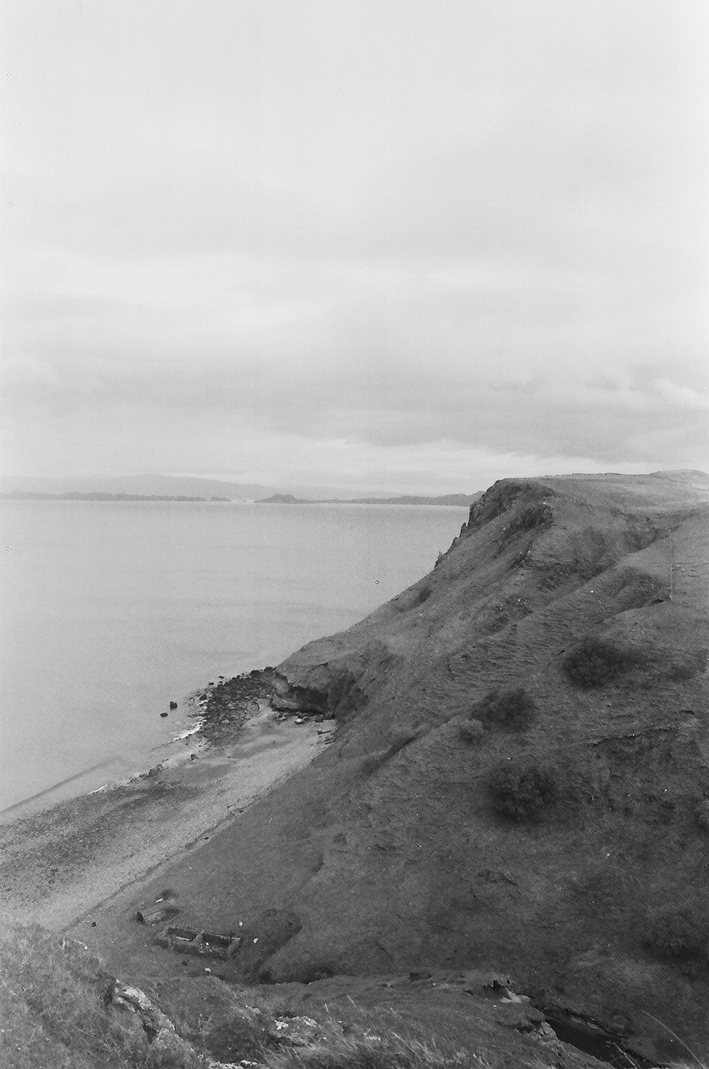

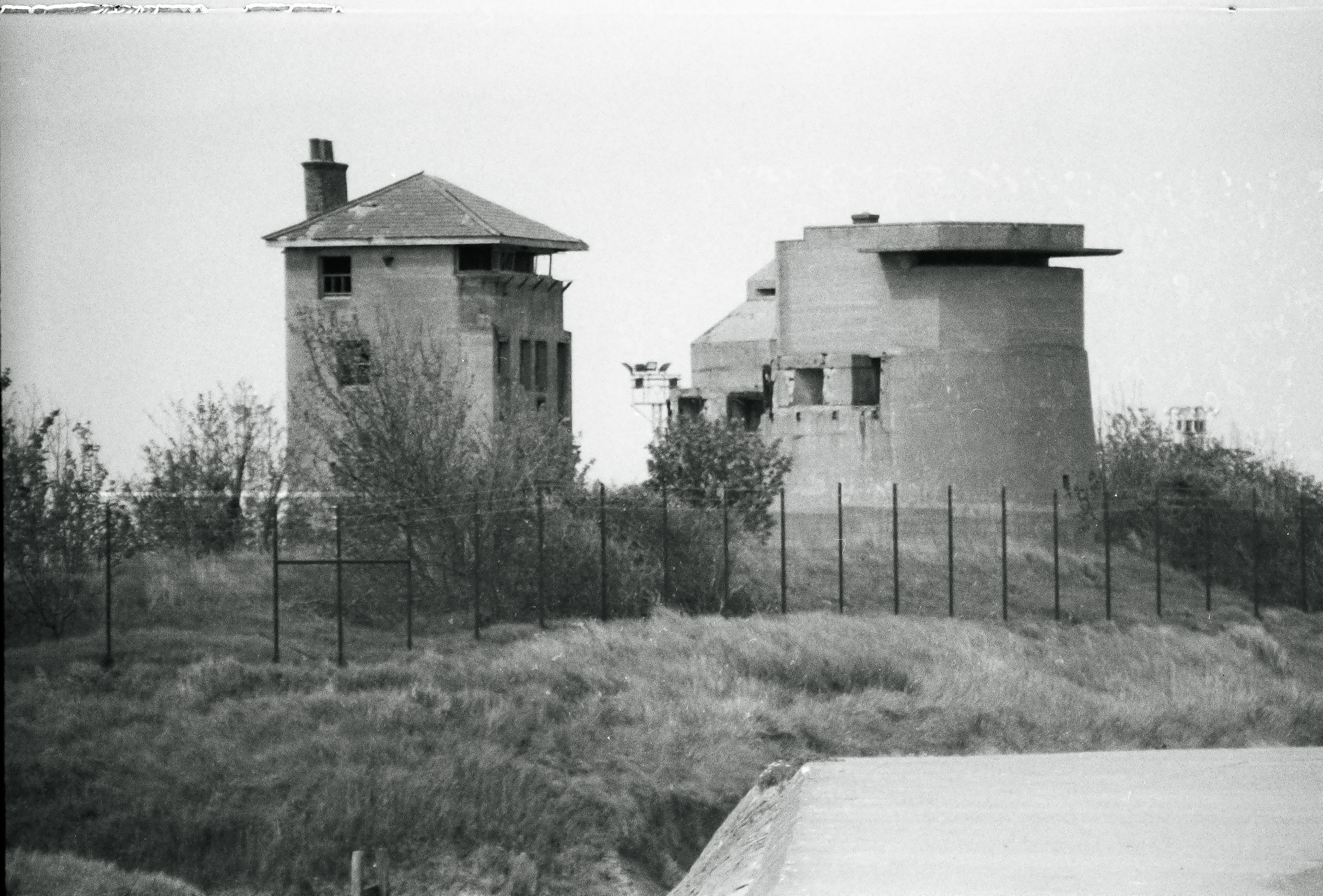

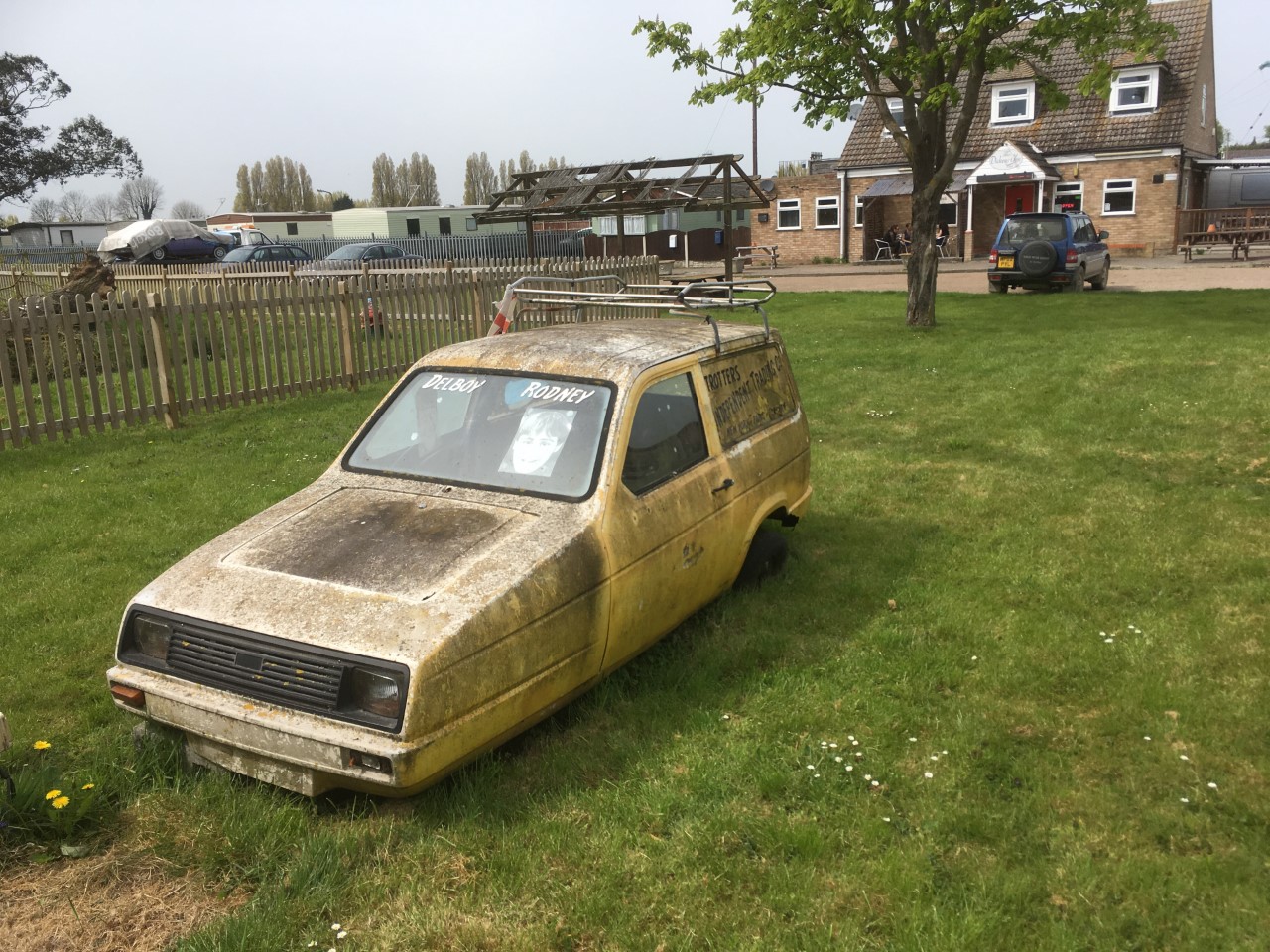

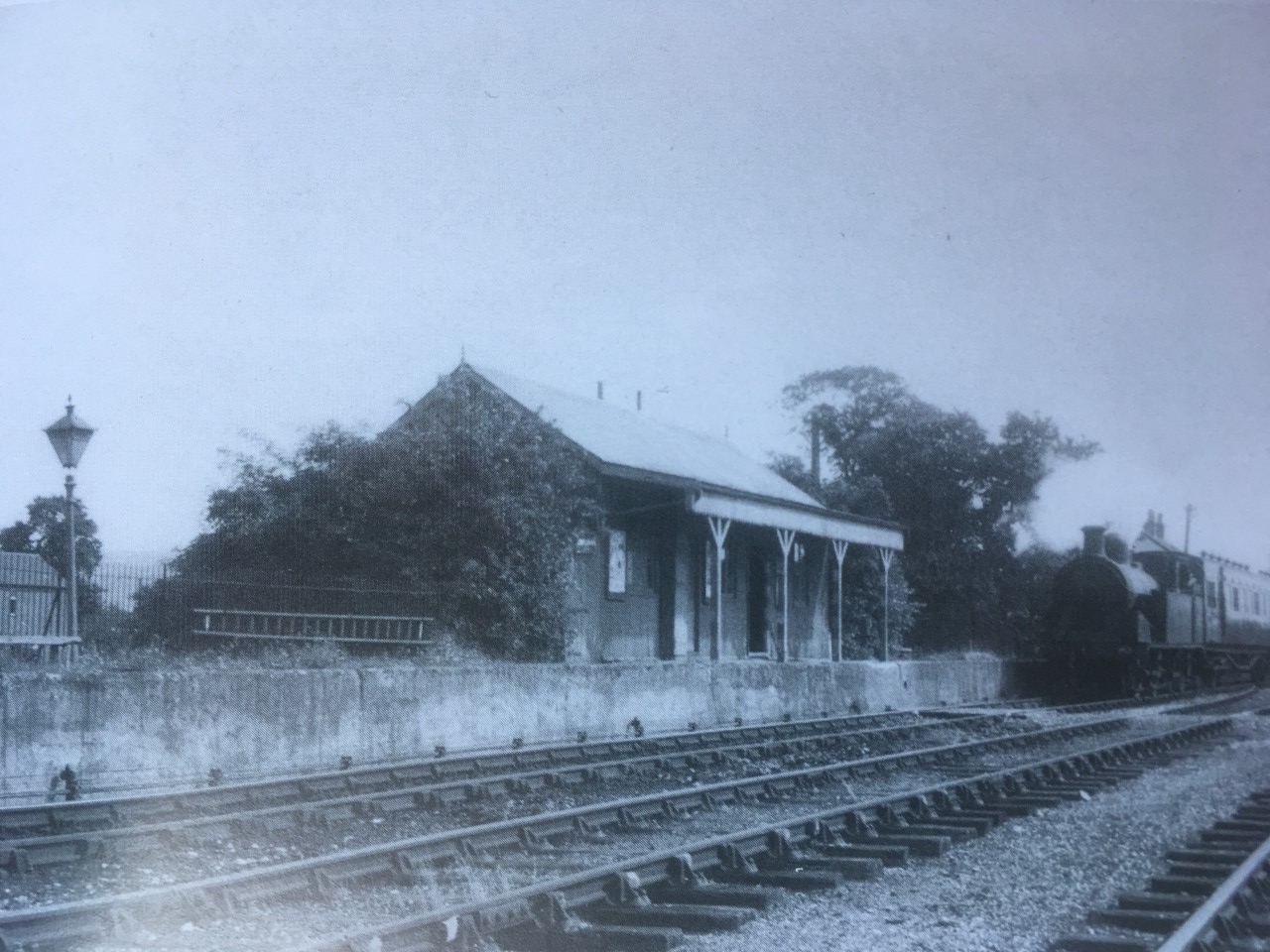


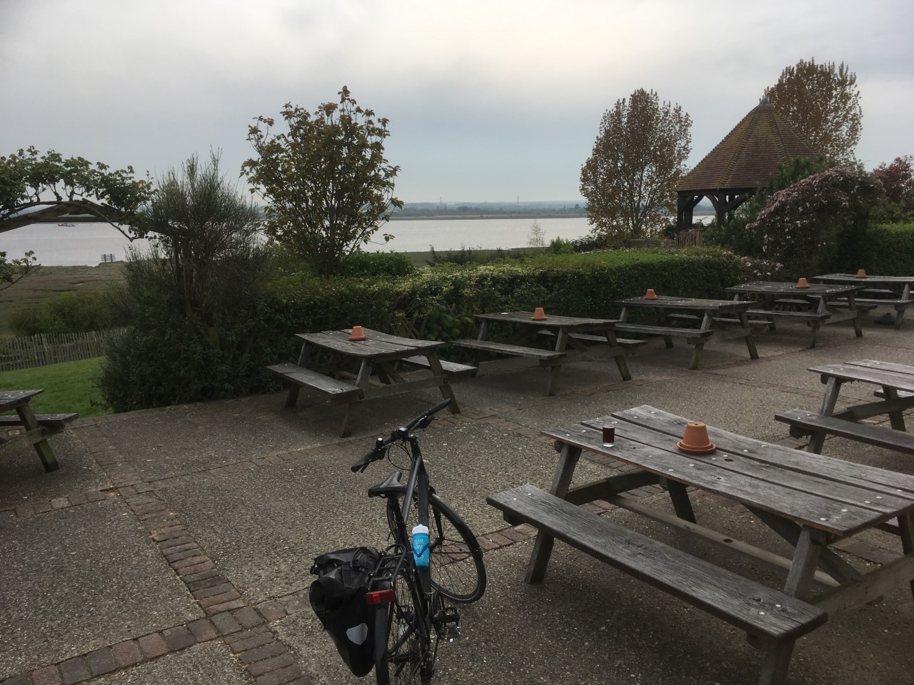
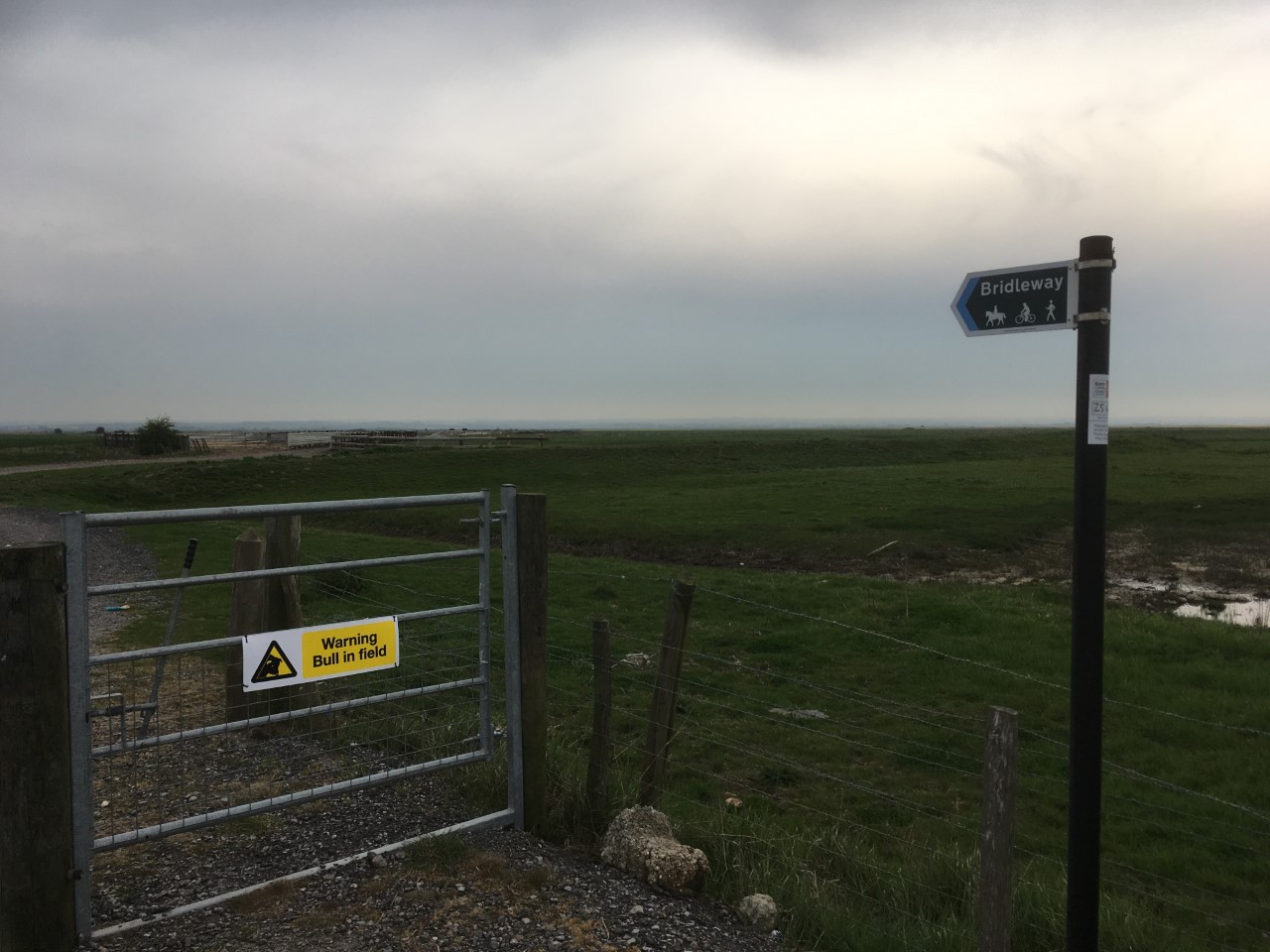


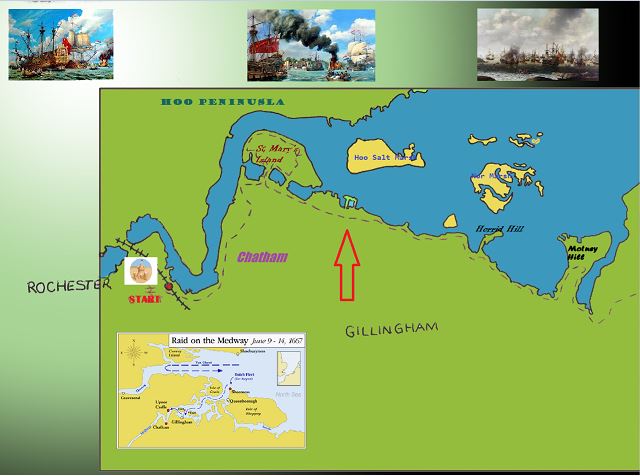
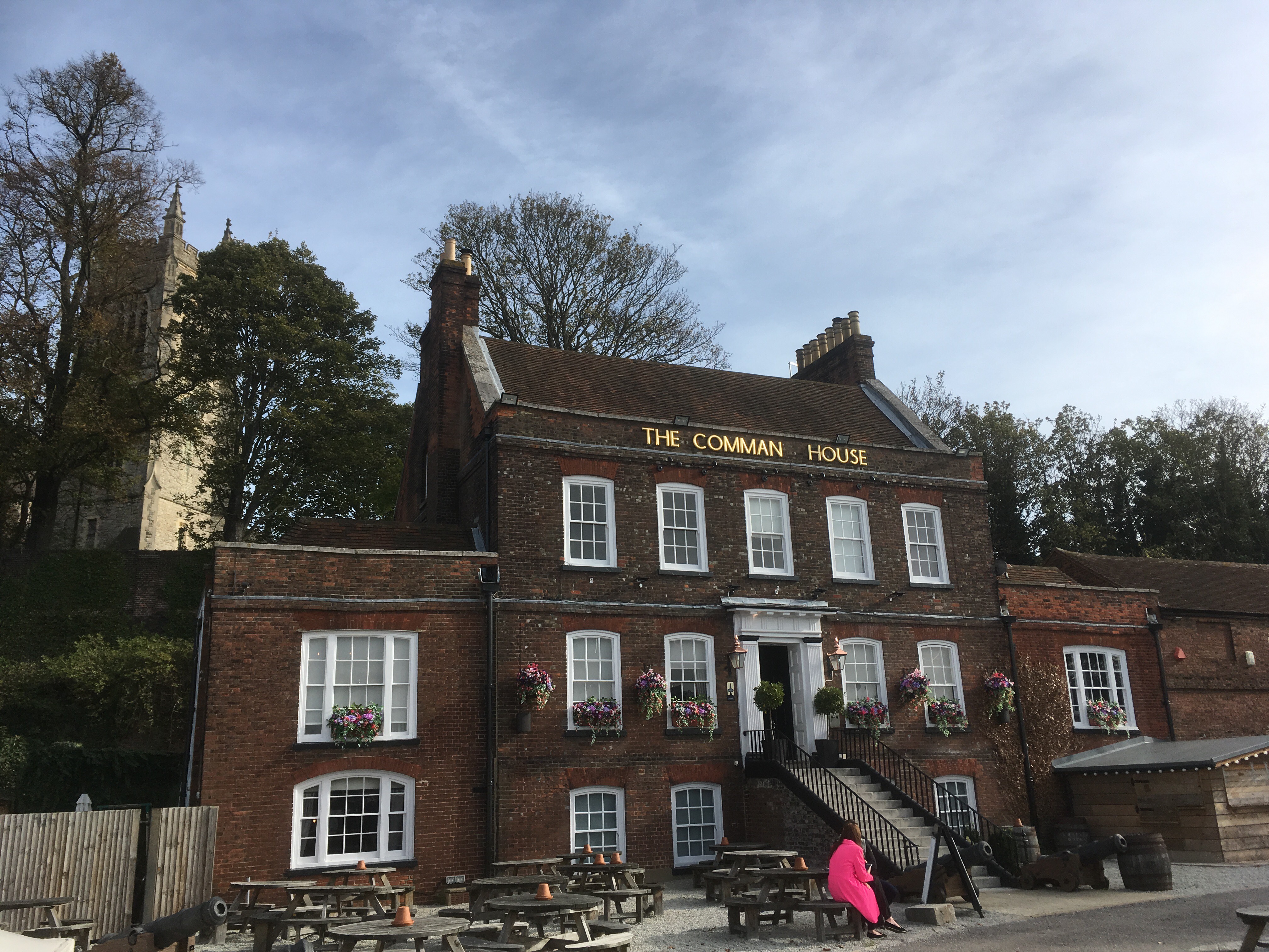


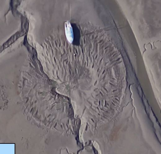
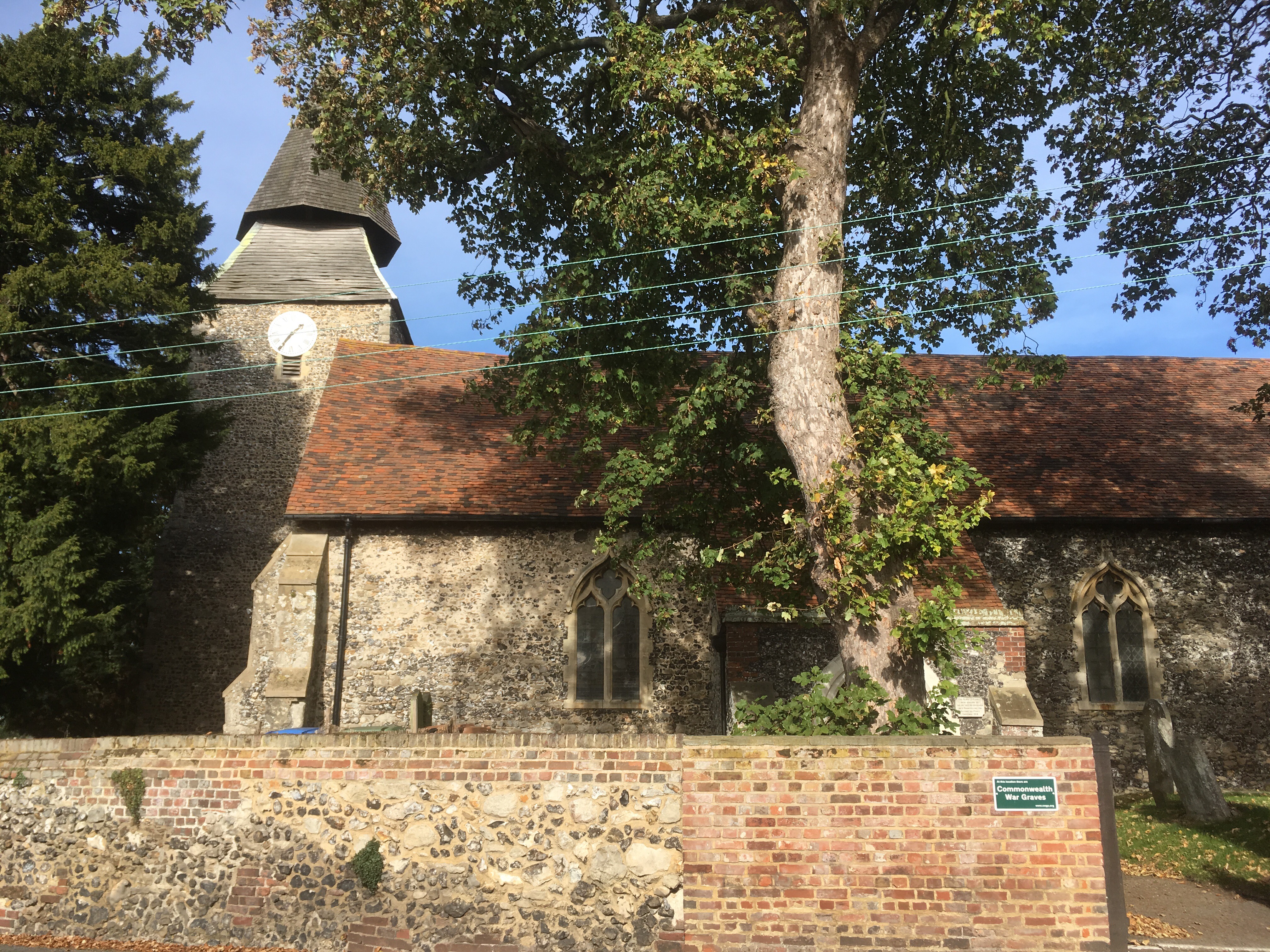
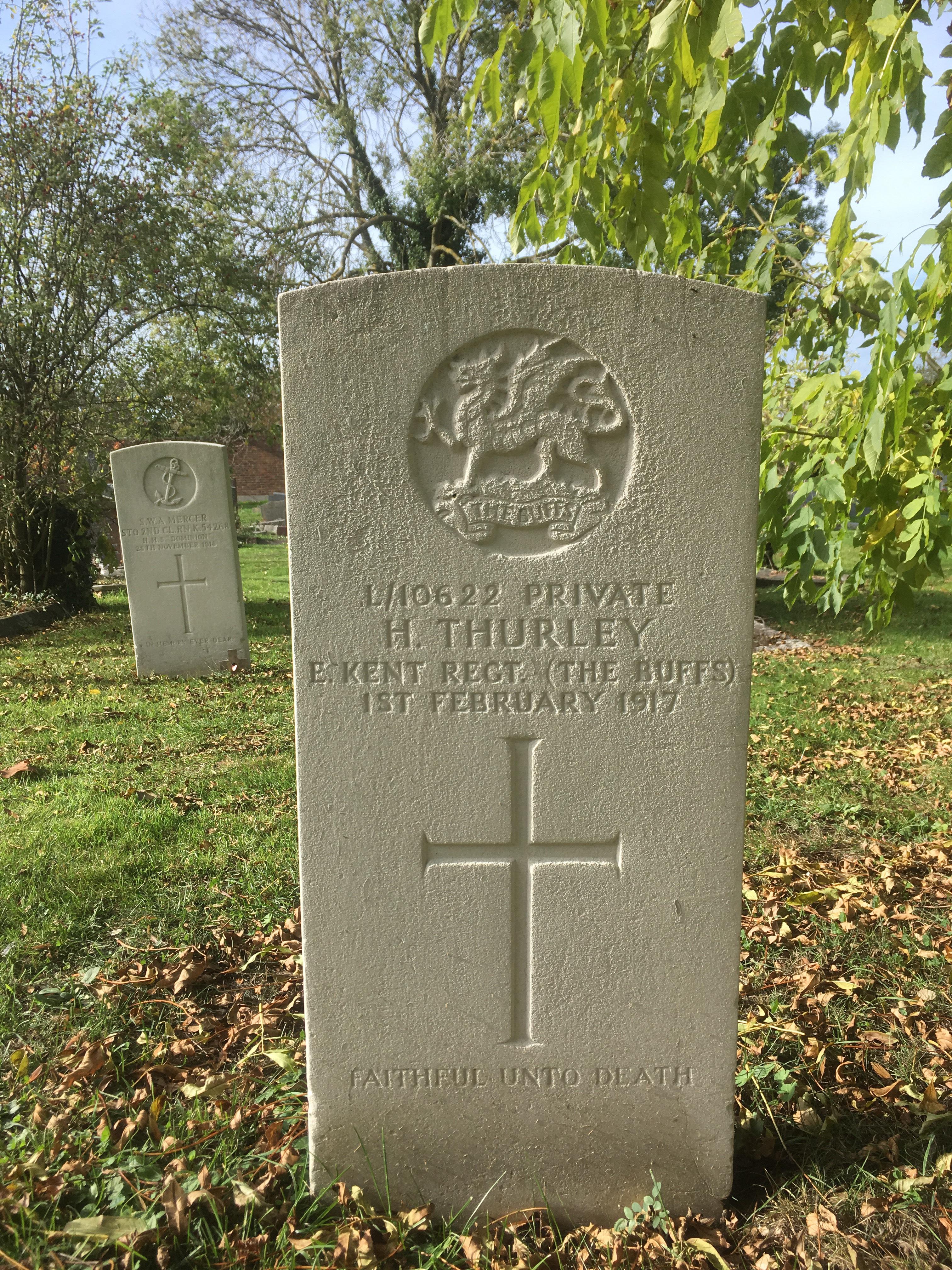


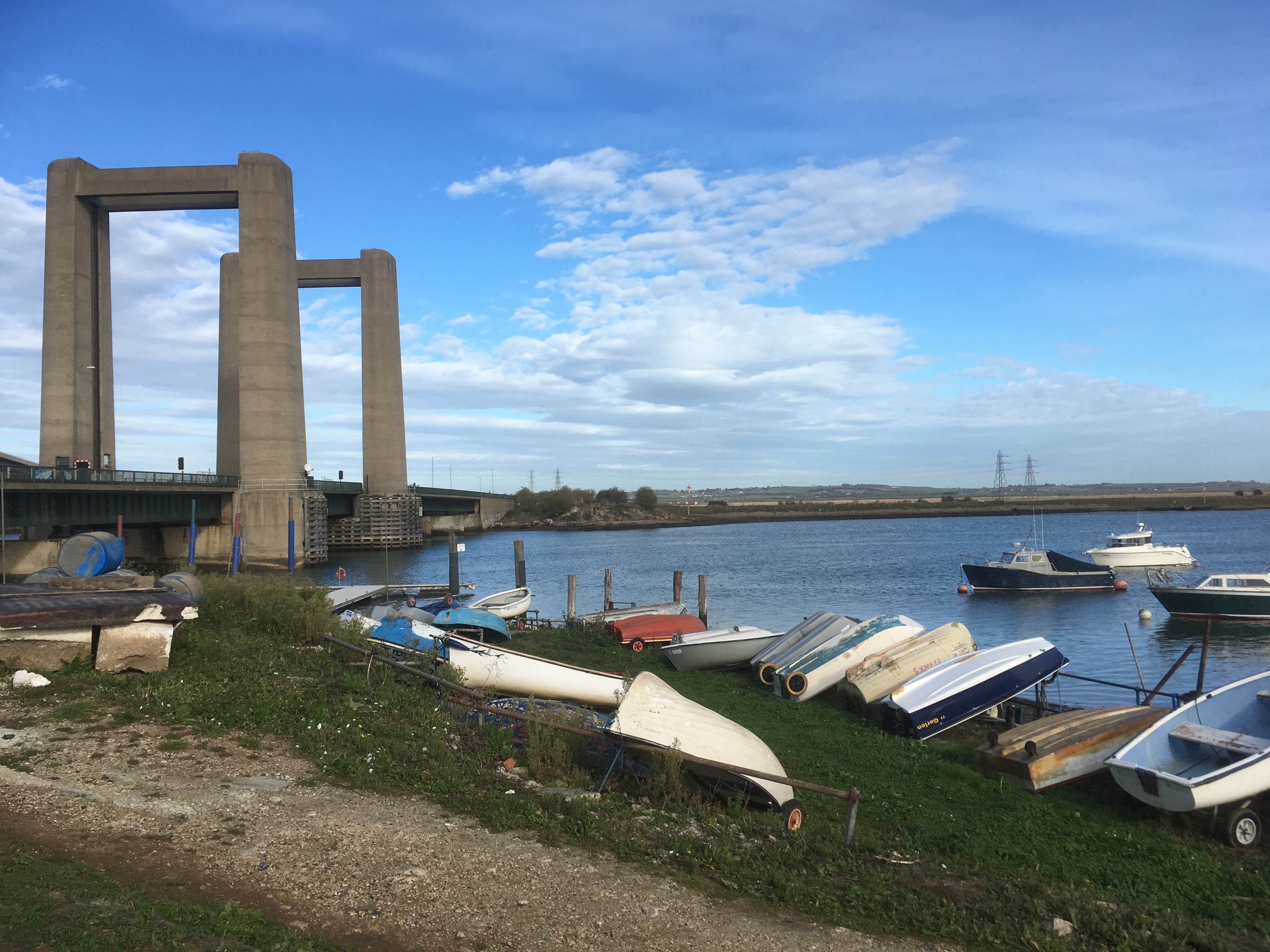

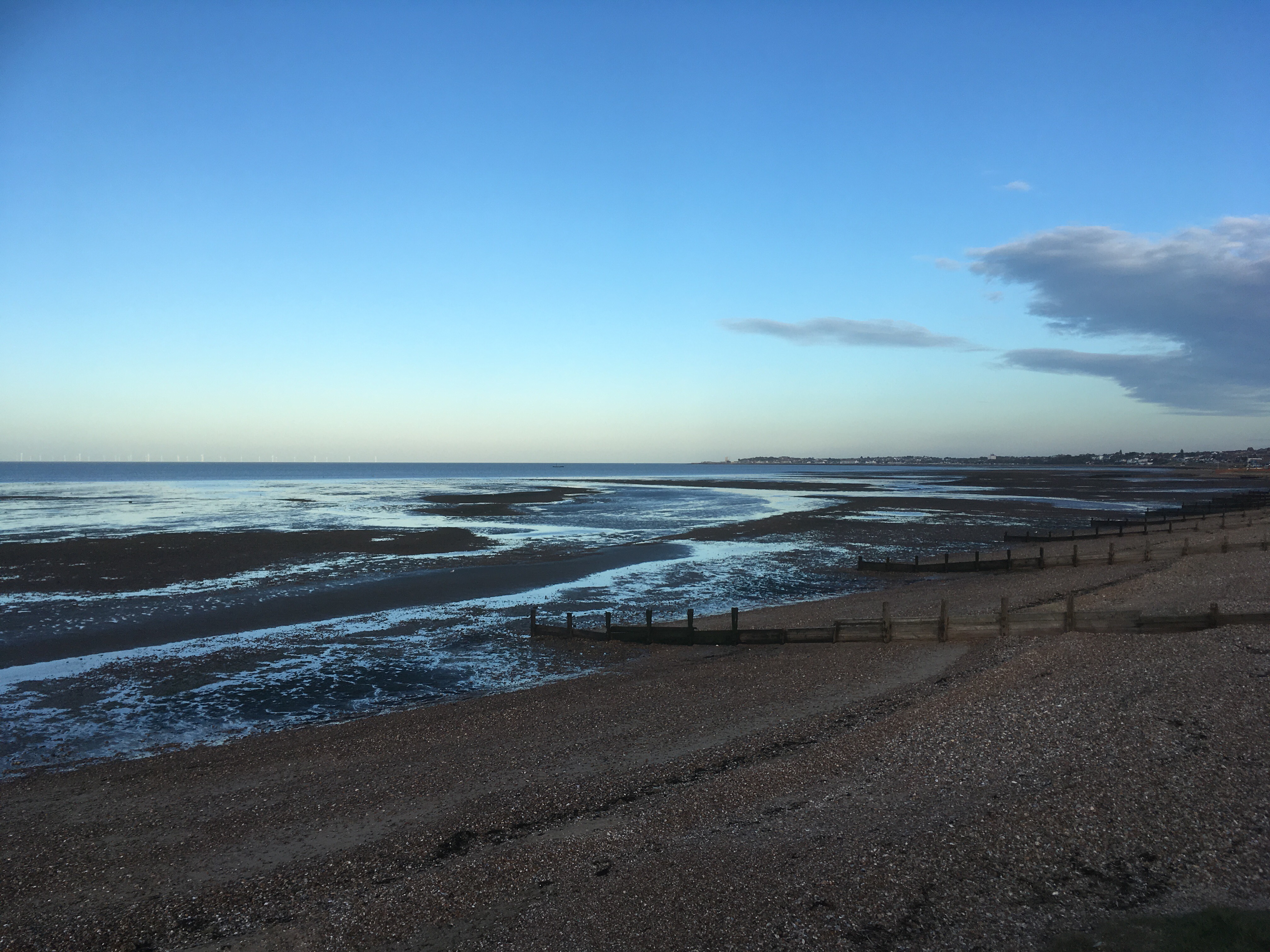

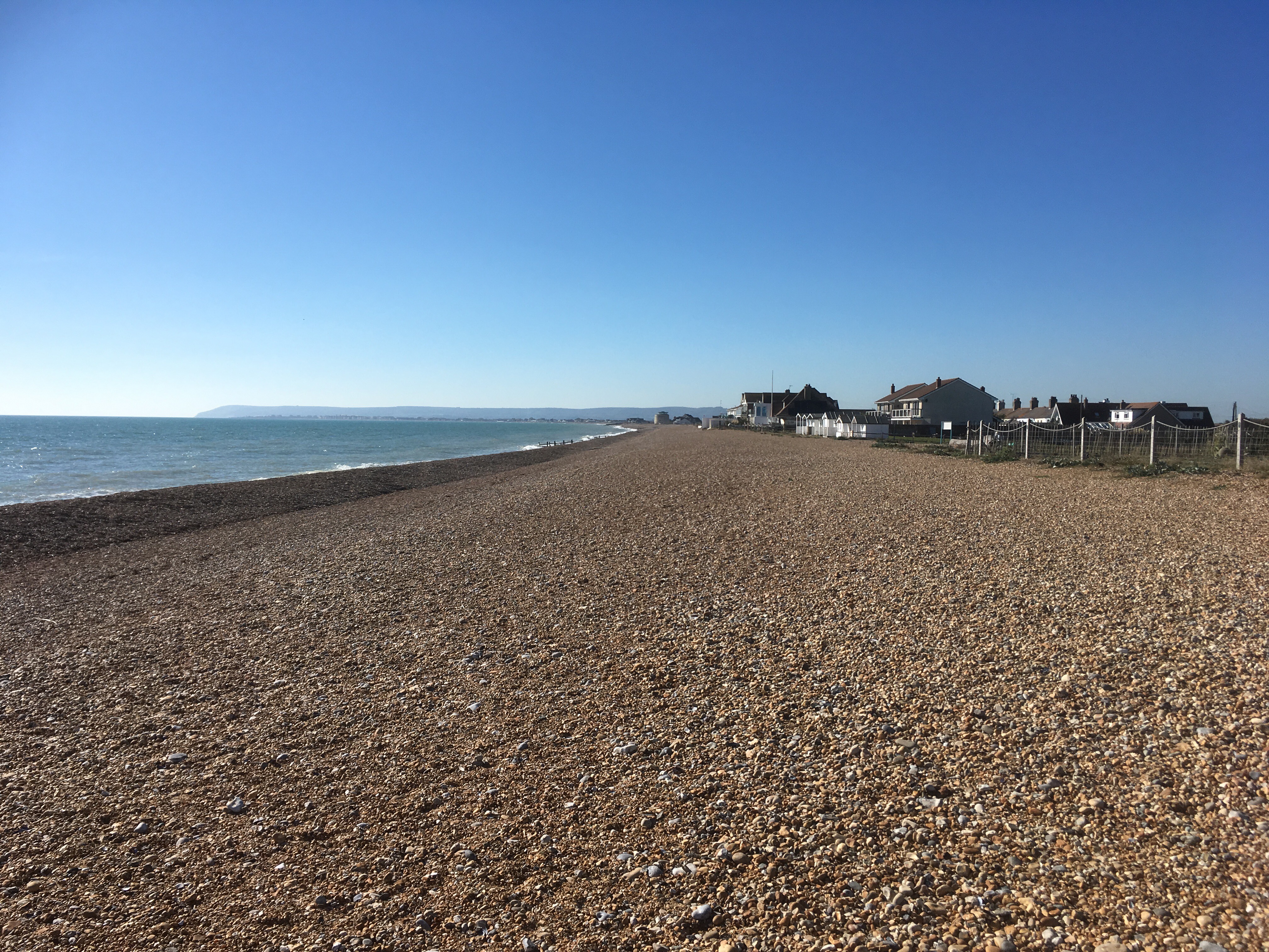
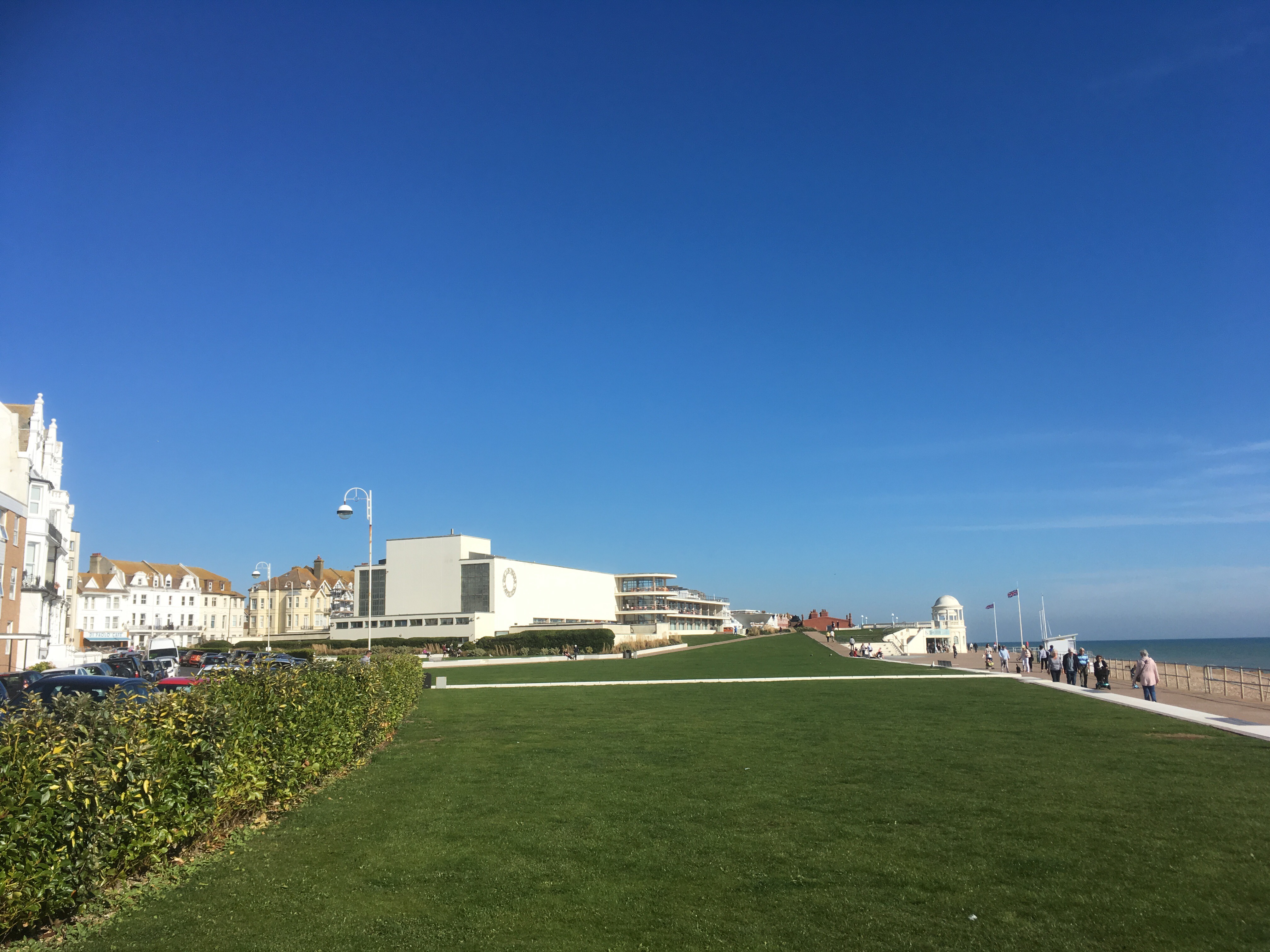


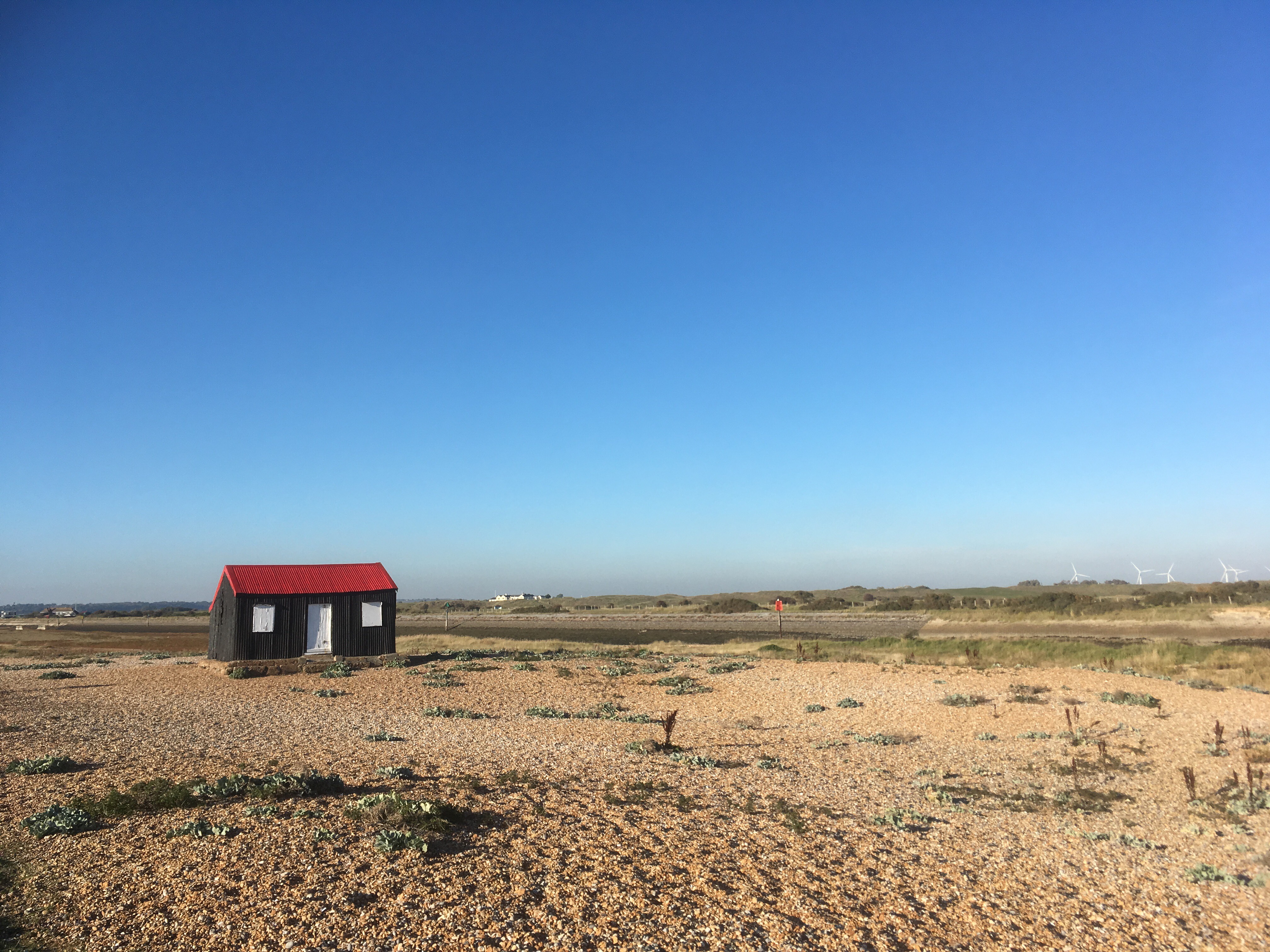


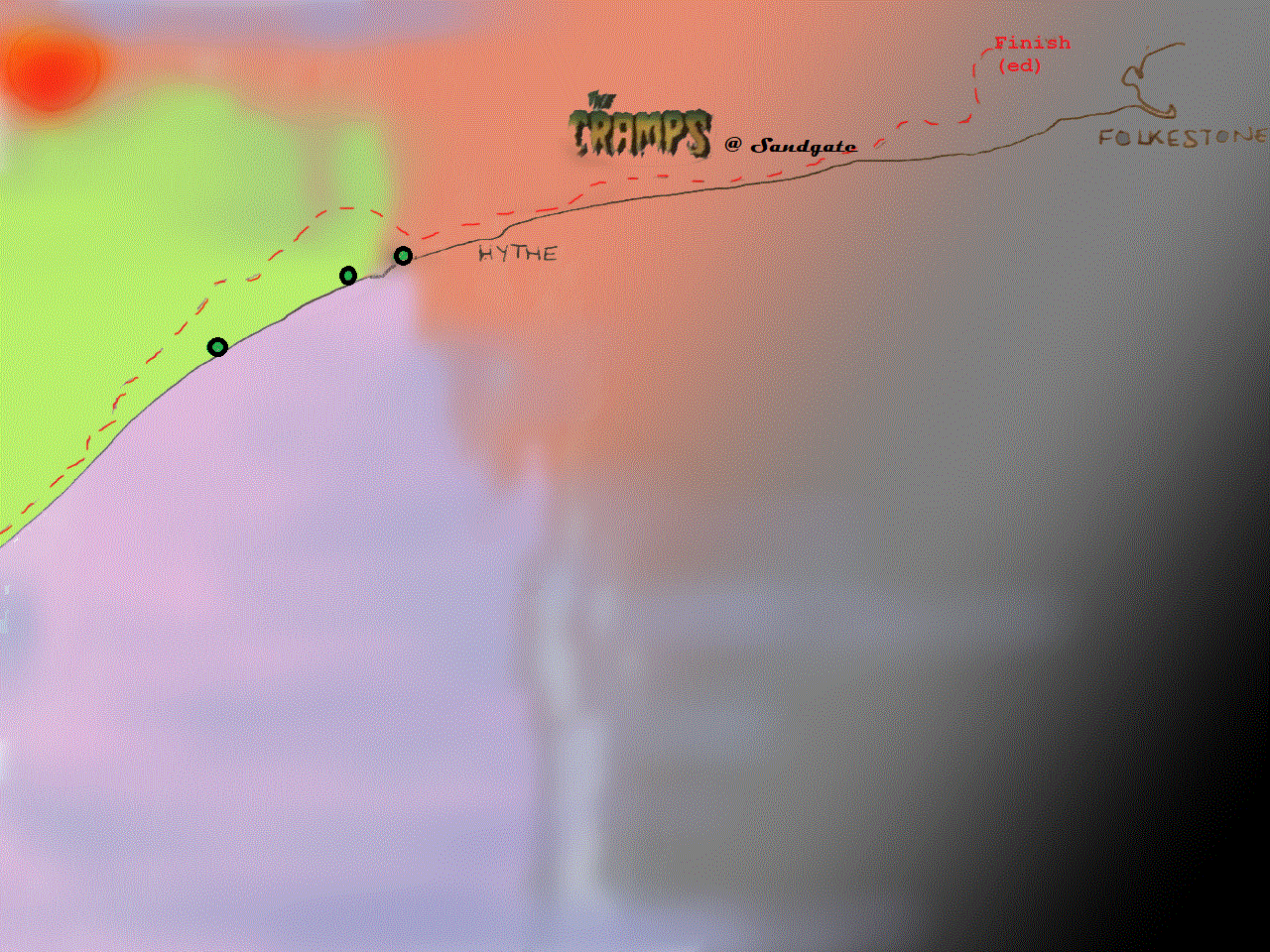


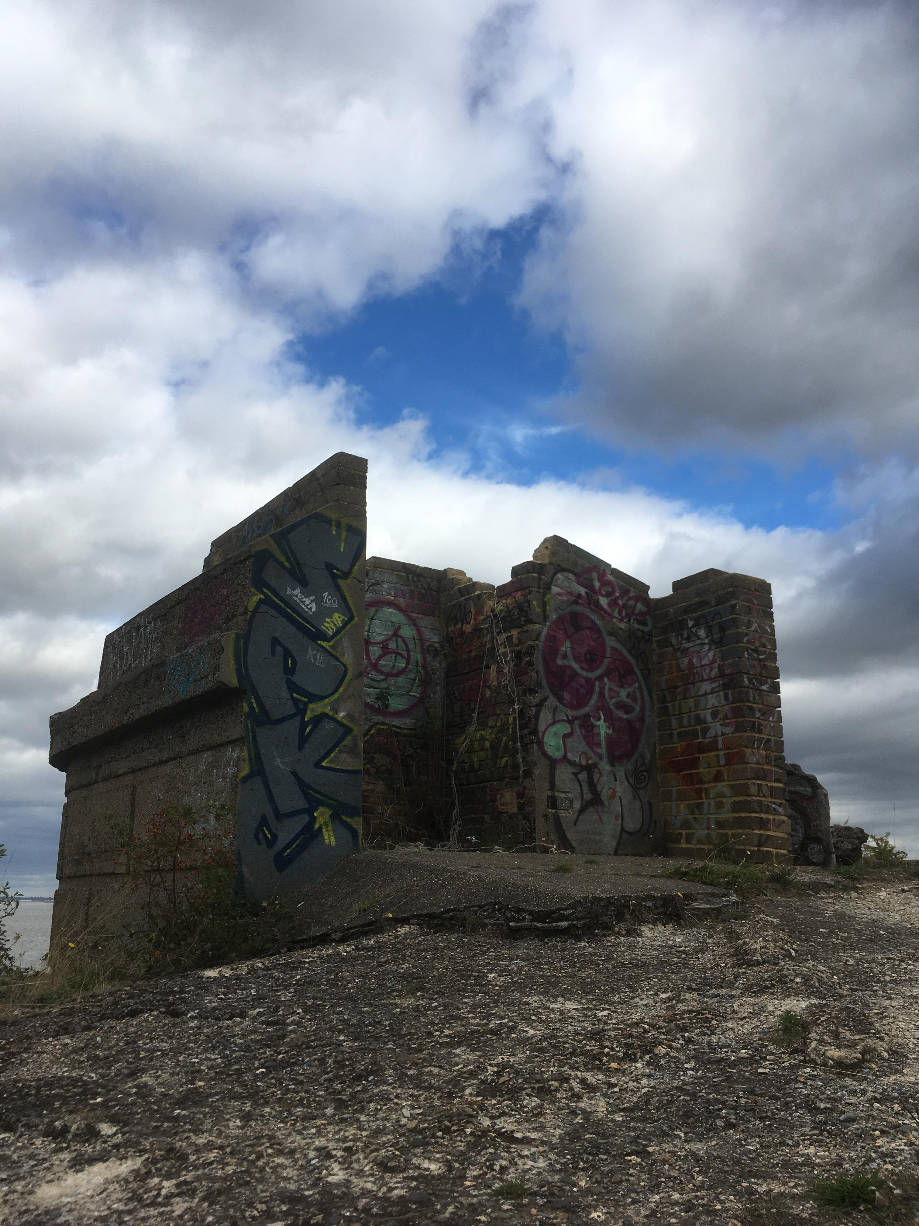

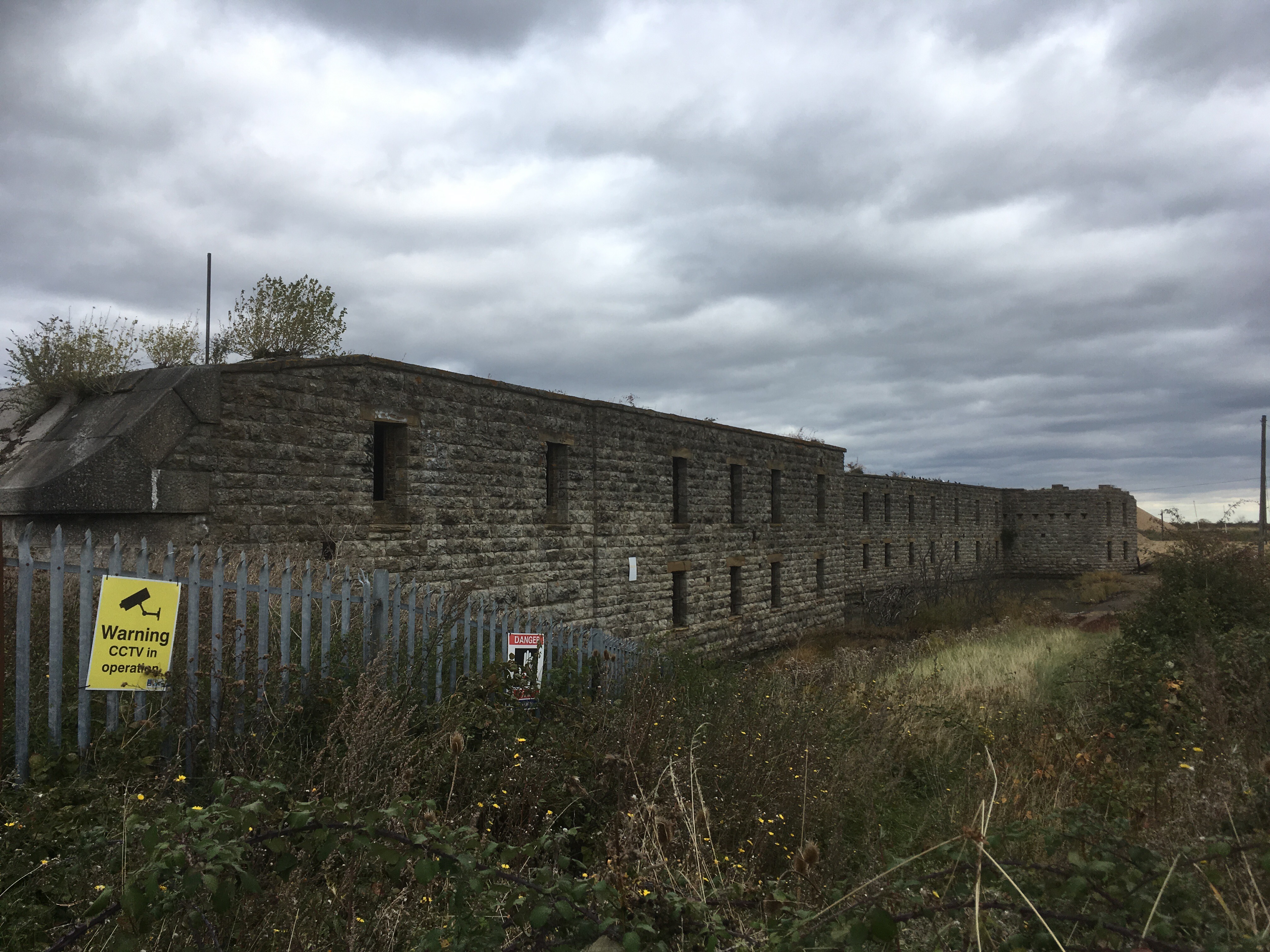

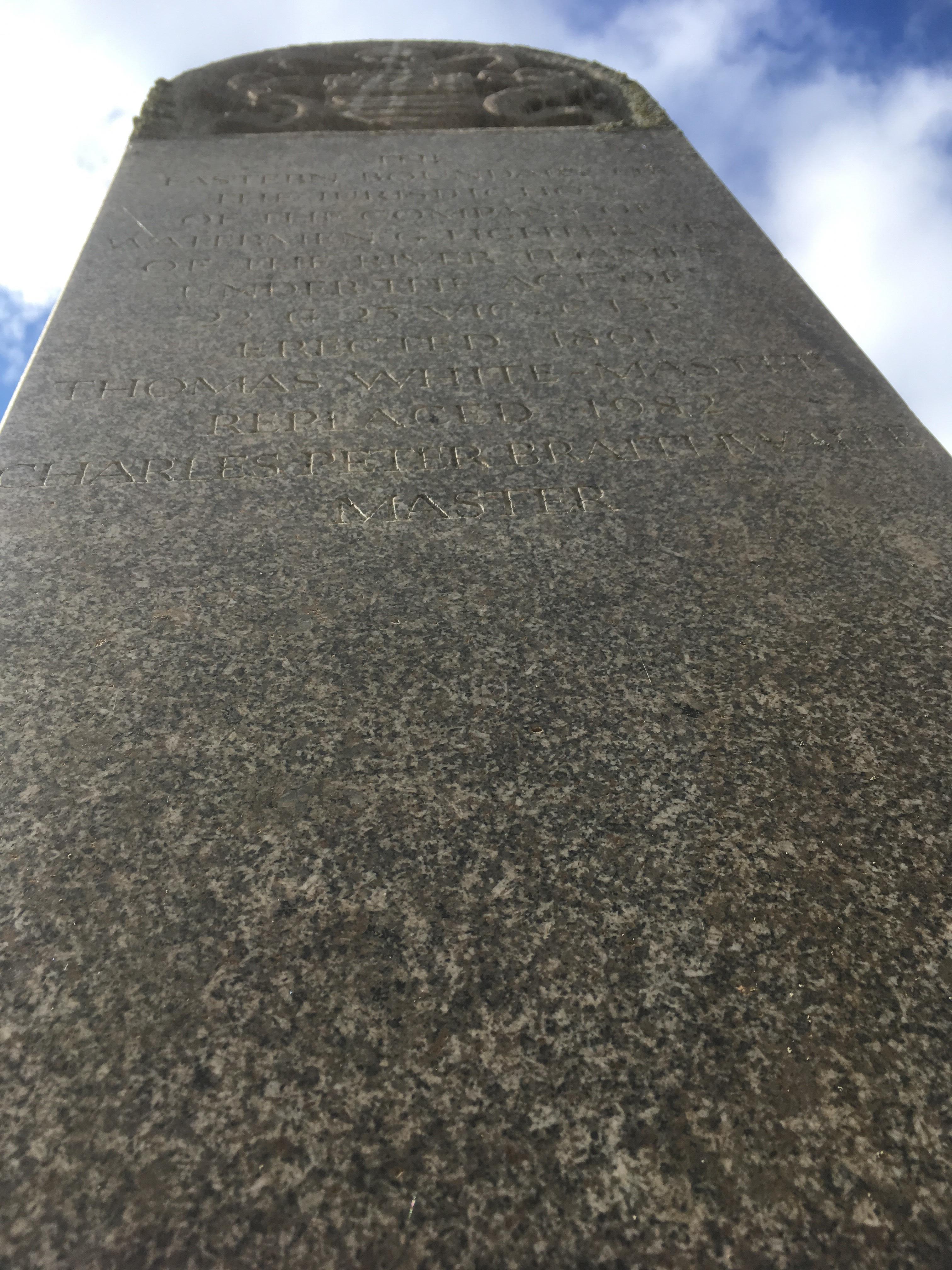


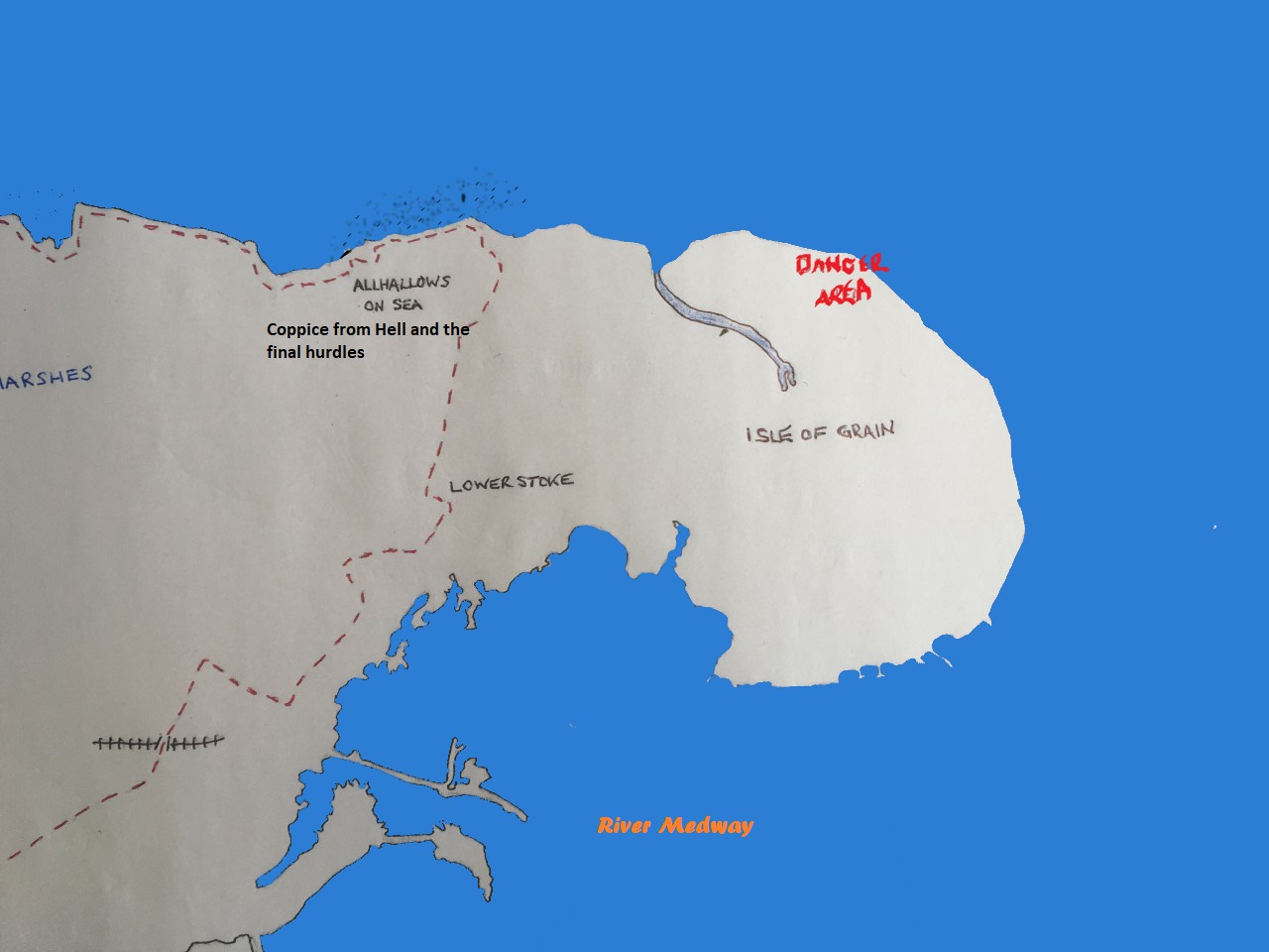

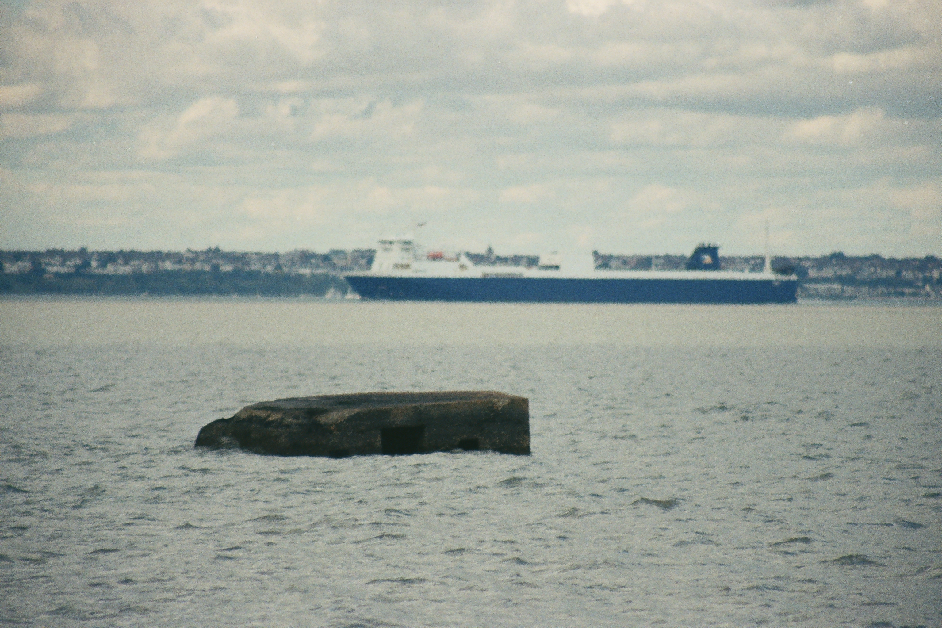

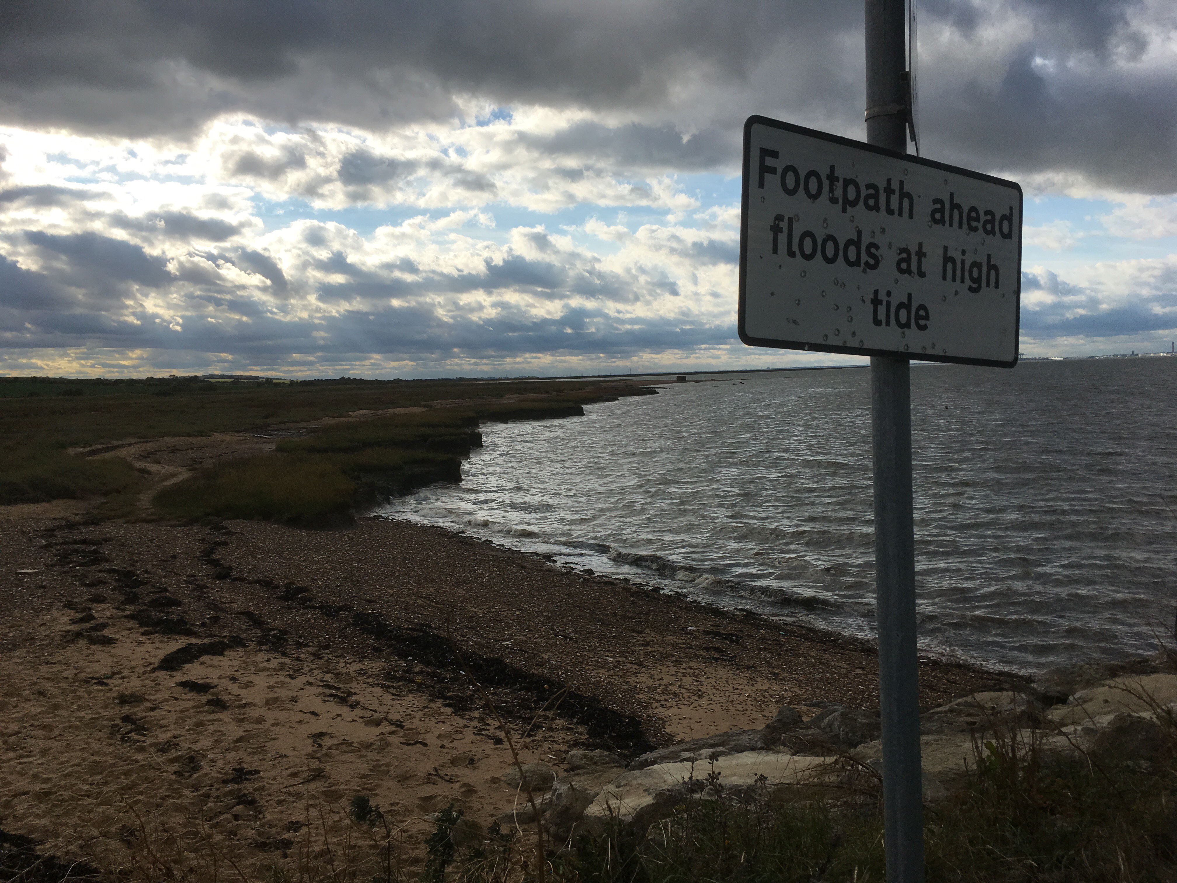
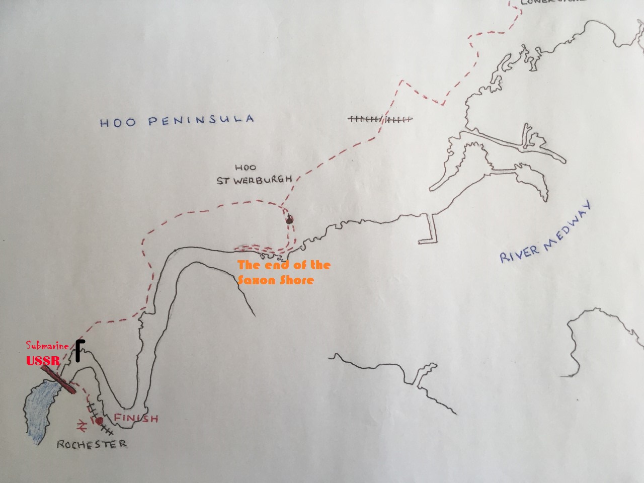

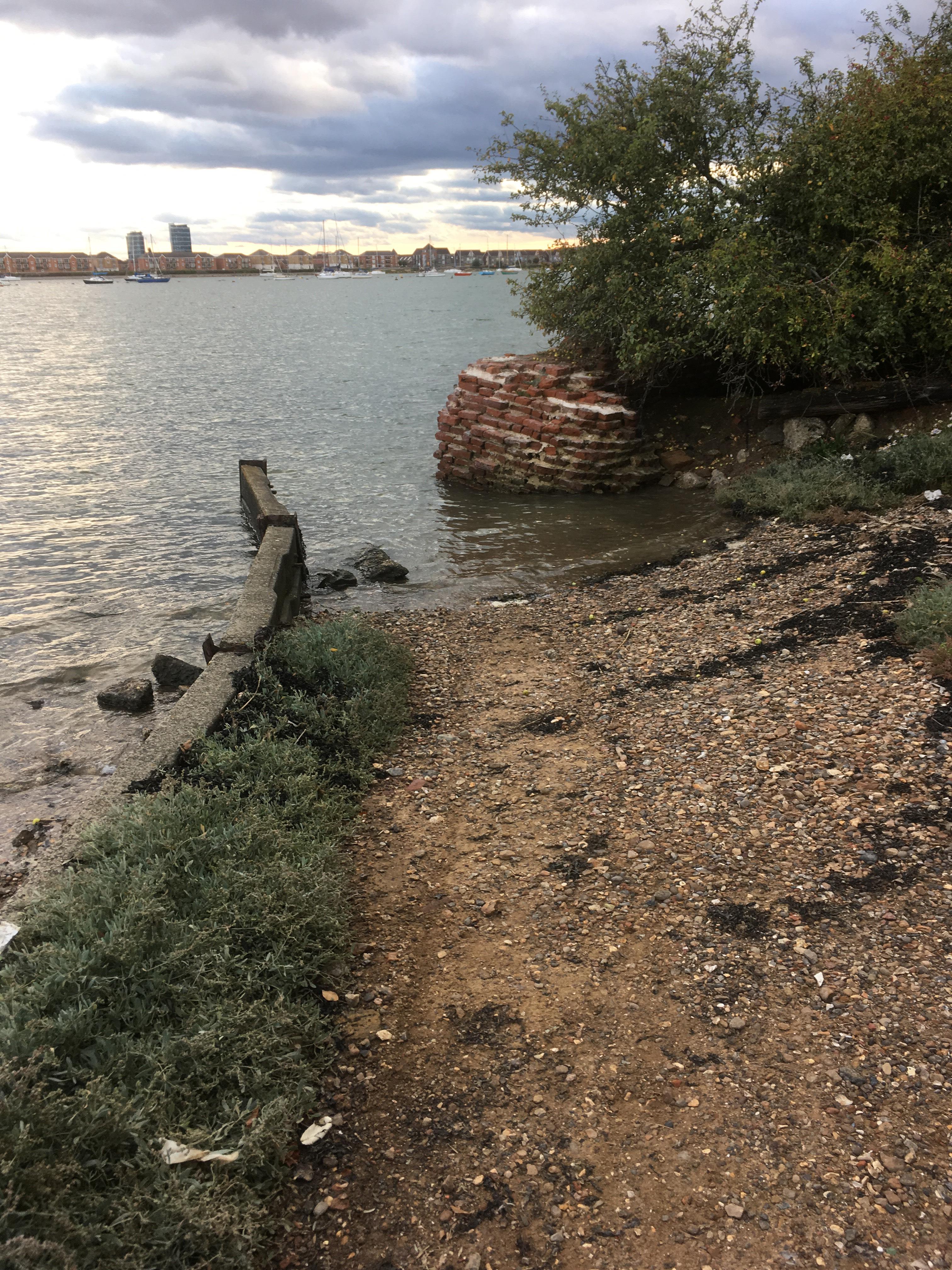
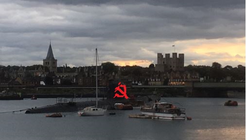

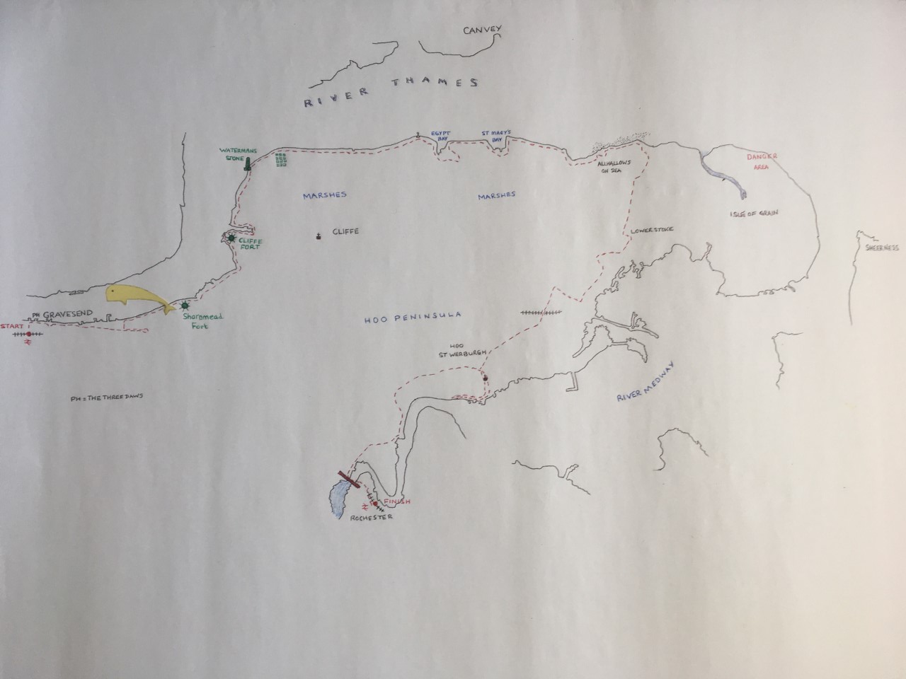
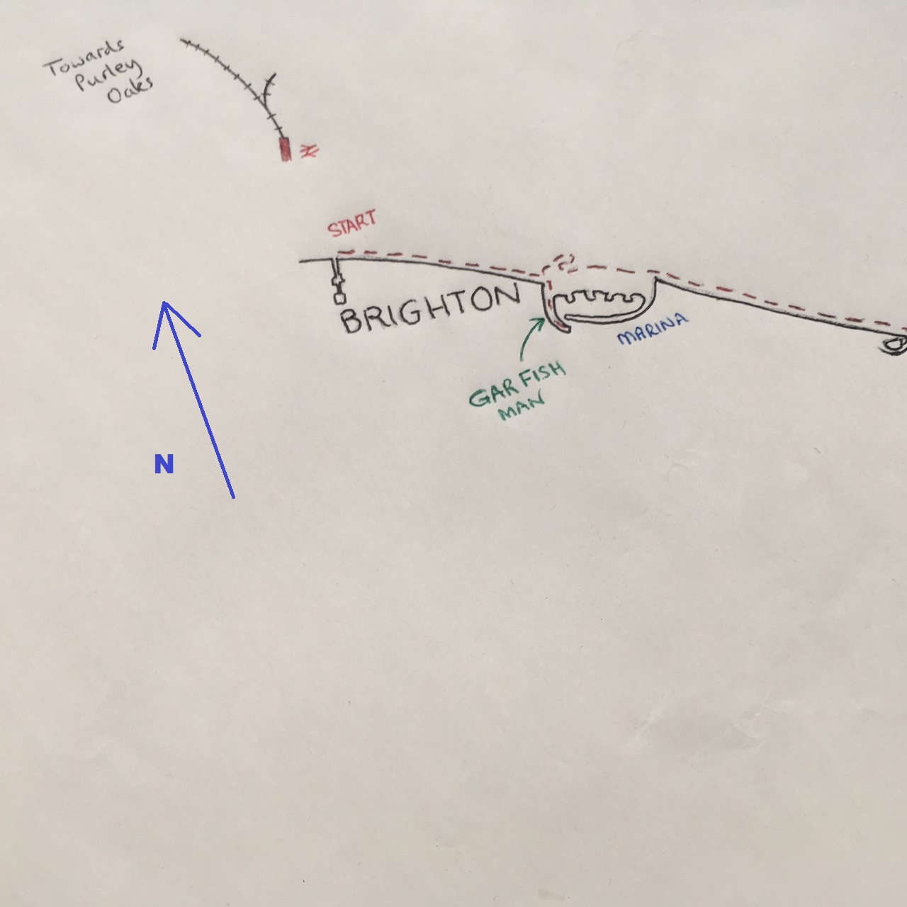
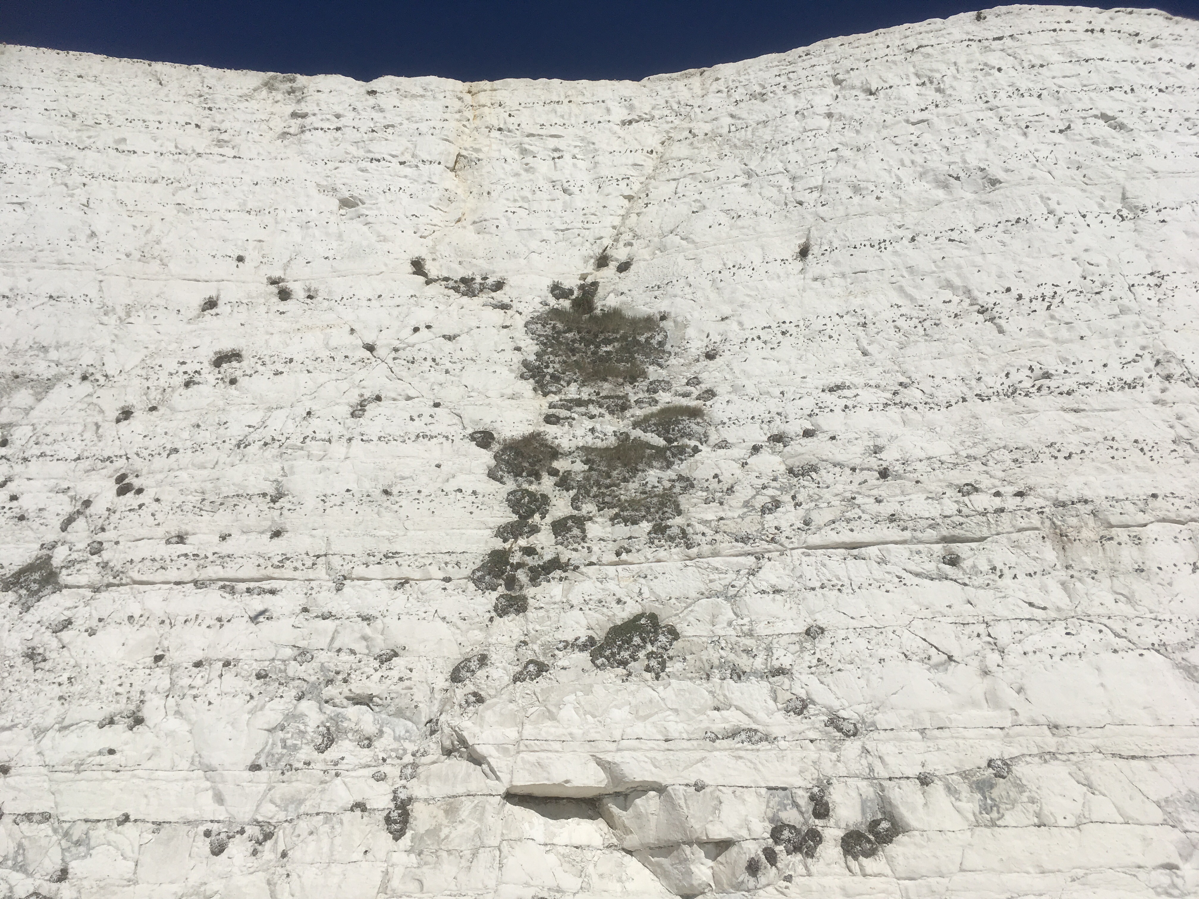

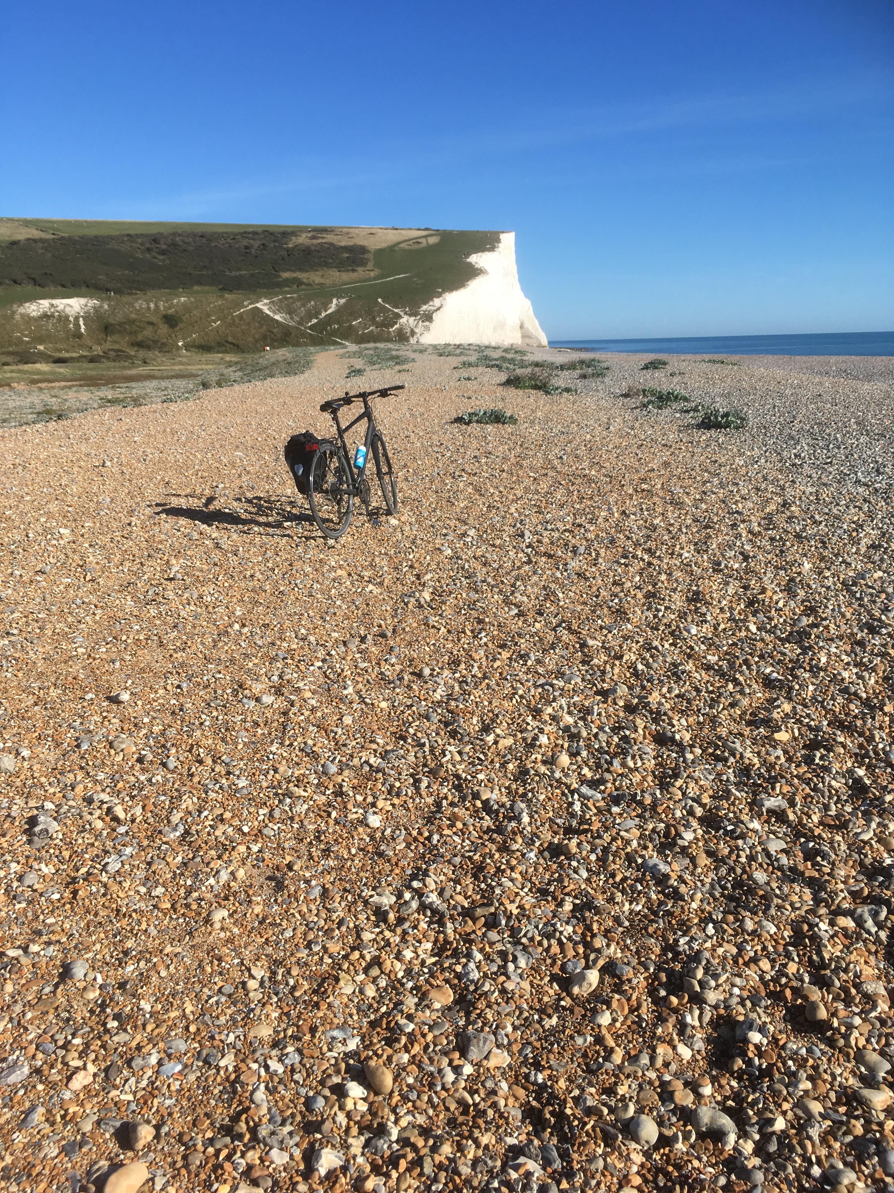

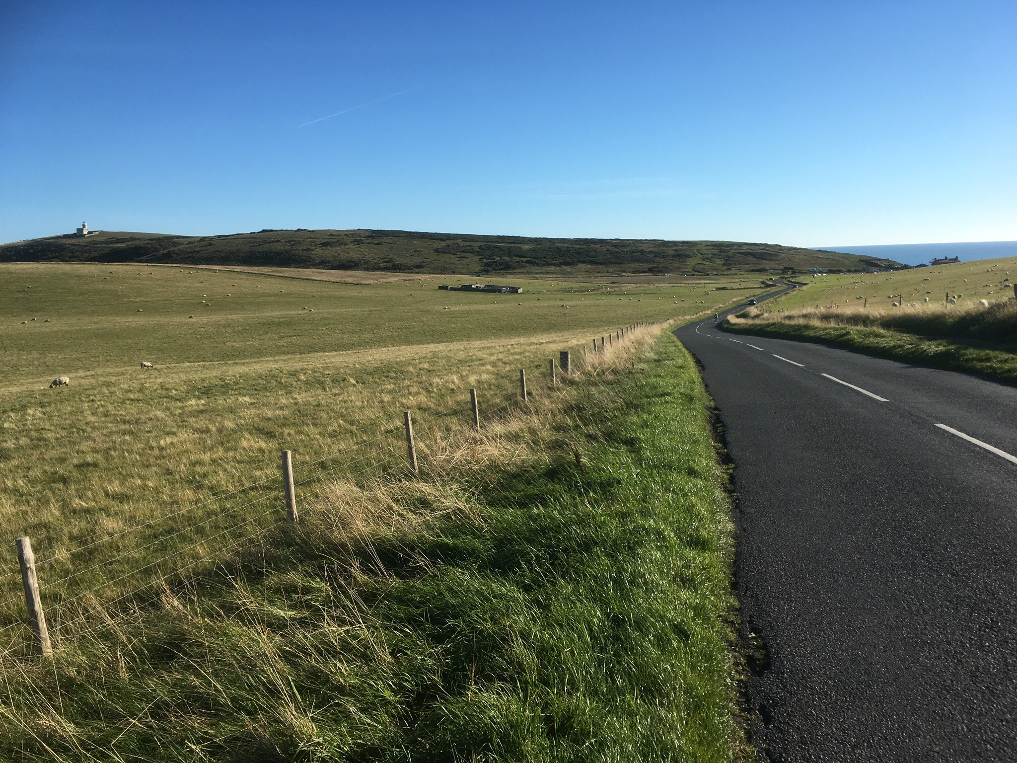
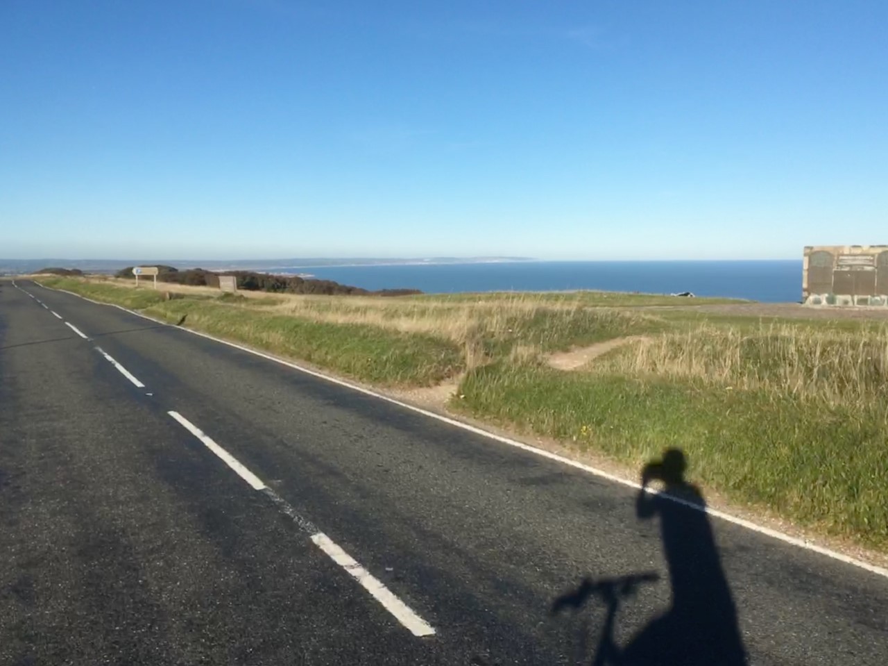


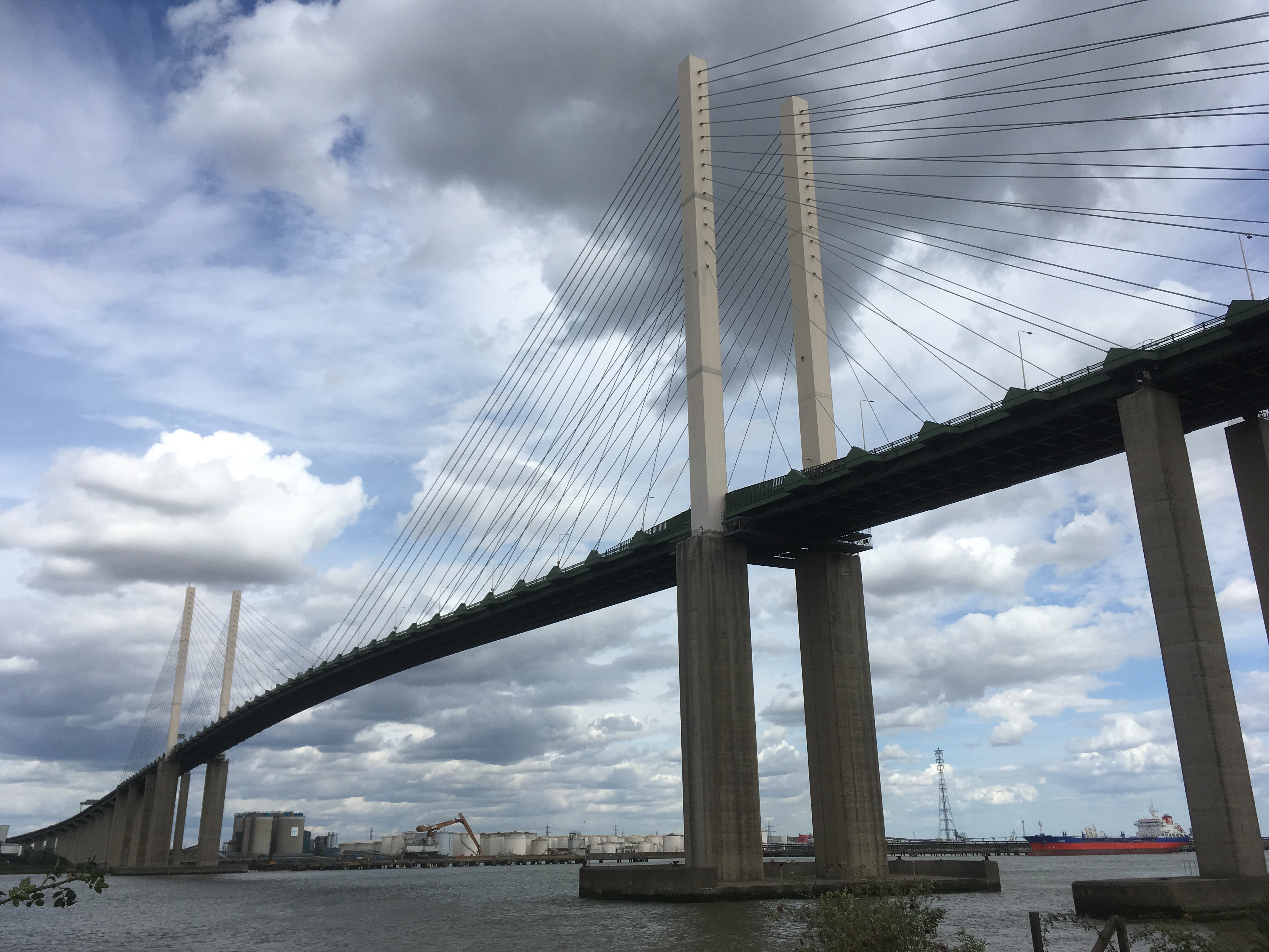

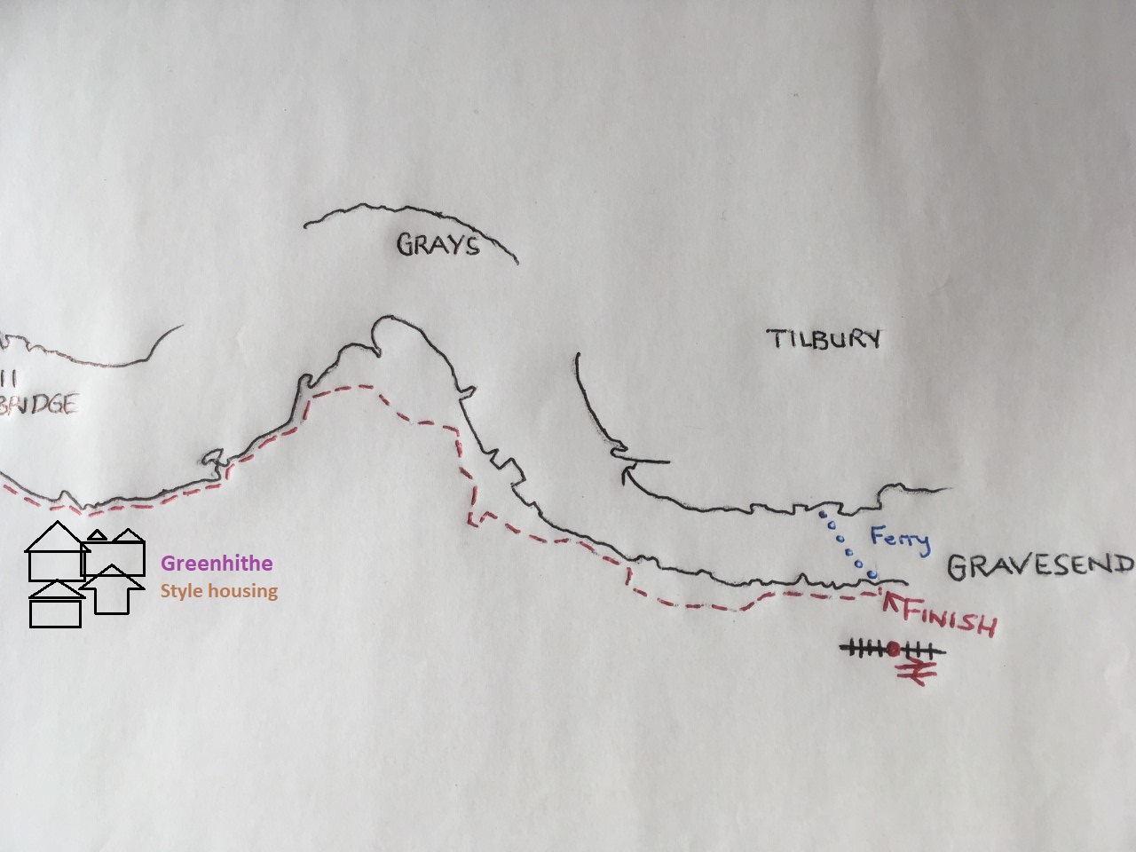
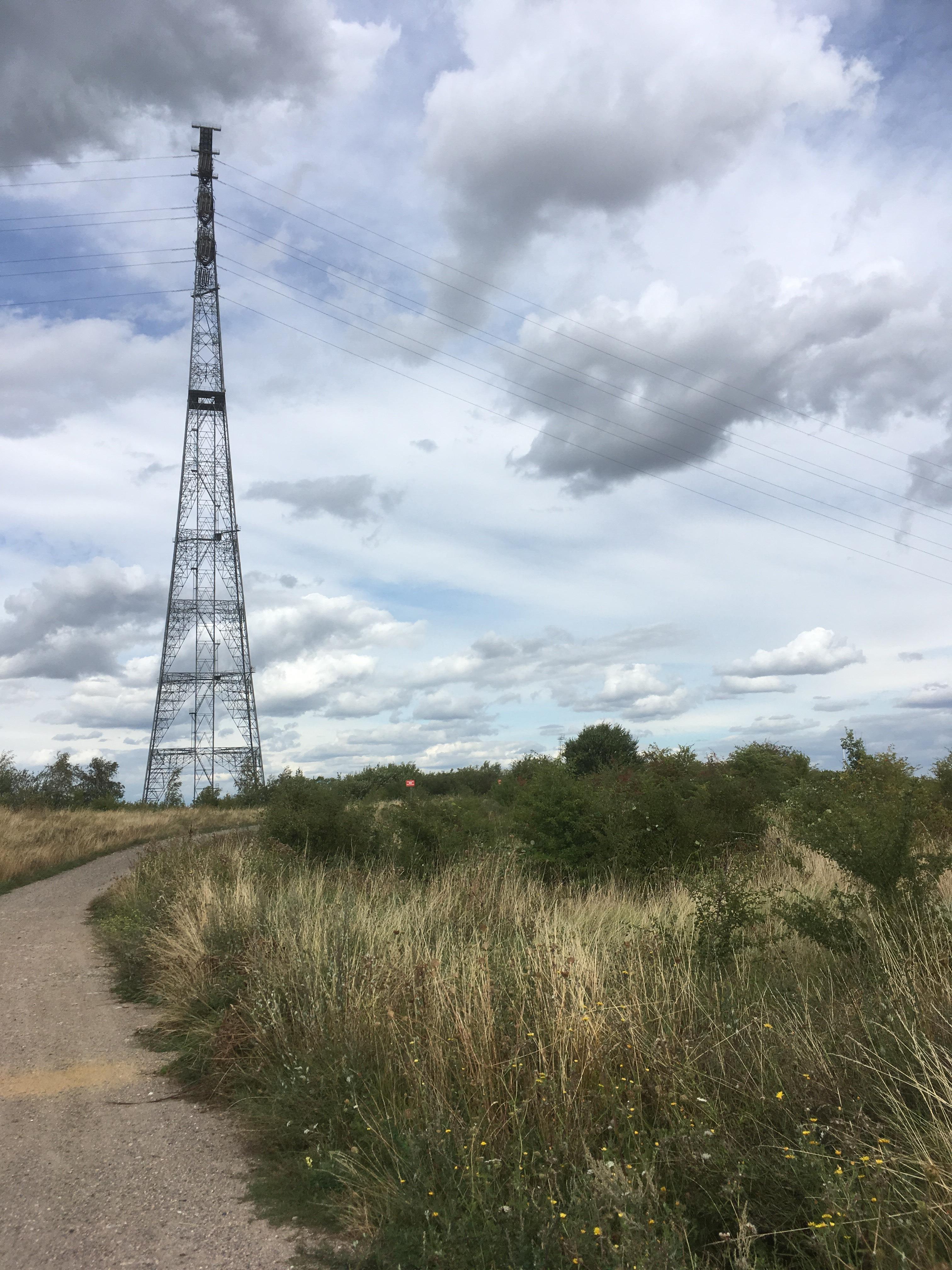


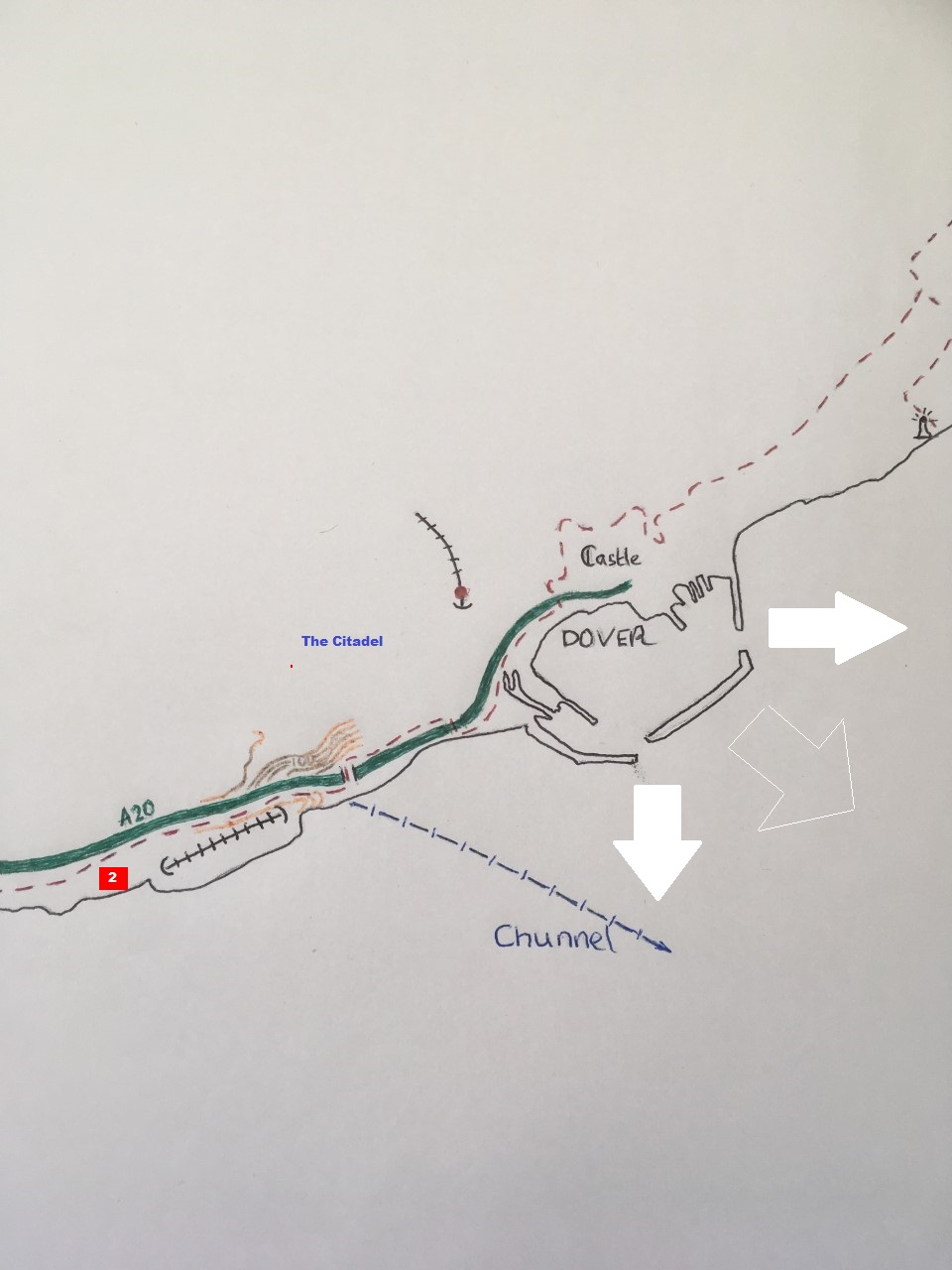


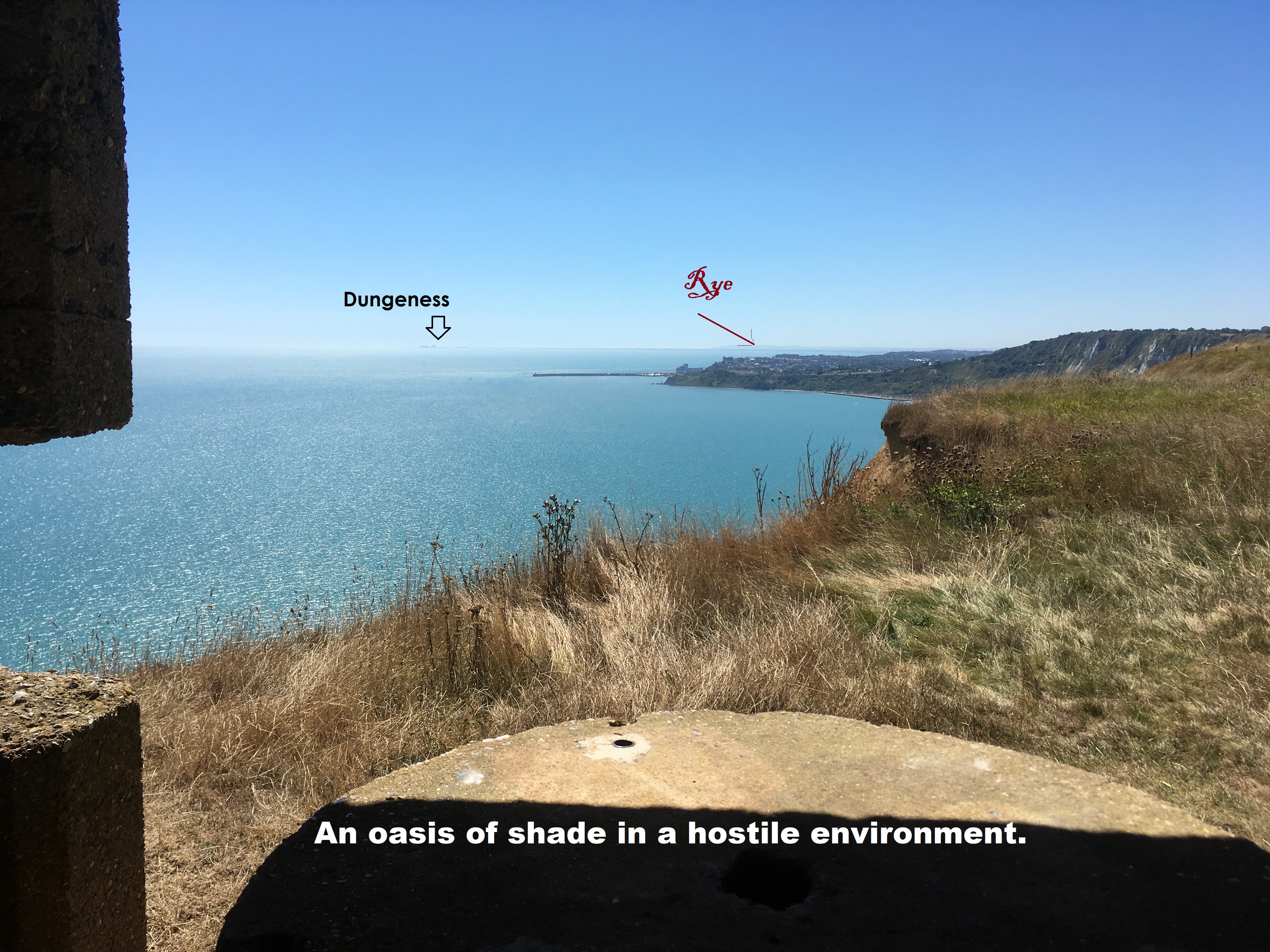

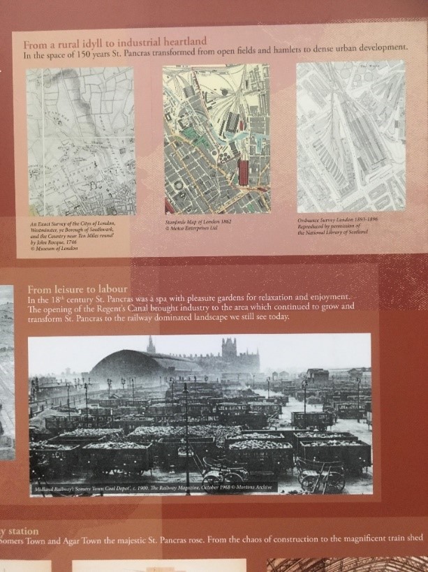 “…the majestic St Pancras rose..”
 Herne Bay station and escape from the network
 SPQR and all that
 Commanding the heights – Reculver
 The tide was in at Margate but the message was clear
 Café to café – Thanet
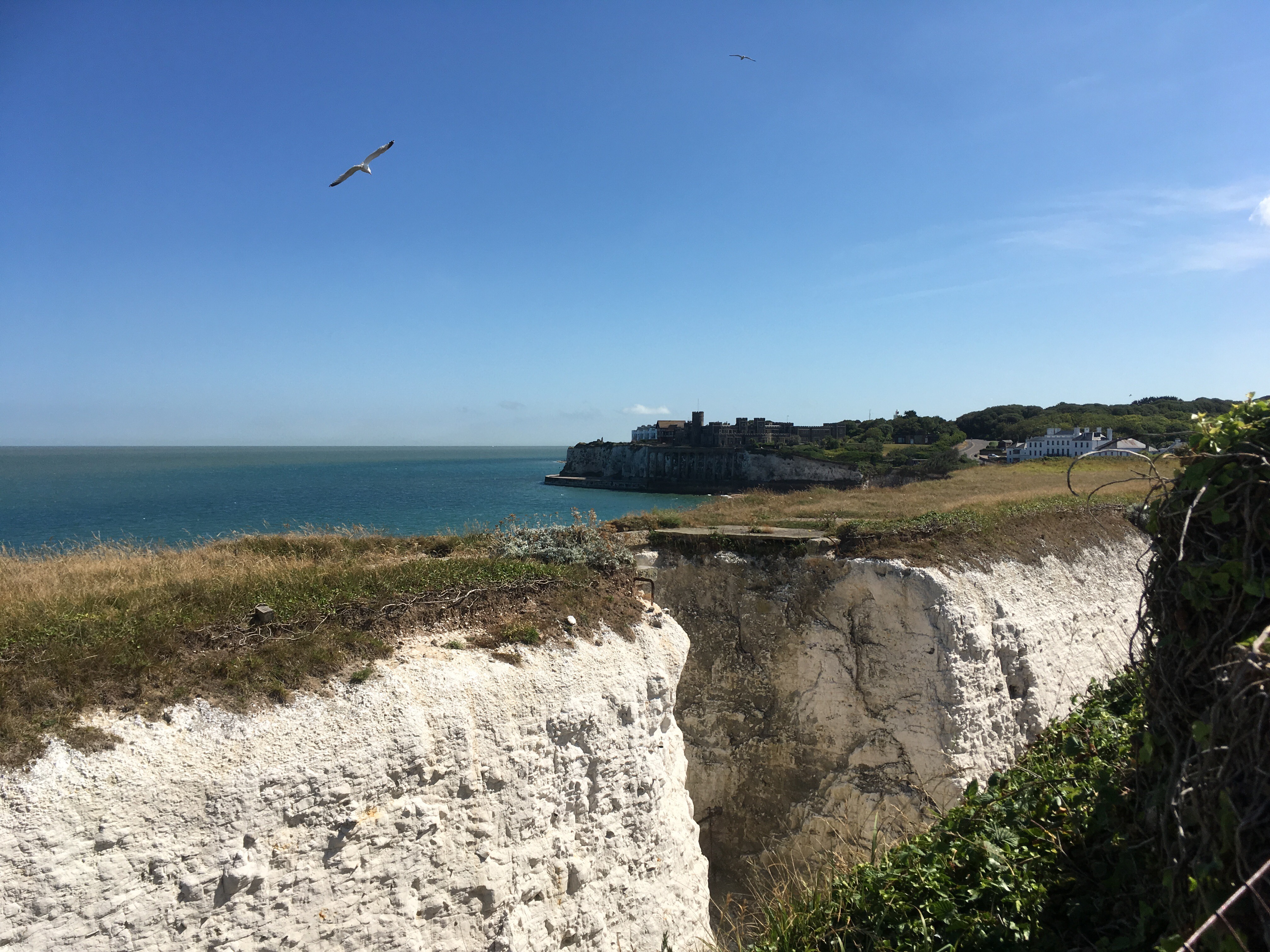 First line of defence – Botany Bay
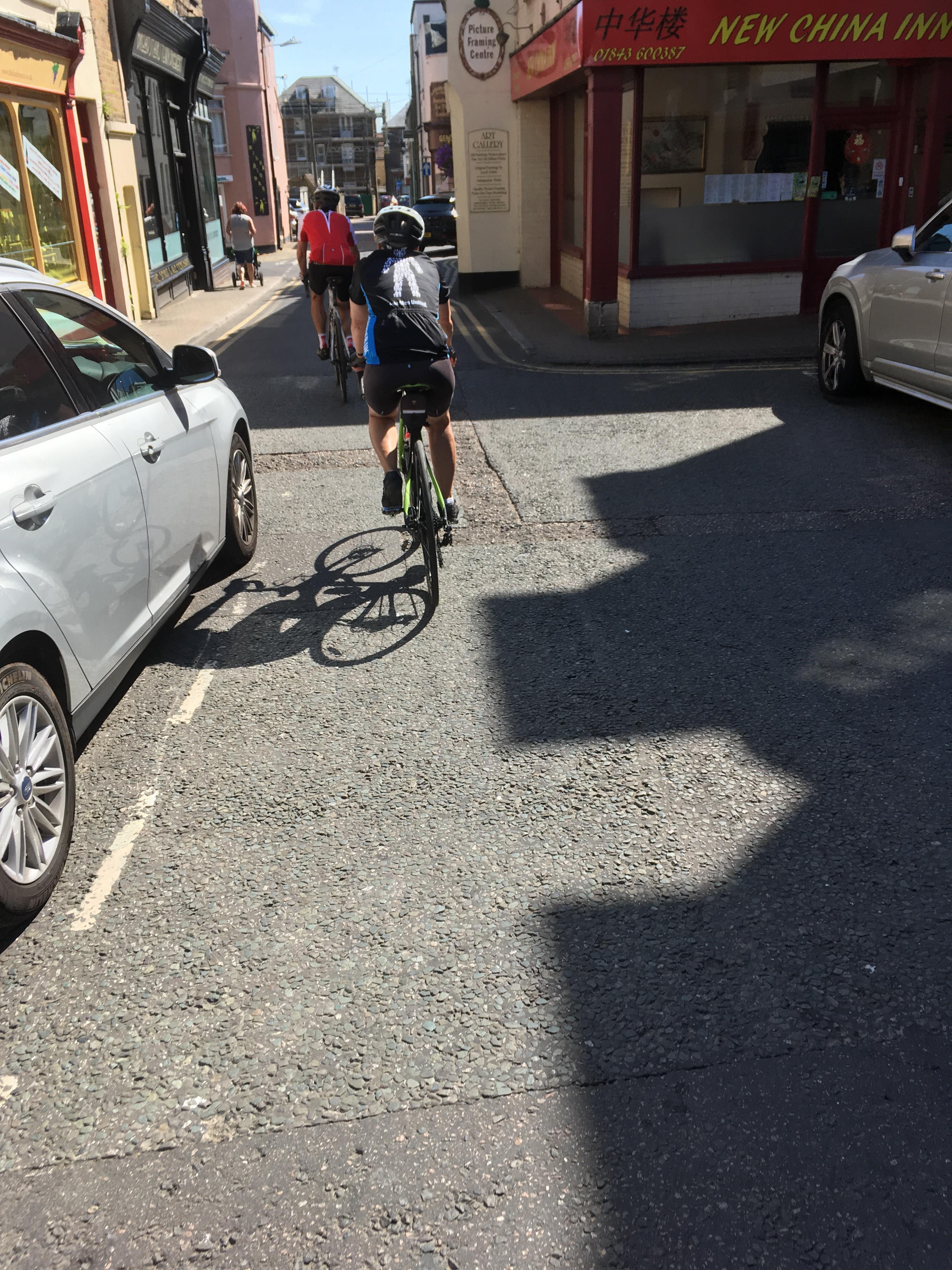 Broadstairs High Street and hanging on to the peloton by a thread.
 Pegwell Pay approx. 1858
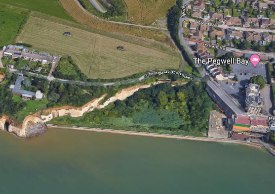 Landfill ahoy