So, here’s the deal. You can either spend the next twenty minutes reading the nonsense below (which gives some context, but in truth is just an exercise in wordplay), or skip straight to the individual accounts of the train and bike trips I took to discover and rediscover the Kent and Sussex coast. As at 2023 there is still one small section, Littlehampton to the Hampshire border, to be completed. Covid and various other reasons (excuses, excuses), keep pushing that back, but 2024 – maybe. Read on, skip to menu or exit now. You’re call.
London. 2018. Belting and melting through July. I’ve lived in and around London for the majority of my sixty years and until recently couldn’t see a time in the future when I would live anywhere else. However, in 2017, some dynamics – not catastrophic – entered the game and changed the position. Looking ahead and by the end of 2019 it was very possible that I would need to vacate the smoke to help bridge some gaps.
A lot of things to consider then. A life changing decision. Perhaps? The money’s on somewhere on the south coast. Kent or maybe Sussex. Leaving aside a detailed and unnecessary list some factors to consider include family, friends, cost, transport links and frankly the weather. Essentials though, and in no particular order:
- A kitchen with sufficient work surface that when you toast some muffins and make a cup of tea it doesn’t look like a bomb has gone off
- At least two nearby pubs to create the illusion that you don’t go drinking every night (I don’t by the way although denial can come in many forms)
- A minimum of one Indian Takeaway within staggering distance or at a push moped delivery (no other fast food options necessary)
- A venue within bus, train or taxi distance which is able to attract half decent tribute bands and rising sub-culture
- A modest garden, south facing and with a degree of privacy
So how do you go about this without spending the next six months watching repeats of “Escape to the Country,” or “Homes Under the Hammer?” Do you just go onto a website and randomly study property types and price range searches on Yaboo, Plastic Zoos or Turtle Shells in each town and community between Portsmouth and Erith in the hope that the pretty little white painted house or bungalow, with a sea view to the south and the Downs in the north, and with the wisteria climbing up the side wall, will magically arrive on your screen? Well yes you could, and maybe that’s all I should do.
But is it really that straight forward? It feels just a bit one dimensional. That dream home may well be about to come up; somewhere. I may have been to that somewhere before and have a reasonably good idea whether or not to follow it up. But if I haven’t, or I have, but it was so long ago, or I was so drunk that any memory of the place has faded away like an old photo left in a frame on a sunny window ledge for too many years – what then? Even if I do think I know that somewhere from a relatively recent visit, I’ve seen with my own eyes how quickly things are changing? Not just in London or the other big cities. It’s pretty much everywhere. Go to Portsmouth and see what’s happened to the town centre in the last few years. There’s not a jolly Jack Tar in sight and the shopping centre near the docks has more exclusive outlets than Regents Street. Even small towns and villages are, willingly or not, liberating land round their edges for housing to meet targets (or line pockets).
So, what other strategies could I deploy?
Word of mouth is certainly helpful but on it’s own has only a limited value.
I could of course drive my old banger out of London once a week (requiring a minimum of one hour to get to any part of the M25), then take one of the main roads, you know the M20 or M23 or even the M3. They work don’t they – mainly? Or, and blimey I nearly forgot,the A3, A24, A22 and A21 (and others in-between). Honestly, I don’t know what people in the North are on about when they complain about not being connected (trains excepted). I mean seriously, apart from some nice views, and villages that have yet to benefit from a by-pass, these classic coaching routes that are the veins and arteries of the south-east, are nothing short of being errrr….well coaching roads! Yes, so no, driving is not a realistic option. I don’t enjoy driving that much and really don’t want to spend long days (and nights) at the wheel just getting to and from a place where I’d be spending another couple of hours weaving up and down avenues and cul de sacs in the search for my ideal home and heating up the planet in the process.
Well – there is an alternative of course, and one that any sane person with a PC, tablet or android would undoubtedly use in these times. Yeah, you know what I’m talking about? That street view tool that allows you a virtual drive down every road, close, and some by-ways in the country and that takes the pain and cost out of motoring. I’ll confess it’s useful but it’s not reality (or maybe it is but I just haven’t caught up yet).
Then there’s the third, fourth or fifth way. Not quite each and every by-way, but a method that combines two passions. Right, let’s just stop romanticising this. I like things to do with trains. I can’t explain it and will make no attempt or waste any effort in doing so. It’s just a thing going back at least 50 years and has nothing to do with Thomas the Tank Engine. The age of steam was dying when I was small and despite rummaging through the remains of the mental filling system I’ve yet to discover a memory in which a steam train featured. It’s possible that living in the southern region area, where electricity had been the predominant method of power generation for a long time already, made that possibility remote in the first place, but certainly on cold, crisp winter nights I could hear the hypnotic rhythms of the tracks a mile or so away, and see the night illuminate whenever, and whatever that reaction is, when the sliding shoe on the train and the third rail interact to create a mini flash of lightning in the suburban skies.
So that’s the supposedly romantic background, but to be clear, it’s not a passion. I stopped reading railway magazines around the same time I started reading NME and Sounds, but somehow I still know enough to tell a class 42 from a class 33 and be a little bit aroused (in a completely non-Benny Hill sort of way) whenever there’s a programme on the TV featuring trains. By the way, did you see the loco they used at the start of the Bodyguard? Seriously BBC – try harder.
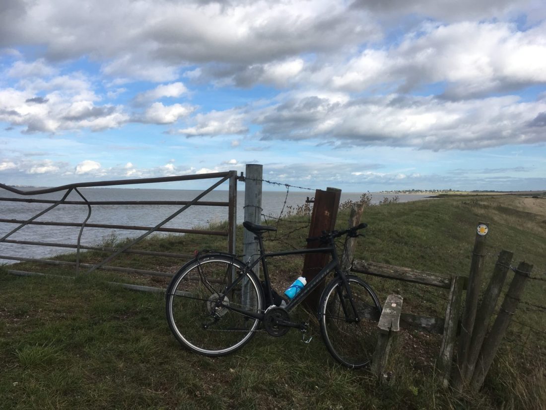
And then add a bike. Like a simple recipe, mix the cycling with the reach of the railways and you have a relatively cheap combination that allows significantly more flexibility and should get you much closer to the action.
On the 18th July 2018, and on a whim, my bike and I took a train from Victoria Station and went to Littlehampton in West Sussex, primarily to re-acquaint myself with the town where I have been to on and off a few times in the last 10 years, and then for the hell of it, and because there was a warm prevailing wind, cycle the coast to Brighton. It was a glorious day.
At some point on the journey, probably sitting on a bench looking out across the Channel and eating a corn beef and pickle sandwich, it occurred to me that if I really wanted to find out if this relocation thing was going to work out, and not be the most disastrous decision I’ve ever taken, bit by bit I could extend this approach over the rest of what remained of the summer and scout out the whole of the Kent and Sussex coastline.
And that’s what I proceeded to do over the coming weeks and into the early autumn of 2018. Checking weather predictions (I’m so fair weather it’s embarrassing really), mapping a route, booking a ticket and then taking the plunge with a heavily laden pannier, some snacks and trusty bike. Because you can’t anticipate the audience (well, if I was being entirely realistic perhaps I should acknowledge now that there won’t be an audience) I may get a bit more specific on technical or factual information in due course (e.g. type of bike for instance, or subtle sandwich variations) recognising that for some this a necessary hook.
I am absolutely certain that many, far more intrepid cyclists, will have done this project over the years, and probably as long ago as the invention of the bike. I’m also certain that many will have done it a lot quicker, and some may even have done it in a day. To be a perfectionist someone with a more clinical approach might say that if you are going to embrace the full experience you should start at the tidal high point of the Thames at Teddington Lock. And I agree! But a pragmatic approach also needed to be considered. To be clear I live in London and spend a lot of free time cycling all over town. I’ve probably cycled the south bank of the river from Teddington Lock to Woolwich so many times over the last two decades that whole new communities have subsequently risen out of the concrete and older communities and industries disappeared beneath the new foundations. So instead, the western limit of the Thames element starts at Woolwich (south-east London) at the Woolwich ferry, although confusingly perhaps the first account starts in Littlehampton (keeping up?).
Again, the purest might also suggest that if you are really going to do the full coastal cycle (or indeed walking) gig, whether for charity, self interest or just plain stupidity, the tidal element should be adhered to rigorously and therefore each creek, stream and river should be navigated to the full tidal extent possible. Yeah, right! Where this was the only option it happened, but honestly, I found out quite quickly that taking this approach usually ended in trouble and so if a road or footbridge presented itself offering the chance to cross whatever the water feature was, I took it.
Another minor detail that actually really mattered was the use of maps. The first two or three expeditions relied on mobile phone technology and on-line maps. Normally I would never have relied on this approach but I figured that simply by coast hugging it would be relatively straight forward when getting my bearings and that the phone would do when in doubt. I quickly realised that in fact what you glean from this approach is always limiting and can lead to unnecessary problems. It’s clever, but it’s too one dimensional, lacks key information and as soon as you zoom away from the point you’re at you lose the bigger picture. I’ll clarify that last bit. In fact you do get a much bigger picture, but it’s either the whole of the south of England or it’s just the five or six square inches that fits on your screen (which in turn is either blinding you with reflected sunlight, or to avoid this, is angled in such a way that it’s impossible to see much more than a hazy smudge). So, after the first couple of adventures, if I didn’t have one for the area already, I invested in a number of Ordinance Survey Landranger maps and refer to these in the narrative, either when they were game changing, or when they too failed the on the ground test.
Based on observations and random thinking, and using cutting edge cartographic techniques, underwhelming digital (and sometimes 35mm) photographs, sketches (if you’re really luck) and pinched knowledge, experience this unique and sometimes painful tour of our south-east coast at your leisure (or preferably not at all), and before we severe our historic ties and slip away from the continent in a just few months from now.
The trip between Littlehampton and Brighton is the first account and unless I change my mind, will publish in the next few days. I’ll be blunt, you might find it a bit bland. Nothing much happened as I recall, but then this wasn’t ever going to be an Indiana Jones adventure or the Iliad.
Lastly, the various journeys that I will endeavour to post on, whenever I’m satisfied I’ve done the accounts justice, were not sequential in a geographic sense. So it’s not a chronological narrative of the coast between the Thames Estuary and West Sussex. I had a little debate with myself whether to post the accounts in a way that linked each stretch through a logical narrative. In the end, rightly or wrongly, I decided to post the accounts in date order. To that end one day you’ll find me peddling merrily through brash south coast resorts, and the next flogging the proverbial dead bike across muddy tidal flats between industrial estates and power stations and with a view of Essex to the north.
Will I achieve my goals? Let’s find out. Oooohh…and if I die between now and the Spring, then the answer is almost certainly no.
*
List of terms, acronyms and other abbreviations that I’ll almost certainly forget to use:
HLG – Historical Land Grab. Refers to a part of the coast not currently available for public access, where at some point in history, a person or organisation purchased the land for residential, hunting or ecclesiastical use, and therefore by implication self-interested desire. An Englishman’s home is his castle – that’s a shame but come the revolution………
ANOB – Area of No Outstanding Beauty. Acquired by corporations, industry and government to exploit natural resources, or for strategic functions. Examples include quarries, power stations, military training facilities and the occasional vehicle testing centre. Often a scar on the landscape, but not necessarily and with some possessing a rare beauty or threatened fauna and flora. Not always inaccessible but mainly.
BALLOCKS – Errr….that would just be private golf courses then (see HLG above)?
PFUC’T – Public Footpath U Can’t Trace. Anglo-Saxon in origin. When prefixed by first person singular pronouns “I” and “am,” usually implies a moment in time, and in the middle of nowhere, when turning back is no longer an option and nearly all hope is lost. Missing the target train is now highly likely if that still remains a high priority at that moment in time
Coastal Erosion – It’s what it says on the tin, or plastic bag, or polystyrene wrapper or whatever else has washed up on the thin wafer of beach between sea and land that you have found, and because it’s probably washed away the path on your map too, now regret having found.
SSH’Ts – Static Holiday Home’s and Trailers – Only really SSH’T’s when their presence prevents coastal path access. So far that hasn’t been a major issue but one or two have required inland diversions.
FFS – Self explanatory (and mindful of some of the rules of this blog site which I have read in full). All other circumstances when the will to live is almost lost and the use of colourful language is the only realistic and meaningful connection with what’s left of your remaining reality. Usually occurs when unexpectedly exceeding 60 miles in a day, or hanging by your jacket, which is attached to barbed wire, over a 200 foot drop and just at the moment when the pannier, with a mind of its own, comes away from the bike and starts rolling slowly towards the edge.
