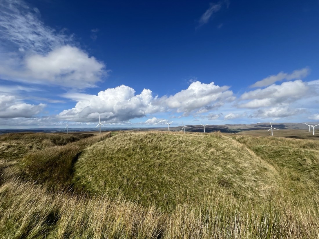
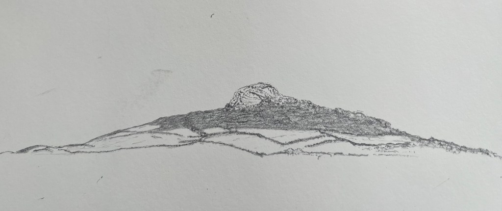
Cresting the County – Pembrokeshire (Sir Benfro)

Foel Cwmcerwyn

Metres 536

Feet 1759

11th September 2025

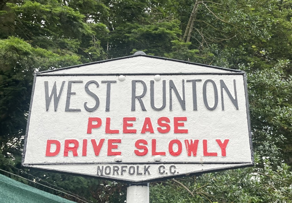
Rosebush Village Limits

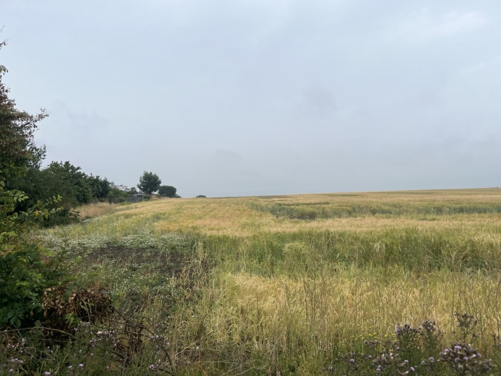
Day four of five in the far south-west of Wales. I had been staying for three nights in St David’s, an international attraction for walkers, pilgrims and casual visitors to its ancient Cathedral. Givin its popularity I had reluctantly paid a small fortune for the privilege of a bed in the cheapest room left in town – a Premier Inn. The weather had been just about as bad as it could have been for the time of year, with the almost relentless rain gusting in at speed from the Atlantic being some sort of revenge for the relentlessly hot, dry summer. On opening the blackout curtains and peering out through the three-inch-thick double glazing, the sky was blue, and early sunshine bathed a distant hill beyond the rugby posts on the nearby recreation ground.

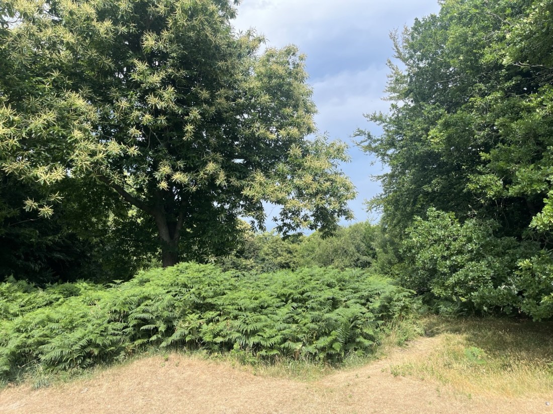
Carn Llidi Tor from the Premier Inn St David’s – weather conditions indeterminate

The previous evening, after being unsuccessful in getting a seat at either of the two snug olde-wordle looking pubs, I retreated to an alternative in a back street to have a quick pint before returning to the hotel. As I sat nursing a freezing cold drink that called itself a “bitter” a middle-aged American couple entered the empty saloon bar, where they stood for a minute or so. The woman who had served me was yacking away with punters in the public bar. It struck me that it might not have been the sort of place the couple were expecting, but if you’ve come 3000 miles on a pilgrimage, needs must.  “We’re trying to book in,” the man said to the woman, after she eventually emerged from the public bar to cater to them.

After checking in and receiving the keys the couple went upstairs, at which point the woman who had served them slipped back into the public bar and proceeded to mock the man’s use of English. ‘” We’re trying to book in”, he says. “We’re trying to book in!” What does he mean, we’re trying to book in?”’ There was some laughter from the locals. I proceeded to carry on reading my old paperback. Ten minutes later the man came back into the bar. The woman went over to him. His wife, he explained, had noticed black mould around the shower. Was this normal and could be cleaned off? At this, instead of expressing empathy to her “guest” who, given he was from the States, may never have seen classic British bathroom black mould, the woman started a long, possibly rehearsed, load of nonsense about the rooms being cleaned down thoroughly every day and that no matter what they did it was impossible to remove. In an almost absurd escalation in the excuse stakes she then went on to explain that they could renew the putty every week, but the mould would be back the next day. That she had used the word “putty” nearly had me snorting into my beer, but apart from that it was an appalling example of how to overwhelm your victim (sorry – guest) through bluster, misinformation and subtle sarcasm. Distracted by this interaction I had stopped reading my book – ironically The Quiet American. The poor man had no effective retaliation in his armoury. Somewhat humiliated, and in the knowledge that he was going to have to go back and explain all this to his disappointed partner, he merely mumbled that “he guessed that was all that could be done then” and retreated sadly towards the stairs, head down. The quiet American alright!

I may have stayed for a second pint, but I didn’t. As soon as the man had disappeared upstairs, I could hear the woman in the other bar repeating almost word for word to the other customers what she had told him. There was some more laughter. I supped up and left. *

The reason I mention this is that the next day, and halfway up Foel Cwmcerwyn (the highest point in Pembrokeshire) I kept thinking about it, every so often shaking my head and wondering about the state of things, and indeed what she might have said to the other punters about me after I had left. ‘”A pint of bitter, please. Please, what does he mean by please?”’  Too late to worry about it now.

I had left St David’s and headed out of town on the north Pembrokeshire coast road. Past the Blue Lagoon at Abereiddy, the charming little post-industrial village of Porthgain and the pretty village of Trefin. The day before I had given up on any walking ambitions and had stopped the car in Trefin seeking refuge in the Ship Inn for an hour until an almost apocryphal downpour had stopped as quickly as it had started, after which I was at last able to go back the way I had come and finally check out some of the hidden gems.

Above Porthgain

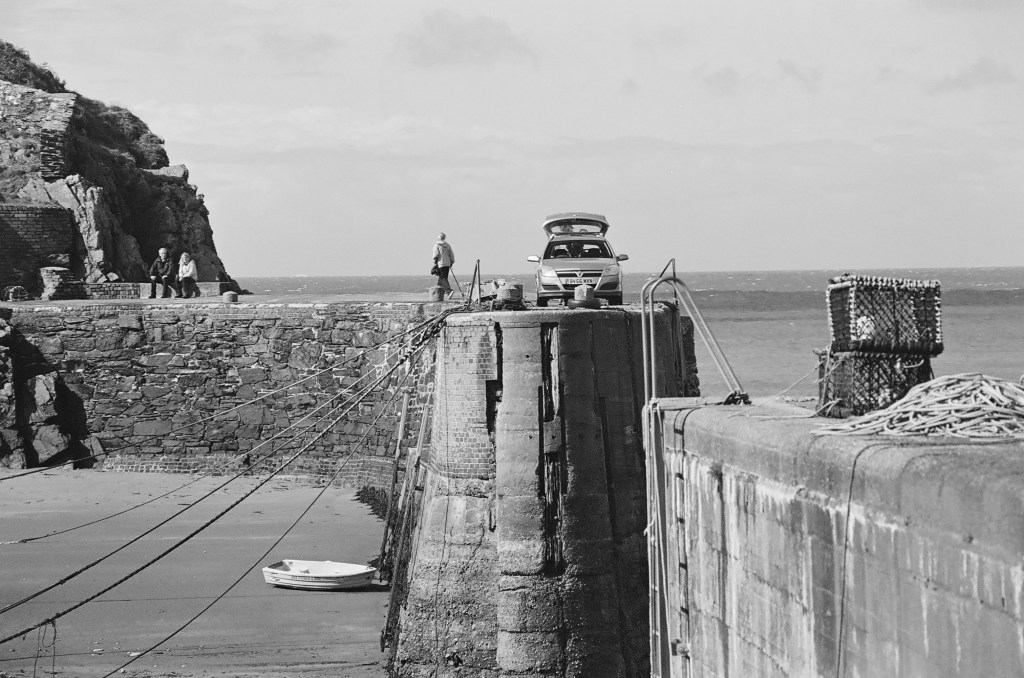
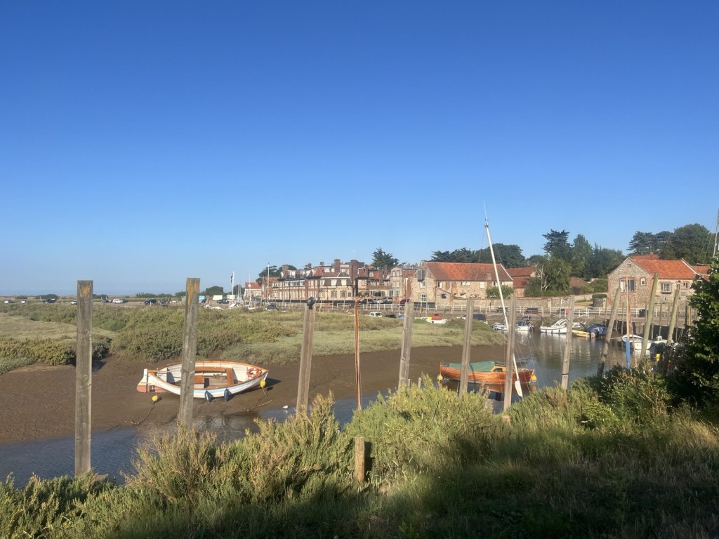
Porthgain – the harbour. The two people on the bench are, like me, trying to work out how the car is going to exit. On the horizon the Fishguard the Rosslare ferry battles against the elements

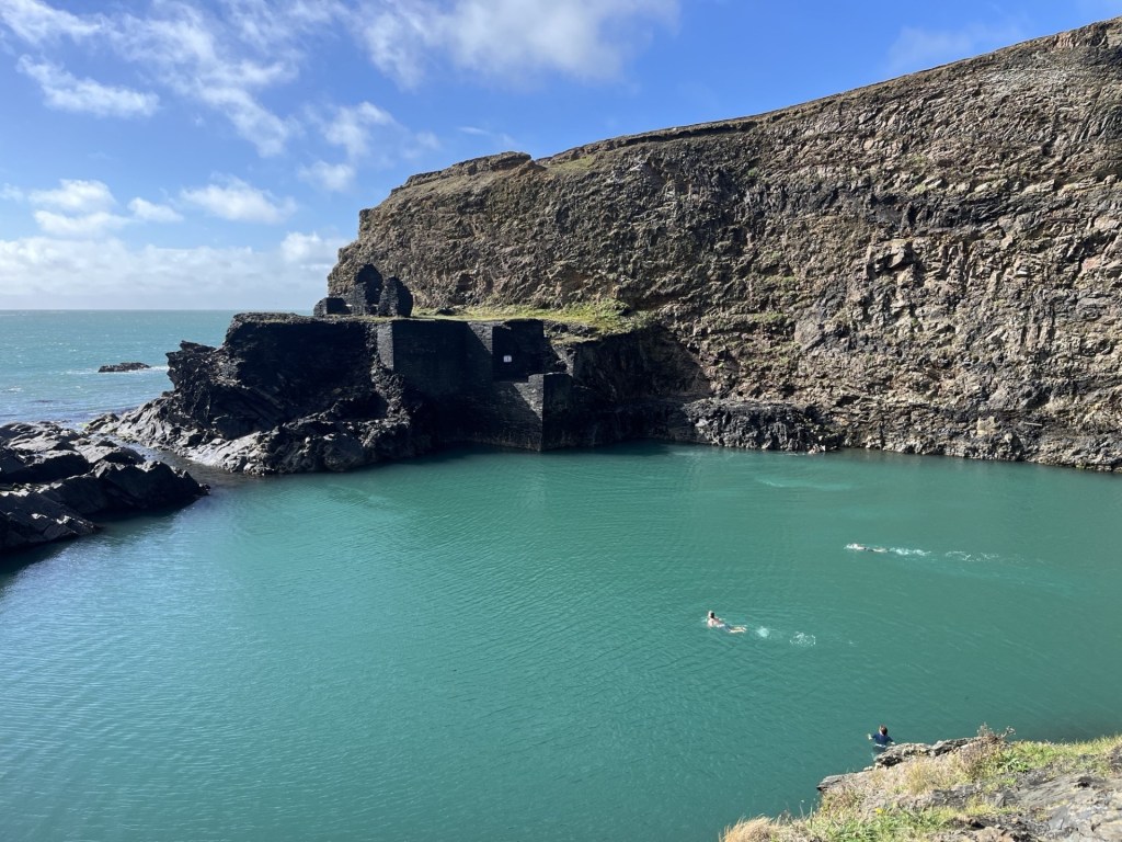
The Blue Lagoon. I wasn’t tempted

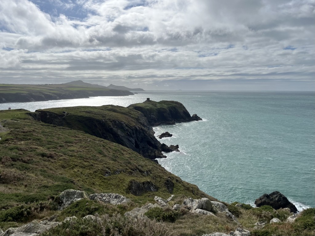
Beyond the Blue Lagoon at Abereiddy

Despite almost persistent rain and gale force winds over the previous two days (these photos deceive), I had managed to squeeze in some short walks along parts of the coastal path. Bracing, soaking but also delightful, with huge Atlantic waves smashing into the igneous and sandstone ramparts defending the rolling hinterland, it was a place that screamed “come back.”

With one night left in Wales, the evening before I had booked a room in Cardigan, situated to the north. Foel Cwmcerwyn was, with a bit of a diversion, on route and in the heart of the Preseli hills of Stonehenge fame (arguably). I reached Fishguard midmorning. The weather forecast was ambiguous, but for the moment it was warm, windy and bright and I decided to stop and find somewhere to eat. I can’t tell you about the initial attempt to park in a pay by phone car park because it’s too painful to recount, but if you want to get close to how I felt I can recommend reading my related accounts of similar experiences with the same service provider in West Sussex and Oxfordshire. Needless to say, it was hideous in extremis. After a brief interaction with a local man who recognising my unstable condition and gave me some profound words of advice, I gave up.  Minutes later I discovered an entirely free car park just a few metres further down the bay.

Fishguard – Gateway to the Republic, and the EU, from the free car park

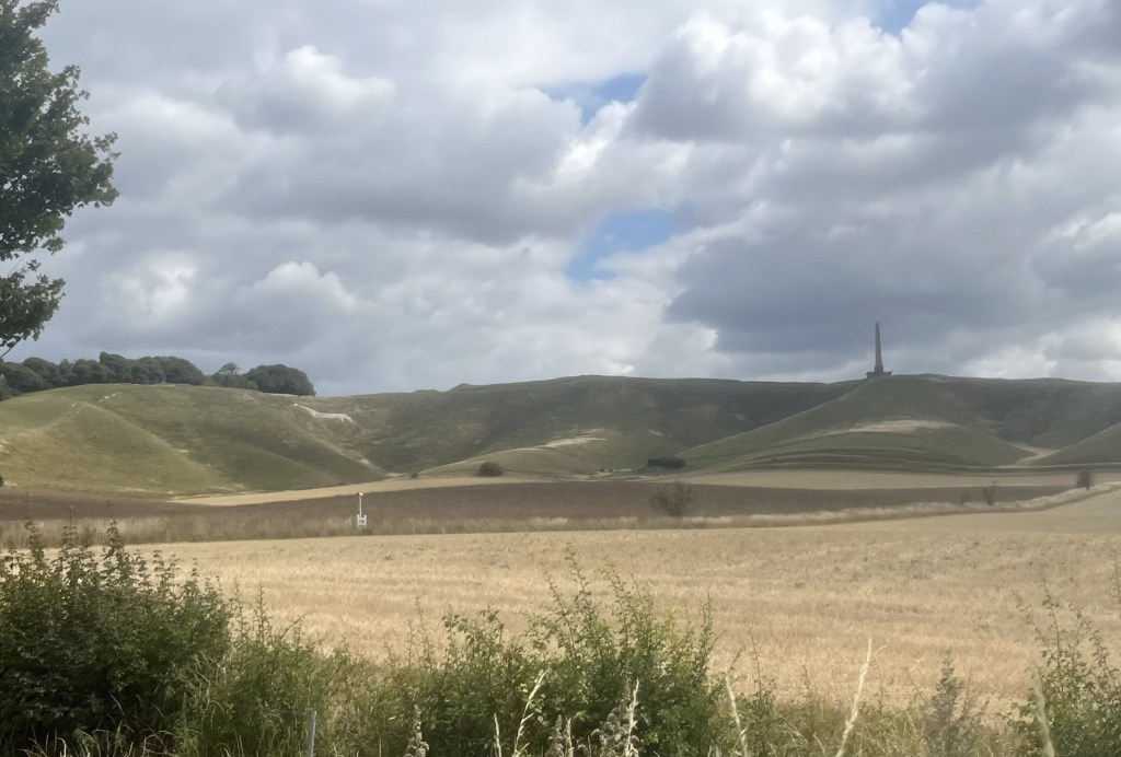
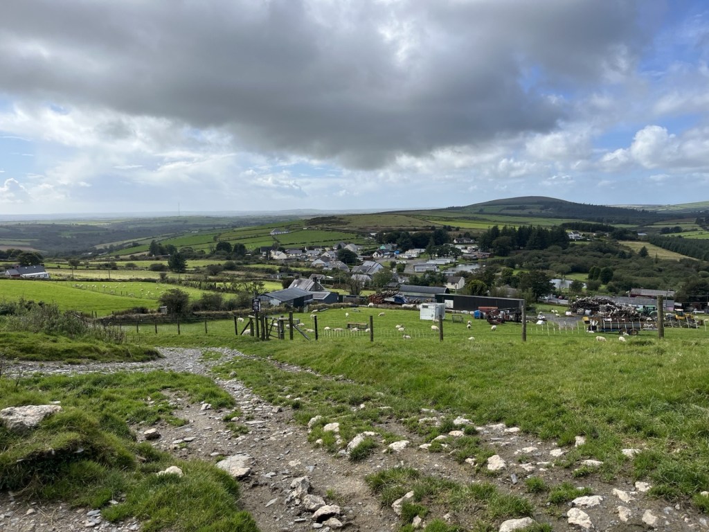
Tempting as it was to stay a while and look out into the bay for the chance of spotting the odd seal pop its head above the surface, I had to crack on. I left Fishguard on the A4313 heading inland and east through picturesque country. I reached the village of Rosebush at around 2pm and found a small car park just past the old railway station (more later).

To reach the top of Foel Cwmcerwyn I had to work my way up to the north-east. I had a rough idea of my route but after an abortive meander north along the line of the dismantled quarry railway I backtracked to the car park and climbed back into the car. Heavy downpours were visibly operating in the area, and one was threatening now. I knew there was a chance I’d get caught out at some point, but who needed a drowning at the get go? The shower somehow missed Rosebush. Once I was reasonably satisfied that I was in the clear for a bit, I walked up to some cottages and then onto a signed footpath that led steeply up past some farm buildings and then through a large field. **

By the time I had climbed to the top of the field, I was, to put it mildly, knackered. It wasn’t a good start, but I figured I’d got the tough bit out of the way, and now on a more significant track with impressive views opening up in every direction, my motivation returned.

On track, after the initial lung buster. Looking down on Rosebush

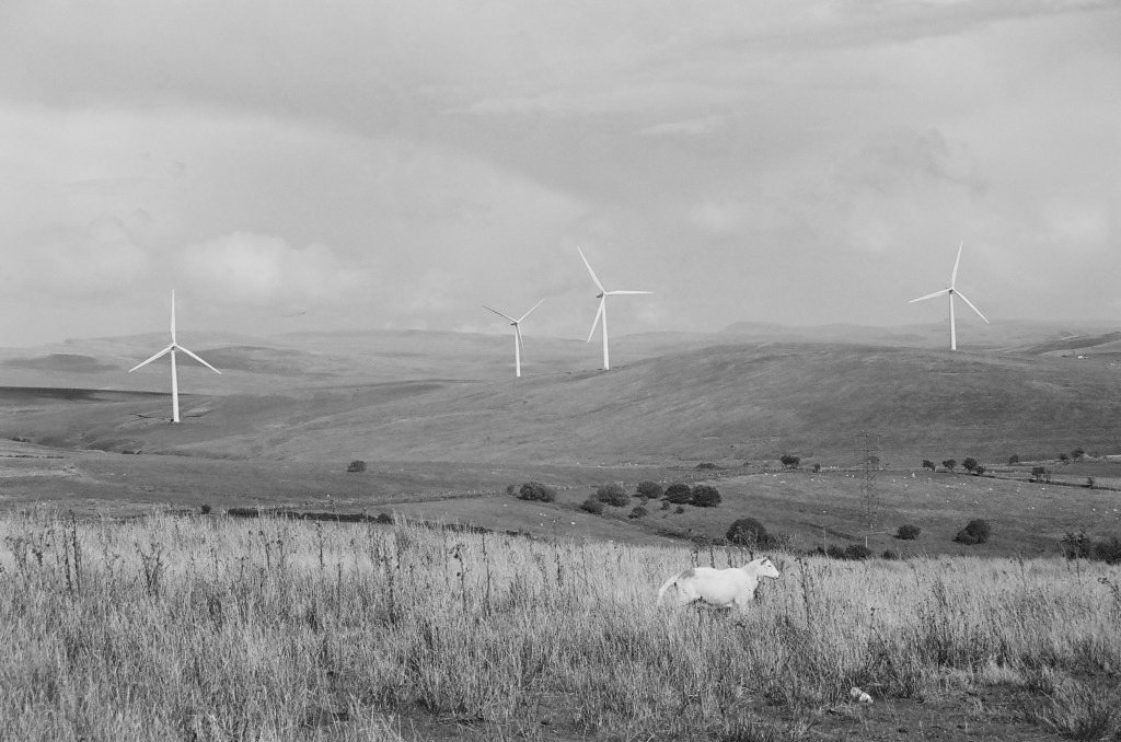
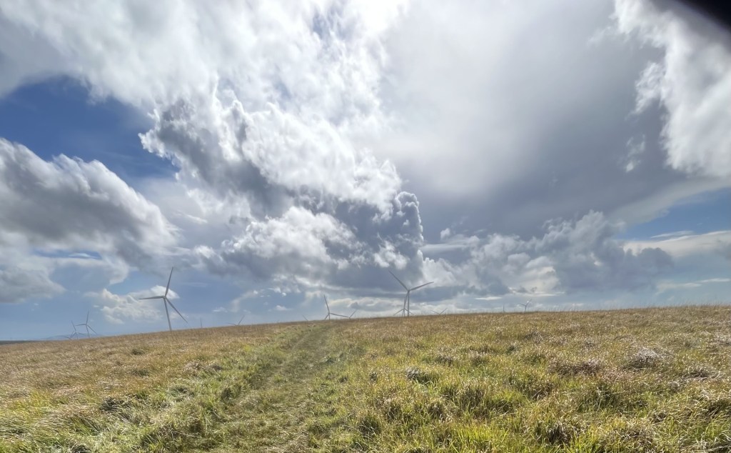
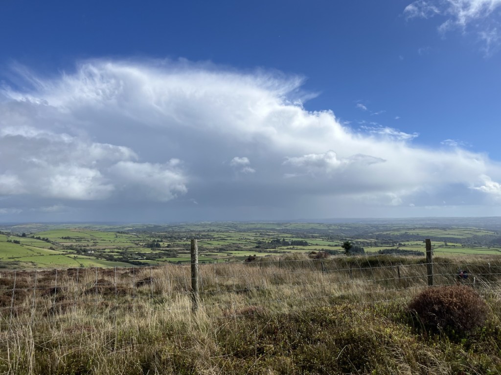
I’ve already mentioned that the weather forecast was ambiguous, by which I mean that it predicted a lot of rain at any moment and very strong winds. I had come fairly well prepared, but now in hot sunshine, and walking resolutely up the well-trod track, I was beginning to wonder if I had overdone it. Looking south a vast battleship grey cloud shedding its load was engulfing a large industrial structure (presumably Milford Haven) dozens of miles away. Already the views were impressive, but so too were the weather systems steaming in from the Atlantic.

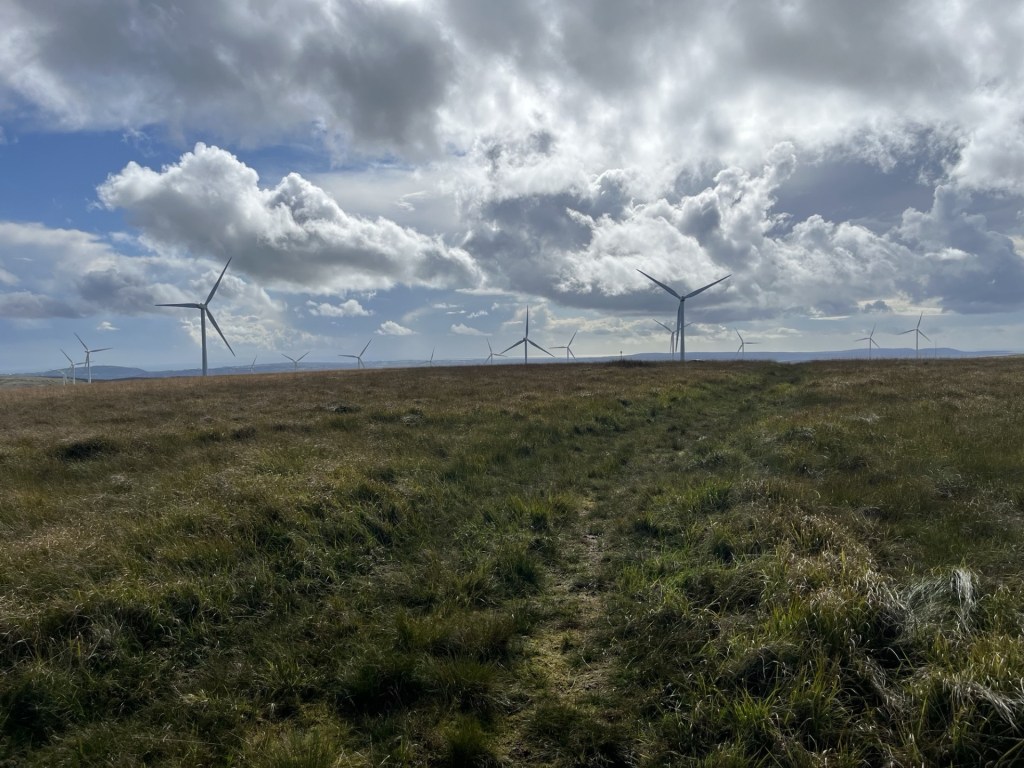
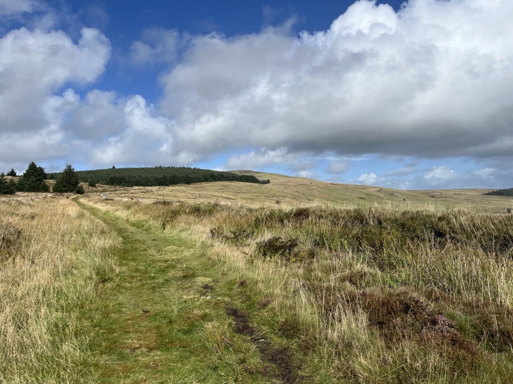
The track maintained a steady course heading north-east and on a reasonably tolerable gradient. Soon forestry plantations appeared on the left, and sweeping views opened up down the lush valley to the right.

Towards the forest

Towards the rest of South Wales and storm alley.

Up until this point I had been the only person on the path, but now, coming down in my direction, a couple appeared on mountain bikes. They stopped and we spoke for a bit. Like me they were from the South-East, although a decade or two younger. The man was on a bike fitted with a battery, although I wasn’t so sure the woman was. We talked a bit about cycling (me admitting I was running out of enthusiasm), and by the time we had said our farewells, I was pretty much sold on the idea of battery power. We’ll see.

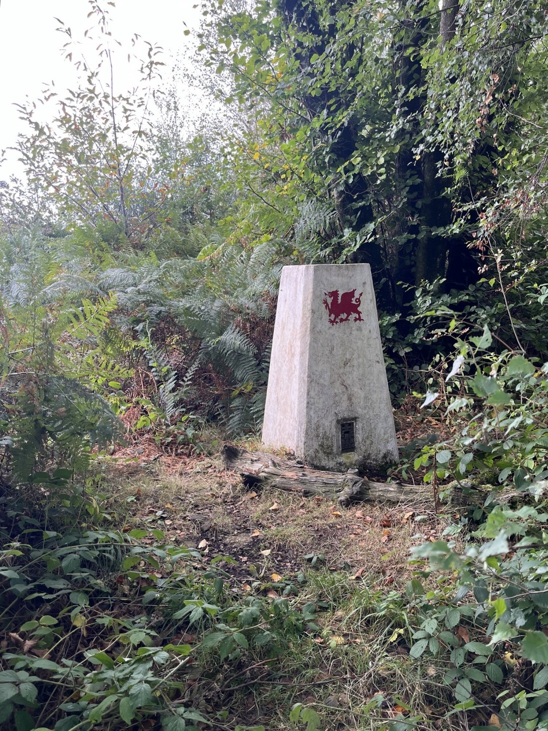
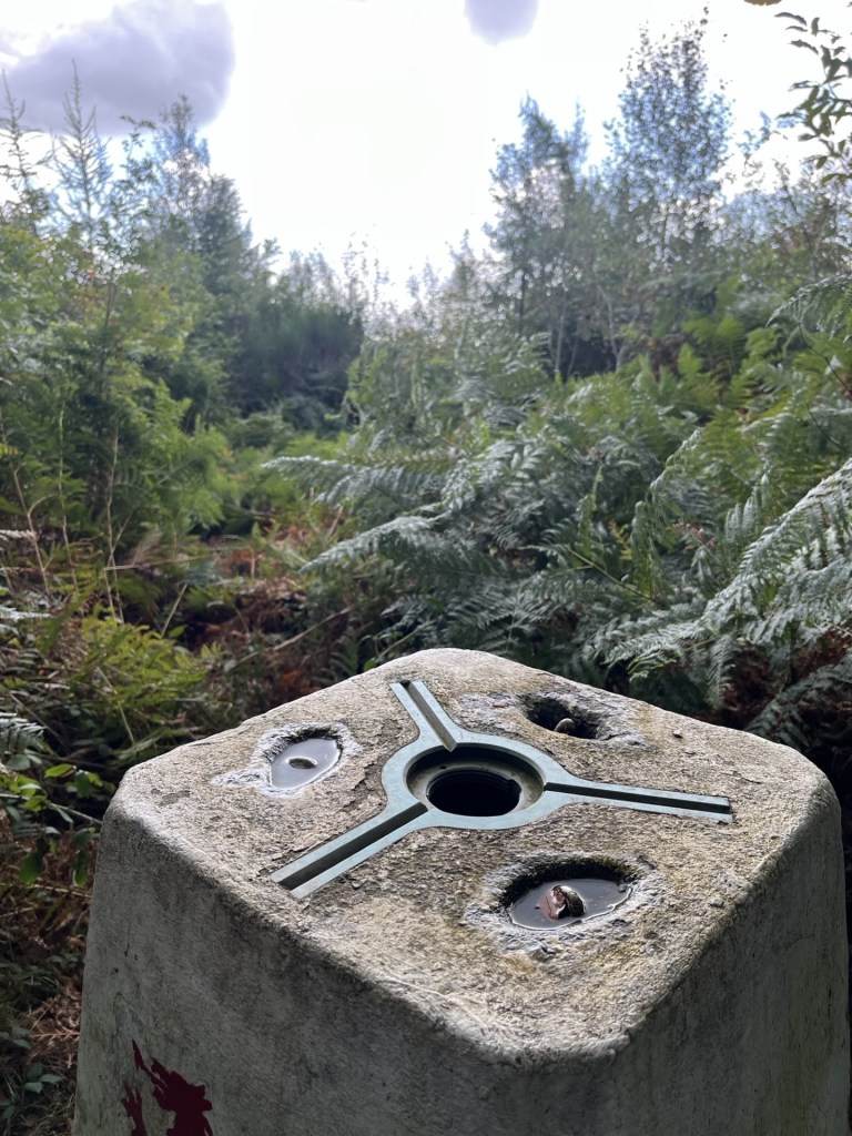
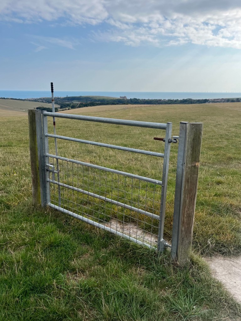
I carried on across boggy ground before more trees appeared to the left, and the gradient started to increase again. Beyond the trees the wind suddenly hit me like a brick. I made it to a wooden gate which would take me onto the open hillside. Here the path steepened significantly (the cyclists had warned me although I’d been sceptical). Now tip toeing up, the wind battered me from behind, bizarrely hindering rather than assisting progress. It took about ten minutes to wearily trapeze the final couple of hundred metres to the trig point at the top. I knew it was going to be there, and with each step I relished the prospect of being able to hunker down behind it to give some respite from the gale.

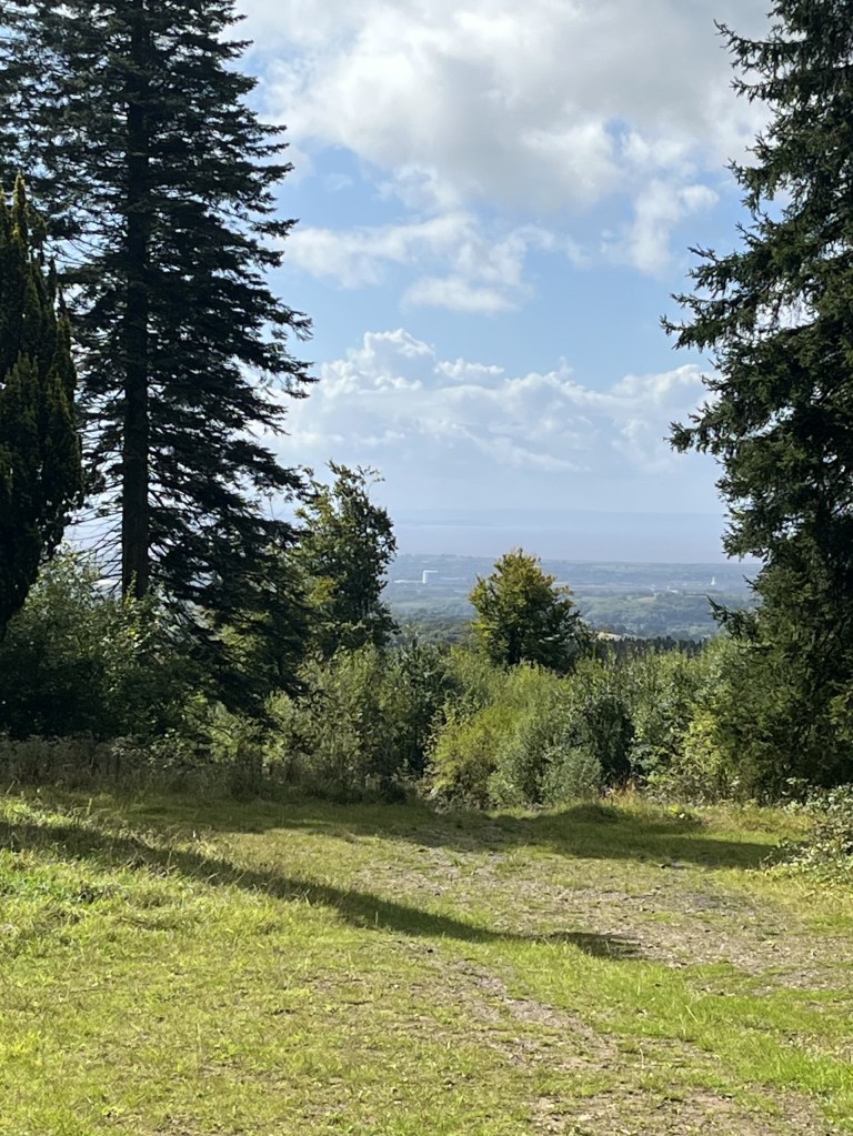
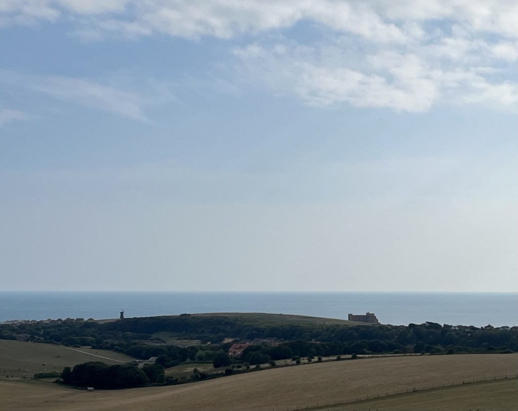
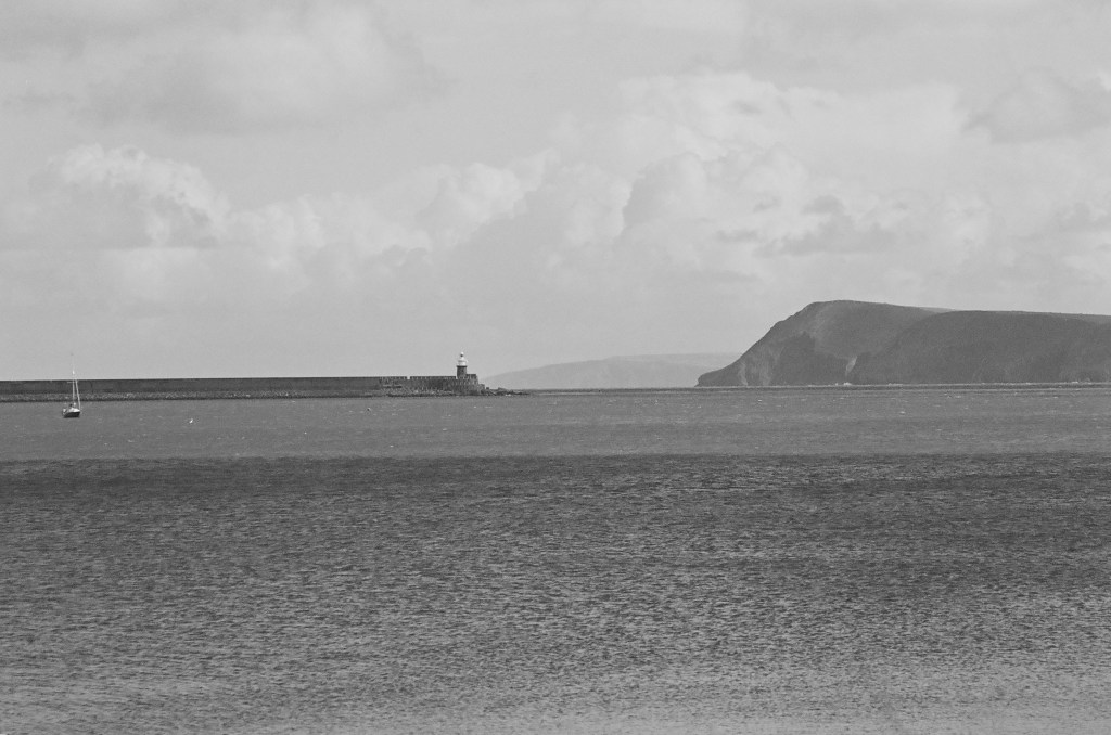
So, on arrival, and finding a group of four other intrepids completely surrounding the concrete structure, my little heart sank. All I could do was loiter around for a bit in the hope they would move on, although that didn’t seem likely given their insatiable need for selfies and group photos (I didn’t begrudge them doing it, given it was an achievement worth recording, but I was a good three decades older and feeling like I’d been sandblasted). Thankfully, after some minutes, they departed in the direction of Rosebush, and I was at last able to grab hold of the trig point and stabilise my condition. The views in all directions were magnificent. Here, at the top of Foel Cwmcerwyn I could see the whole of Pembrokeshire and beyond to Cardigan Bay. To the far west the Rosslare ferry was slipping out of the safety of Fishguard harbour and smashing itself directly into the wild wind and waves of the Irish Sea. Now able to stand reasonably steady I took a few photos that probably don’t do the view justice.

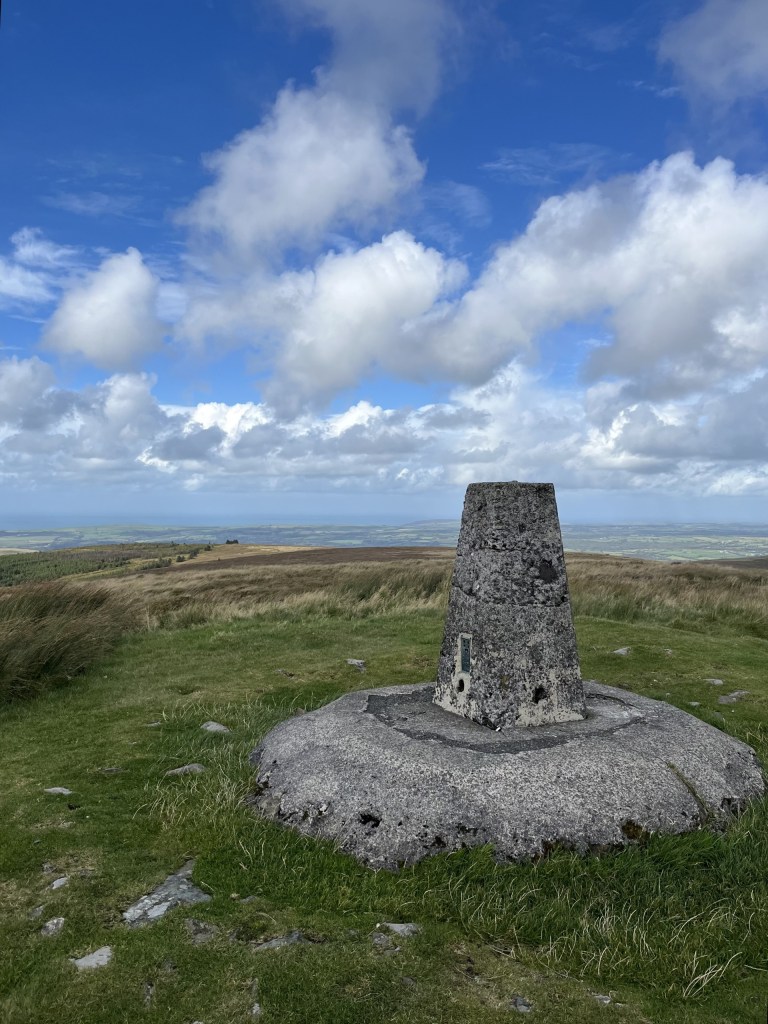
A wild westerly and the resolute Trig

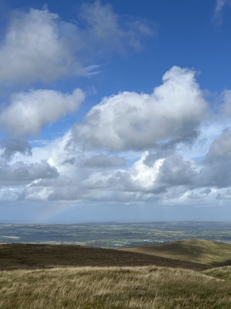
Rainbow over Cardigan Bay

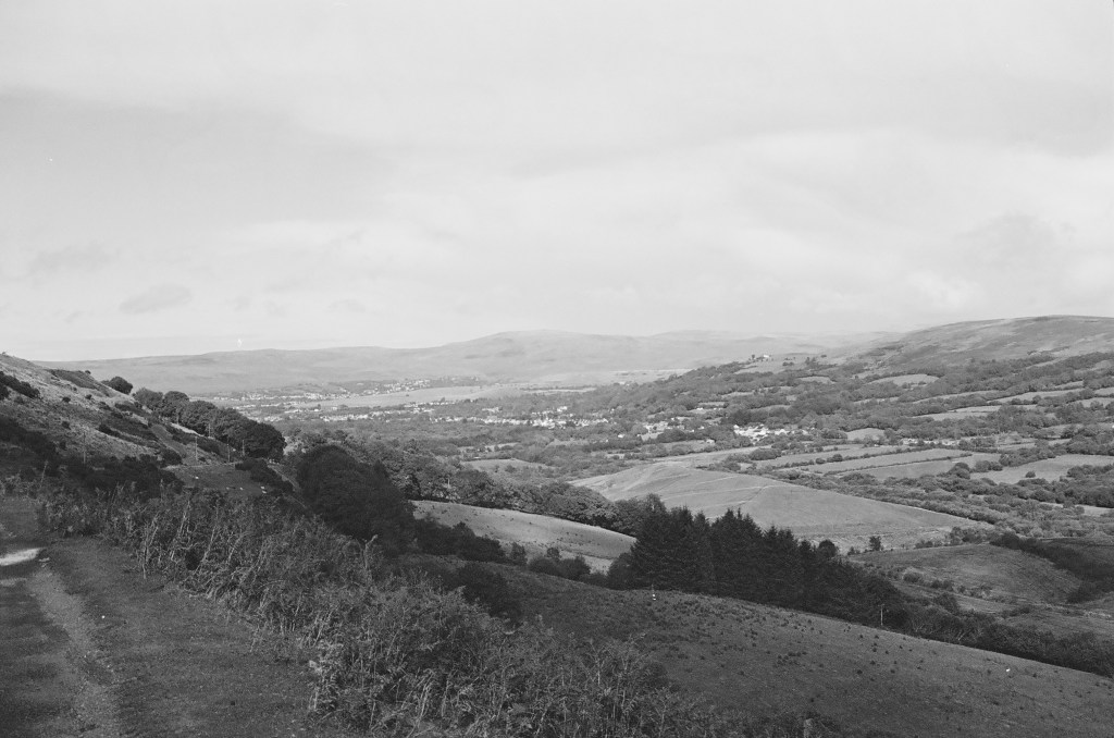
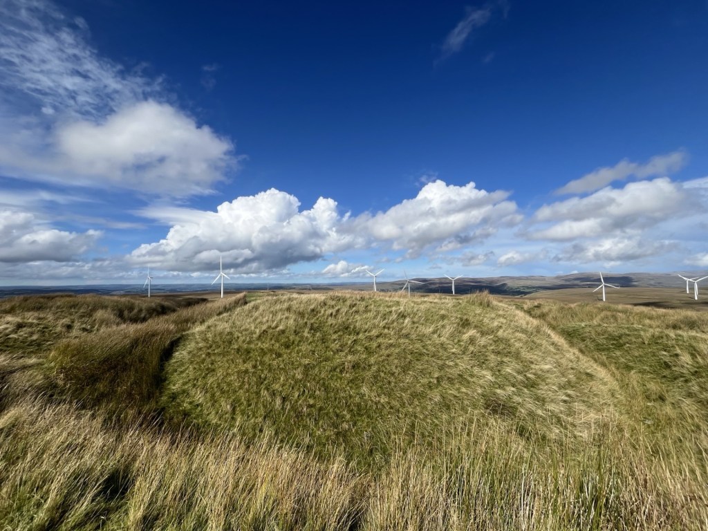
So far, I had been lucky. Rain clouds were dotted around in every direction. It was time to head back. Launching down the path was like trying to walk into a wind tunnel. Without gravity I’d never have made it down to the gate. Beyond the gate the trees once again gave cover, and I was proceeding at a reasonable pace. Now more relaxed I was able to get a better appreciation of the views down the valley and beyond towards south Wales proper.

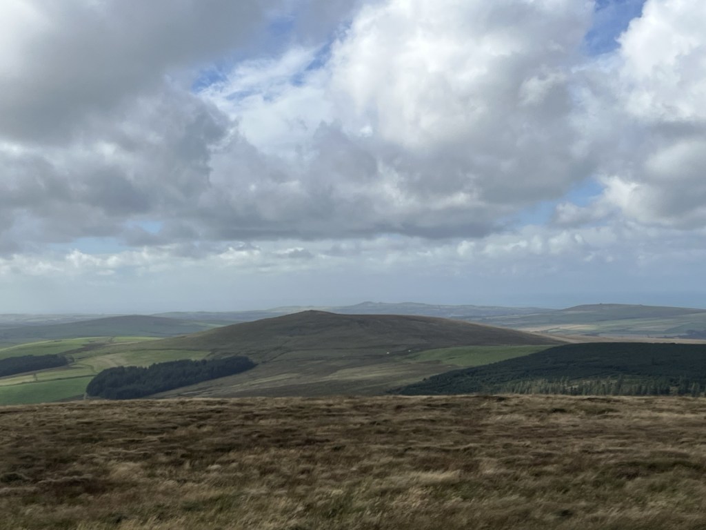
Towards south-west Pembrokeshire

I stopped for a bit to take in the dramatic view. A farmer on a quad bike was heading up the slopes and corralling a long line of white dots from one field to another. The commotion had spooked three horses that were now galloping away under sun and shadow.

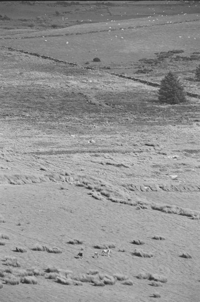
Cantering on the range

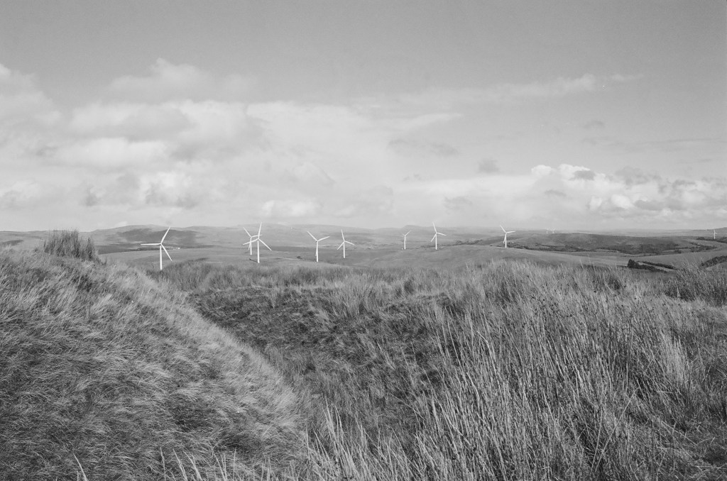
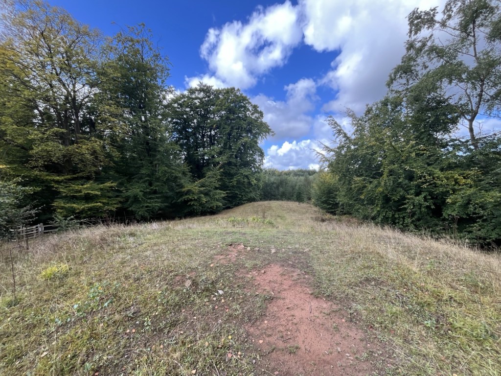
By the time I reached the end of the plantations to my right, I was becoming increasingly concerned by a large looming mass of dark cloud scudding towards my position, and with my name on it. I had nearly caught up with the gang of four who had earlier been hovering back at the trig point. A footpath led west along the edge of the forest. There were two options. Take the path under some tree cover or continue down across the large and exposed field above Pant Mawr farm. I chose the path with the trees. The others chose the field.

Large drops of rain began to fall. Sadly, the isolated tree cover was less than useless so I was forced into a light jog until, on the slopes above the old quarry, I found a large well leafed tree that offered more protection from what was by now an epic deluge. Fortuitously I had packed a small umbrella, which was deployed to surprisingly good effect.

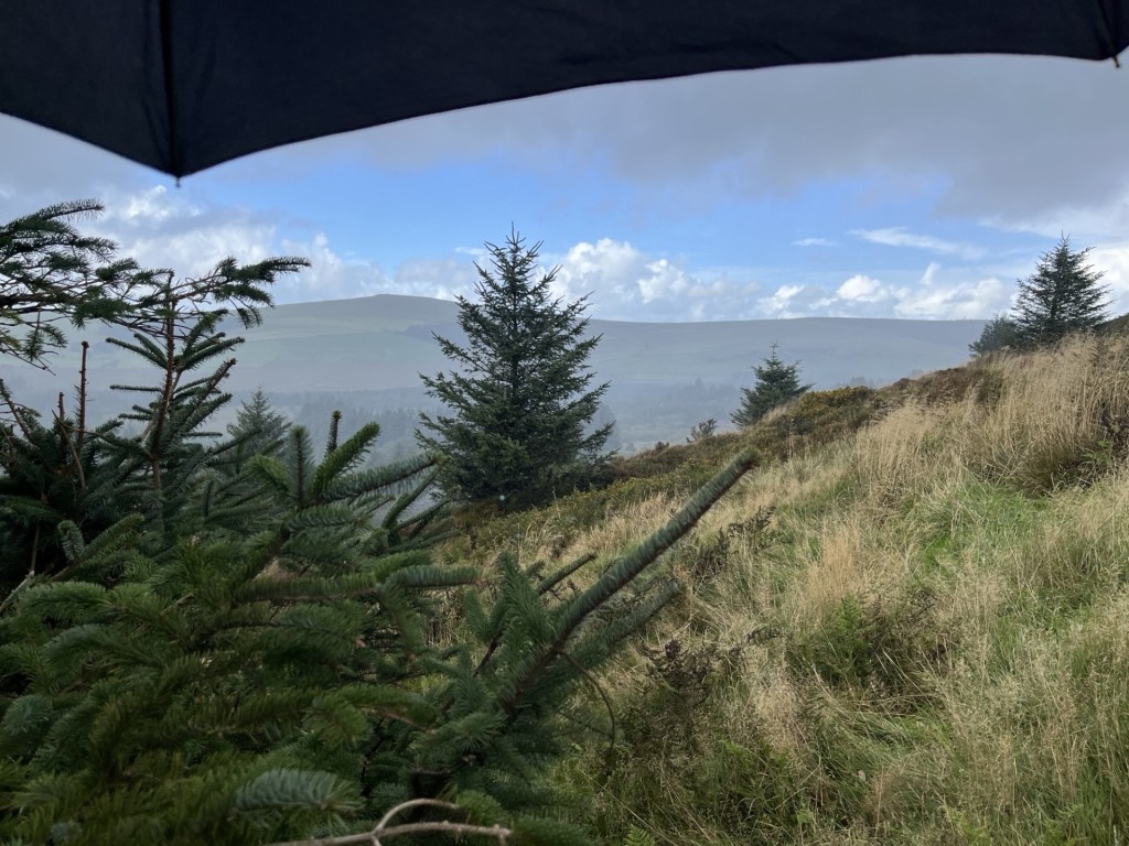
Unaccountably well prepared

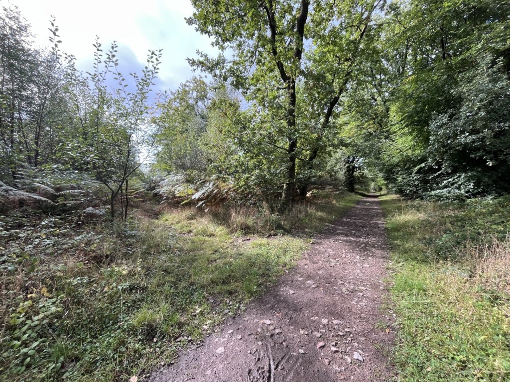
The lashing quickly passed, and I headed on down the lumpy and sodden ground to the route of the old quarry access road and railway line.

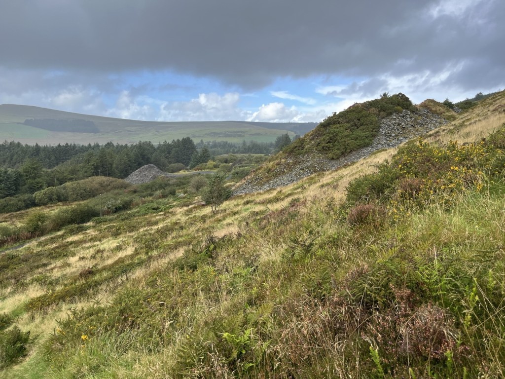
Slate heaps after the rain

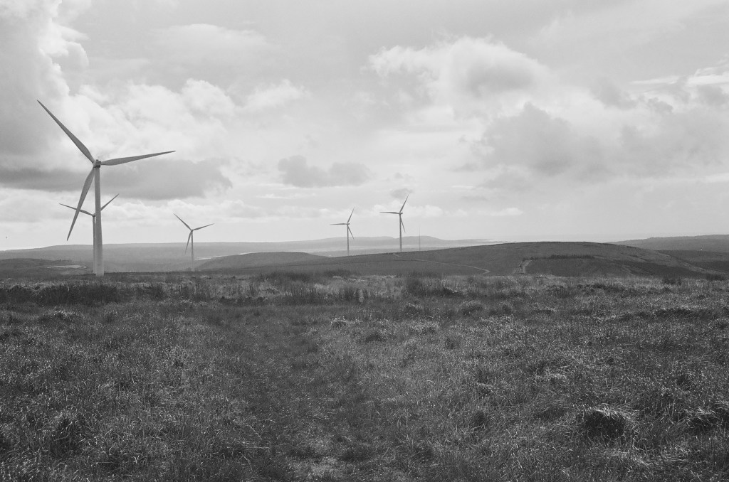
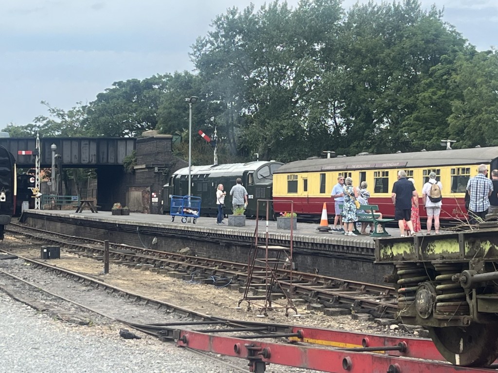
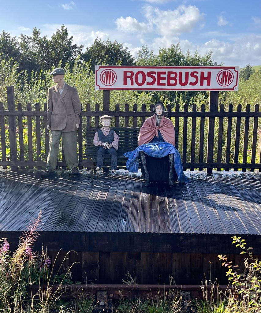
By the time I reached the community run pub at the old station (Tafarn Sinc) I’d walked exactly four miles. Along with the wind and rain it had felt a lot longer but had been worth every step. I’d found a part of Wales off the beaten track, but with a great walk leading to impressive views of the south-west and Pembrokeshire .

I took my coffee out to the open terrace. A small garden area led to where the tracks had once been, and beyond the remains (or possible recreation) of a platform. Three plastic dummies, dressed in period working-class clothing had been assembled, presumably to remind us how it must have been for passengers back in the day. The intense and distant stare on the face of the woman suggested it had been thoroughly miserable, yet despite the passage of time, relative prosperity and different clothes, that look is still familiar on most station platforms today.

A distant echo

As I drove away from Rosebush and towards Cardigan, with the wind still whipping around the nearby trees, the news on the radio announced the end of a political storm that had been brewing away for days across the Atlantic. Peter Mandelson had been sacked.

* I ought to own up here. Whilst I really was appalled by the bar woman’s behaviour towards her American guests, a few weeks earlier I had met up with a very old friend in a small town in the Peloponnese. I was staying in the town, and he was passing through in his camper van. As we sat outside a taverna waiting for food and observing a mink casually saunter up the road on the prowl for anything that moved, I mentioned the sequence of wildlife sounds that had been routinely waking me up in my room every morning. Starting with a crescendo of sparrow chirping around six, followed minutes after that by the sound of a mouse running backwards and forwards in the ceiling space above my bed (it might have been a rat, but I wasn’t prepared to countenance that possibility), and then finally the cicada’s early morning conversations.

The mention of the mouse took my friend back fifty years to a distant moment in time when he had worked at the Waldorf Hotel in London in the mid-1970s. He explained that for a time he had been the night manager and that the worst part of that role was the almost nightly complaints from new American guests about the sound of mice in their room. My friend is one of the funniest people I have ever known, so it was no great surprise that over the next ten minutes he rolled out a long list of all the excuses that the night manager was expected to respond with under these circumstances, and that by the end I was on the floor in hysterics. Without going into specifics, the essential aim was to express immediate and incomprehensible dismay (“A mouse sir! Surely you’re mistaken.”), that the possibility of a mouse in the Waldorf was an impossibility in modern 1970s Britain, that perhaps sirs wife had oversensitive hearing, or that they may have been confused by another source of the noise, or even whether it might have been possible that the guests had brought the mouse into the hotel in their hand baggage. Only in the last resort would a room change be agreed. Of course, it was the 1970s, and not just the Waldorf, but almost every structure in the whole of London was riddled with mice.  

** Not visible at ground level, but when I looked at the area around Rosebush on Google earth, I noticed what appeared to be huge letters spelling the word CAWS in the tree plantation just to the east of the cottages. Surely my eyes were deceived. Well, a bit of research and sure enough, around twenty years ago the local farm, which produces its own cheese, planted a large number of conifers that do indeed spell CAWS, which apparently is the Welsh for “cheese”. Smile! Here’s a free ad for them.

https://pantmawrcheeses.co.uk/

Cresting the County – Swansea Unitary Authority (Abertawe)

Mynydd Y Betwys – Penlle’r Castell

Metres 373

Feet 1224

8th September 2025

On the Road to Mynydd Y Betwys

I’d started the day in Chepstow and by the late morning had undertaken a short one mile walk to the top of Newport Unitary Authority (or County depending on your cup of tea). By the end of the day, I hoped to be in St David’s in the very south-west of Wales, an area of the mainland completely new to me.

South Wales is festooned with Unitary Authorities (also known as Principal Authorities in Wales – yeah, I know, I’m learning this stuff as I’m going alone). Twelve at least. From what I can tell most of these fall within the footprint of the old county of Glamorgan. Given my stay was just a handful of days I had to be realistic about what I could achieve. I plumped on one more on my way to Pembrokeshire.

Leaving Wentwood forest to the north-east of Newport I headed up to Usk, an attractive small Georgian town with its very own well designed but slightly incongruous, Victorian prison. Past Usk and in need of a refreshment, I stopped at the Chainbridge Inn on the banks of the River Usk, adjacent to its namesake bridge (built in 1906 and not a chain bridge!). 

The chain bridge, in black and white. In colour it’s an oddly attractive pastel green.

Rehydrated I carried on to Abergavenny then onto the A465 and the revelation that is the Head of the Valley’s Road. I knew this road headed west but had no idea what to expect. As far as I knew the only major road in south Wales was the M4, which I’d vowed to avoid if I could. The first thing I noticed as I drove away from Abergavenny was the enormity of the rain that suddenly appeared from nowhere and within seconds turned the dual carriageway into a fast-flowing riverbed. The flash flood was so extreme that for the first time in my driving career every other driver slowed down to around 30 miles an hour and took extreme care (I know, I was shocked at having no-one diss).

After ten minutes or so the rains passed, and now in bright sunshine it was possible to get a better sense of the road, and to be fair, it was staggering. Obviously recently improved, the dual carriageway made its way upwards with hills and country to the north, and valley by valley, the old coalmining towns of fame to the south. Blaenavon, Abertillery, Ebbw Vale, Tredegar and then Merthyr Tydfil, just to name a few. This was an impressive and at times spectacular piece of infrastructure, which, it seems, had only been completed in May 2025. It was hard to imagine that not so long ago it would have been a two-way high road with an endless stream of open topped lorries lugging wood and various carbon-based minerals east to west and then south, beset by roadworks, traffic jams and all happening in black and white. If, and when, I come this way again, the A465 is the road for me. And, for context, if I’m to carry on cresting counties, I’m going to have to come back this way as several of the “tops” are on the slopes just to the north of the road. 

Before we get to where we’re going with this account, there is something I need to say about Welsh road signs. And before I say it, I wish to make it clear that it’s my problem, no one else’s (coward!). * So far, it had been so good. What I mean by this is that by and large I had coped with the road signs, primarily because I was familiar with most of the names of the towns en-route. Welsh road signs (in case you’ve not been) are in Welsh and then English. The problem for any non-Welsh speaker is that it’s got to be one of the most impenetrable languages on the planet. I’ve been to quite a few European countries and despite not knowing the languages usually manage to get around fairly easily. Even in Greece, where a lot of the road signs appear in the demotic Greek alphabet, I can usually get a grasp of the look and sound to help me on my way. Sadly, and to my shame, I can’t say the same about Welsh.

Past Merthyr Tydfil I was instantly out of my depth (having yet to get my phone to successfully pair with the in-car audio system) as the road signs came and went without me having the time to fully digest their meaning (the Welsh appears first). To reach Mynydd Y Betwys, the “top” of Swansea and my chosen second “top” of the day, I first had to get to a place called Glynneath, about ten miles west of Merthyr. For the life of me I couldn’t get this to stick in my brain – and it’s an easy one! I had pulled off the A465 twice to check my location before eventually reaching the Glynneath junction. It wasn’t the name that helped me identify the junction but the fact that I had looked at the map so many times I was interpreting the topography and landscape rather than the signage.

Past Glynneath I was now on the A4109 heading up a steep hill and with the radiator grill of a huge articulated lorry looming close in the rear-view mirror. My little old Ford had no gear equal to the challenge and all I could do was metaphorically close my eyes, grip the steering wheel, and hope. Towards the top of this long drag I was eventually able to get clear of the maniac but for a minute or two I had felt like Dennis Weaver in the exemplary thriller Duel.

By now, the road signs had become irrelevant. I was driving by wire and instinct. I knew I needed to get to a place that started with a Y, followed by at least twelve other letters that could have been in any order, and I would never have been able to pronounce it. At one point the road forked in two and taking the left fork, I immediately decided to stop to get my bearings. I got out the phone and looked for the town which started with a Y and decided I had taken the wrong fork. As I put down the phone and set off, I checked the rear mirror (as you do) and there, parked up, twenty-five metres back, on the other side of the road, was the lorry. Don’t panic, it was just a film for forks sake! I made a swift exit onto the A4221. If I could just make it to Y……….. surely I’d be safe. **

The town beginning with Y was a place called Yynnwddsypondywynnagogo. No, of course it wasn’t. It was actually called Ystradglylias, a large town that I had never heard of before. And it wasn’t the only one. There were loads of them. Given that (unaccountably) 2% of my DNA is south Wales I’m ashamed of my ignorance of these places.

Anyway, past Ystradglylias I headed on down the A4067 (the main Swansea road), turned right into Pontardawe and then further inland on the A474. Lost again I pulled over and punched in the destination on my phone. I knew I was close but with my complete inability to absorb any of the information being presented on the road signs I might as well have been shooting at ducks in the night. Ok, so all I had to do, according to Google maps, was to keep heading north on the A474 and take the first left and then uphill for a mile or so and then… well, I’d check again then.

I took the first left onto a small road that headed down into a small valley. So far so good. I reached a municipal recycling centre on the right. The road continued west, but a sign, helpfully in English (No Entry), unhelpfully claimed that further progress was, if not illegal, then certainly not possible. Despite the wondrous progress made on the A465 I had been driving for over two and a half hours. The thought of turning around and trying to navigate another route now was a tad demoralising. Well, whatever was going to happened next, I could only try, and so long as the nutter in the lorry wasn’t coming the opposite way it would probably be okay.  

Just past the prohibitive sign the road narrowed rapidly and then started tracking steeply up and around super tight bends. It reminded me of the sort of roads that in the 1970s, those of a sportier spirit drove small low bodied cars up as fast as they could just to find out how quickly it could be done and as a bonus appear on Saturday afternoon TV. But I wasn’t in a sporty mood and made every effort to reach the top in a record slow time, aware that at any moment I might be confronted by a large slab of concrete.

Coming towards the top a tiny wedge of land opened to my right – just large enough for me to pull over to check the view and how close I was to the edge.

How Green was my Valley? Hmm… wrong film colour! The Upper Glyndach River valley

The road soon reached a plateau. Turning right I was now heading west on a straight road crossing moorland that offered up impressive views in every direction, and numerous sheep that hadn’t yet worked out sensible kerbside etiquette. The road descended again, this time into the Lower Glyndach River valley before ascending steeply again up to another plateau.

I pulled over again to appreciate the view, which now included an impressive set of wind turbines stretching away to the north.

Wind mining and the noble sheep

After the short stop the road curved round to the south-west. Wind turbines were popping up all around. An impressive sight, and no doubt an impressive site. A left turn (my mental map was now switched on and working), and the road continued around the contour until on the left a sliver of a stopping place that I had noted on Google earth presented itself. I wondered about the legitimacy of parking at this spot. Whilst there was no signage to indicate it was a passing point, and the road was reasonably wide; it remained a very exposed spot. I rationalised that the “top” wasn’t too far to the east and given that there wasn’t another vehicle in sight I locked up and set off up the slight incline across the boggy moor. If it hadn’t been such a dry summer the ground underfoot would have been a boot sucking minefield, but as it was it was sufficiently tolerable to make good progress. Sheep and turbines abounded at the top, which was no more than 100 metres from the road.

The approximate top – Mynydd Y Betwys

I knew to carry on for another hundred metres or so to reach the little treasure on the top.

Even when I found it, it wasn’t entirely obvious, but slowly the low ditch and ramparts of Penlle’r Castell emerged. I had assumed it was an Iron Age structure but turns out it was more likely to have been a medieval stronghold of some sort. What exactly they would have been strongholding against wasn’t entirely clear (Knights tilting at windmills perhaps), but the views in all directions were remarkable.

Penlle’r Castell looking north

Penlle’r Castell looking east and as it would have appeared in the 13th century

I skipped across the sphagnum, moorland grass and sheep offerings and back to the car. The wind was hammering in from the west, and the turbines were doing their job. I may have said it before but word from across the pond is that wind turbines are already old technology. Apparently, they are a waste of money, that there is no climate change problem to worry about and they are a blight on golfing landscapes (I’m sure someone once said the same thing about golf courses). Seems that there’s a new technology in town and it ticks all the boxes. Spelt OIL. It’s great to know they have our backs. ***

Big Wheels Keep on Turning, grouse moors keep on burning.

There were no plunging views from the top of Mynydd Y Betwys but you could see for tens of miles in every direction. A gem of a low peak where the energy of the movement of the earth and the seas is trying to turn the tables. It may be too late, but at least someone’s trying.

Can you tell what the forecast was?

I still had 70 odd miles to go in the day, and so it was a relief to find the car still there beyond the roadside ditch. And not a lorry in sight!

*It’s probably just as well that hardly anyone reads these accounts as I am sure if anyone did I would be in hot water over this observation.

** I didn’t see the lorry again and rationalised that the driver had stopped for the very same reason I had. English and lost.

***US oil companies generously donated $445million to Trump’s last election campaign! Who could possibly tell?

Cresting the County – Newport (Casnewydd) County Borough Unitary Authority

Wentwood Forest

Metres 309

Feet 1013

8th September 2025

The Hidden Trig

The last heatwave of the summer had come and gone. I seemed to have missed most of the August one, driving between home, hospitals, care homes and petrol stations but the personal hiatus had calmed down. Before winter set in I decided to head off somewhere new and seek out some more county tops if the opportunity arose. Hmm… but where?

Sunday the 7th of September and I’m to the south of London, heading west on the M25. The day before I had booked a room for the night in Chepstow, just over the big river and just inside Wales. I had plumped for three nights in the extreme south-west of Wales, but the idea of taking that journey on in one day felt a bit too ambitious.

I had only been on the motorway for ten minutes before the almost inevitable slow down. It was still early on a Sunday morning but the M25 has a knack of buggering up your day at any time it wants to. As the stream of traffic plodded along under the scarp slope of the North Downs, at around twenty miles an hour, ahead I could make out the figure of one of our new breed of “patriots” standing on a footbridge, with a balaclava over his head and waving a St George’s flag at the passing motorists. It was a warm day. The window was down, my right arm shooting the breeze and with Cerys on the radio playing sweet Sunday morning melodies. And this “proud” boy had just gone and crushed my karma. In that moment, and just seconds before I passed under the bridge, my right arm made an entirely involuntary movement of the Churchillian variety. I doubt he saw it, waving as he was to someone who had honked, I assumed in support. Sigh… 

Four hours later, and what felt like an over exposure to footbridges sporting St George’s flags (I should say, for balance, that the Women’s Rugby World Cup was on and England were the favourites), I drove over the River Severn at close to low tide, entered the Principality and fifteen minutes later was checking in at the Beaufort Hotel in Chepstow, a town I had passed several times before, but had never peeked.

With the sun beginning to sink I took a walk down to the River Wye. The Chepstow side (Wales) was flat and nestled in a large curve in the river. On the opposite side of the river (England) an impressive limestone cliff reared up. A hole in the cliff was explained away on a noticeboard as being used for different purposes over the centuries, including storing dynamite. Nothing explained away the huge Union Jake chalked onto the surface of the rock just to the right of the hole, but refreshingly it had nothing to do with recent “disturbances”. The tide was still going out, the dirty brown river thundering along and generating a mass of swirling eddies. Not too far downriver the Wye meets the Severn. It crossed my mind that if an opportunity arose in the future, I’d want to see the Severn bore. Looking around, the Castle took me by surprise and as castles go, it was the business. The rest of the town was an interesting mix of Georgian, Victorian and the occasional 1950s concrete misfire. Back in the Beaufort and a quick pint before bed Motorcycle Emptiness by the Manic Street Preachers issued from the speakers at a satisfactorily loud level. I was being welcomed to Wales, and I wasn’t complaining.

Monday morning and a coffee outside the Ugly Mug Cafe whilst planning my routes for the day. Until the construction of the first Severn Road bridge in 1966, the high street in Chepstow was the main road between England and South Wales. The road through the town is a bog standard small town road, but half way up it narrows to one lane as it passes through the medieval town gate, set into the defensive wall. Trying to imagine what it must have been like here before the construction of the bridge and M4 was enough to make the brain hurt. The ultimate destination was to be St David’s in Pembrokeshire. Still a long way to go but I had all day, the sun was still smiling, and so far, I hadn’t seen a St George’s flag. I wove out of town on the B4293 and then the B4235. (I had an uncle, no longer with us, who had the remarkable ability of being able to describe almost any journey to any destination – particularly if it ended in Scotland – by naming each and every A/B and M road on the route, and the exact locations where one became another. If you’d driven to his house from Cape Wrath, it would be time to go home by the time he’d explained to you in detail the way you had come in the first place – Scotch Corner often featured).

I was heading west to Wentwood Forest and the location of the highest point in the Unitary Authority – also referred to as a County Borough – of Newport (which would explain why its football team is called Newport County AFC). Wentwood Forest lies at the authorities’ north-eastern limit and on the boundary with Monmouthshire. The drive up from Chepstow was pleasant and almost traffic free. I wasn’t entirely sure where I was going to end up but as I drove in the general direction of the forest, I met the Usk Road, and a sign pointing back east to the Cadeira Beeches car park. Parking up I checked the phone and was satisfied that it would do. An information board explained that the forest was unique and one of the oldest ancient woodlands in Wales.

Setting off on a wide track to the west of the car park, all I needed to do was keep on going. The track rose gently. A car approached from the opposite direction, which suggested I could have driven closer to the top, but I needed the stretch.

After about a kilometre the track bore to the right. A few metres on a sign pointed into the woods and to Wentworth’s Ancestors? These were two low Bronze Age burial mounds lying in a small clearing in the woods.

The view from one Ancient (me) to another

I climbed to the top of the larger mound. It took three seconds. A moment to ponder what it all meant, but no answers came. Back on the track and what was indeed a road quickly deteriorated into a muddy puddled quagmire that would have certainly swallowed up my little Ford. I’d made a sensible decision.

The track met an unnamed road which I crossed and then into a large carpark with just one vehicle, looking slightly vulnerable. A wide track led on west, but I chose to take a smaller path just to the south, on the basis that it, rather than the track, appeared to continue heading gently upwards.

On the drive up there had been a point near where I had joined the Usk Road where a dramatic view had opened to the north towards the Brecon Beacons and most obviously Sugar Loaf, the distinctive peak that was responsible for all this endeavour in the first place (requires reading the introductory premise). Whilst the walk in the woods was nice, given that I was near the top of the hill, it was a slight disappointment to realise that there wasn’t going to be a similar view at some point. I guess that every tree is sacred, but still!

Another 100 metres on and a communication tower to the left, a good sign at any location that the top is nearby. The path was wooded on both sides and after another 200 metres I sensed that I must have been near, or at the top. I knew that a trig point was somewhere in the neighbourhood, but it wasn’t obvious. Scanning the surrounding thickets I eventually picked out what looked like something of a track leading into the woods just off the main path.

Left turn to the top

It wasn’t immediately obvious but having discovered the indistinct path I took the bait and then, stooping below the brambles, took careful steps through the undergrowth. Every so often flattened vegetation indicated others had recently passed through. Other Crest hunters, it seemed, had been here too.

Within a minute or two I emerged into something of a clearing and there it was. The concrete trig point, painted white and with a red dragon to boot.

The trig in the woods

Any hope of a view here was dashed. The thickets and low trees continued into the distance.

A restricted view

That said it was a serene spot, and the painted trig point an interesting feature. I have an old friend who spent much of his youth growing up in Newport. I sent a photo of the trig, asking him if he could guess where I was.

There was nothing more to do but return the way I had come. I was slightly relieved to emerge onto the path unseen by anyone else. It might have looked a bit odd. The big car park had gained another three or four vehicles in the time I had been to the top, and dog walkers were heading off in various directions. 

Just past the Ancient’s I noticed a break in the tree line and the entrance into what turned out to be a much bigger clearing than anything so far. Sun was occasionally breaking through the clouds. Walking down into the clearing a view of Newport, the Bristol Channel, and far beyond the north Somerset coast, shimmered between isolated tall pines. I stopped for a while to take it all in.

Glimpsing the county

I set off back to the car park, scanning between the trees for just one inch of a view to the north, but it never came.

Back in the car and taking off my boot, a ping announced an incoming text. It just said “Wales?”

I texted back. “If I said no? Well… yes. One-point smart arse.”

Perhaps unsurprisingly, a month on and he’s not replied.

The walk was just two miles, but this was a nice spot, and deeper into Autumn the trees will radiate here. Just a few miles to the west lies Blackwood, the home of the Manic’s. Sorry, any tenuous excuse!

Cresting the County – Brighton and Hove (Unitary Authority)

Bullock Hill

197 Metres

646 feet

23rd August 2025

Move on Up

It was a Saturday, and I had woken up with no particular objective in mind. That said I’d spent nearly a month running around like a headless chicken on caring duties and was truly exhausted. Once upon a time, on a day like this (warm and a soft sun) I often found myself on an empty Saturday slipping onto a train or tube and spending a couple of hours watching football in one part of London or another. Those days are long gone, not least because you can’t just turn up at a ground and expect to get in, but more significantly because I no longer live in London. No footie, no worries. Take a walk instead and hope to avoid all results until Match of the Day.

This one had been on my mind for a while. The old county of Sussex is now (at the time of writing *) split east and west, and at its heart is the Unitary Authority of Brighton and Hove. I had done East and West Sussex in 2024, but Brighton and Hove had eluded me. Today was the day to get on the boots, a train, and then up the chalk.

I missed the first direct train. It was at the platform as I crossed the footbridge but knowing that there was no time to buy tickets and board, I was resigned to wait for the next. That was fine. There was no rush. I wandered down the nearby street, full of second-hand shops, small galleries and one stop dog manicuring facilities. It was busy, and the usual coffee outlets were bursting. Walking back towards the station on the other side of the road, music was seeping, quite loudly, from an unfamiliar shopfront. A vinyl record store that sold coffee. Hmmm… well why not?

With my coffee secured and sitting outside watching the world go by, all was well. And then it got ten times better. Those unmistakable opening brass blasts of Move on Up by Curtis Mayfield get me every time, and it was no different now. If I hadn’t already been motivated, I certainly was now. Sometimes, depending on whether something has inspired me on the day, I embed a music video from YouTube at the end of these accounts, and I’m just telling you now – it’s going to be there. The extended version of course.

The Brighton train pulled into Eastbourne, which is a terminus and where all trains stop for fifteen minutes or so to allow the driver to swap ends before onward progress. It’s a tad frustrating to be honest and is entirely the fault of Mr Beeching, who, along with his committee, decided to remove a mile long section of track to the north of the town. This had provided direct services along the coast, but now it has gone it means that everyone travelling east to west (and back), is sucked into Eastbourne for the mandatory pitstop, thus rendering speedy transit to Brighton or London an impossibility. Well, no worries. I wasn’t in a rush.

The train failed to leave the station at the designated time, but it was only when the guard walked down the carriage apologising to the passengers and explaining that someone had locked themselves in the toilet, that the atmosphere on the train changed. Almost immediately some of my fellow travellers were very loudly offering up a menu of opinions they had in mind if the situation wasn’t dealt with quickly. This included a man near me volunteering to kick the f’ing door down. I’m not sure the guard handled the situation very well to be honest. He chuckled at the offer of assisted violence but also hinted that the person was a teenager trying to avoid paying the fare. By now there were people, male and female, on their feet and baying for blood. A chant went up “get him out, get him out, get him out.” I felt like I was at a footie match in the 1980’s. I sat schtum. It’s felt a bit like the leash has been slipped in recent months, with some unpleasant sentiments and reactions bubbling to the surface of society that would have previously been unacceptable. The situation finally resolved itself when the toilet door opened and moments later three (yup, three) fifteen-year-old lads in trackies appeared on the platform looking cocky and unfazed. There was a muted round of applause for the guard. I looked at the three boys, heads turning this way and that like a group of nervous meerkats. They’d chanced it, had had a moment of fun and annoyed a few people. No one was hurt. Thank God they had been white.

The train left a few minutes late of course. I alighted at Falmer station. Falmer sits just to the northeast of Brighton. It’s the site of the University of Sussex and the relatively new Brighton and Hove Albion football stadium. Earlier I had had a moment of panic when it dawned on me that there might have been a Premier League game at the ground that afternoon. That would have been a drag, but there wasn’t, so I was the only person to get off the train. I was heading to Bullock Hill, the highest point in Brighton and Hove and a mile or so to the south of Falmer.

Walking out of the station I made my way up a series of concrete steps that led towards student residential buildings. It was summer and there was no one in sight. It felt strange wandering through an empty campus, next to an empty football stadium. I’ve supported Tottenham Hotspur since 1967, when they won the FA cup. As a teenager I was brought up in Croydon and so spent a lot of time going to watch Crystal Palace (ironically the current FA Cup holders). Along with Arsenal (see Spurs above), Brighton is the theoretical enemy. When Palace play Brighton, it’s called the M23 derby. As far as I can recall there’s never been any violence, and I hope it stays that way.

Past the university buildings and at a higher level now, I passed along the side of the stadium. On a game free early Saturday afternoon, a soulless place to be. The road led on to the east. I turned and took another look at the ground, nestling into the chalk.

The offside rule explained.

Before we start to go up, here’s a tenuous Brighton joke to break the tedium (I’m afraid it’ a longish read).

A year or two ago I was with family in the garden of a pub in Nottingham, expecting to watch Nottingham Forest on the outdoor TV. Due to a colossal misunderstanding the match (which was taking place a quarter of a mile from where we were sitting) wasn’t televised, so the entertainment had gone missing in action. Except, at just around 3pm, and as we sat disappointed by the development, a middle-aged man wandered over to our bench, sat down and proceeded to tell a joke. Over the next two hours, and without interruption, he told joke after joke, only pausing occasionally to accept the offer of another pint. None were offensive, rude or controversial, but most were funny. This was one of them:

“You’ve heard of the footballer, Danny Welbeck?” Yup, we all answer.

“Played for United, now at Brighton.” Yes, we all answer.

“You’ll have heard of his dad then?” No, we all answer.

“What? Everyone knows Danny’s dad.” Well, we don’t, we reply.

“Yeah, he was in the army. Everyone knew him.” We are all ears.

“A Bomb disposal expert.” Wow! We didn’t know that.

“Yeah, everyone in the army knew him. Great guy.” Hmmm… (where’s this one going?)

“Danny’s Welbeck’s dad,” he paused.  “Yeah, we all knew Stan.”

Boom boom. How we laughed – eventually!

Walking east and away from the Amex Stadium and the university complex I crossed over Falmer Road then started the ascent on a well-maintained cycle/path path. The route was set back from road and tracked it up the chalk slope. Steep at times but then easing off views began to open out to the east and towards Lewis.

Waves of chalk heading towards Lewes

After a mile or so a slight bend in the road and some land set aside for wild planting offered an opportunity to inspect some colourful flora. Looking towards the southwest the view towards  Shoreham was unexpectedly spectacular.

Spot the butterfly

This was a whole new part of the world for me, and I was impressed. Five minutes on and I was at the top of the ridge, with tracks heading directly east and towards my objective. Following the track that flanked the edge of the Woodingdean housing estate (a desolate dormitory in winter I imagined) I soon arrived at a point which presented options. The main one was a signposted path that had all the hallmarks of being official. Tempted, but not convinced, I decided to follow the unmarked track that headed straight into a field and with a telecommunication tower just to the right.

Bullock Hill rising just to the left of the aerial.

Passing the small collection of buildings and rising metal structures I was able to get a sense of where the highest point was located. This required a slightly tricky clomp over bone hard uneven ground until, after a couple of minutes, I could see a trig point in the middle of a recently harvested field.

The other thing I saw was four people gathered around the trig point. I was slightly surprised by this because it was clearly off the beaten track (which officially was running about 200 hundred metres to the north). Slightly self-consciously I cracked on across the cracked land and stubble. As I approached it became clear that the small group were in the middle of something which appeared to involve a camera and badly applied makeup. Despite the absurdity of it all I felt like a brazen intruder. At about ten paces one or two of the group became aware of my presence, which they acknowledged. “Hi,” one of the young men said (it was three young men and a woman). “Can we help?” he added. Feeling like a complete nerk, and not really knowing what to say, I managed to splutter out something about having come a long way and wanting to get to the trig point. “Ok, no problem,” he replied, “we’re nearly finished.”

By now I had noticed that the woman and one of the men were wearing white sheets with randomly applied muddy smears, and the other two men between them carried expensive looking camera and recording equipment. I guessed that they were probably students making the obligatory short zombie movie that they hoped would soon propel them to Hollywood. I stood and looked away towards the communication towers. Self-consciousness doesn’t get close.

Looking away from the action

Within a minute or two they had finished and I wandered towards them. “So, what’s the importance of this place then?” one of them asked.

“Oh, not much,” I replied. “It’s just the highest point in Brighton.” All four faces turned towards me, jaws beginning to drop.

“No way man.” “For real?” “Who knew?” The woman yawned. They looked around and behold, it was true. Moments earlier they had just been sitting in a field on a mound surrounded by loads of other fields on similar sized mounds. Now it was obvious to them that they were on the summit of a mighty hill, staring down imperiously over everything in sight, including the i360 in Brighton.

Conversation flowed. Did I know what the large crater was just a few paces to the east of the trig point. Well, I sort of did but wasn’t 100% sure. “It could be a sink or swallow hole, possibly post-glacial,” I ventured. “Actually, I reckon it’s more likely to be a dew pond. Dug out by a farmer a couple of hundred years ago, perhaps.”

Bullock Hill Trig. Today’s lecture will be from Prof Bull S. Hitter

The crater – subject of various bs theories.

Incredibly, within a minute, I had gone from an awkward stranger to a veteran sage of the mountain. Their collective astonishment at my imparted (and I should add – free) wisdom and knowledge was almost overwhelming, and for almost the first time in my life I had justified my choice of doing a Geography degree in the 1970s. It was time to go before they asked me a question I couldn’t answer, though to be fair I seem to have slipped into bullshit mode effortlessly.

We parted company and I wandered over to the crater for a closer inspection. Yup, artillery – Second World War. Time to move on down.

I followed the edge of the field to an open gate and at a point that met up with a bridleway heading east. I looked at my ancient Ordinance Survey map (Landranger 198). Immediately to the south, at a distance, I was able to make out the black and white form of the Beacon Hill windmill at Rottingdean. Which was exactly where I wanted to be. A path in the field adjacent to the bridleway headed straight towards it. After a quick rest I got on it and strode forth.

Tilting towards a windmill

It all looked pretty straightforward. Follow the path and head on down. At the end of the first field a walker friendly gate gave access into a much bigger field which rolled away on all sides. The only slight concern was a sign to the side of the gate proclaiming private property. That’s as maybe, I thought, before setting off on what felt like a path. After about five minutes I came to another of what appeared to be a recently installed gate. It sat at the end of a few low hawthorn trees and quite literally on its own.

The Riddle of the Gate

Another sign re-stated the private ownership of the land. Was this some sort of fantasy video game in which you had to correctly answer a riddle or question before progressing (Mordon’s Quest on the Spectrum from 1985 came to mind – I never did understand what the saltpetre was for). Obviously, I decided to go around the gate, but had this been the right decision? Well, I didn’t blow up, so I guessed it was and carried on down towards two more of these standalone installation gates, one of which I decided to go through just to make sure it was in working order. Carrying on I headed towards another fence and gate around 400 metres to the south. The land here was shaped into a wide folded dry valley with the crop recently harvested. It was a barren sight, made more dramatic by the endless hot and dry weather. It felt lifeless, except at that moment a green woodpecker flew past, settled on a nearby tree and then let out its distinctive high-pitched call.

Classic chalk dry valley, with the emphasis on “dry”

As I reached the end of the field and the escape gate (here at least there was the more traditional fence either side) a middle-aged woman accompanying a girl on a horse approached in the other direction. I gave way and they came through into the field. I said hello and asked the woman if she knew what the lonely gates in the fields was all about. She didn’t know, but then told me it was private land, and “they” could…… She hesitated, as if realising that what she was about to say next might sound absurd. “Hmm… Shoot me?” I joked. She didn’t look very amused but at least it broke the ice. “No, no,” was all she could muster. I smiled and passed on, thinking that what she probably meant to say was “they could prosecute me for trespass.” Yup, that really would have been absurd, but in England (not Scotland) there are many landowners who will go out of their way to keep the hoi polloi off their domains, either through neglect of the infrastructure, or in some cases, the deliberate blocking of legitimate rights of way. That didn’t explain why here, very new and quite obviously expensive walker friendly gates had been installed right next to signage which aimed to make it clear that walkers weren’t welcome. I did have a look on-line later, and whilst I couldn’t find anything to explain the existence of the gates, quite a vicious outbreak of words had recently appeared on a Woodingdean Facebook site about the allegedly deliberate ploughing of footpaths in the area. I didn’t look too hard because it was quite a brutal read, and perhaps reflective of our species newfound ability to miscommunicate with every touch of the keypad. Oh well, I guess I’ll never know the reason, and that’s probably for the best.

Past the gate I joined a more significant track that led towards a large farm complex. On either side areas of land had been set aside for horses and with people were milling around, mucking out and generally minding their own business. I wondered if they were looking at me through one eye and thinking “trespasser”. Too much paranoia I think (Ossie had only recently died after all). Through the farm and, with a slight sigh of relief, at last I was back on public land.

Continuing south and back on the Falmer Road, I started into Rottingdean. On the left cricket was being played on a pitch that made the slope at Lords look like a salt flat. A sign at the side of the road explained the history of the Rottingdean Cricket club and a little-known fact that the highest score ever run off a single delivery was made on a nearby older ground. For the record it was 67; after the ball had ended up rolling down the high street and before the introduction of boundaries. When the ball eventually arrived back at the wicketkeeper, he missed the stumps and the ball then set off down another street. There’s a metaphor here for something or other.

Howzat?

The buildings entering the town were, to say the least, eclectic, and in the main very well to do. Soon afterwards I was at the busy sea front heading west along the wide Undercliff path and under the chalk cliffs and towards Brighton. The last time I had been here had been some years back, on a cycle ride from Brighton to Eastbourne. Not a particularly long ride but trying to hoik the bike over the Seven Sisters had nearly finished me off. That was something that wasn’t going to happen again. ** Up until this point there had been a fine haze that had kept the temperature at a reasonable level, but that was now lifting, and the sun was occasionally breaking through, illuminating seaweed on the rocks below and bringing life back into the chalk cliffs.

Undercliff path looking back to the east

As added interest a low flying seaplane (type unknown) glided silently past, going west to east.

Flying with the birds

I was beginning to flag a bit and regretted not having stopped for a tea or coffee at Rottingdean. Keeping to the Undercliff path I trudged past the Marina, which seemed to go on far too long. Beyond the Marina I stopped for a few minutes to watch and listen to a rock band entertaining a large crowd gathered at a mini festival. The tune they were blasting out almost sounded familiar, but I couldn’t place it, and it wasn’t quite my cup of tea; speaking of which I was now in desperate need.

Rock the Marina

Madeira Drive looked longer than I remembered it, but it had to be tackled.

I’m not entirely sure if it could be classed as music, but at the halfway point between the Marina and the Pier a brain numbing sound was blasting out from the Concorde 2 music venue. Two or three years earlier, with a friend, I had had the privilege of seeing Steel Pulse there. Whatever the genre was that was crucifying the eardrums of the punters there now, it certainly wasn’t anything like Handsworth Revolution. As I say, I was now desperate for a large tea, and I certainly wasn’t going to get that at the Concorde 2.

Now desperate, and against my better judgement, I finally succumbed to a tea option at one of the tacky seafront fish and chip/kebab/candy floss and ice cream outlets near the Sea World aquarium. Despite emphasising that I just needed a very small drop of milk, the man who served me couldn’t resist pouring a quarter of a pint of the stuff into the cup. I was tempted to protest but didn’t have the energy to follow up any potential conflict with added venom, so grabbed the miserable warm concoction and went and sat on an uncomfortable bench.

At least here there was more entertainment to be had. A small group of mods were posing on their classic scooters on the other side of the road. It was quite hard to establish which one of them was the “Face”. In part this was because all the men were bald and their facial structures, a bit like mine, had slowly collapsed over the fifty odd years since they had first arrived here on the back of watching Quadrophenia. Despite their average age of an estimated 65 plus, most were dressed in state-of-the-art 1960’s mod clothing. Revving up (well that’s not quite the right description – the sound more that of defective lawn mowers hitting hidden twigs), they began to assemble on the opposite pavement with an indication that they were about to ride off in unison. They were waiting for something. And then he was there and being saluted by a collective throttle tonk. The Face! At full speed and his ride decked in at least thirty rear view mirrors, a man drove by at maximum speed…. on his mobility scooter. From my side of the road, a young man and woman dressed in immaculately retro “Rocker” gear jogged across to their motorcycle. They were acknowledged by the mods, and a few friendly words were exchanged. I couldn’t help chuckling. Was it nostalgia, cosplay or a genuine commitment to the cause? Either way it had kept my mind off the task of digesting the disgusting warm milk that I’d paid £3 for.

At least here there was more entertainment to be had. A small group of mods were posing on their classic scooters on the other side of the road. It was quite hard to establish which one of them was the “Face”. In part this was because all the men were bald and their facial structures, a bit like mine, had slowly collapsed over the fifty odd years since they had first arrived here on the back of watching Quadrophenia. Despite their average age of an estimated 65 plus, most were dressed in state-of-the-art 1960’s mod clothing. Revving up (well that’s not quite the right description – the sound more that of defective lawn mowers hitting hidden twigs), they began to assemble on the opposite pavement with an indication that they were about to ride off in unison. They were waiting for something. And then he was there and being saluted by a collective throttle tonk. The Face! At full speed and his ride decked in at least thirty rear view mirrors, a man drove by at maximum speed…. on his mobility scooter. From my side of the road, a young man and woman dressed in immaculately retro “Rocker” gear jogged across to their motorcycle. They were acknowledged by the mods, and a few friendly words were exchanged. I couldn’t help chuckling. Was it nostalgia, cosplay or a genuine commitment to the cause? Either way it had kept my mind off the task of digesting the disgusting warm milk that I’d paid £3 for.

Not in the least bit refreshed but suitably entertained, I continue past the Pavilion and then up the steep backstreets off the Queens Road. A familiar noise began creeping up behind me. I turned around and there they were again. The mods on their sewing machines. As they passed me by, and now closer, I was able to re-assess the average age. It was at least 75 and they were clinging onto the handles for grim death, which of course was waiting just around the corner. Three or four of the riders, who came with their partners on the back, almost had to get off and walk their bikes around the turning into Foundry Street.

By the time I reached Brighton station my ankles were crying out in revolt. I recognised the sensation. The last time I’d experienced similar hadn’t been during the climb of Ben Nevis a year earlier, but instead it had been at this exact spot in May 2024, after walking from Falmer station to Ditchling Beacon (the highest point in East Sussex) and then back into Brighton. History was repeating itself. Eleven miles in total, and whilst to date I have avoided ranking any of these expeditions, I have to say that this one had been a top five contender.

I reached the station just before my ankles reached their limits. It was time to move on up and move on out. Great day.

Meanwhile, in a funky bar somewhere in the Lane’s, four media studies students were huddled around and earnestly reviewing the title for their arthouse short movie. “What about The Zombie’s on Bullock Mountain?”

“Hmm… not catchy enough. How about Zombie Sinkhole Apocolypse?”

“That’s it. Your round Stan.”

The following day Brighton and Hove Albion played Everton away and lost 2 – 1. Danny missed a sitter, and then a penalty. Shucks!

* At the beginning of 2025 a consultation began on whether to reshape local government in Sussex. For what it was worth I put in my thru’ pence worth. We’ll find out soon what the final decision will be, but it looks like it could end up as five unitary authorities with shared services. That may or may not be a good idea, and it may or may not save money, or it may or may not cost everyone more. It may or may not lead to greater local democracy and representation, although I’m not convinced. Either way it will render my efforts to get to county tops somewhat meaningless. Creating two more here in Sussex would be no big deal (by topping Brighton and Hove I’d completed the Sussex set). Another two excursions close to home – okay. The problem is that these changes are likely to be taking place in many locations across the country and the implications of that are – well, to say the least – daunting!

** https://elcolmado57.wordpress.com/wp-admin/post.php?post=96&action=edit

Hey! Why not?

Cresting the County – Wiltshire

Milk Hill

Metres 294

Feet 965

30th July 2025

Two Walks and a Migraine

It was Wednesday. I’d spent two nights in Bristol with my daughter at short notice and was now due to head home. However, something was in the air. Something that suggested I was about to have an unpredictable, intense and taxing experience over the coming weeks (accidents will happen). For the moment at least my brother was on the case. To break the journey back and buy myself a bit of me time before the storm broke, I decided to book a night in a room in Marlborough.

We were in the kitchen (my daughter and I), chatting away and about to go for a therapeutic walk when, for no reason I could fathom (it’s often that way), I spotted the first nondescript but telling sign of an oncoming migraine. Well, that instantaneously knocked the edge off the day! “Ready for our walk Dad?”

As the insidious black and white geometric pattern started to flesh itself out, I closed my eyes. My daughter had enough on her plate and here I was slipping into instant fug. Ten minutes later, against my better judgement and experience, I decided to throw the migraine into the metaphorical bin and put my boots on. “Let’s go.”

Without overdoing it we managed an interesting three mile walk through the Coombe Brook nature reserve and along the Bristol and Bath Railway Path, a fascinating combination of dells, glens, playing fields, open heath and industrial heritage. It will have to be done again when I’m not having to half close my eyes to keep out the light.

This new strategy seemed to have worked, for the moment at least, and I was feeling good enough to set off to Marlborough. We said our goodbyes and soon I was driving east towards Chippenham. Past Chippenham, which just seven weeks on I can’t remember a thing about, I carried on through Calne and continued directly east on the A4. I was heading for Milk Hill, the highest point in Wiltshire. I had done some basic research and noted that somewhere near to the site was a white horse carved into the chalk. And so, as I passed out of the small town of Cherhill and noticing what appeared to be something that looked like a white horse on the north-west facing slope of a range of hills, I assumed I was getting close. I stopped in a layby just past the town and got out to survey the scene.

The first thing I should say is that as white horses carved into chalk go, it was a bit of a disappointment. It looked more like a cross between a stunted giraffe and a starving hyena. It certainly lacked the surrealist brilliance of the truly ancient Uffington white horse I’d seen the previous September, or the starkly beautiful and anatomically accurate Bratton White Horse near Westbury (visited in 2023 but not in the county tops list).

The Cherhill white creature and, at the time, an unidentified interstellar communication device.  

Scanning to the right, along the ridge and unavoidable to the eye, a massive stone pointy thing thrust upwards. A commemorative structure of some sort, no doubt, but not necessarily what I had expected, unless it marked the top of Milk Hill. *

I figured that all I had to do was drive on a bit and eventually I would come to a turning to the right that would get me closer to the top (I had previously done a journey planner on Google where a small road ran a good way up towards the top of Milk Hill). I drove on but nothing materialised. I reached a roundabout at a place called Beckhampton. Things weren’t making any sense. I pulled over again and tried to re-orientate. I had another go at entering a route on the phone, and I was told to carry on east and then turn right onto a small road at West Kennett.

There always seems to be a complication when I’m trying to find these spots. I’ve concluded that the complication is me, and my increasing lack of engagement with new tech. I think this is in part because I don’t want to know everything. Knowing everything means there are no surprises. So, when five minutes on and a bit further down the road I noticed a familiar conical shaped hill just to the left of the A4 I was genuinely surprised and delighted. It had been many decades since I had last gazed at Silbury Hill, and there was time for another quick stop.

Silbury Hill in its original un-grassed state – as re-imagined

After a few minutes of contemplation (Why? Well, because when you see Silbury Hill you do have to wonder) I carried on to West Kennett and located Gunsite Road on the right which, according to Google, was going to take me to within touching distance of Milk Hill (check it out, the blue line takes you to within 300 metres). **

The narrow road headed south and slowly up. A large farm building emerged to my left, and then, just around a corner, a heavy metal gate blocking further progress. This hadn’t been in the script. I stopped and inspected the obstacle. Locked, along with a second metal gate just to the right where another road led away to the west! This was an unexpected blow, but it was obvious that I wasn’t going to be getting near the top on four wheels. Conscious of my delicate condition (I have occasionally had more than one migraine in a day), I turned the car around and headed back towards the A4. Just before reaching the end of Gunsite Road, I noticed a car parked up on a small patch of dry ground just off the road. I pulled in behind and spent a few moments considering my position. My body was weak, that was for sure, but I’d come a long way and doubted that I’d be back this way anytime soon. It was mid-afternoon. A bright sunny day, and not too hot. Sod it.

With my walking boots on I headed back to the locked gate and then onwards along a concrete road that continued south and gradually up. I had by now lost any concept of where the top of Milk Hill was, or even if I was on the right track. It was just a question of keeping on walking, and so long as I was going up, I stood something of a chance. Looking back, I noticed a small number of people dotted around an unusual hump in the landscape on an adjacent rise.

An old barrow. See **** for extra extraordinary information.

I had seen a sign earlier to West Kennett Long Barrow. Judging by the small gathering of people clambering over the mound I figured I was now looking at it and wondered if I had ever been to it. I’d certainly been to Silbury hill many decades before, but nothing came back to me to suggest I had been to the barrow. It was too far away now to divert me just so I could tick a box. I carried on along the concrete road, slightly out of breath, until it levelled off for a while and I reached an isolated barn structure where the road bore to the left. By now the landscape was opening out and I could see what appeared to be the higher ridge stretching east to west a mile or so further to the south. I had more than once toyed with the idea of calling it a day and retreating, but now the objective seemed to be tantalisingly close. I chose to go on.

The first sight of the higher ridge

I expected at some point to find a path that would take me on a direct course but nothing materialised and at the next collection of farm buildings a sign proclaimed the land to be private property, whilst another claimed that CCTV was in operation to prevent rural crime. Whilst sympathetic to the farmers’ need to protect assets and knowing that rural crime is a blight, I hadn’t come this far (still with the threat of a migraine in the back of my mind) to be deterred by these notifications. Rightly or wrongly, I carried on, conscious that my progress/trespass might be being monitored. The road veered back southeast and continued up past huge fields to either side. Stopping to catch my breath I took a 360 look around. Far to the west, at least three miles away, and rising dominantly above the ridge, it was impossible to miss the enormous obelisk I had seen back at Cherhill. Well, that at least told me I had been entirely misguided in my assumption that it might have marked the top of Milk Hill. Despite all the gadgets I had become seriously disoriented and regretted not having an Ordinance Survey map to provide a degree of certainty.

I ploughed on up. Towards what I hoped was near the top, the road intersected with another that led up a steep slope from a valley below. Using this road I soon reached a gate and an information board that hinted that at last I might be close to the top. A path headed directly south across a grassed field and towards some trees, with another cultivated field to the left. Precisely what was being cultivated was unclear to me, but I had little doubt I was looking at Milk Hill, with the highest point a hundred or so metres beyond the barbed wire.

Here’s looking at the top – Milk Hill

Maybe somewhere a path led to the top, but from what I could see it seemed unlikely. I had done as much as I could, and frankly, by now I was more impressed with the magnificent and commanding views of the Vale of Pewsey opening to the south. I still had some reserves in me so carried on along the edge of the field until, with no white horse to be seen, I decided to stop. The reason for stopping was simple. Scattered randomly across the grass were a number of limestone boulders that made perfect seats. They looked entirely comfortable in these surroundings, but as I sat and took in the views, I was left wondering. Wasn’t this chalkland? ***

Unaccountable erratic’s

The landscape looked familiar, yet unfamiliar at the same time. I’d seen a view not dissimilar to this before and it slowly began to occur to me that about twenty years before, along with my son, we had been on these hills, having camped for a couple of days at nearby Pewsey.

I’d pushed my luck getting to this point and decided to abandon the idea of seeking out the white horse. I started back the way I had come. Back on the concrete track and looking west the outline of a huge ditch snaked along the top of the ridge and towards the horizon. Hoping to get a dramatic picture of what was clearly a man-made structure dappled in light and shade, I waited a while for the right combination of sun and shadow. As neither presented themselves and I was getting bored, I took a shot anyway, just at the moment a red kite swung into view. Despite this interesting moment, it remained a disappointing photo.

A disappointing photo of the Wansdyke and a rhyming red kite.

Down I went, now with three or four red kites circling the adjacent fields, and then passing the group of buildings with the CCTV. Happily, there was no one there with a pitchfork to challenge me. A movement to my left and a hare dashed out of some crops, stopped for a moment and then darted at immense speed into more crops. Hare coursing remains a significant rural activity. Those who do it would call it a “sport”. Because it’s illegal it’s not a sport, thankfully. How anyone might get a kick out of setting dogs on one of these stunning creatures is beyond me, but then again, I’m just a townie, so what do I know about the country ways, but it might have explained the CCTV.

As I approached the second solitary barn there was an odd but slightly disturbing thumping noise coming from its general direction. So far, apart from one large harvester in a distant field, I hadn’t seen anyone and whatever was going on inside the structure didn’t sound like it was being generated by a human. Being in Wiltshire, a county steeped in ancient mysticism and crop circles, I moved towards the structure, which was nothing more than a corrugated roof, some metal supports and a few bundles of hay. The knocking noises continued. Suddenly there it was, the source. A deer, quite large but type unsure and clearly startled, skipping around at the back, and trying to escape…. from me!

The poor thing was in a terrible panic. I stood still trying not to make the situation worse. Its problem was that it was trying to get under a corrugated panel and into the field beyond by throwing itself at the light, but its small downy horns kept hitting the metal sheeting and knocking it back. On the third or fourth attempt it eventually managed to hunch low enough and with a final, slightly sickening thud, it scraped under and vanished. For no logical reason I felt slightly guilty for the animal’s discomfort but rationalised that they were hardy creatures and probably found themselves in similar pickles daily.

Silbury Hill and West Kennett Long Barrow from Gunsite Road

I carried on down the road where, to my surprise, a car suddenly appeared coming up what must have been a subsidiary road. This was the moment I thought I would be challenged. But it wasn’t. The car carried on down Gunsite Road. **** Moments later two further vehicles were behind me. I moved over. This was all getting a bit too Southern Comfort for me, but whoever they were (farm workers knocking off for the day I guessed), they passed on by before pulling up a couple of hundred metres ahead at the locked gate, which they opened with ease and disappeared.

I reached the gate a couple of minutes later. It had been locked again, and I noticed that the bridleway sign, which had been upright earlier, was now on its side and lying in a ditch. Sometimes there’s no point in trying to rationalise things. The good news was that I hadn’t experienced another migraine, and the car was still where I had left it. I remembered to stop the walker App. Six miles!!! What had I been thinking? I collapsed into the driver’s seat. I had one night in Marlborough before what I knew were going to be exhausting and challenging weeks ahead. Despite the sudden onset of knackerdom I knew I had made the right call. I’d breathed in the heady Wiltshire air and seen its ups and grassy Downs, I was ready.

* The enormous monument was erected by the 3rd Marquess of Landsdowne (who he?), in honour of one of his ancestors. The Petty-FitzMaurice’s have been around a very long time, and one of them was even Prime Minister around the time the French were despatching with their own aristos. From what I can tell the 9th Marquess still sits, unelected but inherited, in the House of Lords.  

** As at the end of 2025, if you look on Google Street view you can see that the gate is unlocked and just inside the field several cars are parked up. Daytripper’s/hare coursers? Nearby a sign states, “private property”. One way or the other the landowner has since decided to secure the premises and this may be legitimate, but by locking the gate she/he has also blocked a signed byway (thus preventing onward horse travel).

*** It took a while and a lot of searching but I’ve since concluded that the erratic’s at the top of the chalk weren’t limestone but in fact sarsen stones. How they came to be there is unclear (see infinite theories on Stonehenge). The logical answer is by glaciation, but maybe human action too.

**** Well blow me down!!! I decided to see why Gunsite Road was called what it was called and came across this little article (which suggests it once led to a firing range). Just up the hill from the locked gate, going towards the long barrow, was the setting for the moment in Saving Private Ryan when the army officer and priest visit Mrs Ryan at her home on the plains of Utah to tell her three of her sons had died in action. A very moving scene.

https://www.sarsen.org/2019/08/gunsite-road-archaeology.html

Cresting the County – Thurrock (Unitary Authority)

Langdon Hill

Metres 116

Feet 381

2nd July 2025

There, or there abouts!

It was the last chapter of my East Anglian odyssey. Three days before (a Sunday) I had landed on a campsite in north Essex in a heatwave, found my way to the top of Suffolk the following sweltering day, and then the peaked Norfolk on Tuesday in perfect bright and breezy summer weather.

Today was Wednesday and after a long and tedious drive from Blakeney in Norfolk and having reached the twin peaks of Southend-on-Sea in warm drizzle, I was now heading west on the London Road, back into Essex and on towards the Unitary Authority of Thurrock. I don’t know why this large south-west chunk of Essex, now a Unitary Authority, is called Thurrock, but I have, on numerous occasions, called in for sustenance at Thurrock Services, on the M25 just north of the bridge. I’m just throwing that in to beef up the narrative, because the highest point in Thurrock is nowhere near the M25. 

To cut to the quick I left the A13 at Stanford-le-Hope and headed north on a country road (the B1007 to be precise). The road went up (which was a good sign) and at a junction with Old Church Hill a small car park presented itself on the left. I hadn’t researched this spot carefully enough. The precise location of the highest point had been ambiguous, but I sensed the car park was close and so pulled in.

Gravel Hill Wood car park

I stepped out of the car and looked around. My understanding of the precise location of the high spot was that it was on the other side of the road. The fact that there was a large sign proclaiming a welcome to Thurrock, suggested that it probably was. I locked the car and walked across the road, just far enough to put me past the Thurrock sign (the road itself happened to be in Essex, so no scope for confusion there then). There was an outbreak of signage at this point, warning of this that and the other but there was no evidence of a walker friendly path that might get me round to the back of the cluster of buildings laying between me and where I understood the high point to be. Looking back across the road my car sat alone, seemingly forlorn. It was early July, and from my knowledge of annual crime trends (crime peaks in July) my vehicle was probably more at risk than at any other time of the year. The thought of losing it, or its contents, at this precise moment overcame my desire to eke out a small peak victory and so I crossed back. The metal height restriction barrier at the entrance sported some graffiti that suggested it had been a sound decision.

Whoever Youth 21 were, I was evidently on their patch

I still wasn’t sure whether I had got close to the objective, and because the road continued uphill I drove on to where it reached an obvious crest, (passing the very quirky St Mary’s and All Saints church in the process). At the top I stopped in the car park of the Miller and Carter steakhouse, again leaving the car to have a quick gander. There were no sweeping views of Tilbury or Canvey Island. A large wooden structure confirmed this was the Langdon Hill County Park, but whether I was in Essex or Thurrock I was unable to say. I had done as much as I could. I may not have reached the exact highest point in Thurrock, but one way or another I was now, at least for a moment, at a slightly higher spot just above it, and I still had possession of my car.

The top of Langdon Hill, albeit it wasn’t Thurrock.

Cresting the County – Southend-on-Sea Unitary Authority

Heath Mount AND London Road

61 Metres

200 feet

2nd July 2025

Twin Peaks

The forecast was for persistent rain (the first significant precipitation in weeks) starting at 9am. So, when, half awake and in that contented slumber state, the first few heavy drops landed just inches above my head on whatever the modern version of canvas is these days, it was time to leap into action. It was 7am.

When I say leap, what I actually did was roll about for a few minutes in an effort to attach whatever bit of clothing was to hand to my body. Having eventually achieved a degree of decency I unzipped the tent flap and rolled out into the early misty morning day. Isolated large drops of rain landed all around, but it wasn’t yet the predicted downpour.

I rattled around for a bit, setting up the small gas burner, placing a tea bag in a mug whilst simultaneously pulling metal pegs from the rock-hard earth, and decanting various bits and bobs from inside my little mobile home and throwing them into the car boot. It’s surprising what you can achieve when suitably motivated.

Twenty minutes later, suitably lubricated and with all evidence of human occupation removed from the two-metre square patch of grass that had been my bed for the previous two nights, I set off towards the “facilities” for a quick wash and brush up. As I set off, coming in the opposite direction was the friendly woman who ran the site, and I had last seen when checking in. At 7.50 in the morning, and with no other evidence of life, naturally my immediate thought was “what have I done?”

“Good morning,” she said as we neared. “Good morning,” I replied, “ehm… have I not paid you?”

“No, no…. I mean yes you have, but I saw you taking down your tent and just wanted to thank you for staying with us.”

This doesn’t happen in real life. I was genuinely surprised, thanked her back and then got on with my day. Naturally the site received a 5-star rating some days later.

I was going home but had factored in two more “tops” on my journey back. The first was going to be Southend-on-Sea Unitary Authority, and then, closer to London, Thurrock Unitary Authority. It was going to be a long journey down through Norfolk, Suffolk and then Essex, but it was still early, and I was set on the idea of pulling over at the first greasy spoon (AKA diner) on whatever A roads I was going to be on, and getting stuck into a big breakfast and a large pot of tea.

I had a fairly good idea of the roads I was going to take and figured that something along the lines of the breakfast opportunity outlined above would materialise somewhere in the vicinity of the nearby town of Holt. As I approached Holt, the rain, which had stopped seconds after I had left the tent, began to show itself again, but before I knew it, I was beyond Holt with not a cafe in sight. Never mind, it would just be a matter of time before I came across a Happy Eater type roadside.

Time passed, as did countless fields, coppices and the occasional farm. I reached Norwich, which eased me onto a ring road not much shorter than the M25. Time continued to pass, as did countless fields, coppices and the occasional farm. I was now heading towards Ipswich, and so far, not a sniff of a mid-morning breakfast stop.

Under leaden skies that continued to threaten but not produce, I ploughed on south on the A140 and then, just west of Ipswich, on the A12 and towards London. It was late morning, and still not a hint of a roadside cafe or diner other than the occasional petrol station with their generic coffee brands and fast fat grab fests.

There’s always a moment in time when, despite the lofty principles, you have to admit defeat, and that came halfway between Colchester and Chelmsford. Apart from tap water and a small bag of mints, the longed-for breakfast had proved to be a dismal disappointment. With the adventure in Southend still ahead, I had to take an executive decision and pulled in at the BP petrol station just short of Witham. A sign just before the turning had indicated “services”, but (and at risk of legal action by the company in question), the ubiquitous global refreshments retailer outlet on offer suggested otherwise. Given I now had no option I shelled out some hard-won bucks for the soapy sludge they called coffee, and several more for a lump of stodgy dough that was shaped like a croissant. Out of the window, the long-awaited rain at last appeared. What an abject experience.

With “breakfast” now swishing around inside of me, I continued on to Chelmsford and then took the A130 directly south towards Southend. There had been one benefit from stopping at the “services”. I’d taken the opportunity to double check on my objective at Heath Mount. On previous checks I had not been entirely clear on the exact spot. I did another one of my random searches. The result on this occasion: “The highest point in Southend-on-Sea is London Road.”

London Road! What? I searched the London Road suggestion, and it was at least a mile away from Heath Mount. I went back to the source and read on. “Alternatively, and at an equal height, is Heath Mount.”

I had made an important discovery. An authority with twin peaks, although at just 61 metres perhaps twin flats was a more appropriate expectation. Either way I had found this out in just the nick of time. If I hadn’t discovered this till later, I doubt if I would have the enthusiasm, or indeed the life force enough to have returned. Looking at the two locations I decided to chalk off Heath Mount first, and by now had a pretty good idea where to go.

With the rain easing I pulled up on Belfairs Park Drive, a small cul-de-sac just off Woodside, another small road on an interwar estate just south of the A127, but nowhere near the centre of Southend, or indeed the sea.

On Belfairs and Woodside – the inspiration I am sure for many a suburban novel

At the end of the drive there was an entrance to some woods with occasional dog walkers entering and exiting. I walked into the appropriately named Belfair Woods and after a couple of hundred metres rationalised that I must have passed over the highest point, so returned to the car. There was no helpful sign to indicate it was Heath Mount, but I was satisfied that the first part of the mission had been accomplished.

Entrance to the Woods

The heady heights at 200 feet

Back at the car I checked my bearings and then set off, winding my way through unfamiliar streets until I reached the London Road (A13) where I turned right, eventually turning left into Tattershall Gardens and pulling over. There was another peak to conquer. I looked south and directly towards a grey smudge at the end of the straight road. Just a hint of the Thames through the drizzle. If it had been a brighter day, I might have been able to see the eastern tip of Canvey Island, but it wasn’t, so I didn’t (any excuse to slip in a Dr Feelgood reference). *

I walked back up to London Road. On the corner two children’s scooters lay abandoned on the greasy grass verge. Crime had reached a new low in these parts.

Within metres I was standing at the edge of Southend’s boundary with Essex and the town of Hadleigh. Other than a sign it would have been impossible to have distinguished between the two towns.

No ambiguity here

The back gardens of Tattershall Gardens backed onto a large field that largely sat in Essex. Looking south across the field the land appeared to be slightly higher at this point, sadly obscuring the estuary.

The rise of Hadleigh and towards the Thames

But it was Essex and the joint highest point in Southend was approximately somewhere on the pavement I was standing on and looking at a fenced off lump of wood that told a tall tale of some old tree or other being on this spot. There used to be a sign on the side of a modern building in Tavistock Square in London that stated, “Charles Dickens once lived in a house near this spot”. Someone with a sense of humour and objectivity had scrawled next to it “So what!” It was a well-made point and always used to make me smile. It’s gone now. I’m tempted to go back there one day and write on the same wall – “In memory of – So What”.

Maybe instead of a lump of wood commemorating a long-gone tree, a plaque on a large stone pointing out that this was the “joint” highest point in Southend might draw more interest. Just a thought.

So what?

I’d been to Southend-on-Sea several times over my life, mainly with the kids, but also on my bike. I had reached the end of the world’s longest pier (at least twice), and lost money in the arcades, so, on this bleak but humid day I had no desire to head down to the front. I still had one other objective for the day. The excitement of reaching the highest point in Thurrock Unitary Authority was rising and I needed to get going.

*I was going to insert the theme tune to Twin Peaks but having listened to it again for the first time in more than thirty years it’s far too mournful and depressing so here’s some Feelgood instead. Canvey Islands finest assaulting a defenceless French ville in 1976

Cresting the County – Norfolk

Beacon Hill – Roman Camp

105 Metres

344 Feet

1st July 2025

I see no ships

I knew I had landed in Norfolk when I drove past a large sign saying so, but which added that I was also entering Nelson country. It was, apparently, the hottest day of the year so far (so far there had been too many already), and had just reached the top of Suffolk at Great Wood. I was heading for Norfolk’s north coast and a campsite just outside the village of Blakeney, a place I knew nothing about.

Almost as soon as I entered Norfolk the scenery changed. Mile upon mile of heathland and conifers marked out the impressive Breckland landscape, which, prior to undertaking the high points challenge, I had assumed would be where Norfolk’s high point would be found. Apparently not.

I reached the campsite late in the afternoon and was offered the choice of two remaining pitches. One was next to the cleaning facility, the other by a hedge next to the nearby road. The appeal of being close to the toilets was enticing, but something told me to take the other option. After pitching the tent, I needed to take the opportunity of using the facilities, and as I approached in the baking heat, realised that I had made the right call. The septic tank might have been doing its best but there was no mistake – this was another type of county “high”.

In need of food, and having blown my options the previous evening, I walked into town. All I knew about Blakeney was that it was a great spot to see seals, but I had also just read that it had the highest number of exclusive homes in the UK that had been subject to charity lotteries through Omaze, a phenomenon that I simply can’t get my head around. In a town near me a huge modern oligarch type bunker was recently built on the site of an older family house. On completion it suddenly appeared on numerous feeds in one of these lotteries, going for £4m. Who would have thought we were in the middle of a housing crisis?

With the heat still pounding, I spent a while taking in the views around the creeks and then dived into the Kings Arms.

Up a creek

I had hoped to have sat outside, but understandably every seat was taken. It was like a sauna inside the bar. I ordered a meal and a pint and found a snug. The meal arrived within minutes and was as hot as the core of the sun. I had noticed a sign outside claiming that it was a Michelin star establishment. Based on the searing pile of mashed potato and molten gravy offered up, it wasn’t anymore. As I ate, more plates of food of mammoth proportions were being served up around the pub. Each delivery was met with a gasp of incredulity, or perhaps despair, by the customers, many of whom had already placed orders for desserts and were now regretting their enthusiasm. I managed to quell the burnt embers of what was left of my palate with another beer before heading on back to the campsite and promising to myself that I would make do with something from the nearby chippy the following evening.

The weather forecast for the following day was for a scorchio repeat. The night before my tent had been sited under trees and by a cool lake. There was none of that here on the exposed Norfolk field. So, when I woke up after a good night’s slumber, and hadn’t felt the immediate need to escape from an oven, it occurred to me that the weather had changed. And, on crawling out of the tent, it had. The sun was hidden behind low and intermittent clouds. A breeze was pulling in from the north-east and it felt that the sweltering heat had passed. After a couple of brews, it was time to head off to the day’s objective: Beacon Hill at West Runton.

I drove along the north Norfolk coast road, a satisfying journey through interesting looking towns, Cley next the Sea being the pearl. I stopped in Sheringham, ostensibly to grab a pie and a coffee. The best thing about parking up in Sheringham was that the car park serviced the North Norfolk Railway. As I was locking the car I heard the familiar rumble of a class 37 gunning up its distinctive diesel engine. I had my SLR camera on me and was desperate to get onto the platform to get some shots, but with all the flaffing around with bags and mobile phones there was no time to get there so I had to content myself with a quick snap on the phone from the other side of the tracks. 

The Class 37 leaving Sheringham – missing audio enhancement

The town was heaving and at the seafront the sun came and went behind scudding clouds whilst seahorses danced on excitable waves. It was a lovely day, but I was here to secure an interesting breakfast pastry. Walking back up the hectic high street, it became apparent that despite the huge number of food outlets, there was a homogeny common to most of our towns these days. It might just be me, but when the only options are fish and chips, and sausage rolls, we seem to have lost our culinary diversity. The problem was I couldn’t put my finger on it. Was I imagining some previous time that didn’t exist when it was possible to get pastries and tarts that consisted of more than just cheddar cheese and pork? * Either way in the end I had to settle for an average sausage roll from a local bakery. I retreated back to the station, grabbed a coffee nearby and watched the occasional engine moving up and down the line.

Classic diesel multiple unit action

Twenty minutes on and I was parking up on Sandy Lane, West Runton, and just above sea level. Beacon Hill is one of the few county tops that can be reasonably reached after starting any walk from sea-level. One of the few others is Ben Nevis, and here the comparison ends.

Confirmation I was in Norfolk

Some paths led away to the west and into woodland, but I knew that my objective lay almost directly up Sandy Lane and decided to go route one, rather than taking the risk of getting lost in the woods. It was a narrow road, and I had to keep my wits about me whenever a vehicle approached. Large Edwardian homes were set back off the road in dells and with extensive luxuriant grounds. Beyond the houses the beech and birch woodlands spread away on either side. After a kilometre or so I reached the brow of the hill and turned right on a track leading to a caravan site, opposite which was a sign for Roman Camp, the top of Beacon Hill. I read the information board which suggested that there is no evidence for any Roman activity at the site, and that whilst the location had seen some beacon like activity at various points in history, it all seemed a bit vague. A warning sign also warned of the risk of ticks. I was wearing shorts and now was now regretting I hadn’t brought my tweezers.

The top of Beacon Hill – and associated risk warnings

I walked across the flattened ground with its raised grass banking, and looked out to the north, past the trees and towards the North Sea. But there was nothing to see on the small segment of sea that I could see, so I carried on along the track that serviced the caravan site and gradually lost elevation.

No boats or ships to see through the trees and towards the distant sea. 

A couple of weeks ago (as I write), mass hysteria broke out on the beaches of Norfolk when a boat, whose crew were merrily rowing around the UK coast to raise money for charity, was wrongly identified as a vessel full of asylum seekers. Urgent Twitters were sent out by all and sundry, urging a Border Force intervention, and people gathered and marched along the beaches near Great Yarmouth to deter any landing. The local MP Rupert Lowe (ex-Reform, now Independent Witch-finder General) led the on-line charge (sorry – frenzy) and later had to apologise. Of course, this incident is no reflection on the people of Norfolk, the vast majority of whom would find this behaviour a tad indecent and recognise that the chance of a small rowing boat making it from mainland Europe to this coastline would be nothing short of miraculous. Horatio would have been impressed. I only mention this here because since I started this exercise, the xenophobic atmosphere has been escalating, and incidents like the one described here are becoming commonplace. Perhaps I should turn a blind eye, in the Nelson style, but…. Nah!

After a quarter of a mile, I picked a footpath down through the woods and heartland. A nice spot that you could spend some hours just chilling.

A better view

At the foot of the hill a lane headed back towards Sandy Lane with a field to the right. In that field I noticed several large horses. One, a bandy-legged large grey, was gazing at me from a distance. As I walked along the lane this particular individual followed my progress, either with menace, or simple curiosity. Getting closer it struck me that these horses, in particular the bandy-legged big white, were massive. I had realised that they were probably shire horses, but having only ever seen one or two in all my life, I was struck by their size.

Who you lookin’ at?

Outstared I moved on and was back at the car five minutes later.

Returning to the campsite and a quick brew, I legged it back into Blakeney. It was still relatively early, but I wanted to make sure I got to the chip shop before it closed (you never know these days). Guess what? It was closed. A sign indicated that it only opened early afternoons. WTF!!!! How bourgeois!

And so, it was back to the King’s Arms. The heat of the day before had gone so I was happier back in the bar but hesitant to order any more food. On a chalk board a parsnip, coriander and curry soup was being offered, with some bread, for just £7. After it had arrived and I had finished it off, I went to the bar. The woman behind the bar asked what I would like. “I just wanted to say that that was the best soup I have ever had.” And it was.

*A couple of days ago, while watching a TV drama, the main character was walking along a station platform. It must have been filmed a couple of years back because he passed by a closed up Delice de France. And it all came back to me. Once upon a time there had been a Delice de France in most towns, providing just a little bit more than the traditional bland. Now, from what I can see there are no more than a handful across the entire country.

Cresting the County – Suffolk

Great Wood

129 Metres

423 feet

30th June 2025

Hot Footing

The drought and high temperatures of early 2025 had been on-going for weeks, and the weather forecast for the coming days was something along the lines of “another heatwave”, “end of humanity”, “hotter than Athens”, “keep hydrated – unless you live in any of the regions that have run out of water”. You get the idea. I’m generally ok with high temperatures, but there’s something about heatwaves in England that can be stultifying.

Ten days earlier I had managed to spend a couple of sweltering weeks in Greece, where the cicadas sang and the sea breeze stole the heat. Those delights were not going to be available in the UK over the next few days so, with the great outdoors in mind, and a few basic necessities in the backseat of the car, on Sunday 29th June I drove to the village of Gosfield and pitched up under some trees next to Gosfield Lake. At that moment, under the shade, and with a wind from the lake, it was the coolest spot in Britain.

Water, water everywhere, but not a drop to spare

In the evening, I walked into town to seek food and drink from the local hostelry – The Kings Head. Naturally, being a Sunday they didn’t serve food (a tactical mistake on my behalf that required the purchase of three bags of peanuts to stave off disaster), and whilst I had thought when booking the site that I would be spending the night in Suffolk, judging by the accents in the bar (the lack of a soft rural burr was evident), a quick check revealed I had only managed to make it to north Essex.

My overnight stay in Gosfield was just a stepping stone on my journey towards Suffolk and Norfolk, where I hoped to capture the tops of both counties. Returning to the campsite from the Kings Head I noticed a huge old country house (Gosfield Hall) that displayed a variety of historical architectural styles. Once the home to several generations of Courtauld’s (textiles and central London gallery), many of whom now lay in the graveyard of the nearby St Catherine’s church, the rowdy shouting and screaming drifting across the fields betrayed its current status as a wedding venue. A big expensive wedding, in Essex, on a hot summer evening? The stuff of reality TV surely, but what would I know about such things?

Show me the way to go home

Back at the tent and the day-trippers had gone. When I had arrived the extensive site was occupied by large family groups enjoying the weather and surroundings. One family in particular, the one next to where I had pitched my tent, seemed to be very keen to advertise their presence by playing music, which could have been K-Pop for all I knew, at maximum volume through the car speakers and with all the doors open. I should state that these events took place nearly two months ago, but whilst I have been writing this account an email has just arrived from the campsite booking website saying that I haven’t yet reviewed Gosfield Park. I was certain that I had but never mind. What’s important is that had my noisy neighbours still been there on my return that evening, my review of the site would have been very different to what I probably wrote at the time – which was along the lines of it being a very pleasant location for a Sunday night and out of season, but that perhaps during school holidays it might be a different kettle of fish.

That night, as I slowly drifted off into a sleepless night, the souped up internal combustion engines of the local boy racers (presumably on their way home from the nearby wedding) filled the sweet summer air as they greased it up the small country road to the south of the lake; reminding me that the next day I would be in a different, and perhaps slightly quieter, county.

*

It was another scorching morning, and I was grateful for the shade under the old trees and the breeze from the lake as I took down the tent and decanted the site. I drove north along insanely quiet country roads, and at one point on a road I recognised from years before on a cycle ride out of north London, eventually arriving at the town of Clare (just over the border and into Suffolk). Thirsty, but also in need of a substantial calorific infusion after the disappointment of the King’s Head I stopped at the market square, grabbed some scram from the Co-op and took a short stroll around Clare’s blanched centre. I’d never heard of this place before, but it was an architectural gem, stuffed with houses and building going back centuries, with hardly any modern clutter.

After the regenerative input I carried on north, and again along tiny lanes that were almost traffic free. Arriving in the small hamlet of Rede, I parked up near All Saint’s church. The moment I stopped the air became suffocatingly hot. It didn’t seem like a lot but from the OS map (Landranger 155) that I unaccountably possessed, I had a three mile walk ahead of me. I was beginning to have second thoughts, but on the basis that it was extremely unlikely I’d be anywhere near here ever again I dragged myself out of the car with half a bottle of tepid water as my crutch.

All Saints Church – Rede. A handy sign proved invaluable

The church looked kind of interesting, so I ambled over to the grounds, aware that every eye behind the nearby cottage windows was probably on me. It being a church and yard, it was a peaceful spot. I walked along its northern flank, determined to remain in shadow, and became aware of frantic sounds from above. Looking up I could see several bird boxes tucked under the eaves, and every few seconds swallows would fly in and out. The noise of the hungry chicks inside was being amplified through small speakers set next to one or two of boxes. There are so many wrong things going on in the world at the moment, to see that someone had spent a bit of time providing nesting sites for these beautiful birds, and bringing their sounds to the ears of the occasional visitor restored a little bit of faith in humanity.

Bird songs of praise

I walked back to the road, turned right, and then almost immediately left onto a small road that quickly led into a large field. I flanked the northern edge of the field before hopping over a ditch into an adjacent uncultivated field where trees provided some cover. A large military aeroplane with one of those big radar attachments, circled above. A gate at the end of the field took me through a pasture where a sign suggested lurking horses. None were visible.

Another large field opened beyond the small coppice I had emerged from.

Target obtained – The Great Wood!

The path headed straight as an arrow towards what was perhaps the inappropriately named Great Wood. It was obvious where I needed to go, and the baking midday sun made it an imperative I got there as quickly as possible. Under normal circumstances the path should have been a doddle, but with the ground rain free for weeks, the numerous inch wide cracks in the earth required some careful navigation. On reaching the woods, the path continued around its flank to the north. Another field, protected by a wire fence, lay to my right. A sign indicated that it was being left to nature to encourage wildlife. It looked tatty but was clearly performing its designated function. Hundreds, if not thousands, of small white butterflies danced around in the air above the vegetation. These sorts of interventions in the countryside are controversial, particularly as we continue to import more and more food from the other side of the world, and, as evidenced this year, global warming is knocking the shit out of our crops. But, when you can see with your own eyes the astonishing fecundity of nature when we provide the necessary rebalancing habitat, you must be hopeful.    

A thousand small white butterflies – but you’ll have to take my word for it

A common brimstone butterfly, one of many gracing the Peloponnese two weeks earlier.

At the top of the field a huge construction site was generating some activity. An Anglian Water, pipeline and water storage facility the size of a football stadium. It’s infrastructure at least but whether it is too little too late, we’ll have to see.

Top Digger action at the water works

Flanking the works and along a path through shrubland I emerged onto a dusty road network, primarily servicing the construction traffic. From what I had researched the highest point wasn’t in the Great Wood, but directly opposite in a small thicket that sported a communication tower. Lots of warning signs warned of crossing the roads, and to be fair, I was duly warned. There was no point trying to explore further so I sat down on a plastic road barrier (which was bizarrely full of stagnant water that hinted at a mosquito breeding ground) and took a moment out of the sun.

Catching the rays at Suffolks highest point.

Looking at the map I could tell that there was an alternative route back to Rede and that at the end of this route the sign for a public house. It being a Monday, and it also being in the middle of nowhere, I had to accept that a cold soft drink at the end of the walk was unlikely, but it was incentive enough.

I wound back through the shrubby path and after a couple of false starts found the alternative path that took me through woodland to the south of the Great Wood. Despite the relative coolness of the glades, I was conscious of being slightly dehydrated. Emerging from the woods a track headed south-east along the edge of a vast field. Again, the heavily cracked earth made progress mildly treacherous, but eventually the track gave way to a metalled road, Pickard’s Lane. The lane continued into a complex of buildings that looked like a farm, but which seemed to be slightly more industrial. To the right a small field had been contoured and landscaped in an imaginative style, which included what looked like a miniature Glastonbury Tor.

East Anglia’s Avalon. If you’ve reached this point, you’ve gone too far.

A man was delivering some goods to the industrial building just beyond. If I continued along the lane, would I get back to Rede, I asked. No, it was private property (Pykards Hall to be precise), and I had to go back a bit where I would find a path heading north. The thought of any retreat by this stage was slightly depressing but it had to be done. Finding the path, I walked through more woods and eventually emerged at The Plough, which immediately spoke of bygone times and warm beer after a hard day in the fields.

The scene of the crime – The ex-Plough

Initial observations weren’t hopeful. As I suspected, being a Monday it appeared to be very much closed. And I wasn’t wrong. Indeed, it was so closed and devoid of any indication that a good beer, or other sustenance, could be procured that I had to conclude that the old Plough Inn was now very much a private home. I guess it didn’t surprise me too much, but it still felt like a rural murder had been committed. Why hadn’t this made national news?

Opposite the gutted remains of the pub stood a small and neat village hall. A woman with a small dog was sheltering under a nearby tree. As I passed, I said hello and asked her what had happened to the pub. She confirmed it had been closed for some years and was now a private home. Shucks! I thanked her and made for the car. As I passed the side of the hall, I noticed a flyer in one of the windows. A local character called Charlie Haylock was going to be doing a talk about the history of spoken English, at the hall on the 2nd of August, with proceeds going to the church. It might have been interesting, but I wasn’t going to be there, and I also wondered if I would have been able to sit through it without being reminded of Bob Fleming’s, Country Matters from the Fast Show, and not coughing out loud.

Charlie Haylock’s last gig

Walking the short distance back to the car, if Lee Van Cleef had stepped out from behind a post further down the road and spat a mouthful of tobacco into the curb, I wouldn’t have batted an eyelid. I opened the driver’s door to be met by an urgent escape of searingly hot air bursting out into the open, reminding me of the time I’d visited Ravenscraig steel foundry in the 1970’s.

I waited a few minutes before risking getting into the car. I guess I had enjoyed the walk, but it definitely hadn’t been the day to do it. I liked Rede too, though the murder of the pub had probably killed off the hamlet’s beating heart. Still, there was always the village hall and the occasional event, but you’d have had to be there, and it was time for me to vamoose. An ice-cold drink was calling from a faraway town

Cresting the County – Essex

Chrishall Common

147 Metres

482 feet

27th May 2025

The Only Way is Essex

I had been driving around the large and presumably ancient village green at Langley Upper Green for several minutes hopelessly trying to find a legitimate parking space. Not because every parking space was occupied; quite the opposite – there simply wasn’t anywhere to park. Despite my frustration I had to admire the fact that you could take in the sight of the green space without the slightest hint of painted metal and rubber. After several reconnoitres, I noticed a modern building with its own small car park located on the greens eastern flank. I parked up, searched high and low for any signs that might indicate a vehicle indiscretion and concluded it was safe.

I was at Langley Upper Green because, from what I could tell, it was the closest starting point to get to the highest point in Essex, and a spot called Chrishall Common. Half an hour or so before I had been to the top of Cambridgeshire, at the nearby village of Great Chishill. At 146 metres high, Great Chishall is 146 on the list of County and Unitary Authority tops. At 147 metres Chrishall Common is 145 on that same list (keeping up?). If that’s some strange symmetry, make of it what you wish. Or maybe call it a plateau. 

After weeks of drought and high temperatures, a gathering cold front was pulling low, grey but thinnish cloud in from the west and offering the possibility of rain. I pulled on a light anorak and set off across the green and towards the north-west corner, where I hoped to find a path into fields.

A gravel-based road ran along the north of the green, serving some houses on the northern edge, and then a handful of newer mock period houses ranged on the eastern edge. Not unattractive, and blessedly not gated off, but surprising given that I assumed the green had at one time been common land. Maybe it wasn’t. A look at a map from around 100 years earlier showed that the green then was about twice as large.

The green at Upper Langley – not yet gated

I found the path at the top of the green and then passed between two areas of land, possibly orchards that had been fenced off. This path led to a large field with a huge stack of hay, the size of a large building, that can be identified from space on Google earth.

Giant haystacks – The great Bale of Langley

A path flanked the field heading west and then a turn to the right and north and skirting another much larger field.

Sweeping up to the top

A stiff breeze brought with it spots of rain that threatened a possible deluge. It would have been very welcome, but never quite materialised. A large wood lay at the north of the field and stretched away several hundred metres to the west. As far as I understood it, the highest point in Essex was either in, or just beyond the line of trees. A path, identified by a post with multiple signs, led through the woods and into another field.

Every which way in Essex

If the highest point was somewhere in front of me, it was impossible to pinpoint it, and as far as I knew it could have been back in the woods. With the threat of increasing rainfall (which failed to materialise) I retreated to the southern field, and within fifteen minutes was back on the green.

Chrishall Common – The high point!

As a leg stretcher I quite enjoyed this short walk in a big flat landscape. Maybe the overcast conditions didn’t do it justice, and maybe it would be best enjoyed dressed to the max and traipsing across the fields in a February blizzard with the wind whipping in from the east.

A distressing discovery has emerged whilst writing up this account. Earlier in the year, and based on sound research, I had climbed to the highest point in Bristol at Cossham Memorial Hospital, Lodge Hill. So, as I was checking down the height information for this piece on the Peak Bagger list I noticed Bristol, but it was showing a different name!!!  What the what the???? Dundry Hill East! Dumbfounded, I did some searches and sure enough a recent article in Bristol Live explained that following a boundary change in 1949 Dundry Hill was quite a lot higher than Lodge Hill. Peak Bagger must have agreed and made the change. Finding this out means a lot of unpicking, but most distressingly requires another trip. Oh well, the joys.