
Liddington Hillfort
277 metres
909 feet
26th October 2025
The M4 and its relationship with the Iron Age (conclusion – there is none)
The highest point in the Unitary Authority of Swindon is Liddington Hillfort, resting low on chalk downland to the south of the town, and about a kilometre south of the M4 motorway.
I was returning from a weekend in Bristol, and the day before had managed to climb Pen y Fan, the stunning high point of Powys in Wales. Reaching Liddington Hillfort was, I hoped, going to be considerably less taxing.
Coming off the motorway at junction 15, I drove south on Marlborough Road and then turned left onto The Ridgeway. After a minute or so I was able to get a glimpse of the low ramparts of the hillfort on the ridge to the south. I had managed to recce the area earlier in the summer, when I had run out of time to mount a challenge. Fortunately, this meant I knew there were no stopping opportunities on this stretch of road and so continued on until it met the B4192. Just at the junction a small lay-by allows parking for a handful of vehicles, but as my luck would have it, it had already achieved its full complement.
No worries sport. I turned right and just a short distance up the hill, on the right, was a small patch of hard chalky ground large enough for me to park up. The earlier scouting exercise had come in handy. With low grey clouds, and the promise of drizzle filtering in from the west at any moment, I left the car and found the start of the walk just a stone’s throw away. Sadly, although stone throwing with intent had probably last been seen here nearly two-thousand years ago, the practice of rubbish throwing still flourishes.
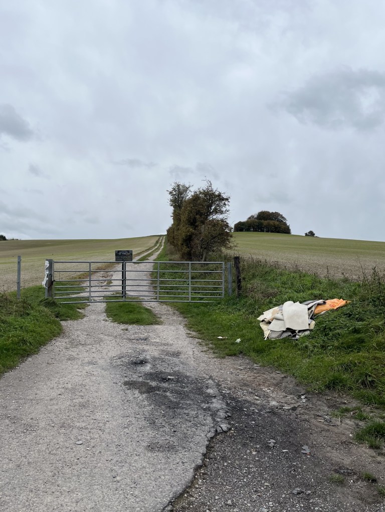
Carpet bombing on the fly(tipping)
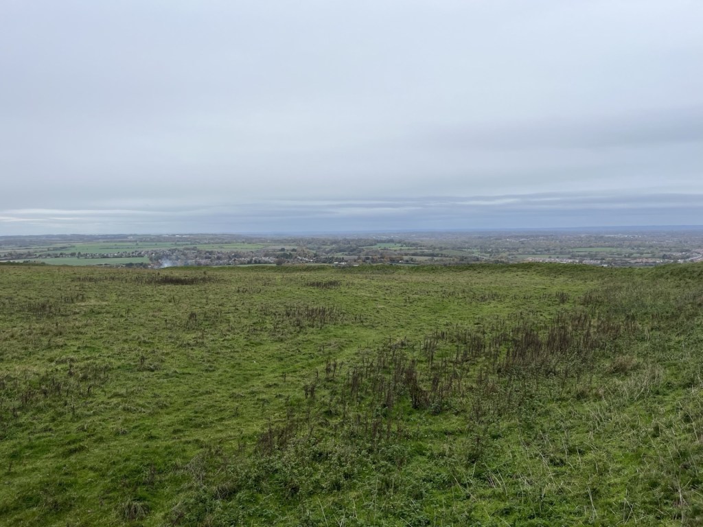
Through the gate and straight on the path that led up the slope, with a cluster of trees towards the top. I stopped for a moment to check that the car was still there. It was but of more interest was the view east and the M4 heading towards London.
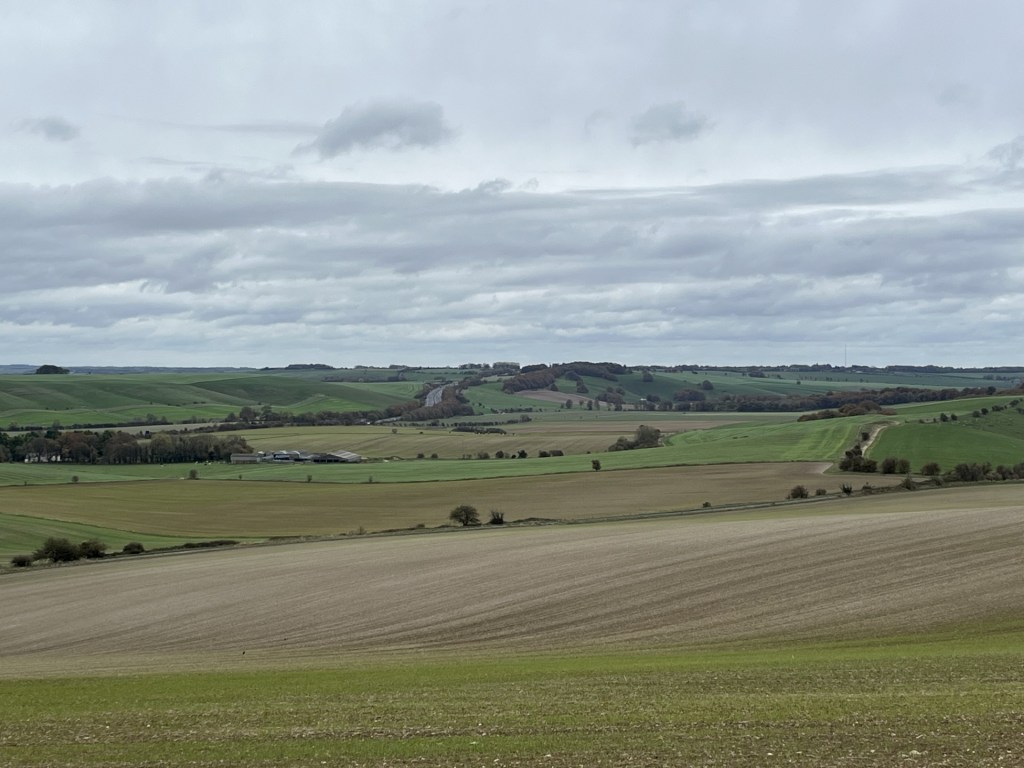
Towards London – the M4 corridor
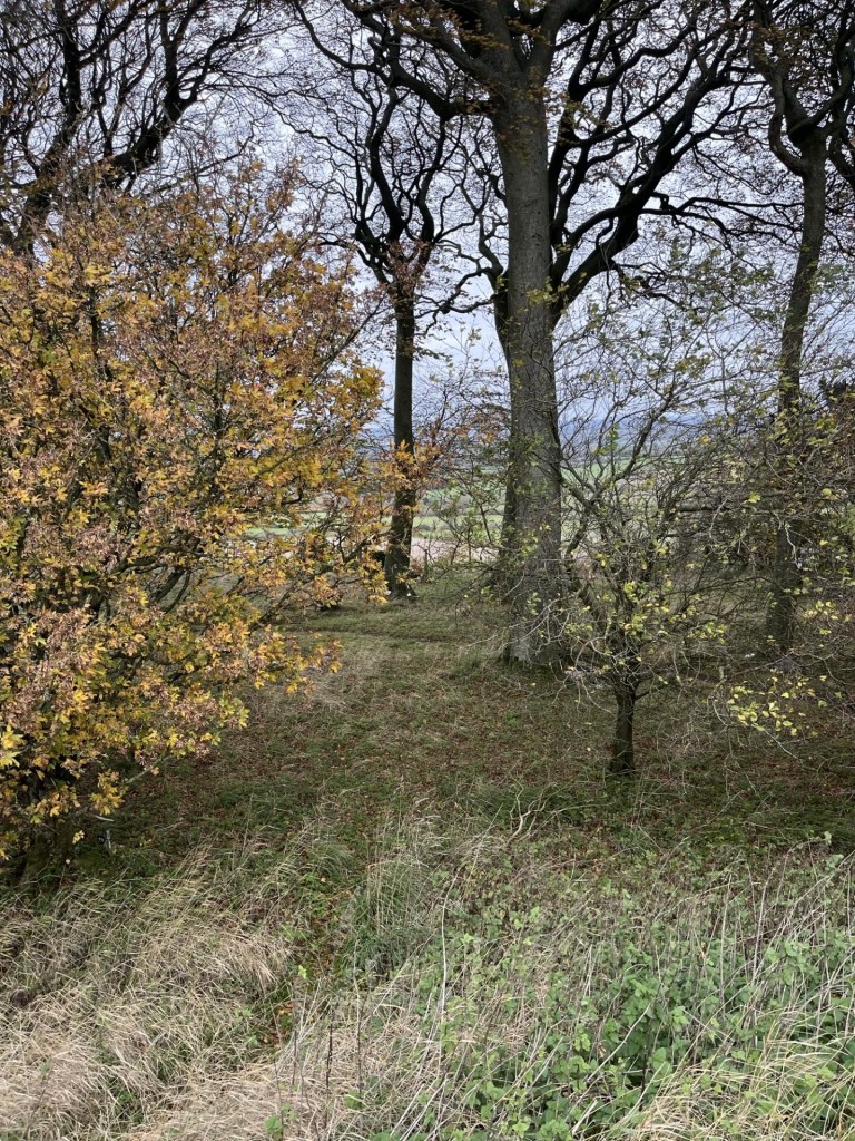
I passed by the small woods to the right and on, with a large field falling away to the south. Eventually a sign pointed north to a path around a large field leading to the hillfort, now visible on the nearby horizon.
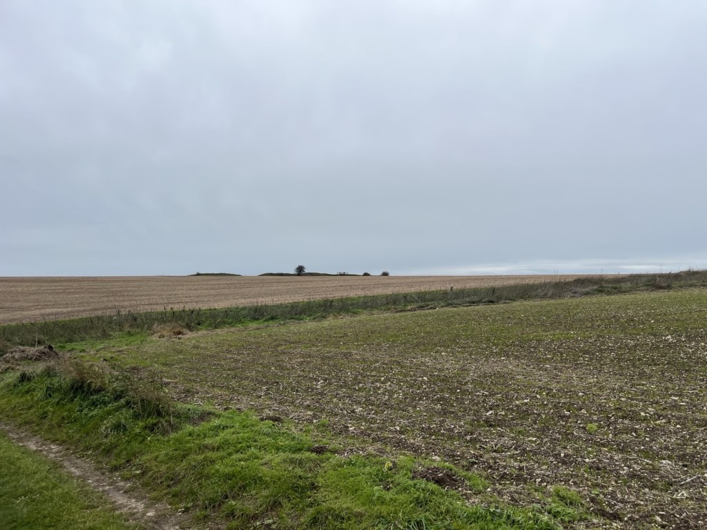
The hillfort destination
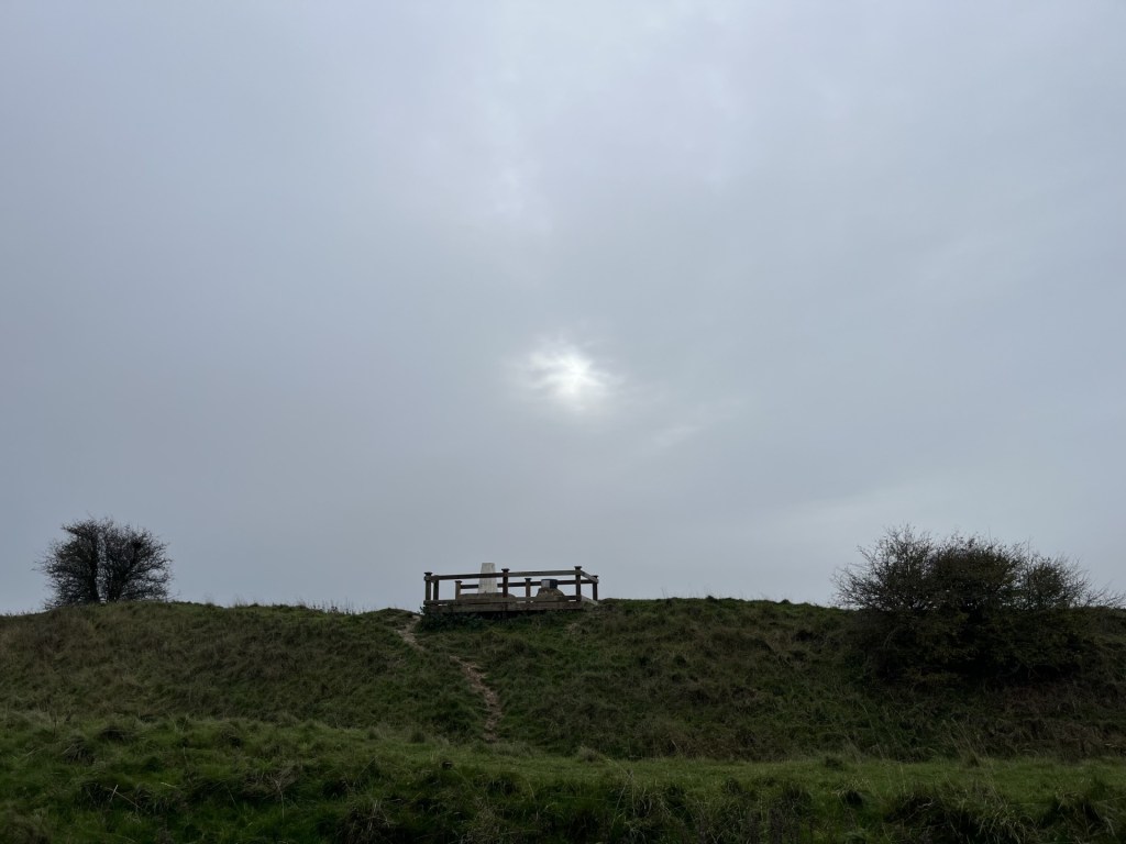
The path led to the end of the field, then through a gate and left along the top of another field and eventually back up towards the ramparts where a wooden construction could be seen on the top of the inner mound.
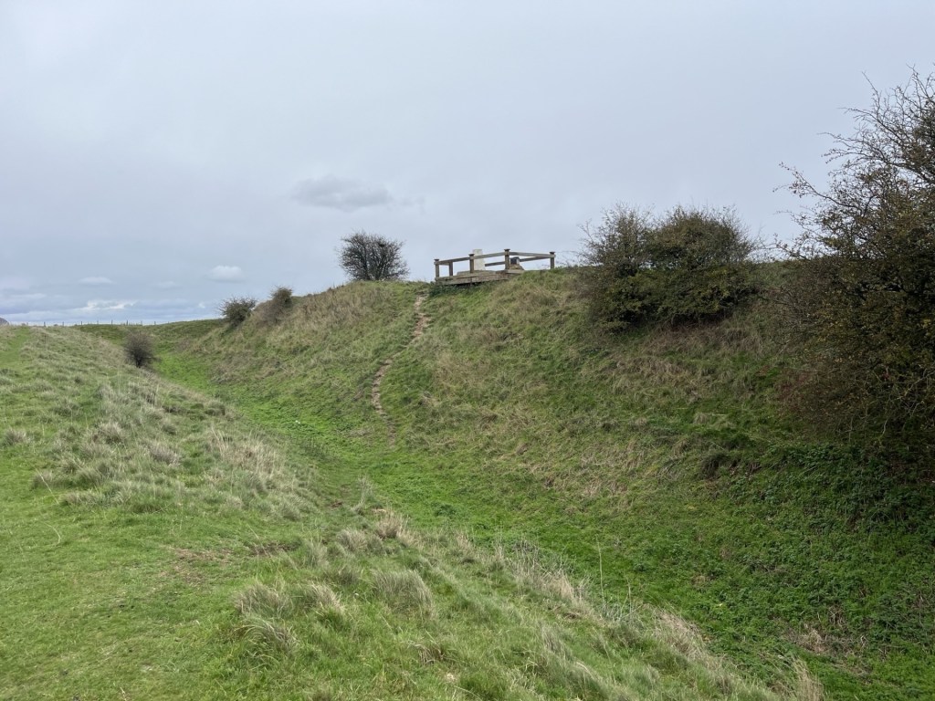
At the ramparts
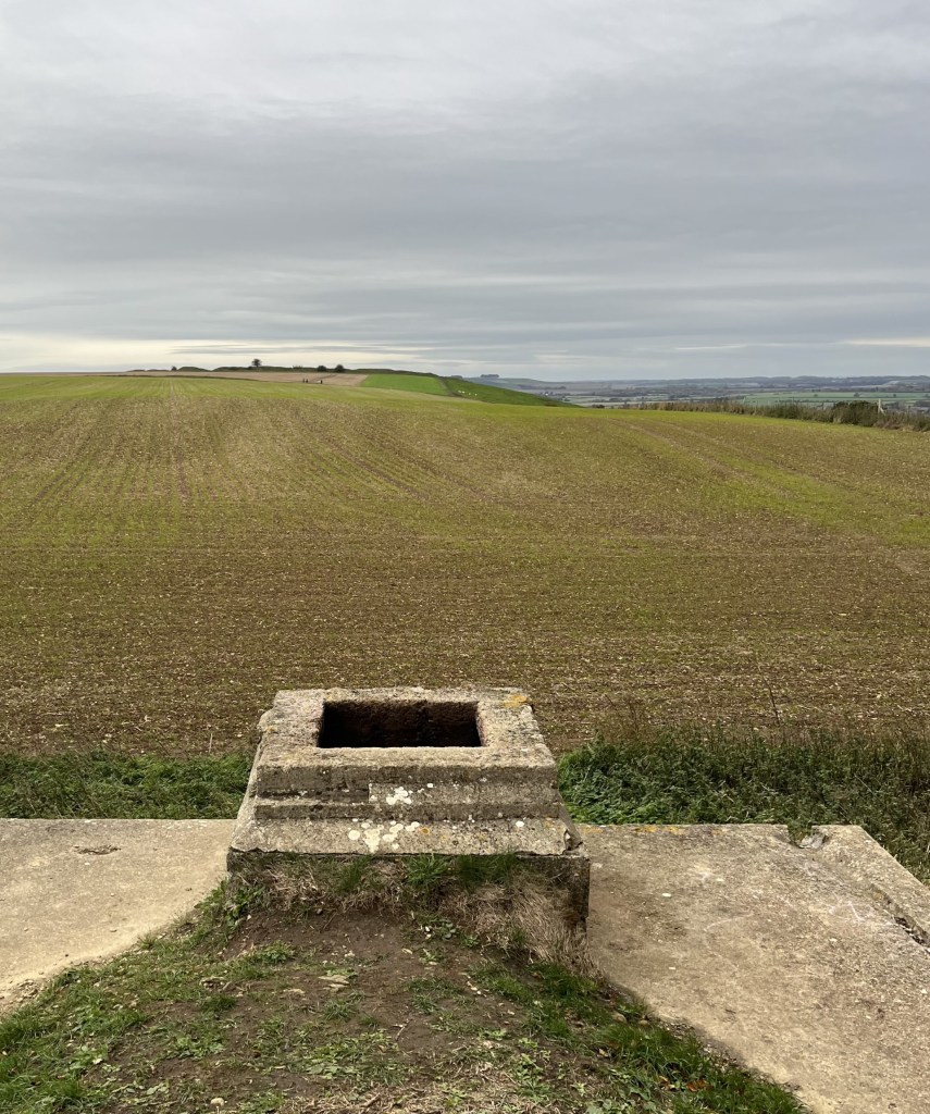
I flanked around along the top of the outer western mound before it descended into what would have been one of the main entrances. Here the ditch was at its deepest, but as chalk hillforts go, the parallel ramparts didn’t seem to amount to much. I passed in and then back along the inner rampart and up the small slope to the wooden construction, which was a mounting deck for a triangulation point (strange) and an underwhelming directional toposcope.
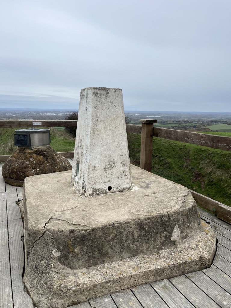
The raised Trig and beyond the confusingly disappointing toposcope, with Swindon beyond
With the low grey cloud formation still threatening rain at any moment, I wasn’t going to hang about, but looking west across the large enclosure site something didn’t quite add up. Most, indeed all, iron age hillfort sites I had previously been to sit firmly on the top of the hills they are located on, using the natural contours to create the series of broadly horizontal ramparts and ditches that complete the structure, and with a relatively flat central enclosure (the nearby Uffington Hillfort to the east of Swindon, and coincidentally the highest point in Oxfordshire, is a perfect example of this).* Here the land fell away in all directions, down what was effectively the side of the hill. Indeed, a later check on the BGS Geology Viewer showed a drop of at least ten metres from the top entrance down to the north-west corner. Now, I’m no archaeologist but I do know this, when you haven’t a clue it’s probably best not to speculate. It was a mystery, nonetheless.
Falling away?
I left. Just for a moment, as I passed east of the wooden plinth, a teasing watery sun threatened to break through.
Here comes the sun (before it went again)
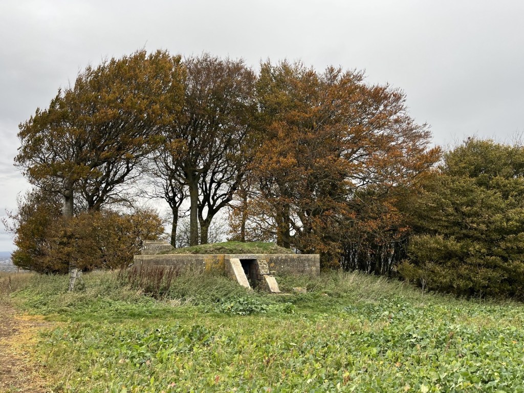
Heading back the way I had come I looked over to the small woods, now to my left, and noticed a low structure. Of course! When I had researched the area a couple of months earlier, I had noted a reference to some sort of bunker. And there it was. I diverted from the main track and followed the edge of a recently tilled field.
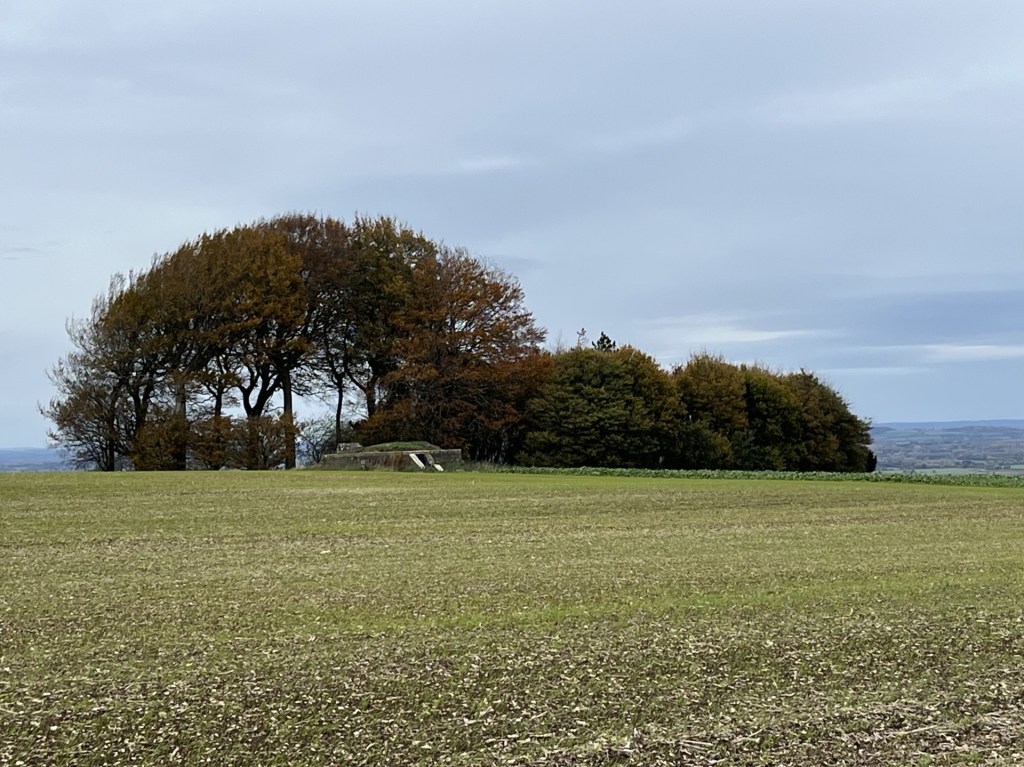
The Starfish Decoy Control Bunker lurking at distance
The obvious question that popped into my head was, what was it? Fortunately, my phone had a signal, and a quick enquiry told me that it was one of many built around the country during WW2. Starfish (SF) Decoy bunkers were used to light fires away from urban and industrial areas to mislead Luftwaffe bombers, who, I guess the hope was, would drop their load in the wrong place. With this nugget of information, I approached with a degree of curiosity. When I was a kid growing up in the 1960s me and my pals spent many happy hours playing war, making fires, smoking and throwing bangers around in an old concrete bunker in a field near a river close to home. Who needed the internet? **
Naturally the bunker required further investigation.
An investigative approach
With the obvious exception of missing blast proof doors, externally the structure appeared to be in relatively good condition.
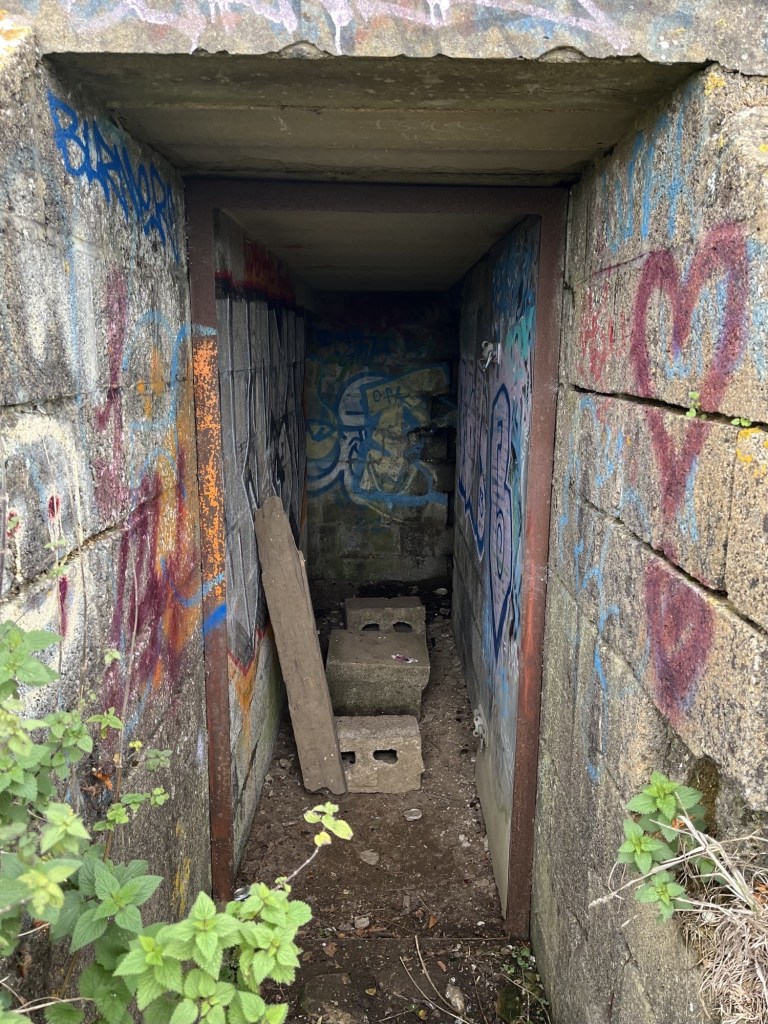
Looking in
I slipped through the entrance. Due to age, and a lack of understanding of local youth peer group culture, I was unable to translate the colourful graffiti. The concrete corridor led a few metres to the rear where two rooms led off to the left and right, with large rusting metal tanks sitting looking sorry for themselves. Whether they formed part of the original operational structure, or whether it was just something the landowner had dumped out of sight many moons ago I couldn’t say. Presumably because of the bunkers remote location, whilst a few beer and cider cans predictably littered the floor, I’d certainly been in a lot less salubrious WW2 bunkers and pill boxes.
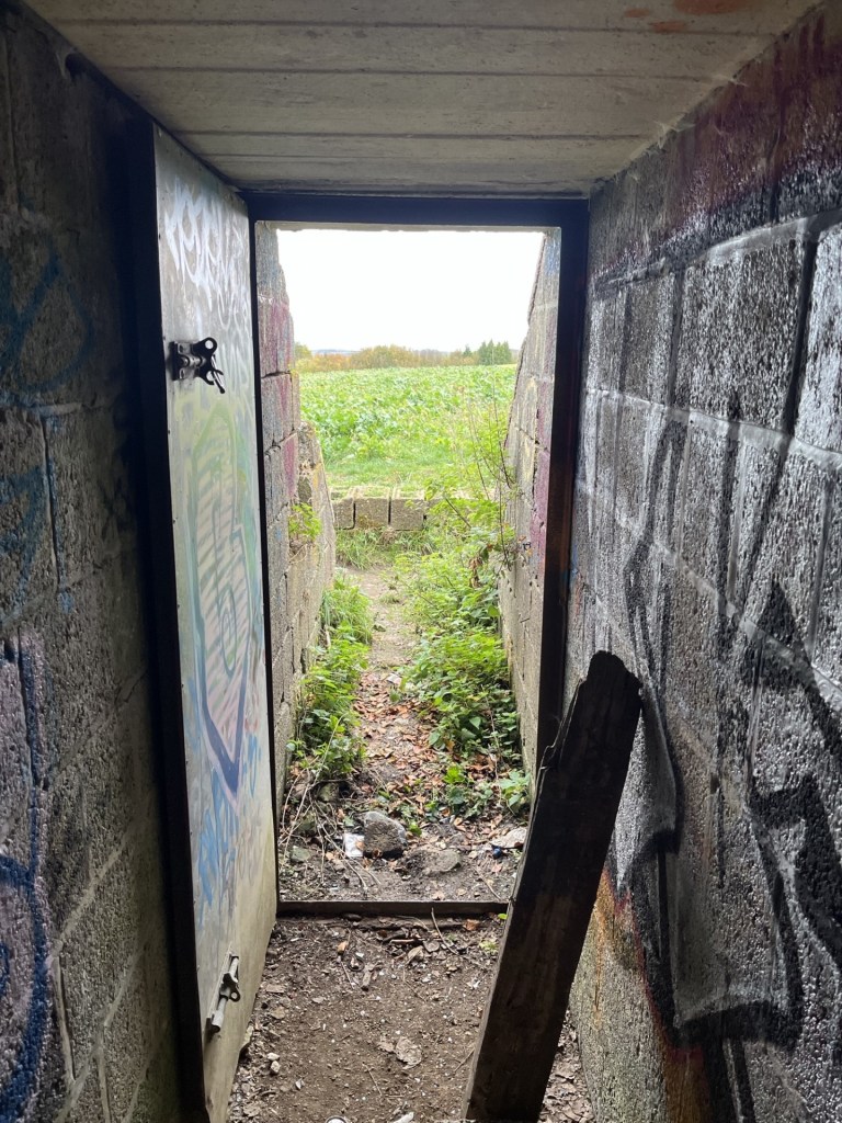
Towards the light – Looking out
Back outside I thought it only correct to climb onto the grass covered roof. The view was only marginally better than at door level, but the outline of Liddington hillfort was on full display to the west.
Towards the hillfort. I felt confident I had discovered a new lay line.
From the roof I was able to look down into the woods, delightfully called Liddington Clump. I noticed that at various points within the small group of trees, discretely laid bunches of flowers had been deliberately lain. There is something similar near me, just set back from a road in woods at the edge of the local park. I’ve never looked too closely but have always assumed they were for much loved but departed pets. So, assuming the same here, when I later read that in fact the woods contained some natural burials – for humans, I wasn’t sure what to think. I’m pretty sure that on some sort of ethical, spiritual and/or humanist level I can see the attraction (maybe there’s a better way of putting that), but what would the consequences be if we all opted for a natural burial? A walk in the country near any urban setting would very quickly become a precarious totter through an ever-increasing open graveyard. Hmmm…. another moral quandary to occupy the mind.
Now, here’s the thing, and it needs to be told. I discovered the reference to the burial site in a quick search on the phone back at the car. I probably only glanced at the article for a few seconds, but it had registered. So, now, a couple of weeks on and wanting to find out a bit more, I have singularly failed to find any mention of a natural burial site at Liddington Clump. I have found a brief reference in a random comment on a post on Facebook that it is a memorial site for people and pets. The only explanation I can think of is, that there being an iron-age burial mound not far from the woods, and in some sort of mixed-up dystopian word jumble confusion, I’ve put too many one’s and one’s together and come up with fake news. It must be either that, or, and I am inclined to go with this theory, it was an involuntary AI search that led me up the woodland path. Either way, it had got me thinking about natural burials (which, for the benefit of doubt, are a thing); their implications, ethics and carbon footprint, and despite the latter being a justifiable reason, I think I’ll stick with the furnace.
In a similar vein, on-line information available on the Liddington decoy bunker, and indeed Starfish Decoy bunkers in general, is scant to say the least. I found a short article that gave a perfunctory description of their use, but no real explanation on how they were crewed and operated (I assume that gas or oil pipes radiated away from the bunker to where outlets would be lit for effect). A few weeks earlier, and completely coincidentally (a friend had sent me a fantastic short BBC documentary on YouTube about Swindon Town football club in the 1960s called 1963: Six Days to Saturday, which included some footage of the locomotive works, and…. oh, I’m straying badly here), I had read an article about bombing raids on Swindon. Surprisingly, given that the one thing everyone in the world knows Swindon for is its vast railway works (and XTC), it seems that the works survived relatively intact. Some surrounding houses were hit and sadly people did die, but apart from the odd unfortunate cow, the railway works were barely troubled by the Luftwaffe. There is no doubt about the fact that the decoy bunker at Liddington would have been placed there to keep the bombers away from Swindon, and very specifically the railway. To that end, it’s just possible that the tactic worked. Maybe one day some new information will emerge. Just as this was about to go to ‘print’ I came across a short YouTube video that followed a couple of modern day night raiders to the bunker, where they film the inside (see my descriptions above) and then leave, providing no more context than I have managed to offer up here. Quite why they filmed it at night is a complete mystery. It’s perfectly accessible at any time. But, and there’s a twist, just as they are about to leave, one of the participants drops off the roof, and (here’s the spooky bit) says they’re about to go into the graveyard!!!! What do they know that I thought I did, but now I don’t? The mystery continues.
Liddington Clump – The mystery continues
I left the bunker (“thank gawd” you shout) and returned to the gate at the end of the long path. Just past the gate the fly tipped mound had still not been cleared (bloody local councils are useless, aren’t they?), but miraculously my car was still in place.
Ten minutes later I was back on the M4 heading east and towards London. As I joined the motorway I glanced up to my right and could make out the ramparts of the hillfort. I must have driven past it over a hundred times and never noticed it. Half a mile further on and to my left, a familiar feature along the side of a chalk upland, where the side of the hill is distinguished by a crinkle cut pattern of indents that can only be explained by seeing them (just visible in the second photo to the left of the M4). Unlike the hillfort I had noticed these on many occasions before and now at last I understood their context within the M4 corridor. Never stop learning.
* https://elcolmado57.co.uk/2024/10/20/cresting-the-county-oxfordshire/
** In the interest of public safety, and to avoid the possibility of being sued, I strongly advise against allowing ten-year-old children access to matches, lighters, cigarettes and fireworks. It’s right that we have regulated these products to the extent that what I was able to get away with as a child is technically not possible today. When I look back I find it mind boggling that the so called straight up honest shopkeepers of old England would recklessly turn a blind eye to almost anything we wanted to get our grubby little mitts on (apparently, things are so much worse these days – or so you’d be led to believe if you spend too much time on social media – just saying).
