Cresting the County – Brighton and Hove (Unitary Authority)

Bullock Hill

197 Metres

646 feet

23rd August 2025

Move on Up

It was a Saturday, and I had woken up with no particular objective in mind. That said I’d spent nearly a month running around like a headless chicken on caring duties and was truly exhausted. Once upon a time, on a day like this (warm and a soft sun) I often found myself on an empty Saturday slipping onto a train or tube and spending a couple of hours watching football in one part of London or another. Those days are long gone, not least because you can’t just turn up at a ground and expect to get in, but more significantly because I no longer live in London. No footie, no worries. Take a walk instead and hope to avoid all results until Match of the Day.

This one had been on my mind for a while. The old county of Sussex is now (at the time of writing *) split east and west, and at its heart is the Unitary Authority of Brighton and Hove. I had done East and West Sussex in 2024, but Brighton and Hove had eluded me. Today was the day to get on the boots, a train, and then up the chalk.

I missed the first direct train. It was at the platform as I crossed the footbridge but knowing that there was no time to buy tickets and board, I was resigned to wait for the next. That was fine. There was no rush. I wandered down the nearby street, full of second-hand shops, small galleries and one stop dog manicuring facilities. It was busy, and the usual coffee outlets were bursting. Walking back towards the station on the other side of the road, music was seeping, quite loudly, from an unfamiliar shopfront. A vinyl record store that sold coffee. Hmmm… well why not?

With my coffee secured and sitting outside watching the world go by, all was well. And then it got ten times better. Those unmistakable opening brass blasts of Move on Up by Curtis Mayfield get me every time, and it was no different now. If I hadn’t already been motivated, I certainly was now. Sometimes, depending on whether something has inspired me on the day, I embed a music video from YouTube at the end of these accounts, and I’m just telling you now – it’s going to be there. The extended version of course.

The Brighton train pulled into Eastbourne, which is a terminus and where all trains stop for fifteen minutes or so to allow the driver to swap ends before onward progress. It’s a tad frustrating to be honest and is entirely the fault of Mr Beeching, who, along with his committee, decided to remove a mile long section of track to the north of the town. This had provided direct services along the coast, but now it has gone it means that everyone travelling east to west (and back), is sucked into Eastbourne for the mandatory pitstop, thus rendering speedy transit to Brighton or London an impossibility. Well, no worries. I wasn’t in a rush.

The train failed to leave the station at the designated time, but it was only when the guard walked down the carriage apologising to the passengers and explaining that someone had locked themselves in the toilet, that the atmosphere on the train changed. Almost immediately some of my fellow travellers were very loudly offering up a menu of opinions they had in mind if the situation wasn’t dealt with quickly. This included a man near me volunteering to kick the f’ing door down. I’m not sure the guard handled the situation very well to be honest. He chuckled at the offer of assisted violence but also hinted that the person was a teenager trying to avoid paying the fare. By now there were people, male and female, on their feet and baying for blood. A chant went up “get him out, get him out, get him out.” I felt like I was at a footie match in the 1980’s. I sat schtum. It’s felt a bit like the leash has been slipped in recent months, with some unpleasant sentiments and reactions bubbling to the surface of society that would have previously been unacceptable. The situation finally resolved itself when the toilet door opened and moments later three (yup, three) fifteen-year-old lads in trackies appeared on the platform looking cocky and unfazed. There was a muted round of applause for the guard. I looked at the three boys, heads turning this way and that like a group of nervous meerkats. They’d chanced it, had had a moment of fun and annoyed a few people. No one was hurt. Thank God they had been white.

The train left a few minutes late of course. I alighted at Falmer station. Falmer sits just to the northeast of Brighton. It’s the site of the University of Sussex and the relatively new Brighton and Hove Albion football stadium. Earlier I had had a moment of panic when it dawned on me that there might have been a Premier League game at the ground that afternoon. That would have been a drag, but there wasn’t, so I was the only person to get off the train. I was heading to Bullock Hill, the highest point in Brighton and Hove and a mile or so to the south of Falmer.

Walking out of the station I made my way up a series of concrete steps that led towards student residential buildings. It was summer and there was no one in sight. It felt strange wandering through an empty campus, next to an empty football stadium. I’ve supported Tottenham Hotspur since 1967, when they won the FA cup. As a teenager I was brought up in Croydon and so spent a lot of time going to watch Crystal Palace (ironically the current FA Cup holders). Along with Arsenal (see Spurs above), Brighton is the theoretical enemy. When Palace play Brighton, it’s called the M23 derby. As far as I can recall there’s never been any violence, and I hope it stays that way.

Past the university buildings and at a higher level now, I passed along the side of the stadium. On a game free early Saturday afternoon, a soulless place to be. The road led on to the east. I turned and took another look at the ground, nestling into the chalk.

The offside rule explained.

Before we start to go up, here’s a tenuous Brighton joke to break the tedium (I’m afraid it’ a longish read).

A year or two ago I was with family in the garden of a pub in Nottingham, expecting to watch Nottingham Forest on the outdoor TV. Due to a colossal misunderstanding the match (which was taking place a quarter of a mile from where we were sitting) wasn’t televised, so the entertainment had gone missing in action. Except, at just around 3pm, and as we sat disappointed by the development, a middle-aged man wandered over to our bench, sat down and proceeded to tell a joke. Over the next two hours, and without interruption, he told joke after joke, only pausing occasionally to accept the offer of another pint. None were offensive, rude or controversial, but most were funny. This was one of them:

“You’ve heard of the footballer, Danny Welbeck?” Yup, we all answer.

“Played for United, now at Brighton.” Yes, we all answer.

“You’ll have heard of his dad then?” No, we all answer.

“What? Everyone knows Danny’s dad.” Well, we don’t, we reply.

“Yeah, he was in the army. Everyone knew him.” We are all ears.

“A Bomb disposal expert.” Wow! We didn’t know that.

“Yeah, everyone in the army knew him. Great guy.” Hmmm… (where’s this one going?)

“Danny’s Welbeck’s dad,” he paused.  “Yeah, we all knew Stan.”

Boom boom. How we laughed – eventually!

Walking east and away from the Amex Stadium and the university complex I crossed over Falmer Road then started the ascent on a well-maintained cycle/path path. The route was set back from road and tracked it up the chalk slope. Steep at times but then easing off views began to open out to the east and towards Lewis.

Waves of chalk heading towards Lewes

After a mile or so a slight bend in the road and some land set aside for wild planting offered an opportunity to inspect some colourful flora. Looking towards the southwest the view towards  Shoreham was unexpectedly spectacular.
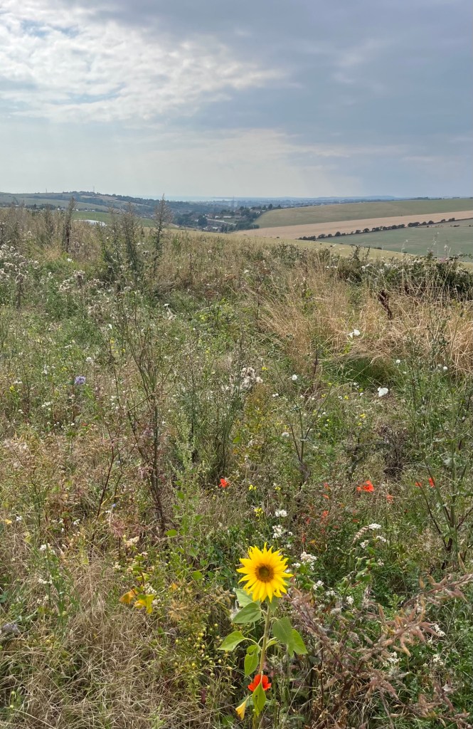
Spot the butterfly

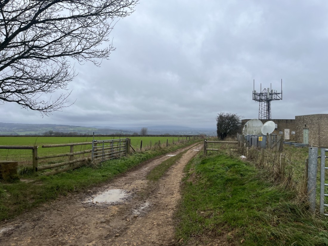
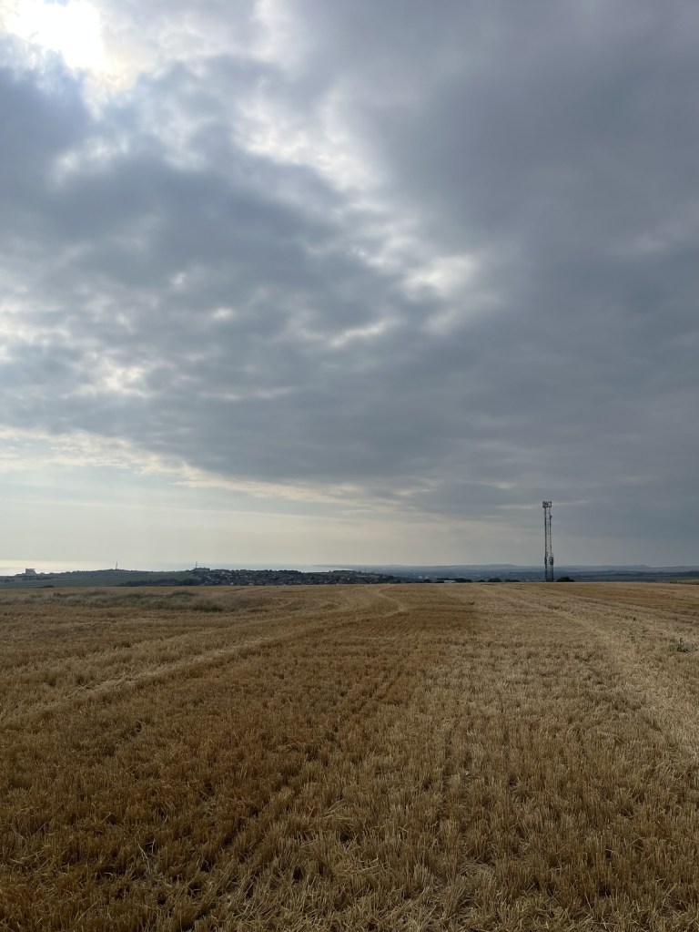
This was a whole new part of the world for me, and I was impressed. Five minutes on and I was at the top of the ridge, with tracks heading directly east and towards my objective. Following the track that flanked the edge of the Woodingdean housing estate (a desolate dormitory in winter I imagined) I soon arrived at a point which presented options. The main one was a signposted path that had all the hallmarks of being official. Tempted, but not convinced, I decided to follow the unmarked track that headed straight into a field and with a telecommunication tower just to the right.

Bullock Hill rising just to the left of the aerial.

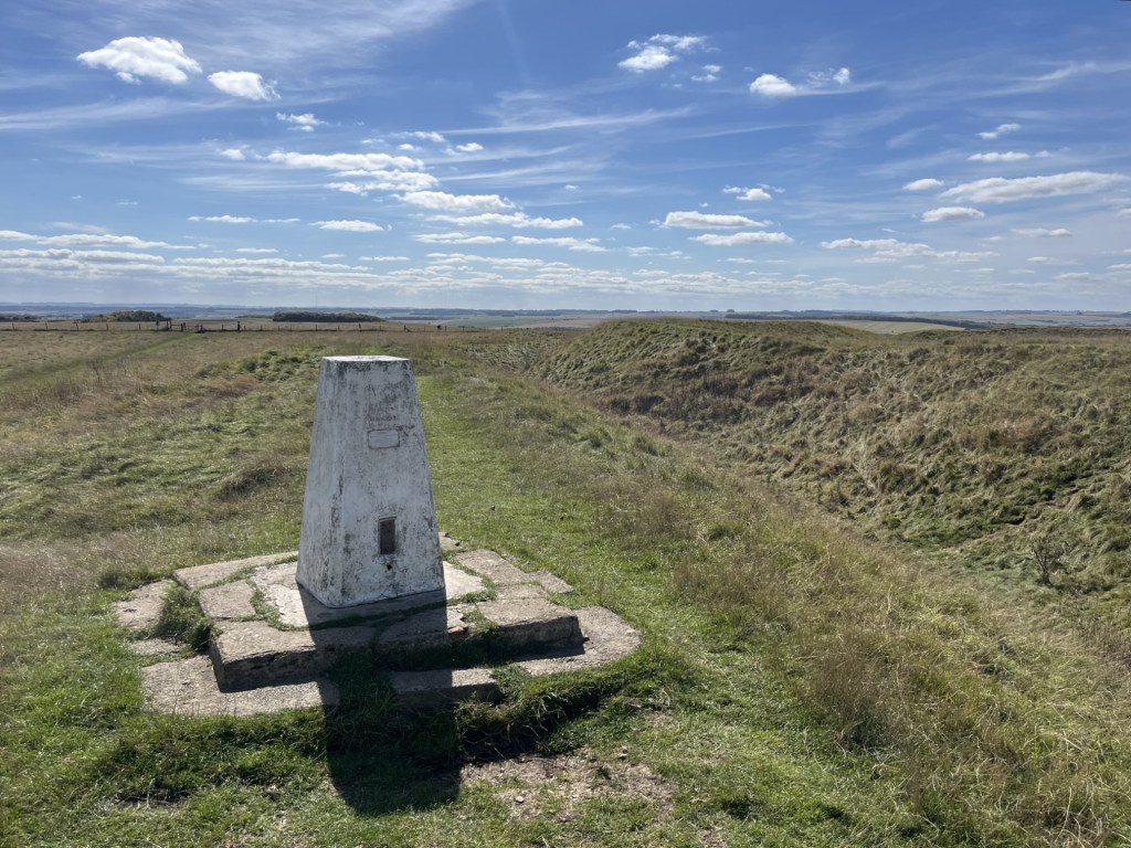
Passing the small collection of buildings and rising metal structures I was able to get a sense of where the highest point was located. This required a slightly tricky clomp over bone hard uneven ground until, after a couple of minutes, I could see a trig point in the middle of a recently harvested field.

The other thing I saw was four people gathered around the trig point. I was slightly surprised by this because it was clearly off the beaten track (which officially was running about 200 hundred metres to the north). Slightly self-consciously I cracked on across the cracked land and stubble. As I approached it became clear that the small group were in the middle of something which appeared to involve a camera and badly applied makeup. Despite the absurdity of it all I felt like a brazen intruder. At about ten paces one or two of the group became aware of my presence, which they acknowledged. “Hi,” one of the young men said (it was three young men and a woman). “Can we help?” he added. Feeling like a complete nerk, and not really knowing what to say, I managed to splutter out something about having come a long way and wanting to get to the trig point. “Ok, no problem,” he replied, “we’re nearly finished.”

By now I had noticed that the woman and one of the men were wearing white sheets with randomly applied muddy smears, and the other two men between them carried expensive looking camera and recording equipment. I guessed that they were probably students making the obligatory short zombie movie that they hoped would soon propel them to Hollywood. I stood and looked away towards the communication towers. Self-consciousness doesn’t get close.

Looking away from the action

Within a minute or two they had finished and I wandered towards them. “So, what’s the importance of this place then?” one of them asked.

“Oh, not much,” I replied. “It’s just the highest point in Brighton.” All four faces turned towards me, jaws beginning to drop.

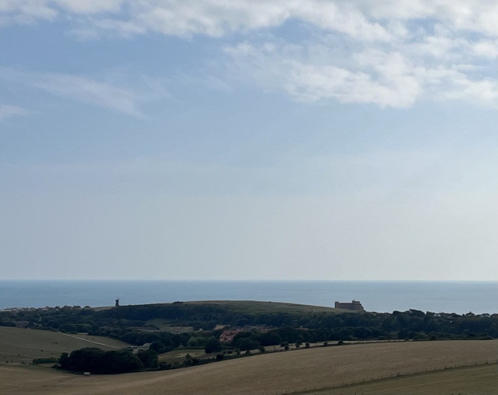
“No way man.” “For real?” “Who knew?” The woman yawned. They looked around and behold, it was true. Moments earlier they had just been sitting in a field on a mound surrounded by loads of other fields on similar sized mounds. Now it was obvious to them that they were on the summit of a mighty hill, staring down imperiously over everything in sight, including the i360 in Brighton.

Conversation flowed. Did I know what the large crater was just a few paces to the east of the trig point. Well, I sort of did but wasn’t 100% sure. “It could be a sink or swallow hole, possibly post-glacial,” I ventured. “Actually, I reckon it’s more likely to be a dew pond. Dug out by a farmer a couple of hundred years ago, perhaps.”

Bullock Hill Trig. Today’s lecture will be from Prof Bull S. Hitter

The crater – subject of various bs theories.

Incredibly, within a minute, I had gone from an awkward stranger to a veteran sage of the mountain. Their collective astonishment at my imparted (and I should add – free) wisdom and knowledge was almost overwhelming, and for almost the first time in my life I had justified my choice of doing a Geography degree in the 1970s. It was time to go before they asked me a question I couldn’t answer, though to be fair I seem to have slipped into bullshit mode effortlessly.

We parted company and I wandered over to the crater for a closer inspection. Yup, artillery – Second World War. Time to move on down.

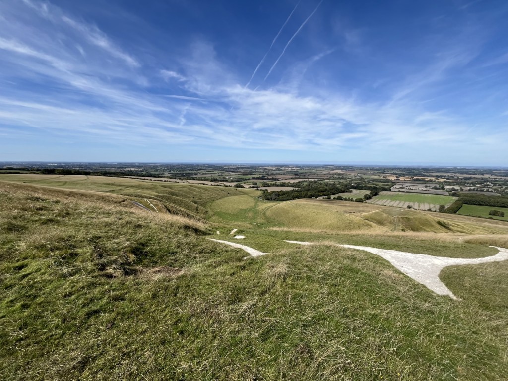
I followed the edge of the field to an open gate and at a point that met up with a bridleway heading east. I looked at my ancient Ordinance Survey map (Landranger 198). Immediately to the south, at a distance, I was able to make out the black and white form of the Beacon Hill windmill at Rottingdean. Which was exactly where I wanted to be. A path in the field adjacent to the bridleway headed straight towards it. After a quick rest I got on it and strode forth.

Tilting towards a windmill

It all looked pretty straightforward. Follow the path and head on down. At the end of the first field a walker friendly gate gave access into a much bigger field which rolled away on all sides. The only slight concern was a sign to the side of the gate proclaiming private property. That’s as maybe, I thought, before setting off on what felt like a path. After about five minutes I came to another of what appeared to be a recently installed gate. It sat at the end of a few low hawthorn trees and quite literally on its own.

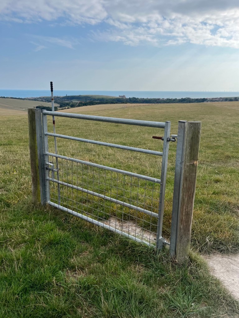
The Riddle of the Gate

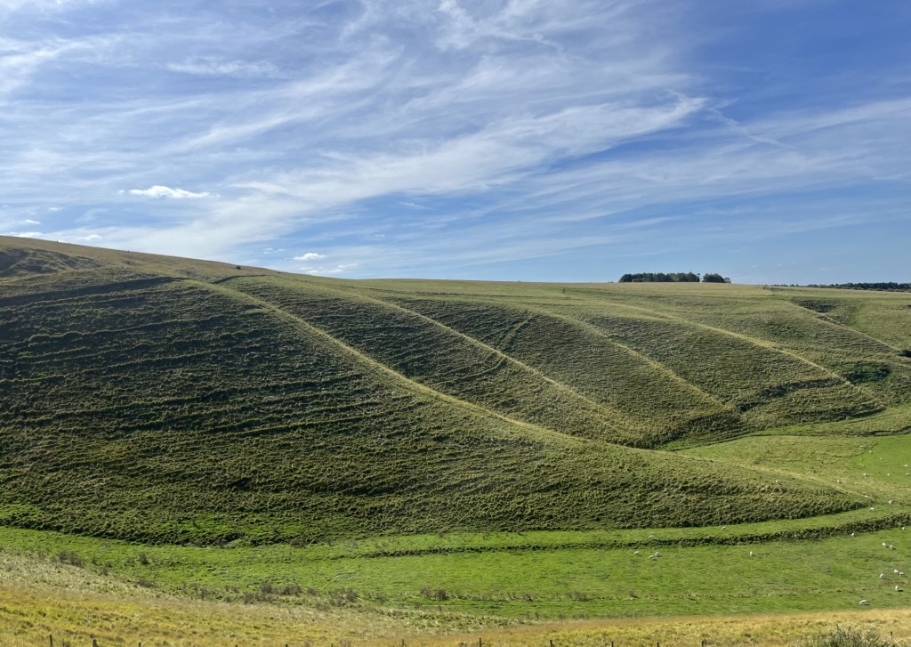
Another sign re-stated the private ownership of the land. Was this some sort of fantasy video game in which you had to correctly answer a riddle or question before progressing (Mordon’s Quest on the Spectrum from 1985 came to mind – I never did understand what the saltpetre was for). Obviously, I decided to go around the gate, but had this been the right decision? Well, I didn’t blow up, so I guessed it was and carried on down towards two more of these standalone installation gates, one of which I decided to go through just to make sure it was in working order. Carrying on I headed towards another fence and gate around 400 metres to the south. The land here was shaped into a wide folded dry valley with the crop recently harvested. It was a barren sight, made more dramatic by the endless hot and dry weather. It felt lifeless, except at that moment a green woodpecker flew past, settled on a nearby tree and then let out its distinctive high-pitched call.

Classic chalk dry valley, with the emphasis on “dry”

As I reached the end of the field and the escape gate (here at least there was the more traditional fence either side) a middle-aged woman accompanying a girl on a horse approached in the other direction. I gave way and they came through into the field. I said hello and asked the woman if she knew what the lonely gates in the fields was all about. She didn’t know, but then told me it was private land, and “they” could…… She hesitated, as if realising that what she was about to say next might sound absurd. “Hmm… Shoot me?” I joked. She didn’t look very amused but at least it broke the ice. “No, no,” was all she could muster. I smiled and passed on, thinking that what she probably meant to say was “they could prosecute me for trespass.” Yup, that really would have been absurd, but in England (not Scotland) there are many landowners who will go out of their way to keep the hoi polloi off their domains, either through neglect of the infrastructure, or in some cases, the deliberate blocking of legitimate rights of way. That didn’t explain why here, very new and quite obviously expensive walker friendly gates had been installed right next to signage which aimed to make it clear that walkers weren’t welcome. I did have a look on-line later, and whilst I couldn’t find anything to explain the existence of the gates, quite a vicious outbreak of words had recently appeared on a Woodingdean Facebook site about the allegedly deliberate ploughing of footpaths in the area. I didn’t look too hard because it was quite a brutal read, and perhaps reflective of our species newfound ability to miscommunicate with every touch of the keypad. Oh well, I guess I’ll never know the reason, and that’s probably for the best.

Past the gate I joined a more significant track that led towards a large farm complex. On either side areas of land had been set aside for horses and with people were milling around, mucking out and generally minding their own business. I wondered if they were looking at me through one eye and thinking “trespasser”. Too much paranoia I think (Ossie had only recently died after all). Through the farm and, with a slight sigh of relief, at last I was back on public land.

Continuing south and back on the Falmer Road, I started into Rottingdean. On the left cricket was being played on a pitch that made the slope at Lords look like a salt flat. A sign at the side of the road explained the history of the Rottingdean Cricket club and a little-known fact that the highest score ever run off a single delivery was made on a nearby older ground. For the record it was 67; after the ball had ended up rolling down the high street and before the introduction of boundaries. When the ball eventually arrived back at the wicketkeeper, he missed the stumps and the ball then set off down another street. There’s a metaphor here for something or other.
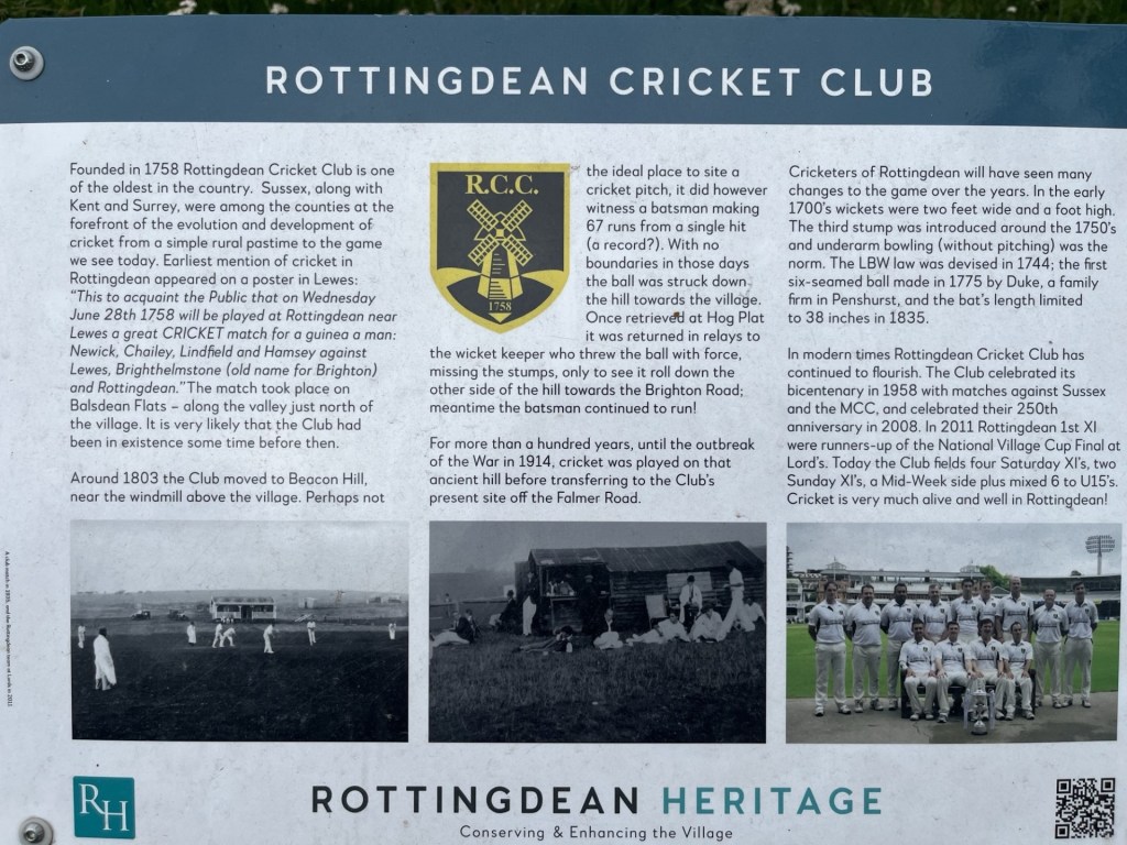
Howzat?

The buildings entering the town were, to say the least, eclectic, and in the main very well to do. Soon afterwards I was at the busy sea front heading west along the wide Undercliff path and under the chalk cliffs and towards Brighton. The last time I had been here had been some years back, on a cycle ride from Brighton to Eastbourne. Not a particularly long ride but trying to hoik the bike over the Seven Sisters had nearly finished me off. That was something that wasn’t going to happen again. ** Up until this point there had been a fine haze that had kept the temperature at a reasonable level, but that was now lifting, and the sun was occasionally breaking through, illuminating seaweed on the rocks below and bringing life back into the chalk cliffs.

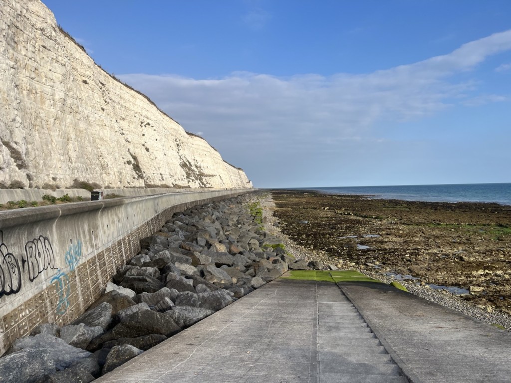
Undercliff path looking back to the east

As added interest a low flying seaplane (type unknown) glided silently past, going west to east.

Flying with the birds

I was beginning to flag a bit and regretted not having stopped for a tea or coffee at Rottingdean. Keeping to the Undercliff path I trudged past the Marina, which seemed to go on far too long. Beyond the Marina I stopped for a few minutes to watch and listen to a rock band entertaining a large crowd gathered at a mini festival. The tune they were blasting out almost sounded familiar, but I couldn’t place it, and it wasn’t quite my cup of tea; speaking of which I was now in desperate need.

Rock the Marina

Madeira Drive looked longer than I remembered it, but it had to be tackled.

I’m not entirely sure if it could be classed as music, but at the halfway point between the Marina and the Pier a brain numbing sound was blasting out from the Concorde 2 music venue. Two or three years earlier, with a friend, I had had the privilege of seeing Steel Pulse there. Whatever the genre was that was crucifying the eardrums of the punters there now, it certainly wasn’t anything like Handsworth Revolution. As I say, I was now desperate for a large tea, and I certainly wasn’t going to get that at the Concorde 2.

Now desperate, and against my better judgement, I finally succumbed to a tea option at one of the tacky seafront fish and chip/kebab/candy floss and ice cream outlets near the Sea World aquarium. Despite emphasising that I just needed a very small drop of milk, the man who served me couldn’t resist pouring a quarter of a pint of the stuff into the cup. I was tempted to protest but didn’t have the energy to follow up any potential conflict with added venom, so grabbed the miserable warm concoction and went and sat on an uncomfortable bench.

At least here there was more entertainment to be had. A small group of mods were posing on their classic scooters on the other side of the road. It was quite hard to establish which one of them was the “Face”. In part this was because all the men were bald and their facial structures, a bit like mine, had slowly collapsed over the fifty odd years since they had first arrived here on the back of watching Quadrophenia. Despite their average age of an estimated 65 plus, most were dressed in state-of-the-art 1960’s mod clothing. Revving up (well that’s not quite the right description – the sound more that of defective lawn mowers hitting hidden twigs), they began to assemble on the opposite pavement with an indication that they were about to ride off in unison. They were waiting for something. And then he was there and being saluted by a collective throttle tonk. The Face! At full speed and his ride decked in at least thirty rear view mirrors, a man drove by at maximum speed…. on his mobility scooter. From my side of the road, a young man and woman dressed in immaculately retro “Rocker” gear jogged across to their motorcycle. They were acknowledged by the mods, and a few friendly words were exchanged. I couldn’t help chuckling. Was it nostalgia, cosplay or a genuine commitment to the cause? Either way it had kept my mind off the task of digesting the disgusting warm milk that I’d paid £3 for.

At least here there was more entertainment to be had. A small group of mods were posing on their classic scooters on the other side of the road. It was quite hard to establish which one of them was the “Face”. In part this was because all the men were bald and their facial structures, a bit like mine, had slowly collapsed over the fifty odd years since they had first arrived here on the back of watching Quadrophenia. Despite their average age of an estimated 65 plus, most were dressed in state-of-the-art 1960’s mod clothing. Revving up (well that’s not quite the right description – the sound more that of defective lawn mowers hitting hidden twigs), they began to assemble on the opposite pavement with an indication that they were about to ride off in unison. They were waiting for something. And then he was there and being saluted by a collective throttle tonk. The Face! At full speed and his ride decked in at least thirty rear view mirrors, a man drove by at maximum speed…. on his mobility scooter. From my side of the road, a young man and woman dressed in immaculately retro “Rocker” gear jogged across to their motorcycle. They were acknowledged by the mods, and a few friendly words were exchanged. I couldn’t help chuckling. Was it nostalgia, cosplay or a genuine commitment to the cause? Either way it had kept my mind off the task of digesting the disgusting warm milk that I’d paid £3 for.

Not in the least bit refreshed but suitably entertained, I continue past the Pavilion and then up the steep backstreets off the Queens Road. A familiar noise began creeping up behind me. I turned around and there they were again. The mods on their sewing machines. As they passed me by, and now closer, I was able to re-assess the average age. It was at least 75 and they were clinging onto the handles for grim death, which of course was waiting just around the corner. Three or four of the riders, who came with their partners on the back, almost had to get off and walk their bikes around the turning into Foundry Street.

By the time I reached Brighton station my ankles were crying out in revolt. I recognised the sensation. The last time I’d experienced similar hadn’t been during the climb of Ben Nevis a year earlier, but instead it had been at this exact spot in May 2024, after walking from Falmer station to Ditchling Beacon (the highest point in East Sussex) and then back into Brighton. History was repeating itself. Eleven miles in total, and whilst to date I have avoided ranking any of these expeditions, I have to say that this one had been a top five contender.

I reached the station just before my ankles reached their limits. It was time to move on up and move on out. Great day.

Meanwhile, in a funky bar somewhere in the Lane’s, four media studies students were huddled around and earnestly reviewing the title for their arthouse short movie. “What about The Zombie’s on Bullock Mountain?”

“Hmm… not catchy enough. How about Zombie Sinkhole Apocolypse?”

“That’s it. Your round Stan.”

The following day Brighton and Hove Albion played Everton away and lost 2 – 1. Danny missed a sitter, and then a penalty. Shucks!

* At the beginning of 2025 a consultation began on whether to reshape local government in Sussex. For what it was worth I put in my thru’ pence worth. We’ll find out soon what the final decision will be, but it looks like it could end up as five unitary authorities with shared services. That may or may not be a good idea, and it may or may not save money, or it may or may not cost everyone more. It may or may not lead to greater local democracy and representation, although I’m not convinced. Either way it will render my efforts to get to county tops somewhat meaningless. Creating two more here in Sussex would be no big deal (by topping Brighton and Hove I’d completed the Sussex set). Another two excursions close to home – okay. The problem is that these changes are likely to be taking place in many locations across the country and the implications of that are – well, to say the least – daunting!

** https://elcolmado57.wordpress.com/wp-admin/post.php?post=96&action=edit

Hey! Why not?

Cresting the County – Warwickshire

Ebrington Hill

261 Metres

865 feet

20th December 2024

A Winter Warmer

Despite Warwickshire being almost bang central England, when I came to think about it (other than driving through parts of it, mainly on the M6), I had only ever been there twice. Once, for a day trip nearly forty years ago when visiting Stratford upon Avon and Warwick, and once to visit Coventry in my 50th year (by which time the fair City was no longer in the county).

That said, there was one other occasion, and it lasted about a year. I was born in Coventry in late 1957 but had left the city a few months later. In 1957 Coventry was enjoying a relatively short number of years (132 to be precise) back in Warwickshire, after being banished from the county in 1451, and not re-establishing its presence again until 1842. It was dispatched again, to become part of the West Midlands Combined Authority in 1974, where it remains. Looking at a modern map of Warwickshire it looks like a sea cucumber type creature that’s taken a kick in the stomach, with Coventry being the tip of the boot that’s sticking it in.

If you have been keeping up with this irrelevant preamble, you’ll see that by the respective dates, at the time of my birth, Coventry was in Warwickshire. That makes me a son of the county. Who knew? When I was fifty, I thought it was about time I took a diversion on a journey further north and investigate where I’d spent my first few months. By then of course, it was no longer part of Warwickshire (see above!). I arrived at the large estate to the northeast of the city centre and found the road where I knew the flats were located. Except they had gone. Demolished, presumably, as part of an estate regeneration program. From what I could see of what was left, it was going to take a lot more than a regeneration program, or a visit from Michael Heseltine, to breathe any life back into it. I didn’t get out of the car, and drove on with a sense of outrage and shame. * 

But this is not about Coventry. It’s about Ebrington Hill, the highest point in Warwickshire, (located on the boundary with Gloucestershire, to the very southwest of the county), how I got there, and then home.  

A week before Christmas, and a couple of months since I’d last topped a county (Oxfordshire and White Horse Hill), and I was getting twitchy. I had a family appointment in Bedfordshire on Wednesday afternoon. Normally I would have made the journey and then driven the three hours plus trip back home. But I didn’t much fancy that prospect. I looked at a map. Where could I get to in an hour or so after my visit that didn’t take me too far from home, and gave me an option on a summit the next day? 

It didn’t take too long, and the day before I left, I booked a reasonably priced room in an hotel in Royal Leamington Spa, a place I knew with all certainty that I had never been to before. On the day I arrived just before 8pm, and as quick as a flash had made it into town and sequestered the only remaining seat in the Copper Pot inn, just in time for kick off. Tottenham v Manchester United in the League Cup quarter final. I’m determined to avoid football references as much as possible in these accounts, but for 60 minutes I felt as if I was in a dream after Spurs marched into a three-goal lead, and with no hint whatsoever that United were going to be able to lay a glove on the boys from the Lane. And then, inexplicably, our goalie (good, but old, and not first choice) managed to pass the ball directly to an opposition forward, and it was 3-1. Then, just a couple of minutes later, the same goalie dithered on the ball in his own box, and another opposition forward, half his age, nipped in and slipped the ball into the net to make it 3-2, and suddenly Spurs were on the ropes. My little daytrip treat to myself was now beginning to feel like a monstrous mistake. But then, with just two minutes of the ninety left on the clock, Son Heung-min swung the ball directly into the net from a corner and it was 4-2, and we were safe. The United fans behind me at the bar, who had been urging their team on after the two self-inflicted calamities, were mercifully silenced and the United goalie spent the next two minutes running around after the referee claiming he’d been fouled. It was comically embarrassing. At least the Spurs goalie had just shook his head and taken his shots. With five minutes of extra time United made it 4-3, and despite a final nervous moment Spurs had won and were in the semi-finals. I hadn’t been that happy in years, and on the way back to the hotel popped into a nice local pub where the TV was showing an interview with the droll Spurs antipodean manager. I just sat with my beer giggling. 

The next morning, and after a hearty breakfast, I went back into town strolling the Georgian streets and the charming riverside park (even in mid-December), scratching my head and wondering why I had never been to Leamington Spa before. By the time it was time to go I had made a mental note that a visit on a warmer day would not be without reward, but also made a note not to bother revisiting the station, unless I was going to be arriving by train. Art-deco is not generally my thing, but I understand that at the time it was a valid art and design form and has occasionally produced significantly important architecture (think Hoover building at Perivale, or the Carreras Cigarette factory at Mornington Crescent). Whoever was responsible for the brutalist art-deco station in Georgian, Royal Leamington Spa (Percy Emerson Culverhouse to be precise), had clearly come from a splinter faction influenced by certain, in vogue at the time, European dictatorships.  

You can’t blame WW2 for this one

I set off from outside the hotel just after 10.30am and straight into a traffic jam that refused to release me for the next half an hour. A tad frustrating, but eventually I was just south of Warwick castle and looking at the map to find my way south to my objective. There were several options, all pretty much the same in terms of time, but the route that would take me along Flat Rabbit Road appealed, I guess for the obvious curiosity factor. Somehow, I must have missed the turn for Flat Rabbit Road, because a while later I was turning right at a roundabout and onto the Fosse Way and hadn’t seen a single flat rabbit. 

Taking the Fosse Way (the old Roman road from Lincoln to Exeter) had not been in my route plan but after a few minutes, as the virtually straight road rose and took the high ground, and with fine views across the Midlands, I was overcome by a sense of nostalgia. Forty-six years before, and living in Leicester, a housemate in the student digs I lived in offered to take me for a weekend in Bristol, near to where he lived. We set off in his moss-covered classic green Austin Morris 1000 Traveller, and instead of doing the obvious, taking the M1 and then M4, and probably because the engine was ill-equipped to pass muster, we stuck to the Fosse Way for most of the journey. As I drove on southwest, taking in the vastness of the unfolding views, the original journey was coming back to me in spades. My friend Andy was one of those people who just made life worth living. An intelligent bright spirit, great footballer and full of life, and who was so funny you could be in tears of laughter for hours. 

Generally, I loathe driving but fittingly my iPod, as if it was sensing the occasion, started chucking out some bangers. The volume went up and the miles passed by with the likes of the Manics and Jimi Hendrix pounding out the soundtrack. Every so often, red and white signage at the side of the road reminded people that it was a High Risk Crash Route, and came with casualty statistics. It made grim reading, and whilst I was doing my best not to get carried away, and sticking to the speed limits despite the motivational music, I could easily see how less disciplined motorists might find it very tempting to put the pedal to the metal on the Fosse Way.

For three or four years after leaving university I kept in touch with Andy, but eventually the letters stopped, and we went on to have our separate lives. There was nothing particularly odd about that in those days. Decades on, and with the ability to connect to anyone on the planet with the touch of a keypad, occasionally I have tried to search him out, but to no avail. I guess, having a Christian name that at the time would have been one of the most common in the country, and a surname that very much is the most popular in the country, my failure to track down the charming man, has perhaps not been unexpected. I miss him and his company. Thanks for showing me the Fosse Way, Mr Smith. 

At Halford the road I’d hoped to take to Armscote was closed. With a bit of guesswork, I found another narrow back road that took me into what appeared to be a very exclusive village. I headed west out of the Armscote and some minutes later arrived in the larger village of Ilmington. I parked up on Grump Street, which overlooked a large green, and checked my bearings. I could see from the directions on the phone app that I was near my destination, but for the moment I took a few seconds to look over the green towards the fine solid buildings, and beyond the stone tiled roofs of the village. Without exception, and despite the overcast conditions, every building, old and new, radiated an exquisite orangey, yellow colour that I assumed to be sandstone. (Nevertheless, and overcome by a sense of curiosity, I later looked at the area on the British Geological Survey’s Geology viewer. Much to my surprise I discovered that this was the start of the Cotswolds, and that the building material in the area was Oolitic limestone). On another day I would have parked up and walked through the village and found a way up to the top of the hill. But rain was in the air, the wind was whipping up and it wasn’t another day.

Driving out of the village and heading west, the road suddenly started a steep climb that continued for about a mile. Instinctively I knew I was heading in the right direction, the direction being up. The bright low midwinter sun of the early morning that had illuminated Leamington Spa, was now a distant memory. The road began to flatten out and large muddy fields opened out on either side. The last remaining leaves were being cleared from their parent branches and being flung at the windscreen. Now driving west on Nebsworth Road I knew I would soon arrive at a small road on the right. Moments later, and about a hundred metres on, a small and immaculate vintage sky-blue tractor pulled out of a turning on the right and started towards me. A contented looking man sat on the open seat. From what I could see the tractor was pulling a small trailer with a couple of bales of hay. I hadn’t seen a quaint rustic sight like this in decades, but one thing was for certain, that turning was my road. I could very easily have missed it if the farmer hadn’t chosen that moment to deliver some hay to his flock.

The land that carried this one-track road appeared to be flat. Hardly the stuff of county peaks, but after a quarter of a mile I recognised Lark Stoke transmitter station on the left-hand side. I had read that the highest point was just nearby. Despite the narrow hedged lane, a verge on the left (and just short of the transmitter entrance), allowed enough room to pull over and park up (remarkably I had noticed this tiny detail when I’d checked out the location on Google). I changed into my boots and stepped out into a gale. For some reason I had imagined that at this moment twenty Disney cartoon red breasted robins would descend chirping merrily from the nearby trees and knowingly escort me to my destination. But, for some reason they didn’t, and I was left to my own devices.  

Just opposite the transmitter station (a building that looked like it had another more sinister purpose to that advertised) a signed footpath led me between two fields. I tiptoed through muddy puddles for about a hundred metres until I was certain that the land was beginning to dip away, turned my phone camera into the brutal wind, took a single shot (my eyes were streaming so much I couldn’t be arsed to take a second), and beat the retreat back to the car.

Somewhere around here, I think. Ebrington Hill and a seasonal crop?

I had just enough interest in the moment to have a glance around and took a second photo of the wide-open landscape to the west, where hills cropped up here and there and onto the horizon, before surrendering and falling back into the car. I had had my moment on the Birdlip limestone peak of Mount Ebrington. **

Lark Hill Transmitter – Not the right direction to the top

Whilst I wasn’t entirely sure that I had taken the right path (some posts about this location give the misleading impression that the top of Ebrington Hill is along the track past the transmitter station, near a trig point set in a wall), I was pretty certain that I had been there or thereabouts. I may have missed it by an inch, but it was getting on and I needed to get home. 

I didn’t bother changing back into my trainers. Turning the car around and heading back south, some distance down the lane a couple with a dog were sauntering in my direction. As I neared them it was obvious that the road wasn’t wide enough to allow continuous safe passage, so I stopped to let them pass. As they neared it suddenly struck me that being in such a remote setting there would be customs to observe, and it would be rude not to say something (although of course I could have just smiled and nodded). They were virtually by the side of the car when I let the window down. The problem with my plan was that, at just the moment they looked down at me, I hadn’t come up with anything to say other than an awkward “hello.” Whatever the impulse was that had led me into this potentially disastrous course of action was now horribly exposed, but they smiled, and I knew I had to say something more. The problem was that the “something more,” which had suddenly popped into my head, was going to sound so insane that initially I couldn’t spit it out. Nonetheless, I could see they were hanging on, as if waiting for a punchline.

“Ehhmm… err.. I err.. hmmmm,” (I had made an appalling start), “was wondering if that err.. field back there is… errrr… the, hmm….,” (I knew they were now worrying for their personal safety), “maybe the hmmm.. highest point in…. ehhmm…err…. Warwickshire?”    

It seemed (from my perspective at least) that the tension was broken, and indeed they both smiled a bit more confidently. “Yes, yes,” the woman said, “just down the path a bit and at the hedge opposite the wireless station.” It was a huge affirmation, which of course I hadn’t really needed, but hey!

To my great relief, and almost certainly as a consequence of being spared further embarrassment, I immediately turned into a chirpy cockney type, gave them a big smile, said that that was great and I could now tick it off my list, and then thanked them profusely. They smiled back sympathetically, giving looks that implied they were asked the same question every other day. I figured that the local neighbourhood watch would be notified regardless (and correctly), and with a little wave set off south. 

I should really end this narrative around now with a succinct summary, but I still had to get down South, and home, so I’m afraid there is a little bit more to consume. 

I headed off in the general direction of Chipping Campden, but would be veering back east at some point and heading for Banbury, the M40 and then the three-and-a-half-hour journey beyond. It was the Friday before Christmas and the radio was alive with warnings about it being the busiest day on the roads all year. Great!! I hadn’t factored that scenario in at the planning stage.

A mile or so from Ebrington Hill, and on a road that headed downhill, four jays emerged out of the surrounding hedges and flew (knowingly perhaps) in front of the car for a couple of hundred metres. I have never seen more than one jay at any one time, so to have four – well perhaps it was the Disney moment I’d hoped for earlier. 

The B4035, that headed east, and would get me across the county to Banbury, was picturesque, even in the bleak midwinter. Villages and small towns that were so rural pretty they looked like they had been built with the sole intention of being photographed for Christmas cards and biscuit tins, came and went. I don’t exactly know where the alleged north/south divide starts and finishes (I think it used to be Watford), or even if it has any real meaning, but judging by the apparent affluence on display in this part of Warwickshire, if this really was north the societal characteristics are being well hidden.  

Approaching the outskirts of Banbury I stopped driving and sat in a jam for twenty minutes. Forty minutes later I was slowly squeezed out of Banbury and onto the M40. The forecast of road chaos had been accurate, at least in and around the small market town, and with deep foreboding about what would happen at the M25, I started to head south. After a few minutes I recognised the tell-tale embryonic signs of a migraine, an irritating event that comes out of the blue from time to time. That said, on this occasion I had half an idea why. A long day driving the day before, followed by three pints of the local best in Royal Leamington Spa, and then being woken before 6am by the extraction system from the kitchen in the nursing home opposite my room (surprisingly, not advertised in the on-line blurb promoting the rooms benefits), almost certainly played a part. Knowing how things might pan out, a couple of miles on I pulled into Cherwell service station. An hour, and two rejuvenating strong tea’s later, I had recovered. Somehow, I’d missed a bullet. It could have been a lot worse. If it had, I may have had to abandon further travel and book into the on-site hotel. As I sipped on my tea, eye’s half closed and avoiding bright lights, I thought about the hundred or so migraines I have had over the last two decades. About 50% had been of the mild variety (like the one I was having), and about 50% had left me debilitated for hours. Fortunately, I don’t get the serious headaches that can have a major impact on other people’s lives but trying to explain to anyone what my migraines are like is an almost impossible task. As I thought back on the day it occurred to me that the next time someone asks me what one of my bad one’s is like, I would say that I felt like a flat rabbit.

As I went back to the car I checked emails on my mobile phone. There was one from a delivery company saying they were delivering a package that afternoon, and at a time I knew I wasn’t going to be home in time for. Given that I hardly every order anything on-line it was frustrating. I tried to open a link that said I could give further instructions if I wasn’t going to be home (where was that function when I had ordered it?), but there was insufficient signal so that was that. 

I carried on south, feeling okay, but increasingly anxious about the delivery and the prospect of it being dumped outside the door in the pouring rain. With the M25 approaching fast I saw a sign to Beaconsfield services. I still had an hour to influence the delivery, and so pulled in and parked up as far from the main building as possible. This time there was a signal and I managed to open the link. The options were limited (like, where was the option to leave it behind the white Grecian style planter with the eucalyptus bush?), so I nominated a favoured neighbour (and apologised in my head at the same moment). After I was as satisfied as I could be that I had completed the task, I looked up. And there it was! In the parking bay opposite, and in the photo below. Wrong colour, and the driver a different gender, but a ghost from the past, nevertheless.    

What, I wondered, were the odds?

Whatever all the fuss was about, the anticipated nightmare on the M25 failed to materialise, and I circumnavigated the south of London faster than I had in years. The migraine aside it had been a very satisfactory 48-hours, and I’d connected another bit of the puzzle. On this occasion to Gloucestershire, Oxfordshire and Worcestershire. The other adjacent counties, Northamptonshire, Leicestershire, Staffordshire, and, it now seemed, West Midlands Combined Authority, would have to wait until next year (or the next, who knows?).

The following day, browsing as you do, an ad popped up. Big Country (the band) were playing Leamington Spa in April 2025. Hmmm…?

* Just three days after writing this piece a news feed popped up on my phone informing me that, for the moment, no decision was going to be taken to merge Warwickshire with the West Midlands Combined Authority. As if that had ever been a thing! But it was, and it is. I’m going to have to check to see if the West Midlands Combined Authority is on my list and where its highest point lies. This is getting trickier. 

**The birdlip limestone at Ebrington hill is the same formation that outcrops at Cleeve Hill in Gloucester, which I had been to two months earlier. Without looking this up I would never have made any connection between these two very differing landscapes. It’s a big county indeed.  

To my old friend Andy Smith and the spirit of the Fosse Way. 

Cresting the County – Oxfordshire

Uffington Castle

262 metres

860 feet

14th September 2024

In the Footsteps of Alfred Watkins – Part 2 – Chalk Art and Car Parks (Part Two)

As I drove carefully along Station Road towards the B4507 at Kingston Winslow, to the east of Swindon, I knew with absolute certainty that I had never been anywhere near this rural delight before. I was returning home after a few days exploring and contemplating Alfred Watkins theories on the possibilities of ley lines in the Hereford and Worcestershire area. Whilst I was left unconvinced, his 100-year-old book “The Old Straight Track” provided a charming account of a bygone ideal. I was now heading towards a point of reference that was oddly missing from his account, the Uffington White Horse (the nearby “castle” being the highest point in Oxfordshire). For once, it was a glorious day.

A narrow road to the south of Woolstone took me up to a busy National Trust car park. At the pay and display machine several confused people stood around trying to figure out the least complicated way to part with their money. My heart sank when it was my turn. The machine refused to give me an option to pay by card (unless I was a member?). Having not quite recovered from a brutally traumatic experience at the National Trust car park at Beacon Hill in West Sussex, it was with a deep sense of foreboding that I called the pay by phone number. The mind-numbingly awful, computerised voice was hideously familiar, and when it asked for my PIN number (you know that number that’s so embedded in your brain that it is instantly memorable every time you use it, once or twice a year), I knew I was going to lose another valuable part of my life to the task. And I did and I’ll say no more.

On the plus side, the cold blast from the north that had dominated the week had subsided, and it was now warm and sunny enough to wear just a T-shirt and light jumper. Bliss. After the frustrating pay by phone debacle, I left the car park through a gate to the east and was immediately on the open chalk down. The hill fort was a few hundred metres up a gentle slope. This was going to be over a tad too quickly.

As I reached the lower ditch a track headed away to the south, and keen to stretch the legs I flanked round the structure, watched a kestrel and then two red kites patrolling the farm fields nearby, and then met up with the Ridgeway path to the south-east. There was no point putting off the exploration of the hill fort any longer. A short walk north and I was at the trig point sited at the eastern point of the massive earthworks.

At the top already..

The trig point stood at the top of the eastern rampart of the deep ditch (the terminology used here is likely dubious). The earthworks on the other side of the ditch seemed to be marginally higher, though surely that was just a trick of the eye. I clambered over and at the top was able to get the full view of the ancient structure. I have no expertise in these areas, but even to my untrained eye, the huge expanse of ground that lay within the single, broadly circular ditch and earthworks, was quite obviously not a defensive structure. Whilst the ditch would have been deeper and the earthworks higher, to describe it as a castle or hill fort is fundamentally misleading, but possibly increases tourist numbers. Even imagining a wooden fenced structure around the perimeter left me in no doubt that trying to defend this huge area would have been a completely pointless exercise.

Keen to guarantee I would stand at the top of the county, and extend the stroll, I decided to walk the full circumference. As I ambled along the rampart, I mused on what its purpose might have been. It reminded me, in size and shape, of a cricket ground. A proto-Oval or Lords perhaps. As there is absolutely no evidence (yet), of cricket being played in the Iron Age I ruled that possibility out, but the idea that it was an arena of some sort persisted. I wasn’t alone in beating the bounds, and as I passed couples and families out enjoying the day, the same observation kept cropping up in conversations. “What an amazing view.” Despite the relative lack of elevation, on a stunning day like this, they weren’t wrong.

On the ramparts looking west towards Swindon

Having completed the full circuit I chose to do what no one else was doing. I left the earthworks and walked in something of a direct line to what I figured was the centre. The ground seemed to rise slightly from east to west which meant that until I got to the approximate centre it wasn’t possible to see the western ramparts. The untidy vegetation had been left to grow, which further ruled out the possibility of cricket being played, at least until the first cut next year. An enormous mushroom emerged from the undergrowth, reminding me that what we buy at the local supermarket is a pale reflection on what you can obtain in the wild. I was tempted to pluck it, but decided to leave it in the ground as I would never get through it.

I headed northeast and towards one of the three or four entrances. A small metal plaque explained a bit more.

Keep off the grass.

Beyond the embankment a sort of path took me to the area above the White Horse. Understandably, it was roped off, but trying to pick out the chalk detail was easier said than done. I think I was able to make out the head and neck, but it would have to wait until a later inspection of the photograph I took to get a better understanding.

Who knows? Dragon hill below right.

Below, a beautiful sweep of land with a dry valley and a flat-topped hill made for an impressive vista, and invited the observer to descend, maybe for a better view of the horse. A path continued above the carving and then gradually descended with another stunning dry valley to the right.

A classy dry valley

The path eventually crossed a narrow road and continued to Dragon Hill, with steep steps leading to the top. Whilst a natural feature, the top has been flattened. The story goes that George (he of the Saint status) killed a dragon here, and that the blood of the dragon poisoned the ground at the northern point, so now no grass grows. That’s one explanation… I guess. I mean, I just about get the dragon thing, but the idea that George ever came to these isles is clearly prosperous. I was drawn to the patch of bare chalk. Like thousands of people every year, and no doubt down the millennia, it’s about the only spot where you can get any sort of view of the White Horse. And perhaps that’s another explanation for the bare patch? But, even at this point the view was limited.

You still have to use your imagination. The bare chalk in the foreground remains a mystery, apparently!

I left the hill slightly disappointed. It was obvious that this exceptional work of art wasn’t going to reveal itself when up close and personal, and that being able to see it in its entirety was probably only possible from the Vale to the north. On the plus side, a chalk ridge, its scarp slope wave-like notches formed in the ice-age, curved away to the west to dramatic effect.

The Manger. I suppose it could be a dragon’s tail. I might be onto something.

Retreating from Dragon Hill, and avoiding puddles of dragon’s blood, I followed the narrow road back towards the top, taking in the views at every opportunity. Two kestrels, unperturbed by my presence, patrolled the field just below me.

Halfway up the hill and looking back, it was just possible to get a more complete view of the horse.

Ah yes, that’s better!

The image is very familiar to most of us, and unquestionably it is a work of art. The sense of motion is palpable. The people who dug it out of the soil were not only deeply artistic, but also observational scientists. It wasn’t until the 1870’s that a photographer (Eadweard Muybridge) was able to demonstrate convincingly how horses moved their legs whilst galloping (and I’m not going to attempt to explain it here), but you only need to look at an image of the White Horse to see that the ancients had already nailed it.

Unless it’s supposed to be a hare?

Back near the ramparts I headed towards a plinth. A circular steel directional plate lay on top. The third toposcope in four days. One of the many arrows pointed northeast towards Muswell Hill at 46 kilometres. I hadn’t realised I was so close to London, and was no less mystified that they had chosen to highlight the home of the Kinks rather than Highgate or Hampstead. Well, it was a mystical place, so I guessed there must have been a reason. *

I drove back down the steep road from the National Trust car park, and onto the B4507. The amount of roadkill here was extraordinary but, to be fair, it was of the highest quality. Mainly pheasants! I heard recently that the entire biomass (total weight) of all game birds reared for the purpose of being shot in Britain is greater than the entire biomass of all our wild birds. I suspect that’s pretty shocking, but I don’t know for sure. Either way, these dead ducks had skilfully managed to avoid death by traditional lead shot. Whether taking a broadside from a Range Rover Defender is a more, or less, dignified way to die is hard to say, but as I rounded a bend in the road I had to brake sharply in the old Ford to avoid terminating a buzzard that was lazily dining off the King’s asphalt table.

A moment or two later one of the seven thousand plus tracks on my iPod kicked in. Given the Muswell Hill reference at the toposcope, I had been chewing over which (of surprisingly many), Kinks tracks could neatly bookend this quintessentially English piece, but with the windows down, instantaneously the song randomly playing on this high, blue-skied late summer’s day, just outside Swindon, was entirely perfectamundo. It wasn’t Elgar, but it was XTC.

* The Muswell Hill indicated at the toposcope lies beyond Oxford, in the middle of nowhere and certainly nowhere near the Clissold Arms, East Finchley.

Footnote on the White Horse

The White Horse at Uffington is unique. But Alfred Watkins failed to mention it in the Old Straight Track. Having re-read his theories (after something of a fifty-year interregnum), it’s now very easy to pull apart most of his examples, not least because the science of archaeology has since been transformed.

Nevertheless, given Alfred was so convinced he was onto something significant, not to present some evidence of ley lines associated with the White Horse seems inconsistent, not least because whilst not on his doorstep, it wasn’t a million miles away either. One of the examples he relies on, more than once, is the Long Man of Wilmington on the north slope of the South Downs, between Eastbourne and Lewes (and many, many more miles from his home). It’s an impressive feature on the landscape and can be seen for miles. Watkins contended that the figure, standing erect and holding a staff in both outstretched hands, was conclusive proof that the pre-Romans were skilled surveyors and that the Long Man evidenced how they would have created the leys.

At the time you certainly wouldn’t have been able to write this thinking off, until along came the pesky archaeologists with their fancy new dating techniques and discovered that it was only a few hundred years old! That was in 2003. Just a few years earlier, and before all this science stuff got in the way, two of Watkins’ apostles, Nigel Pennick and Paul Devereux, published their own updated money maker, Lines on the Landscape. Rather stupidly, at the time being part of a history book club that specialised in slightly off the planet theorising, I bought it. It must have been a lean month subject wise.

In this book the authors go one step further than Watkins. They do indeed reference Uffington, detailing a supposed ley line that passes through (interestingly not the middle) of the nearby hilltop fort. Whilst they mention the White Horse, it’s only noted as being “nearby.” That, though, is very important. On the same page they also illustrate ley lines that pass through the Long Man of Wilmington, and a ley line that passes “near” the Cerne Abbas Giant in Dorset. It is possible that the rather alarming looking Cerne Abbas is somewhat older than the Long Man, but using the same contemporary dating techniques, applied just a handful of years after their claim, it too, at its oldest, is probably Anglo-Saxon. Given what we now know about the age of these landmarks, and without giving Pennick and Devereux much more undue attention, it’s probably time to lay the leys theory to rest. It’s clearly a busted flush.

Yet the Uffington White Horse, an abstract work of art, etched with passion and care into the landscape, is very actually pre-Roman. Since visiting, I have hardly stopped thinking about it. It has been regularly maintained ever since its creation over two thousand years ago, including during the Roman period and the Dark Ages. If it had been left to its own devices for just a couple of decades throughout this time it would have disappeared for good. It has a story still to tell, and I have an ominous feeling I’m about to disappear down a labyrinthine rabbit hole (and my middle name is Alfred too!). My book, The Uffington White Horse, Thoroughbred or Carthorse in the Neolithic Astral Plane, will be published (honestly, it will!).

Cresting the County – Buckinghamshire

Haddington Hill

267 metres

876 feet

21st July 2024

Chilterns Two Peaks Challenge – Part 1

I’ve struggled to work out how to start this relatively short narrative. This is an account of how, in the middle of August I walked to the top of Buckinghamshire, and then Hertfordshire, in just over a couple of hours. But, for the sake of the purity of the project, do I separate these accounts or not? 

Whilst I’m working on how to square that circle, here’s something to think about. Trusting, or not, in information on the internet in respect of the accuracy of heights and locations will, I’m sure, feature somewhere.

I have decided to stick to two separate accounts. This is the account of a walk from my car to the highest point in Buckinghamshire. Having reached that point I then carried on into Hertfordshire. That slightly longer tale can be found here

https://wordpress.com/post/elcolmado57.wordpress.com/764

A couple of weeks earlier I had been contacted by an old work colleague suggesting a meet up in London. It had been some years and sounded like a good idea. I had suggested Wednesday 21st July and had made an arrangement to stay with my youngest brother in north London the night before. Unfortunately, the next day my old colleague had to cancel, and so I had an option of going straight home on Wednesday, or, oh yes, a short drive out of north London, then the M25 west and up the A41 and lo, two adjacent high points were available just west of Tring.

On the day it was a warm and sunny morning. I drove into the Tring salient on the A41, and then took a left onto the B4009 toward Wendover.* A mile or so on and a left onto St Leonard’s (a small lane heading up into the woods), and then just before Chiltern Forest Golf Club, a right onto a one way lane that, after a long and winding drive, eventually got me to the large car park at Wendover Woods (where your registration is filmed and you simply pay before leaving – nice!).

I’d opted for the T-shirt n’ shorts look for the day’s tramp, and after donning the walking boots I set off with a 1983 Ordnance Survey Landranger map, a bottle of water, sunglasses and a sun hat. I walked to the very modern and attractive restaurant/coffee shop, found my bearings and walked east and onto the exit road from the car park. Woods of mainly beech stretched away in all directions. After just a couple of minutes, and just before the barrier gates that released the cars that had paid, a break in the fence and a small track led into the forest on my left. A sign indicated that the full path was closed due to trees presenting danger, but that it was still possible to access the cairn. A cairn? Sounded impressive. I looked forward to the sweeping views across Buckinghamshire. 

A well-defined path wound through the woods, and then, there it was. Four large stones, three laying down and one standing stone in the middle and surrounded in every direction by trees and heavy undergrowth.

A gathering of stones

A metal plaque informed me that the stone arrangement marked the highest spot in Buckinghamshire and that it had been erected by the Royal Air Force for the local Parish Council in 1977 to commemorate an infamous event that took place that year.** Early June if I remembered correctly. The plaque bore alarming indentations that indicated it had been used for target practice at various points in the preceding years. I wondered if I should duck, just to be on the safe side.

Deep in the east woods. Feeling lucky punk?

The sun had disappeared, and I was beginning to regret not bringing a jumper, but it was too late now. I had the highest point in Hertfordshire to conquer next. I set off back through the woods to the road.

So, that was that – 1977 and, as Polystyrene noted, we were going mad. **

Tick

*   The Tring salient is an abstract concept that exists solely in my head. The problem with borders (there’s plenty of scope for further discussion but for the sake of the international order, let’s not), is that by and large they make no sense. If you were to look at a map of the Hertfordshire boundary, at its western limit with Buckinghamshire it should probably end somewhere around Berkhamsted. Instead, a finger reaches out to the northwest and ends beyond Tring in fields near, ironically, Folly Farm, just beyond Long Marston and deep in the Chiltern Hundreds (don’t ask!). Almost certainly some sort of mediaeval territorial land grab thing, but its mark remains.

** 1977 – It wasn’t all street parties. Happy days

Cresting the County – Surrey

Leith Hill

294 metres

965 feet

8th July 2024

Ploughing Inn a Well-Worn Furrow

I finished this short ascent and descent in the garden of the Plough Inn, Coldharbour. The sun had momentarily picked a hole through the now familiar blanket of grey cloud but by the time I had reached the large back garden, juggling a pot of tea, a jug of milk, and a saucerful of sugar it had inevitably gone, and a light drizzle danced in the breeze. But that was okay.

On a handful of occasions, over many years, I had sat in this place with friends, supping warm beer after strolling to the top of Leith Hill, not just the highest point in Surrey, but the whole of England’s southeast.* Today, being a Monday, with the recent weather dialled down to “it really can’t get much worse,” the garden was empty, but to all intents and purposes, it hadn’t changed too much.

I can’t remember much about getting to the top of the hill the first-time round. It was an end of year school outing from south-east London in the early summer of 1973. The whole year dispatched to Dorking to expand the minds. The comprehensive school had only opened three years earlier. We were the top year throughout, having all of us completed our first year of secondary education in other establishments, and consequently we were small in number.

From what I know of end of year school trips these days, a visit to the nearest theme park seems to be the order of the day, but the nearest to a thrill ride back in 1973 was when a handful of the lads jumped on the back of a milk float a mile out of Dorking, on Coldharbour Lane, treating themselves to mid-morning pasteurised refreshments.

I am pretty sure that some of the accompanying teachers made small efforts to educate us about the history and geography of the area, but in truth we weren’t really an intellectually motivated bunch, and anyway Walk on the Wild Side was in the charts, and it was the summer of glam and retro rock n roll. We’d all let our hair down (even the skinheads).

Just in case you might be interested, here’s a selection of the tunes that formed the backdrop to life at that time (and be warned – it’s not as great as I remember it).

https://www.everyhit.com/retrocharts/1973-June.html

The walk along Coldharbour Lane wound up the lower slopes of the hill and then through a mile long section of high, overhanging beech trees that lined the flanks of the tight road, creating an impressive tunnel effect. I can hardly remember any of the ascent to the top of the hill, but for reasons best known to the enlightened teachers who accompanied us, we ended up (or at least some of us did), in the garden of the Plough Inn at Coldharbour.

With dedicated ambition, and some subterfuge, the bolder and perhaps more mature looking students, procured warm pints and pork pies for those interested in being educated in the art of beer drinking (I, being one). The Plough Inn at that time, was a typically rural affair, with a sprinkling of locals enjoying an afternoon pint or two, but now inundated by feral urban youths’ intent on having fun. My abiding memory is of taking a chunk out of my allocated pork pie, and possibly being a tad tipsy, watching, as if in slow motion, what remained of the pie roll gracefully out of the wrapper and bounce onto the dusty floor below my seat. Having then loudly announced that I wasn’t going to eat the rest of it, an old boy sitting opposite, and closely resembling Ted from the Fast Show, explained assertively that having served in the trenches during the First World War, I was an insult to him and humanity in general, and demanded that I pick it up and eat it. A dreadful image entered my head but there was no arguing with his logic. I ate the pie and learned an important life lesson. Don’t waste anything.

The second ascent took place just three years later, in 1976. Two mates and I (including my friend Bill from school), took the same journey by train to Dorking and then on foot up Coldharbour Lane. Having now reached our majority, the plan was to complete the walk, revisit the Plough, have a few and then sway back to Dorking and home. If only! The weather was of a completely different composition to that of 1973. Wet and cold (which, given that it was 1976, strongly suggested that this was not a summer campaign). Having completed the climb, and now soaked and freezing, it was just a question of legging it back to the pub. Which, in the best traditions of the times, and the then licensing act…. had closed two minutes before our arrival. With the rain now hammering down, no cover in sight and desperately disappointed (you can imagine), the thought of walking back to Dorking was the last thing we wanted to do. That said, there didn’t appear to be another option.

As I write this, I am very aware that I have strayed a million miles off subject. The subject of course, in case that’s already been lost to the wind, was about getting to the top of the highest points in each county. Back in the present I had driven up from home, with some time to kill before a later appointment back in southeast London. Through Dorking and up the familiar route of Coldharbour Lane. I once drove this road at a ridiculously early hour of a Spring morning, with dawn beginning to break, and after having dropped a friend off at Gatwick for a first out flight. I could have gone straight back to north London, but opportunities like this didn’t come round every day and in the weirdness of the early hour I took these narrow, high lanes. As wondrous and mystical as the Surrey Hills were in the dawn, it was hideously counterpoised by the appalling slaughter that the endless roadkill evidenced on these small backroads. And that was in the days when 4X4’s were exclusively owned by farmers!! I dread to think what dawn might be like now.

There was no evidence of mass slaughter today. Maybe the recent incessant rain had washed all the roadkill away? I reached Coldharbour and parked up in the small car park opposite the Plough. As far as I could see nothing much had changed, although a large sign on the car park gate advertised a music festival in a field somewhere in Surrey, with a range of old bands that back in the 1970’s I may or may not have seen in the Greyhound in Croydon. *

The Plough Inn and shop – Coldharbour – 2024

Whilst it wasn’t raining, it was overcast and a bit muggy. To justify parking in the pub car park, and because I quite fancied a drink, I went over to the pub, which looked a tad closed. However, just to the side, and by the arch that would have once seen coaches and horses pass through to take up stables for the night, was a small cafe, obviously associated with the pub, but thankfully open. The cafe came with a small shop which sold a range of random essentials, almost certainly a bit of a lifeline to the handful of locals.

I finished off a coffee and then set off on what I knew to be a short climb (other routes are available but don’t start and finish at an ancient pub). The route started opposite the pub and up a metalled road. Within thirty seconds I was reminded of just how steep this section is. Driving for two hours and then quaffing down a coffee was irresponsible preparation. I stopped and took some deep breaths. I couldn’t just give up. Could I? Off again and the gradient increased! Another stop. Ludicrous. Just two weeks earlier I had managed over 4000 ft. Further up I could tell that some people were coming down in the other direction. This was no time to look like an old man walking (which of course is exactly what it was), and so after a deep draw I trudged on, managing to mutter a “good morning” as the couple passed, and after a few more minutes was over the worst of the gradient. By now the road had become a track, and with it huge muddy puddles where only 4X4’s and ponies could cross. Carefully picking my way through muddy paths away from the main track I eventually broke the tree cover and there it was. The cricket pitch. I had almost completely forgotten what must be one of the most remote and eccentric pitches in the land. The fact that it was still there and clearly still in use, post Covid, was good to see.

At this point I had two options. Left or right. I took the left, and the path up through the woods. It all felt very familiar, except for the signs warning you not to stray from the path into the woods, where the evidence of storm damaged trees was scattered widely. On and up, and then the final push up a steeper section, with a new mountain bike trail close by on the right.

Over a decade earlier, and working in an inner-city concrete jungle, where youth crime and disorder was the backdrop to everyday life, and which I had some responsibility in trying to address it, I was invited by a colleague to take a group of young people, identified as being at risk of offending, on a day’s mountain biking in the Surrey hills, not a million miles from Leith Hill. I can’t think now why I agreed, but at the time it felt like saying no wasn’t an option. My colleague was very persuasive.

A minibus ride from the heart of north London with 15 or so kids who had rarely been out of their postcode, and a couple of hours later we were in paradise and being put through our paces. As a moderately keen cyclist, I was looking forward to observing, but the reality was unexpected, not least because I hadn’t expected to participate, and would have been more than happy just to watch and shout encouragement. But no. Along with everyone else I was allocated a bike and told to cycle as fast as I could towards a large log that lay across a dirt path. This felt completely mad and counterintuitive to anything I had ever done on a bike before. The problem was that so far, all the kids had fearlessly taken on the challenge and passed with literally flying colours. Now there was a small issue of kudos at stake (“kudos” being a parochial north London gang term for someone who shows a lot of front in the face of establishment, and other gangs). The front wheel of the bike hit the log with jaw juddering force and my time was surely up, but a miracle occurred, and I was over. The kids from the estates even clapped.

A few minutes later I was on my arse and plucking leaves, bark and twigs from various parts of my clothing and skin after showing too much kudos trying to take a bend that came with a hump, logs and insecure stones. Two of the lads (remember they would have been at risk of offending) immediately dropped their bikes and helped me up, concerned that as an old person I may have needed immediate medical attention. Maybe I did, but this wasn’t the time to show it. By the end of the day everyone was exhausted, and ecstatic, at the same time. It had been a great day, but it had come to an end, nonetheless. As the saying goes, you can take the boys and girls out of London, but you can’t take London out of the boys and girls. One less day in the summer holidays when otherwise they could have been getting into trouble outside their door, but it was time to go home. I am certain that that day of taking risks in the Surrey hills would have made a small impression on these great young people, but also that it alone wouldn’t have been enough to change things in the long term. Since then, our youth services and provision has been devastated by cuts and I doubt very much if these sorts of trips still happen. I strongly suspect not.

Back in the present, after the final steep ascent the tree canopy ended and directly in front was the iconic red brick tower, built in 1765 by Richard Hull, ** a Bristol based merchant philanthropist, designed to elevate the intrepid walker over 1000 feet, and open to all (until it fell into disrepair!).

Hull’s Enlightened Folly

The walk from the pub had been about 250 metres in elevation, but little over a mile in distance. I was a bit pooped, and rather than add to the effort, chose not to climb the 65 further feet to the top of the tower. I sat on a bench just back from the trig point and took in the views to the south.

Somehow this photo managed to miss all the other walkers with their dogs

The day had brightened up a bit and the South Downs were clearly visible. Whether it was my imagination or not, and given my eyesight isn’t what it was, on a couple of occasions I was sure I could make out the wind turbines off the coast beyond Worthing. And looking far to the southeast I was sure I could see the Fire Hills at Fairlight. If so, it was quite a view. I was tempted to get a drink at the small cafe at the foot of the tower, but decided instead to wait until I was back at the Plough. After a few minutes I wandered round to the north of the tower and to another bench that I thought was slightly higher than the base of the tower and the trig point. I guessed this was the highest point and took in the view of London beyond, regretting having not brought binoculars.

The South Downs towards Brighton

Setting off back down I followed part of the mountain bike trail, where to the left more signs indicated that due to storms and other weather-related activity (rain I guess), the woods were unsafe to walkers. After a short distance an option was presented to take alternative routes. I’d forgotten that there were other paths down. A sign to the left pointed to Friday Street, a route which I had done with my old school friend and another old mate when we were in our forties.

Dead ahead was the Duke’s Warren. Sadly, I didn’t have time for the romance of a diversion towards Friday Street and so headed into Duke’s Warren and its outstanding sandy heathland.

For a few years, when I was young, I lived in Woking, located a few miles to the northwest. A pretty average town with a railway station, the oldest mosque in England, and virtually in London. Except, and brilliantly, it was almost entirely surrounded by easily accessible heathland. As a child in the 1960’s, and old enough to be out of the home all day when it wasn’t school or mid-winter, I’d spend hours either on my own or with mates on the heaths. Playing war and mods and rockers, starting fires (I know, I know!!!), exploring World War 2 pill boxes, breaking bottles (I know!!!!!!!!) and catching frogs and lizards. Very fond memories and I’m not usually much for nostalgia, but the stroll through Duke’s Warren reminded me of the beauty and richness of Surrey’s heathland. I am pretty sure there’s not as much now as there was then, but what’s left must be left. I stopped for a bit to see if there were any signs of reptile life.

Whilst my trip to Leith Hill with the school in 1973 was the first official visit, I have subsequently learned that I had been here in the 1960’s with my parents, on a day trip. Whilst I had no idea at the time that it was Leith Hill I do have a very vivid memory of us arriving at a sandy point on a hill and my mum throwing down a rug, only to realise that it had landed on a huge basking snake, which offended, did some sort of slithery thing and hissed off into the bracken. Given that it was definitely an adder, we grabbed the rug and ran. I say we ran, but in truth I dawdled, fascinated and hopeful that it might reappear. It didn’t, and whilst there are certainly adders to be found in these parts, it was far too big, and was almost certainly a grass snake.

I sat alone, but nothing happened. It didn’t matter.

The path eventually emerged from the heathland back at the cricket pitch, which was now a hive of activity. A man was out in the middle with a lawn mower, and contractors were working on the roof of the small pavilion, and from what I could tell, installing solar panels. I guess if they want to play evening 20/20 matches here against Gomshall Mill or Abinger Hammer, they’re going to need flood lights too. The old pavilion, not content with providing changing facilities, is also available to hire for parties, weddings and bat watching. And why not?

One day the sun will shine above our heads, and a new energy will power the karaoke – Catch!!

Fifteen minutes later I was back at the bottom of the steep road and looking towards the Plough Inn. Emerging at this point in 1976, and more than ready for a well-earned pint or two, you’ll recall (surely!) that the pub had closed two minutes earlier, it was cold and teeming down with rain. The only cover at all was to be found in the public phone box. We squeezed in, with no hope in our hearts. I guess we were fortunate to be trapped in a phone box in a tiny settlement in the middle of nowhere. The chance of an operational public phone where we were from was almost nil, vandalism being an endemic hobby locally in the 1970’s. So, here was a phone that worked, and we had a few pence that now wasn’t going to get us a beer. I guarantee that if we are lucky, most of us only know one phone number. Our own mobile number. Before mobile phones you not only knew your own number but could usually recall the numbers of most of your friends, because you regularly had to call these numbers using your digits. And so it was that Bill took the initiative, and a bit of a punt, and called another friend back in London. This friend was slightly older and owned a Fiat 500 (I’d insert an image here, but you wouldn’t believe it and think I’d created it digitally). He agreed, quite why, to drive down and pick us up. Another hour or so passed, and maybe longer. There was no way of knowing if he was going to come through with the goods. By the time he eventually arrived the phone box was wetter, with condensation and cigarette smoke, on the inside than out.

Somehow, we squeezed into the tiny Fiat 500 (which in respect of cubic capacity was almost certainly smaller than the phone box), and an hour later we were back in suburbia and recovering from the ordeal in one of our regular inauspicious haunts.    

But today I had my own car and a bit of time on my hands. I fancied a tea. I walked up to the door of the pub. Hmmm. There didn’t appear to be any lights on. And when I tested the handle there seemed to be more resistance than I had anticipated. I gazed through the window and took in all the smart tables that were set out for fine diners. I was perplexed by the notion that 48 years on it still closed at 2pm? It looked less than hopeful, and the little cafe annex had closed too. I turned away just at the moment a sound came from behind the door. A woman stepped out with an enormous dog in tow. She looked like she had just woken up. “Err …sorry, I’m guessing you’re closed?” I think the woman’s initial instinct might have been to say yes, it was, but maybe she took pity and a minute or so later I was sitting on my own in the large rear garden nursing a welcome pot of tea and a packet of crisps (unsurprisingly they don’t do pork pies anymore!). Not a lot had changed except it seemed to be a bit bigger and the quality of the furniture had improved considerably. I sat and contemplated. There were no locals or Western Front survivor’s here now. Was it nostalgia or just curiosity?

I sent a text to my old school friend Bill. “When did we go to Leith Hill with the school?” Moments later the reply. “1973.” Not even a question mark. I guess some memories are bigger than others. Minds Alive. ****

* Along, I’m sure with most people, Leith Hill has always been sold to me as the highest point in southeastern England. Except, nobody has ever mentioned Walbury Hill in Berkshire, which is nine feet higher. Another bubble burst.

** Actually, apart from seeing Hugh when he was with the Stranger’s a couple of times, I haven’t seen any of ‘em!

*** Richard Hull, to my surprise, given that he hailed from Bristol, does not seem to have had direct connections to the slave trade, but after his death the estate (Leith Hill Place) was owned by William Philip Perrin, who had inherited his wealth from his father’s five Jamaican sugar plantations, and the 135 slaves who worked them. The various links to the Leith Hill tower seem to tell different tales, but either it fell into ruin after Hull’s death and Perrin then renovated it and added to the height (by 1808 it seemed he had lost his entire fortune), or it just fell into ruin and sealed up for another 70 years, or it was sealed up and not fully reopened again until 1984. We may never know.

**** https://www.youtube.com/watch?v=XdumsNbxHJI