Wentwood Forest
Metres 309
Feet 1013
8th September 2025
The Hidden Trig
The last heatwave of the summer had come and gone. I seemed to have missed most of the August one, driving between home, hospitals, care homes and petrol stations but the personal hiatus had calmed down. Before winter set in I decided to head off somewhere new and seek out some more county tops if the opportunity arose. Hmm… but where?
Sunday the 7th of September and I’m to the south of London, heading west on the M25. The day before I had booked a room for the night in Chepstow, just over the big river and just inside Wales. I had plumped for three nights in the extreme south-west of Wales, but the idea of taking that journey on in one day felt a bit too ambitious.
I had only been on the motorway for ten minutes before the almost inevitable slow down. It was still early on a Sunday morning but the M25 has a knack of buggering up your day at any time it wants to. As the stream of traffic plodded along under the scarp slope of the North Downs, at around twenty miles an hour, ahead I could make out the figure of one of our new breed of “patriots” standing on a footbridge, with a balaclava over his head and waving a St George’s flag at the passing motorists. It was a warm day. The window was down, my right arm shooting the breeze and with Cerys on the radio playing sweet Sunday morning melodies. And this “proud” boy had just gone and crushed my karma. In that moment, and just seconds before I passed under the bridge, my right arm made an entirely involuntary movement of the Churchillian variety. I doubt he saw it, waving as he was to someone who had honked, I assumed in support. Sigh…
Four hours later, and what felt like an over exposure to footbridges sporting St George’s flags (I should say, for balance, that the Women’s Rugby World Cup was on and England were the favourites), I drove over the River Severn at close to low tide, entered the Principality and fifteen minutes later was checking in at the Beaufort Hotel in Chepstow, a town I had passed several times before, but had never peeked.
With the sun beginning to sink I took a walk down to the River Wye. The Chepstow side (Wales) was flat and nestled in a large curve in the river. On the opposite side of the river (England) an impressive limestone cliff reared up. A hole in the cliff was explained away on a noticeboard as being used for different purposes over the centuries, including storing dynamite. Nothing explained away the huge Union Jake chalked onto the surface of the rock just to the right of the hole, but refreshingly it had nothing to do with recent “disturbances”. The tide was still going out, the dirty brown river thundering along and generating a mass of swirling eddies. Not too far downriver the Wye meets the Severn. It crossed my mind that if an opportunity arose in the future, I’d want to see the Severn bore. Looking around, the Castle took me by surprise and as castles go, it was the business. The rest of the town was an interesting mix of Georgian, Victorian and the occasional 1950s concrete misfire. Back in the Beaufort and a quick pint before bed Motorcycle Emptiness by the Manic Street Preachers issued from the speakers at a satisfactorily loud level. I was being welcomed to Wales, and I wasn’t complaining.
Monday morning and a coffee outside the Ugly Mug Cafe whilst planning my routes for the day. Until the construction of the first Severn Road bridge in 1966, the high street in Chepstow was the main road between England and South Wales. The road through the town is a bog standard small town road, but half way up it narrows to one lane as it passes through the medieval town gate, set into the defensive wall. Trying to imagine what it must have been like here before the construction of the bridge and M4 was enough to make the brain hurt. The ultimate destination was to be St David’s in Pembrokeshire. Still a long way to go but I had all day, the sun was still smiling, and so far, I hadn’t seen a St George’s flag. I wove out of town on the B4293 and then the B4235. (I had an uncle, no longer with us, who had the remarkable ability of being able to describe almost any journey to any destination – particularly if it ended in Scotland – by naming each and every A/B and M road on the route, and the exact locations where one became another. If you’d driven to his house from Cape Wrath, it would be time to go home by the time he’d explained to you in detail the way you had come in the first place – Scotch Corner often featured).
I was heading west to Wentwood Forest and the location of the highest point in the Unitary Authority – also referred to as a County Borough – of Newport (which would explain why its football team is called Newport County AFC). Wentwood Forest lies at the authorities’ north-eastern limit and on the boundary with Monmouthshire. The drive up from Chepstow was pleasant and almost traffic free. I wasn’t entirely sure where I was going to end up but as I drove in the general direction of the forest, I met the Usk Road, and a sign pointing back east to the Cadeira Beeches car park. Parking up I checked the phone and was satisfied that it would do. An information board explained that the forest was unique and one of the oldest ancient woodlands in Wales.
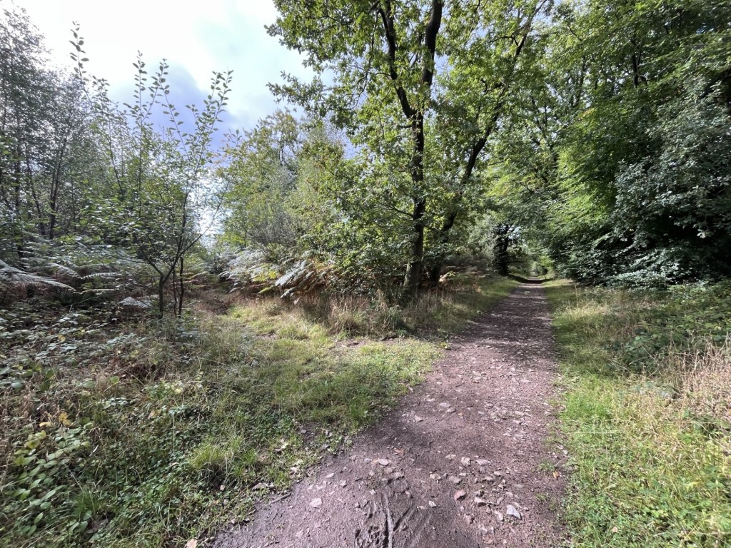
Setting off on a wide track to the west of the car park, all I needed to do was keep on going. The track rose gently. A car approached from the opposite direction, which suggested I could have driven closer to the top, but I needed the stretch.
After about a kilometre the track bore to the right. A few metres on a sign pointed into the woods and to Wentworth’s Ancestors? These were two low Bronze Age burial mounds lying in a small clearing in the woods.
The view from one Ancient (me) to another
I climbed to the top of the larger mound. It took three seconds. A moment to ponder what it all meant, but no answers came. Back on the track and what was indeed a road quickly deteriorated into a muddy puddled quagmire that would have certainly swallowed up my little Ford. I’d made a sensible decision.
The track met an unnamed road which I crossed and then into a large carpark with just one vehicle, looking slightly vulnerable. A wide track led on west, but I chose to take a smaller path just to the south, on the basis that it, rather than the track, appeared to continue heading gently upwards.
On the drive up there had been a point near where I had joined the Usk Road where a dramatic view had opened to the north towards the Brecon Beacons and most obviously Sugar Loaf, the distinctive peak that was responsible for all this endeavour in the first place (requires reading the introductory premise). Whilst the walk in the woods was nice, given that I was near the top of the hill, it was a slight disappointment to realise that there wasn’t going to be a similar view at some point. I guess that every tree is sacred, but still!
Another 100 metres on and a communication tower to the left, a good sign at any location that the top is nearby. The path was wooded on both sides and after another 200 metres I sensed that I must have been near, or at the top. I knew that a trig point was somewhere in the neighbourhood, but it wasn’t obvious. Scanning the surrounding thickets I eventually picked out what looked like something of a track leading into the woods just off the main path.
Left turn to the top
It wasn’t immediately obvious but having discovered the indistinct path I took the bait and then, stooping below the brambles, took careful steps through the undergrowth. Every so often flattened vegetation indicated others had recently passed through. Other Crest hunters, it seemed, had been here too.
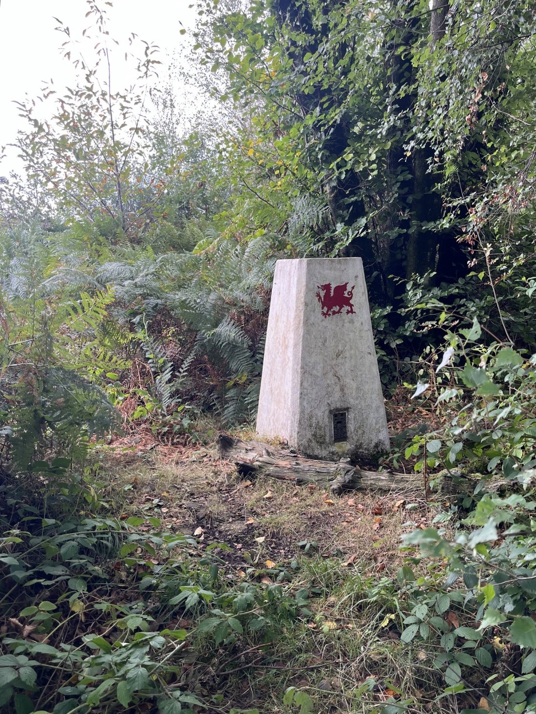
Within a minute or two I emerged into something of a clearing and there it was. The concrete trig point, painted white and with a red dragon to boot.

The trig in the woods
Any hope of a view here was dashed. The thickets and low trees continued into the distance.
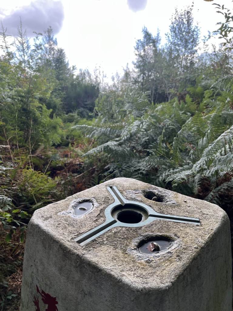
A restricted view
That said it was a serene spot, and the painted trig point an interesting feature. I have an old friend who spent much of his youth growing up in Newport. I sent a photo of the trig, asking him if he could guess where I was.
There was nothing more to do but return the way I had come. I was slightly relieved to emerge onto the path unseen by anyone else. It might have looked a bit odd. The big car park had gained another three or four vehicles in the time I had been to the top, and dog walkers were heading off in various directions.
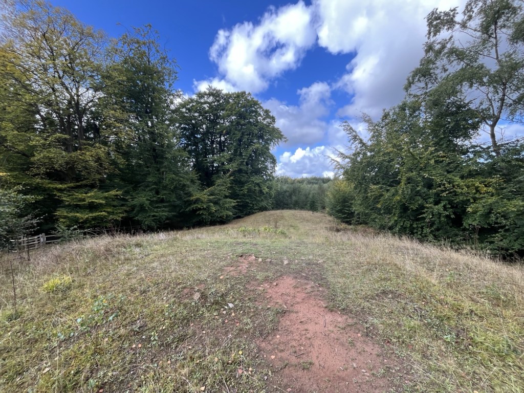
Just past the Ancient’s I noticed a break in the tree line and the entrance into what turned out to be a much bigger clearing than anything so far. Sun was occasionally breaking through the clouds. Walking down into the clearing a view of Newport, the Bristol Channel, and far beyond the north Somerset coast, shimmered between isolated tall pines. I stopped for a while to take it all in.
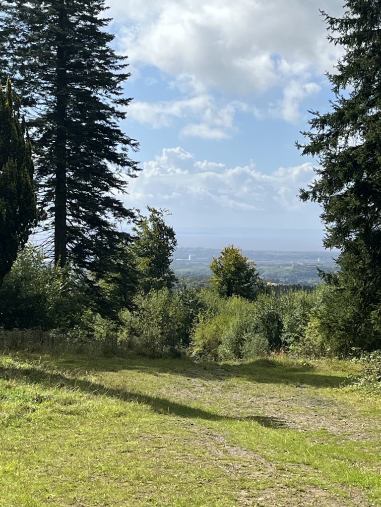
Glimpsing the county
I set off back to the car park, scanning between the trees for just one inch of a view to the north, but it never came.
Back in the car and taking off my boot, a ping announced an incoming text. It just said “Wales?”
I texted back. “If I said no? Well… yes. One-point smart arse.”
Perhaps unsurprisingly, a month on and he’s not replied.
The walk was just two miles, but this was a nice spot, and deeper into Autumn the trees will radiate here. Just a few miles to the west lies Blackwood, the home of the Manic’s. Sorry, any tenuous excuse!
