Cresting the County – Powys (Unitary Authority)

Pen y Fan

886 Metres

2970 feet

25th October 2025

A Second Chance

My word. What a place! Sometimes you just get very lucky and remain eternally grateful for a while after (well, make up your mind – is it eternal, or just for a while?).

Pen y Fan is the highest point in the Unitary Authority of Powys. It’s the twelfth highest county top in the UK and the highest point in southern Britain after the magnificent Cadair Idris, eighty odd miles to the north.

Friday night with my daughter and her partner J in Bristol, checking weather apps whilst scoffing down an excellent take-away curry, and losing yet again at Catan. “So, are we looking to climb Pen Y Fan tomorrow?” J asks. “Yeah,” my daughter responded, “we’ve been talking about it for years.” That was true, not least because I had been nagging away about it for, literally, years (nine to be precise). Nonetheless, with conflicting forecasts, the certainty that there was going to be a brisk cold wind directly from the north, and in the knowledge that they had both done it several times before, I was prepared to be pragmatic. “I’m entirely flexible,” I added. “Maybe we just see how it is in the morning and if it’s not looking that good, we do something else?”

“We’re doing Pen y Fan dad. Get over it.” That was me told. I slept badly that night.

*

But, before we get there, I need to rewind and explain why climbing Pen y Fan had become something of an obsession for me.

Friday the 11th of March 2016, I was about to leave a hotel room in Weston-Super-Mare after a couple of days seeing my daughter and walking the local coastline whilst using up untaken annual leave. I had a plan for the day. Pop over the Severn road bridge, head down the M4 and climb to the top of Pen y Fan before driving back to London.

My phone rings. It’s my son and he sounds frazzled. My daughter in law’s waters had broken the night before, and far too many weeks before the baby was due. There had been no space in the local hospitals premature baby unit, so options as far afield as Liverpool and other points hundreds of miles away had been talked of before, finally, she was being offered a fifty-mile ambulance drive to St Mary’s Hospital in Paddington. It had been a hideously stressful night and just listening to the events had me shaking in my boots. “What can I do?” I asked. My son was reassuring. Everything was being done and there was nothing I could do but get on with my day.

After we ended the conversation, I wasn’t so sure, but rationalised that there really was nothing I could do. I drove up the M5 to Bristol and with the London option still weighing heavily on my mind, I shook it off and went west and then over the big bridge. I can’t explain why the need to climb Pen y Fan was so strong and why it had to be then. For one thing, the idea of climbing county tops had never entered my head and wasn’t going to for another eight years. Maybe I had seen a programme on TV about it, or just that visiting Bristol on a regular basis after my daughter had moved there had seeded my thinking. Either way, climbing a mountain, instead of going straight home and fretting around the house, felt like a suitable distraction.

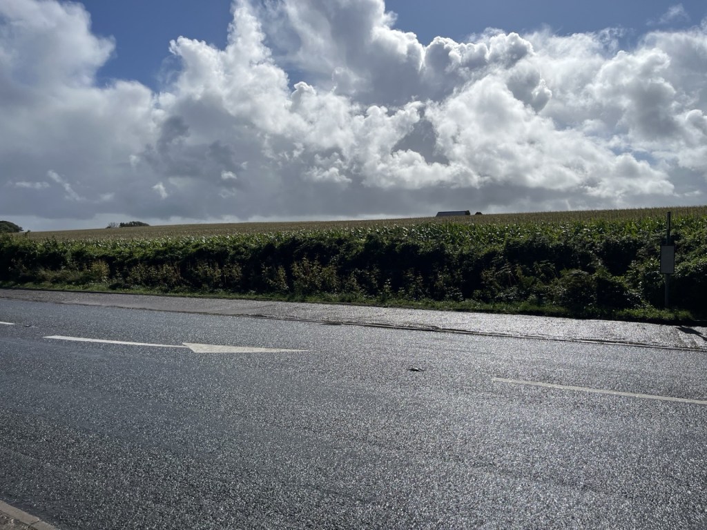
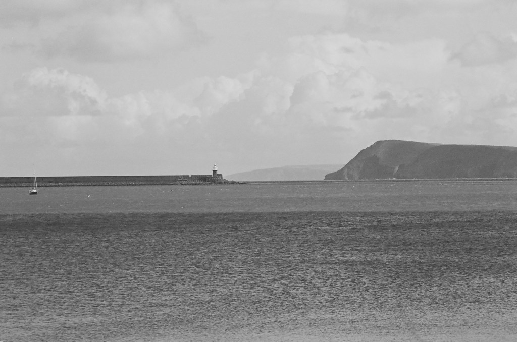
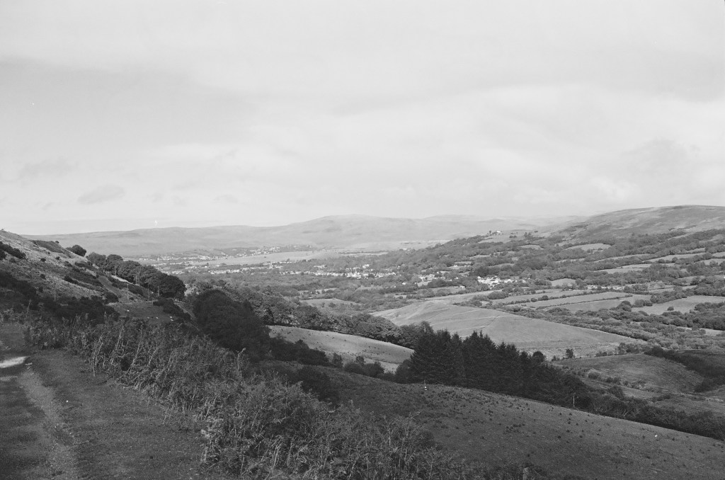
I drove up from Merthyr Tydfil and the valleys on the A470 and then into open countryside. The skies were cold winter blue, the land sparkling green. I had no idea what to expect, or pretty much where I was going, but sensing I was getting close I pulled up in a lay-by next to Beacons Reservoir, jumped out of the car and without any thought of whether or not I was in a good spot, or whether there was a more user friendly route to the top, I crossed the road, saw a footpath sign pointing over a wall towards open country, and was over without hesitation.

By the time I reached the first snow pockets I began to have doubts.

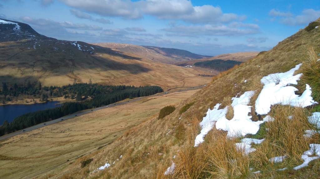
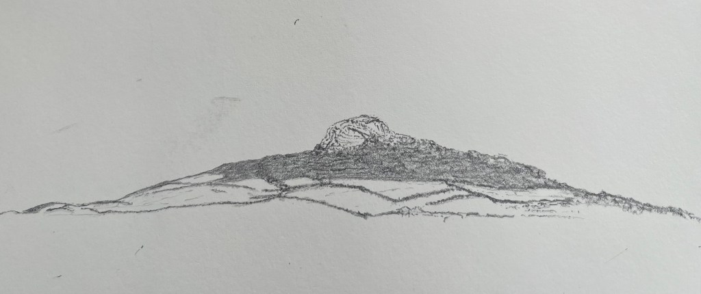
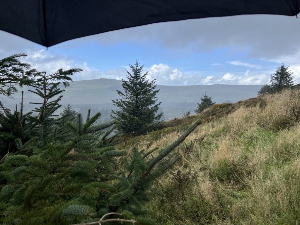
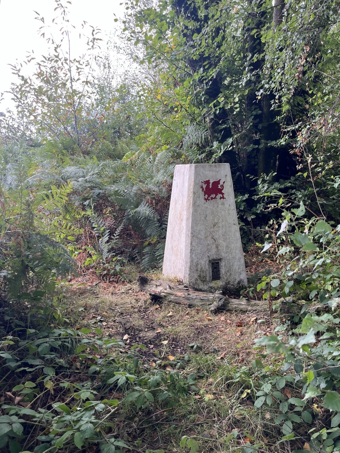
The lay of the land – March 2016

*

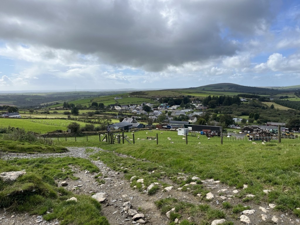
Back in the present, despite early morning rain the sun was making an effort to show off, and we bit the bullet. I drove (there is no significance in this other than if I read it again years from now, it will remind me that on the way back they both fell asleep) and instead of going all the way to Cardiff we headed off to Abergavenny before taking the majestic Head of the Valleys road west (my second experience of it in just over a month).

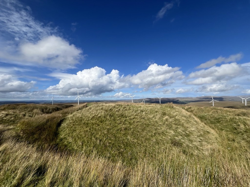
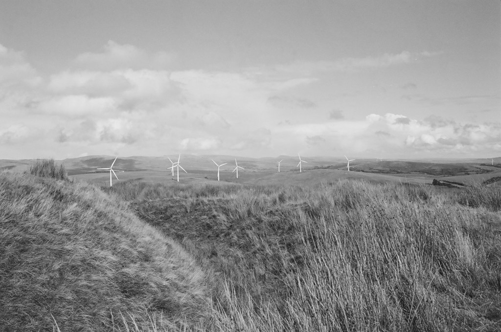
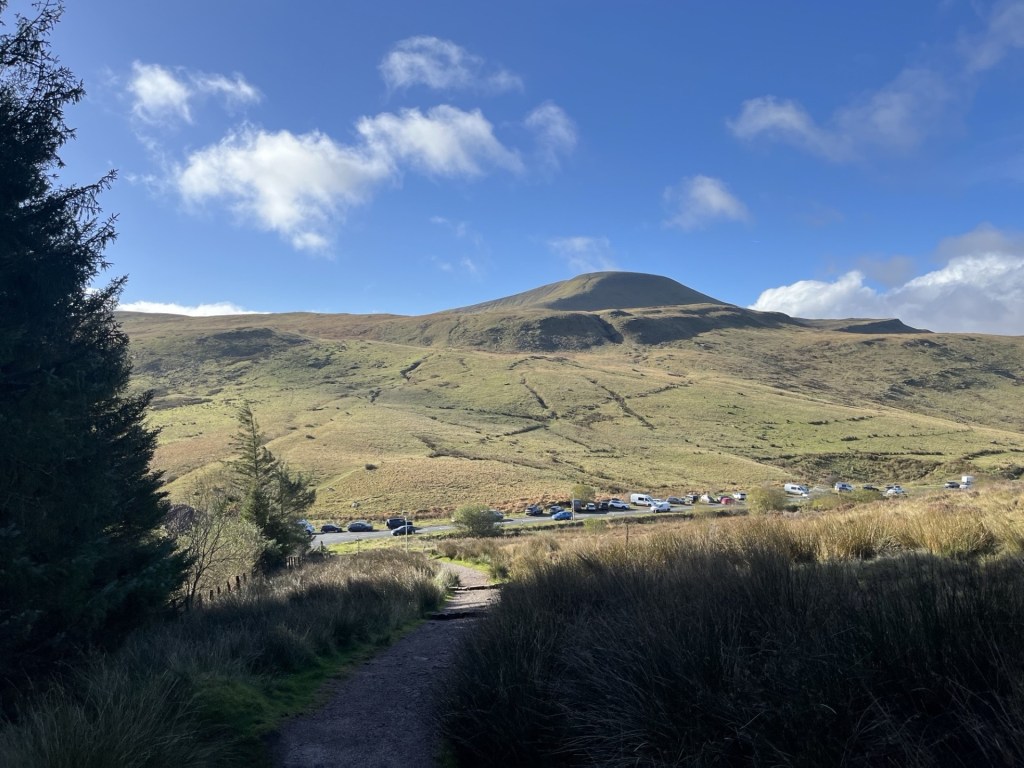
We arrived at the main National Trust car park and visitors centre at around 11:30, having passed the lay-by I had stopped at nine and a half years earlier. We were lucky to get a space and already streams of people were heading up and down the main trail which starts just to the south of the car park. Instead, we headed off on a flattish track (the Taff Trail) that took us north with the road and the impressive looking Fan Fawr mountain to the left, and a forestry plantation to the right. After a short while we were approaching the top of the pass where the A470 would start to descend towards Brecon, and past the Storey Arms Outdoor Activity Centre. This was the point where from now on the only way was up.

Looking west towards Fan Fawr. I was already panting Fawr air (no more puns.. Ed)

Due to the steep opening ascent, each faltering step started giving increasingly panoramic views of the surrounding landscape, particularly down the top of the Taff valley. The path underfoot was well trod and well-maintained, using slabs of the local stone, which, with the evidence of the alluvial waters in which they had formed millions of years ago indented on their surface, gave context to the surroundings.

After about fifteen minutes of this early lung breaker, we seemed to have reached a flatter section.

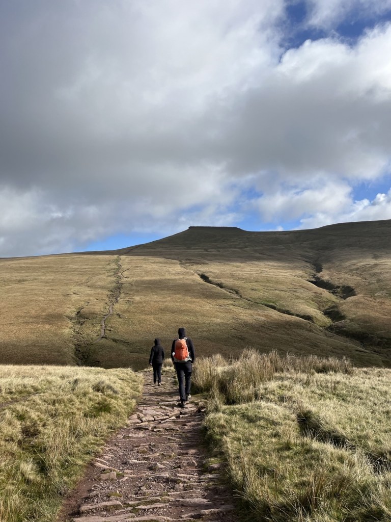
The kids, marching towards the top, or maybe not

For the first time it was possible to see to the top and a snaking path that headed directly (or possibly indirectly if you get my drift) to what I was assured was Pen y Fan. The only fly in the ointment, having made the initial effort to gain respectable elevation, was that the path was beginning to head back down. Don’t worry, I was assured, it only goes down a bit. Yeah, right!

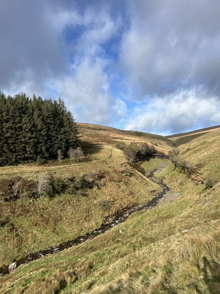
Sometime later, and having lost considerable elevation, we crossed over a mountain stream.

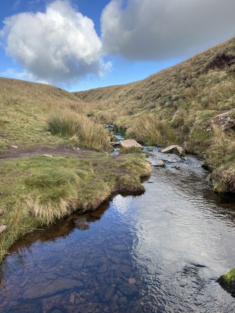
Crossing the mighty Blaen Taf Farw

To the south it was possible to watch a stream of people gaining altitude on the main path from the car park. It seemed to me that they had only just about left the car park, confirming we had managed to lose most of the elevation we had gained in the first heavy lift. As I stood in the middle of the stream mulling over the meaning of life, my daughter and J seemed to be taunting me from the bank, taking photos as if I were some sort of endangered species (these have been deleted).
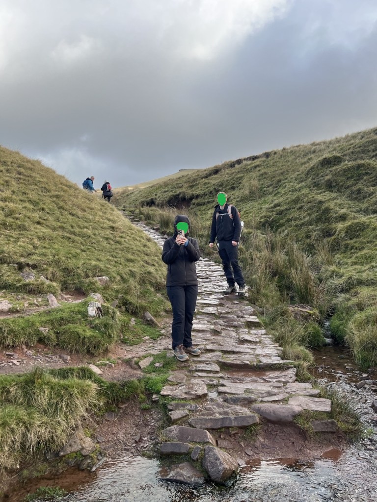
The paparazzi

Humph! Slogging on and straight up. Unremitting but at least the top was in view, seemingly quite close. There was a map consultation which I used as an excuse to slow down the ascent, and the truth was out. We were in fact looking at Corn Du, the slightly shorter twin peak to the east of Pen y Fan. Until now I had been putting one shaky leg beyond the other, head down and hoping it would all be over soon. Gazing now at Corn Du, a mere pretender, the little enthusiasm left in me started to ebb away. Even though it appeared to be in touching distance the stone path remained resolutely up. Don’t worry, I was reassured, Pen y Fan was just a short walk further on. It was time to trust in others, so on we (I) trudged.

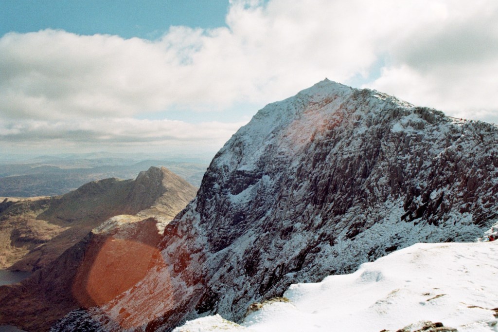
Another 500 metres went by, and with almost no warning we were standing at a point where Pen y Fan came into view and the land to the north of the path dropped away dramatically.

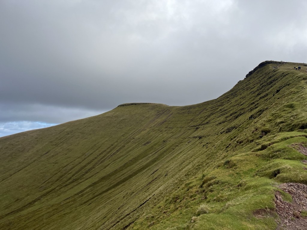
The first sight of Pen y Fan, with Corn Du in the foreground.

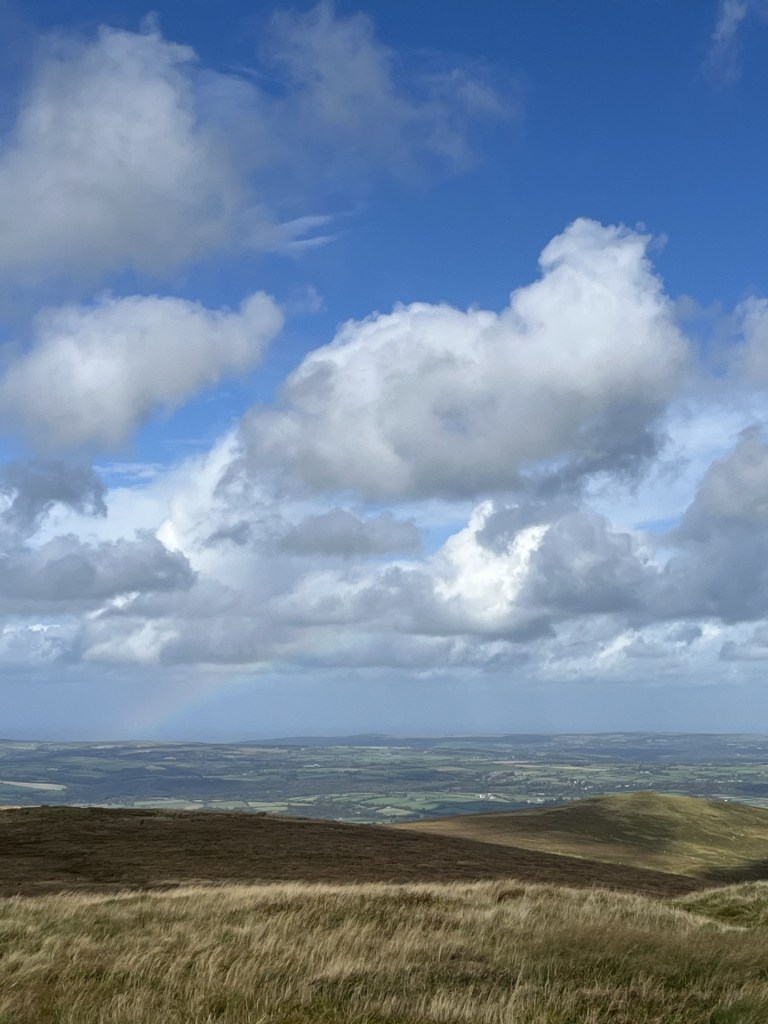
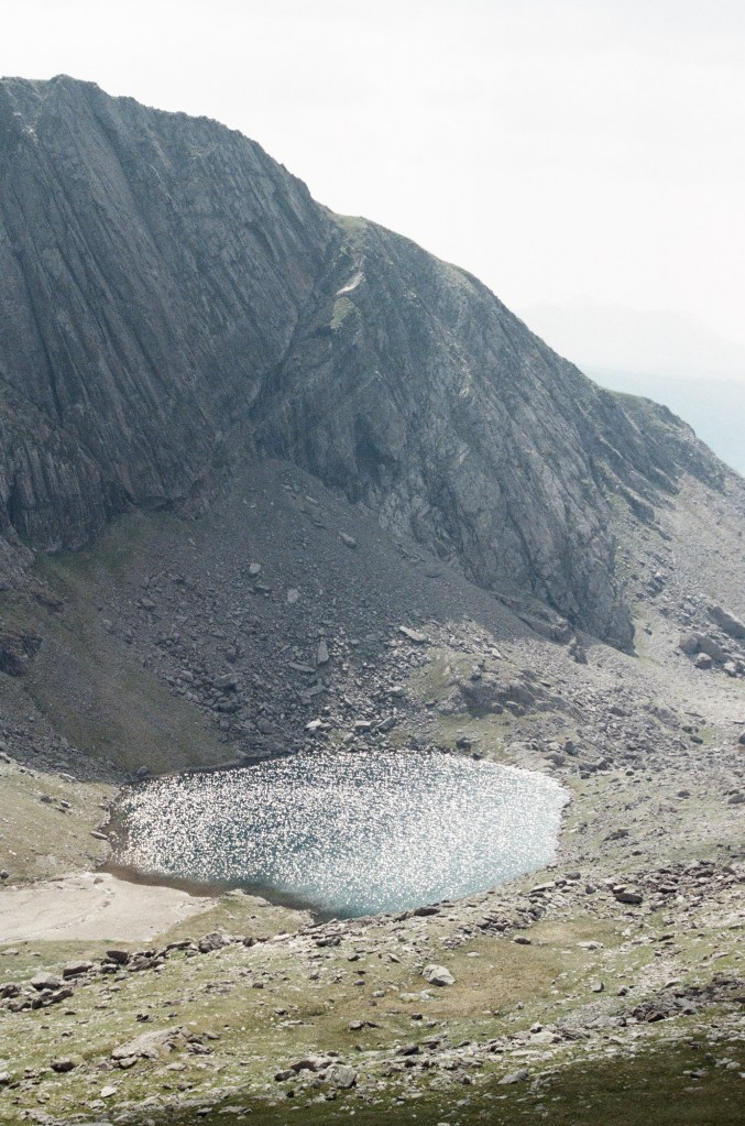
With this unexpected view, and the sheer drop down to a small corrie (the Welsh is Cwm) tucked under the mountain, a sense of validation began to return. That said, it took an age to complete the last 200 metres to the top of Corn Du. In my experience most mountains tend to ease off as you approach the top. Not here. Just short of the top of Corn Du we stopped and took the time to recuperate, take in the views and eat sandwiches. A rainbow had been developing far away towards Brecon. It was one of those days. Bright, very breezy but with scudding clouds menacing away directly from the Arctic. Time for some photos.

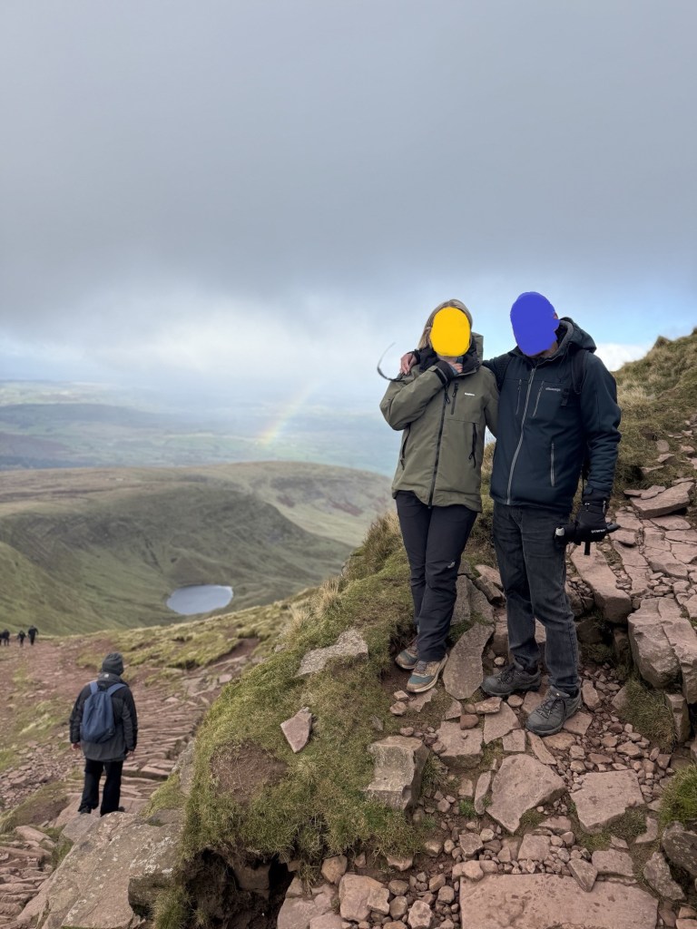
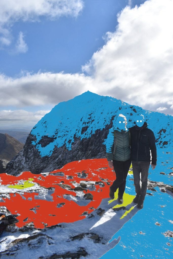
With the motivator on Corn Du with Llyn Cwm Llwch below

In the time it had taken to take this photo and grab another bite of cheese and pickle, the rainbow had suddenly shifted from what appeared to be the far distance to directly below, and almost magically issuing out and up from the corrie. Frantic scrabbling for phones followed by all around to grab the moment. A rainbow’s a rainbow – right? Ah! Not so….

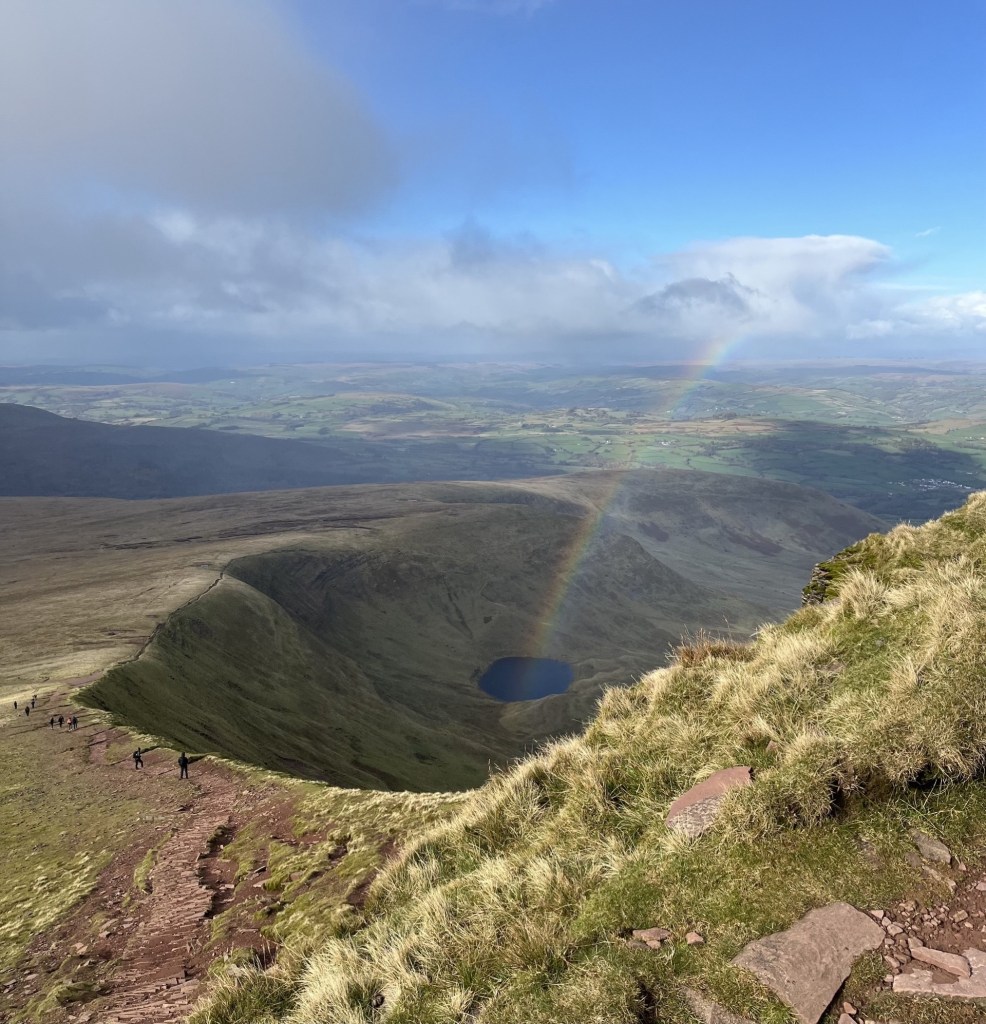
This is not AI generated and no filters have been applied. Just physics

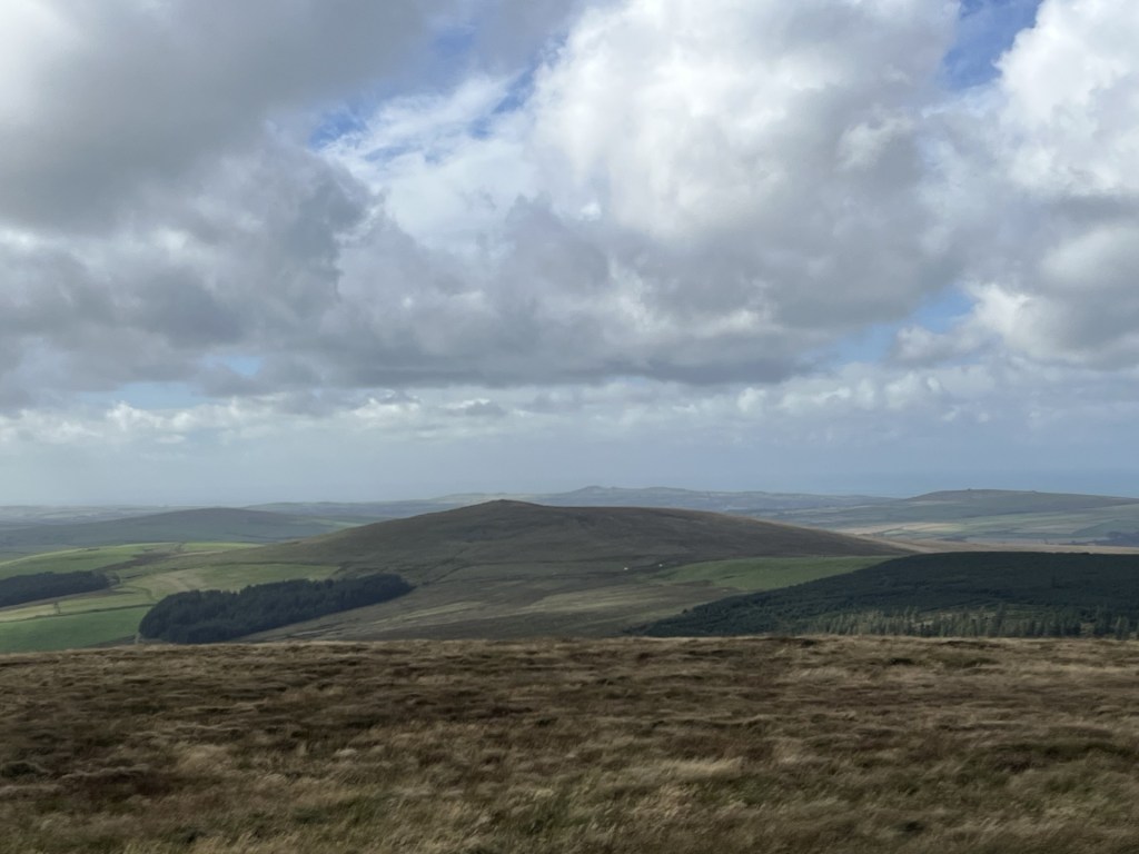
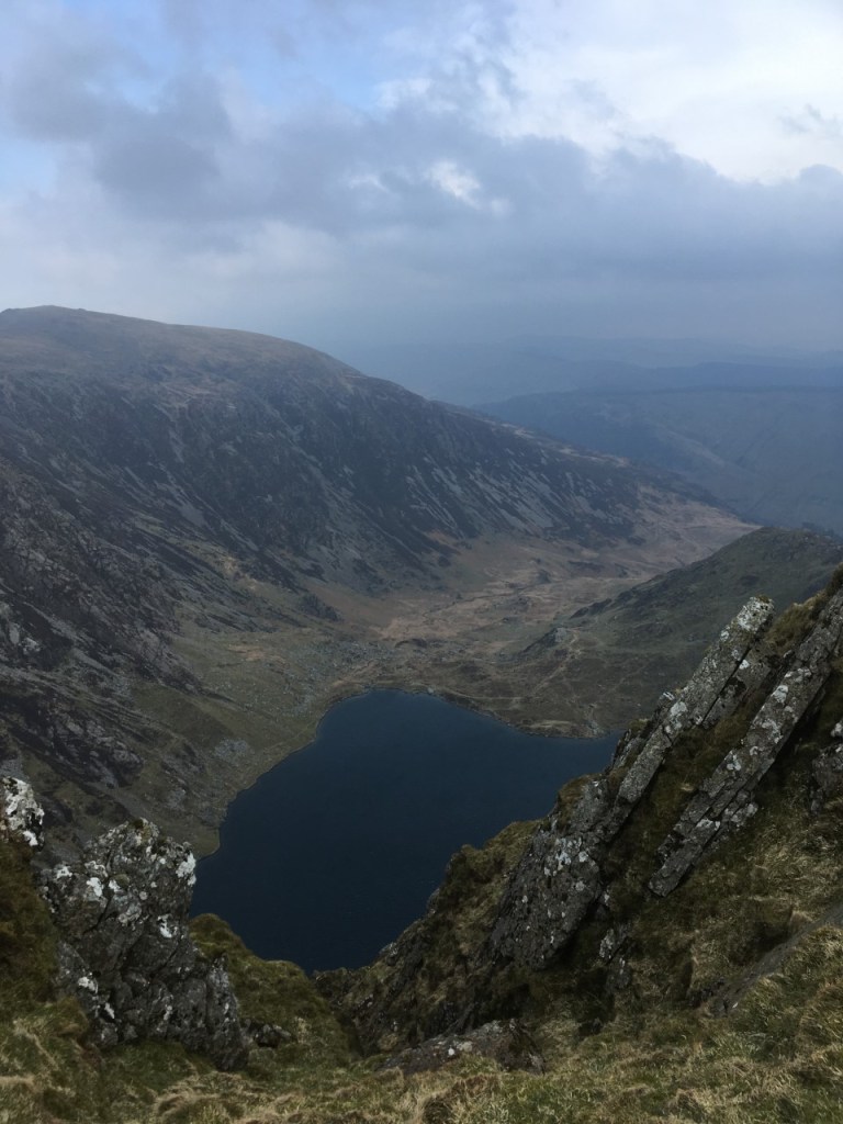
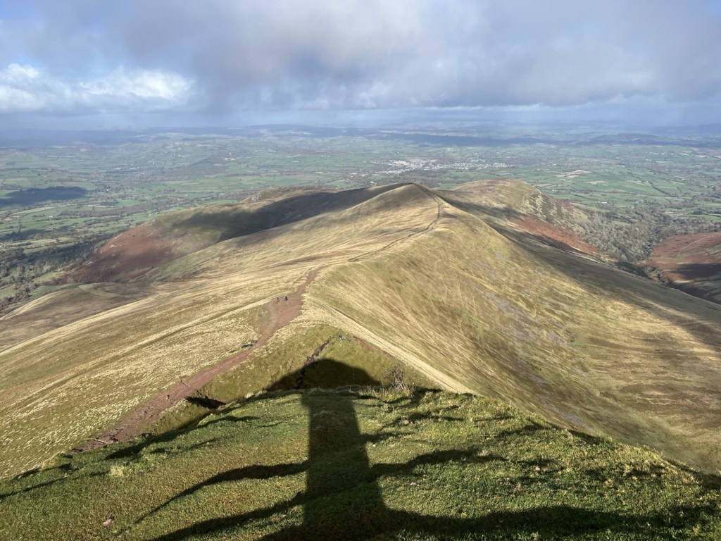
We carried on east along the high ridge, with plunging views to the north and a huge U-shaped valley disappearing to the south-east. J pointed out an abandoned reservoir further down the valley. Upper Neuadd Reservoir, empty for some years since faults had been found in the Victorian dam. J explained that they had climbed up from there a year or two before. It looked like a miniature wonderland but still showed as water bearing on the OS map. The views had me flipping out. Until we had reached the top of Corn Du, I hadn’t fully appreciated the landscape. It was a glacially shaped masterpiece, even more extraordinary in that it lies on a similar latitude to Luton.

Glacial delights and the remains of the Upper Neuadd Reservoir (left of centre)

Getting across the ridge and covering the 300 metres or so to the top of Pen y Fan was relatively civilised. A bit down and then a bit up. At the final up, as the increasingly violent northerly hurled itself across the rounded top, my game was up and finding a large stone slab, lay myself down on alluvial remains.

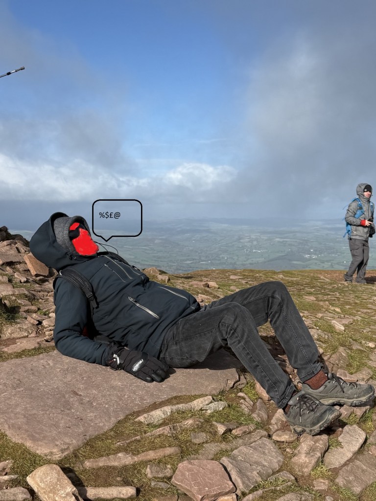
This sitting position is unique in nature.

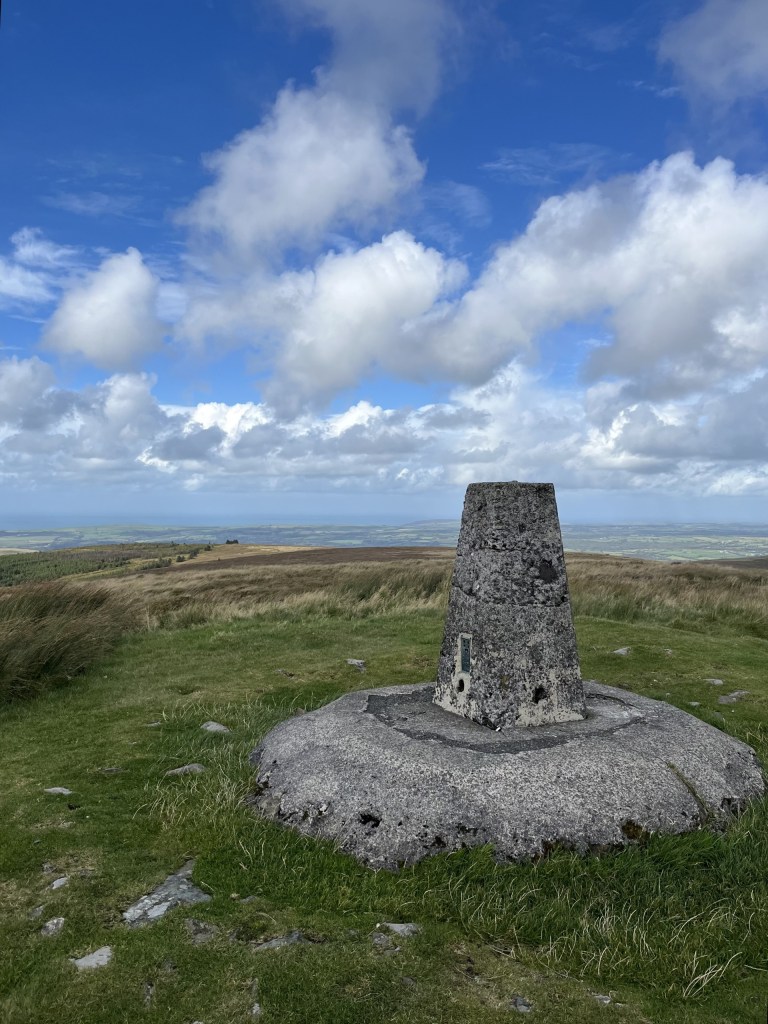
Once I had regained some composure, I crawled to the top for the obligatory victory photo (along with several dozen others doing the same).

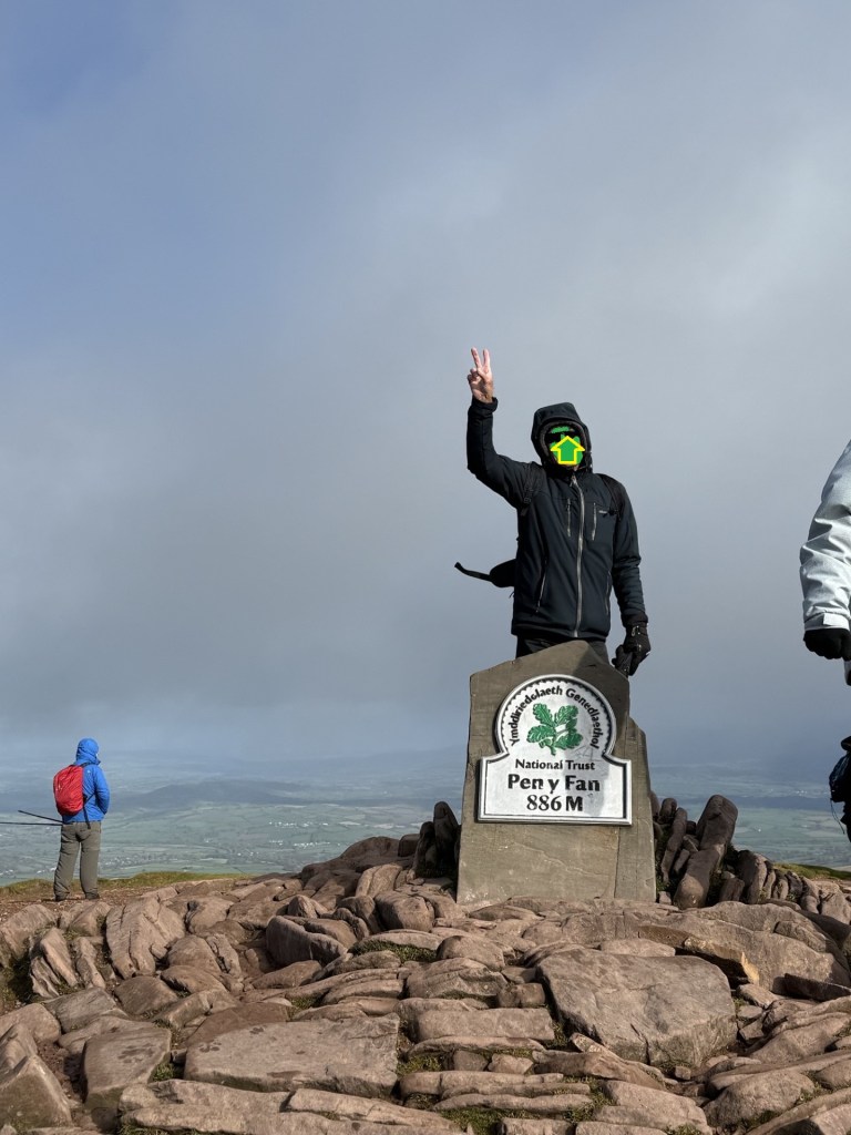
Time’s up – now clear off.

The views in all directions were outstanding. Powys is the biggest council area in Wales, and from what I could tell you could see most of it, along with most of the rest of Wales. More glaciated U-shaped valleys lined up to the east facing north.

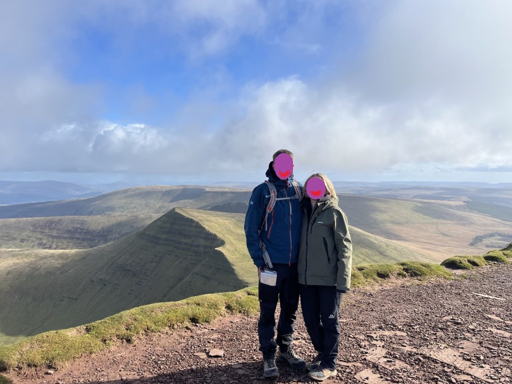
My compadres complimenting the unique landscape

Pointing towards Brecon and the whole of Wales, and 1500ft of elevation under the belt

After soaking up the moment we started back along the ridge towards Corn Du. An almost constant stream of people was moving in the opposite direction, and quite a few of them seemingly dressed for a different season. There is a Welsh joke and unprintable poem, that claims every Welsh person has been to the top of Pen y Fan. Obviously not true, but from the numbers making the journey it seemed to be a national ambition.

Instead of going back to the top of Corn Du we took the lower track to the south just below the summit. It was at this point, and just before we were about to emerge back onto another ridge, that the sun disappeared, the sky turned grey, and a furious hailstorm crashed in at too many miles an hour from the north. One look at the direction of assault was enough to tear lumps of skin off your face, and more than one other walker was reduced to tears. We hunkered down with our backs to the wind with just a few tufts of grass to give protection. It helped, and within a minute it was over. I stood and started to carry on walking. A mistake. As I emerged onto the ridge proper, a second and even more violent wave of ice bullets blasted into me. Having moments earlier sacrificed the relative security of the grass tufts there was no escape other than drift down the slope to the south. It made no difference and all I could do now was surrender to the moment. I stood with my back to the onslaught with hood up and completely accepting the conditions. I suppose knowing that it would be over in a minute or two helped, but in that moment, I don’t think I had ever felt so alive.

Counting hailstones

It went as quickly as it had arrived, and we took to the descent, observing the wreckage of humanity that had taken the full force and gathering their senses as they continued up. With a warm sun back in control it was a shame to be exiting the mountain, but you have to come down sooner or later. Halfway down a middle-aged man with some writing on his clothing trudged past us on the way up.

“I think that was Pen y Fan man,” J commented. Interesting, I thought, who was Pen y Fan man, I asked.

“Pen y Fan Dan. He climbs the mountain every day for charity.” *

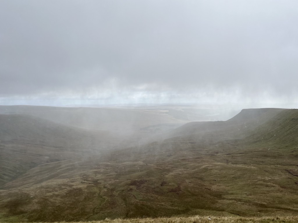
As we approached the bottom of the path a beautiful waterfall plunged down to our right and begged to be photographed.

The view of the waterfall as it should have been

The view of the waterfall as it actually was. Boy oh boy! A picture can paint a thousand words, and in that moment I had none.

It was a last chance to look south and back down the valley. Nearly ten years before I had climbed over a wall and began a yomp straight up the side of the steep slope leading up to the ridge south of Corn Du. I had no structured plan other than getting to the top and then heading north. Despite the early cold it had warmed up, and I was having to de-layer. Whether I was sweating due to the weather, or my advanced state of anxiety, I had no idea, but one thing was for sure; I was beginning to wonder what on earth I was trying to prove. Patches of snow began to appear. I was about two thirds of the way to the top, breathing heavily but still intent on reaching the ridge when a ping went off on my phone.

“They’re in St Mary’s hospital now.”

I looked around. It was a beautiful spot, but the text was all I needed to bring me back to my senses.

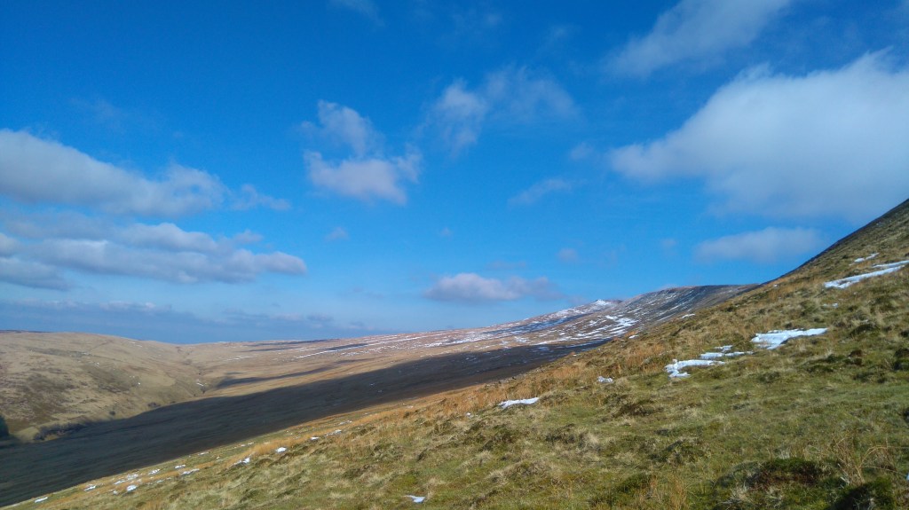
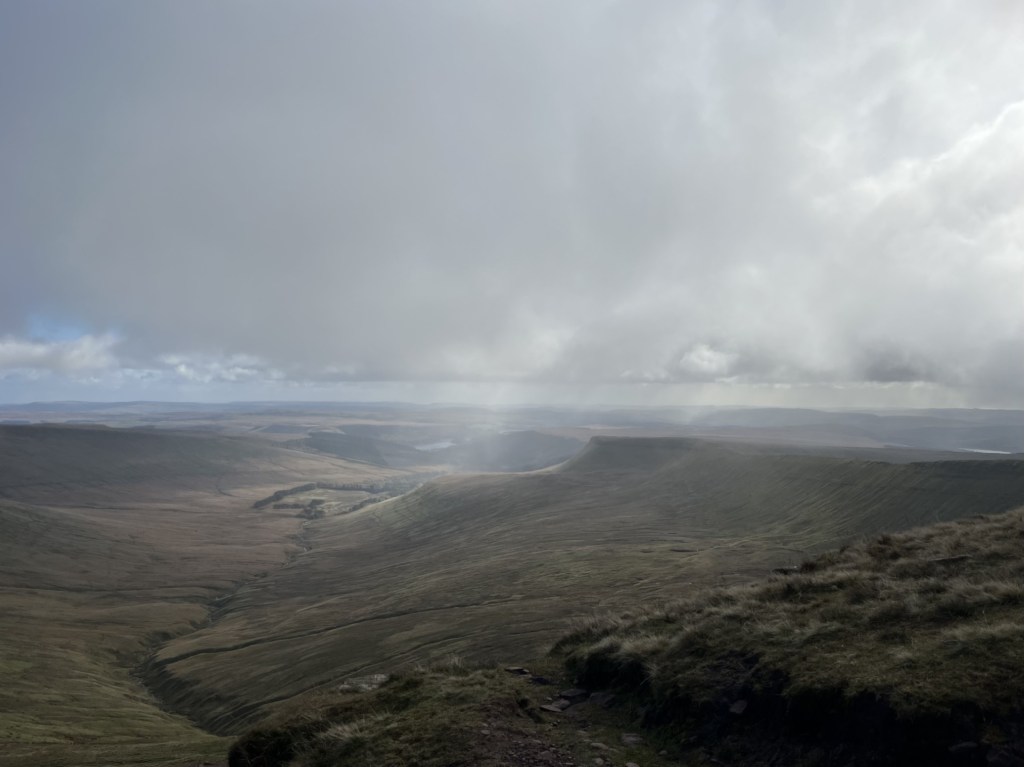
The point of reality and return – Corn Du in the distance. March 2016

I believe in the meditative power of walking, but also in the adage that there’s always another day. Pen y Fan was going to have to wait.

I scurried back down to the car and three and a half hours later was parking up outside the hospital on South Wharf Road, Paddington. It was my first encounter with pay by phone parking, which, in torrential rain, I spent twenty minutes painfully navigating through to the eventual point of payment (it’s funny how this little detail has stuck).

My daughter in law was in the best of hands, my son was looking exhausted and of course there really was nothing for me to do, but I knew I had made the right decision. Two weeks later my gorgeous granddaughter was born (it wasn’t easy either but that’s another story), and any thoughts of an immediate return to Powys were banished for some years. But hey, there really was to be another day, and what a day it had been.

* Pen y Fan Dan doesn’t just climb the mountain every day, he’s often doing it three times a day, for charity. I’d say that’s impressive, so here’s a link to his fundraiser.

https://www.justgiving.com/team/penyfan365

In answer to the question to myself at the start – Eternal, or memorable, just for a while? I won’t forget Pen y Fan, the views, the storm blast, the encouragement of my daughter and J, it’s significance to me as a grandparent and it’s shear glacial glory. I guess that makes it eternal.

Cresting the County – Vale of Glamorgan (Bro Morgannwg) – Unitary Authority

Tair Onnen

137 metres

449 feet

12th September 2025

Bus Stop Quandy

After five fascinating exploratory days in South, and south-west Wales, it was time to head home. I’d spent the last night in Cardigan, after climbing Foel Cwmcerwyn, the highest point in Pembrokeshire. Having checked into my accommodation I took a stroll along Cardigans attractive historic high street, then over the river Teifi and to the fine-looking Castle Inn.

So many old boozers have had their internal organs ripped from them, often resembling sanitised airport style cafes, that when you walk into one that looks like it hasn’t changed in a century, and hasn’t been illuminated up to the gunnels, it is barely believable. I ordered a pint and found a table and chair where, in an underlit snug, I could look out of an old window and across the waters.

It had been daylight when I had entered, but in the few minutes it had taken to purchase my beer and sit down the day had turned to night, and as if on cue the heavens had opened and rain was lashing down on the tidal swell. The movement of the dark water, where river and sea merged whilst gale fuelled rain pounded the surface, was mesmerising and I just sat and watched as behind me two young women caught up with their respective lives over pints of stout. In that moment all was right with the world.

I would have liked to have spent an hour or two mouching around Cardigan the following morning, but I had over 300 miles to drive and hadn’t taken the precaution of breaking the journey back. I was also planning to take a slight diversion from the main route and see if I could locate Tair Onnen, the highest point in the Vale of Glamorgan.

It’s highly likely that I took an entirely unnecessary long route along the lanes south and east of Cardigan, but I was in no rush, and it was almost traffic free quality countryside. I reached Carmarthen and continued down the A48 and then the M4. The blast furnace (now dormant) and steel works at Port Talbot dominated the view to the right for several miles. I once had a conversation with a friend about industrial buildings and brutalist urban landscapes. I think I was trying to suggest that there was almost always a strange beauty in nearly all things. She was having none of it and quoted some geezer who had famously (apparently) said something along the lines that if you see an ugly building, to save your soul, never look at it again. There is no doubt that Port Talbot, in any traditional sense, is as ugly an industrial stain on the landscape as you’ll find, but, like the tidal dance of the Afon Teifi, I have been mesmerised by it on the few occasions I have passed by. Today was no exception. If there had been a stopping opportunity, I would have spent some time trying to absorb it all, but there wasn’t and so I carried on south and then east to Bridgend, then leaving the M4 and rejoined the A48 towards Cowbridge. * 

Past Cowbridge the land gently undulated, with large fields (mainly stuffed with maize), to left and right. At a point where the road began to rise and swung slowly to the left, then to the right, I was visualising my location and knew I needed to be pulling over soon. Moments later a lay-by appeared on the left and I duly stopped. Looking across the road, I could see the field, recently ploughed, that held the county top (a distinctive farm building sitting proud on the skyline).

7 metres below the high point, just to the left of the farm building pictured on the ridge

I already had a predetermined plan of attack, based on earlier close inspection of the site on Google maps. I would walk east along the footpath at the side of the road until I reached the end of the field, hope to find a footpath to the top, take a snap of the trig point and then head back the way I had come. I had factored in a 15-minute walk.

I got out of the car with the intention of getting my walking boots from the boot (English doesn’t make any sense sometimes), but before getting to that point I took a longer look around. As I surveyed the landscape and surroundings, bit by bit my confidence began to stutter. The most obvious issue was that the field appeared to be much larger than it had seemed on Google maps (which of course it blooming was). The road stretched away into the distance, as did the field. Based on the visual evidence it felt like any attempt would take at least 30 minutes.

I had also been under an assumption, based on what I had seen on Google maps, that there would be a pavement along the side of the road which would enable safe and swift movement. The reality on the ground was a sad disappointment. There was no pavement on either side of the road, and whilst there was a verge, it was lumpy, uneven and soaking wet. Essentially, given the flow of traffic, it was looking like an unexpectedly high-risk venture.

Stranded at the bus stop

Along with the distance and roadside dynamics, whilst it was a reasonably large stopping area, it doubled up as a bus stop, and I wasn’t too comfortable with the idea of leaving the car for too long.

Without any pavement, this, and the bus stop opposite, were hideously dangerous to access for any pedestrians.

There was one last and obvious disincentive. The weather. Even if I had been prepared to risk life and limb clinging to the edge of the highway, in the half hope of finding a path further down the road than I had originally anticipated and taking a risk that the car would survive unattended, the chances of making it without a serious soaking looked almost nil. I still had 200 miles to go, and I intended to do it dry.

Foresters Lodge bus stop. Two buses an hour!! Who for?

After reading the bus timetable (there appeared to be a reasonable service) I took another look around. I wondered how on earth anyone could access this and the stop on the other side of the road, without running the risk of serious harm. A thick hedgerow backed onto the stop and ran in either direction for twenty to thirty metres, and with nothing other than a rough strip of lumpy grass between it and the 60 mile an hour A48. It didn’t look like a location that would necessarily generate a lot of potential passengers, but if I was a parent and had a child who relied on the bus to get to and from school I would be freaking out every time they set off.  I guessed that the only safe way to get to the stop would be by car (the irony).

As I returned to the car, a single decker bus shot by. It made no attempt to stop. To be fair I hadn’t hailed it, and the driver might have put two and two together vis a vis the stationary car, but how could he or she have known for sure? I drove off and was soon on the outskirts of Cardiff. A ring road took me north and onto the M4, where the traffic ground to a halt. I should have been able to get back the River Severn and across the bridge in just over thirty minutes, but it was well past Newport before the traffic began to ease. An hour and forty-five minutes to do the 33 miles. A couple of years ago the Welsh government managed to annoy a whole lot of Welsh people, and even more English people with no skin in the game, by reducing the speed limits in many urban, town and village settings to 20 miles an hour. Anyone would have thought the French had invaded. I’m not sure if the person who owns that expensive electric vehicle company chipped in but it’s exactly the sort of thing he would have.

I had just spent five days in Wales, avoiding where possible the M4, and by and large driving on rural A and B roads. I passed through many settlements of varying size and discovered that these pesky 20 mile an hour limits caused, well, they caused almost no inconvenience at all. There was one small town deep in the country where I did think that the speed limit extended an unreasonable distance but overall, I genuinely couldn’t work out what the fuss was about. Having lived in London when the 20 mile an hour limit was widely introduced, I am possibly more relaxed about it, but what a lot of hot air over almost nothing. So, having taken an hour and forty-five minutes to go just over thirty miles on Wales’s premier motorway, with no obvious sign of roadworks or accident, the irony that I had averaged just 20 miles an hour throughout was not lost.

I have strayed too far. What was the subject again? Ah, reaching the highest point in the Vale of Glamorgan. ** Well, I didn’t make it to the top of the county, but I could see it from the road, and that’s probably the best I could have done under the circumstances. Taking a look on Google maps I have since realised that there was another bus stop about 300 metres to the east at the end of the field. A sign on the opposite side of the road points to a footpath. Whether or not the path went to the trig point or just flanked the field I have not been able to determine, but what Google does show is that just over the brow of the hill, and facing south towards the Bristol Channel there is a large area of land covered in solar panels. A solar farm, I guess. I think I would have liked to have seen that. Oh well, another time (you’re kidding!).  ***

PS. Just over a month on, and before I had finally finished off this account, I was flicking through the December 2025 edition of TRAIL – a climbing and hiking magazine that my daughters partner gets monthly. Towards the middle there’s a two-page feature called “High and Low’s – 10 of the most curious County Tops”. Apart from being flattened by the fact that the whole county tops thing seems to have gone stratospheric, more astonishingly I had done four of the ten referenced, including, and this really knocked me for six, the Hill with No Name – The Top of The Vale of Glamorgan, along with an image taken from an OS map. For copyright reasons I won’t quote the short article, but the author noted that annoyingly, there’s no public access.

* I prefer a quote I have found by Matt Haig which reads – “If you think something is ugly, look harder.”

** I have since discovered that apart from the Vale of Glamorgan, there is no such place as Glamorgan. That has come as quite a shock. The old county of Glamorgan, or, Glamorganshire, covered most of south Wales. When I was a kid, I remember watching, in black and white, and probably on the news, one of the most amazing moments in the history of sport. Never mind Leicester winning the Premier League in 2016 or Gordon Banks save against Pele, when Gary Sobers, the then captain of Nottinghamshire County Cricket Club, hit six sixes off Glamorganshire’s bowler Malcolm Nash in one over at Glamorgan’s ground in nearby Swansea, no-one in the history of cricket had ever seen anything like it before. And it was on TV! On the BBC! On terrestrial TV! And it was free! And it’s still on YouTube! Gawd bless yer Aunty.

*** Just in case you feel a bit let down by this account and need to know more about how to reach Tair Onnen – the main man – Richard Gower has provided this helpful guide (should have read it first – doh!), though according to TRAIL, it’s inaccessible!!!

https://www.richardgower.com/blog/taironen

Cresting the County – Pembrokeshire (Sir Benfro)

Foel Cwmcerwyn

Metres 536

Feet 1759

11th September 2025

Rosebush Village Limits

Day four of five in the far south-west of Wales. I had been staying for three nights in St David’s, an international attraction for walkers, pilgrims and casual visitors to its ancient Cathedral. Givin its popularity I had reluctantly paid a small fortune for the privilege of a bed in the cheapest room left in town – a Premier Inn. The weather had been just about as bad as it could have been for the time of year, with the almost relentless rain gusting in at speed from the Atlantic being some sort of revenge for the relentlessly hot, dry summer. On opening the blackout curtains and peering out through the three-inch-thick double glazing, the sky was blue, and early sunshine bathed a distant hill beyond the rugby posts on the nearby recreation ground.

Carn Llidi Tor from the Premier Inn St David’s – weather conditions indeterminate

The previous evening, after being unsuccessful in getting a seat at either of the two snug olde-wordle looking pubs, I retreated to an alternative in a back street to have a quick pint before returning to the hotel. As I sat nursing a freezing cold drink that called itself a “bitter” a middle-aged American couple entered the empty saloon bar, where they stood for a minute or so. The woman who had served me was yacking away with punters in the public bar. It struck me that it might not have been the sort of place the couple were expecting, but if you’ve come 3000 miles on a pilgrimage, needs must.  “We’re trying to book in,” the man said to the woman, after she eventually emerged from the public bar to cater to them.

After checking in and receiving the keys the couple went upstairs, at which point the woman who had served them slipped back into the public bar and proceeded to mock the man’s use of English. ‘” We’re trying to book in”, he says. “We’re trying to book in!” What does he mean, we’re trying to book in?”’ There was some laughter from the locals. I proceeded to carry on reading my old paperback. Ten minutes later the man came back into the bar. The woman went over to him. His wife, he explained, had noticed black mould around the shower. Was this normal and could be cleaned off? At this, instead of expressing empathy to her “guest” who, given he was from the States, may never have seen classic British bathroom black mould, the woman started a long, possibly rehearsed, load of nonsense about the rooms being cleaned down thoroughly every day and that no matter what they did it was impossible to remove. In an almost absurd escalation in the excuse stakes she then went on to explain that they could renew the putty every week, but the mould would be back the next day. That she had used the word “putty” nearly had me snorting into my beer, but apart from that it was an appalling example of how to overwhelm your victim (sorry – guest) through bluster, misinformation and subtle sarcasm. Distracted by this interaction I had stopped reading my book – ironically The Quiet American. The poor man had no effective retaliation in his armoury. Somewhat humiliated, and in the knowledge that he was going to have to go back and explain all this to his disappointed partner, he merely mumbled that “he guessed that was all that could be done then” and retreated sadly towards the stairs, head down. The quiet American alright!

I may have stayed for a second pint, but I didn’t. As soon as the man had disappeared upstairs, I could hear the woman in the other bar repeating almost word for word to the other customers what she had told him. There was some more laughter. I supped up and left. *

The reason I mention this is that the next day, and halfway up Foel Cwmcerwyn (the highest point in Pembrokeshire) I kept thinking about it, every so often shaking my head and wondering about the state of things, and indeed what she might have said to the other punters about me after I had left. ‘”A pint of bitter, please. Please, what does he mean by please?”’  Too late to worry about it now.

I had left St David’s and headed out of town on the north Pembrokeshire coast road. Past the Blue Lagoon at Abereiddy, the charming little post-industrial village of Porthgain and the pretty village of Trefin. The day before I had given up on any walking ambitions and had stopped the car in Trefin seeking refuge in the Ship Inn for an hour until an almost apocryphal downpour had stopped as quickly as it had started, after which I was at last able to go back the way I had come and finally check out some of the hidden gems.

Above Porthgain

Porthgain – the harbour. The two people on the bench are, like me, trying to work out how the car is going to exit. On the horizon the Fishguard the Rosslare ferry battles against the elements

The Blue Lagoon. I wasn’t tempted

Beyond the Blue Lagoon at Abereiddy

Despite almost persistent rain and gale force winds over the previous two days (these photos deceive), I had managed to squeeze in some short walks along parts of the coastal path. Bracing, soaking but also delightful, with huge Atlantic waves smashing into the igneous and sandstone ramparts defending the rolling hinterland, it was a place that screamed “come back.”

With one night left in Wales, the evening before I had booked a room in Cardigan, situated to the north. Foel Cwmcerwyn was, with a bit of a diversion, on route and in the heart of the Preseli hills of Stonehenge fame (arguably). I reached Fishguard midmorning. The weather forecast was ambiguous, but for the moment it was warm, windy and bright and I decided to stop and find somewhere to eat. I can’t tell you about the initial attempt to park in a pay by phone car park because it’s too painful to recount, but if you want to get close to how I felt I can recommend reading my related accounts of similar experiences with the same service provider in West Sussex and Oxfordshire. Needless to say, it was hideous in extremis. After a brief interaction with a local man who recognising my unstable condition and gave me some profound words of advice, I gave up.  Minutes later I discovered an entirely free car park just a few metres further down the bay.

Fishguard – Gateway to the Republic, and the EU, from the free car park

Tempting as it was to stay a while and look out into the bay for the chance of spotting the odd seal pop its head above the surface, I had to crack on. I left Fishguard on the A4313 heading inland and east through picturesque country. I reached the village of Rosebush at around 2pm and found a small car park just past the old railway station (more later).

To reach the top of Foel Cwmcerwyn I had to work my way up to the north-east. I had a rough idea of my route but after an abortive meander north along the line of the dismantled quarry railway I backtracked to the car park and climbed back into the car. Heavy downpours were visibly operating in the area, and one was threatening now. I knew there was a chance I’d get caught out at some point, but who needed a drowning at the get go? The shower somehow missed Rosebush. Once I was reasonably satisfied that I was in the clear for a bit, I walked up to some cottages and then onto a signed footpath that led steeply up past some farm buildings and then through a large field. **

By the time I had climbed to the top of the field, I was, to put it mildly, knackered. It wasn’t a good start, but I figured I’d got the tough bit out of the way, and now on a more significant track with impressive views opening up in every direction, my motivation returned.

On track, after the initial lung buster. Looking down on Rosebush

I’ve already mentioned that the weather forecast was ambiguous, by which I mean that it predicted a lot of rain at any moment and very strong winds. I had come fairly well prepared, but now in hot sunshine, and walking resolutely up the well-trod track, I was beginning to wonder if I had overdone it. Looking south a vast battleship grey cloud shedding its load was engulfing a large industrial structure (presumably Milford Haven) dozens of miles away. Already the views were impressive, but so too were the weather systems steaming in from the Atlantic.

The track maintained a steady course heading north-east and on a reasonably tolerable gradient. Soon forestry plantations appeared on the left, and sweeping views opened up down the lush valley to the right.

Towards the forest

Towards the rest of South Wales and storm alley.

Up until this point I had been the only person on the path, but now, coming down in my direction, a couple appeared on mountain bikes. They stopped and we spoke for a bit. Like me they were from the South-East, although a decade or two younger. The man was on a bike fitted with a battery, although I wasn’t so sure the woman was. We talked a bit about cycling (me admitting I was running out of enthusiasm), and by the time we had said our farewells, I was pretty much sold on the idea of battery power. We’ll see.

I carried on across boggy ground before more trees appeared to the left, and the gradient started to increase again. Beyond the trees the wind suddenly hit me like a brick. I made it to a wooden gate which would take me onto the open hillside. Here the path steepened significantly (the cyclists had warned me although I’d been sceptical). Now tip toeing up, the wind battered me from behind, bizarrely hindering rather than assisting progress. It took about ten minutes to wearily trapeze the final couple of hundred metres to the trig point at the top. I knew it was going to be there, and with each step I relished the prospect of being able to hunker down behind it to give some respite from the gale.

So, on arrival, and finding a group of four other intrepids completely surrounding the concrete structure, my little heart sank. All I could do was loiter around for a bit in the hope they would move on, although that didn’t seem likely given their insatiable need for selfies and group photos (I didn’t begrudge them doing it, given it was an achievement worth recording, but I was a good three decades older and feeling like I’d been sandblasted). Thankfully, after some minutes, they departed in the direction of Rosebush, and I was at last able to grab hold of the trig point and stabilise my condition. The views in all directions were magnificent. Here, at the top of Foel Cwmcerwyn I could see the whole of Pembrokeshire and beyond to Cardigan Bay. To the far west the Rosslare ferry was slipping out of the safety of Fishguard harbour and smashing itself directly into the wild wind and waves of the Irish Sea. Now able to stand reasonably steady I took a few photos that probably don’t do the view justice.

A wild westerly and the resolute Trig

Rainbow over Cardigan Bay

So far, I had been lucky. Rain clouds were dotted around in every direction. It was time to head back. Launching down the path was like trying to walk into a wind tunnel. Without gravity I’d never have made it down to the gate. Beyond the gate the trees once again gave cover, and I was proceeding at a reasonable pace. Now more relaxed I was able to get a better appreciation of the views down the valley and beyond towards south Wales proper.

Towards south-west Pembrokeshire

I stopped for a bit to take in the dramatic view. A farmer on a quad bike was heading up the slopes and corralling a long line of white dots from one field to another. The commotion had spooked three horses that were now galloping away under sun and shadow.

Cantering on the range

By the time I reached the end of the plantations to my right, I was becoming increasingly concerned by a large looming mass of dark cloud scudding towards my position, and with my name on it. I had nearly caught up with the gang of four who had earlier been hovering back at the trig point. A footpath led west along the edge of the forest. There were two options. Take the path under some tree cover or continue down across the large and exposed field above Pant Mawr farm. I chose the path with the trees. The others chose the field.

Large drops of rain began to fall. Sadly, the isolated tree cover was less than useless so I was forced into a light jog until, on the slopes above the old quarry, I found a large well leafed tree that offered more protection from what was by now an epic deluge. Fortuitously I had packed a small umbrella, which was deployed to surprisingly good effect.

Unaccountably well prepared

The lashing quickly passed, and I headed on down the lumpy and sodden ground to the route of the old quarry access road and railway line.

Slate heaps after the rain

By the time I reached the community run pub at the old station (Tafarn Sinc) I’d walked exactly four miles. Along with the wind and rain it had felt a lot longer but had been worth every step. I’d found a part of Wales off the beaten track, but with a great walk leading to impressive views of the south-west and Pembrokeshire .

I took my coffee out to the open terrace. A small garden area led to where the tracks had once been, and beyond the remains (or possible recreation) of a platform. Three plastic dummies, dressed in period working-class clothing had been assembled, presumably to remind us how it must have been for passengers back in the day. The intense and distant stare on the face of the woman suggested it had been thoroughly miserable, yet despite the passage of time, relative prosperity and different clothes, that look is still familiar on most station platforms today.

A distant echo

As I drove away from Rosebush and towards Cardigan, with the wind still whipping around the nearby trees, the news on the radio announced the end of a political storm that had been brewing away for days across the Atlantic. Peter Mandelson had been sacked.

* I ought to own up here. Whilst I really was appalled by the bar woman’s behaviour towards her American guests, a few weeks earlier I had met up with a very old friend in a small town in the Peloponnese. I was staying in the town, and he was passing through in his camper van. As we sat outside a taverna waiting for food and observing a mink casually saunter up the road on the prowl for anything that moved, I mentioned the sequence of wildlife sounds that had been routinely waking me up in my room every morning. Starting with a crescendo of sparrow chirping around six, followed minutes after that by the sound of a mouse running backwards and forwards in the ceiling space above my bed (it might have been a rat, but I wasn’t prepared to countenance that possibility), and then finally the cicada’s early morning conversations.

The mention of the mouse took my friend back fifty years to a distant moment in time when he had worked at the Waldorf Hotel in London in the mid-1970s. He explained that for a time he had been the night manager and that the worst part of that role was the almost nightly complaints from new American guests about the sound of mice in their room. My friend is one of the funniest people I have ever known, so it was no great surprise that over the next ten minutes he rolled out a long list of all the excuses that the night manager was expected to respond with under these circumstances, and that by the end I was on the floor in hysterics. Without going into specifics, the essential aim was to express immediate and incomprehensible dismay (“A mouse sir! Surely you’re mistaken.”), that the possibility of a mouse in the Waldorf was an impossibility in modern 1970s Britain, that perhaps sirs wife had oversensitive hearing, or that they may have been confused by another source of the noise, or even whether it might have been possible that the guests had brought the mouse into the hotel in their hand baggage. Only in the last resort would a room change be agreed. Of course, it was the 1970s, and not just the Waldorf, but almost every structure in the whole of London was riddled with mice.  

** Not visible at ground level, but when I looked at the area around Rosebush on Google earth, I noticed what appeared to be huge letters spelling the word CAWS in the tree plantation just to the east of the cottages. Surely my eyes were deceived. Well, a bit of research and sure enough, around twenty years ago the local farm, which produces its own cheese, planted a large number of conifers that do indeed spell CAWS, which apparently is the Welsh for “cheese”. Smile! Here’s a free ad for them.

https://pantmawrcheeses.co.uk/

Cresting the County – Swansea Unitary Authority (Abertawe)

Mynydd Y Betwys – Penlle’r Castell

Metres 373

Feet 1224

8th September 2025

On the Road to Mynydd Y Betwys

I’d started the day in Chepstow and by the late morning had undertaken a short one mile walk to the top of Newport Unitary Authority (or County depending on your cup of tea). By the end of the day, I hoped to be in St David’s in the very south-west of Wales, an area of the mainland completely new to me.

South Wales is festooned with Unitary Authorities (also known as Principal Authorities in Wales – yeah, I know, I’m learning this stuff as I’m going alone). Twelve at least. From what I can tell most of these fall within the footprint of the old county of Glamorgan. Given my stay was just a handful of days I had to be realistic about what I could achieve. I plumped on one more on my way to Pembrokeshire.

Leaving Wentwood forest to the north-east of Newport I headed up to Usk, an attractive small Georgian town with its very own well designed but slightly incongruous, Victorian prison. Past Usk and in need of a refreshment, I stopped at the Chainbridge Inn on the banks of the River Usk, adjacent to its namesake bridge (built in 1906 and not a chain bridge!). 

The chain bridge, in black and white. In colour it’s an oddly attractive pastel green.

Rehydrated I carried on to Abergavenny then onto the A465 and the revelation that is the Head of the Valley’s Road. I knew this road headed west but had no idea what to expect. As far as I knew the only major road in south Wales was the M4, which I’d vowed to avoid if I could. The first thing I noticed as I drove away from Abergavenny was the enormity of the rain that suddenly appeared from nowhere and within seconds turned the dual carriageway into a fast-flowing riverbed. The flash flood was so extreme that for the first time in my driving career every other driver slowed down to around 30 miles an hour and took extreme care (I know, I was shocked at having no-one diss).

After ten minutes or so the rains passed, and now in bright sunshine it was possible to get a better sense of the road, and to be fair, it was staggering. Obviously recently improved, the dual carriageway made its way upwards with hills and country to the north, and valley by valley, the old coalmining towns of fame to the south. Blaenavon, Abertillery, Ebbw Vale, Tredegar and then Merthyr Tydfil, just to name a few. This was an impressive and at times spectacular piece of infrastructure, which, it seems, had only been completed in May 2025. It was hard to imagine that not so long ago it would have been a two-way high road with an endless stream of open topped lorries lugging wood and various carbon-based minerals east to west and then south, beset by roadworks, traffic jams and all happening in black and white. If, and when, I come this way again, the A465 is the road for me. And, for context, if I’m to carry on cresting counties, I’m going to have to come back this way as several of the “tops” are on the slopes just to the north of the road. 

Before we get to where we’re going with this account, there is something I need to say about Welsh road signs. And before I say it, I wish to make it clear that it’s my problem, no one else’s (coward!). * So far, it had been so good. What I mean by this is that by and large I had coped with the road signs, primarily because I was familiar with most of the names of the towns en-route. Welsh road signs (in case you’ve not been) are in Welsh and then English. The problem for any non-Welsh speaker is that it’s got to be one of the most impenetrable languages on the planet. I’ve been to quite a few European countries and despite not knowing the languages usually manage to get around fairly easily. Even in Greece, where a lot of the road signs appear in the demotic Greek alphabet, I can usually get a grasp of the look and sound to help me on my way. Sadly, and to my shame, I can’t say the same about Welsh.

Past Merthyr Tydfil I was instantly out of my depth (having yet to get my phone to successfully pair with the in-car audio system) as the road signs came and went without me having the time to fully digest their meaning (the Welsh appears first). To reach Mynydd Y Betwys, the “top” of Swansea and my chosen second “top” of the day, I first had to get to a place called Glynneath, about ten miles west of Merthyr. For the life of me I couldn’t get this to stick in my brain – and it’s an easy one! I had pulled off the A465 twice to check my location before eventually reaching the Glynneath junction. It wasn’t the name that helped me identify the junction but the fact that I had looked at the map so many times I was interpreting the topography and landscape rather than the signage.

Past Glynneath I was now on the A4109 heading up a steep hill and with the radiator grill of a huge articulated lorry looming close in the rear-view mirror. My little old Ford had no gear equal to the challenge and all I could do was metaphorically close my eyes, grip the steering wheel, and hope. Towards the top of this long drag I was eventually able to get clear of the maniac but for a minute or two I had felt like Dennis Weaver in the exemplary thriller Duel.

By now, the road signs had become irrelevant. I was driving by wire and instinct. I knew I needed to get to a place that started with a Y, followed by at least twelve other letters that could have been in any order, and I would never have been able to pronounce it. At one point the road forked in two and taking the left fork, I immediately decided to stop to get my bearings. I got out the phone and looked for the town which started with a Y and decided I had taken the wrong fork. As I put down the phone and set off, I checked the rear mirror (as you do) and there, parked up, twenty-five metres back, on the other side of the road, was the lorry. Don’t panic, it was just a film for forks sake! I made a swift exit onto the A4221. If I could just make it to Y……….. surely I’d be safe. **

The town beginning with Y was a place called Yynnwddsypondywynnagogo. No, of course it wasn’t. It was actually called Ystradglylias, a large town that I had never heard of before. And it wasn’t the only one. There were loads of them. Given that (unaccountably) 2% of my DNA is south Wales I’m ashamed of my ignorance of these places.

Anyway, past Ystradglylias I headed on down the A4067 (the main Swansea road), turned right into Pontardawe and then further inland on the A474. Lost again I pulled over and punched in the destination on my phone. I knew I was close but with my complete inability to absorb any of the information being presented on the road signs I might as well have been shooting at ducks in the night. Ok, so all I had to do, according to Google maps, was to keep heading north on the A474 and take the first left and then uphill for a mile or so and then… well, I’d check again then.

I took the first left onto a small road that headed down into a small valley. So far so good. I reached a municipal recycling centre on the right. The road continued west, but a sign, helpfully in English (No Entry), unhelpfully claimed that further progress was, if not illegal, then certainly not possible. Despite the wondrous progress made on the A465 I had been driving for over two and a half hours. The thought of turning around and trying to navigate another route now was a tad demoralising. Well, whatever was going to happened next, I could only try, and so long as the nutter in the lorry wasn’t coming the opposite way it would probably be okay.  

Just past the prohibitive sign the road narrowed rapidly and then started tracking steeply up and around super tight bends. It reminded me of the sort of roads that in the 1970s, those of a sportier spirit drove small low bodied cars up as fast as they could just to find out how quickly it could be done and as a bonus appear on Saturday afternoon TV. But I wasn’t in a sporty mood and made every effort to reach the top in a record slow time, aware that at any moment I might be confronted by a large slab of concrete.

Coming towards the top a tiny wedge of land opened to my right – just large enough for me to pull over to check the view and how close I was to the edge.

How Green was my Valley? Hmm… wrong film colour! The Upper Glyndach River valley

The road soon reached a plateau. Turning right I was now heading west on a straight road crossing moorland that offered up impressive views in every direction, and numerous sheep that hadn’t yet worked out sensible kerbside etiquette. The road descended again, this time into the Lower Glyndach River valley before ascending steeply again up to another plateau.

I pulled over again to appreciate the view, which now included an impressive set of wind turbines stretching away to the north.

Wind mining and the noble sheep

After the short stop the road curved round to the south-west. Wind turbines were popping up all around. An impressive sight, and no doubt an impressive site. A left turn (my mental map was now switched on and working), and the road continued around the contour until on the left a sliver of a stopping place that I had noted on Google earth presented itself. I wondered about the legitimacy of parking at this spot. Whilst there was no signage to indicate it was a passing point, and the road was reasonably wide; it remained a very exposed spot. I rationalised that the “top” wasn’t too far to the east and given that there wasn’t another vehicle in sight I locked up and set off up the slight incline across the boggy moor. If it hadn’t been such a dry summer the ground underfoot would have been a boot sucking minefield, but as it was it was sufficiently tolerable to make good progress. Sheep and turbines abounded at the top, which was no more than 100 metres from the road.

The approximate top – Mynydd Y Betwys

I knew to carry on for another hundred metres or so to reach the little treasure on the top.

Even when I found it, it wasn’t entirely obvious, but slowly the low ditch and ramparts of Penlle’r Castell emerged. I had assumed it was an Iron Age structure but turns out it was more likely to have been a medieval stronghold of some sort. What exactly they would have been strongholding against wasn’t entirely clear (Knights tilting at windmills perhaps), but the views in all directions were remarkable.

Penlle’r Castell looking north

Penlle’r Castell looking east and as it would have appeared in the 13th century

I skipped across the sphagnum, moorland grass and sheep offerings and back to the car. The wind was hammering in from the west, and the turbines were doing their job. I may have said it before but word from across the pond is that wind turbines are already old technology. Apparently, they are a waste of money, that there is no climate change problem to worry about and they are a blight on golfing landscapes (I’m sure someone once said the same thing about golf courses). Seems that there’s a new technology in town and it ticks all the boxes. Spelt OIL. It’s great to know they have our backs. ***

Big Wheels Keep on Turning, grouse moors keep on burning.

There were no plunging views from the top of Mynydd Y Betwys but you could see for tens of miles in every direction. A gem of a low peak where the energy of the movement of the earth and the seas is trying to turn the tables. It may be too late, but at least someone’s trying.

Can you tell what the forecast was?

I still had 70 odd miles to go in the day, and so it was a relief to find the car still there beyond the roadside ditch. And not a lorry in sight!

*It’s probably just as well that hardly anyone reads these accounts as I am sure if anyone did I would be in hot water over this observation.

** I didn’t see the lorry again and rationalised that the driver had stopped for the very same reason I had. English and lost.

***US oil companies generously donated $445million to Trump’s last election campaign! Who could possibly tell?

Cresting the County – Newport (Casnewydd) County Borough Unitary Authority

Wentwood Forest

Metres 309

Feet 1013

8th September 2025

The Hidden Trig

The last heatwave of the summer had come and gone. I seemed to have missed most of the August one, driving between home, hospitals, care homes and petrol stations but the personal hiatus had calmed down. Before winter set in I decided to head off somewhere new and seek out some more county tops if the opportunity arose. Hmm… but where?

Sunday the 7th of September and I’m to the south of London, heading west on the M25. The day before I had booked a room for the night in Chepstow, just over the big river and just inside Wales. I had plumped for three nights in the extreme south-west of Wales, but the idea of taking that journey on in one day felt a bit too ambitious.

I had only been on the motorway for ten minutes before the almost inevitable slow down. It was still early on a Sunday morning but the M25 has a knack of buggering up your day at any time it wants to. As the stream of traffic plodded along under the scarp slope of the North Downs, at around twenty miles an hour, ahead I could make out the figure of one of our new breed of “patriots” standing on a footbridge, with a balaclava over his head and waving a St George’s flag at the passing motorists. It was a warm day. The window was down, my right arm shooting the breeze and with Cerys on the radio playing sweet Sunday morning melodies. And this “proud” boy had just gone and crushed my karma. In that moment, and just seconds before I passed under the bridge, my right arm made an entirely involuntary movement of the Churchillian variety. I doubt he saw it, waving as he was to someone who had honked, I assumed in support. Sigh… 

Four hours later, and what felt like an over exposure to footbridges sporting St George’s flags (I should say, for balance, that the Women’s Rugby World Cup was on and England were the favourites), I drove over the River Severn at close to low tide, entered the Principality and fifteen minutes later was checking in at the Beaufort Hotel in Chepstow, a town I had passed several times before, but had never peeked.

With the sun beginning to sink I took a walk down to the River Wye. The Chepstow side (Wales) was flat and nestled in a large curve in the river. On the opposite side of the river (England) an impressive limestone cliff reared up. A hole in the cliff was explained away on a noticeboard as being used for different purposes over the centuries, including storing dynamite. Nothing explained away the huge Union Jake chalked onto the surface of the rock just to the right of the hole, but refreshingly it had nothing to do with recent “disturbances”. The tide was still going out, the dirty brown river thundering along and generating a mass of swirling eddies. Not too far downriver the Wye meets the Severn. It crossed my mind that if an opportunity arose in the future, I’d want to see the Severn bore. Looking around, the Castle took me by surprise and as castles go, it was the business. The rest of the town was an interesting mix of Georgian, Victorian and the occasional 1950s concrete misfire. Back in the Beaufort and a quick pint before bed Motorcycle Emptiness by the Manic Street Preachers issued from the speakers at a satisfactorily loud level. I was being welcomed to Wales, and I wasn’t complaining.

Monday morning and a coffee outside the Ugly Mug Cafe whilst planning my routes for the day. Until the construction of the first Severn Road bridge in 1966, the high street in Chepstow was the main road between England and South Wales. The road through the town is a bog standard small town road, but half way up it narrows to one lane as it passes through the medieval town gate, set into the defensive wall. Trying to imagine what it must have been like here before the construction of the bridge and M4 was enough to make the brain hurt. The ultimate destination was to be St David’s in Pembrokeshire. Still a long way to go but I had all day, the sun was still smiling, and so far, I hadn’t seen a St George’s flag. I wove out of town on the B4293 and then the B4235. (I had an uncle, no longer with us, who had the remarkable ability of being able to describe almost any journey to any destination – particularly if it ended in Scotland – by naming each and every A/B and M road on the route, and the exact locations where one became another. If you’d driven to his house from Cape Wrath, it would be time to go home by the time he’d explained to you in detail the way you had come in the first place – Scotch Corner often featured).

I was heading west to Wentwood Forest and the location of the highest point in the Unitary Authority – also referred to as a County Borough – of Newport (which would explain why its football team is called Newport County AFC). Wentwood Forest lies at the authorities’ north-eastern limit and on the boundary with Monmouthshire. The drive up from Chepstow was pleasant and almost traffic free. I wasn’t entirely sure where I was going to end up but as I drove in the general direction of the forest, I met the Usk Road, and a sign pointing back east to the Cadeira Beeches car park. Parking up I checked the phone and was satisfied that it would do. An information board explained that the forest was unique and one of the oldest ancient woodlands in Wales.

Setting off on a wide track to the west of the car park, all I needed to do was keep on going. The track rose gently. A car approached from the opposite direction, which suggested I could have driven closer to the top, but I needed the stretch.

After about a kilometre the track bore to the right. A few metres on a sign pointed into the woods and to Wentworth’s Ancestors? These were two low Bronze Age burial mounds lying in a small clearing in the woods.

The view from one Ancient (me) to another

I climbed to the top of the larger mound. It took three seconds. A moment to ponder what it all meant, but no answers came. Back on the track and what was indeed a road quickly deteriorated into a muddy puddled quagmire that would have certainly swallowed up my little Ford. I’d made a sensible decision.

The track met an unnamed road which I crossed and then into a large carpark with just one vehicle, looking slightly vulnerable. A wide track led on west, but I chose to take a smaller path just to the south, on the basis that it, rather than the track, appeared to continue heading gently upwards.

On the drive up there had been a point near where I had joined the Usk Road where a dramatic view had opened to the north towards the Brecon Beacons and most obviously Sugar Loaf, the distinctive peak that was responsible for all this endeavour in the first place (requires reading the introductory premise). Whilst the walk in the woods was nice, given that I was near the top of the hill, it was a slight disappointment to realise that there wasn’t going to be a similar view at some point. I guess that every tree is sacred, but still!

Another 100 metres on and a communication tower to the left, a good sign at any location that the top is nearby. The path was wooded on both sides and after another 200 metres I sensed that I must have been near, or at the top. I knew that a trig point was somewhere in the neighbourhood, but it wasn’t obvious. Scanning the surrounding thickets I eventually picked out what looked like something of a track leading into the woods just off the main path.

Left turn to the top

It wasn’t immediately obvious but having discovered the indistinct path I took the bait and then, stooping below the brambles, took careful steps through the undergrowth. Every so often flattened vegetation indicated others had recently passed through. Other Crest hunters, it seemed, had been here too.

Within a minute or two I emerged into something of a clearing and there it was. The concrete trig point, painted white and with a red dragon to boot.

The trig in the woods

Any hope of a view here was dashed. The thickets and low trees continued into the distance.

A restricted view

That said it was a serene spot, and the painted trig point an interesting feature. I have an old friend who spent much of his youth growing up in Newport. I sent a photo of the trig, asking him if he could guess where I was.

There was nothing more to do but return the way I had come. I was slightly relieved to emerge onto the path unseen by anyone else. It might have looked a bit odd. The big car park had gained another three or four vehicles in the time I had been to the top, and dog walkers were heading off in various directions. 

Just past the Ancient’s I noticed a break in the tree line and the entrance into what turned out to be a much bigger clearing than anything so far. Sun was occasionally breaking through the clouds. Walking down into the clearing a view of Newport, the Bristol Channel, and far beyond the north Somerset coast, shimmered between isolated tall pines. I stopped for a while to take it all in.

Glimpsing the county

I set off back to the car park, scanning between the trees for just one inch of a view to the north, but it never came.

Back in the car and taking off my boot, a ping announced an incoming text. It just said “Wales?”

I texted back. “If I said no? Well… yes. One-point smart arse.”

Perhaps unsurprisingly, a month on and he’s not replied.

The walk was just two miles, but this was a nice spot, and deeper into Autumn the trees will radiate here. Just a few miles to the west lies Blackwood, the home of the Manic’s. Sorry, any tenuous excuse!

Cresting the County – Gwynedd

Snowdon *

1085 metres

3560 feet

Date/s:   1972? 2001? 16th May 2019 and 6th March 2022

Trains, Planes and Cafe Culture – One from the Vaults

Where do you start with Snowdon? Well, Llanberis generally, but other routes are available.

In the autumn of 1978, I was in my last year at a red brick University in the East Midlands, studying Geography. I lived in a small purpose-built room, in a purpose-built block, with nine other, not fit for purpose young male adults, a shared kitchen and bathroom, and the sound of punk and new wave painting the backdrop. In the third year an intake of new students had included a young man who I’ll call Dom. Everyone had hobbies of some sort, predominantly football and drinking as it happened, but Dom was a bit of an exception. Whilst unremarkable in many respects he was a fanatical rock climber. More worryingly he was also the only person still playing Tubular Bells, on repeat.

Often was the time when we’d return after a few pints in the cheapest bars in town and begin to climb the concrete staircase, only to be freaked out by Dom hanging directly over us as he shimmied up the walls in full kit. All outstretched limbs and magnetic rubber soled shoes. 

The winter of 1978/9 was one of the coldest in my lifetime. At the end of November, a wickedly cold period of snow, and then brutally low temperatures, embalmed the east of England in ice. A long-standing overflow pipe that wept water from the top floor led to a build-up of solid ice down the side of the block. Dom, never slow to miss an opportunity, laid his hands on a hose which, by running a slow trickle of water down the outside of the building, slowly increased the volume of frozen water to create an ice wall he planned to hone his ice axe skills on. Someone studying engineering eventually intervened, after assessing that if his artificial ice slope was to reach the required thickness for his ice pick, there was every probability of the house collapsing first.

Most weekends Dom would disappear with his friends to practise his art in nature. I don’t think any of us were ever told where he was going, and to be honest I don’t think we particularly cared, but he was always back on Sunday evenings. So, when one Sunday afternoon there was a knock at the front door, and whoever answered it was met by a journalist from the local newspaper and asking if Dom lived at the address, our curiosity was peaked. On being told that he did, but that he was not at home, the journalist was less than forthcoming and advised that we might want to watch the early evening news.  

And, sure enough, on the regional early evening news that night, all was revealed. A search had been going on all day for a couple of climbers who had gone missing on a massive cliff below the top of Snowdon. I think we were somewhat concerned. 

Some hours later, and late in the evening, Dom suddenly appeared in the kitchen. Consternation all round, but it was water off Dom’s back. What was all the fuss about? The day before he and a mate had made a start on one of the almost vertical 300 metre cliffs rising above one of the small tarns below. At some point in the late afternoon, and a long way up, a rope had failed, and he and the other climber had fallen a long way before being left to dangle on what was left of the rope, some distance above the base of the cliff. 

The night had drawn in, and then the realisation that there was no prospect of a rescue in the dark. The agreed solution was for one of them (I can’t remember who) to cut their rope and then climb down without any safety equipment to get help. Somehow or other this all panned out and early the next day the other climber was safely down, and they set off home. When Dom found out that the nations paparazzi had been trying to hunt him down, he was completely perplexed, finished his cup of tea and then went to bed (after a few finger pull ups from the second floor gutter for good measure). 

I have no such stories to tell, but I have climbed Snowdon in the more traditional manner, three or four times. My first visit to the top of Snowdon had taken place just six years before Dom’s adventure, on a summer trip in north Wales with family. I would have been 14, and yet to discover the interesting effects of alcohol, or the rarefied atmosphere of a provincial University and its less than bohemian, yet delightfully diverse community. My memories are slim, but one thing is for certain, we didn’t climb up. We took the train, had some snacks in the old cafe and then walked back down. Given that this was the first proper mountain I had been up, I may well have been left with a somewhat distorted understanding of what they offered. A train, a cafe and stunning views. All very Bavarian. 

I have what could be a phantom memory of climbing Snowdon many years after being at university, but for the life I can’t place it. I did spend some days in north Wales in early September 2001, and it could have been then. A day or so after, and having returned to London, I was ironing the afternoon away and contemplating the horrors of returning to work the following day. With the tele muted in the background, for no reason I can think of, I glanced up and watched as what appeared to be a plane smashed into what looked like one of the towers of the World Trade Centre. Thinking it was some weird afternoon disaster movie being shown on some dodgy TV channel I paid it no attention and got on with the job at hand. Looking up again some minutes later, it began to occur to me that all was not what it seemed, and I turned the volume up. Once the full enormity of what was happening had sunk in, I stopped ironing. So, it is entirely possible that at that moment, as I urgently collected the kids from their respective schools, any memory of climbing Snowdon a couple of days before was banished forever.   

Some years later, and with more freedom now that the kids had become more independent, I started to visit north Wales more often, either staying in Barmouth or Aberystwyth. There was always enough nature to keep me interested in and around these towns. However, in May 2019, I needed a major distraction whilst waiting on the outcome of the final mind bogglingly expensive and tortuous days of negotiations by a solicitor to buy the freehold of my, and my neighbours flat from a rogue freeholder (a distorted legal legacy from our feudal past). I slipped up to Aberystwyth and decided to take the hike. Anything to block out the never-ending flow of increasingly negative emails.

Driving up from Aberystwyth and through Blaenau Ffestiniog I was flabbergasted by the scale of the slate quarrying that had taken place over the centuries. If I hadn’t already had an objective in mind I would have stopped and spent the day exploring the area. 

I arrived at Llanberis and parked up. It all felt reasonably familiar to me, hence why I am pretty sure I had climbed it sometime between 1972 and 2019. It didn’t seem to be particularly busy, but there was one minor problem. Over the previous day or two I had developed a slightly debilitating pain in my right leg, between my knee and hip. This wasn’t a new issue and seemed to flare up from time to time, most commonly at precisely the wrong time. A year or two earlier I had set off on a spritely jaunt from Barmouth up the south bank of Afon Mawddach to Penmaenpool, but on the way back down the river, on the road to the north, my leg had seized up so painfully it took me nearly an hour to drag the throbbing knee gristle over the last half mile into town. At the time I genuinely thought my walking days were over, but the body’s ability to recover is a funny thing. 

Whilst I wasn’t going to let a bit of late morning leg pain put me off my plans, I was nevertheless just a tad mindful that if I had a repeat of the Barmouth debacle anywhere beyond halfway up the mountain, I might not have the resolve to make it back down. But, no worries, there was always an alternative if such would occur, and I went to make enquiries in the visitors’ centre. 

“Oh no dear, I don’t think that could be done, unless of course you book in advance.”

“OK. So, just to be on the safe side, could I buy a ticket back down for later?” I was at the old ticket office at Snowdon Railway Station, and had enquired as to whether, should I become disabled somewhere up the mountain, it might be possible to hop on a returning train. 

“Well, you can try of course, but you have to do it online.” That’s the sort of message that instantaneously causes me to go into a state of deep anxiety, along with an instant resentment towards the modern world. Nevertheless, if that was what needed to be done….

“Ok. What’s the website please?”

“Actually luv, you’ll probably be wasting your time. We’re so busy these days that you need to book months in advance.” 

Deflated, but grateful for the fact that the heads-up had quashed further unnecessary mobile phone induced internet curiosity and anxiety, I looked around the large shop, cafe and waiting room, and at the swathes of people holding walking sticks, crutches, or propped up by walking frames. It was obvious that the assistant was right. This was no place for the slightly enfeebled young at heart to be seen lurking. 

I seemed to instinctively know where to go (which again suggests another visit within modern history). Leaving the station I walked down Rhes Fictoria (needs no translation) and then started on the small road up through trees on the Llanberis Path. Again, it all felt very familiar, not least because I was reminded that the first half kilometre is a complete pig of a climb, so steep I was almost walking on tiptoes. As I rounded a bend, at a pace that if maintained would see me arriving at the summit sometime the following week, a poseur on a mountain bike slowly passed me by. We didn’t exchange greetings, on account that neither of us had the energy. 

And there, around the bend, just fifty metres on, was a cafe! I’d only been walking for ten minutes but the call of bun and coffee was too much. By now, in the crawling position, it still took me a while to get there. It was a busy little hub of activity, and there was just a suspicion that many of the customers had set off with good intentions but had surrendered at the first hurdle. I too came close, but that would have been shameful. 

So, on I went, continuing up the road until eventually turning left onto the path that headed southeast and gradually up. After a while, and looking towards the east, the sight of the gargantuan Dinorwig Slate quarry, rising hundreds of feet above Llyn Peris, a moraine blocked lake formed after the last ice-age, was breathtaking. Despite the utter devastation inflicted over two-hundred years by the roof hungry world on Snowdon’s neighbouring mountain, what should be an assault on the eyes somehow gets away with it. Not unlike a northern hemisphere version of Machu Picchu it once served a purpose, and now nature is slowly reclaiming the land. **

Dinorwig Slate quarry

Continuing up, the slopes rose to the east and slowly obscured the views towards the quarry, but a slight distance down the slope to the right, the narrow gauge vernacular railway track, that shadowed the path for most of the rest of the climb, made itself apparent when one of the trains (that I would be banned from riding on should I stumble and fall) cranked past and up. 

The climb was steady, only really problematic in places where it was necessary to stretch the limbs at low step features. The route worked up the valley with increasingly impressive views opening to the south and west. After three or four kilometres, and quite unexpectedly, another refreshment opportunity presented itself at a small snack shack. It hadn’t been in the plan but any excuse. It had turned into a warm day, so sugar, salt and liquid refreshment was becoming essential. In any case, a break to take in the view sitting on my backside, rather than on the hoof, was very welcome. 

After this point the angle of ascent began to steepen as the path swung to the east and on a more direct route up the valley slope. As the climb became a harder challenge, the reward was the increasingly pleasing views to the southwest, and the mystical slate blue, occasionally trout brown, waters of Llyn Du’r Arddu, a glacial tarn that sits on a plateau beneath the soaring cliffs that form the north face under the final ascent.  

Llyn Du’r Arddu

The path continued up, hugging the slope, with the tarn on permanent display to the west, and then eventually ducked under a small stone bridge supporting the train line. From this point on the main track was to the east of the line, and the view of the tarn now restricted. Slogging on south, and up, I was beginning to get a sense of height. Surrounding peaks were now to be looked down on, rather than up to. Continuing for another mile or so, the well-worn path presented little in the form of interest, although a particular feature of this zone was the extraordinary number of discarded banana skins (some of which may well become fossils in due course and in millions of years will create great confusion to geologists). 

At 1000 metres I suddenly broke cover from the bland slope, at a point where several paths met. Directly to the south was the craggy summit, with a line of human ants picking their way up to, and down from, the peak.

You have to imagine the hoards queuing at the top

To the east the land fell away hundreds of feet, worryingly, but spectacularly down to a beautiful tarn. A hazardous looking path zigzagged dramatically down the steep slopes and cliffs, and I thanked myself for not taking this route at the start of the day (it had crossed my mind as I had passed the busy car park at Pen Y Pass but had instead continued to Llanberis). Looking down the plunging cliff face below the peak, I momentarily thought of Dom, and shuddered. 

I can see for miles

This was the point which had made the whole experience worth it. Whilst not quite at the top the views in every direction were dreamlike, and I wondered briefly whether there was much point in carrying on. Of course I did, and with the path following the railway line for the rest of the walk I eventually reached the summit station, and the very modern cafe and visitors centre (the old pre-war café now long demolished).

Not far to the café now

Purchasing a coffee and sandwich in a space not dissimilar to your average motorway service station, but with a better view, I went out and sat on some steps, just taking in the vistas. It was a warm afternoon, but despite the altitude the number of flies and wasps was deeply dispiriting. As far as I could tell, such a gathering could only have been exceeded by Clive James’s outdoor dunny at his childhood home at Kogarah in suburban Sydney. A smell, similar to what you get if you have the bad luck of getting a face full of extractor outside a KFC or McDonald’s (and for the sake of any potential litigation, other big fast food brand frying smells are available) hung over the establishment and had clearly attracted every diptera in the Eryri National Park (sorry, I mean Snowdonia – see footnote). And not just flies. Hundreds of gulls swooped, in the hope of a quick snatch and grab, or just wandered around the perimeter picking off discarded rubbish but studiously ignoring the hundreds of discarded banana skins. 

Depressed by the scale of the human footprint just below the peak I took a quick look up. So many people were formed into a line winding up the hundred or so extra feet to the top, I rationalised that I’d done it before at some point and instead started my descent. Not long after, and with nothing particular on my mind, an almighty “whooshing” (old Welsh word) noise to my left, and in almost touching distance, the belly of a glider hurtled from below the ridge and then up sharply before disappearing out of sight. The whole thing lasted just a few seconds but I, and a few other witnesses, stood aghast wondering what on earth had just happened, and grateful that any underlying heart conditions hadn’t been accidentally triggered.

Despite my earlier concern about the durability of my right leg, it thankfully held up to the relentless impact stress on the largely stone stepped path. Relieved that I wasn’t going to have to resort to a dying swan act next to the railway track, I dug in and got on with the retreat. Back the way I’d come, and incident free. 

For six or seven hours of the walk I’d put any worries about domestic issue to one side, but back at the car the first thing I did was check my emails. Nada! 

The following day, the last of my short stay in north Wales, I drove up the northwest coast and circumnavigated the previously unexplored, and delightful Llyn Peninsula. I stopped at Aberdaron, a small village near the peninsula’s end and walked along the beach. There was no Wi-Fi signal of any sort, which was a curse and blessing in equal measure. Back at the village I grabbed a sandwich and cup of tea in a small cafe. The man serving asked what I’d been up to. I mentioned Snowdon. He knew it well, he said, and then explained he’d been up it numerous times, including three or four times on a bike (one time in snow). I should have been impressed I suppose, but I still had a lot on my mind. I asked him if they had Wi-Fi (the great equaliser). They did, and I took my drink and sandwich to a table outside and logged on.

I had been out of signal range for some hours, but I immediately registered a series of text messages from my neighbour pleading for me to read the emails. By now, and racked with anxiety, I opened Outlook, and the inbox was alight with emails. Judging from the jubilation being expressed in my neighbour’s emails, at long last (the whole process we had reached the end of a painful legal process (which had taken 18 long months – don’t do it unless you really must).

The good news was that we had finally gained the freehold. The bad news was that I was now broke. But the good news was that I could now get on and sell the flat, to address the now being broke situation. The bad news was that I would have to sell the flat. Oh well, as I looked out to sea, I realised that there could have been worse places to celebrate and commiserate at the same time. How many times did the lad say he’d cycled up Snowdon? Well, that was the last time I’d be attempting it either on foot, or by train. 

The phone pinged again. An email from our solicitor. “Congratulations, please transfer £X%@&ing1000’s of pounds by close of play!” Wails from Wales!

*

And so, it came as a bit of a shock when, in March 2022, and after two long years of lockdowns, I ended up staying with my daughter and her partner in a small cottage in a valley in the middle of a very rural north Wales, somewhere near Cerrigydrudion. It was so remote that at night, if a car entered the valley two miles away its headlights lit the roads and hedgerows like a 1940’s black and white film noir. I expected a knock on the door and two men in beige gabardine coats demanding to see my identity papers at any moment. The shock was that as part of the deal (it being in part a birthday treat), there was an expectation that a climb up Snowdon was required. “But,” I explained, “I vowed I would never go up Snowdon again.” Of course, and quite rightly, my feeble excuse fell quite literally on stony ground, and so on the morning of the 6th March 2022, I was back at the visitors centre in Llanberis. At least, I rationalised as I looked up to the snow covered peak, if my leg gives in this time, I had two young Sherpas to get me back down. 

We set off, and of course I’d forgotten again how gut bustingly steep the first half mile was. The route, of course, was the same as before, and before that and that, and despite the gloriously sunny day it was cold. Maybe it was the time of year, or maybe it was a consequence of Covid, but there was no sign of life at the halfway snack shack. Lynn Du’r Arddu was a challenging slate blue. No signs were necessary, but if there had been they would have said “Swim here – If you think you’re hard enough!” I assumed that the guy from the cafe at Aberdaron had already done it, before climbing up the rest of the mountain on his hands.  

The snowfield started at around 900 metres. A light dusting at first but gradually increasing in depth where the ground wasn’t fully exposed to the wind. By 1000 metres, and where the path emerged onto the col at Bwlch Glas, for the first time in my life I was high on a mountain in polar conditions. It was cold but the exhilaration of being at that location, there and then, and with my daughter and her partner blocked out any discomfort. I guess that if there had been the slightest of breezes it would have been a different matter, but we were lucky.

Compare and contrast (Spring 2019 above)

As we took photos and gawped at the magnificent views, I noticed my daughter and partner had started up a conversation with a couple standing nearby. It transpired that they were work colleagues from some time back. About the only time I have ever randomly bumped into an old friend was coming out of the tube at Tufnell Park station, so it seemed almost incredible that this was happening at 3000 feet on a mountain in north Wales; in winter. I was introduced to the couple, who were on their way back down after reaching the summit. I rather pathetically mentioned that at 64, and from what I had seen on the trek, I was almost certainly the oldest person on the mountain. But apparently not. They’d come up with one of their dad’s. He was 70. “Right. Where is he now?” I asked, embarrassed and somewhat deflated. “Oh, we left him at the top.” There was no hint of irony or further explanation. I looked towards the frozen summit. Perhaps, I wondered, it was a discrete form of assisted dying? I am sure I’m not alone in having an older relative say something to the effect that “if I ever end up like that just throw me off a cliff.” When it happened to me a couple of years ago, I had to explain that whilst I understood the sentiment, the consequences for me would be life in prison. However, being left at the top of a freezing mountain without walking aids? Hmmmm…. I haven’t had that conversation with my children…yet!

My daughter is waiting for me to say something. It can wait.

After parting company with the couple we carried on, following the line of the railway track, covered in snow and under maintenance. We reached the cafe, which was also closed. Fortunately, we had some bananas. We sat on the same steps I had sat on three years earlier, admiring the surrounding landscape and untroubled by any flies or the smell of hot fat. 

After a short break we joined the queue to the peak (resistance was futile), and not long after we attained the summit, took the obligatory photos and headed back down.

Near summit view towards the sea

I’d kept a careful eye on all the other climbers throughout, and at no stage did I see any man who looked remotely 70 years old. Curious?

Don’t leave me…just yet! We need to talk about it.

Despite my initial misgivings, climbing back up Snowdon in such invigorating conditions, and in good company, was wholly worthwhile. But I’ll never do it again! The kids left the next day, and I spent a couple of extra days staying in Barmouth. Someone had recommended taking a look at Cadair Idris, and despite still sore legs I made my way to Minffordd, a short drive from Barmouth. 

I could write another thousand words on my day on Cadair Idris, but that’s not the point of this exercise. At 2930 feet, it’s a long way from even being the second highest peak in Gwynedd, but from a purely aesthetic point of view it is a little gem of a mountain. A challenging walk with glorious examples of every glacial feature that physical geographers dream about (think roche moutonnee’s, but not for too long), and because of its solitary location, breath taking views in all directions, Cadair Idris is far more than worthwhile. A big thank you to the person who recommended it, and don’t tell anyone on Instagram.  

Cadair Idris. This view is for free

* Anyone who has had the endurance to read this far will almost certainly be concerned, positively or negatively, that I have stuck with the traditional English name, Snowdon, and not the traditional Welsh name Yr Wyddfa (Snowdon). There is an interesting (if you’re into etymology) discussion to be had as to what came first, and indeed what both these words mean. The English Snowdon is pretty straight forward. Don is “hill” and snow is – well pretty obvious. The first documented use of the Old English Snowdon was recorded in the 11th century – so, pretty old. Yr Wyddfa is a bit more ambiguous, and without walking into a linguistic minefield I have no understanding of, it either means a cairn or burial mound, or a high place. The use of Yr Wyddfa as a name for this place is recorded, but some centuries or two after the English version. Regardless, I have stuck with Snowdon on this occasion for the simple reason that the official name change took place late in 2022, some months after my last ascent.

I am 99% certain I will not be climbing it again, but if I do, and need to update this account, Yr Wyddfa it shall be. 

** As I was writing up this account a BBC news story popped up about wanton damage being caused by a large rise in people visiting, and recklessly exploring the Dinorwig Slate quarry. Unfortunately, in the process vandalism and damage was being caused to the historically important industrial heritage site, including buildings being set on fire. Arson aside, I’m not entirely sure where I stand on this. Given the centuries of industrial scale brutalisation on the landscape, trying to preserve its legacy in aspic feels somewhat ironic. No culprits were named, but the main driver had been identified. Instagram!