The M4 and its relationship with the Iron Age (conclusion – there is none)
The highest point in the Unitary Authority of Swindon is Liddington Hillfort, resting low on chalk downland to the south of the town, and about a kilometre south of the M4 motorway.
I was returning from a weekend in Bristol, and the day before had managed to climb Pen y Fan, the stunning high point of Powys in Wales. Reaching Liddington Hillfort was, I hoped, going to be considerably less taxing.
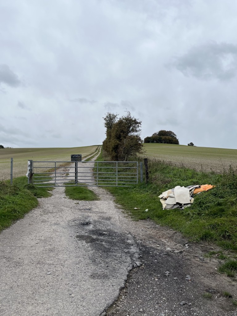
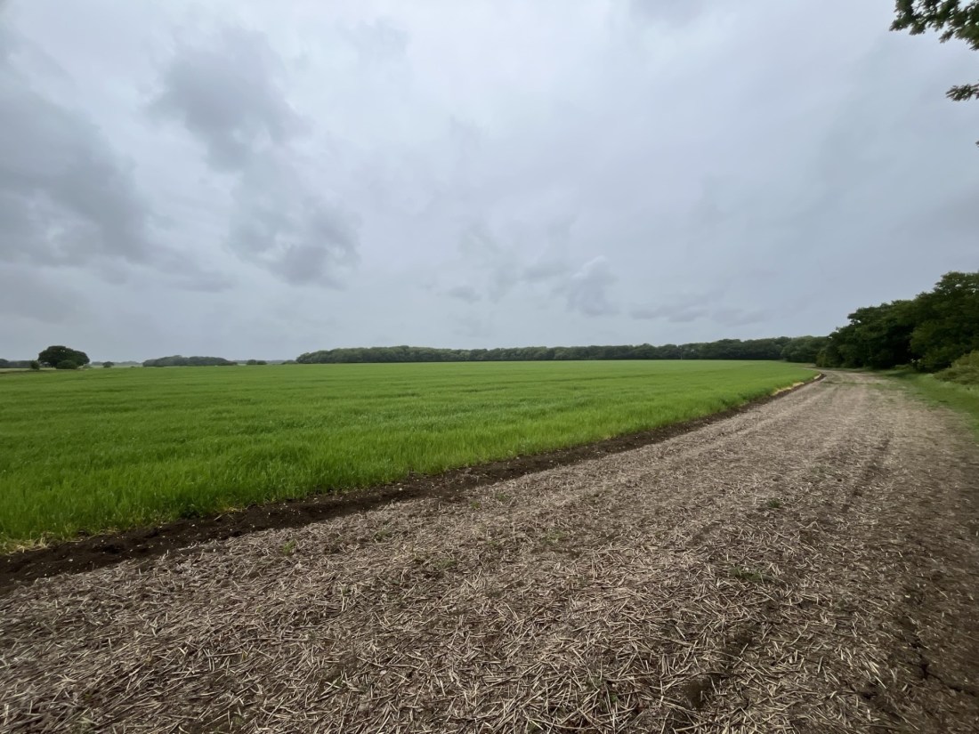
Coming off the motorway at junction 15, I drove south on Marlborough Road and then turned left onto The Ridgeway. After a minute or so I was able to get a glimpse of the low ramparts of the hillfort on the ridge to the south. I had managed to recce the area earlier in the summer, when I had run out of time to mount a challenge. Fortunately, this meant I knew there were no stopping opportunities on this stretch of road and so continued on until it met the B4192. Just at the junction a small lay-by allows parking for a handful of vehicles, but as my luck would have it, it had already achieved its full complement.
No worries sport. I turned right and just a short distance up the hill, on the right, was a small patch of hard chalky ground large enough for me to park up. The earlier scouting exercise had come in handy. With low grey clouds, and the promise of drizzle filtering in from the west at any moment, I left the car and found the start of the walk just a stone’s throw away. Sadly, although stone throwing with intent had probably last been seen here nearly two-thousand years ago, the practice of rubbish throwing still flourishes.
Carpet bombing on the fly(tipping)
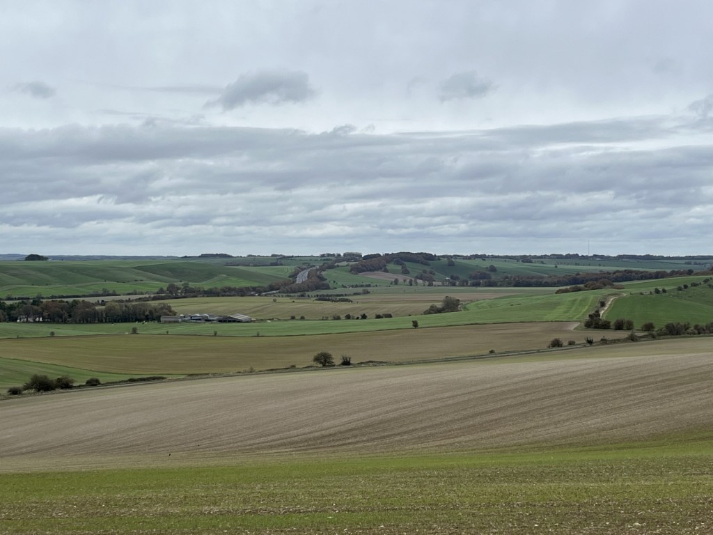
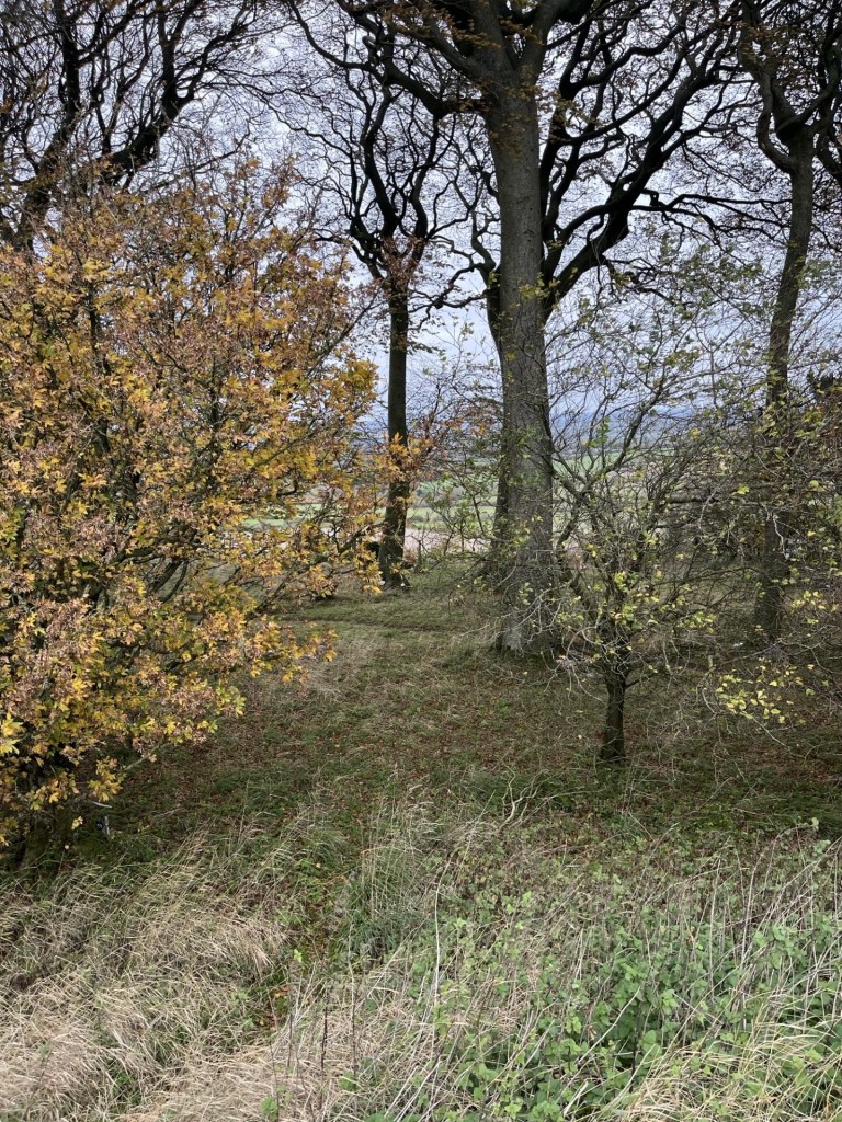
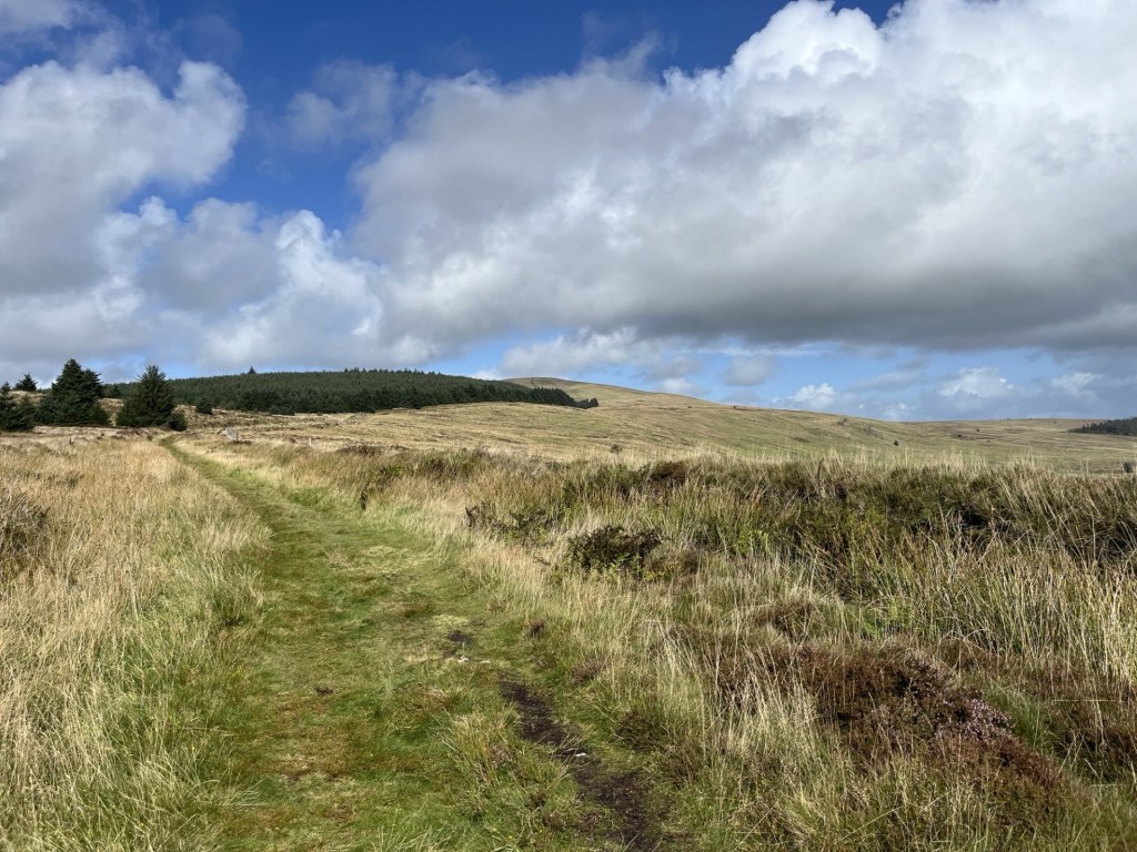
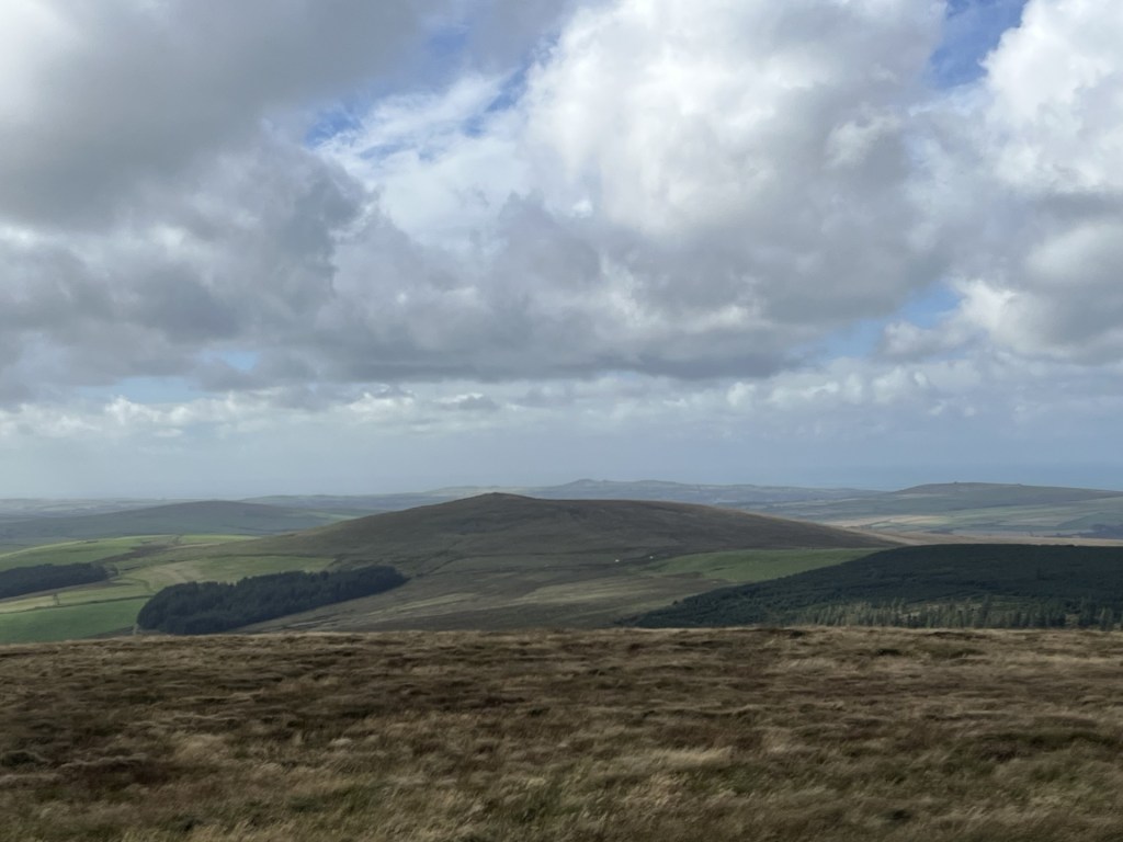
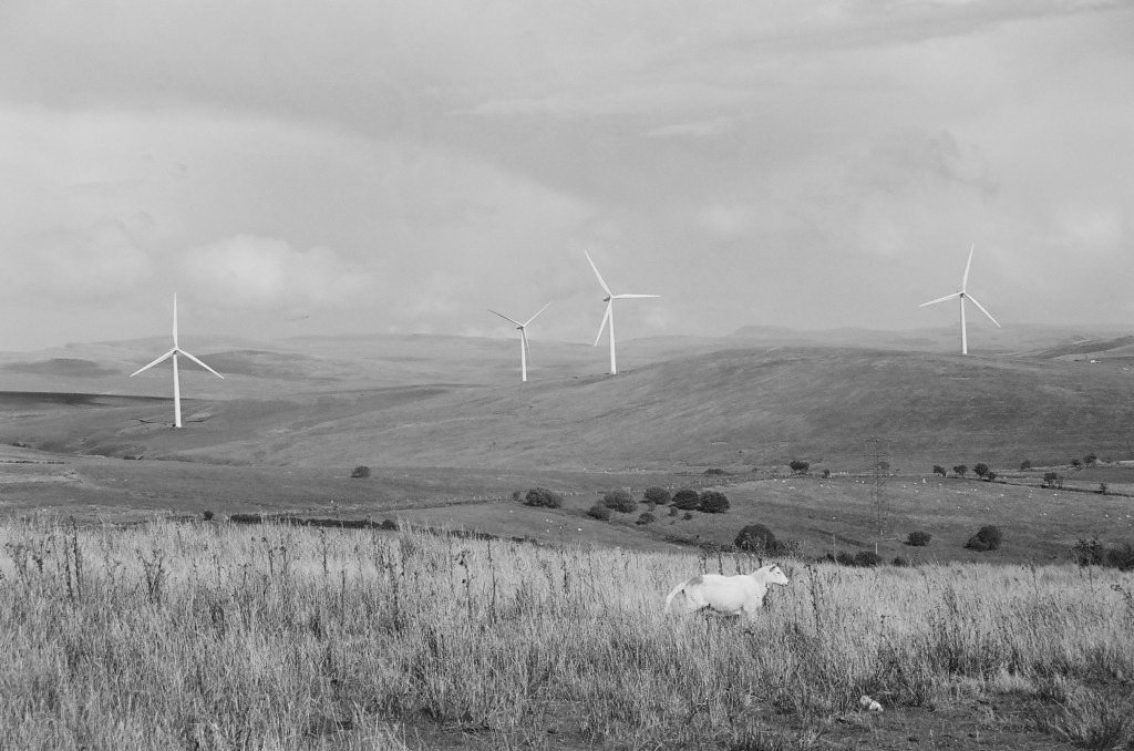
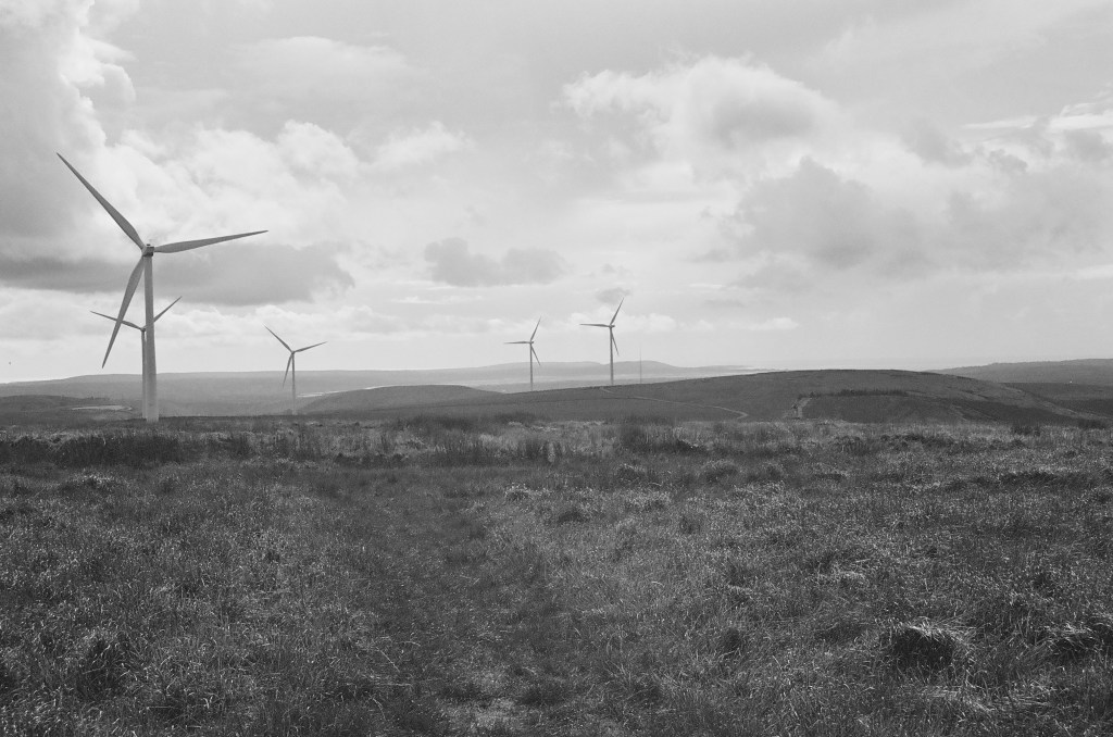
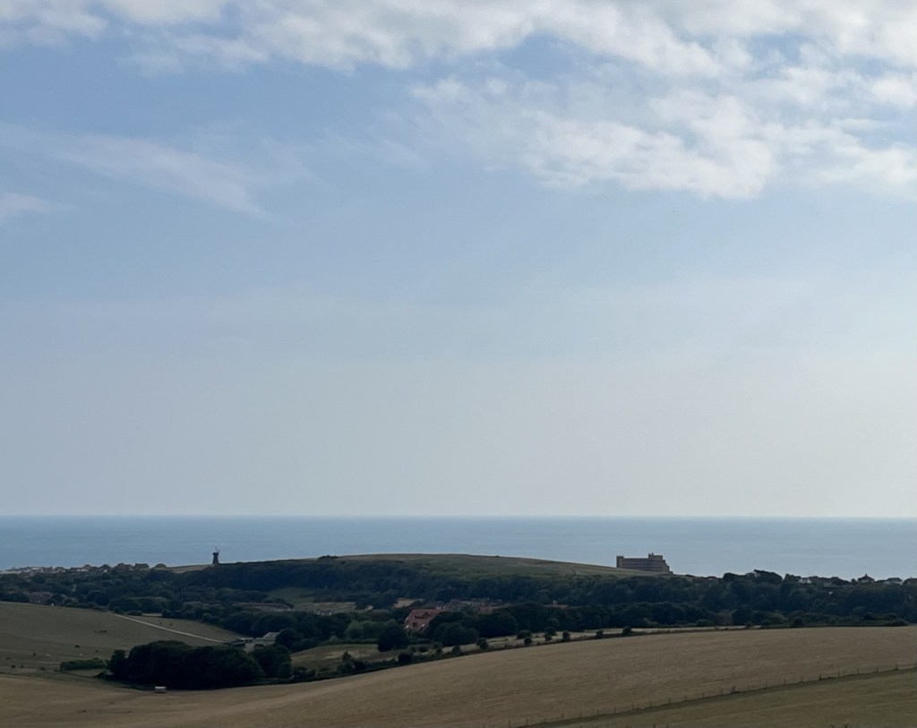
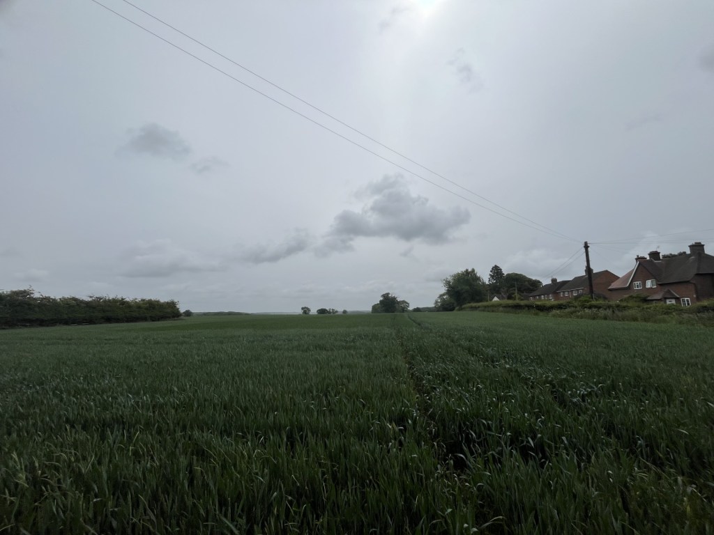
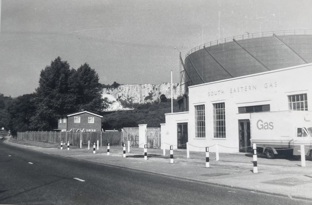
Through the gate and straight on the path that led up the slope, with a cluster of trees towards the top. I stopped for a moment to check that the car was still there. It was but of more interest was the view east and the M4 heading towards London.
Towards London – the M4 corridor
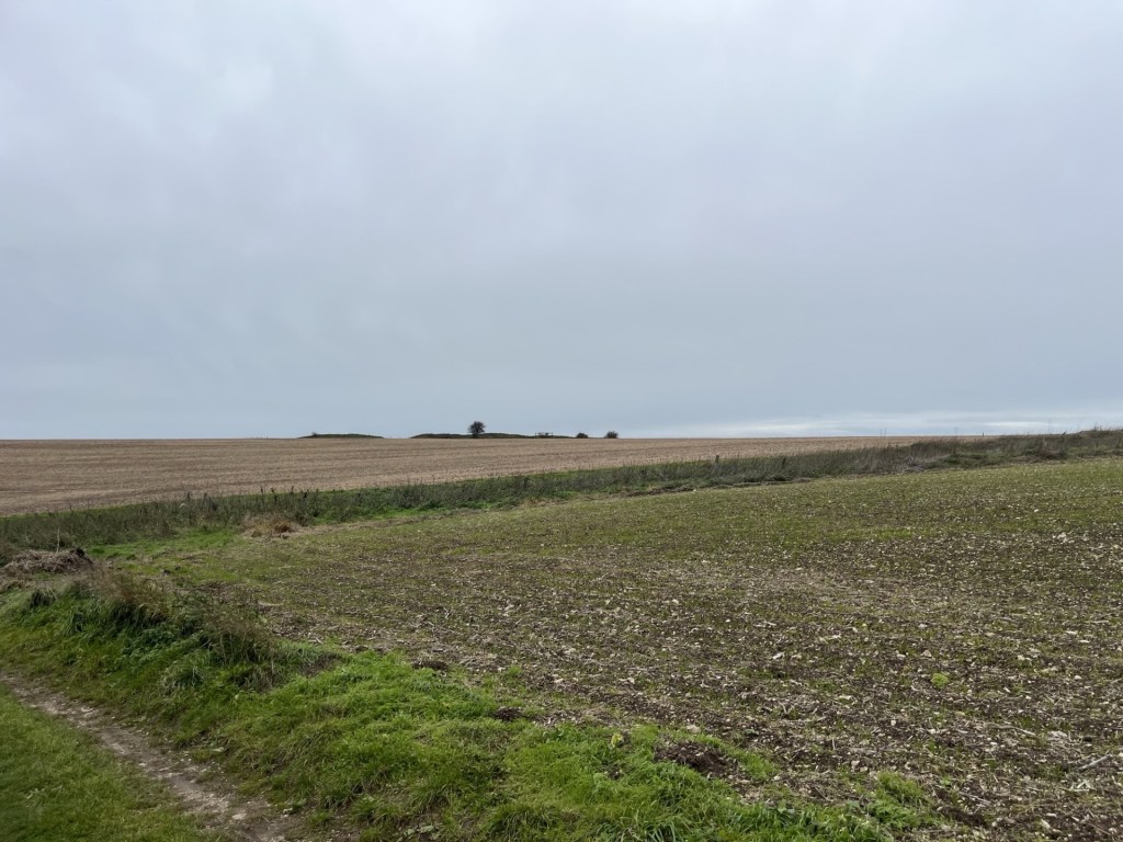
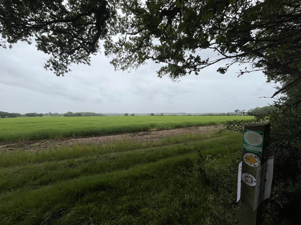
I passed by the small woods to the right and on, with a large field falling away to the south. Eventually a sign pointed north to a path around a large field leading to the hillfort, now visible on the nearby horizon.
The hillfort destination
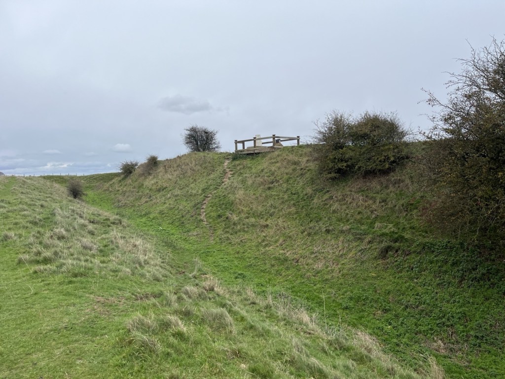
The path led to the end of the field, then through a gate and left along the top of another field and eventually back up towards the ramparts where a wooden construction could be seen on the top of the inner mound.
At the ramparts
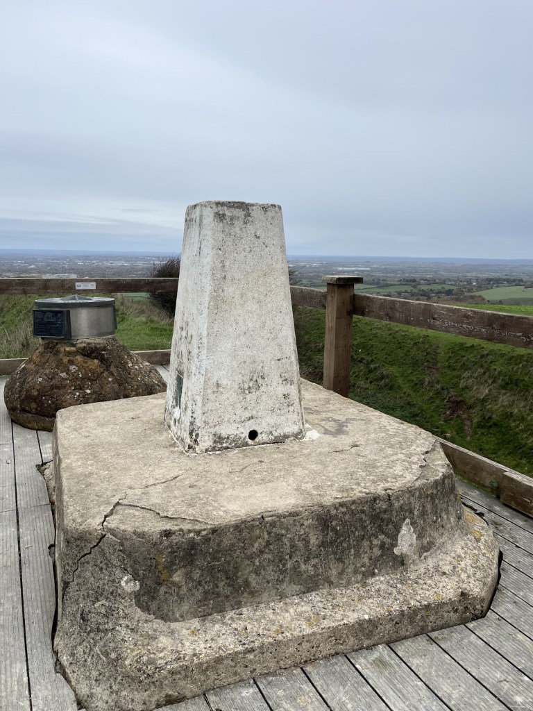
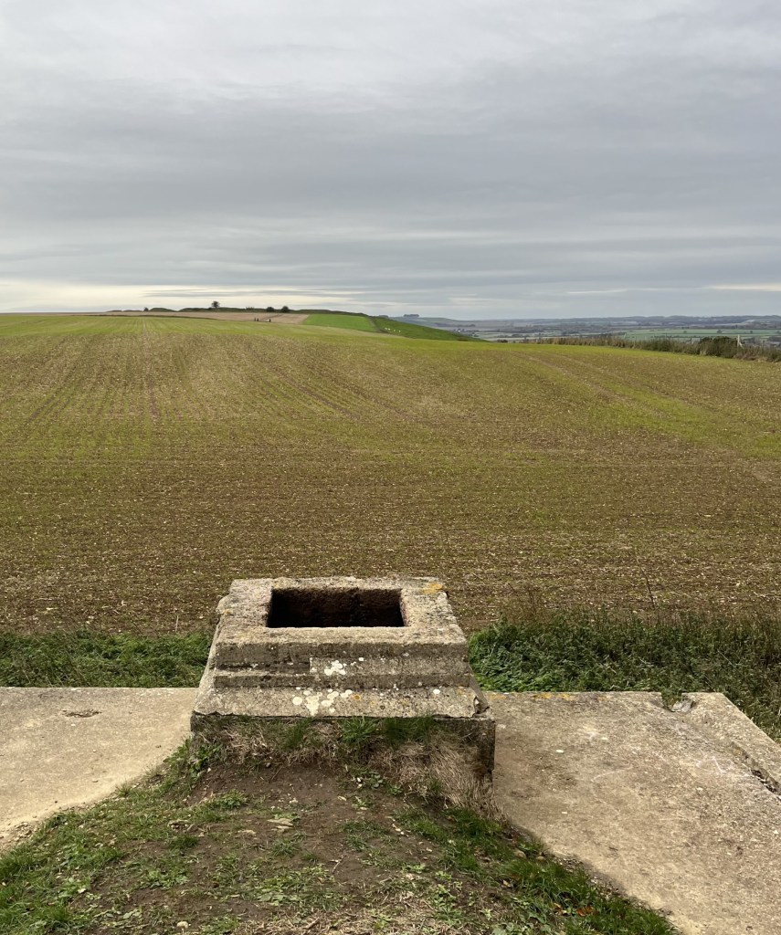
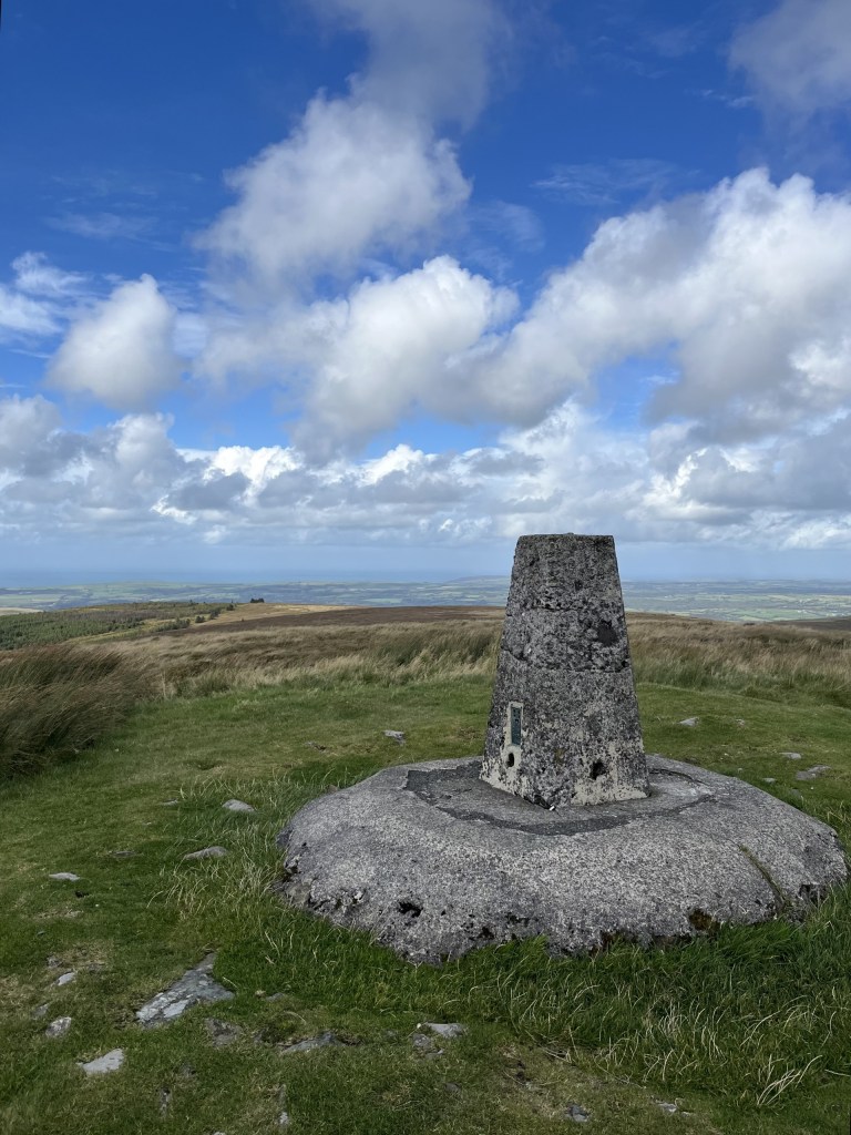
I flanked around along the top of the outer western mound before it descended into what would have been one of the main entrances. Here the ditch was at its deepest, but as chalk hillforts go, the parallel ramparts didn’t seem to amount to much. I passed in and then back along the inner rampart and up the small slope to the wooden construction, which was a mounting deck for a triangulation point (strange) and an underwhelming directional toposcope.
The raised Trig and beyond the confusingly disappointing toposcope, with Swindon beyond
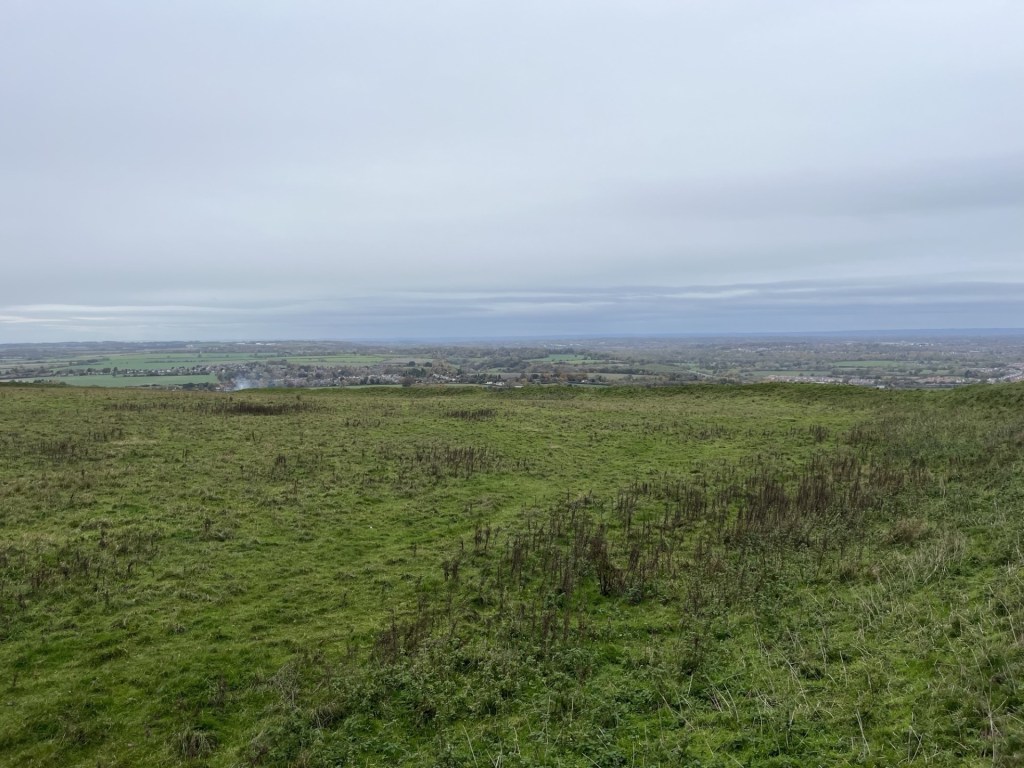
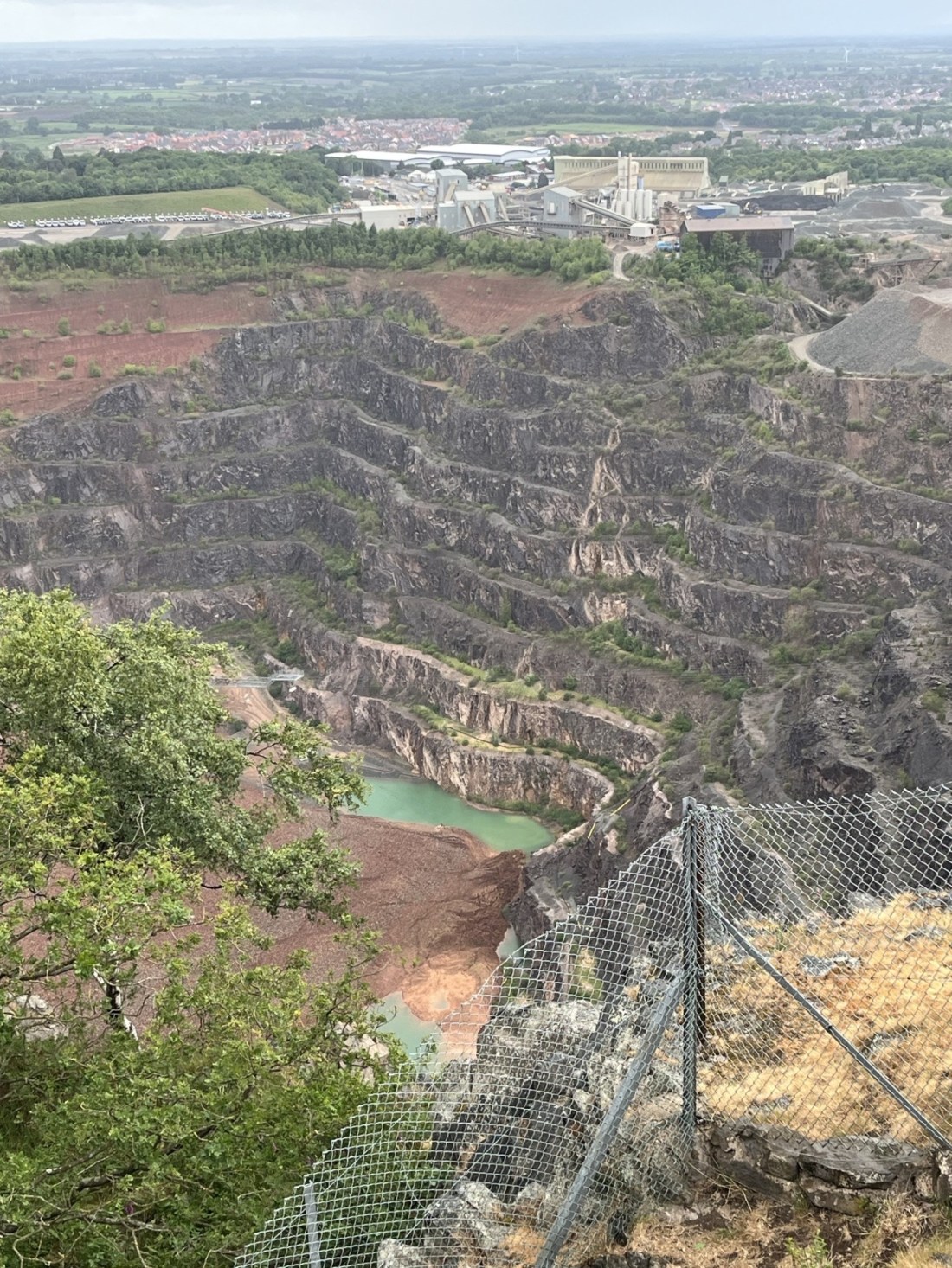
With the low grey cloud formation still threatening rain at any moment, I wasn’t going to hang about, but looking west across the large enclosure site something didn’t quite add up. Most, indeed all, iron age hillfort sites I had previously been to sit firmly on the top of the hills they are located on, using the natural contours to create the series of broadly horizontal ramparts and ditches that complete the structure, and with a relatively flat central enclosure (the nearby Uffington Hillfort to the east of Swindon, and coincidentally the highest point in Oxfordshire, is a perfect example of this).* Here the land fell away in all directions, down what was effectively the side of the hill. Indeed, a later check on the BGS Geology Viewer showed a drop of at least ten metres from the top entrance down to the north-west corner. Now, I’m no archaeologist but I do know this, when you haven’t a clue it’s probably best not to speculate. It was a mystery, nonetheless.
Falling away?
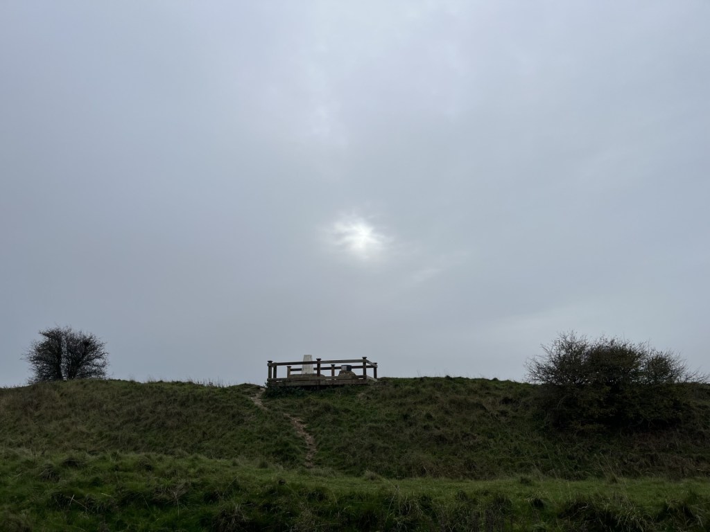
I left. Just for a moment, as I passed east of the wooden plinth, a teasing watery sun threatened to break through.
Here comes the sun (before it went again)
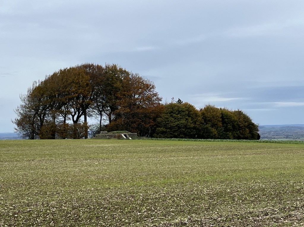
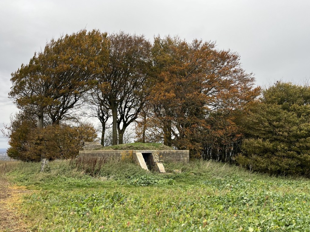
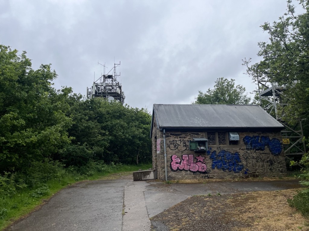
Heading back the way I had come I looked over to the small woods, now to my left, and noticed a low structure. Of course! When I had researched the area a couple of months earlier, I had noted a reference to some sort of bunker. And there it was. I diverted from the main track and followed the edge of a recently tilled field.
The Starfish Decoy Control Bunker lurking at distance
The obvious question that popped into my head was, what was it? Fortunately, my phone had a signal, and a quick enquiry told me that it was one of many built around the country during WW2. Starfish (SF) Decoy bunkers were used to light fires away from urban and industrial areas to mislead Luftwaffe bombers, who, I guess the hope was, would drop their load in the wrong place. With this nugget of information, I approached with a degree of curiosity. When I was a kid growing up in the 1960s me and my pals spent many happy hours playing war, making fires, smoking and throwing bangers around in an old concrete bunker in a field near a river close to home. Who needed the internet? **
Naturally the bunker required further investigation.
An investigative approach
With the obvious exception of missing blast proof doors, externally the structure appeared to be in relatively good condition.
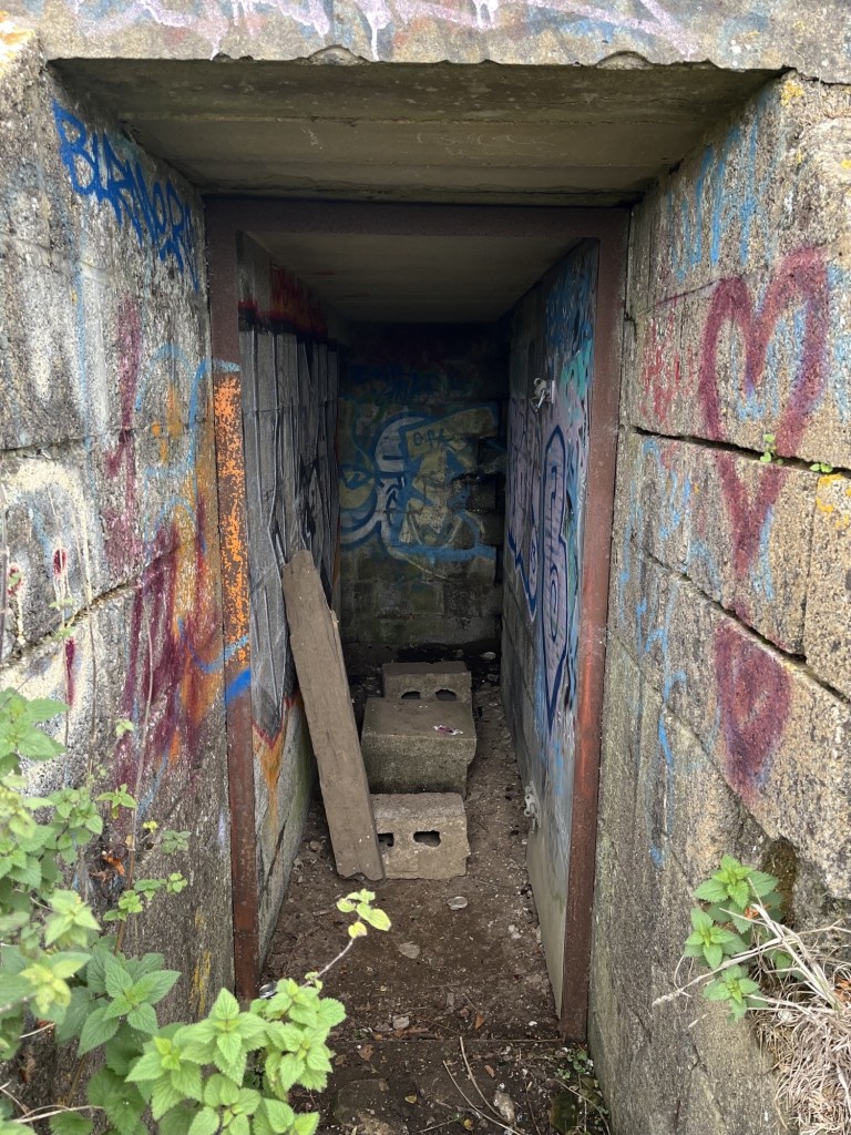
Looking in
I slipped through the entrance. Due to age, and a lack of understanding of local youth peer group culture, I was unable to translate the colourful graffiti. The concrete corridor led a few metres to the rear where two rooms led off to the left and right, with large rusting metal tanks sitting looking sorry for themselves. Whether they formed part of the original operational structure, or whether it was just something the landowner had dumped out of sight many moons ago I couldn’t say. Presumably because of the bunkers remote location, whilst a few beer and cider cans predictably littered the floor, I’d certainly been in a lot less salubrious WW2 bunkers and pill boxes.
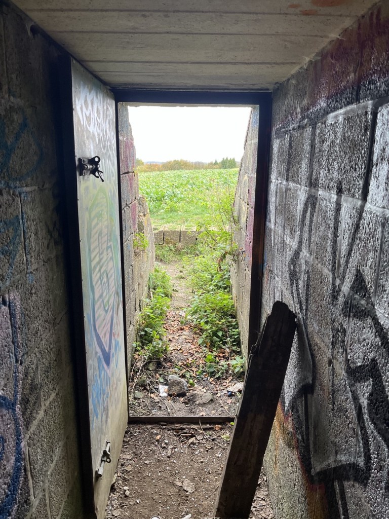
Towards the light – Looking out
Back outside I thought it only correct to climb onto the grass covered roof. The view was only marginally better than at door level, but the outline of Liddington hillfort was on full display to the west.
Towards the hillfort. I felt confident I had discovered a new lay line.
From the roof I was able to look down into the woods, delightfully called Liddington Clump. I noticed that at various points within the small group of trees, discretely laid bunches of flowers had been deliberately lain. There is something similar near me, just set back from a road in woods at the edge of the local park. I’ve never looked too closely but have always assumed they were for much loved but departed pets. So, assuming the same here, when I later read that in fact the woods contained some natural burials – for humans, I wasn’t sure what to think. I’m pretty sure that on some sort of ethical, spiritual and/or humanist level I can see the attraction (maybe there’s a better way of putting that), but what would the consequences be if we all opted for a natural burial? A walk in the country near any urban setting would very quickly become a precarious totter through an ever-increasing open graveyard. Hmmm…. another moral quandary to occupy the mind.
Now, here’s the thing, and it needs to be told. I discovered the reference to the burial site in a quick search on the phone back at the car. I probably only glanced at the article for a few seconds, but it had registered. So, now, a couple of weeks on and wanting to find out a bit more, I have singularly failed to find any mention of a natural burial site at Liddington Clump. I have found a brief reference in a random comment on a post on Facebook that it is a memorial site for people and pets. The only explanation I can think of is, that there being an iron-age burial mound not far from the woods, and in some sort of mixed-up dystopian word jumble confusion, I’ve put too many one’s and one’s together and come up with fake news. It must be either that, or, and I am inclined to go with this theory, it was an involuntary AI search that led me up the woodland path. Either way, it had got me thinking about natural burials (which, for the benefit of doubt, are a thing); their implications, ethics and carbon footprint, and despite the latter being a justifiable reason, I think I’ll stick with the furnace.
In a similar vein, on-line information available on the Liddington decoy bunker, and indeed Starfish Decoy bunkers in general, is scant to say the least. I found a short article that gave a perfunctory description of their use, but no real explanation on how they were crewed and operated (I assume that gas or oil pipes radiated away from the bunker to where outlets would be lit for effect). A few weeks earlier, and completely coincidentally (a friend had sent me a fantastic short BBC documentary on YouTube about Swindon Town football club in the 1960s called 1963: Six Days to Saturday, which included some footage of the locomotive works, and…. oh, I’m straying badly here), I had read an article about bombing raids on Swindon. Surprisingly, given that the one thing everyone in the world knows Swindon for is its vast railway works (and XTC), it seems that the works survived relatively intact. Some surrounding houses were hit and sadly people did die, but apart from the odd unfortunate cow, the railway works were barely troubled by the Luftwaffe. There is no doubt about the fact that the decoy bunker at Liddington would have been placed there to keep the bombers away from Swindon, and very specifically the railway. To that end, it’s just possible that the tactic worked. Maybe one day some new information will emerge. Just as this was about to go to ‘print’ I came across a short YouTube video that followed a couple of modern day night raiders to the bunker, where they film the inside (see my descriptions above) and then leave, providing no more context than I have managed to offer up here. Quite why they filmed it at night is a complete mystery. It’s perfectly accessible at any time. But, and there’s a twist, just as they are about to leave, one of the participants drops off the roof, and (here’s the spooky bit) says they’re about to go into the graveyard!!!! What do they know that I thought I did, but now I don’t? The mystery continues.
Liddington Clump – The mystery continues
I left the bunker (“thank gawd” you shout) and returned to the gate at the end of the long path. Just past the gate the fly tipped mound had still not been cleared (bloody local councils are useless, aren’t they?), but miraculously my car was still in place.
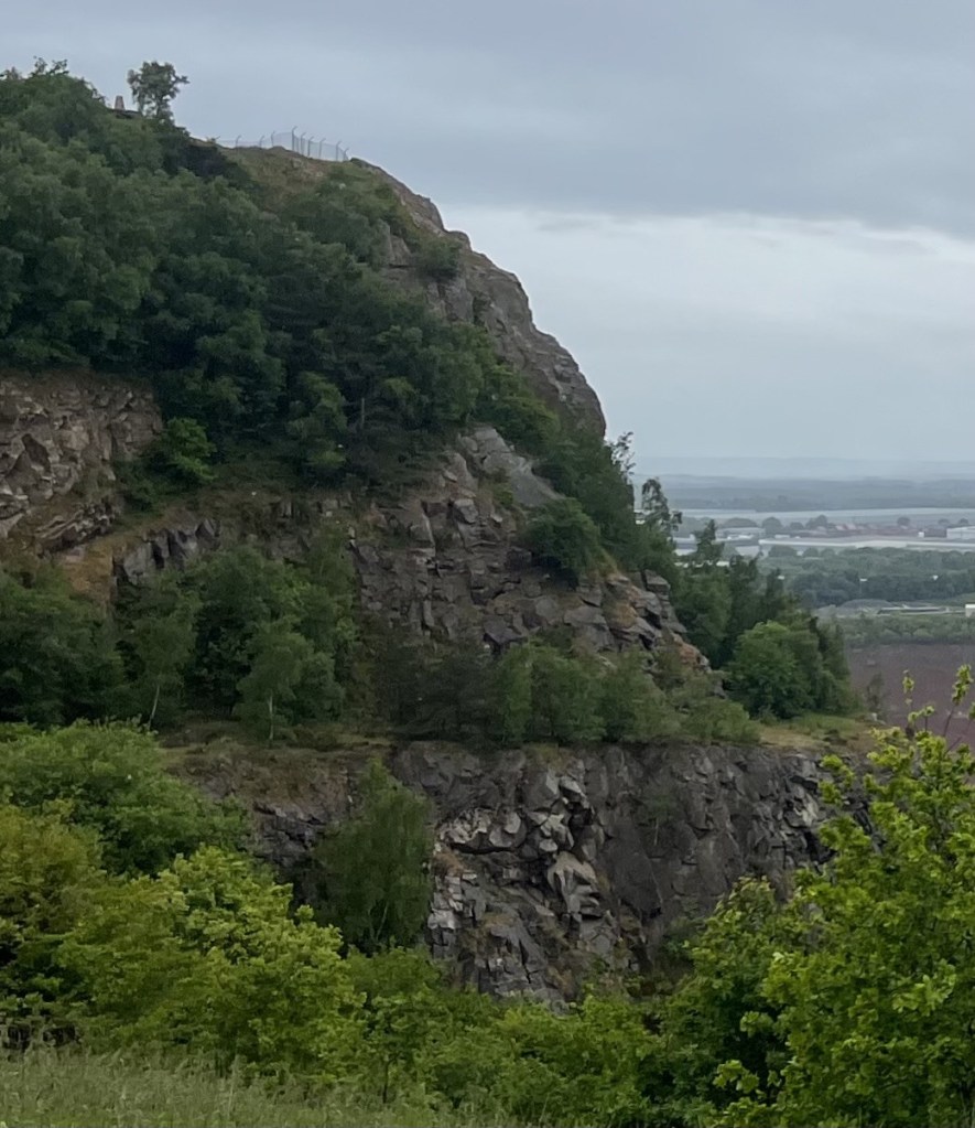
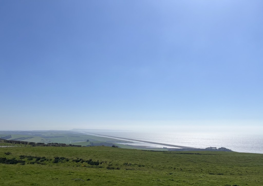
Ten minutes later I was back on the M4 heading east and towards London. As I joined the motorway I glanced up to my right and could make out the ramparts of the hillfort. I must have driven past it over a hundred times and never noticed it. Half a mile further on and to my left, a familiar feature along the side of a chalk upland, where the side of the hill is distinguished by a crinkle cut pattern of indents that can only be explained by seeing them (just visible in the second photo to the left of the M4). Unlike the hillfort I had noticed these on many occasions before and now at last I understood their context within the M4 corridor. Never stop learning.
** In the interest of public safety, and to avoid the possibility of being sued, I strongly advise against allowing ten-year-old children access to matches, lighters, cigarettes and fireworks. It’s right that we have regulated these products to the extent that what I was able to get away with as a child is technically not possible today. When I look back I find it mind boggling that the so called straight up honest shopkeepers of old England would recklessly turn a blind eye to almost anything we wanted to get our grubby little mitts on (apparently, things are so much worse these days – or so you’d be led to believe if you spend too much time on social media – just saying).
Day four of five in the far south-west of Wales. I had been staying for three nights in St David’s, an international attraction for walkers, pilgrims and casual visitors to its ancient Cathedral. Givin its popularity I had reluctantly paid a small fortune for the privilege of a bed in the cheapest room left in town – a Premier Inn. The weather had been just about as bad as it could have been for the time of year, with the almost relentless rain gusting in at speed from the Atlantic being some sort of revenge for the relentlessly hot, dry summer. On opening the blackout curtains and peering out through the three-inch-thick double glazing, the sky was blue, and early sunshine bathed a distant hill beyond the rugby posts on the nearby recreation ground.
Carn Llidi Tor from the Premier Inn St David’s – weather conditions indeterminate
The previous evening, after being unsuccessful in getting a seat at either of the two snug olde-wordle looking pubs, I retreated to an alternative in a back street to have a quick pint before returning to the hotel. As I sat nursing a freezing cold drink that called itself a “bitter” a middle-aged American couple entered the empty saloon bar, where they stood for a minute or so. The woman who had served me was yacking away with punters in the public bar. It struck me that it might not have been the sort of place the couple were expecting, but if you’ve come 3000 miles on a pilgrimage, needs must. “We’re trying to book in,” the man said to the woman, after she eventually emerged from the public bar to cater to them.
After checking in and receiving the keys the couple went upstairs, at which point the woman who had served them slipped back into the public bar and proceeded to mock the man’s use of English. ‘” We’re trying to book in”, he says. “We’re trying to book in!” What does he mean, we’re trying to book in?”’ There was some laughter from the locals. I proceeded to carry on reading my old paperback. Ten minutes later the man came back into the bar. The woman went over to him. His wife, he explained, had noticed black mould around the shower. Was this normal and could be cleaned off? At this, instead of expressing empathy to her “guest” who, given he was from the States, may never have seen classic British bathroom black mould, the woman started a long, possibly rehearsed, load of nonsense about the rooms being cleaned down thoroughly every day and that no matter what they did it was impossible to remove. In an almost absurd escalation in the excuse stakes she then went on to explain that they could renew the putty every week, but the mould would be back the next day. That she had used the word “putty” nearly had me snorting into my beer, but apart from that it was an appalling example of how to overwhelm your victim (sorry – guest) through bluster, misinformation and subtle sarcasm. Distracted by this interaction I had stopped reading my book – ironically The Quiet American. The poor man had no effective retaliation in his armoury. Somewhat humiliated, and in the knowledge that he was going to have to go back and explain all this to his disappointed partner, he merely mumbled that “he guessed that was all that could be done then” and retreated sadly towards the stairs, head down. The quiet American alright!
I may have stayed for a second pint, but I didn’t. As soon as the man had disappeared upstairs, I could hear the woman in the other bar repeating almost word for word to the other customers what she had told him. There was some more laughter. I supped up and left. *
The reason I mention this is that the next day, and halfway up Foel Cwmcerwyn (the highest point in Pembrokeshire) I kept thinking about it, every so often shaking my head and wondering about the state of things, and indeed what she might have said to the other punters about me after I had left. ‘”A pint of bitter, please. Please, what does he mean by please?”’ Too late to worry about it now.
I had left St David’s and headed out of town on the north Pembrokeshire coast road. Past the Blue Lagoon at Abereiddy, the charming little post-industrial village of Porthgain and the pretty village of Trefin. The day before I had given up on any walking ambitions and had stopped the car in Trefin seeking refuge in the Ship Inn for an hour until an almost apocryphal downpour had stopped as quickly as it had started, after which I was at last able to go back the way I had come and finally check out some of the hidden gems.
Above Porthgain
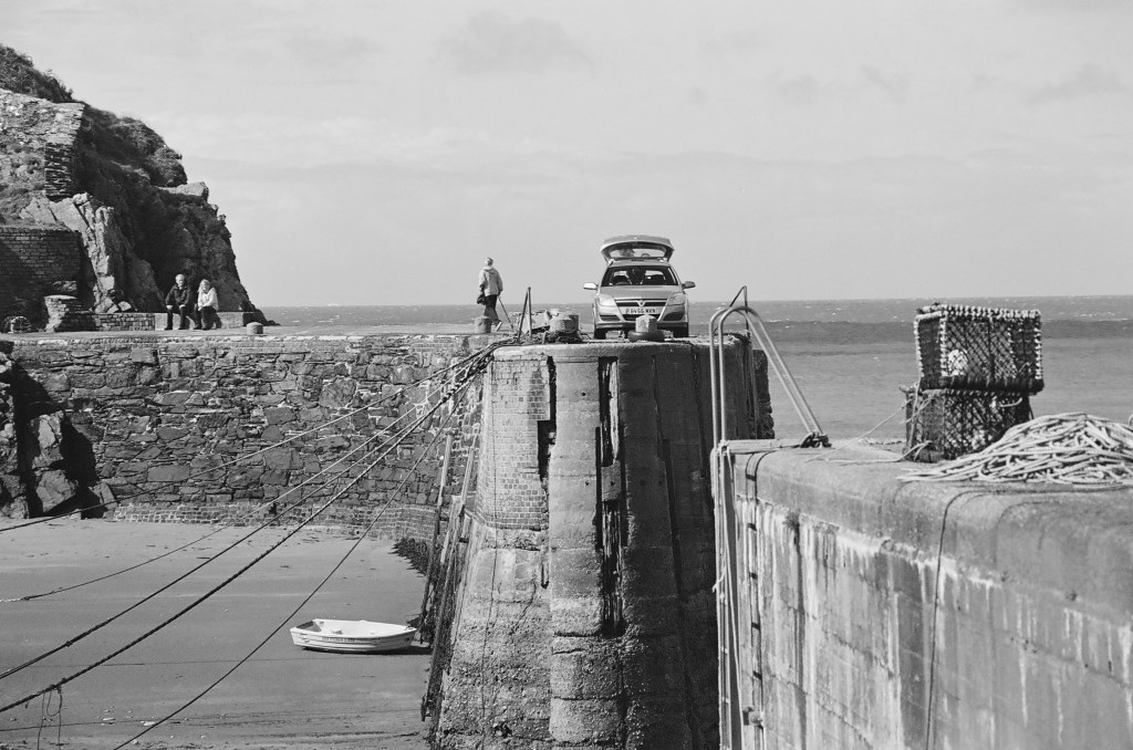
Porthgain – the harbour. The two people on the bench are, like me, trying to work out how the car is going to exit. On the horizon the Fishguard the Rosslare ferry battles against the elements
The Blue Lagoon.I wasn’t tempted
Beyond the Blue Lagoon at Abereiddy
Despite almost persistent rain and gale force winds over the previous two days (these photos deceive), I had managed to squeeze in some short walks along parts of the coastal path. Bracing, soaking but also delightful, with huge Atlantic waves smashing into the igneous and sandstone ramparts defending the rolling hinterland, it was a place that screamed “come back.”
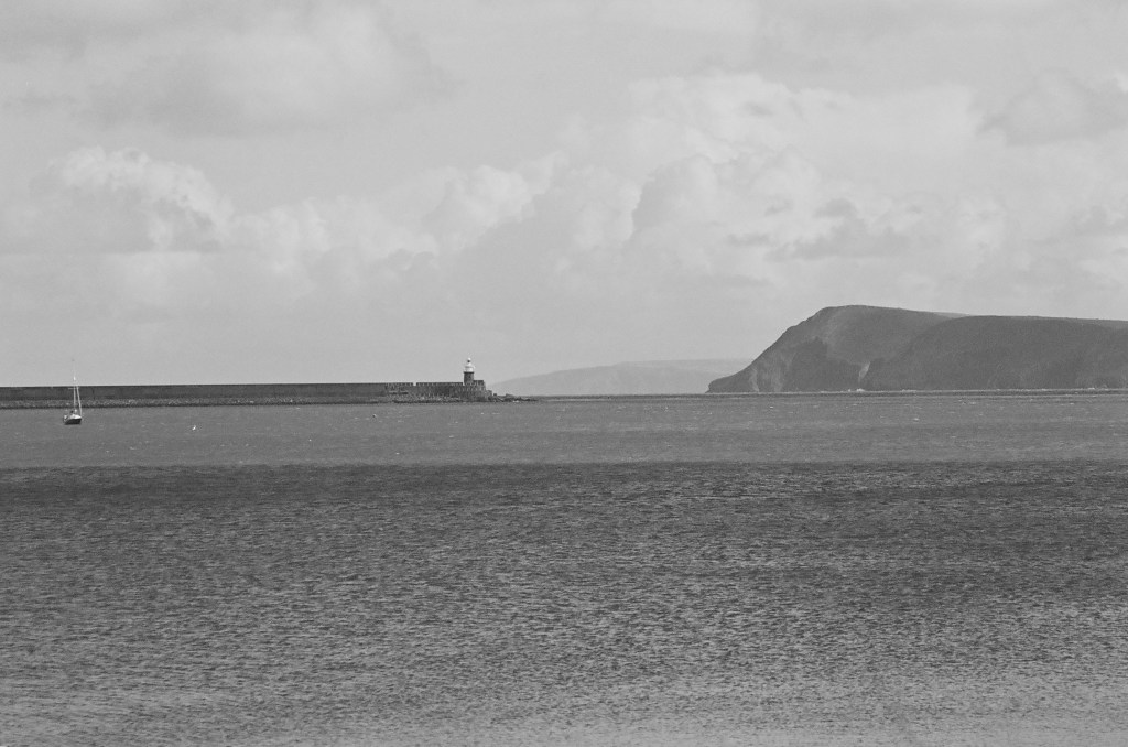
With one night left in Wales, the evening before I had booked a room in Cardigan, situated to the north. Foel Cwmcerwyn was, with a bit of a diversion, on route and in the heart of the Preseli hills of Stonehenge fame (arguably). I reached Fishguard midmorning. The weather forecast was ambiguous, but for the moment it was warm, windy and bright and I decided to stop and find somewhere to eat. I can’t tell you about the initial attempt to park in a pay by phone car park because it’s too painful to recount, but if you want to get close to how I felt I can recommend reading my related accounts of similar experiences with the same service provider in West Sussex and Oxfordshire. Needless to say, it was hideous in extremis. After a brief interaction with a local man who recognising my unstable condition and gave me some profound words of advice, I gave up. Minutes later I discovered an entirely free car park just a few metres further down the bay.
Fishguard – Gateway to the Republic, and the EU, from the free car park
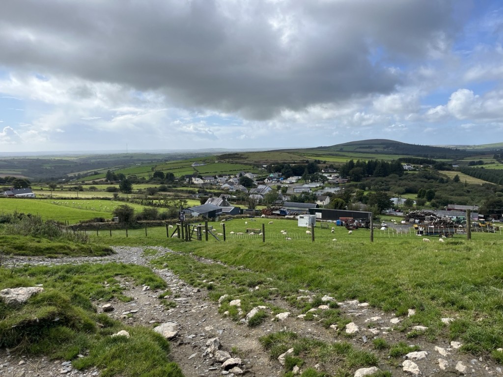
Tempting as it was to stay a while and look out into the bay for the chance of spotting the odd seal pop its head above the surface, I had to crack on. I left Fishguard on the A4313 heading inland and east through picturesque country. I reached the village of Rosebush at around 2pm and found a small car park just past the old railway station (more later).
To reach the top of Foel Cwmcerwyn I had to work my way up to the north-east. I had a rough idea of my route but after an abortive meander north along the line of the dismantled quarry railway I backtracked to the car park and climbed back into the car. Heavy downpours were visibly operating in the area, and one was threatening now. I knew there was a chance I’d get caught out at some point, but who needed a drowning at the get go? The shower somehow missed Rosebush. Once I was reasonably satisfied that I was in the clear for a bit, I walked up to some cottages and then onto a signed footpath that led steeply up past some farm buildings and then through a large field. **
By the time I had climbed to the top of the field, I was, to put it mildly, knackered. It wasn’t a good start, but I figured I’d got the tough bit out of the way, and now on a more significant track with impressive views opening up in every direction, my motivation returned.
On track, after the initial lung buster. Looking down on Rosebush
I’ve already mentioned that the weather forecast was ambiguous, by which I mean that it predicted a lot of rain at any moment and very strong winds. I had come fairly well prepared, but now in hot sunshine, and walking resolutely up the well-trod track, I was beginning to wonder if I had overdone it. Looking south a vast battleship grey cloud shedding its load was engulfing a large industrial structure (presumably Milford Haven) dozens of miles away. Already the views were impressive, but so too were the weather systems steaming in from the Atlantic.
The track maintained a steady course heading north-east and on a reasonably tolerable gradient. Soon forestry plantations appeared on the left, and sweeping views opened up down the lush valley to the right.
Towards the forest
Towards the rest of South Wales and storm alley.
Up until this point I had been the only person on the path, but now, coming down in my direction, a couple appeared on mountain bikes. They stopped and we spoke for a bit. Like me they were from the South-East, although a decade or two younger. The man was on a bike fitted with a battery, although I wasn’t so sure the woman was. We talked a bit about cycling (me admitting I was running out of enthusiasm), and by the time we had said our farewells, I was pretty much sold on the idea of battery power. We’ll see.
I carried on across boggy ground before more trees appeared to the left, and the gradient started to increase again. Beyond the trees the wind suddenly hit me like a brick. I made it to a wooden gate which would take me onto the open hillside. Here the path steepened significantly (the cyclists had warned me although I’d been sceptical). Now tip toeing up, the wind battered me from behind, bizarrely hindering rather than assisting progress. It took about ten minutes to wearily trapeze the final couple of hundred metres to the trig point at the top. I knew it was going to be there, and with each step I relished the prospect of being able to hunker down behind it to give some respite from the gale.
So, on arrival, and finding a group of four other intrepids completely surrounding the concrete structure, my little heart sank. All I could do was loiter around for a bit in the hope they would move on, although that didn’t seem likely given their insatiable need for selfies and group photos (I didn’t begrudge them doing it, given it was an achievement worth recording, but I was a good three decades older and feeling like I’d been sandblasted). Thankfully, after some minutes, they departed in the direction of Rosebush, and I was at last able to grab hold of the trig point and stabilise my condition. The views in all directions were magnificent. Here, at the top of Foel Cwmcerwyn I could see the whole of Pembrokeshire and beyond to Cardigan Bay. To the far west the Rosslare ferry was slipping out of the safety of Fishguard harbour and smashing itself directly into the wild wind and waves of the Irish Sea. Now able to stand reasonably steady I took a few photos that probably don’t do the view justice.
A wild westerly and the resolute Trig
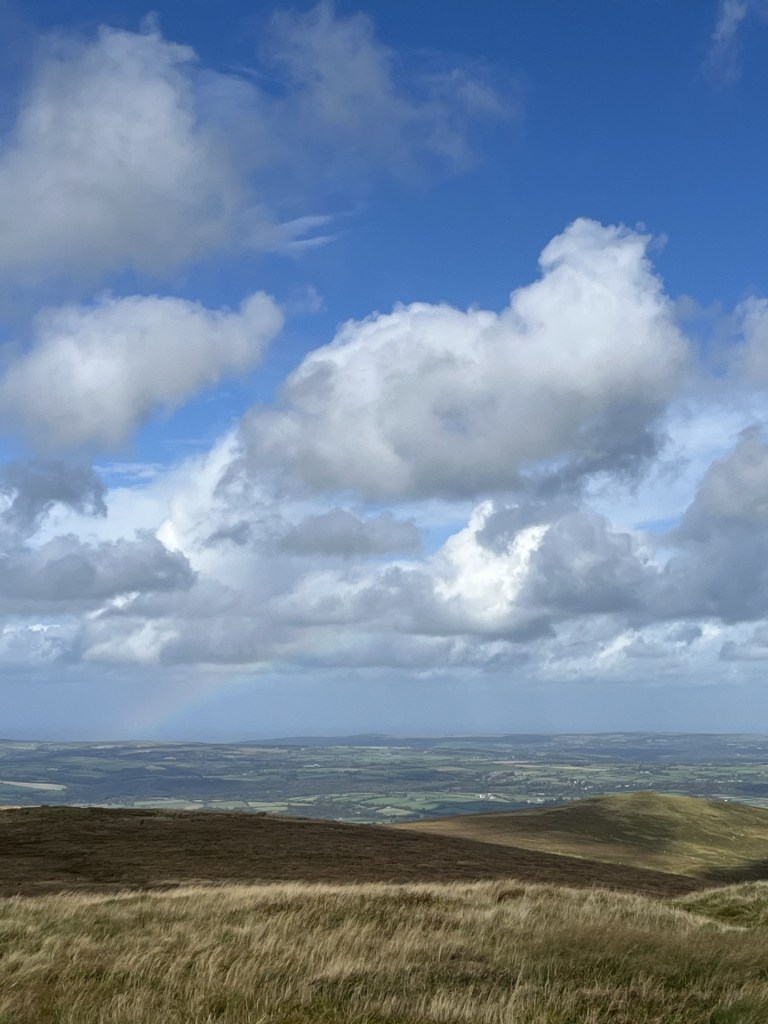
Rainbow over Cardigan Bay
So far, I had been lucky. Rain clouds were dotted around in every direction. It was time to head back. Launching down the path was like trying to walk into a wind tunnel. Without gravity I’d never have made it down to the gate. Beyond the gate the trees once again gave cover, and I was proceeding at a reasonable pace. Now more relaxed I was able to get a better appreciation of the views down the valley and beyond towards south Wales proper.
Towards south-westPembrokeshire
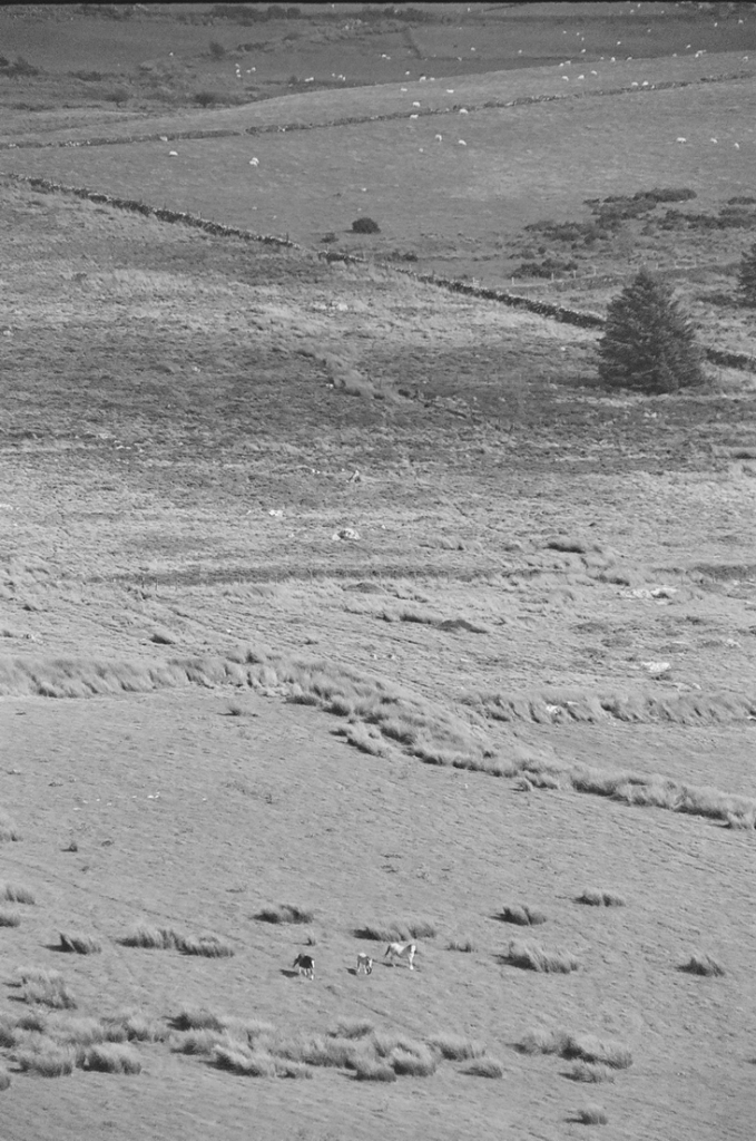
I stopped for a bit to take in the dramatic view. A farmer on a quad bike was heading up the slopes and corralling a long line of white dots from one field to another. The commotion had spooked three horses that were now galloping away under sun and shadow.
Cantering on the range
By the time I reached the end of the plantations to my right, I was becoming increasingly concerned by a large looming mass of dark cloud scudding towards my position, and with my name on it. I had nearly caught up with the gang of four who had earlier been hovering back at the trig point. A footpath led west along the edge of the forest. There were two options. Take the path under some tree cover or continue down across the large and exposed field above Pant Mawr farm. I chose the path with the trees. The others chose the field.
Large drops of rain began to fall. Sadly, the isolated tree cover was less than useless so I was forced into a light jog until, on the slopes above the old quarry, I found a large well leafed tree that offered more protection from what was by now an epic deluge. Fortuitously I had packed a small umbrella, which was deployed to surprisingly good effect.
Unaccountably well prepared
The lashing quickly passed, and I headed on down the lumpy and sodden ground to the route of the old quarry access road and railway line.
Slate heaps after the rain
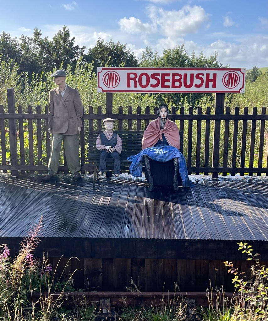
By the time I reached the community run pub at the old station (Tafarn Sinc) I’d walked exactly four miles. Along with the wind and rain it had felt a lot longer but had been worth every step. I’d found a part of Wales off the beaten track, but with a great walk leading to impressive views of the south-west and Pembrokeshire .
I took my coffee out to the open terrace. A small garden area led to where the tracks had once been, and beyond the remains (or possible recreation) of a platform. Three plastic dummies, dressed in period working-class clothing had been assembled, presumably to remind us how it must have been for passengers back in the day. The intense and distant stare on the face of the woman suggested it had been thoroughly miserable, yet despite the passage of time, relative prosperity and different clothes, that look is still familiar on most station platforms today.
A distant echo
As I drove away from Rosebush and towards Cardigan, with the wind still whipping around the nearby trees, the news on the radio announced the end of a political storm that had been brewing away for days across the Atlantic. Peter Mandelson had been sacked.
* I ought to own up here. Whilst I really was appalled by the bar woman’s behaviour towards her American guests, a few weeks earlier I had met up with a very old friend in a small town in the Peloponnese. I was staying in the town, and he was passing through in his camper van. As we sat outside a taverna waiting for food and observing a mink casually saunter up the road on the prowl for anything that moved, I mentioned the sequence of wildlife sounds that had been routinely waking me up in my room every morning. Starting with a crescendo of sparrow chirping around six, followed minutes after that by the sound of a mouse running backwards and forwards in the ceiling space above my bed (it might have been a rat, but I wasn’t prepared to countenance that possibility), and then finally the cicada’s early morning conversations.
The mention of the mouse took my friend back fifty years to a distant moment in time when he had worked at the Waldorf Hotel in London in the mid-1970s. He explained that for a time he had been the night manager and that the worst part of that role was the almost nightly complaints from new American guests about the sound of mice in their room. My friend is one of the funniest people I have ever known, so it was no great surprise that over the next ten minutes he rolled out a long list of all the excuses that the night manager was expected to respond with under these circumstances, and that by the end I was on the floor in hysterics. Without going into specifics, the essential aim was to express immediate and incomprehensible dismay (“A mouse sir! Surely you’re mistaken.”), that the possibility of a mouse in the Waldorf was an impossibility in modern 1970s Britain, that perhaps sirs wife had oversensitive hearing, or that they may have been confused by another source of the noise, or even whether it might have been possible that the guests had brought the mouse into the hotel in their hand baggage. Only in the last resort would a room change be agreed. Of course, it was the 1970s, and not just the Waldorf, but almost every structure in the whole of London was riddled with mice.
** Not visible at ground level, but when I looked at the area around Rosebush on Google earth, I noticed what appeared to be huge letters spelling the word CAWS in the tree plantation just to the east of the cottages. Surely my eyes were deceived. Well, a bit of research and sure enough, around twenty years ago the local farm, which produces its own cheese, planted a large number of conifers that do indeed spell CAWS, which apparently is the Welsh for “cheese”. Smile! Here’s a free ad for them.
I’d started the day in Chepstow and by the late morning had undertaken a short one mile walk to the top of Newport Unitary Authority (or County depending on your cup of tea). By the end of the day, I hoped to be in St David’s in the very south-west of Wales, an area of the mainland completely new to me.
South Wales is festooned with Unitary Authorities (also known as Principal Authorities in Wales – yeah, I know, I’m learning this stuff as I’m going alone). Twelve at least. From what I can tell most of these fall within the footprint of the old county of Glamorgan. Given my stay was just a handful of days I had to be realistic about what I could achieve. I plumped on one more on my way to Pembrokeshire.
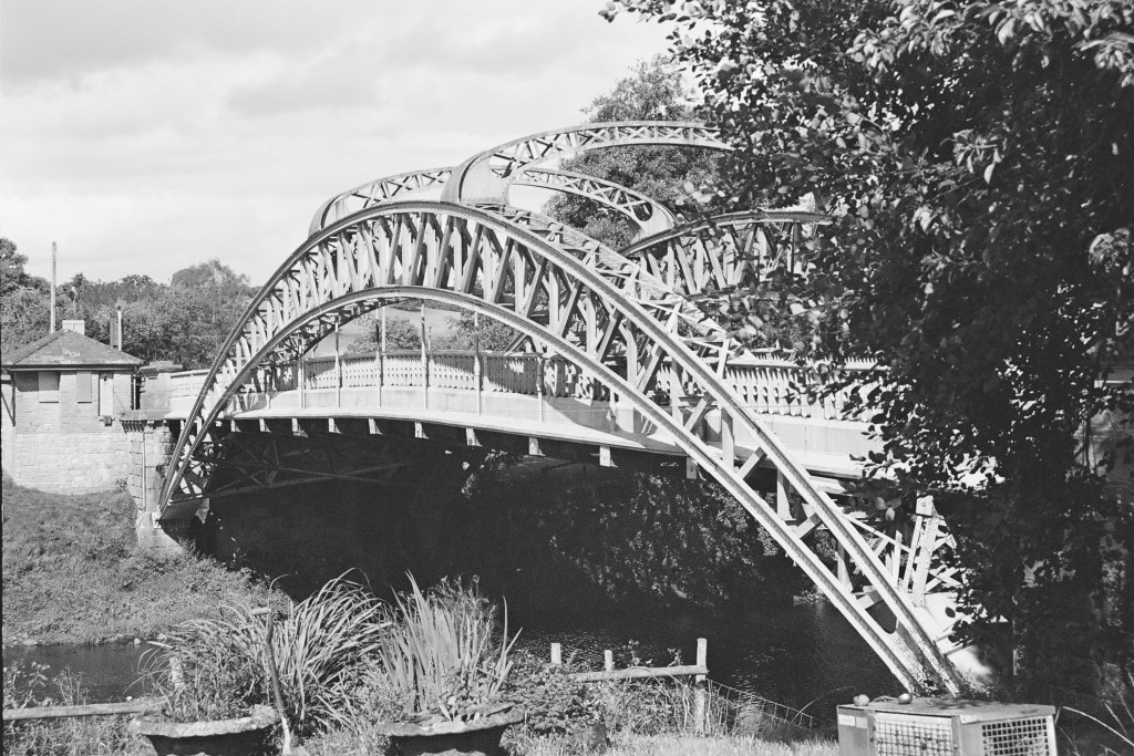
Leaving Wentwood forest to the north-east of Newport I headed up to Usk, an attractive small Georgian town with its very own well designed but slightly incongruous, Victorian prison. Past Usk and in need of a refreshment, I stopped at the Chainbridge Inn on the banks of the River Usk, adjacent to its namesake bridge (built in 1906 and not a chain bridge!).
The chain bridge, in black and white. In colour it’s an oddly attractive pastel green.
Rehydrated I carried on to Abergavenny then onto the A465 and the revelation that is the Head of the Valley’s Road. I knew this road headed west but had no idea what to expect. As far as I knew the only major road in south Wales was the M4, which I’d vowed to avoid if I could. The first thing I noticed as I drove away from Abergavenny was the enormity of the rain that suddenly appeared from nowhere and within seconds turned the dual carriageway into a fast-flowing riverbed. The flash flood was so extreme that for the first time in my driving career every other driver slowed down to around 30 miles an hour and took extreme care (I know, I was shocked at having no-one diss).
After ten minutes or so the rains passed, and now in bright sunshine it was possible to get a better sense of the road, and to be fair, it was staggering. Obviously recently improved, the dual carriageway made its way upwards with hills and country to the north, and valley by valley, the old coalmining towns of fame to the south. Blaenavon, Abertillery, Ebbw Vale, Tredegar and then Merthyr Tydfil, just to name a few. This was an impressive and at times spectacular piece of infrastructure, which, it seems, had only been completed in May 2025. It was hard to imagine that not so long ago it would have been a two-way high road with an endless stream of open topped lorries lugging wood and various carbon-based minerals east to west and then south, beset by roadworks, traffic jams and all happening in black and white. If, and when, I come this way again, the A465 is the road for me. And, for context, if I’m to carry on cresting counties, I’m going to have to come back this way as several of the “tops” are on the slopes just to the north of the road.
Before we get to where we’re going with this account, there is something I need to say about Welsh road signs. And before I say it, I wish to make it clear that it’s my problem, no one else’s (coward!). * So far, it had been so good. What I mean by this is that by and large I had coped with the road signs, primarily because I was familiar with most of the names of the towns en-route. Welsh road signs (in case you’ve not been) are in Welsh and then English. The problem for any non-Welsh speaker is that it’s got to be one of the most impenetrable languages on the planet. I’ve been to quite a few European countries and despite not knowing the languages usually manage to get around fairly easily. Even in Greece, where a lot of the road signs appear in the demotic Greek alphabet, I can usually get a grasp of the look and sound to help me on my way. Sadly, and to my shame, I can’t say the same about Welsh.
Past Merthyr Tydfil I was instantly out of my depth (having yet to get my phone to successfully pair with the in-car audio system) as the road signs came and went without me having the time to fully digest their meaning (the Welsh appears first). To reach Mynydd Y Betwys, the “top” of Swansea and my chosen second “top” of the day, I first had to get to a place called Glynneath, about ten miles west of Merthyr. For the life of me I couldn’t get this to stick in my brain – and it’s an easy one! I had pulled off the A465 twice to check my location before eventually reaching the Glynneath junction. It wasn’t the name that helped me identify the junction but the fact that I had looked at the map so many times I was interpreting the topography and landscape rather than the signage.
Past Glynneath I was now on the A4109 heading up a steep hill and with the radiator grill of a huge articulated lorry looming close in the rear-view mirror. My little old Ford had no gear equal to the challenge and all I could do was metaphorically close my eyes, grip the steering wheel, and hope. Towards the top of this long drag I was eventually able to get clear of the maniac but for a minute or two I had felt like Dennis Weaver in the exemplary thriller Duel.
By now, the road signs had become irrelevant. I was driving by wire and instinct. I knew I needed to get to a place that started with a Y, followed by at least twelve other letters that could have been in any order, and I would never have been able to pronounce it. At one point the road forked in two and taking the left fork, I immediately decided to stop to get my bearings. I got out the phone and looked for the town which started with a Y and decided I had taken the wrong fork. As I put down the phone and set off, I checked the rear mirror (as you do) and there, parked up, twenty-five metres back, on the other side of the road, was the lorry. Don’t panic, it was just a film for forks sake! I made a swift exit onto the A4221. If I could just make it to Y……….. surely I’d be safe. **
The town beginning with Y was a place called Yynnwddsypondywynnagogo. No, of course it wasn’t. It was actually called Ystradglylias, a large town that I had never heard of before. And it wasn’t the only one. There were loads of them. Given that (unaccountably) 2% of my DNA is south Wales I’m ashamed of my ignorance of these places.
Anyway, past Ystradglylias I headed on down the A4067 (the main Swansea road), turned right into Pontardawe and then further inland on the A474. Lost again I pulled over and punched in the destination on my phone. I knew I was close but with my complete inability to absorb any of the information being presented on the road signs I might as well have been shooting at ducks in the night. Ok, so all I had to do, according to Google maps, was to keep heading north on the A474 and take the first left and then uphill for a mile or so and then… well, I’d check again then.
I took the first left onto a small road that headed down into a small valley. So far so good. I reached a municipal recycling centre on the right. The road continued west, but a sign, helpfully in English (No Entry), unhelpfully claimed that further progress was, if not illegal, then certainly not possible. Despite the wondrous progress made on the A465 I had been driving for over two and a half hours. The thought of turning around and trying to navigate another route now was a tad demoralising. Well, whatever was going to happened next, I could only try, and so long as the nutter in the lorry wasn’t coming the opposite way it would probably be okay.
Just past the prohibitive sign the road narrowed rapidly and then started tracking steeply up and around super tight bends. It reminded me of the sort of roads that in the 1970s, those of a sportier spirit drove small low bodied cars up as fast as they could just to find out how quickly it could be done and as a bonus appear on Saturday afternoon TV. But I wasn’t in a sporty mood and made every effort to reach the top in a record slow time, aware that at any moment I might be confronted by a large slab of concrete.
Coming towards the top a tiny wedge of land opened to my right – just large enough for me to pull over to check the view and how close I was to the edge.
How Green was my Valley? Hmm… wrong film colour! The Upper Glyndach River valley
The road soon reached a plateau. Turning right I was now heading west on a straight road crossing moorland that offered up impressive views in every direction, and numerous sheep that hadn’t yet worked out sensible kerbside etiquette. The road descended again, this time into the Lower Glyndach River valley before ascending steeply again up to another plateau.
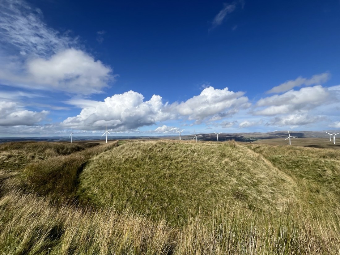
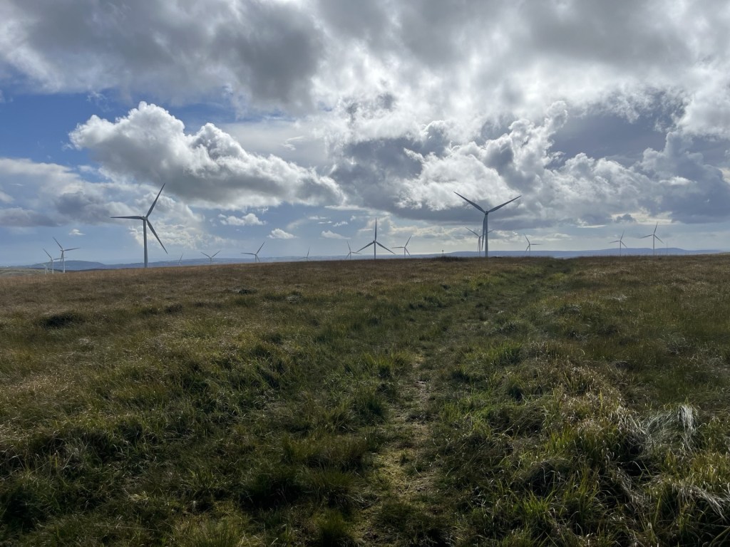
I pulled over again to appreciate the view, which now included an impressive set of wind turbines stretching away to the north.
Wind mining and the noble sheep
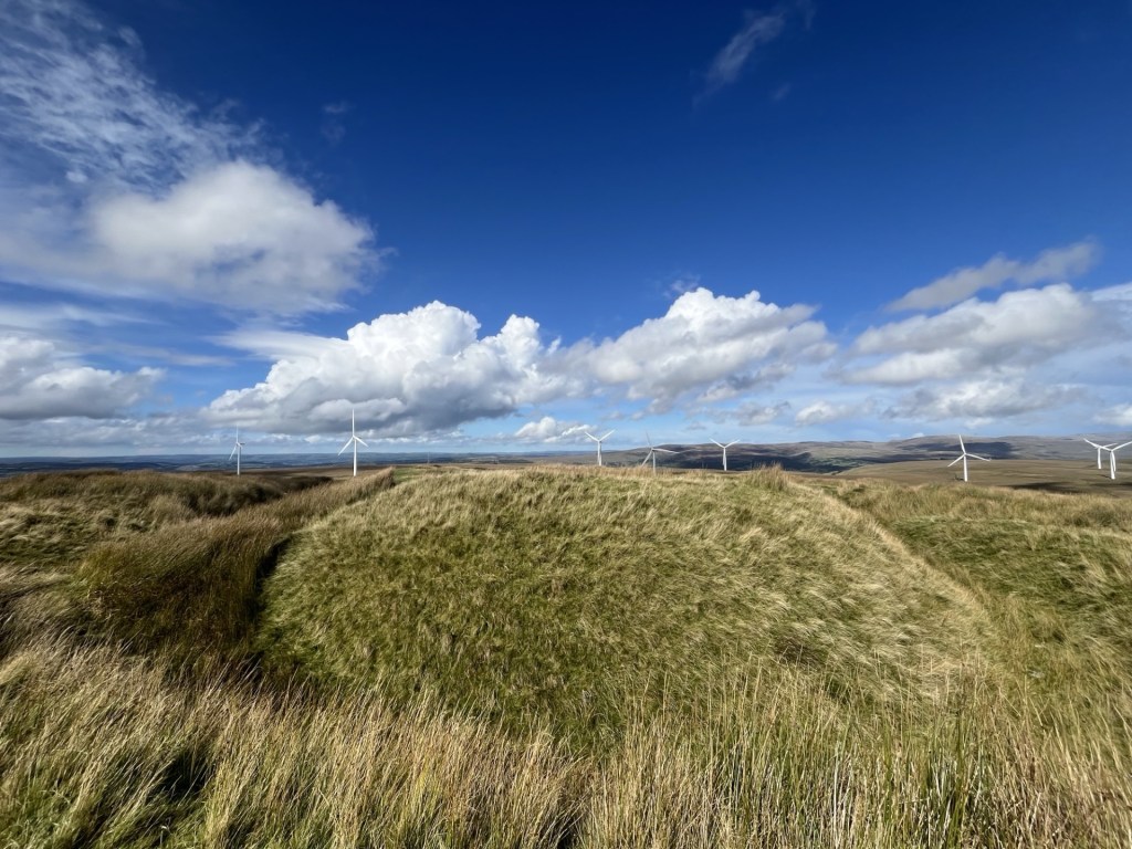
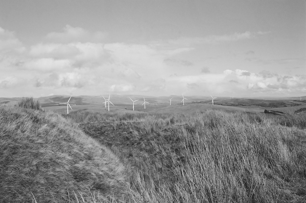
After the short stop the road curved round to the south-west. Wind turbines were popping up all around. An impressive sight, and no doubt an impressive site. A left turn (my mental map was now switched on and working), and the road continued around the contour until on the left a sliver of a stopping place that I had noted on Google earth presented itself. I wondered about the legitimacy of parking at this spot. Whilst there was no signage to indicate it was a passing point, and the road was reasonably wide; it remained a very exposed spot. I rationalised that the “top” wasn’t too far to the east and given that there wasn’t another vehicle in sight I locked up and set off up the slight incline across the boggy moor. If it hadn’t been such a dry summer the ground underfoot would have been a boot sucking minefield, but as it was it was sufficiently tolerable to make good progress. Sheep and turbines abounded at the top, which was no more than 100 metres from the road.
The approximate top – Mynydd Y Betwys
I knew to carry on for another hundred metres or so to reach the little treasure on the top.
Even when I found it, it wasn’t entirely obvious, but slowly the low ditch and ramparts of Penlle’r Castell emerged. I had assumed it was an Iron Age structure but turns out it was more likely to have been a medieval stronghold of some sort. What exactly they would have been strongholding against wasn’t entirely clear (Knights tilting at windmills perhaps), but the views in all directions were remarkable.
Penlle’r Castell looking north
Penlle’r Castell looking east and as it would have appeared in the 13th century
I skipped across the sphagnum, moorland grass and sheep offerings and back to the car. The wind was hammering in from the west, and the turbines were doing their job. I may have said it before but word from across the pond is that wind turbines are already old technology. Apparently, they are a waste of money, that there is no climate change problem to worry about and they are a blight on golfing landscapes (I’m sure someone once said the same thing about golf courses). Seems that there’s a new technology in town and it ticks all the boxes. Spelt OIL. It’s great to know they have our backs. ***
Big Wheels Keep on Turning, grouse moors keep on burning.
There were no plunging views from the top of Mynydd Y Betwys but you could see for tens of miles in every direction. A gem of a low peak where the energy of the movement of the earth and the seas is trying to turn the tables. It may be too late, but at least someone’s trying.
Can you tell what the forecast was?
I still had 70 odd miles to go in the day, and so it was a relief to find the car still there beyond the roadside ditch. And not a lorry in sight!
*It’s probably just as well that hardly anyone reads these accounts as I am sure if anyone did I would be in hot water over this observation.
** I didn’t see the lorry again and rationalised that the driver had stopped for the very same reason I had. English and lost.
***US oil companies generously donated $445million to Trump’s last election campaign! Who could possibly tell?
It was a Saturday, and I had woken up with no particular objective in mind. That said I’d spent nearly a month running around like a headless chicken on caring duties and was truly exhausted. Once upon a time, on a day like this (warm and a soft sun) I often found myself on an empty Saturday slipping onto a train or tube and spending a couple of hours watching football in one part of London or another. Those days are long gone, not least because you can’t just turn up at a ground and expect to get in, but more significantly because I no longer live in London. No footie, no worries. Take a walk instead and hope to avoid all results until Match of the Day.
This one had been on my mind for a while. The old county of Sussex is now (at the time of writing *) split east and west, and at its heart is the Unitary Authority of Brighton and Hove. I had done East and West Sussex in 2024, but Brighton and Hove had eluded me. Today was the day to get on the boots, a train, and then up the chalk.
I missed the first direct train. It was at the platform as I crossed the footbridge but knowing that there was no time to buy tickets and board, I was resigned to wait for the next. That was fine. There was no rush. I wandered down the nearby street, full of second-hand shops, small galleries and one stop dog manicuring facilities. It was busy, and the usual coffee outlets were bursting. Walking back towards the station on the other side of the road, music was seeping, quite loudly, from an unfamiliar shopfront. A vinyl record store that sold coffee. Hmmm… well why not?
With my coffee secured and sitting outside watching the world go by, all was well. And then it got ten times better. Those unmistakable opening brass blasts of Move on Up by Curtis Mayfield get me every time, and it was no different now. If I hadn’t already been motivated, I certainly was now. Sometimes, depending on whether something has inspired me on the day, I embed a music video from YouTube at the end of these accounts, and I’m just telling you now – it’s going to be there. The extended version of course.
The Brighton train pulled into Eastbourne, which is a terminus and where all trains stop for fifteen minutes or so to allow the driver to swap ends before onward progress. It’s a tad frustrating to be honest and is entirely the fault of Mr Beeching, who, along with his committee, decided to remove a mile long section of track to the north of the town. This had provided direct services along the coast, but now it has gone it means that everyone travelling east to west (and back), is sucked into Eastbourne for the mandatory pitstop, thus rendering speedy transit to Brighton or London an impossibility. Well, no worries. I wasn’t in a rush.
The train failed to leave the station at the designated time, but it was only when the guard walked down the carriage apologising to the passengers and explaining that someone had locked themselves in the toilet, that the atmosphere on the train changed. Almost immediately some of my fellow travellers were very loudly offering up a menu of opinions they had in mind if the situation wasn’t dealt with quickly. This included a man near me volunteering to kick the f’ing door down. I’m not sure the guard handled the situation very well to be honest. He chuckled at the offer of assisted violence but also hinted that the person was a teenager trying to avoid paying the fare. By now there were people, male and female, on their feet and baying for blood. A chant went up “get him out, get him out, get him out.” I felt like I was at a footie match in the 1980’s. I sat schtum. It’s felt a bit like the leash has been slipped in recent months, with some unpleasant sentiments and reactions bubbling to the surface of society that would have previously been unacceptable. The situation finally resolved itself when the toilet door opened and moments later three (yup, three) fifteen-year-old lads in trackies appeared on the platform looking cocky and unfazed. There was a muted round of applause for the guard. I looked at the three boys, heads turning this way and that like a group of nervous meerkats. They’d chanced it, had had a moment of fun and annoyed a few people. No one was hurt. Thank God they had been white.
The train left a few minutes late of course. I alighted at Falmer station. Falmer sits just to the northeast of Brighton. It’s the site of the University of Sussex and the relatively new Brighton and Hove Albion football stadium. Earlier I had had a moment of panic when it dawned on me that there might have been a Premier League game at the ground that afternoon. That would have been a drag, but there wasn’t, so I was the only person to get off the train. I was heading to Bullock Hill, the highest point in Brighton and Hove and a mile or so to the south of Falmer.
Walking out of the station I made my way up a series of concrete steps that led towards student residential buildings. It was summer and there was no one in sight. It felt strange wandering through an empty campus, next to an empty football stadium. I’ve supported Tottenham Hotspur since 1967, when they won the FA cup. As a teenager I was brought up in Croydon and so spent a lot of time going to watch Crystal Palace (ironically the current FA Cup holders). Along with Arsenal (see Spurs above), Brighton is the theoretical enemy. When Palace play Brighton, it’s called the M23 derby. As far as I can recall there’s never been any violence, and I hope it stays that way.
Past the university buildings and at a higher level now, I passed along the side of the stadium. On a game free early Saturday afternoon, a soulless place to be. The road led on to the east. I turned and took another look at the ground, nestling into the chalk.
The offside rule explained.
Before we start to go up, here’s a tenuous Brighton joke to break the tedium (I’m afraid it’ a longish read).
A year or two ago I was with family in the garden of a pub in Nottingham, expecting to watch Nottingham Forest on the outdoor TV. Due to a colossal misunderstanding the match (which was taking place a quarter of a mile from where we were sitting) wasn’t televised, so the entertainment had gone missing in action. Except, at just around 3pm, and as we sat disappointed by the development, a middle-aged man wandered over to our bench, sat down and proceeded to tell a joke. Over the next two hours, and without interruption, he told joke after joke, only pausing occasionally to accept the offer of another pint. None were offensive, rude or controversial, but most were funny. This was one of them:
“You’ve heard of the footballer, Danny Welbeck?” Yup, we all answer.
“Played for United, now at Brighton.” Yes, we all answer.
“You’ll have heard of his dad then?” No, we all answer.
“What? Everyone knows Danny’s dad.” Well, we don’t, we reply.
“Yeah, he was in the army. Everyone knew him.” We are all ears.
“A Bomb disposal expert.” Wow! We didn’t know that.
“Yeah, everyone in the army knew him. Great guy.” Hmmm… (where’s this one going?)
“Danny’s Welbeck’s dad,” he paused. “Yeah, we all knew Stan.”
Boom boom. How we laughed – eventually!
Walking east and away from the Amex Stadium and the university complex I crossed over Falmer Road then started the ascent on a well-maintained cycle/path path. The route was set back from road and tracked it up the chalk slope. Steep at times but then easing off views began to open out to the east and towards Lewis.
Waves of chalk heading towards Lewes
After a mile or so a slight bend in the road and some land set aside for wild planting offered an opportunity to inspect some colourful flora. Looking towards the southwest the view towards Shoreham was unexpectedly spectacular.
Spot the butterfly
This was a whole new part of the world for me, and I was impressed. Five minutes on and I was at the top of the ridge, with tracks heading directly east and towards my objective. Following the track that flanked the edge of the Woodingdean housing estate (a desolate dormitory in winter I imagined) I soon arrived at a point which presented options. The main one was a signposted path that had all the hallmarks of being official. Tempted, but not convinced, I decided to follow the unmarked track that headed straight into a field and with a telecommunication tower just to the right.
Bullock Hill rising just to the left of the aerial.
Passing the small collection of buildings and rising metal structures I was able to get a sense of where the highest point was located. This required a slightly tricky clomp over bone hard uneven ground until, after a couple of minutes, I could see a trig point in the middle of a recently harvested field.
The other thing I saw was four people gathered around the trig point. I was slightly surprised by this because it was clearly off the beaten track (which officially was running about 200 hundred metres to the north). Slightly self-consciously I cracked on across the cracked land and stubble. As I approached it became clear that the small group were in the middle of something which appeared to involve a camera and badly applied makeup. Despite the absurdity of it all I felt like a brazen intruder. At about ten paces one or two of the group became aware of my presence, which they acknowledged. “Hi,” one of the young men said (it was three young men and a woman). “Can we help?” he added. Feeling like a complete nerk, and not really knowing what to say, I managed to splutter out something about having come a long way and wanting to get to the trig point. “Ok, no problem,” he replied, “we’re nearly finished.”
By now I had noticed that the woman and one of the men were wearing white sheets with randomly applied muddy smears, and the other two men between them carried expensive looking camera and recording equipment. I guessed that they were probably students making the obligatory short zombie movie that they hoped would soon propel them to Hollywood. I stood and looked away towards the communication towers. Self-consciousness doesn’t get close.
Looking away from the action
Within a minute or two they had finished and I wandered towards them. “So, what’s the importance of this place then?” one of them asked.
“Oh, not much,” I replied. “It’s just the highest point in Brighton.” All four faces turned towards me, jaws beginning to drop.
“No way man.” “For real?” “Who knew?” The woman yawned. They looked around and behold, it was true. Moments earlier they had just been sitting in a field on a mound surrounded by loads of other fields on similar sized mounds. Now it was obvious to them that they were on the summit of a mighty hill, staring down imperiously over everything in sight, including the i360 in Brighton.
Conversation flowed. Did I know what the large crater was just a few paces to the east of the trig point. Well, I sort of did but wasn’t 100% sure. “It could be a sink or swallow hole, possibly post-glacial,” I ventured. “Actually, I reckon it’s more likely to be a dew pond. Dug out by a farmer a couple of hundred years ago, perhaps.”
Bullock Hill Trig. Today’s lecture will be from Prof Bull S. Hitter
The crater – subject of various bs theories.
Incredibly, within a minute, I had gone from an awkward stranger to a veteran sage of the mountain. Their collective astonishment at my imparted (and I should add – free) wisdom and knowledge was almost overwhelming, and for almost the first time in my life I had justified my choice of doing a Geography degree in the 1970s. It was time to go before they asked me a question I couldn’t answer, though to be fair I seem to have slipped into bullshit mode effortlessly.
We parted company and I wandered over to the crater for a closer inspection. Yup, artillery – Second World War. Time to move on down.
I followed the edge of the field to an open gate and at a point that met up with a bridleway heading east. I looked at my ancient Ordinance Survey map (Landranger 198). Immediately to the south, at a distance, I was able to make out the black and white form of the Beacon Hill windmill at Rottingdean. Which was exactly where I wanted to be. A path in the field adjacent to the bridleway headed straight towards it. After a quick rest I got on it and strode forth.
Tilting towards a windmill
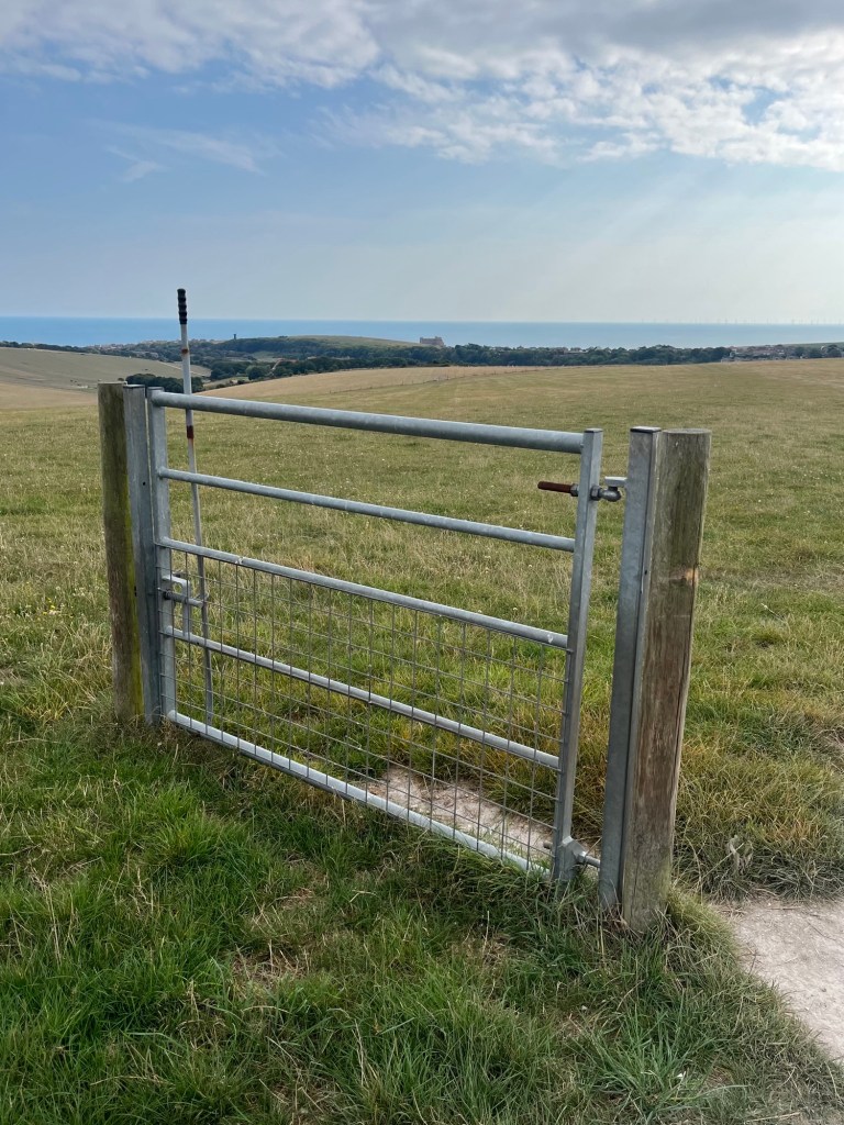
It all looked pretty straightforward. Follow the path and head on down. At the end of the first field a walker friendly gate gave access into a much bigger field which rolled away on all sides. The only slight concern was a sign to the side of the gate proclaiming private property. That’s as maybe, I thought, before setting off on what felt like a path. After about five minutes I came to another of what appeared to be a recently installed gate. It sat at the end of a few low hawthorn trees and quite literally on its own.
The Riddle of the Gate
Another sign re-stated the private ownership of the land. Was this some sort of fantasy video game in which you had to correctly answer a riddle or question before progressing (Mordon’s Quest on the Spectrum from 1985 came to mind – I never did understand what the saltpetre was for). Obviously, I decided to go around the gate, but had this been the right decision? Well, I didn’t blow up, so I guessed it was and carried on down towards two more of these standalone installation gates, one of which I decided to go through just to make sure it was in working order. Carrying on I headed towards another fence and gate around 400 metres to the south. The land here was shaped into a wide folded dry valley with the crop recently harvested. It was a barren sight, made more dramatic by the endless hot and dry weather. It felt lifeless, except at that moment a green woodpecker flew past, settled on a nearby tree and then let out its distinctive high-pitched call.
Classic chalk dry valley, with the emphasis on “dry”
As I reached the end of the field and the escape gate (here at least there was the more traditional fence either side) a middle-aged woman accompanying a girl on a horse approached in the other direction. I gave way and they came through into the field. I said hello and asked the woman if she knew what the lonely gates in the fields was all about. She didn’t know, but then told me it was private land, and “they” could…… She hesitated, as if realising that what she was about to say next might sound absurd. “Hmm… Shoot me?” I joked. She didn’t look very amused but at least it broke the ice. “No, no,” was all she could muster. I smiled and passed on, thinking that what she probably meant to say was “they could prosecute me for trespass.” Yup, that really would have been absurd, but in England (not Scotland) there are many landowners who will go out of their way to keep the hoi polloi off their domains, either through neglect of the infrastructure, or in some cases, the deliberate blocking of legitimate rights of way. That didn’t explain why here, very new and quite obviously expensive walker friendly gates had been installed right next to signage which aimed to make it clear that walkers weren’t welcome. I did have a look on-line later, and whilst I couldn’t find anything to explain the existence of the gates, quite a vicious outbreak of words had recently appeared on a Woodingdean Facebook site about the allegedly deliberate ploughing of footpaths in the area. I didn’t look too hard because it was quite a brutal read, and perhaps reflective of our species newfound ability to miscommunicate with every touch of the keypad. Oh well, I guess I’ll never know the reason, and that’s probably for the best.
Past the gate I joined a more significant track that led towards a large farm complex. On either side areas of land had been set aside for horses and with people were milling around, mucking out and generally minding their own business. I wondered if they were looking at me through one eye and thinking “trespasser”. Too much paranoia I think (Ossie had only recently died after all). Through the farm and, with a slight sigh of relief, at last I was back on public land.
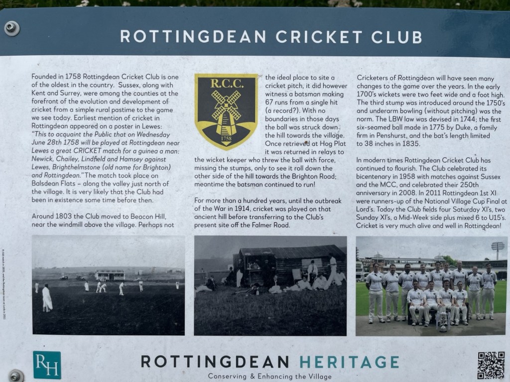
Continuing south and back on the Falmer Road, I started into Rottingdean. On the left cricket was being played on a pitch that made the slope at Lords look like a salt flat. A sign at the side of the road explained the history of the Rottingdean Cricket club and a little-known fact that the highest score ever run off a single delivery was made on a nearby older ground. For the record it was 67; after the ball had ended up rolling down the high street and before the introduction of boundaries. When the ball eventually arrived back at the wicketkeeper, he missed the stumps and the ball then set off down another street. There’s a metaphor here for something or other.
Howzat?
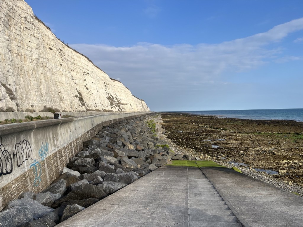
The buildings entering the town were, to say the least, eclectic, and in the main very well to do. Soon afterwards I was at the busy sea front heading west along the wide Undercliff path and under the chalk cliffs and towards Brighton. The last time I had been here had been some years back, on a cycle ride from Brighton to Eastbourne. Not a particularly long ride but trying to hoik the bike over the Seven Sisters had nearly finished me off. That was something that wasn’t going to happen again. ** Up until this point there had been a fine haze that had kept the temperature at a reasonable level, but that was now lifting, and the sun was occasionally breaking through, illuminating seaweed on the rocks below and bringing life back into the chalk cliffs.
Undercliff path looking back to the east
As added interest a low flying seaplane (type unknown) glided silently past, going west to east.
Flying with the birds
I was beginning to flag a bit and regretted not having stopped for a tea or coffee at Rottingdean. Keeping to the Undercliff path I trudged past the Marina, which seemed to go on far too long. Beyond the Marina I stopped for a few minutes to watch and listen to a rock band entertaining a large crowd gathered at a mini festival. The tune they were blasting out almost sounded familiar, but I couldn’t place it, and it wasn’t quite my cup of tea; speaking of which I was now in desperate need.
Rock the Marina
Madeira Drive looked longer than I remembered it, but it had to be tackled.
I’m not entirely sure if it could be classed as music, but at the halfway point between the Marina and the Pier a brain numbing sound was blasting out from the Concorde 2 music venue. Two or three years earlier, with a friend, I had had the privilege of seeing Steel Pulse there. Whatever the genre was that was crucifying the eardrums of the punters there now, it certainly wasn’t anything like Handsworth Revolution. As I say, I was now desperate for a large tea, and I certainly wasn’t going to get that at the Concorde 2.
Now desperate, and against my better judgement, I finally succumbed to a tea option at one of the tacky seafront fish and chip/kebab/candy floss and ice cream outlets near the Sea World aquarium. Despite emphasising that I just needed a very small drop of milk, the man who served me couldn’t resist pouring a quarter of a pint of the stuff into the cup. I was tempted to protest but didn’t have the energy to follow up any potential conflict with added venom, so grabbed the miserable warm concoction and went and sat on an uncomfortable bench.
At least here there was more entertainment to be had. A small group of mods were posing on their classic scooters on the other side of the road. It was quite hard to establish which one of them was the “Face”. In part this was because all the men were bald and their facial structures, a bit like mine, had slowly collapsed over the fifty odd years since they had first arrived here on the back of watching Quadrophenia. Despite their average age of an estimated 65 plus, most were dressed in state-of-the-art 1960’s mod clothing. Revving up (well that’s not quite the right description – the sound more that of defective lawn mowers hitting hidden twigs), they began to assemble on the opposite pavement with an indication that they were about to ride off in unison. They were waiting for something. And then he was there and being saluted by a collective throttle tonk. The Face! At full speed and his ride decked in at least thirty rear view mirrors, a man drove by at maximum speed…. on his mobility scooter. From my side of the road, a young man and woman dressed in immaculately retro “Rocker” gear jogged across to their motorcycle. They were acknowledged by the mods, and a few friendly words were exchanged. I couldn’t help chuckling. Was it nostalgia, cosplay or a genuine commitment to the cause? Either way it had kept my mind off the task of digesting the disgusting warm milk that I’d paid £3 for.
At least here there was more entertainment to be had. A small group of mods were posing on their classic scooters on the other side of the road. It was quite hard to establish which one of them was the “Face”. In part this was because all the men were bald and their facial structures, a bit like mine, had slowly collapsed over the fifty odd years since they had first arrived here on the back of watching Quadrophenia. Despite their average age of an estimated 65 plus, most were dressed in state-of-the-art 1960’s mod clothing. Revving up (well that’s not quite the right description – the sound more that of defective lawn mowers hitting hidden twigs), they began to assemble on the opposite pavement with an indication that they were about to ride off in unison. They were waiting for something. And then he was there and being saluted by a collective throttle tonk. The Face! At full speed and his ride decked in at least thirty rear view mirrors, a man drove by at maximum speed…. on his mobility scooter. From my side of the road, a young man and woman dressed in immaculately retro “Rocker” gear jogged across to their motorcycle. They were acknowledged by the mods, and a few friendly words were exchanged. I couldn’t help chuckling. Was it nostalgia, cosplay or a genuine commitment to the cause? Either way it had kept my mind off the task of digesting the disgusting warm milk that I’d paid £3 for.
Not in the least bit refreshed but suitably entertained, I continue past the Pavilion and then up the steep backstreets off the Queens Road. A familiar noise began creeping up behind me. I turned around and there they were again. The mods on their sewing machines. As they passed me by, and now closer, I was able to re-assess the average age. It was at least 75 and they were clinging onto the handles for grim death, which of course was waiting just around the corner. Three or four of the riders, who came with their partners on the back, almost had to get off and walk their bikes around the turning into Foundry Street.
By the time I reached Brighton station my ankles were crying out in revolt. I recognised the sensation. The last time I’d experienced similar hadn’t been during the climb of Ben Nevis a year earlier, but instead it had been at this exact spot in May 2024, after walking from Falmer station to Ditchling Beacon (the highest point in East Sussex) and then back into Brighton. History was repeating itself. Eleven miles in total, and whilst to date I have avoided ranking any of these expeditions, I have to say that this one had been a top five contender.
I reached the station just before my ankles reached their limits. It was time to move on up and move on out. Great day.
Meanwhile, in a funky bar somewhere in the Lane’s, four media studies students were huddled around and earnestly reviewing the title for their arthouse short movie. “What about The Zombie’s on Bullock Mountain?”
“Hmm… not catchy enough. How about Zombie Sinkhole Apocolypse?”
“That’s it. Your round Stan.”
The following day Brighton and Hove Albion played Everton away and lost 2 – 1. Danny missed a sitter, and then a penalty. Shucks!
* At the beginning of 2025 a consultation began on whether to reshape local government in Sussex. For what it was worth I put in my thru’ pence worth. We’ll find out soon what the final decision will be, but it looks like it could end up as five unitary authorities with shared services. That may or may not be a good idea, and it may or may not save money, or it may or may not cost everyone more. It may or may not lead to greater local democracy and representation, although I’m not convinced. Either way it will render my efforts to get to county tops somewhat meaningless. Creating two more here in Sussex would be no big deal (by topping Brighton and Hove I’d completed the Sussex set). Another two excursions close to home – okay. The problem is that these changes are likely to be taking place in many locations across the country and the implications of that are – well, to say the least – daunting!
It was Wednesday. I’d spent two nights in Bristol with my daughter at short notice and was now due to head home. However, something was in the air. Something that suggested I was about to have an unpredictable, intense and taxing experience over the coming weeks (accidents will happen). For the moment at least my brother was on the case. To break the journey back and buy myself a bit of me time before the storm broke, I decided to book a night in a room in Marlborough.
We were in the kitchen (my daughter and I), chatting away and about to go for a therapeutic walk when, for no reason I could fathom (it’s often that way), I spotted the first nondescript but telling sign of an oncoming migraine. Well, that instantaneously knocked the edge off the day! “Ready for our walk Dad?”
As the insidious black and white geometric pattern started to flesh itself out, I closed my eyes. My daughter had enough on her plate and here I was slipping into instant fug. Ten minutes later, against my better judgement and experience, I decided to throw the migraine into the metaphorical bin and put my boots on. “Let’s go.”
Without overdoing it we managed an interesting three mile walk through the Coombe Brook nature reserve and along the Bristol and Bath Railway Path, a fascinating combination of dells, glens, playing fields, open heath and industrial heritage. It will have to be done again when I’m not having to half close my eyes to keep out the light.
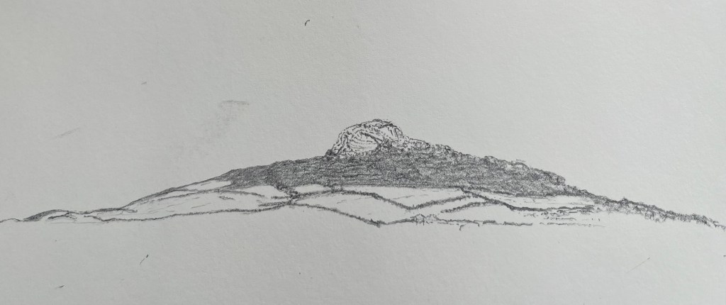
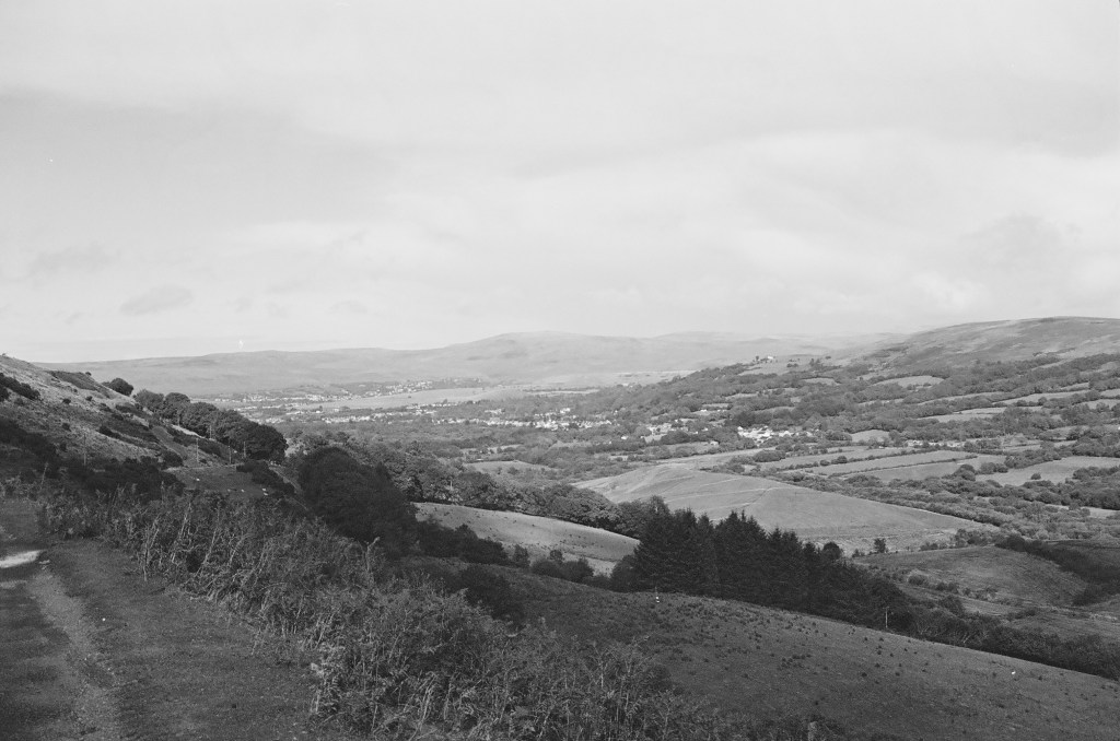
This new strategy seemed to have worked, for the moment at least, and I was feeling good enough to set off to Marlborough. We said our goodbyes and soon I was driving east towards Chippenham. Past Chippenham, which just seven weeks on I can’t remember a thing about, I carried on through Calne and continued directly east on the A4. I was heading for Milk Hill, the highest point in Wiltshire. I had done some basic research and noted that somewhere near to the site was a white horse carved into the chalk. And so, as I passed out of the small town of Cherhill and noticing what appeared to be something that looked like a white horse on the north-west facing slope of a range of hills, I assumed I was getting close. I stopped in a layby just past the town and got out to survey the scene.
The first thing I should say is that as white horses carved into chalk go, it was a bit of a disappointment. It looked more like a cross between a stunted giraffe and a starving hyena. It certainly lacked the surrealist brilliance of the truly ancient Uffington white horse I’d seen the previous September, or the starkly beautiful and anatomically accurate Bratton White Horse near Westbury (visited in 2023 but not in the county tops list).
The Cherhill white creature and, at the time, an unidentified interstellar communication device.
Scanning to the right, along the ridge and unavoidable to the eye, a massive stone pointy thing thrust upwards. A commemorative structure of some sort, no doubt, but not necessarily what I had expected, unless it marked the top of Milk Hill. *
I figured that all I had to do was drive on a bit and eventually I would come to a turning to the right that would get me closer to the top (I had previously done a journey planner on Google where a small road ran a good way up towards the top of Milk Hill). I drove on but nothing materialised. I reached a roundabout at a place called Beckhampton. Things weren’t making any sense. I pulled over again and tried to re-orientate. I had another go at entering a route on the phone, and I was told to carry on east and then turn right onto a small road at West Kennett.
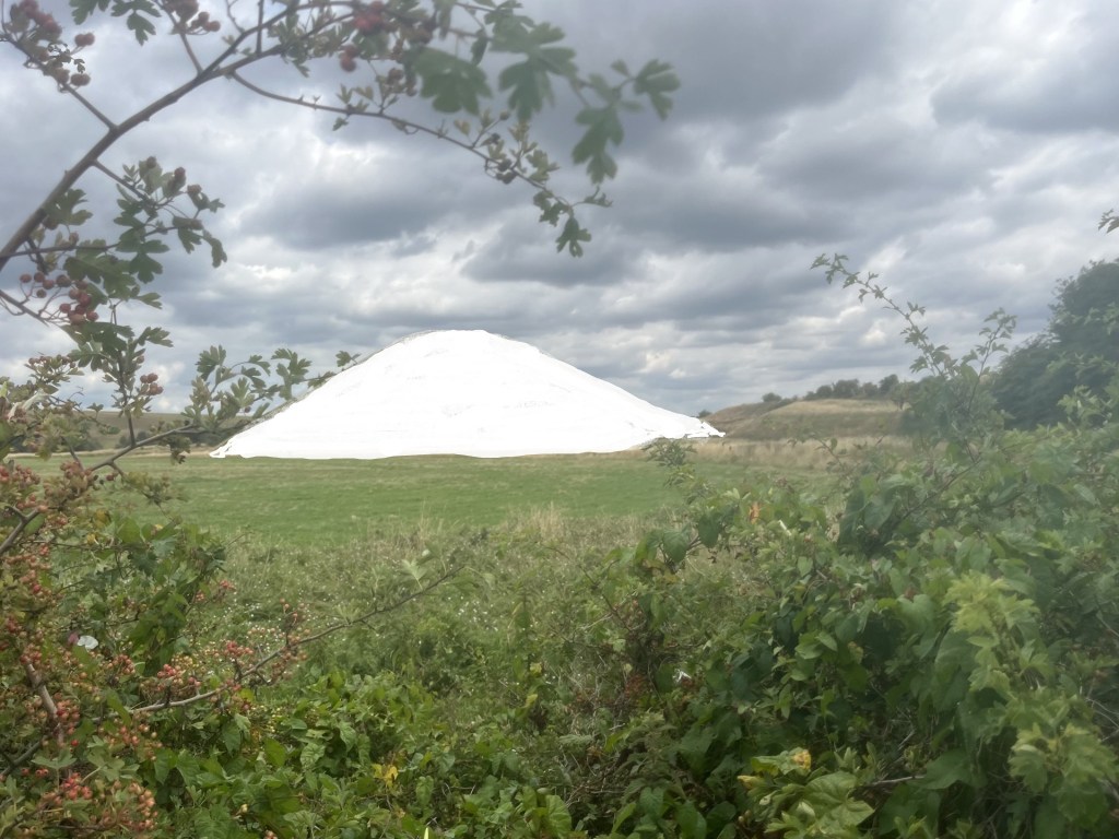
There always seems to be a complication when I’m trying to find these spots. I’ve concluded that the complication is me, and my increasing lack of engagement with new tech. I think this is in part because I don’t want to know everything. Knowing everything means there are no surprises. So, when five minutes on and a bit further down the road I noticed a familiar conical shaped hill just to the left of the A4 I was genuinely surprised and delighted. It had been many decades since I had last gazed at Silbury Hill, and there was time for another quick stop.
Silbury Hill in its original un-grassed state – as re-imagined
After a few minutes of contemplation (Why? Well, because when you see Silbury Hill you do have to wonder) I carried on to West Kennett and located Gunsite Road on the right which, according to Google, was going to take me to within touching distance of Milk Hill (check it out, the blue line takes you to within 300 metres). **
The narrow road headed south and slowly up. A large farm building emerged to my left, and then, just around a corner, a heavy metal gate blocking further progress. This hadn’t been in the script. I stopped and inspected the obstacle. Locked, along with a second metal gate just to the right where another road led away to the west! This was an unexpected blow, but it was obvious that I wasn’t going to be getting near the top on four wheels. Conscious of my delicate condition (I have occasionally had more than one migraine in a day), I turned the car around and headed back towards the A4. Just before reaching the end of Gunsite Road, I noticed a car parked up on a small patch of dry ground just off the road. I pulled in behind and spent a few moments considering my position. My body was weak, that was for sure, but I’d come a long way and doubted that I’d be back this way anytime soon. It was mid-afternoon. A bright sunny day, and not too hot. Sod it.
With my walking boots on I headed back to the locked gate and then onwards along a concrete road that continued south and gradually up. I had by now lost any concept of where the top of Milk Hill was, or even if I was on the right track. It was just a question of keeping on walking, and so long as I was going up, I stood something of a chance. Looking back, I noticed a small number of people dotted around an unusual hump in the landscape on an adjacent rise.
An old barrow. See **** for extra extraordinary information.
I had seen a sign earlier to West Kennett Long Barrow. Judging by the small gathering of people clambering over the mound I figured I was now looking at it and wondered if I had ever been to it. I’d certainly been to Silbury hill many decades before, but nothing came back to me to suggest I had been to the barrow. It was too far away now to divert me just so I could tick a box. I carried on along the concrete road, slightly out of breath, until it levelled off for a while and I reached an isolated barn structure where the road bore to the left. By now the landscape was opening out and I could see what appeared to be the higher ridge stretching east to west a mile or so further to the south. I had more than once toyed with the idea of calling it a day and retreating, but now the objective seemed to be tantalisingly close. I chose to go on.
The first sight of the higher ridge
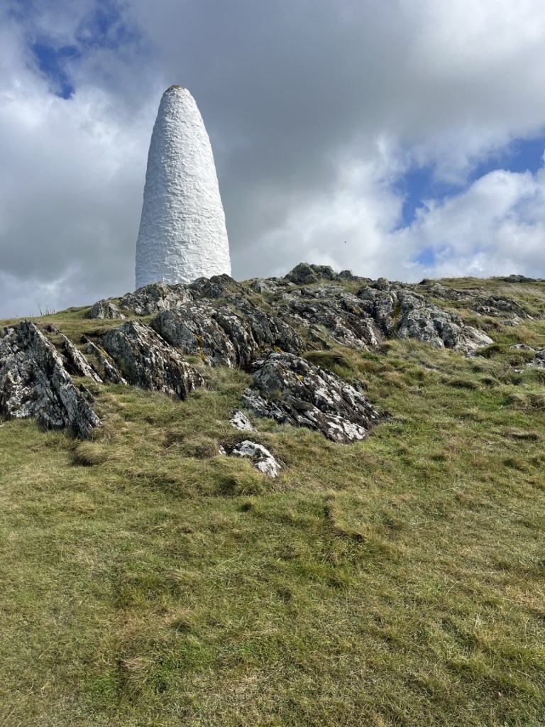
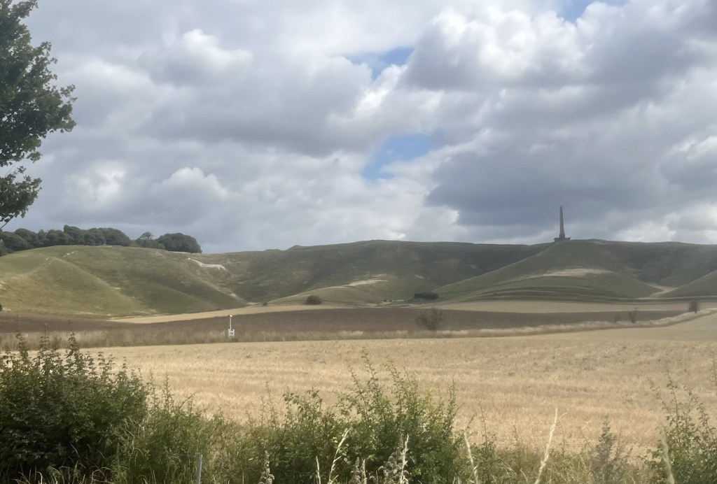
I expected at some point to find a path that would take me on a direct course but nothing materialised and at the next collection of farm buildings a sign proclaimed the land to be private property, whilst another claimed that CCTV was in operation to prevent rural crime. Whilst sympathetic to the farmers’ need to protect assets and knowing that rural crime is a blight, I hadn’t come this far (still with the threat of a migraine in the back of my mind) to be deterred by these notifications. Rightly or wrongly, I carried on, conscious that my progress/trespass might be being monitored. The road veered back southeast and continued up past huge fields to either side. Stopping to catch my breath I took a 360 look around. Far to the west, at least three miles away, and rising dominantly above the ridge, it was impossible to miss the enormous obelisk I had seen back at Cherhill. Well, that at least told me I had been entirely misguided in my assumption that it might have marked the top of Milk Hill. Despite all the gadgets I had become seriously disoriented and regretted not having an Ordinance Survey map to provide a degree of certainty.
I ploughed on up. Towards what I hoped was near the top, the road intersected with another that led up a steep slope from a valley below. Using this road I soon reached a gate and an information board that hinted that at last I might be close to the top. A path headed directly south across a grassed field and towards some trees, with another cultivated field to the left. Precisely what was being cultivated was unclear to me, but I had little doubt I was looking at Milk Hill, with the highest point a hundred or so metres beyond the barbed wire.
Here’s looking at the top – Milk Hill
Maybe somewhere a path led to the top, but from what I could see it seemed unlikely. I had done as much as I could, and frankly, by now I was more impressed with the magnificent and commanding views of the Vale of Pewsey opening to the south. I still had some reserves in me so carried on along the edge of the field until, with no white horse to be seen, I decided to stop. The reason for stopping was simple. Scattered randomly across the grass were a number of limestone boulders that made perfect seats. They looked entirely comfortable in these surroundings, but as I sat and took in the views, I was left wondering. Wasn’t this chalkland? ***
Unaccountable erratic’s
The landscape looked familiar, yet unfamiliar at the same time. I’d seen a view not dissimilar to this before and it slowly began to occur to me that about twenty years before, along with my son, we had been on these hills, having camped for a couple of days at nearby Pewsey.
I’d pushed my luck getting to this point and decided to abandon the idea of seeking out the white horse. I started back the way I had come. Back on the concrete track and looking west the outline of a huge ditch snaked along the top of the ridge and towards the horizon. Hoping to get a dramatic picture of what was clearly a man-made structure dappled in light and shade, I waited a while for the right combination of sun and shadow. As neither presented themselves and I was getting bored, I took a shot anyway, just at the moment a red kite swung into view. Despite this interesting moment, it remained a disappointing photo.
A disappointing photo of the Wansdyke and a rhyming red kite.
Down I went, now with three or four red kites circling the adjacent fields, and then passing the group of buildings with the CCTV. Happily, there was no one there with a pitchfork to challenge me. A movement to my left and a hare dashed out of some crops, stopped for a moment and then darted at immense speed into more crops. Hare coursing remains a significant rural activity. Those who do it would call it a “sport”. Because it’s illegal it’s not a sport, thankfully. How anyone might get a kick out of setting dogs on one of these stunning creatures is beyond me, but then again, I’m just a townie, so what do I know about the country ways, but it might have explained the CCTV.
As I approached the second solitary barn there was an odd but slightly disturbing thumping noise coming from its general direction. So far, apart from one large harvester in a distant field, I hadn’t seen anyone and whatever was going on inside the structure didn’t sound like it was being generated by a human. Being in Wiltshire, a county steeped in ancient mysticism and crop circles, I moved towards the structure, which was nothing more than a corrugated roof, some metal supports and a few bundles of hay. The knocking noises continued. Suddenly there it was, the source. A deer, quite large but type unsure and clearly startled, skipping around at the back, and trying to escape…. from me!
The poor thing was in a terrible panic. I stood still trying not to make the situation worse. Its problem was that it was trying to get under a corrugated panel and into the field beyond by throwing itself at the light, but its small downy horns kept hitting the metal sheeting and knocking it back. On the third or fourth attempt it eventually managed to hunch low enough and with a final, slightly sickening thud, it scraped under and vanished. For no logical reason I felt slightly guilty for the animal’s discomfort but rationalised that they were hardy creatures and probably found themselves in similar pickles daily.
Silbury Hill and West Kennett Long Barrow from Gunsite Road
I carried on down the road where, to my surprise, a car suddenly appeared coming up what must have been a subsidiary road. This was the moment I thought I would be challenged. But it wasn’t. The car carried on down Gunsite Road. **** Moments later two further vehicles were behind me. I moved over. This was all getting a bit too Southern Comfort for me, but whoever they were (farm workers knocking off for the day I guessed), they passed on by before pulling up a couple of hundred metres ahead at the locked gate, which they opened with ease and disappeared.
I reached the gate a couple of minutes later. It had been locked again, and I noticed that the bridleway sign, which had been upright earlier, was now on its side and lying in a ditch. Sometimes there’s no point in trying to rationalise things. The good news was that I hadn’t experienced another migraine, and the car was still where I had left it. I remembered to stop the walker App. Six miles!!! What had I been thinking? I collapsed into the driver’s seat. I had one night in Marlborough before what I knew were going to be exhausting and challenging weeks ahead. Despite the sudden onset of knackerdom I knew I had made the right call. I’d breathed in the heady Wiltshire air and seen its ups and grassy Downs, I was ready.
* The enormous monument was erected by the 3rd Marquess of Landsdowne (who he?), in honour of one of his ancestors. The Petty-FitzMaurice’s have been around a very long time, and one of them was even Prime Minister around the time the French were despatching with their own aristos. From what I can tell the 9th Marquess still sits, unelected but inherited, in the House of Lords.
** As at the end of 2025, if you look on Google Street view you can see that the gate is unlocked and just inside the field several cars are parked up. Daytripper’s/hare coursers? Nearby a sign states, “private property”. One way or the other the landowner has since decided to secure the premises and this may be legitimate, but by locking the gate she/he has also blocked a signed byway (thus preventing onward horse travel).
*** It took a while and a lot of searching but I’ve since concluded that the erratic’s at the top of the chalk weren’t limestone but in fact sarsen stones. How they came to be there is unclear (see infinite theories on Stonehenge). The logical answer is by glaciation, but maybe human action too.
**** Well blow me down!!! I decided to see why Gunsite Road was called what it was called and came across this little article (which suggests it once led to a firing range). Just up the hill from the locked gate, going towards the long barrow, was the setting for the moment in Saving Private Ryan when the army officer and priest visit Mrs Ryan at her home on the plains of Utah to tell her three of her sons had died in action. A very moving scene.
I had been driving around the large and presumably ancient village green at Langley Upper Green for several minutes hopelessly trying to find a legitimate parking space. Not because every parking space was occupied; quite the opposite – there simply wasn’t anywhere to park. Despite my frustration I had to admire the fact that you could take in the sight of the green space without the slightest hint of painted metal and rubber. After several reconnoitres, I noticed a modern building with its own small car park located on the greens eastern flank. I parked up, searched high and low for any signs that might indicate a vehicle indiscretion and concluded it was safe.
I was at Langley Upper Green because, from what I could tell, it was the closest starting point to get to the highest point in Essex, and a spot called Chrishall Common. Half an hour or so before I had been to the top of Cambridgeshire, at the nearby village of Great Chishill. At 146 metres high, Great Chishall is 146 on the list of County and Unitary Authority tops. At 147 metres Chrishall Common is 145 on that same list (keeping up?). If that’s some strange symmetry, make of it what you wish. Or maybe call it a plateau.
After weeks of drought and high temperatures, a gathering cold front was pulling low, grey but thinnish cloud in from the west and offering the possibility of rain. I pulled on a light anorak and set off across the green and towards the north-west corner, where I hoped to find a path into fields.
A gravel-based road ran along the north of the green, serving some houses on the northern edge, and then a handful of newer mock period houses ranged on the eastern edge. Not unattractive, and blessedly not gated off, but surprising given that I assumed the green had at one time been common land. Maybe it wasn’t. A look at a map from around 100 years earlier showed that the green then was about twice as large.
The green at Upper Langley – not yet gated
I found the path at the top of the green and then passed between two areas of land, possibly orchards that had been fenced off. This path led to a large field with a huge stack of hay, the size of a large building, that can be identified from space on Google earth.
Giant haystacks – The great Bale of Langley
A path flanked the field heading west and then a turn to the right and north and skirting another much larger field.
Sweeping up to the top
A stiff breeze brought with it spots of rain that threatened a possible deluge. It would have been very welcome, but never quite materialised. A large wood lay at the north of the field and stretched away several hundred metres to the west. As far as I understood it, the highest point in Essex was either in, or just beyond the line of trees. A path, identified by a post with multiple signs, led through the woods and into another field.
Every which way in Essex
If the highest point was somewhere in front of me, it was impossible to pinpoint it, and as far as I knew it could have been back in the woods. With the threat of increasing rainfall (which failed to materialise) I retreated to the southern field, and within fifteen minutes was back on the green.
Chrishall Common – The high point!
As a leg stretcher I quite enjoyed this short walk in a big flat landscape. Maybe the overcast conditions didn’t do it justice, and maybe it would be best enjoyed dressed to the max and traipsing across the fields in a February blizzard with the wind whipping in from the east.
A distressing discovery has emerged whilst writing up this account. Earlier in the year, and based on sound research, I had climbed to the highest point in Bristol at Cossham Memorial Hospital, Lodge Hill. So, as I was checking down the height information for this piece on the Peak Bagger list I noticed Bristol, but it was showing a different name!!! What the what the???? Dundry Hill East! Dumbfounded, I did some searches and sure enough a recent article in Bristol Live explained that following a boundary change in 1949 Dundry Hill was quite a lot higher than Lodge Hill. Peak Bagger must have agreed and made the change. Finding this out means a lot of unpicking, but most distressingly requires another trip. Oh well, the joys.
I woke up in an hotel room in Cambridge, having chosen to break my journey home from North Yorkshire the day before. In the 16 hours I had been in the city not one person had tried to recruit me into the Communist Party, the Workers Revolutionary Party or the Russian secret service. I had, for once, to agree with all those doomsters who post on social media that the country really had gone to s..t.
Great Chishill, the highest point in Cambridgeshire, stands at 146 metres, and just so happens to be 146 on the list of County and Unitary Authority tops. Up until I researched this, I had assumed that the county with the lowest average land above sea-level was Norfolk, but several sites (including the Lord Lieutenant of Cambridgeshire’s own website) claim Cambridgeshire. Cambridgeshire (according to my sources) is the flattest and lowest county in the UK, with an average height above sea level of not a lot and has the lowest point in the UK at a place caled Holme Fen, lying 9 feet below sea-level (about 40 miles from King’s Lynn, and the sea at the Wash). Just to complete the picture I was almost about to reveal that whilst Norfolk was not the county with the lowest average land height in the UK, its men were in fact the shortest, at an average of 5ft 6inches. This was revealed in 2016 by the Suffolk Gazette, apparently following “research”. Fortunately, I bothered to read beyond the first few paragraphs, which were convincing enough, until, in the fourth paragraph it stated the following:
“Researchers found the average man in Norfolk was only five feet six – while Norfolk women were also five feet six… wide.”
Call me old fashioned but at the time of writing I have refused (knowingly) to engage with any information provided by Artificial Intelligence. So, it was with some delight that when I checked back on this article, I noted that at the top of the feeds, the depressingly omnipresent AI Overview showed its “true” colours.
Nothing more needs to be said
But hey, I hear all one reader shout. What has any of this to do with the highest point in Cambridgeshire. Fair point. Let’s get back on track, literally.
Until 1895 Great Chishill was in Essex. The highest point in modern day Essex is a few miles away at a place called Chrishall Common. Standing one metre higher than its nearby, nearly namesake, Chrishall Common manages to come in at 145 on the tops hit parade. Judging by these statistics, when the inter-administrative prisoner exchange took place in 1895, Essex was clearly determined to hold onto its higher status. *
I left Cambridge mid-morning, drove south, and without too much difficulty drove into the small car park opposite the impressive St Swithin’s Church, Great Chishill; a large village with some impressive, thatched buildings on the approach.
The task was simple. Leave the car, walk south on Haydon Road, turn left onto Hall Lane and walk east until the highest point. There’s not a lot to say. I passed some houses on either side of the road until a well-resourced recreation ground and cricket pitch on the left. At approximately 300 metres into the walk, and again on the left, a field opened out. If you look on Google maps a pin drop titled Highest Point in Cambridgeshire, marks the spot. All of one person has rated it and left a review. Christian Goss – get a grip. This is not a 5-star site although I assume that the comment “Great spot, remember to take an oxygen mask though” was tongue in cheek.
The highest point is somewhere in this photo
After a quick look over the field and being satisfied that I had reached the top of the county, I walked back to the crossroads and took a peek into the church grounds.
At the north side of the church, it was just possible, looking to the west, to get a view and a slight sense of height above other land, but to be fair it was marginal.
The sweeping vista to the north-west
The WW1 grave to Private Frank F Rogers of the Suffolk Regiment, who died aged 20 on 20th August 1916 carried the added poignancy of the additional gravestone to his older brother William, born in 1891 and who survived his younger brother by an incomprehensible sixty-nine years.
Brothers reunited
Just as I was leaving the grounds I heard a low drone coming from the west. Looking up, what appeared to be a Tiger Moth type biplane was slowly coming into view and began to circulate above the village before slowly turning back in the direction it had come from. On the way to Great Chishill I had passed Duxford Airfield. Duxford is part of the Imperial War Museum and sure enough (I checked later), for £209.00 (at the time of writing), you can go up in one of these WW2 training planes for 15 minutes. It’s impossible to escape the reminders of war.
Across the road and just before the car park a brick bus shelter offered shelter from the rain to the users of public transport, and a canvas for the imaginative. Most notably a remark, chalked into the brick – Chishill for Life. Several possibilities sprung to mind:
A local stonemasons motto promoting the health benefits of his or her trade
An errant resident whose crime resulted in a tag for life, limiting his or her movement beyond the village
A supporter of the local football team who, in a misplaced sense of place and aspiration, had attached their flag to the mast and won’t be turned – for ever!
The musings of an aspiring Steven Morrissey type, who’s seen the future and has accepted the brutal reality.
The last will and testament of a traveller who passed away waiting for the non-existent last bus out of town. I had noted a grave to the unknown traveller moments earlier.
Despite the damp but warm morning, I shivered at the thought of all the options above. There was nothing particularly exceptional about Great Chishill, nor was there anything particularly awful. It was entirely average, and I guess it was the thought of the very average for life that chilled me most. I drove out of town on Hall Lane as quickly as the speed limit allowed. Within a mile I was in Essex.
Chishill For Life – Be careful what you wish for
* None of the facts contained in this section can be verified 100% so take on board at your own risk.
I was travelling from the Rosedale Valley in North Yorkshire, with the intention of spending the night in Cambridge. Five days earlier, on my journey north, and aiming for Nottingham, I had hoped to make an attempt on Bardon Hill in Leicestershire, but time was against me, so it had to be postponed. Earlier in the day, after eventually finding Stock Hill (the highest point in the City of York Unitary Authority area) I crawled south on the A1(M) and then the M1. It was a Bank Holiday Monday, and it was depressingly obvious.
When, over a year ago now, I started out on my quest to reach the tops of our counties, I was fairly confident that having climbed up to Old John in Bradgate Park (on at least two or three occasions over the years), Leicestershire was already in the bag. Bradgate Park lies to the north of Leicester and has a feel of a slice of lowland Scotland. I had first visited and climbed to the highest point (where the Old John folly adds a few more metres) in 1978, with my girlfriend. It had been a warm and sunny day when we caught a bus out of Leicester. Aww… a perfect picture, except, as we approached the summit, clouds rapidly began to gather. Within minutes the rain started to hammer down and all we had for cover was the small lintel of a door set into the tower facing away from the wind. The fun of the day quickly evaporated as the precipitation enveloped every nook and cranny, and as we slowly drowned in our light clothing, I was overcome by regret in my choice of activity in what was quickly becoming a seriously misguided attempt to impress (I was studying for a Geography degree – what can I say!). How did I feel? Inadequate. No worse. I could now empathise with King Lear:
Blow, winds, and crack your cheeks! rage! blow!
You cataracts and hurricanoes, spout
Till you have drench’d our steeples, drown’d the cocks!
You sulphurous and thought-executing fires,
Vaunt-couriers to oak-cleaving thunderbolts,
Singe my white head! And thou, all-shaking thunder,
Smite flat the thick rotundity o’ the world!
Crack nature’s moulds, an germens spill at once,
That make ingrateful man!
After the rain had passed so had the laughs. We traipsed off down the open slopes and back to the park entrance, where, to compound my juvenile insecurity, the last bus to Leicester had departed. There was nothing else to do but walk. On a road that may or may not have been heading back into Leicester a van pulled over, the occupants clearly having taken pity on us. My memory of exactly what happened next is hazy, but I do recall that by the time we got out we were nothing but relieved. Whilst the two men in the van may well have been acting out of charity; there had been an unsettling sub-text to their conversation that perhaps suggested another agenda. We eventually made it back into town and still wet through found sanctuary in a small pub where we dried out over a couple of wet ones.
But of course, for this account that story would have to be abandoned, because on double checking on the highest point in Leicestershire I discovered that Old John, whilst a significant and delightful high point, was overshadowed by the nearby Bardon Hill, just to the south of Coalville.
Leaving the M1 at junction 23, I navigated south and eventually parked up on Romans Crescent, a road passing through a pleasant newish estate on the edge of Coalville. I had previously researched the location on Google Maps and had taken a screen shot for reference. Despite the recent heatwaves, from what I could tell Coalville came with a rather troubling weather pattern of its own, where permafrost meets the temperate zone.
Fortunately, on the day I visited only warm drizzle filled the air. A short walk south and to an opening into a wooded area. The path extended further south with trees on the left and a wide field to the right extending slowly upwards. I had no idea what to expect on this walk. Despite having lived in Leicester for some years it had never registered that there was significant high ground to the north-west. I had read that from the top of Brandon Hill it was possible on a clear day to see the Malvern Hills, all the way to the south-west in Worcestershire. This seemed to me to be inconceivable, not just because Bardon Hill wasn’t exactly a mountain but because of the distance (around 70 miles at a guess). The other thing I knew was that at some point there was a quarry of some sort, but its extent remained unknown.
Just beyond the field – the boulders may have been a sign
With the field ending the path led into mature woodland, and just a short distance in a sign made it clear that something of interest probably lay ahead.
Oh! No, this is a sign. Well, you get the gist
The track continued and then an obvious upward path to the right indicated a steeper ascent. Continuing up through the woodland the gradient increased significantly, and after four or five minutes I was beginning to pant. The occasional dog walker passed by, going down. I was envious.
After maybe ten minutes the woodland began to retreat from the edge of the path, and slowly the land eased in its gravitas. The surroundings were now more heathland than woodland, with minor tracks leading away towards the quarry. I wasn’t too curious. There would be a view at the top I was certain. A large wooden bench and some smooth rocks presented a rest opportunity. For some reason I chose the rocks.
Resting point
After a few minutes I carried on up a short way to the top of the rise. A concrete structure sat to the right in some woods and the land beyond fell away. I had clearly reached the top.
The top?Obs…
Mission accomplished, I retreated to the bench and stone combo. A short distance to the left provided a partial view of the quarry looking north-west. I had expected to see something quite significant, but the size of the hole in the ground was far bigger than I had expected. Largely overgrown on its higher slopes I wondered if there were any items of a policeman’s uniform hidden in the undergrowth. If you are wondering why I was thinking this you’d be right to ask.
The view from near the bench
At the time of my visit there had been a national news story about a Leicestershire policeman whose helmet had been lost some twenty years earlier but had recently been found and recovered from a local quarry. He was delighted with the discovery but had no memory of how it was lost, or how it had ended up in the quarry. Quite why this was a national news story was bewildering. Perhaps Trump had lost his phone, or the Russian army was on a day off. Well, I reckon if you had lost your helmet on duty, you’d know about it and remember the moment. And if you couldn’t remember it, your colleagues would and would never let you forget. My best guess was that after a long shift on a Friday night, the squad had some down time where alcohol may have been consumed, and in a moment of abandon the helmet was disconnected from its appointed owner and hurled randomly in an unfortunate direction. Was I now looking down into the quarry in question, and at the scene of the crime? We will probably never know.
Back at the bench I concluded that I had fulfilled my obligation and so started my descent. About one hundred metres on, and another small path appeared to the left. Well, one more look wouldn’t harm. I reached the fence where the view to the west and south was more expansive than before. I looked up to the highest point. Hmmm…. It looked much higher than I had expected, and what was that feature near the edge? Ah! A trig point, and with that realisation an instantaneous sense of mission failure. The journey from York south had been painfully slow and I was keen to press on to Cambridge and some time to rest. But… and it was an important but, whilst I have contented myself with the notion that for various reasons I wasn’t always going to get to the very top of each county, falling a long way short, without adequate excuse, was inherently lame. Reluctantly, I was going to have to address the situation.
Trig warning – top left ☹
Back at the main path I trudged up to the bench and stone location, and then on to the point which I had previously considered the top of the hill. *
I noted that the path carried on, descending away to the right. I dutifully followed and after a short distance it began to rise again. About 100 metres on a large abandoned, graffiti covered building brightened up the overcast day.
The art of installation
The track meandered onwards, up and down, over rocks and through thickets. Not the easiest terrain. Emerging out of some woods, at last, I had reached the end of the journey. The trig point stood proudly ahead.
That’ll do
Clambering to the very top the view of the quarry was fully exposed, and despite its devastating impact on the hill, bleakly impressive. There was no sign of the Malvern Hills seventy miles to the south-west, but there was a battered information board, that by deduction must have been installed around thirty years earlier, given a reference (top left) to the “recent eruption at Montserrat, West Indies”. 1995 for the record.
An information board struggling to survive.
I moved over to the railings at the edge of the quarry. Looking down it was very obvious that it was still an on-going operation. The rock was volcanic, and the excavated material aggregate, something, when you think about it, we can’t do without. Once upon a time (570 million years ago by what I have read), a volcano had erupted and created the conditions which, an incomprehensible number of years later, allow us to extract the rock to build roads, support railway lines, and in more inhospitable parts of the country form the basis of paths and tracks that allow walkers and ramblers the opportunity to reach wild summits. No doubt soon after the eruptions stopped it would have been possible to stand on a lip of ground, much higher than today, and look down into the volcano’s caldera. Now I stood slightly aghast and looked down on a man-made caldera. It was overcast and grey, but on a sunny day, with its azure, blue lagoon, I suspected it would be of some strange beauty.
A large chunk of Leicestershire, now missing
I knew from an earlier check that this was not the only large quarry in the area. There were at least another two nearby. The Bardon Hill quarry produces 15% of the county’s aggregates. Whilst larger country’s boast much larger holes in the ground, by the UK’s standards, this is a big one and had been bolstering the nations infrastructure for around 400 years. Well, I’d found out a bit more about my land. I’d enjoyed the climb and what I’d found. If I lived locally I would be clambering up as often as possible (in the hope that on one very clear day I might just see the top of the Malvern Hills). Thirty minutes on and I was back at the car and soon after back on the M1.
An hour or two later, I was driving slowly into Cambridge from the north-west. No dreaming spires on show, but as I approached on Castle Street and looking directly ahead into the heart of the city, I conjured up images of Burgess and MacLean, Philby and Blunt (in no particular order). I turned left into Chesterton Lane, running along the north bank of the river Cam, arriving at the Arundel Hotel shortly afterwards. Parking up at the back and trying to fathom how I had managed to wangle a room here for £70 I soon found my way through to reception, passing a tall, lean fellow wearing a tweed jacket and carrying The Times, which carelessly enfolded a copy of the Morning Star. A woman was working in the office at the back, no doubt sending encrypted messages to Russia, Romania or the USA. She noticed my presence, smiled and approached the counter.
“Good evening,” she said. I smiled and thanked her. “Are you with the party sir?”
Momentarily taken aback I considered the question carefully. “No,” I replied, “just on my own.”
She handed me the keys, but as no further contact was made during my stay it can’t have been the correct response.
* “Top of the Hill” from the superlative album “Bandstand” by Leicestershire’s finest Family.
I arrived at Ashford International station on a small train. On leaving the carriage, the intention being to catch an onward train to Paddock Wood, the early warmth of the day had dissipated. As I waited on the desolate platform, a cold wind from the north knocked the stuffing out of me. Poor old Ashford. Battered by Brexit and then Covid, the last of the Eurostar’s left from here some years ago, and they ain’t coming back anytime soon.
After twenty minutes, by which time my fingers had gone an unhealthy yellowy white, and I was pondering on the wisdom of the decision to do this journey, my onward train arrived. As it sped west through Kent, I read that today was the day that Reform UK succeeded the Tories by taking control of Kent County Council. Well, good luck with that, I thought, before reassuring myself that I was, at least, going to spend part of the rest of the day in the Unitary Authority of Medway, a chunk of the world on the south bank of the Thames that had once formed part of the wider Kent (the summit of which – Betsom’s Hill – I had reached on my very first outing nearly a year to the day before, and also before I had decided to include Unitary Authorities within the scope of these investigation). *
At Paddock Wood I changed trains again, and shortly I was heading north, with the river Medway to the right. This route was entirely new to me. Despite having lived in the South-East for much of my life, somehow this area had eluded me. And very pleasant it was too! The short train stopped frequently, and it struck me that at some point in the future a walk along the banks of the river from station to station would make for a productive afternoon.
I was excited at the prospect of passing through Maidstone, a town I knew nothing about other than last year their football team had made impressive progress in the FA Cup. On arrival, the prospect on show was pitifully disappointing. No sign of the town beyond the tatty old warehouses and poorly designed modern flats.
Heading north out of Maidstone and towards Snodland (my destination for the start of my walk), heavy industry flanked the line, although at a distance the ridge of the North Downs stretched away to the east.
Snodland, for reasons I can’t account for, seems to crop up on the news, and on the sort of programmes made by middle aged male “has-beens” professing their love for our railways (I’m just jealous really). I had no idea what to expect as I left the quaint Victorian station and headed up a road leading west and towards the town. I had an Ordnance Survey map (OS Landranger 178) and had an idea of my route to Holly Hill, but I hadn’t expected to be taken over a depressing road bridge that spanned the miserably busy A228 road below.
Having made it across the bridge, an even less inviting pedestrian path to the right (not a place you’d want to hang around in the dark) took me down to the start of the town, and a dead end which would, at one time, have continued to the station had it not been for its amputation by the A228. A few Victorian terrace houses, one having been a long-closed pub, lined the road on the left. A very impressive Tudoresque house stood to the right, with a very expensive car, covered to protect its identity, parked outside.
It was all downhill (or was it up) from here
These few buildings aside, I’m afraid to report that the rest of Snodland offered up nothing of interest. I walked up the High Road into the town, crossing another main road, and then after a few minutes had reached the end of Snodland and was onto Paddlesworth Road. Almost immediately this narrow and very rural lane took me out of the urban sprawl. I knew from my map that at some point soon I would find a footpath on the right-hand side and momentarily got excited when I came across a fairly new and robust looking metal kissing gate, obviously intended for public access. Disappointing then to find it strapped up with heavy duty padlocks, and thoroughly overgrown. What had been the intention? I’ll never know.
Best laid plans
Further up the road, which, when a vehicle appeared, required one to back carefully into the hedgerow, a footpath sign to the right, and I was now off the road and following a straight chalk path up through the middle of a large field. Halfway up I noticed increasing evidence of broken pottery and other bits and bobs that indicated that at some time in the fairly distant past this area had been used as an early fly tipping site. Very Kent – now the beating heartland of rural desecration by organised crime.
The old straight tip track
At the top of the field a wide track to the left, flanked on both sides by enormous, recently trimmed hedges, pointed me in the direction of my destination. The land ahead rose towards thick woodland and somewhere beyond that was Holly Hill. The track took a while to navigate, and the recently trimmed branches proved surprisingly awkward to traverse. To my right I could see a very solid green metal fence with pointy bits on top, clearly intended to protect people like me from the unknown danger that lay beyond.
Beware of recently cut hedgerow because it’s sure to get you
Eventually I was free of the hedge track, and now on a more traditional country path with fields to my right. I stopped to take a look over the more traditional barbed wire fence. Beyond, and stretching for hundreds of metres, was evidence of what must have been a huge chalk quarry (or pit). I have a certain thing for chalk pits. My second year Geography degree dissertation in 1978 had been about the chalk quarries of south Croydon. I mean, you know, someone had to do it. And at times, whilst also trying to earn a few bob working in the electrical department of a now long-gone department store, it was quite enjoyable cycling up and down the steep terrain, with a camera and notebook, trying to figure out what was what and trying to formulate a suitable narrative. I even ended up being invited into a Coca Cola bottling factory on an industrial estate which occupied one of the old quarries, and being told about the danger to life and limb of their employees from the kids on the estate above who specialised in throwing rocks down into the quarry after school. This of course was a very long time before the internet and PCs. Academic research was confined to whatever the main Croydon library had to offer, which was probably more than I could have expected. Once I had written up my opus magna it had to be professionally typed up (and blooming well bound), at a cost that left me in debt for some years to come. Once submitted, that was the last I saw of it. It became the property of the University!! Huh! And there was no feedback, or indication on whether it had any merit.
Many years later I came across a small exhibition somewhere in Croydon, which seemed to me to cover some very familiar territory (if not the copyright of the University). It piqued my curiosity. Where had my dissertation ended up? I wrote to the University and asked if I could be sent a copy or at least have access to it. The reply came – they no longer had a copy! Huh – again! Along with all the effort, expenses and the £20 for the typing, I felt slightly robbed. Am I straying a thousand miles from the subject matter here? I’m over it now though. In 1980, and not to be caught out again by the typing scam, I obtained a cheap typewriter and taught myself to type. Never very proficient, and for many years I felt that all the effort had been a complete waste of time – until, well, until the modern world intruded and the keyboard was now the only thing on earth of any value. Bingo! Unintended consequences. **
Towards the Quarries
But none of the quarries on the scarp face of the North Downs in Surrey were on anything like the same scale I now saw before me. As I contemplated this scene I could hear the sound of excited dogs somewhere ahead. A kennel I suspected. A little ominous too. Carrying on up the path, I became aware of movement quite a distance ahead. A young woman was coming in my direction, being, from what I could tell, dragged along by a dog the size of an adult pig, and with the appearance of a Baskerville hound. It had already been the driest Spring on record, but the amount of slobber sloshing from this abomination’s mouth would have been enough to rejuvenate the driest of streams. There certainly wasn’t room for the both of us to pass and so; to give myself a chance, I climbed high up the embankment to my left and uttered a cheery “afternoon” as they passed. I assumed that the dog was a temporary inmate at the nearby kennels which were at the end of the path, but to the person, somewhere, who has created this breed, whatever it was, and to the people who purchase similar, please stop!
At the top of the path (just to confirm I survived the dog moment unscathed), a track led left and right, but I chose the gate directly ahead and a path that started to ascend up through some woods. To the right, an old derelict house sat in amongst the trees. A sign attached to a fence said Keep Out – Property of the Blue Circle Cement Company, which explained a lot. The path continued through beech and birch trees in the first flush of new growth. A teapot, naturally, sat wedged in the cleft of one of these trees. Art, a tiny house that tiny things lived in, or just fly tipping, it was hard to tell, but in truth it looked quite at home in the tree.
Brewing Up
At this point the path began to head downhill. Welcome to a degree, but with the caveat that all height lost meant more pain later. I emerged into a large glade, surrounded by pines and other varieties. A dirt road passed east to west, and a solitary dead tree stood in the middle of the glade sporting a large sign explaining that something was private property. Given that there was no sign of any fencing it was hard to determine what this instruction referred to, other than it might have been the dead tree. I had no plan to climb it.
I didn’t get the message
I chose to follow the track that ran westwards, and a while on did indeed come across a fence to my left, and a large field of scrubland that stretched up to the north. In places the last primroses of Spring clung to the edge of the track. Consulting the map, I could see that somewhere at the top of this open ground there was a footpath that led into some woods that emerged into bigger fields which would lead up to the top of Holly Hill, and so it was onwards and up.
Up the scrub and looking towards the Medway
It was a fair old hike to the top of the scrubland (for an old person anyway). Having reached the top, I worked around the dilapidated fencing and came across a similarly dilapidated stile. Anyone who does a bit of recreational walking in the country will know that slightly deflating feeling when coming across an unmaintained stile or gate. It was patently obvious that this location was rarely ever troubled by the public and had not been interfered with for some weeks, or months. Chest high nettles had grown with vigour on both sides. I considered going back down to find a better route, but that felt slightly defeatist so instead I took some minutes preparing to climb over; grateful that I wasn’t wearing short trousers. With a brave heart and hands held high I progressed purposefully and made it without incident.
Travelling in stile
Now I was in a small glade. The remnants of a path took me so far before evaporating in a jungle of more nettles and enthusiastic young brambles. The land ahead rose sharply up through dense woodland. Somewhere within this tangle of nature there was a legitimate route, but it was no use. I began to pick my way up as carefully as possible, trying not to brush skin on anything that represented a threat, which was everything. This was hard going and I’m not the nimble gazelle I once was. Trying to pick the least worst route took ages, and even the least worse routes involved repeated trouser snagging. This was a very short climb, but it took me about twenty minutes.
Don’t be deceived – These bluebells were lethal
At last, and to my great relief, I was out of the morass and standing at the edge of a large agricultural field. Disorientated, I had no idea where at the edge of the field I was and the map couldn’t help me, but I knew that heading north and keeping to the edge of the field would get me there eventually. A while on and to the right, another less than useless stile indicated where I ought to have emerged.
Somewhere in a field, somewhere still in Kent
Keeping to the edge of the field eventually I headed directly across rough ground and to a hedge line that I hoped was the top. It wasn’t. A settlement a short distance away confirmed I had another large field to go. By now I was certain of the objective. A large old tree stood on its own in the field beyond. I aimed directly at it, despite a minor uncertainty as to whether I was trespassing or not. Near the tree a large area of the field, about the size of two football pitches, had been turned over, for no obvious reason I could think of. I guessed that some sort of greening subsidy was being used to make something of this otherwise neglected field.
A few steps into Medway
To my north the field was lined with dense woodland, where, if I was to believe some of the literature online, the highest point in Medway lay just beyond the hedge line. The thing to note about this endeavour was that whilst almost the entire field area, stretching to the south, was in Kent, for reasons that simply can’t be explained, expect by the officer who plotted the boundary, the county line (not to be confused with County Lines – which is a completely different pursuit), makes a triangular shaped intrusion into the field. This Medway intrusion must be very confusing for the landowner and must lead to inter authority bureaucratic squabbling over incidents of fly tipping.
The Medway Unitary Authority salient (in orange). Kent/Medway boundary marked by dash/dot black line
I sniffed a bit along the hedge line at approximately the location that PeakBagger had indicated was the “top”, to see if there was any sign of higher land within the woods, but it didn’t seem as if there was, and looking back at the field I had crossed, despite being something of a plateau, I was fairly convinced that the land past the tree, and where the field had been turned over, was marginally higher than anywhere else. ***
Somewhere, just to the right of the tree, the top
Having, one way or another, crested Medway UA, I certainly wasn’t going to battle back down the way I had come and already had an alternative route in mind. Back down the field a bit, and to the east, a decent enough gate led the walker into dense woodland, and as I passed into its embrace, I was back in Kent.
A short walk into the woods and the path split in two directions. One carrying on with the contour and the other falling away down a slope. At the junction I beheld a quintessential English country landmark. None other than a plastic litter bin overflowing with plastic bottles and dog shit bags. There was obviously a good reason for it being there i.e. the compulsion of a large minority of people to drop their drinks containers and dog shit bags on the ground, rather than the inconvenience of taking them home. So, cause and effect, some kind heart/s had installed the bin to limit the impact. Bless them, but poor sods too, having to come out here probably every day to empty, rinse and repeat cycle. Depressing really.
Where the path diverges. Dog shit marks the spot.
I opted on the downhill route, on the basis that it was downhill and I rather desired to get down sooner than later. Not as easy as it looked. Quite a lot of branches blocked the way. Not enough to prevent further progress, but I hadn’t done my stretching exercises in the morning. I was now.
And then the trail took a much steeper dive. The ground was bone dry, but I was going to need to take some care. At this point I noticed what appeared to be lumps of iron sticking out of the ground, and they spoke of instant disaster. I also noticed to my left a rope that fell away along the side of the path. What was I getting myself into? It slowly began to make sense. The foot wide lumps of metal, hammered into the ground every couple of feet, were there, along with the rope, to aid the walker, or in this case, climber. In wet conditions I am certain that the metal steps would be extremely useful but covered in dry dirt and a lot of vegetation, they now made for an almost inevitable trip feature. I took the greatest care of going down, and it continued down for some minutes. Eventually, uninjured, the path exited the woods at a small road.
Believe me, every one of those steps hides a trip hazard
Walking up the road it soon bore to the right. It felt logical to follow it, but just to my left a footpath sign and a sturdy kissing gate invited more interesting countryside exploration.
The gate took some negotiating. It clearly hadn’t been used in a very long time, but once in the field, and having looked at my map, a footpath could just be discerned heading across the large, tatty field. Overgrown, largely with thistle type plants, this part of the stroll was particularly unpleasant, and I now regretted not having stuck to the road. Eventually this annoying part of the journey ended, with the path dropping back to the road through a thicket so thick that a machete would have come in handy.
I followed the road for a while and occasionally looked at the views towards the north and east. Across the river Medway to the east and more evidence of vast chalk quarries hacked out of the North Downs.
Into the Medway
The road became more of a dirt track as it entered the top of the large field with dense woodland to the left. The track then turned downhill, heading southeast until reaching Ladd’s farm at the junction with the Pilgrims Way. The farm buildings, apart from long ago extensions here and there, remained remarkably, and you could say charmingly, unaltered since the 19th Century.
Ladd’s Farm
A small road (Ladd’s Lane) ran roughly south, almost directly opposite the farm, but a small sign pinned to a lump of wood at the side of the field opposite caught my attention. Another sad memorial to the dead of previous wars. This time, Denis Page, Pilot Number 127990, killed when his Mustang fighter crashed into the nearby field. He was just twenty!
This poignant story was counterpoised by the huge field opposite, where a yellow swathe of rape flowers lay like a carpet over the chalk, and where beyond a long low chalk cliff formed the base to a small community above.
The artificial chalk cliffs of Halling
With the field to my right the lane started to head east and back towards Snodland. In the late afternoon, and apart from the odd vehicle coming out of Snodland, it made for a pleasant end to the walk. Eventually the fields gave way to the heavy-duty green metal fencing with pointy tips that I had encountered earlier in the walk. Clearly intended to prevent access to the huge old quarries and pits lurking beyond.
The road eventually reached an area called Holborough where, before reaching the A228, a large newish estate with pond features created on land reclaimed from the old quarries. As modern estates go it looked pretty good. A path headed south along the backs of older housing, which at least meant avoiding contact with the dual carriageway, and I was soon back in Snodland and then the station, just as a freight train pulled by a class 66 locomotive thundered northwards (sorry, it’s a niche sideline).
I had twenty minutes to wait for my train back to Paddock Wood, but that was okay. My son rang to touch base. When I explained the day he expressed some interest, which was kind! It had been an unexpectedly excellent seven mile walk in an area I knew absolutely nothing about, but which I now felt I knew a lot more.
Snodland Station – next stop Paddock Wood
* Medway Unitary Authority covers the area of Rochester, Chatham, Gillingham and the Hoo Peninsula. Some years ago, when I was a tad younger and fitter, I wasted some time on my bike sticking as far as I could to the coast, and if you are desperate for more of where this comes from these links will take you to the north.
** In a moment of extraordinary serendipity, as I was coming to the end of writing this account, I was also multitasking, having decided to reorganise my clothes draws. I started on the bottom draw, having completely forgotten what it contained, and having not opened it in some years. No clothes, but instead random “stuff” that included a plastic bag. I felt in the bag and the first thing out was a cardboard envelope, in which, and to my amazement, a draft copy of my dissertation. For the next hour I sat and re-read it. In parts it was naive, and in truth (I had had a very Comprehensive education) at times the spelling and grammar left a lot to be desired. I suppose I was only 20 years old at the time, yet despite these minor self-criticisms, it made for an interesting and informative read. At the end I considered that one day it ought to be possible to rejuvenate one of these old chalk quarries as a leisure water park. And so, when looking on Google maps and at the area to the north of Ladd’s Lane – St Andrew’s Lakes. A deep water “aqua” leisure park, built into an old chalk quarry some years ago. I had missed a trick!
Kenley Chalk Pit 1978 – Car free adolescence
*** This is the point that Peak Bagger claims as the top, and I believe they are correct. On the other hand, Peak Visor, which is another clever looking site, places the top of Medway a bit further to the north at a place called Round Hill, which, according to the BGS App, falls short by 10 metres.
This one ought to be brief, but unashamedly I’ll draw it out for dramatic effect. Now that Unitary Authorities (UA’s) had entered the equation and given that I was travelling from Lyme Regis to stay the night with a couple of old work colleagues in Portsmouth, I felt obliged to seek out the highest points in Poole, Bournemouth and Christchurch, which according to my enormous map of the UK were three separate UA’s. Given that each lay approximately on the route, I considered that locating and cresting each would be fairly straight forward.
In my room at the Nags Head Inn the previous evening I had spent some time on the laptop typing in search variations for the highest points, and to be honest it was tying me in knots. I had confidence in the location for Poole – Corfe Hills – but searches for Bournemouth and Christchurch threw up various options, which often seemed to find their way back to the Corfe Hills. Surely it couldn’t be the highest point for all three authorities. I couldn’t fathom it out, so in the end gave up, went out for something to eat and a couple of beers before the slow trudge back up the hill for a whiskey nightcap, and a nod and a wink to the framed photo of Harold Wilson that hung on the wall of the bar. Whatever else, he’d see me right.
I drove out of Lyme Regis, took to the A35 and stopped for a while in West Bay, where I sat on the cob for an hour contemplating the rapidly retreating Jurassic cliffs to the east and west. Given that West Bay is definitely not in the oldie woldie West Country tradition (apart from a small cluster of older buildings by the harbour) there was something about it I really liked.
The cliffs in retreat – West Bay
Back on the A35, and taking the high road above Chesil Beach, with not a cloud in the sky, the views towards Portland demanded a couple of mandatory photo stops; which in the end singularly failed to capture the mood, but here you go.
Chesil Beach to Portland
It took another ninety minutes to get from Abbotsbury to the outskirts of Poole (navigating the English south coast by road is, if you’ll allow me to dabble in metaphor – no small walk in the park). Even though it was only a few weeks ago now, I couldn’t tell you a thing about the drive into Poole, and nor do you need to know either, but from my map research I had a fair idea of where I was going. Naturally, trusting in my outstanding memory and recklessly not having a sat nav system, I did get into a bit of a pickle at a point where the A35 encountered multiple roundabouts. Thus, after some pottering about in a carpark between an Aldi and a B&Q, I was heading north on Broadstone Way, and then at Broadstone itself turned left at another roundabout onto Higher Blandford Road. I was now within touching distance of my objective.
Higher Blandford Road headed steadily up for about a mile, then levelled out with a large school to the left before starting to show signs of descent, at which point I pulled over, turned the car around, and back near the school pulled over at a handy layby. I wasn’t sure if I needed to get out of the car, given that I was 100% certain I had arrived at the correct spot, but I had been driving for what seemed like hours and so stretched my legs for five minutes, taking in the impressive view of a modern school and a communications aerial opposite. Judging by the moans and groans of two men hidden behind the tree flanked heathland next to the layby, their search for a lost ball or two indicated a golf course.
This should put most people off – the top of Corfe Hills with the golf course beyond
Yup ☹
It was now just past 2pm. My ETA in Portsmouth was around 5.30pm, so despite not being in a rush I was going to have to get my skates on if I was going to get to grips with the highest points in both Bournemouth and Christchurch, neither of which locations I was sure of. Back in the car I did another search for Bournemouth and again it threw up Corfe Hills. It was patently a lie, given that where I sat was clearly in Poole and the border with Bournemouth was miles away. Another option was offered up. Hengistbury Head. Well, a nod is as good as a wink as “they” say, so off I went.
Another 30 minutes on and eventually I pulled up at the side of a long road near the seafront, with rough grassland either side, and in the distance the low hump of Hengistbury Head. A pleasant enough looking spot, but I was slightly doubtful about the “highest point” claim. In any case, I’d been driving for hours and needed to properly stretch my legs.
A brisk wind but a crystal-clear day, I walked the tracks to the gradually rising land and after no more than a mile was standing at the top of Hengistbury Head, looking out across the Solent towards the Needles at the western tip of the Isle of Wight.
Towards the Needles and beyond
The wind came from the east (a constant trend in recent weeks; increasingly becoming the prevailing direction) scuffing up thousands of white horses on the crest of the waves. Looking to the northeast a sandbar almost, but not quite, connected the Head to the mainland; lined its entire length with what appeared to be beach huts. I realised that I didn’t know this area at all but was in no doubt that each one of those small holiday boltholes probably had a land value higher than anywhere else in the country.
The most expensive real estate – not long for disappearing I suspect
I was standing at 36 metres, yet despite a very tangible sense of elevation, looking back towards Bournemouth, and with the exception of the nearest mile, most of what I was looking at appeared to be higher. Maybe not by much, but certainly enough to convince me that this wasn’t the highest point in the borough.
West to Bournemouth and higher ground
I appeared to have been duped, but didn’t regret having found this spot. If you happened to live nearby It is a magnificent asset to have on your doorstep. Walking back to the car I passed the visitors centre, a small enclosure that boasted what appeared to be a replica Iron Age roundhouse; apparently built to ancient beach hut style and standards.
An insight into the beach life of our ancestors
A quick coffee at the nearby Hiker Cafe and then back to the car for the onward journey to Portsmouth. Time was pushing on and I was no longer enthusiastic about hunting down Bournemouth’s highest point, let alone any further investigations in Christchurch. These UAs were proving to be trickier than I had expected.
So, here’s the thing. In 2019 (five years after the publication of my very big wall map), the three separate Unitary Authorities of Poole, Bournemouth and Christchurch were combined into one single UA. And that, I can tell you, is a blessed relief, because, let’s face it, life really is too short. Delightfully, Corfe Hills were all I had needed to do.