Cresting the County – Surrey

Leith Hill

294 metres

965 feet

8th July 2024

Ploughing Inn a Well-Worn Furrow

I finished this short ascent and descent in the garden of the Plough Inn, Coldharbour. The sun had momentarily picked a hole through the now familiar blanket of grey cloud but by the time I had reached the large back garden, juggling a pot of tea, a jug of milk, and a saucerful of sugar it had inevitably gone, and a light drizzle danced in the breeze. But that was okay.

On a handful of occasions, over many years, I had sat in this place with friends, supping warm beer after strolling to the top of Leith Hill, not just the highest point in Surrey, but the whole of England’s southeast.* Today, being a Monday, with the recent weather dialled down to “it really can’t get much worse,” the garden was empty, but to all intents and purposes, it hadn’t changed too much.

I can’t remember much about getting to the top of the hill the first-time round. It was an end of year school outing from south-east London in the early summer of 1973. The whole year dispatched to Dorking to expand the minds. The comprehensive school had only opened three years earlier. We were the top year throughout, having all of us completed our first year of secondary education in other establishments, and consequently we were small in number.

From what I know of end of year school trips these days, a visit to the nearest theme park seems to be the order of the day, but the nearest to a thrill ride back in 1973 was when a handful of the lads jumped on the back of a milk float a mile out of Dorking, on Coldharbour Lane, treating themselves to mid-morning pasteurised refreshments.

I am pretty sure that some of the accompanying teachers made small efforts to educate us about the history and geography of the area, but in truth we weren’t really an intellectually motivated bunch, and anyway Walk on the Wild Side was in the charts, and it was the summer of glam and retro rock n roll. We’d all let our hair down (even the skinheads).

Just in case you might be interested, here’s a selection of the tunes that formed the backdrop to life at that time (and be warned – it’s not as great as I remember it).

https://www.everyhit.com/retrocharts/1973-June.html

The walk along Coldharbour Lane wound up the lower slopes of the hill and then through a mile long section of high, overhanging beech trees that lined the flanks of the tight road, creating an impressive tunnel effect. I can hardly remember any of the ascent to the top of the hill, but for reasons best known to the enlightened teachers who accompanied us, we ended up (or at least some of us did), in the garden of the Plough Inn at Coldharbour.

With dedicated ambition, and some subterfuge, the bolder and perhaps more mature looking students, procured warm pints and pork pies for those interested in being educated in the art of beer drinking (I, being one). The Plough Inn at that time, was a typically rural affair, with a sprinkling of locals enjoying an afternoon pint or two, but now inundated by feral urban youths’ intent on having fun. My abiding memory is of taking a chunk out of my allocated pork pie, and possibly being a tad tipsy, watching, as if in slow motion, what remained of the pie roll gracefully out of the wrapper and bounce onto the dusty floor below my seat. Having then loudly announced that I wasn’t going to eat the rest of it, an old boy sitting opposite, and closely resembling Ted from the Fast Show, explained assertively that having served in the trenches during the First World War, I was an insult to him and humanity in general, and demanded that I pick it up and eat it. A dreadful image entered my head but there was no arguing with his logic. I ate the pie and learned an important life lesson. Don’t waste anything.

The second ascent took place just three years later, in 1976. Two mates and I (including my friend Bill from school), took the same journey by train to Dorking and then on foot up Coldharbour Lane. Having now reached our majority, the plan was to complete the walk, revisit the Plough, have a few and then sway back to Dorking and home. If only! The weather was of a completely different composition to that of 1973. Wet and cold (which, given that it was 1976, strongly suggested that this was not a summer campaign). Having completed the climb, and now soaked and freezing, it was just a question of legging it back to the pub. Which, in the best traditions of the times, and the then licensing act…. had closed two minutes before our arrival. With the rain now hammering down, no cover in sight and desperately disappointed (you can imagine), the thought of walking back to Dorking was the last thing we wanted to do. That said, there didn’t appear to be another option.

As I write this, I am very aware that I have strayed a million miles off subject. The subject of course, in case that’s already been lost to the wind, was about getting to the top of the highest points in each county. Back in the present I had driven up from home, with some time to kill before a later appointment back in southeast London. Through Dorking and up the familiar route of Coldharbour Lane. I once drove this road at a ridiculously early hour of a Spring morning, with dawn beginning to break, and after having dropped a friend off at Gatwick for a first out flight. I could have gone straight back to north London, but opportunities like this didn’t come round every day and in the weirdness of the early hour I took these narrow, high lanes. As wondrous and mystical as the Surrey Hills were in the dawn, it was hideously counterpoised by the appalling slaughter that the endless roadkill evidenced on these small backroads. And that was in the days when 4X4’s were exclusively owned by farmers!! I dread to think what dawn might be like now.

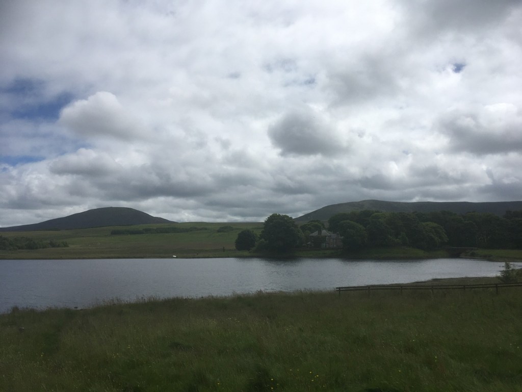
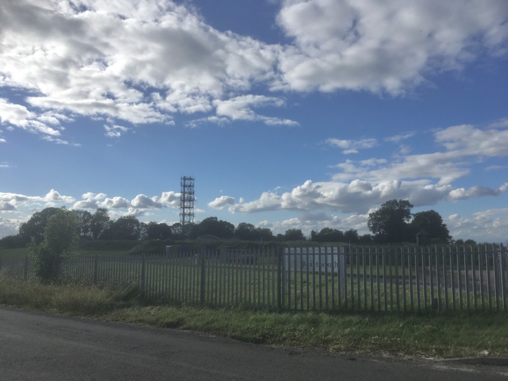
There was no evidence of mass slaughter today. Maybe the recent incessant rain had washed all the roadkill away? I reached Coldharbour and parked up in the small car park opposite the Plough. As far as I could see nothing much had changed, although a large sign on the car park gate advertised a music festival in a field somewhere in Surrey, with a range of old bands that back in the 1970’s I may or may not have seen in the Greyhound in Croydon. *

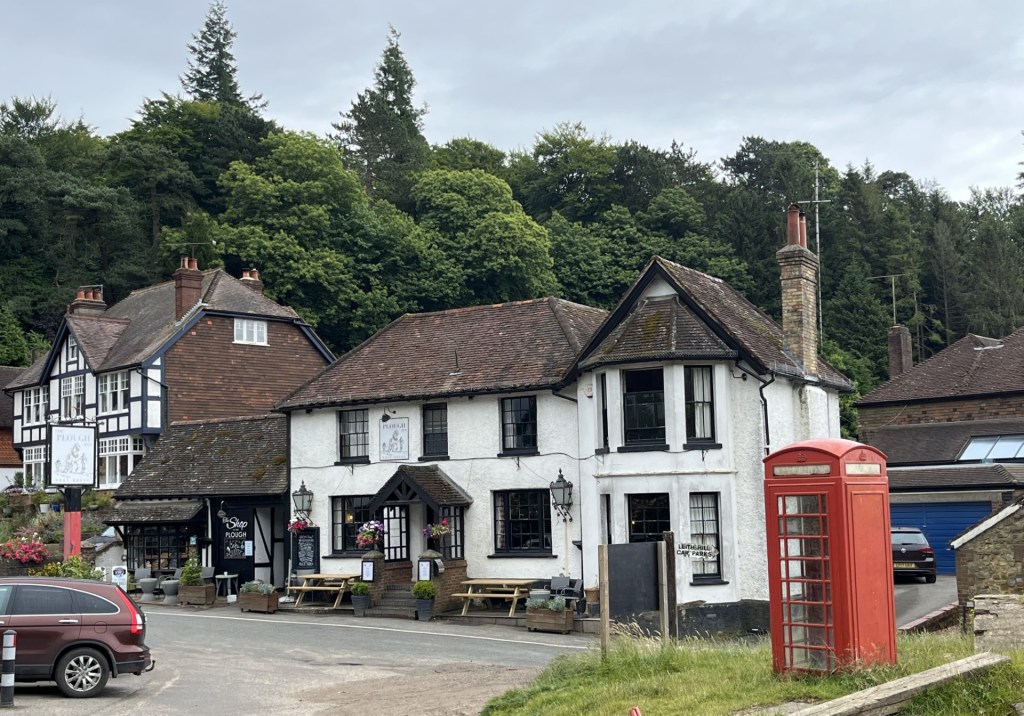
The Plough Inn and shop – Coldharbour – 2024

Whilst it wasn’t raining, it was overcast and a bit muggy. To justify parking in the pub car park, and because I quite fancied a drink, I went over to the pub, which looked a tad closed. However, just to the side, and by the arch that would have once seen coaches and horses pass through to take up stables for the night, was a small cafe, obviously associated with the pub, but thankfully open. The cafe came with a small shop which sold a range of random essentials, almost certainly a bit of a lifeline to the handful of locals.

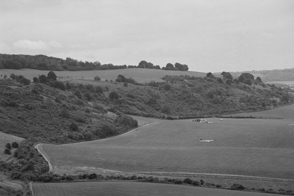
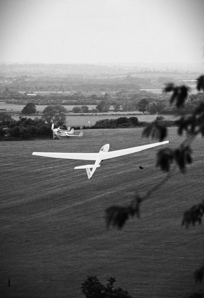
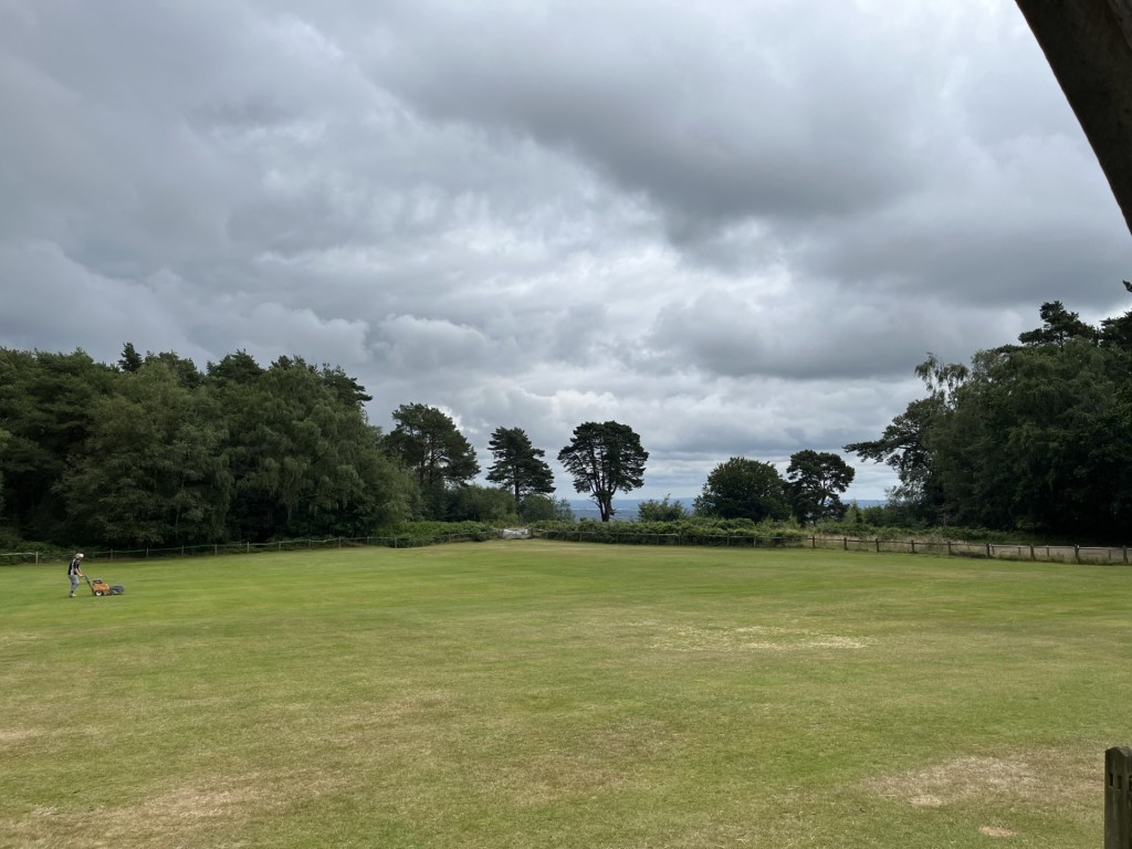
I finished off a coffee and then set off on what I knew to be a short climb (other routes are available but don’t start and finish at an ancient pub). The route started opposite the pub and up a metalled road. Within thirty seconds I was reminded of just how steep this section is. Driving for two hours and then quaffing down a coffee was irresponsible preparation. I stopped and took some deep breaths. I couldn’t just give up. Could I? Off again and the gradient increased! Another stop. Ludicrous. Just two weeks earlier I had managed over 4000 ft. Further up I could tell that some people were coming down in the other direction. This was no time to look like an old man walking (which of course is exactly what it was), and so after a deep draw I trudged on, managing to mutter a “good morning” as the couple passed, and after a few more minutes was over the worst of the gradient. By now the road had become a track, and with it huge muddy puddles where only 4X4’s and ponies could cross. Carefully picking my way through muddy paths away from the main track I eventually broke the tree cover and there it was. The cricket pitch. I had almost completely forgotten what must be one of the most remote and eccentric pitches in the land. The fact that it was still there and clearly still in use, post Covid, was good to see.

At this point I had two options. Left or right. I took the left, and the path up through the woods. It all felt very familiar, except for the signs warning you not to stray from the path into the woods, where the evidence of storm damaged trees was scattered widely. On and up, and then the final push up a steeper section, with a new mountain bike trail close by on the right.

Over a decade earlier, and working in an inner-city concrete jungle, where youth crime and disorder was the backdrop to everyday life, and which I had some responsibility in trying to address it, I was invited by a colleague to take a group of young people, identified as being at risk of offending, on a day’s mountain biking in the Surrey hills, not a million miles from Leith Hill. I can’t think now why I agreed, but at the time it felt like saying no wasn’t an option. My colleague was very persuasive.

A minibus ride from the heart of north London with 15 or so kids who had rarely been out of their postcode, and a couple of hours later we were in paradise and being put through our paces. As a moderately keen cyclist, I was looking forward to observing, but the reality was unexpected, not least because I hadn’t expected to participate, and would have been more than happy just to watch and shout encouragement. But no. Along with everyone else I was allocated a bike and told to cycle as fast as I could towards a large log that lay across a dirt path. This felt completely mad and counterintuitive to anything I had ever done on a bike before. The problem was that so far, all the kids had fearlessly taken on the challenge and passed with literally flying colours. Now there was a small issue of kudos at stake (“kudos” being a parochial north London gang term for someone who shows a lot of front in the face of establishment, and other gangs). The front wheel of the bike hit the log with jaw juddering force and my time was surely up, but a miracle occurred, and I was over. The kids from the estates even clapped.

A few minutes later I was on my arse and plucking leaves, bark and twigs from various parts of my clothing and skin after showing too much kudos trying to take a bend that came with a hump, logs and insecure stones. Two of the lads (remember they would have been at risk of offending) immediately dropped their bikes and helped me up, concerned that as an old person I may have needed immediate medical attention. Maybe I did, but this wasn’t the time to show it. By the end of the day everyone was exhausted, and ecstatic, at the same time. It had been a great day, but it had come to an end, nonetheless. As the saying goes, you can take the boys and girls out of London, but you can’t take London out of the boys and girls. One less day in the summer holidays when otherwise they could have been getting into trouble outside their door, but it was time to go home. I am certain that that day of taking risks in the Surrey hills would have made a small impression on these great young people, but also that it alone wouldn’t have been enough to change things in the long term. Since then, our youth services and provision has been devastated by cuts and I doubt very much if these sorts of trips still happen. I strongly suspect not.

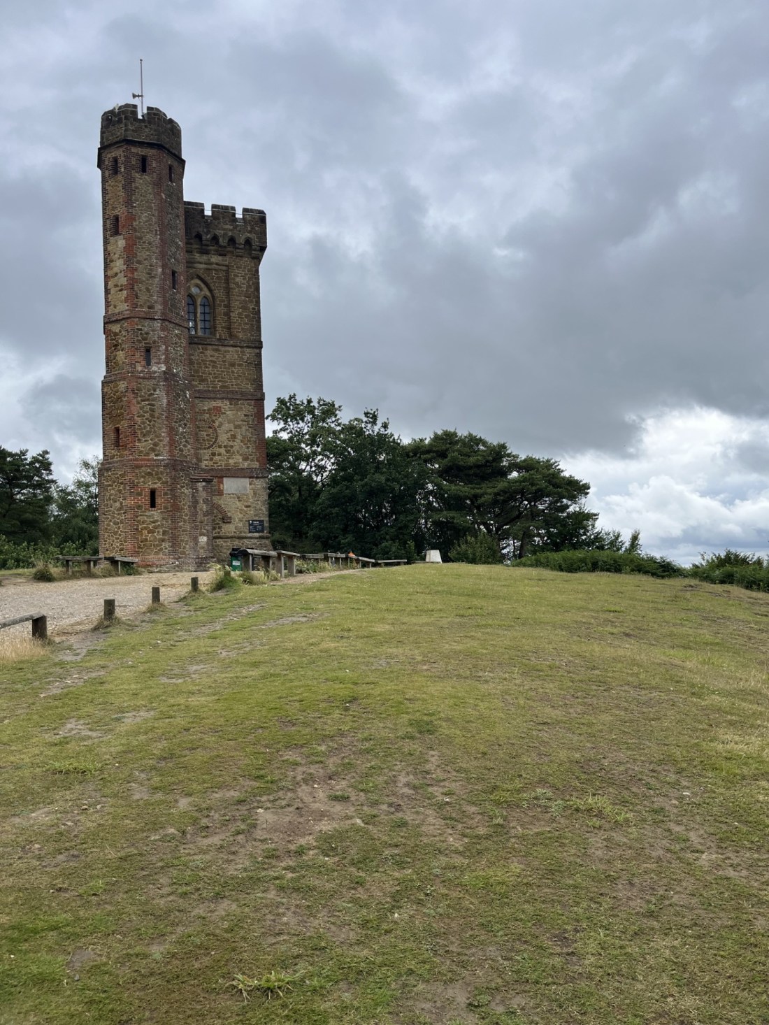
Back in the present, after the final steep ascent the tree canopy ended and directly in front was the iconic red brick tower, built in 1765 by Richard Hull, ** a Bristol based merchant philanthropist, designed to elevate the intrepid walker over 1000 feet, and open to all (until it fell into disrepair!).

Hull’s Enlightened Folly

The walk from the pub had been about 250 metres in elevation, but little over a mile in distance. I was a bit pooped, and rather than add to the effort, chose not to climb the 65 further feet to the top of the tower. I sat on a bench just back from the trig point and took in the views to the south.

Somehow this photo managed to miss all the other walkers with their dogs

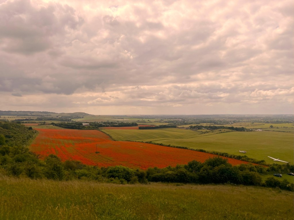
The day had brightened up a bit and the South Downs were clearly visible. Whether it was my imagination or not, and given my eyesight isn’t what it was, on a couple of occasions I was sure I could make out the wind turbines off the coast beyond Worthing. And looking far to the southeast I was sure I could see the Fire Hills at Fairlight. If so, it was quite a view. I was tempted to get a drink at the small cafe at the foot of the tower, but decided instead to wait until I was back at the Plough. After a few minutes I wandered round to the north of the tower and to another bench that I thought was slightly higher than the base of the tower and the trig point. I guessed this was the highest point and took in the view of London beyond, regretting having not brought binoculars.

The South Downs towards Brighton

Setting off back down I followed part of the mountain bike trail, where to the left more signs indicated that due to storms and other weather-related activity (rain I guess), the woods were unsafe to walkers. After a short distance an option was presented to take alternative routes. I’d forgotten that there were other paths down. A sign to the left pointed to Friday Street, a route which I had done with my old school friend and another old mate when we were in our forties.

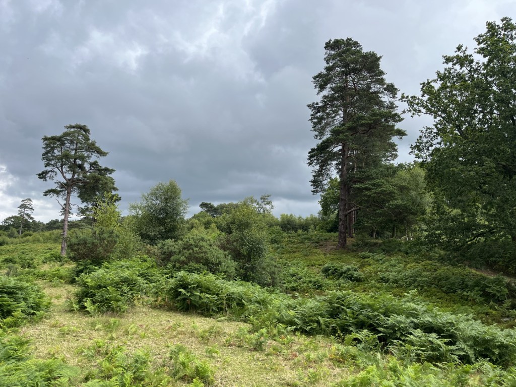
Dead ahead was the Duke’s Warren. Sadly, I didn’t have time for the romance of a diversion towards Friday Street and so headed into Duke’s Warren and its outstanding sandy heathland.

For a few years, when I was young, I lived in Woking, located a few miles to the northwest. A pretty average town with a railway station, the oldest mosque in England, and virtually in London. Except, and brilliantly, it was almost entirely surrounded by easily accessible heathland. As a child in the 1960’s, and old enough to be out of the home all day when it wasn’t school or mid-winter, I’d spend hours either on my own or with mates on the heaths. Playing war and mods and rockers, starting fires (I know, I know!!!), exploring World War 2 pill boxes, breaking bottles (I know!!!!!!!!) and catching frogs and lizards. Very fond memories and I’m not usually much for nostalgia, but the stroll through Duke’s Warren reminded me of the beauty and richness of Surrey’s heathland. I am pretty sure there’s not as much now as there was then, but what’s left must be left. I stopped for a bit to see if there were any signs of reptile life.

Whilst my trip to Leith Hill with the school in 1973 was the first official visit, I have subsequently learned that I had been here in the 1960’s with my parents, on a day trip. Whilst I had no idea at the time that it was Leith Hill I do have a very vivid memory of us arriving at a sandy point on a hill and my mum throwing down a rug, only to realise that it had landed on a huge basking snake, which offended, did some sort of slithery thing and hissed off into the bracken. Given that it was definitely an adder, we grabbed the rug and ran. I say we ran, but in truth I dawdled, fascinated and hopeful that it might reappear. It didn’t, and whilst there are certainly adders to be found in these parts, it was far too big, and was almost certainly a grass snake.

I sat alone, but nothing happened. It didn’t matter.

The path eventually emerged from the heathland back at the cricket pitch, which was now a hive of activity. A man was out in the middle with a lawn mower, and contractors were working on the roof of the small pavilion, and from what I could tell, installing solar panels. I guess if they want to play evening 20/20 matches here against Gomshall Mill or Abinger Hammer, they’re going to need flood lights too. The old pavilion, not content with providing changing facilities, is also available to hire for parties, weddings and bat watching. And why not?

One day the sun will shine above our heads, and a new energy will power the karaoke – Catch!!

Fifteen minutes later I was back at the bottom of the steep road and looking towards the Plough Inn. Emerging at this point in 1976, and more than ready for a well-earned pint or two, you’ll recall (surely!) that the pub had closed two minutes earlier, it was cold and teeming down with rain. The only cover at all was to be found in the public phone box. We squeezed in, with no hope in our hearts. I guess we were fortunate to be trapped in a phone box in a tiny settlement in the middle of nowhere. The chance of an operational public phone where we were from was almost nil, vandalism being an endemic hobby locally in the 1970’s. So, here was a phone that worked, and we had a few pence that now wasn’t going to get us a beer. I guarantee that if we are lucky, most of us only know one phone number. Our own mobile number. Before mobile phones you not only knew your own number but could usually recall the numbers of most of your friends, because you regularly had to call these numbers using your digits. And so it was that Bill took the initiative, and a bit of a punt, and called another friend back in London. This friend was slightly older and owned a Fiat 500 (I’d insert an image here, but you wouldn’t believe it and think I’d created it digitally). He agreed, quite why, to drive down and pick us up. Another hour or so passed, and maybe longer. There was no way of knowing if he was going to come through with the goods. By the time he eventually arrived the phone box was wetter, with condensation and cigarette smoke, on the inside than out.

Somehow, we squeezed into the tiny Fiat 500 (which in respect of cubic capacity was almost certainly smaller than the phone box), and an hour later we were back in suburbia and recovering from the ordeal in one of our regular inauspicious haunts.    

But today I had my own car and a bit of time on my hands. I fancied a tea. I walked up to the door of the pub. Hmmm. There didn’t appear to be any lights on. And when I tested the handle there seemed to be more resistance than I had anticipated. I gazed through the window and took in all the smart tables that were set out for fine diners. I was perplexed by the notion that 48 years on it still closed at 2pm? It looked less than hopeful, and the little cafe annex had closed too. I turned away just at the moment a sound came from behind the door. A woman stepped out with an enormous dog in tow. She looked like she had just woken up. “Err …sorry, I’m guessing you’re closed?” I think the woman’s initial instinct might have been to say yes, it was, but maybe she took pity and a minute or so later I was sitting on my own in the large rear garden nursing a welcome pot of tea and a packet of crisps (unsurprisingly they don’t do pork pies anymore!). Not a lot had changed except it seemed to be a bit bigger and the quality of the furniture had improved considerably. I sat and contemplated. There were no locals or Western Front survivor’s here now. Was it nostalgia or just curiosity?

I sent a text to my old school friend Bill. “When did we go to Leith Hill with the school?” Moments later the reply. “1973.” Not even a question mark. I guess some memories are bigger than others. Minds Alive. ****

* Along, I’m sure with most people, Leith Hill has always been sold to me as the highest point in southeastern England. Except, nobody has ever mentioned Walbury Hill in Berkshire, which is nine feet higher. Another bubble burst.

** Actually, apart from seeing Hugh when he was with the Stranger’s a couple of times, I haven’t seen any of ‘em!

*** Richard Hull, to my surprise, given that he hailed from Bristol, does not seem to have had direct connections to the slave trade, but after his death the estate (Leith Hill Place) was owned by William Philip Perrin, who had inherited his wealth from his father’s five Jamaican sugar plantations, and the 135 slaves who worked them. The various links to the Leith Hill tower seem to tell different tales, but either it fell into ruin after Hull’s death and Perrin then renovated it and added to the height (by 1808 it seemed he had lost his entire fortune), or it just fell into ruin and sealed up for another 70 years, or it was sealed up and not fully reopened again until 1984. We may never know.

**** https://www.youtube.com/watch?v=XdumsNbxHJI

Cresting the County – Central Bedfordshire*

Dunstable Downs

243 metres

797 feet

2nd July 2024

Summer Thermals

A week or so earlier, on a trip back from Scotland, I had strayed a mile or so from the M1 to ascend the mighty Newtonwood Lane, the highest point in Nottinghamshire. ** Today, another county high, not a million miles from the M1. The morning had started warm and sunny, but by the time I had reached the M25 in Kent, a heavy, oppressive orangey cloud base had gathered. The sort of cloud that dystopian, post atomic war films often rely on to give that sense of a sunless world. This type of weather is beginning to be the order of the day. Last year was similar and I don’t doubt the suggestion that global warming has its part to play. Happy daze.

After leaving the M1 at junction 9 and working through some completely deserted and obviously prosperous back lanes I arrived at the carpark at the top of Dunstable Downs. I had started off in a T-shirt, but three hours later, and as I got out of the car to buy the £3.50 all day parking ticket, I decided to don a jumper and light coat. These days you need to have thermal back up, even in the middle of summer. As I turned towards the visitor’s centre, looking north, a white glider was thrown up into the sky from below the chalk scarp slope, seeking out its own thermals.

Impressive, but not as impressive as the cauliflower curry pasty that the excellent visitors centre offered as a midday snack. Vegetable curries in a Cornish style pasty is the future. You heard it here first.

I spent a minute looking at the noticeboard that showed the various walks around the country park, with a hot cup of coffee in hand, and surrounded by young parents with babies and small children stoically taking on the conditions. My time was limited but given that I was at the top already I felt duty bound to make a token effort. Having visited this spot on at least a couple of occasions with family over the years, primarily to fly kites with kids, I had previously strolled to the woods to the west, so instead decided to explore along the ridge to the east and see where it took me. Despite the gloomy overcast conditions, a Red Kite drifted slowly overhead and the views across the plains stretching out to the north and west were impressive. If only the sun would push through?

I headed almost directly north along the chalk ridge. After 15 minutes or so I had reached a group of distinctive Neolithic and Bronze age burial mounds.

The Five Knolls – Picture enhanced to indicate how it might have looked on a brighter day!

Small hawthorn trees and wildflowers enhanced the sense of romance that could be attributed to the site, but whether it had any major significance historically I couldn’t say. Whenever I am at a pre-Romano British location, I try to put myself in the shoes (or whatever the footwear might have been) of people who may have stood there 2000 years earlier and attempt to visualise the landscape they were likely to have seen. From the Five Knolls burial mounds, and looking east, the urban sprawl of Dunstable and Luton spread towards the horizon. On this occasion my imagination was sadly not up to the task and the photo I took with the airport and Vauxhall works in the distance has no aesthetic value whatsoever. 

Motor City and Eric Morcombe’s Saturday afternoon’s entertainment. Picture unenhanced

The views in every other direction, and despite the drab conditions, were nevertheless inspiring. After weaving up, down and through the Five Knolls, the path (a small section of the long distance Icknield Way) dropped quickly towards to the end of the country park. It was the cue to turn sharp left and then along a path with garden fences to the right and thick woodland and shrubs to the left. No more than ten minutes or so of walking at a distinct ankle turning angle, the path broke cover and the view along the scarp slope reaching out to the southwest provided perfect context to the topography of the chalk. 

Intel(R) JPEG Library, version 1,5,4,36

Topography. Never use a black and white film in the SLR on a gloomy day (lesson learnt too late)

The milky white path continued southwest, hugging a contour and with the rounded forms of the chalk grassland bulwarks rising steeply to the left. The clouds had thinned too and with a hint of sun the temperature had suddenly lifted. I immediately regretted the layers I had earlier invested in.

A clearing sky and wildflower jungles

With time running away I had little time to hang around and take in the unfamiliar array of butterflies that flitted between the diversity of wildflowers, but in the distance, and in large fields about a mile on, it was impossible to ignore the impressionistic reddy, orange tones of millions of poppies.

I couldn’t possibly say if this one has been enhanced, but let’s just say the sun had gone again

The track continued to hug the fields at the foot of the slope. Chalk is the dominant bedrock in the south and east of England. 80 to 100 million years old, its thick but gentle folds appear and disappear before petering out north of York. By the time it reaches Dunstable it’s facing northwest, and beyond the clays of the Midlands and then the millstone grits, limestones and granites of the north. Compared to the 700–800-foot ramparts of the South Downs, the 300-foot scarp slopes of the Downs at Dunstable are relatively diminished but still presents an impressive feature. I had reached the field where the gliders were being prepared and launched. Throughout the time I had been walking, gliders had been catapulted into the air, or dragged up by a light aeroplane, at an astonishing frequency. Who knew that so many people seemed to have the time to take to the air on an ordinary Tuesday in June. Impressive as it was, I wasn’t tempted, but could have done with a ride back to the top.

With the time now pressing (I had grandparenting duties and a children’s concert to attend), any thoughts of a longer walk up through the woods to the west had evaporated and it was now a simple hoick straight up the slope. I say “simple” but in truth, despite being relatively fit for an old person, I had to stop a few times to regain my breath and save any wheezing embarrassment should anyone have come the other way. As you do in these moments, you turn your gaze away from the slope as if to indicate that you are simply taking in the view. As I executed this increasingly awkward move on the third occasion, in the field below another glider was being catapulted into the sky. 

Chocks away….it’s dreary Tuesday

Excitement over I bent forward, took a deep breath, and struggled on up. Eventually the slope slackened off and the visitors centre came back into view, fronted some distance away by a large abstract metal structure that may have been art, or may have been functional, or may have been both. And, without wishing to cause offence to artists and engineers alike, that’s as much as I am able to say on that.

Whatever else this dominant point represents, it is popular, does great curry pasties and its dynamic thermals will fly kites, carry gliders and give birds of prey an obvious advantage for thousands of years to come; even if the rivers rise. I was happy to have experienced it all, if only for a short while.

* Amended from Bedfordshire to Central Bedfordshire 3rd May 2025 on discovery that the old county of Bedfordshire had, some years ago, been divided into a number of Unitary Authorities.

**https://elcolmado57.wordpress.com/2024/07/05/cresting-the-county-nottinghamshire/

Cresting the County – East Sussex

Ditchling Beacon – – OS Landranger 198

248 metres

814 feet

Friday 17th May 2024

Wild Life

I don’t want to be sedated!

A phone call from the dentist on Wednesday the 15th of May. “We can bring the appointment for measuring your crown forward. Are you free tomorrow?” “Great, yes, thanks.”

Thursday 16th May. 8.55am – Phone rings. “Really sorry but your dentist is “detained”, and we need to reschedule your appointment. Can you do it tomorrow morning?” “Hmmm… I guess so. Thanks.”

It was not the end of the world, but Thursday would have been perfect. It poured with rain all day and I had already targeted Friday for the Ditchling Beacon ascent because it came with a very rare these days, 100% rain free forecast. The Friday morning dental intrusion was going to limit the time available.

At 9.55am at the dentist’s I walk into the room. I don’t know what I was expecting, but when he said he was going to give me a jab before working on the tooth I hesitated. “I err…had plans for today.” “It’s just a slight tingling, don’t worry it won’t affect your day.” What could I do? It had already cost an arm and a leg and needed attention.

After some drilling and grinding and with a temporary crown in place, I headed home, packed a small bag, and reached the station just in time for the Brighton train. Except, as it rolled into the platform, I was still at the machine, desperately trying to extricate the appropriate day return tickets. The train had left by the time I had mastered the technology. The next train was in thirty minutes, so just enough time to pop out of the station, gain supplies and assess the effect of the pain relief. At the cafe I picked up a soft roll with a filling (a granary option was available but given the recent dental work…) and ordered a double espresso, which, with my mouth still in full stuffed cotton wool mode, I dribbled carefully from the corner of my mouth. I made sure no-one was watching. As I wiped my chin, I decided that travelling the whole hog to Brighton and expecting to complete a circular walk to the top of the Downs was too much of a challenge and having had a quick look at the Ordnance Survey map decided to alight at Falmer, a couple of miles to the northeast of the town centre.

Arriving at Falmer an hour later, I left the station, with the Amex Stadium (not as impressive as I expected) framing the background, went under the A27 and then headed east along this very busy road to a roundabout. Just up to the left, and on the opposite side of the road, with the University of East Sussex beyond, I walked up Mill Lane, and then left onto Ridge Road. I knew I’d made a good decision as instead of a long hike out of Brighton I was already in the countryside. And it was going to be straight up from there.

The road headed north and up through overhanging trees, their leaves still showing the fresh lime colours of late Spring. After half a mile or so a signed footpath to the right indicated a route to the top, heading north-east and away from the objective. It was already late, so I kept to the road, and then an annoyingly long descent that ended at St Mary’s farm. Here another signed footpath headed north-west and directly up through fields and to the Beacon. As much as I was tempted, I had a feeling this might come with some challenging inclines and instead chose to continue on the road, which here gave way to a stoney track. With woods to the right, and a large dry valley to my left I made reasonable progress. Every few minutes peacock butterflies rose in front of me, startled by my presence and interrupting their rest stops on the warming flint track.

Towards the top of this stretch I noticed four buzzards rising on the currents just to my right. I stopped and watched for a while and looked east and along the line of the Downs towards Newhaven and Seaford. Given my relative height against these hills it felt like I had a way to go. I carried on, but stopped again when for a moment I perceived the first signs of a migraine. A slight anomaly in my vision. I get migraines occasionally. Not the full-blown debilitating headaches that can knock people out for days, but a fifteen-minute slow motion psychedelic visual display that can leave me flat for up to twenty-four hours. If it was going to happen I’d soon know, but despite the expectation (the fact that I hadn’t been able to eat at all, and that I was still quite significantly impacted by the anaesthetic were possible cause, but equally it could have been as a result of reflected light from the thousands of flints embedded in the track), somehow the full immersive experience failed to materialise, and for the moment at least I was able to carry on and not blinking for a few minutes (just occasionally I have been able to avert the crisis by not closing my eyes – don’t ask me how this works, but as on this occasion I think it did).

The track ended past some rape fields and at a highly elevated farm complex, which looked like it may have been repurposed. A footpath continued to the east of the farm and eventually met with the South Downs Way, the primary walking and cycling route from west to east along the top of the chalk escarpment. I started west and immediately a car crossed my path! A small road disappeared steeply down the north scarp face but ended here at a car park which was home to a drink and snacks van. As it was hot, and I’d been on the hoof for some time, a nice cup of tea here would have been perfect, but having assessed that this would present a very public opportunity to dribble more liquid down my chin, I wised up and carried on.

The route slowly rose and with it the views to the north, west and east became more and more impressive. What appeared to be my target lay directly to the west and seemed to be half a mile or so away. Given that it was the highest point in East Sussex, and the second highest point in the south-east (Leith Hill in Surrey is the parent summit), looking around at the vast array of ridges and hills of Sussex and Surrey I felt that I still had some elevation to go before I would be above the rest.

In Graham Greene’s early and underrated novel, The Man Within, the central character, Andrew’s, makes a journey across this ridge on his way from Shoreham (to the west of Brighton) to the Assizes at Lewes. Unlike me, he’s not having a casual midweek stroll to liven up the senses. It’s in the heady days of smuggling and he’s being hunted. I have read this book two or three times. It’s not typical Greene. His later books deal very specifically with introspection and awkward relationships. Here you are in Andrew’s shoes from the first page, and you don’t have to have been to Ditchling Beacon and this area to know and feel it. It’s cold and wet. Not like today. He spends a fraught night in a farm high on the Downs before continuing his journey. Two hundred years ago, around the time the story is told, and not on such a glorious day, this area would have been bleak, and regardless of your condition, possibly enough to terrify. As Andrew’s crest Ditchling Beacon he sees a man crossing in a horse drawn cart, people in the fields below working, and other travellers along what at the time must have been a major route on higher ground. But it’s not the people he can see that troubles him, it’s the people he knows are out there but can’t be seen. His pursuers. Maybe The Man Within was a test run for The Power and the Glory (one of the great novels about a priest on the run in an intolerant Mexican state), but as I head on towards the Beacon all I see are people out enjoying the moment. That’s not to say these hills no longer hold a threat, or a darker side (tragic and sad things still happen up here), but on this day, and in hope, a long hot summer is in the air.

Looking west towards the top

Another road crossed my path, a larger one than the previous, and I suspect the final heave ho on the route for the determined riders who do the London to Brighton cycle ride (I’m pretty certain the A23 is not an option). Crossing the road another car park and a refreshments van, but I needed to press on. A short climb and there was the triangulation point that marked the spot. I walked over to it, took in the view and a couple of photos, and then collapsed down onto a random slab of concrete. There’s an ancient hill fort here somewhere, but it is impossible to make it out. A steady stream of walkers of all ages, including groups of teenagers experiencing the great outdoors, but mainly having a giggle and moaning about the weight of their packs, passed along the main track but only one older couple recognise the significance of the triangulation point and come towards it, and me. At exactly the moment when I had plucked up enough courage to start squeezing the contents of the soft roll between my lips on the right side of my face; mayonnaise slowly dripping down my cheeks. The man apologised for interrupting my solitude. I mumbled something incoherent along the lines that I was having difficulty speaking, and after a quick photo op, perhaps concerned for their personal safety, they unsurprisingly left. After three more attempts at the soft roll I gave up and instead took the opportunity to dribble some water down my left cheek and chin.

Time to take a moment, with a soft roll.

Taking in the panoramic view to the north I could see as far as Leith Hill, though trying to pick it out was not obvious. I could also see Box Hill and the ridges towards Guildford, Newlands Corner and the Hogs Back. Further west and the chalk uplands twisted far into the distance. Looking south and there was Brighton, with the observation tower thing and beyond, through a heat haze, the magnificent rows and rows of wind turbines (that I understand many people detest, which I don’t get). To the east the view was less impressive, but there, thirty odd miles away, and to my surprise and through ageing eyes, I picked out the four residential tower blocks that landmark my neighbourhood.

Looking east towards Eastbourne and Hastings.

Had one stood here over 600,000 years ago, and just before the ice-age, the landscape would have been entirely different. I’m not sure what the view south would have been like, but to the east, west and north the chalk would have continued rising a further two thousand feet before descending back to the Thames basin and what now remains of the North Downs. Ditchling Beacon is not a high peak, but now that the monolithic chalk uplands have gone and the clays and sandstones of the Weald are left to slowly wash away into the North Sea, on a clear and pleasant day the view is hard to beat.

I moved on west. Almost immediately there was an option to descend but I wanted to keep to the top for a bit longer and then head down the Sussex Border path and a more direct route into Brighton. I passed a small dew pond to the left. It looked relatively new, lined with concrete and featureless. A quarter of a mile on and a second dew pond, again on the left. Dew ponds are man-made, and this one had almost certainly been here for at least a century or more. This one was exceptionally beautiful, even though the sun had gone for the moment. Two small hawthorn trees, bent and battered to the east by the prevailing wind, hugged the edge, and several sheep, including lambs, wandered around their watering hole, undisturbed by my presence. I took a photograph that I knew was going to be good, but I later found this wonderful site which contains some stunning shots of this surreal spot:  https://suxxesphoto.com/ditchling-beacon-dew-pond/

Pond Life

Another couple of hundred yards and a third dew pond to the right, surrounded by low shrubs, and hanging on the ridge. This one must have been at least as old as the second, with copper coloured water. A fence prevented access, but it was possible to stand a few feet from the edge. Movements in the water indicated a plethora of wildlife. In this blog’s introduction page, I indicate that Cresting the County has nothing to do with the geographical distribution of crested or great crested newts across the United Kingdom. And as I stood gazing into the shallows, it occurred to me that I may have got this wrong. Very quickly I was able to pick out three or four newts moving slowly across the silty floor. I looked back down towards Brighton. There are no rivers or other major water sources anywhere near this point. The nearest stream would be four to five hundred feet immediately downhill at the foot of the scarp slope. There is no point in speculating on the how’s and motivations of these newts to take on the heroic task of moving from a safe area with a regular source of water, to the highest point in the county, where the frequent risk of water scarcity would be inevitable but seeing them on this occasion was the last thing I had expected.

Just beyond the newt pond it was time to head on down the dip slope and once over a stile on the left I was walking directly towards town and with the elevation tower i360 straight ahead. How could I go wrong from here? Well, unintentionally, and perhaps fixated on keeping a lay line focus on the tower, I must have diverged from the Sussex Boundary path. This only became apparent sometime later. The path I was on took me down towards a farm. As I reached another stile just to my left, there was a thrashing in the undergrowth that rose up below the structure, and just feet away a female pheasant leapt clear and flew with difficulty directly away from me. I reached a modern barn structure, and noted the pheasant again, looking a bit sheepish and paddling around in puddles. I had noted on the map earlier that at some point on this walk I would come across a war memorial. There was an option here to go left and down a track towards the farm. Mindful that this was unlikely to take me to the memorial and noting a footpath sign just to the right of the barn, I chose the latter route which took me immediately up a short but very steep climb and then across another field to another stile which I crossed over. At this point I decided to stop and take a break.

The numb jaw was easing, and without hesitation I whipped the rest of the soft roll from my bag and despatched it straight into my mouth, without any spillage. I gazed across the landscape and noticed a footpath crossed my tracks, but my attention was diverted by the sight of a kestrel that swooped smoothly out of a hawthorn tree and hovered over a small field just fifty metres from my position. As the bird was below me the stunning plumage, set against the late Spring greens, was mesmerising. The bird almost immediately flew back to the tree, but then seconds later it was back and attacking something on the ground. I couldn’t tell if its strike had been effective as it rose and headed off down the dry valley and beyond sight. Along with this spectacular moment, and perhaps high on the pseudo narcotic fallout from the soft roll, I hesitated no longer, and set off directly south and onto what I assumed was a path that hugged a field of wheat, having completely overlooked the other, more dominant path that I had noticed a few minutes earlier.

Within a few minutes I was regretting this decision. The field had clearly been ploughed to oblivion over the years, and whatever my previous understanding of chalk had been prior to this moment, the concept that it was entirely made of large chunks of split, splintered and ankle twisting flint had eluded me. Negotiating what turned out to be two or three hundred metres of this body shuddering terrain was miserable, although I noticed and then pocketed an elusive but almost perfect flint nodule, about the size of a small cannonball. It was covered in chalky mud, so I popped it into the soft roll wrapper (never leave a trace).

An almost perfect flint nodule. Note precision measuring tool.

At the end of this hideous field, a gate and a pasture field trailing on down the valley. I could see a gate at the bottom of the field that led to a small road, and without consulting my map I concluded it was my objective. Every year, around this time, you’ll see or hear features on the radio or on television, about the number of people injured or worse by cows. I never gave walking across a field of cows a second thought until about twenty years ago when in the very act in a field somewhere forgotten, a herd of cows decided to start tracking me with what I considered to be deadly intent. Fortunately, I was slightly livelier and nibble on my feet then (and hadn’t just walked across an ankle sapping flintscape) and was able to track along the edge of the field, making sure that there were escape points to leap. After which, annually and without fail, I have heard or watched one of these articles about the dangers of cows, and whilst still not paranoid about outcomes, I treat any field full of them with some caution and respect. And, yes, here I was faced with a field of cows, walking slowly from south to north and directly across the path that would take me to the gate. With the prospect of now having to safely navigate a herd of killer cows, and with the effect of the dental inoculation now easing rapidly (I was beginning to feel a nagging pain at the back of my jaw), and still mindful of the possibility of a migraine at any moment, I was beginning to conclude that perhaps I should have delayed the trip. Too late now buddy.

I chose my moment carefully and set off across the field at precisely the moment three of the cattle (almost certainly bulls) had made their way as far from the bottom gate as they could get. All good then, but just at the point when I was halfway across the large field three or four more cows appeared from nowhere and were on a similar trajectory. All I could do was up my pace and hope. As the lead cow plodded on and gazed at me in a manner that strongly suggested attack, but was more than likely indifference, I ignored the possible outcomes and made it to the gate and escaped. Now on a small road I noticed a sign pointing back into the field and towards the elusive war memorial. I wasn’t going back, but as I continued south along the road I looked back for a moment, and about a quarter of a mile back up the slope a small white structure, like a stunted minaret, stood impressively alone.

The aim now was to get into Brighton as quickly as possible, but another hill, and then a lengthy stretch of road followed before coming to an end where it butted up against the enormous embankments of the A27. Another footpath sign here indicated the track I had hoped to have taken, but had missed, but also named the war memorial. I had missed the Chattri memorial.* Too late now.

At the huge A27 embankment and junction complex it was a simple left or right choice down uninspiring narrow roads. With no way of knowing the correct way to cross the man-made barrier (that said if I could have been bothered to use the phone map at this point it may have helped), I chose left and set on down the lane, which spoke of multiple fly tipping events and opportunities. Half a mile on and a footbridge took me over the flow of vehicles and beyond through some woods and then a recreation and cricket ground. I sat down here for a few minutes to get my bearings, and to catch my breath. After I had made a partial recovery, I headed up the road to the west and entered the St Mary’s neighbourhood. A cluster of early and mid-Victorian cottages, an attractive church (St Mary’s Barnes) and at the foot of the side road and 1930’s pub. This small street heading down to the main A23 was a completely unexpected gem of an area, and like nothing else I’d ever associated with Brighton, and probably completely unaffordable.

By now I was beginning to wonder if a bus into town might represent a compromising option, but as there were none in sight I trudged on. Large interwar houses, set back from the A23 on both sides, some lining small roads leading away and distinguished by large modernist brick gate posts with lights on top (quite a statement at the time I guess).

Onwards and past a sign pointing up to the Withdean stadium and sports facilities, the most unlikely of places that Brighton and Hove Albion AFC used as a temporary home during their sojourn years. A shoelace comes undone. I hardly have the resolve to sit on a low wall to bend down and retie it, and if someone had come up to me at that moment and offered to exchange my walking boots for a pair of trainers, I’d have snapped their legs off. But more work to do.

Re-tied, and by now realising that gaining the seafront and dipping my toes in the ocean was now an impossibility, I carried on with Preston Park to my left, and the first of the old Victorian Brighton streets huddled around the Crown and Anchor to my right. Preston Park looked delightful, but it was on the wrong side of the road, and I couldn’t find the strength to cross over and explore.

Eventually, under the magnificent Victorian railway viaduct that takes the trains east, I was in Brighton proper. Busy, busy, Brighton, on a Friday evening. I worked my way up the streets with new and unfamiliar residential developments on all sides, and eventually the open east side of Brighton Station came into sight. A train, looking very similar to the one I had set out on, stood on the nearest platform. As I neared the adjacent railings a digital departure board confirmed that it was my intended train, and that it was leaving in one minute. Tough, there was no possible way that I was going to manage a sprint to the barrier, and now that my mouth was returning to full working order, a hot, strong coffee called. The train left. I paused the walking app. 12.24 miles and over 1000ft of elevation!!! I was a broken man.

* The Chattri Memorial, the one I missed. A first world war memorial to Sikh and Hindu Indian troops who died after ending up in a local Brighton hospital. So, not a minaret then but a reminder of Brighton’s architectural heritage and the idiocy of war.  https://www.chattri.org/

Cresting the County – Nottinghamshire

Newtonwood Lane

205 metres 673ft

27th June 2024

It’s more about the journey

Growing up in the 1960’s and 1970’s in the south of England, it’s likely that my early preconceptions of the “North” were formed through watching films like Friday Night, Saturday Morning, The Loneliness of the Long-Distance Runner, amongst other classics.

The northernmost point of Nottinghamshire is just to the east of Doncaster, further north than Sheffield, and it seems that the highest point in the county is nearer to Chesterfield than the city of Nottingham. Sometimes it is hard to distinguish the East Midlands from the North, but one thing was for sure. I’d started the day very far to the north, after spending nearly two weeks touring around Scotland and finishing with a short stay with a cousin in Falkirk.

Three days earlier, and in something of a hurry, I had made an abortive attempt to get to West Cairn Hill, the highest point in West Lothian. The day had started early; a drive across the Cairngorms on the A9 with the objective of dropping off a very close family member at Edinburgh airport mid-morning, for an early afternoon flight to New York. The background to this is too complex to explain, but safe to say it was at very short notice. After an hour or so, and in half reasonable weather (for a change), it became apparent that the very close family member had woken up to the rather tricky detail that even a short stay in the States required an ESTA. After an understandable display of disbelief and invective (hey, I was just the driver), the next half hour was a study in concentration (aided and abetted by me saying nothing), as the on-line application was submitted on a mobile phone and the long wait followed. The first message back alluded to a 72-hour turnaround. Pretty good I thought, but by 9.30am they only had four hours before the flight. My other thought was that this occurrence must happen every day and that hope was not lost. I chose not to mention it (or maybe I did). As we headed further south, and towards Perth, another message gave a sort of mixed message, that the small payment required had been accepted but that this was no guarantee of a speedy resolution. The tension in the car hung as heavily as the dirty grey clouds that had pursued me over the previous ten days north of the border.

Less than an hour from the airport, and there was nothing to report. We had agreed to get to the airport as soon as possible (thereby losing the leisurely coffee stop moment) to confront reality, and maybe a solution, head on. I noticed a sign to the left – Welcome to Fife. A chance for my mind to wander for a second or two. The county of Fife, where my maternal grandfather’s family had their roots. He had died in the early 1930’s, over twenty years before I was born, but I wondered if at that moment he might have been smiling down on his great-unidentified close family member. What was the chance of that? Well, obviously none at all, but just ten seconds after my unsaid thought, a whoop and a punch in the air and the United States of America’s Electric System for Travel Authorisation had come up with the goods (I was going to use the term “trumps” but it’s already a critically divided world).

Crisis over and by 11am the close family member was on their way to the entrance to the airport, and I was on my way out of the car park. I had no intention of taking my time (I was going to use the term “biding” but it’s probably just as contentious as “trump”). I was going to be staying for three nights with my cousin in Falkirk (the one who I had climbed Goat Fell in 2001 with), but I had previously indicated that I was going to be arriving mid-afternoon, and it was far too early to cold call. I parked up soon after leaving the airport and made use of my mobile phone (something I try to avoid). I appeared to be in West Lothian, and a quick search indicated that the highest point in the county was West Cairn Hill. I went to Google maps and hey, jolly good show, it was just a thirty-five-minute drive away and showed a direct route to the hilltop. Well, I’m not proud and it would be a quick win after a highly strung morning. After all, a low hung berry is a low hung berry fae aw that (to quote the lyrics of a well-known Scottish jam maker’s song).

I don’t own a Satnav. I can normally take a quick look at a road map and get a fairly good understanding of what I need to do. As a backup I occasionally resort to the phone, but for reasons best known to everyone else but me, I have yet to master the audio that tells you which turn to take next, which means whenever I think I’m off piste I have to pull over and reorientate. I had made it to Livingstone, but by the time I had reached Mid Calder and its unknown environs I had pulled over at least eight times and felt as if I was in a never-ending loop of car insanity misery. With the time ebbing away I eventually managed to break out of the urban jungle and was heading towards West Cairn Hill, which I occasionally glimpsed beyond trees and hedgerows, and looking a tad higher than I had expected.

Eventually I reached the A70 and was now heading back east, towards Edinburgh, but that was okay. I felt that now I was in with a chance. At a fork in the road, and to the right, a road that I felt sure was the one that the phone map had highlighted well over an hour earlier, and which would get me to the top of the hill, now clearly visible and bathed in a hazy hint of sunlight. I headed down the lane. A large lake appeared on the left, and then a car park on the right. I stopped. A road headed off to the right, but there was a large red sign making it clear that it was private. The road I was on continued straight ahead, though it wasn’t shouting “take me.” Nevertheless, and with nothing particularly to lose, I proceeded a few yards, and then pulled over to allow a bearded man on a quad bike, with his dog in tow, to pass. As he drew adjacent to my open window he stopped; I assumed to thank me. “Can I help you?” It was delivered in a pleasant enough manner, but I was already pretty sure my goose was cooked. “I err.. is it possible to drive to the top of the hill along this road?” “No.”

And that was that. I parked up in the small car park, stepped out of the car to stretch my legs, and took a photo of West Cairn Hill. I could tell it was West Cairn Hill because it was the low peak to the west end of a ridge, and East Cairn Hill, which looked of equal height, lay, unsurprisingly, about a kilometre to the east on the same ridge of the Pentland Hills. Any thought of walking to the top was dashed by the sheer distance from the car park. A couple of miles at least. So, because I missed out on West Cairn Hill (for the moment at least), here are some brief facts. West Cairn Hill is 562 metres high (1844 ft) and is the highest point in West Lothian, but East Cairn Hill (that’s the one to the east) is marginally higher at 567 metres (1860 ft) and is the highest point in the City of Edinburgh area. * And another fact. Being denied two possible conquests on the one day, and all because Google maps led me to believe that it was possible to drive to the very top, was galling to say the least. Yeah, well, you live and learn.

One or two more for another day, perhaps. East and West Cairn Hills

Research is everything and Google maps can very actually lead you, or your articulated lorry, up the pretty garden path.

I abandoned ship, and car park, and spent the next couple of days in Falkirk, visiting the National Railway Museum at Bo’ness and then Edinburgh for a day when it didn’t rain, the sun came out and the wind wasn’t driving in from Iceland. Both excellent days, but on the 27th of June it was time to call it a day north of the border and head back south. I was due at my sons in Bedfordshire to look after my grandson on Friday afternoon, but I knew my driving limits and decided to camp out somewhere in the Midlands, where the weather over the previous week had been mind bendingly hot (so I gathered, pah!). I did a bit of research the night before leaving Falkirk and plumped on a campsite just outside the village of Higham in Derbyshire, and just a mile or two to the west of the M1

I won’t bother describing the journey south, save to say it was a week before the General election and all parties were desperately trying to avoid any cataclysmic cockups. But that wasn’t stopping the Conservatives self-imploding with a gambling scandal which seemed to sum up the previous fourteen years. I came off the M1 at junction 29 and drove west and south, through small towns and communities, quite picturesque in places and some obviously showing signs of a coal mining heritage.

Without having to resort to the phone mapper, I reached the small campsite at 5pm. Despite the allegations of hot weather in the south, it was heavily overcast and with light drizzle in the air. I quickly erected the tent and then headed off towards my objective (I can sense the excitement now).

I passed through the village of Morton and then Tibshelf (which up until that moment I genuinely believed was nothing more than quite a good motorway service station), over the M1 and then east, turning right on Chesterfield Road. The road curved up a hill and suddenly a small road, again to the right, and I was on Newtonwood Lane. A couple of hundred metres and I was at the brow of a hill, with a small area of off-road gravel to the left and I was there. I parked up, a bit disorientated by the sheer lack of grandeur. I got out of the car. On the north side of the road, a perimeter fence and beyond a network of small buildings and the concrete flattop of what was self-evidently a reservoir (reservoirs may feature at some of the other top of the county locations).

Newtonwood Lane – The Reservoir (note endangered blue sky)

I looked around for something. In my research it had been evident that the top point in the county was highly disputed. Fortunately, I didn’t discover the bogus (hey, you erect a sign and make a claim you gotta back it up) claims of nearby Strawberry Bank until after my visit, otherwise I might have been driving around all night, but the old SiIverhill colliery,** which I had assumed was where I was standing at, did make the claim and had erected a powerful statue of a kneeling miner at the summit.

Where I stood bore no resemblance to what I had imagined the Silverhill nature reserve to look like. This was a scrappy area (similar to many scrappy areas of countryside just outside our cities the length and breadth of the land) with none of the proclaimed woodland walks and commanding views. Just over a hedge, by my parked car, a field fell away gently, and a huge electricity pylon reared up just a few metres in. If the miner’s statue was hiding anywhere around here it was doing a good job and I had little or no intention of making further enquiries. Despite some minor reservations I was pretty sure I was at the right spot and had indeed crested the county of Nottinghamshire. And if there was any doubt at all, I concluded that the top of the adjacent pylon was a slam dunk.

Newtonwood Lane looking south. The highest point?

I drove on back and as I entered the village of Morton there was a sign. Morton – The Heart of England. Could this be true? Not only had I crested the highest point in Nottinghamshire, but moments later I had reached the very beating heart of England. And just a bit further into the village hey presto, the Sitwell Arms, to my right, which spoke to me and said “son, you’ve had a busy day, come on in.” How could I refuse?

After a slow pint and some further Googling I discovered that the Silverhill site was about half a mile further to the east, but no worries, after some locals had brought into question its claim to be the highest point, and in 2010 the various high points had been remeasured and there was now no doubt that Newtonwood Lane was the top dog and Strawberry Bank wasn’t even in the running. Strawberry Banks claims may have been a sham, but Morton’s claim to be the most central point in England by north, south, east and westerly coordinates seemed to be entirely genuine, and it seems much underplayed. 

Back at the campsite, just a short distance from middle England, I huddled over the radio to listen to England play India in the T20 cricket World Cup semi-finals. It was cool and overcast, but not as wet as in the West Indies. Seems I had brought the Scottish weather with me. As England stumbled towards an emphatic defeat (they were probably very lucky to have been in the semi-final in the first place), I considered that one of the unintended consequences of this rather bizarre project, to go to the top points in each county, was exactly what I had hoped. Reaching places I would never have considered going to. The small, tightly knit towns and villages of this county borderlands area of England have long histories and untold stories but I, and I suspect most others, have never heard of them, and whether or not I was in the East Midlands, or the North, it didn’t seem to matter. The background to those gritty 1950’s and 1960’s films is still there, but the subject matter has changed for good.

Nb The States allowed the close family member in. Phew!

*If you search on Google for the highest point in West Lothian the answer is conclusively West Cairn Hill. So, when I was reading up on East Cairn Hill, which is slightly higher, it said that three counties, including West Lothian, meet at the top. Doubts!

**The Silverhill Colliery closed in 1993, just nine years after the end of the miners’ strike. The statue of the kneeling miner at the top of the artificial hill is called Testing for Gas. The view is supposed to be impressive and on a good day takes in five counties.

Cresting the County – Kent

Betsom’s Hill

251 metres

823ft

10th May 2024

First things first. The route I am about to describe is not recommended. Not all of it, but certainly the first two miles. It has no merit and is frankly very dangerous. Betsom’s Hill is located close to where the Ultra Low Emission Zone cameras of southeast London, kiss the invisible boundary with northwest Kent, and by all accounts, including the Guinness book of records (according to the helpful local I spoke to for directions), is the highest point in Kent.

Surely that’s already enough to get you excited. I decided to take this mammoth on after a welfare trip to Croydon to run errands and look after the elderly and infirm. Ironic really given that I am quickly becoming one myself. But, hey, it had been a glorious Spring day, and in the late afternoon, a short walk to victory on the way home was an opportunity too obvious to miss.

I parked up on an estate just at the northern tip of Westerham. I figured this was one of the lowest points locally so it would at least involve a climb of some sort, rather than a park up at the top and a quick peek. Returning to my opening comments, this was a mistake. If I had parked up in South Street, just to the north of Betsom’s Hill, the risks would have been low, but the approach would have been from another county. You can see the dilemma.

Once out of the car I immediately headed directly north and within a couple of minutes was crossing over the M25, a river of glittering metal heading both east and west, and partly on the route of the old railway that served Westerham. It was gratifying to know that for today at least I wasn’t part of the scrum.

The road continued north and I hugged an overgrown footpath between field hedges and the tarmac, clearly a conduit rarely used by other pedestrians or cyclists. A mile in and I pass the Velo Cafe. New one to me but clearly a mega hub for the explosion in cycling in recent years, particularly in these hilly parts just beyond the metropolis. Fifty years ago, me and my school mates would cycle out of Croydon and reach these parts before regretting our actions, and then have to slog it up the scarp face of the North Downs to reach Botley Hill (the highest point on the North Downs) before a downhill breeze took us back home. Martin’s Raleigh Chopper was no match for it then, but he never complained and is now a full-on practitioner.

I started on the main ascent with the busy A233 to my right. The footpath continued for another quarter of a mile before vanishing without cause. Private land appears to be the theme round here so no doubt the will to improve the lives of non-vehicle users was dashed against the interests of the landed. What this meant, in effect, was that I had to walk with purpose on the road itself. I was less than happy but the options were, well, non-existent. I crossed over as there seemed to be more room to step off the road and of course it’s usually best to walk against the traffic. This may seem obvious, but it is not always clear cut. Waves of cars, vans and the occasional lorry hurtled down towards Westerham. Each time I’d retreat carefully into the bushes before seizing a moment and then gaining another twenty metres or so of tarmac, and a bit more elevation. This process continued for much longer than I had anticipated and liked. A blue van passed, and the horn was blasted and some words shouted through an open window. I had no idea what the significance was, but based on historical experience I think an accurate interpretation would have been something along the lines of “What the f…, you crazy b……., take a load of this, t…t.” Naturally I was grateful to the occasional driver who moved out a bit, but the truth was this was no place for a human, and every so often the evidence of Spring roadkill was quite apparent.

Towards the top, the steep gradient gave way to a gentler climb, but I had to cross over to the other side because the escape zones had disappeared on the right. As I approached the top I had to cross over again, and then again back to the left side of the road. Despite having my wits about me this had become tedious. Eventually, on the left, a small road, and a building. I crossed back over, recognising proximity to a safer future.

As I arrived at the other side of the road a man in a car pulled into the track and then parked up next to a large house. I guessed this was part of the wider Betsom’s Hill Farm complex and recognised that being a lonely pedestrian at this location might have been raising some small alarm amongst the Neighbourhood Watch teams. Walking up the track that led west, and I believed towards my goal, now felt a bit awkward, and so instead I leant on a field gate, took a shot south, releasing this might be the closest I was going get to the rearing summit and then trotted off along the A233 and to the next small track to the left.

As close as I got.

Another house, and this time a man in his garden emptying the waste. It was hot and I was completely undecided on my next steps, which seemed likely to involve heading back down the bloody main road, and a reasonable chance of calamity. I took a gamble and said hello, and could he tell me where the top of Betsom’s Hill might be.

He’s friendly and very willing to talk. I explain that I’m not a threat, or a council officer inspecting is bin rotation regime, and that I’m trying to get to the top. It’s in a field just up and past the building I had just passed, he explains, but it’s on private land so I can’t reach it. He agrees it’s a shame and adds that there’s an old fort on the site. I ask if it was Victorian. No, earlier. Georgian perhaps (actually, it is Victorian and built, along with several others, as a go to defensive position to protect London should a hostile force seek to invade). He goes on to explain that if I carry on a bit further and past the Garden Centre (did I know it? No!) and turn left, there was a rough road I should take past Little Bensom’s Hill farm and then a track south to get back to the bottom and The Avenue (did I know it? Yes). This was a very positive interaction and one I am sure he has every err ……. decade?

I half wondered if heading on north an unknown distance, just to be a bit safer, was a wise decision, but given his generously given advice, I thought it would be rude to ignore it and instead take the daft option, which could lead to emergency vehicles and a lengthy road closure. I clung again to hedges until eventually I got to the garden centre. A sign at the road junction pointed to Biggin Hill and Bromley. Greater London. Fortunately, the promised unmade road was on the left and took me along an avenue of old trees, past Little Betsom’s Hill farm, and to the footpath that headed south and back down the scarp face of the North Downs.

Little Betsom’s Farm. So close!!!!

After a quarter mile or so the path met a six-foot-high wooden fence and then skirted it. I peeked over to see if there was any sort of view at all but immediately realised that I was peering into a very rich person’s grounds, and towards a huge, covered swimming pool that you’d be hard pressed to find bettered on the Costa del Plenty. Voices and some laughter told me that people were at home, and I very quickly ducked my head and carried on down the hill. The fence continued to form a barrier to my right for at least two to three hundred metres, which told its own story, and eventually I pitched out onto another unmade road. This was obviously the Avenue. I recalled passing it on my slog up the A233 and now wished I had done a bit more research before setting out so I could have used this track to ascend. Maybe a sign at the road junction indicating a footpath further down would have been helpful, but I guess that’s just too much to expect and in truth if you lived in one of these exclusive hidey-holes you really wouldn’t want the riff raff passing on a regular basis.

The footpath continued down the slope, through pleasant woods and then ended abruptly on the banks of the Pilgrims Way. Ha! If that’s not a deception I don’t know what is. What was once a long-distance track that allowed people to make their pious way to Canterbury from all points west, is now a pathless road, the purpose of which seemed to exist entirely for the benefit of the super-rich dudes and who own the handful of uber mansions along the northern side of the asphalt. As I headed east and back towards the A233 I was slightly taken aback by the size of some of these pre and post war status symbols. Even the Beatles in their Virgina Water heyday may have been a bit jealous. To the south and beyond high hedges, fields had been given over to growing grapes. I walked the entire half mile back to the A233, hedge hopping again as cars and home delivery vans passed east and west. Not as hair-raising as the earlier experience. Not a single footpath across the fields beyond to be found, but plenty of signs warning of dire consequences if you were to stray off the highway.

Down from the top

I reached the A233 and the Velo Cafe. It was closed. I turned right and at last, now back on a path, I hot legged it back to the car. A beautiful evening spoiled only by the tonked up low riders of the local south London boy racers associations heading south to unknown destinations and unreliable outcomes. I hadn’t quite made it to the top of the topper most point in Kent, but the point I had reached was only a hundred or so metres short, and just a few feet lower in terms of height, and I’d have had to break the law and been prepared to receive buckshot to acquire the prize. It seemed I wasn’t that committed.

At the time of writing there are only four reviews on Google maps. Two are simple star ratings (why bother?). One, from three years ago, just says “Snow, Snow, Snow” with a photo of a kid playing in what looks more like slush and could quite literally be anywhere on the planet where it slushes from time to time. And the fourth and most detailed, a one-star rating from rich80wba saying “Maybe you can get to it via the bottom, but not at the top. It’s effectively someone’s garden and private land. Poor for the highest point of Kent.” He makes some very valid points in just a few words, and as it happens Betsom’s Hill appears to be the only county high point that cannot be accessed by the public.

Back home, and a few hours later I stepped out into the back garden. I noticed in the black night that a whitish haze was gravitating from the north and ending in a sharp point above my head. Probably a high cloud of vapour, I rationalised. I stepped further into the garden and there were more of these hazy apparitions. Like a crown with very long and sharp points. I’d never seen anything like this before and then one of these strands of whatever, began to turn a light shade of purple and I suddenly realised what I was looking at. And it was something I never thought I’d see. At that moment, being at the top of Betsom’s Hill might well have been the ideal spot to witness the aurora. So it goes!