Nether Hall
110 Metres
360 feet
21st May 2025
A Sedimentary Life
Part of the appeal of visiting the highest points of Britain’s counties (and subsequently Unitary Authorities) was the possibility of finding new places of interest, whether historic, aesthetic or geographic. Before I say more on this, I need to be clear that Nether Hall, the highest point in the City of Leicester, is none of these.
I was on my way to Nottingham for a very important engagement. Having left the A1 and then got as close as a field away from the highest point in the county of Rutland (Cold Overton Park) I was back on the road and heading towards Leicester’s north-eastern suburbs. After crossing into Leicestershire, the Cold Overton Road became the Oakham Road. I passed through the small village of Knossington, and then driving by instinct over intelligence, sometime later I was on a narrow road just past Marefield and in a rural landscape that was reminiscent of a time before the invention of the car.
The road traversed a grassy field with long horned cattle nonchalantly observing my progress. Just half an hour earlier I’d bottled out of crossing a field (on foot) to reach the top of Rutland, due to the presence of a herd of modern industrialised cows, but this lot looked so benign I would have been happy to have got out of the car and stroked them.
At the end of the field I passed under a magnificent old red brick railway bridge, clearly abandoned. I pulled up just past the bridge and spent a few minutes scouting round the structure and taking another look at the recumbent cattle. There was no obviously legal route up the bank and onto the old track, although breaks in the fencing indicated that to get there might not be impossible. I returned to the car and made a mental note to check the location’s heritage at a later time.*

Bridge to nowhere – Marefield
The narrow lane continued through an equally appealing rural landscape. At a junction I headed south (I was aiming for the A47) but my precise location was indeterminate. I passed through Tilton on the Hill and then did a right onto Tilton Lane. Why, you might ask, am I banging on about the route, when I ought to cut to the chase and just post a picture of Nether Hall. Well, it’s because, having thought I knew Leicester and Leicestershire well, I genuinely wasn’t expecting to find myself on a gradually rising road which, halfway along, suddenly broke cover onto a ridge with unexpectedly delightful views to the south and north. It felt more like being in parts of the Yorkshire Dales than the East Midlands.
The reason for this topographical anomaly is a layer of Dyrham formation sedimentary rock that projects like a Cornwall shaped peninsular into and above a lower layer of Charmouth mudstone (another sedimentary rock). Everything ultimately boils down to geology (why are there wars?), and in this case it has produced a small nugget of essentially English countryside. Not having enough time to stop and explore a little I filed it in my memory bank (or as Christopher Plummer, playing the part of Wellington, said in the film Waterloo, “It may surprise you to know that I saw this ground a year ago. And I kept it in my pocket.”). I may return.
Eventually gaining the A47 I drove directly west and reaching the suburb of Bushby, turned right onto Station Lane and then left onto Scraptoft Lane. At an imposing and impressive looking Georgian pub (the White House – now a Wetherspoon’s!!) I took an immediate right and passed through Scraptoft. I still wasn’t yet within the Leicester City boundary, but this name took me back nearly five decades.
Between 1976 and 1979 I studied Geography at Leicester University, and Scraptoft, despite never visiting at that time, was a place that I had heard of. On looking this up a while later I discovered that in 1976 it became one of the campuses for the then Leicester Polytechnic. Now, there are only two reasons why I would have known about it then. Either some of my pals, the footballing lot, had played the Poly’s footballing lot, or possibly, and sadly more likely, some of my other acquaintances at the time, who grew up on the Stretford End terrace at Manchester United, had gone to a disco there and enjoyed a Saturday night ruck. That was a very long time ago, and another life. In 2003 the hall was sold for development. What’s new?
I was close and a short drive north on Hamilton Lane and then left onto Keyham Lane West, where I pulled over. I was back in Leicester…. just!
A small “green” occupied the south side of Keyham Lane West, beyond which lay some modest but reasonably attractive housing. The border (for want of a better word) between Leicester City and Leicestershire lay on the east side of Hamilton Lane, and thus the objective had been achieved. **
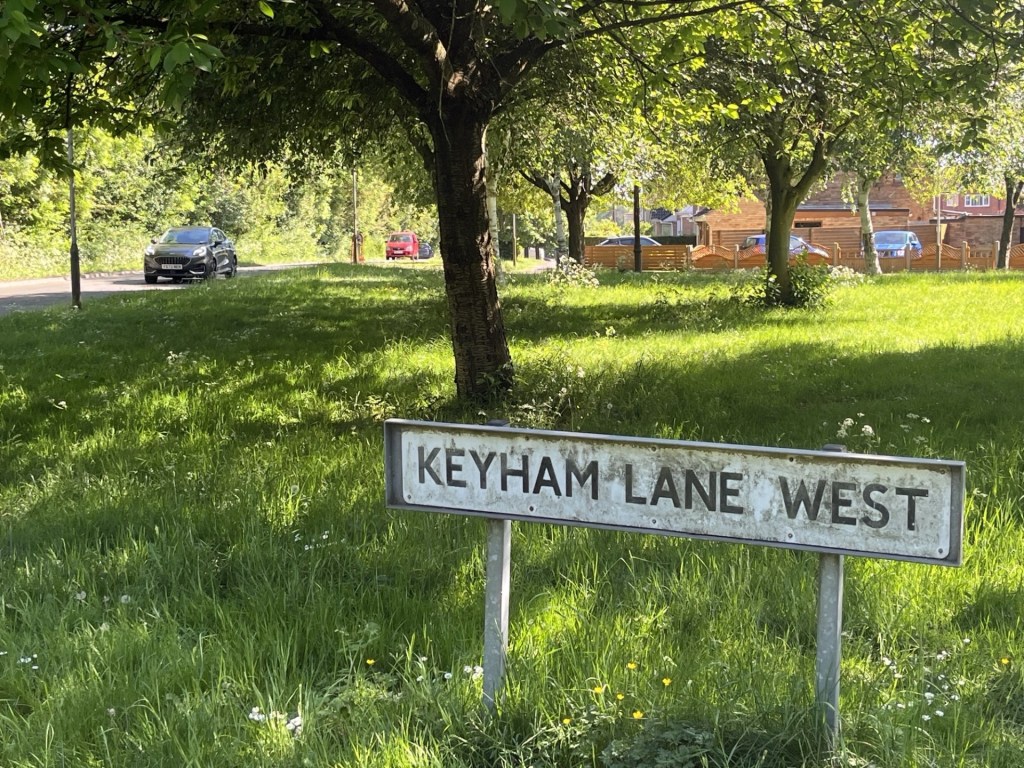
The sign could do with a wash. The high point is just a few metres to the left
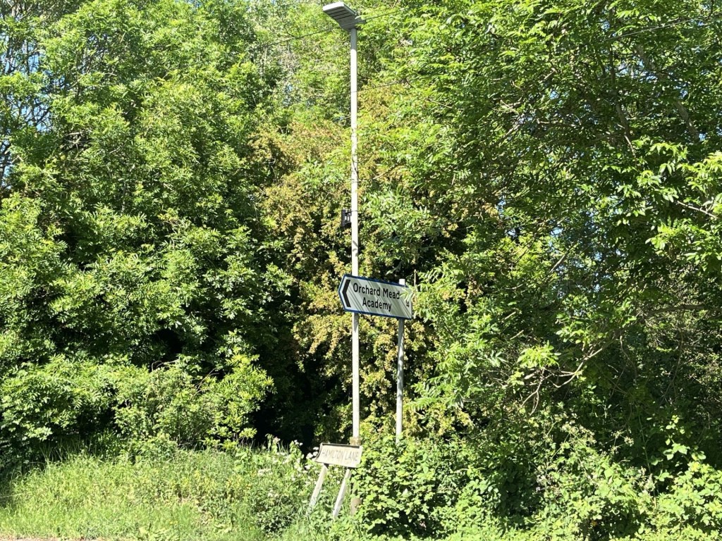
Another sign in distress. Just over the border in Leicestershire – Hamilton Lane
Time was getting on. Any thoughts of reaching the highest point in Leicestershire (Bardon Hill), evaporated as the traffic moved at a snail’s pace around the northern ring road. But the names were coming back to me. Humberstone, Thurmaston, Glen Parva and Anstey. I’m not particularly nostalgic, but I loved Leicester in the 1970’s, and having visited it again two years ago, I still do. It has a positive buzz and an attractive town centre. And, hey… I saw some of the best bands there back in the day (The Jam, The Clash and the Live Stiffs tour, to name check just a few).
As I say, no scope for nostalgia here from me (ha!). I had an appointment with my brother and sister-in-law in the Test Match pub in West Bridgford. Back in December 2024 I had sat in the Copper Pot in Leamington Spa and watched one of the most exciting games of football I’d seen in ages. Spurs had ripped Manchester United to shreds in the first half, but only just managed to survive after their goalie (Fraser Foster) made two howling errors and clung onto a 4-3 win in the quarter final of the League Cup. The next day I visited the highest point in Warwickshire. Well, a few weeks later Liverpool thrashed Spurs at the Lane in the semi-final, and after Spurs were knocked ingloriously out of the FA Cup, all that was left was the Europa League Trophy. Despite an atrocious second half of the season for both teams, Spurs and Manchester United somehow managed to get to the final in Portugal. And joy oh joy…. Spurs won!
I’d topped Rutland (nearly) and the City of Leicester, found a bit of countryside just east of Leicester that might call me back one day, and seen my team win a cup for the first time in 17 years. What more could an old man wish for? Oh, did I mention that my home team, Crystal Palace, had also just won the FA Cup? ***
*The old railway tracks at Marefield converge just to the west of Manor Farm. Unbelievably three stations lay within the area. A joint venture undertaken by the Great Northern and the London and North West railway companies in the late 19th century, it was primarily a goods line (Iron Ore, Coal and agricultural products) and several trains a day made journeys to all points south, north, east and west. By the 1960’s it had closed (like so many other lines). Today, with the exception of some old stranded redbrick bridges, you’d never know what a hive of industrial activity had once dominated the landscape.

The ghost of Marefield Junction
**Don’t be fooled. Peak Visor, which is a decent enough site, names Birstall Hill, further to the west as being the highest point. I think I can say with some certainty that it is not.
*** https://www.youtube.com/watch?v=1injh4-n1jY&list=RD1injh4-n1jY&start_radio=1
