Langdon Hill
Metres 116
Feet 381
2nd July 2025
There, or there abouts!
It was the last chapter of my East Anglian odyssey. Three days before (a Sunday) I had landed on a campsite in north Essex in a heatwave, found my way to the top of Suffolk the following sweltering day, and then the peaked Norfolk on Tuesday in perfect bright and breezy summer weather.
Today was Wednesday and after a long and tedious drive from Blakeney in Norfolk and having reached the twin peaks of Southend-on-Sea in warm drizzle, I was now heading west on the London Road, back into Essex and on towards the Unitary Authority of Thurrock. I don’t know why this large south-west chunk of Essex, now a Unitary Authority, is called Thurrock, but I have, on numerous occasions, called in for sustenance at Thurrock Services, on the M25 just north of the bridge. I’m just throwing that in to beef up the narrative, because the highest point in Thurrock is nowhere near the M25.
To cut to the quick I left the A13 at Stanford-le-Hope and headed north on a country road (the B1007 to be precise). The road went up (which was a good sign) and at a junction with Old Church Hill a small car park presented itself on the left. I hadn’t researched this spot carefully enough. The precise location of the highest point had been ambiguous, but I sensed the car park was close and so pulled in.

Gravel Hill Wood car park
I stepped out of the car and looked around. My understanding of the precise location of the high spot was that it was on the other side of the road. The fact that there was a large sign proclaiming a welcome to Thurrock, suggested that it probably was. I locked the car and walked across the road, just far enough to put me past the Thurrock sign (the road itself happened to be in Essex, so no scope for confusion there then). There was an outbreak of signage at this point, warning of this that and the other but there was no evidence of a walker friendly path that might get me round to the back of the cluster of buildings laying between me and where I understood the high point to be. Looking back across the road my car sat alone, seemingly forlorn. It was early July, and from my knowledge of annual crime trends (crime peaks in July) my vehicle was probably more at risk than at any other time of the year. The thought of losing it, or its contents, at this precise moment overcame my desire to eke out a small peak victory and so I crossed back. The metal height restriction barrier at the entrance sported some graffiti that suggested it had been a sound decision.

Whoever Youth 21 were, I was evidently on their patch
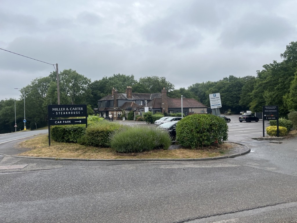
I still wasn’t sure whether I had got close to the objective, and because the road continued uphill I drove on to where it reached an obvious crest, (passing the very quirky St Mary’s and All Saints church in the process). At the top I stopped in the car park of the Miller and Carter steakhouse, again leaving the car to have a quick gander. There were no sweeping views of Tilbury or Canvey Island. A large wooden structure confirmed this was the Langdon Hill County Park, but whether I was in Essex or Thurrock I was unable to say. I had done as much as I could. I may not have reached the exact highest point in Thurrock, but one way or another I was now, at least for a moment, at a slightly higher spot just above it, and I still had possession of my car.
The top of Langdon Hill, albeit it wasn’t Thurrock.
