The highest point in the Unitary Authority of Slough, at 51 meters is, along with the Isles of Scilly, the fifth lowest high point in the County Top challenge (Peakbagger). Which implies that as a group of islands, the Scilly’s must be much lower than I had assumed and at serious risk. If I ever get there, I’ll double check.
I’d spent the night in an hotel room in Newbury (having reached the top of Walbury Hill in West Berkshire the day before) and was heading back to South London to recommence duties. Sleep had been illusive after the phenomenally annoying drunken behaviour of the guys staying in the rooms either side of mine, which only finally tailed off around 3am. Once upon a time I might have made a fuss but frankly I chose to avoid confrontation.
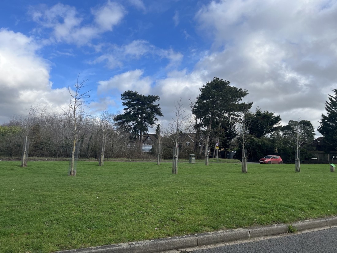
Reaching East Burnham Park, the highest point in Slough (and being frank again, don’t get excited), would complete the County Tops in the Thames Valley. I drove east on the M4 and turned left towards Sloughs suburbs at junction 7. Turning left again at the first roundabout and onto the Bath Road I caught a glimpse of a road sign directing motorists towards Dorney, Taplow and Dorney, named, obviously after three of the four stand out twenty storey tower blocks on Adelaide Road in north London. The one missing from the sign, which would have completed the set, was Bray, where our son was born in 1986 (on the 14th floor to be precise!).
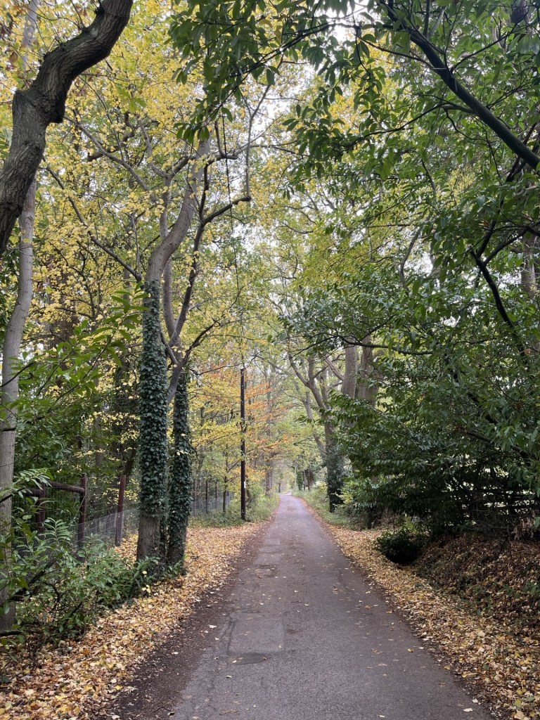
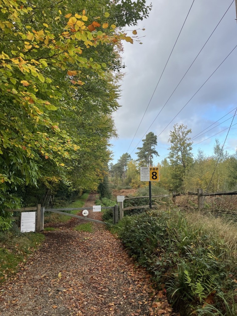
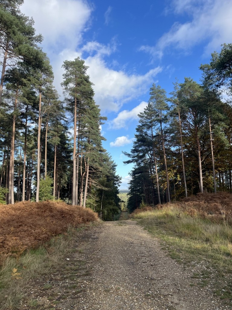
North through Burnham and onto the Farnham Lane, which seemed to define where the surrounding country met urban Slough. I pulled over on a slip road of Farnham Lane opposite Crown Lane, a small road heading north towards Burnham Beeches. *
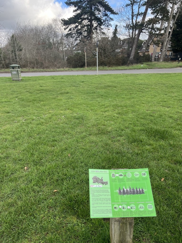
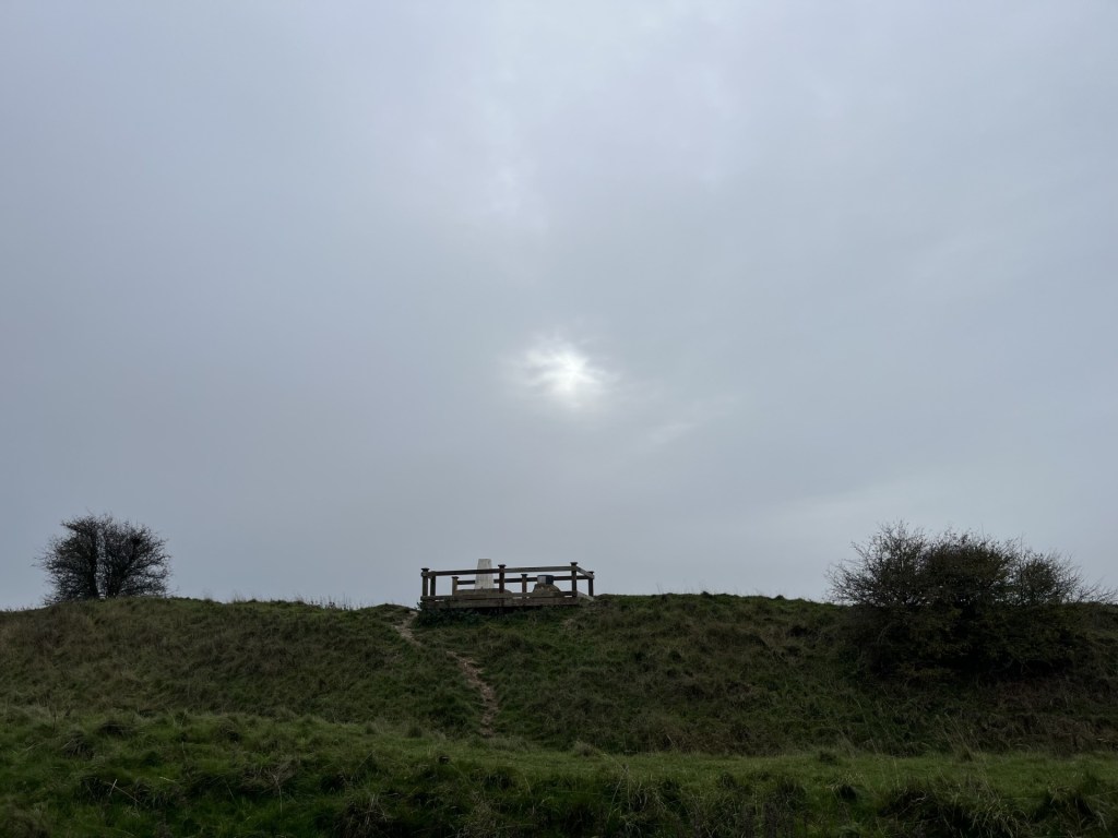
From what I had read the highest point was just beyond a hedge and fence where Crown Lane met Farnham Lane. I stepped out of the car and walked across an open area of grass, planted in places with young trees. A small sign explained that the land formed part of the Slough Digital Urban Forest. Some of what followed made a lot of sense, “biodiversity”, “Carbon Capture” etc, but it had been the use of the word “digital” that immediately closed my brain functions and left me scratching my head in disinterest.
A digital forest?!
What did catch my eye was a lonely litter bin sited near the road (see photo), but without any connection, from what I could see, to any potential meaningful interaction with intended clients. Maybe it was part of Slough’s Digital Waste Space initiative.
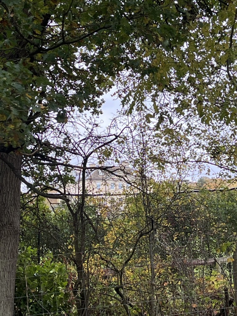
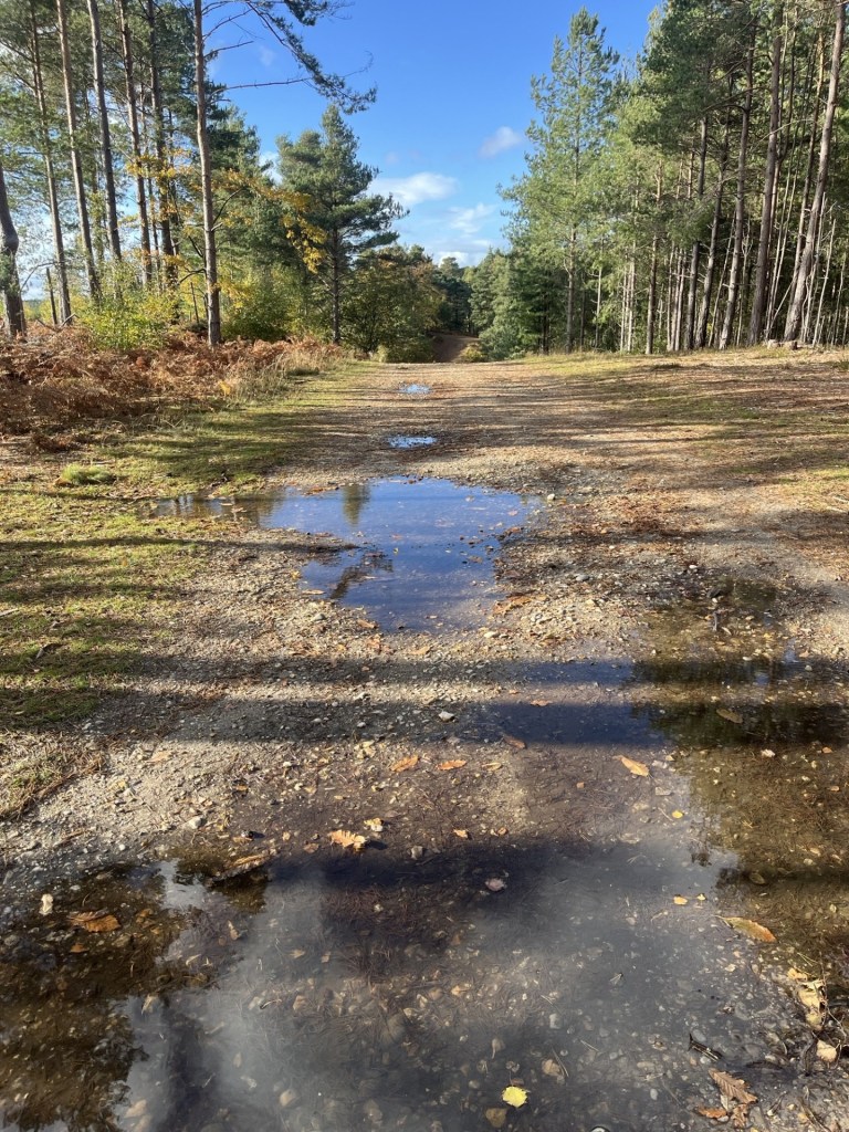
I looked across the road and to the junction with Crown Lane. The high point marked on the Peakbagger map sat just back from the road and in the trees. I don’t know why I didn’t bother to cross over the road for completion’s sake, maybe there was a low fence or something, but I concluded I had seen enough, and indeed a later check suggested that where I stood was the same height (51 meters).
The big tree on the left probably marked the spot
County Top number 50. Tick.
I drove back towards the M4 the way I had come, until I realised, I was somewhere I hadn’t been before. Ten minutes later and I was slap bang in the midst of a huge industrial/retail park sitting to the west of the town centre. It all appeared to be modernistic and high tech. Back in 1937 John Betjeman (who at the time lived in the rather quaint village of Uffington some miles to the west) wrote poetic lines on Slough, famously starting with “Come, friendly bombs, and fall on Slough..”
I had always known this opening line but wasn’t sure I had ever read the entire poem. Whoa! It’s excruciating. He must have been going through his Morrissey phase. Just as well he was never on social media. Between the wars a vast new trading/factory estate had been constructed in Slough. His poem railed against these developments. From what I could see there were no mid-Century buildings left or dirty smoke billowing up. All very clean and tidy now, though it’s still called Slough Trading Estate. It can only be a matter of time before a “Digital” finds its way into the name, “Trading” is replaced by “Enterprise” and “Estate” by “Park”. But will they keep “Slough”? I wonder!
* Burnham Beeches rang a bell for me. Famous for something, but only later did I discover that a whole slew of famous films had been shot there (not least Goldfinger). Perhaps I should have crossed the road.
If you know your history of Slough, you’ll appreciate the musical choice. Before Rod went in another direction! Other artists are available
Since my last outing (a long weekend in late October when I managed to chalk off five tops) a lot of “stuff” has been going on, and it is a long list. Greenland, Epstein fallout (on repeat), Tariffs misunderstood, Ukraine (US inertia continues), Andrew (see above – on repeat loop) and so much more. On a personal note, getting opportunities to travel have been severely limited. The weather for one thing (I wonder if we’ll look back in years to come and remember the incessant rain, cold and absence of sun), but also an elderly family member’s slow decline and on-going care requirements. Which prompted this very short getaway.
With a very small window of opportunity I made a last minute, value for money, two-night booking at a pub come hotel in Newbury. I won’t name it because it was pretty good to be fair, but my need for sleep was rudely interrupted on both nights, and I came away less equipped for my on-going commitments than I had been at the start. Shucks!
I chose Newbury, a small town just south of the M4 corridor between Reading and Swindon because it was near to Walbury Hill (and Slough – but that’s a future post), sufficiently close to where I had come from and where I needed to be on the Tuesday, and because, surprisingly I had never been there before. Going to somewhere I have never been before has been one of the secondary objectives of the County tops endeavour.
Arriving in Newbury early evening I had time to grab some food and relax over a couple of beers in local pubs. The first, The Lock, Stock and Barrel, located by the side of the river Kennett, was great, and the riverside terrace would be a must do in warmer weather. As it was, the river (a tributary of the Thames, and probably not much to look at most of the time) was a raging torrent, just inches from breaching the pubs defences. I asked a local couple if they had seen it so high before. The answer was a definite NO. The second pub, which will remain nameless, was shocking. Arsenal had beaten Spurs at the Lane 4 – 1. I expected Spurs to lose, and don’t begrudge Arsenal, but the boys were still pretty hopeless.
I slept like a log, until at around 5am, when, with a monumental crashing sound, the bottle recycling team turned up to remove the pubs Friday and Saturday empties. Wide awake for a while until asleep again. At 6.30am an almost identical noise announced someone from the pub emptying Sunday’s empties into the recycling bin that had just been emptied a couple of hours earlier. Again, wide awake until sometime on. I know this for sure because I woke again an hour later when the sound of beer kegs being dropped from the back of the dray (a lorry that carries barrels of beer), was pretty much the final straw. I think I counted about 20 metal on padded concrete interactions before it eventually buggered off.
Having been up with the larks, metaphorically, on three occasions, I gave up the fight. I had a task to complete after all. Before that I strolled into the town centre and then along the Kennet and associated canal. And very pleasant it was too, although for people living nearby, they must live in a state of high anxiety for half the year.
Where does all the water go?
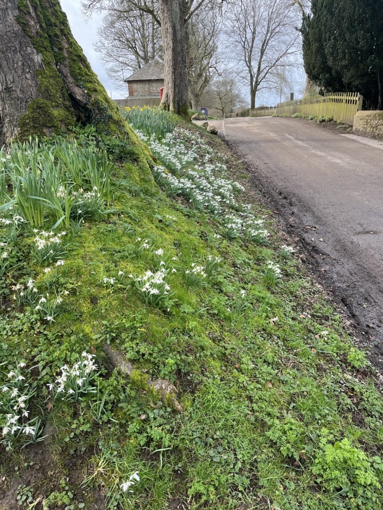
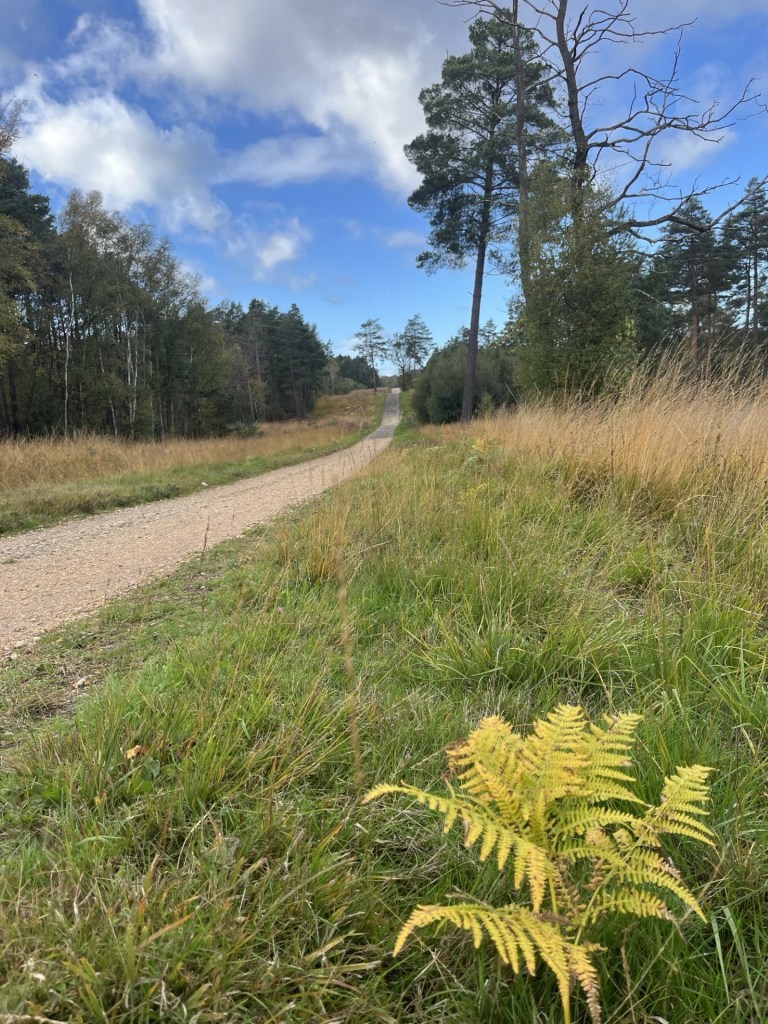
I drove out towards the southwest, noticing that many of the dense hedges were well over two meters wide – something I haven’t noticed elsewhere.* Not a long journey but made longer by taking a wrong turn and inadvertently arriving at Ashmansworth, where a year or so ago I had stopped briefly to get my bearings before finding Pilot Hill, the highest point in Hampshire (see https://elcolmado57.co.uk/2025/04/12/cresting-the-county-hampshire/). I took some bearings and then made my way along the narrow but traffic free lanes to Faccombe, where I stopped to take some bearings. Faccombe boasted a handful of very large houses, a church and a big pub called the Jack Russell, which for some reason looked a bit out of place. I stopped in the carpark of the Jack Russell (to get bearings) and considered calling in for a coffee. However, being surrounded by an array of high spec 4 by 4’s and SUV’s (are these the same things?), all of them looming over my little Ford, I chose to pass on through, aware that if anyone were to ask me my views on fox hunting I’d probably be lucky to get away with just a slashed tyre. Instead, I took a short stroll to the village pond, then took a photo of a swath of snowdrops, with daffodils above.
The lanes were awash with snowdrops, and I am pretty sure the daffodils were out far too soon
The road continued north. I noticed to my right a view across a valley towards Pilot Hill.
Pilot Hill – a new perspective.
I took some more bearings and shortly afterwards arrived at a small unmarked muddy carpark where I put on my boots and stepped forth.
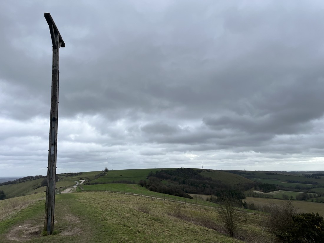
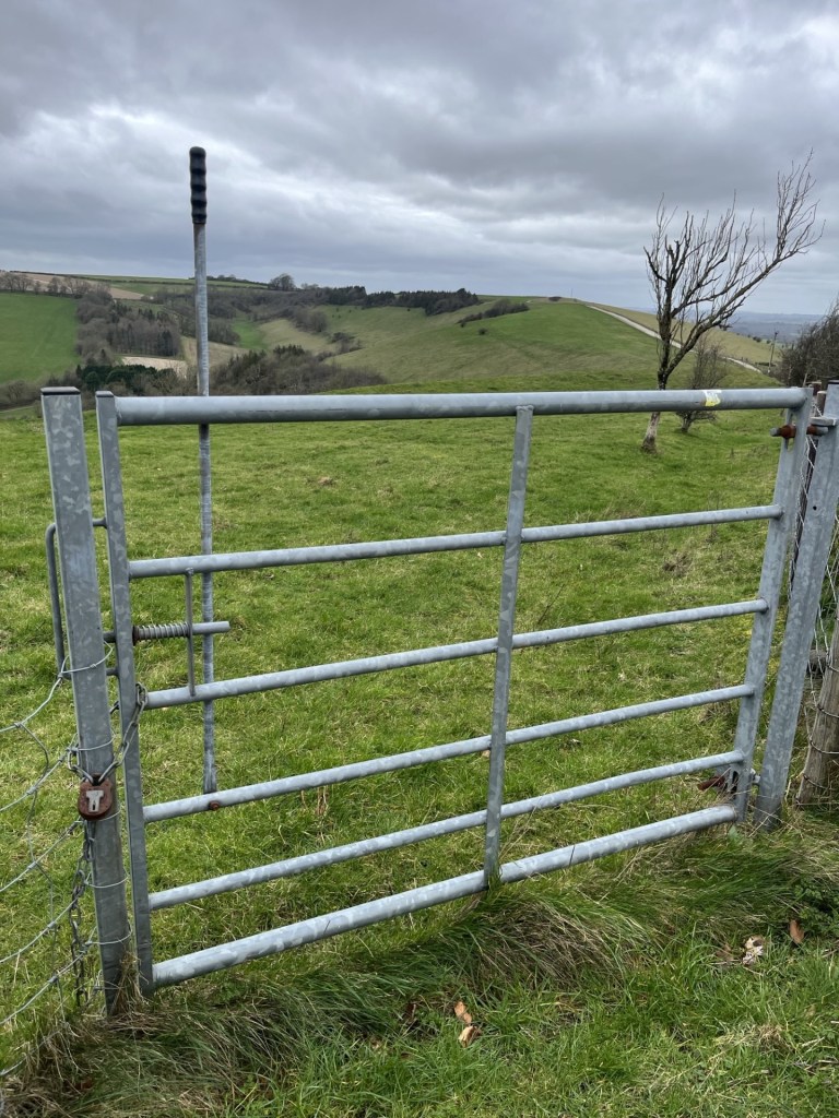
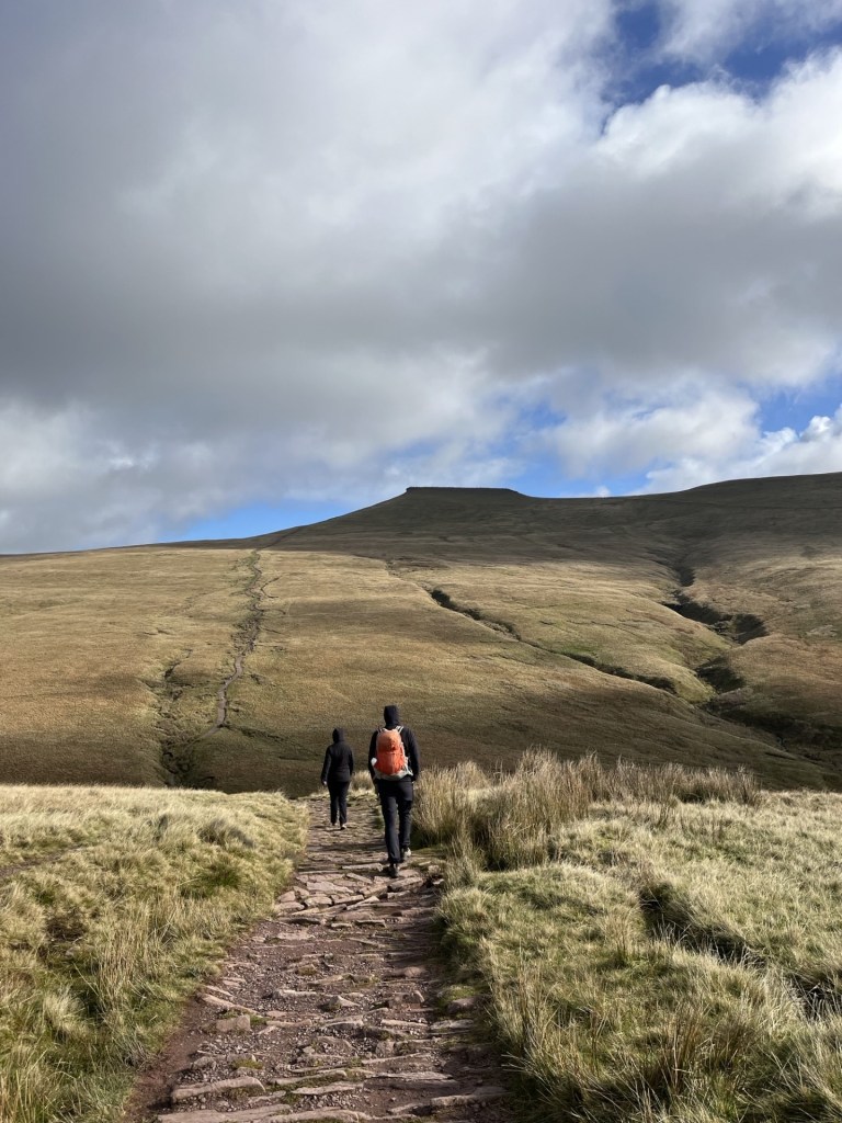
A rutted chalk track took me northwest. It felt like it would rain at any minute, but it didn’t, which was a relief. The hill boasts an Iron Age camp, but the evidence on the ground was limited, with just a few mounds indicating the structure. After half a mile, with a field to my left that contained the summit of Walbury Hill, I came to a large metal gate. I had read that access to the summit, which was on private land, could be gained at this point. Judging by the padlock and a sign that emphasised the private property, no public access angle, I figured there must be another access point further along.
Towards the summit, and a hint at the top of the trig point.
I carried on along the track, now losing elevation. Another 200 meters or so on another large gate, but sitting next to it a pedestrian gate, with all the hallmarks of hiking legitimacy. Except, again the private property sign and a rusty padlock that said it all.
The rusty padlock, an assertion of power and ownership?Combe Gibbet on the horizon
I was getting the message. At some point, maybe even still, the land was/is owned by the Astor Family. I couldn’t be bothered to do the research, but I knew that they had/still are, very, very rich. Original oligarch templates, I guess. Oh well, not much I could do about that, but to block access to the highest point in the whole of the southeast of England felt mean and petty. Maybe I had just missed a trick and somewhere, somewhere, there was a legitimate route (I later re-read the on-line blurb about Walbury Hill and realised that I had misread the bit about access from the main track – there was none).
The walk had been short and in a desperate need to keep stretching my legs (the last few weeks having largely consisted of sitting behind a steering wheel and watching the rain whilst stuck in traffic) I carried on along the track, across a minor road that fell away down the scarp slope of the chalk and towards the settlement of Inkpen. The track, part of the Wayfarers Way, an old drover’s route, headed up the ridge and to another high point. I couldn’t miss it. It had an enormous gibbet to mark the spot.
Combe Gibbet. Just so you get the message.
In 1676 George Broomham and Dorothy Newman had the unfortunate experience of having their mercifully dead bodies hoisted up and left to hang from the cross beam so that everyone could see what happened to murderers. So far, fair enough, given the nature of crime and justice at that time, except the only witness was “Mad Thomas” (no further details available). I make no further comment other than I’m pretty sure evidential rules have changed over time, and probably for the best (even though there are some people now emerging into the light who would be quite happy to turn the clock back).
I set off back the way I came, crossing over the road and passing between more substantial Iron Age ditches, workings, ramparts, whatever they may have been. The extent of the camp/fort must have been enormous, and given it was subsequently bisected by the later drover’s route, presumably served as a large enclosure for cattle and sheep – although that’s just a hunch.
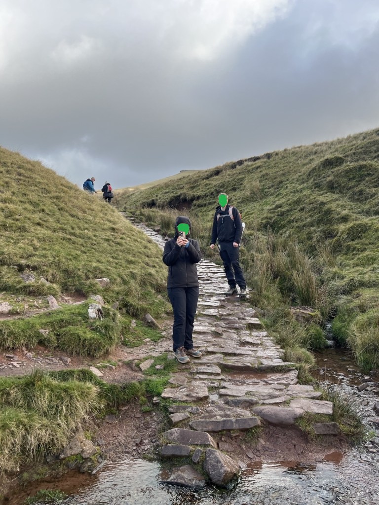
Back past the padlocked pedestrian gate and eventually the larger locked gate, situated within striking distance of the summit. I’d already pretty much made up my mind, and having a quick look around to see that the coast was clear, I clambered over the gate and walked directly south across the pasture field. The clear outlines of foot traffic indicated that others had passed this way before. The topography was plateau-like, and I figured that I wasn’t going to be attracting attention.
The day before, in the now febrile atmosphere that is the Divided States of America, a young man, carrying a shotgun and some canisters, and one assumes not in his right mind (I have no idea), somehow managed to get into the grounds of Mar-a-Lago. With sad inevitability he was shot and killed by security. It all feels relentless and unsolvable.
I tried to keep a low profile as I approached the top
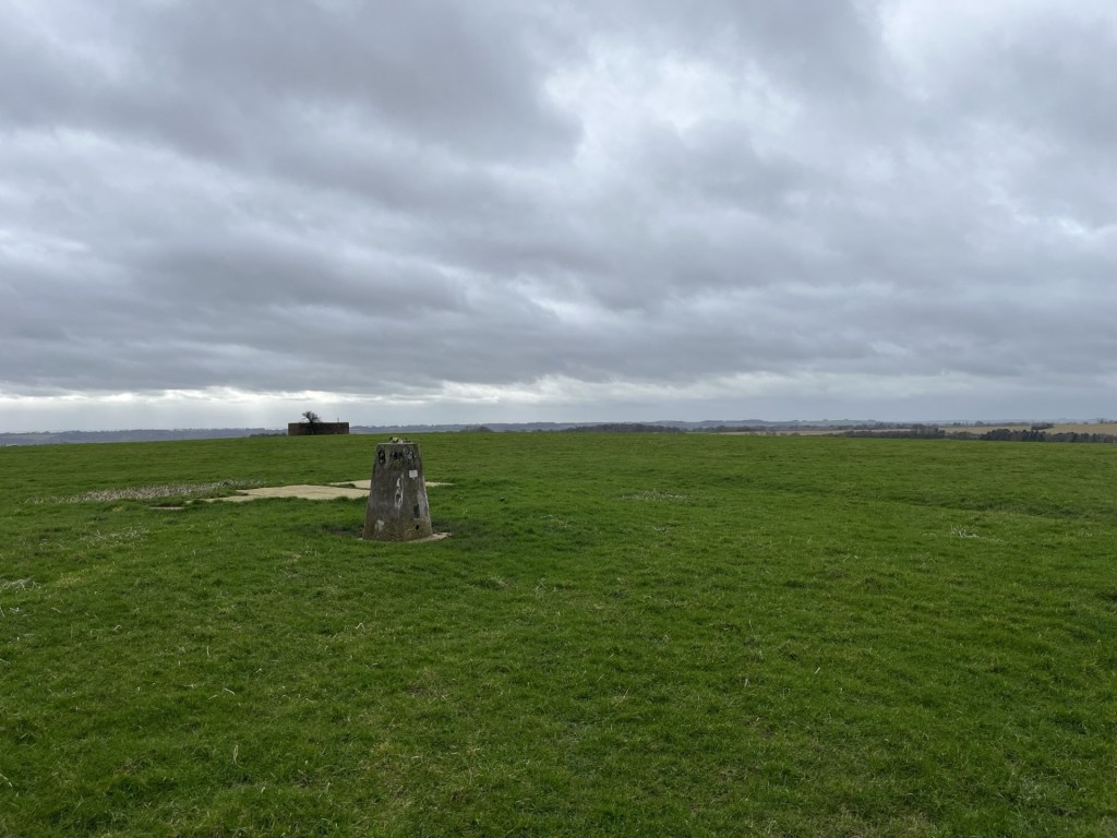
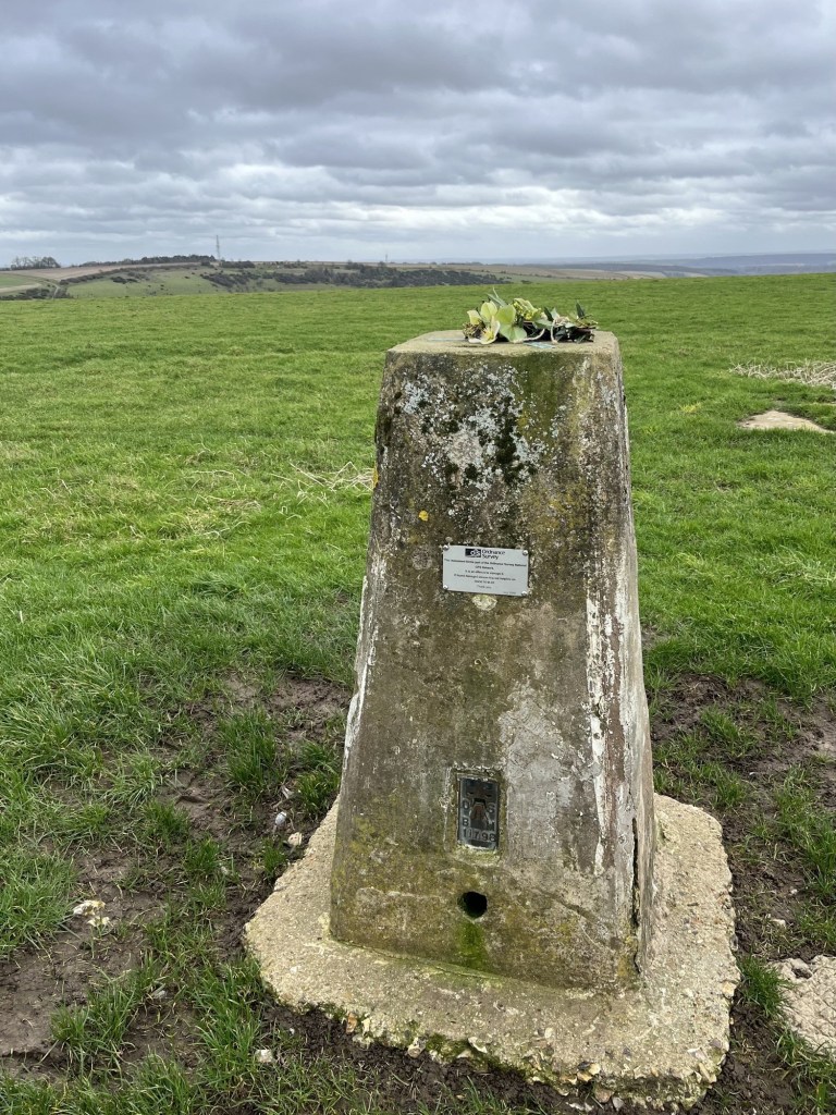
After about 200 meters I was at the trig point. Someone had placed a plastic wreath on top. I struggled to understand how it hadn’t blown away in the wind, but the spot had obviously meant something to someone. A metal plaque attached to the concrete structure (not seen on trig points I have previously visited) informed that the monument formed part of the Ordnance Survey National GPS Network and that it was an offence to damage it. Which seemed to suggest that there was some sort of signalling gadget embedded in the structure. Surely not! In any event the number 11798 is listed as Inkpen on my latest on-line find – the Trig Pillar Map. Life just continues to get better.
Please don’t vandalise this gift from a bygone age. It’s older than me!!
Next to the trip point was a small flat area of old concrete that served no obvious purpose. Except, on reading up on the site a bit later, back when there were only a handful of satellites (about two years ago I think, given the hundreds that Elon now fires up there every other day), live broadcasting of the horse racing at Newbury was made possible by men (I’m just guessing) in mustard coloured coats, pipe smoking and wearing heavy rimmed glasses driving an enormous signal mast to this point in order to transmit black and white, and then colour, images of the action to daytime television viewers and the punters in the bookies. On a windy wet day in winter, they must have been over the moon to have got the gig. There’s no need for it now, and from what I can see racing on daytime TV is not such a big thing. Anyway, it was a nice image to take away with me.
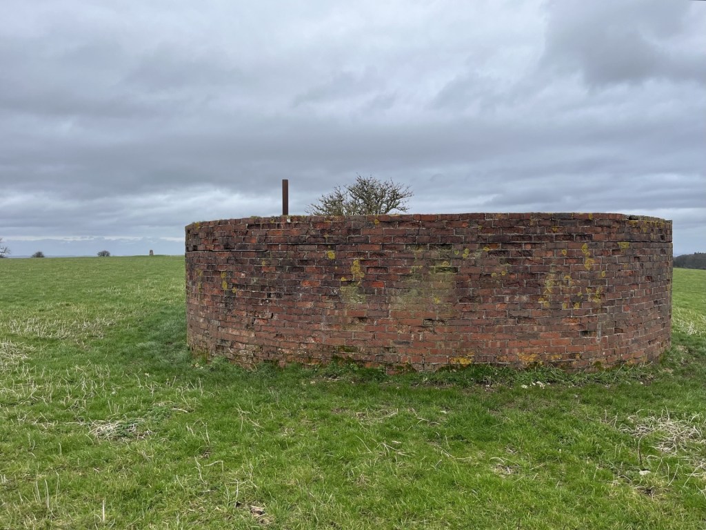
Further to the south was another interesting looking structure. I should say that it was probably only interesting to a niche audience, but I’m happy to count myself as part of it. On the basis that so far, no pellets had whizzed past my ears, I cautiously walked on. A low circular red brick building, capped off by concrete and with a pipe for ventilation peeking out the top. It could only have been a reservoir but had all the attributes of a WW2 pill box, except it lacked slit loopholes.
Note the traditional running pattern in the brickwork. No fancy Flemish bond needed here.
Back at the trig point I took a quick look around. To the east I could make out Pilot Hill. It’s said that Walbury Hill is the furthest point to be seen from the top of the Shard in central London (approximately 50 miles).** That seems highly improbable to me, although to be fair on the only occasion I went to the top of the Shard, the snowstorm was so bad that the furthest point seen was the roof of London Bridge station directly below.
2013 – I know, the Shardenfreude is not lost on me. The further point observed was the conning tower on the Belfast
It was time to hop back over the gate and make my getaway to the car. The carpark was still as muddy as it had been an hour earlier. A couple of guys with a farm dog on a quad bike, entering the nearby field, eyed me suspiciously. Maybe they’d had a call to intercept a trespasser. Ah well. On the subject of trespass, or more precisely, why it is that so much of England is inaccessible, The Book of Trespass – Crossing the Lines that Divide Us, by Nick Hayes, is an essential read.
I can’t tell you about how I slept that night back in the room. That’s because, thanks to the two drunken, off their cup’s young men in the adjacent room, I didn’t get any.
The quest continues.
* In answer to the Google search “Why are hedges in Berkshire so wide?” There is none.
** On a related note, my daughters partner J, recently passed me a copy of the December 2025 edition of TRAIL – (The UK’s best-selling hillwalking magazine). Initially I flicked through it but then stopped and went back to the start. The articles were well written and interesting. An article titled the Long Shot, by Philip Thomas, really grabbed my attention. He explained that hypothetically, at 144 miles, the longest view in the UK was from the summit of Merrick, the highest point in Dumfries and Galloway, and the top of Yr Wyddfa (Snowdon), which we know is the highest point in Gwynedd (and Wales). It’s technically the longest view but for all sorts of atmospheric and technical reasons, it’s never actually been seen or more importantly photographed. The longest view that has been photographed is between a point in the Pyrenees and a point in the French Alps (275 miles).
A few pages on from this fascinating article (believe me), was another feature called Top of the World (mistitled I fear) which extoled the virtues of the County Tops challenge and listed 10 varied examples, some of which I had done.
Having immersed myself in the publication I decided that come the New Year I would start subscribing. When I mentioned this to J, he frowned and then told me that I was holding in my hand the last edition – ever! What a blow.
In the Long Shot article mentioned above, the author starts by referencing the Who’s 1960’s hit, I Can See for Miles. Nice touch, so why not?
I was thinking about Scafell. Why had I never climbed it, wondering how on earth I would get the opportunity to do so now, and by extension reach the top of Cumbria. It had been bothering me, not least because I had climbed Helvellyn, a close second (or third as Scafell boasts two peaks, both slightly higher). But even Helvellyn was vexing me. It wasn’t on my itinerary, primarily because it wasn’t the top of Cumbria, but also because for the life of me my brain struggled to put together when and why I had been there in the first place.
It’s nineteen months since I started the county top challenge, and every week I’m finding out new things; not least that quite a lot of the on-line references, which on the surface look authoritative, often end up being unreliable; not deliberately, or due to casual research, but almost certainly because it’s a shifting shore.
My original list of counties, compiled just over a year ago from what, at the time, I assumed to be a reliable source, had included Scafell (which remains a legitimate target), in the county of Cumbria. My very large map obtained in December 2024 doesn’t disagree. So, some time ago, when a news article, or something similar, made mention of Westmorland, my ears started to twitch. Westmorland was a word I was certainly familiar with, but on checking the list it wasn’t to be found. I could have just left it like that, assuming that it was something along the lines of a generic term for a geographical area, but I’m beginning to find out that it’s best not to take anything for granted. I enquired further and soon discovered that Cumbria had been abolished in 2023 and divided in two, with Cumberland in the west and Westmorland and Furness to the east (are we keeping up?). And before anyone gets too nostalgic or sentimental about the demise of the ancient county of Cumbria, it ought to be noted that it (Cumbria) only came into existence in 1974 following the combining effect of, err… Cumberland, Westmorland, parts of Lancashire (!) and, (I can’t even believe the Yorkies let this happen without another civil war), part of the West Riding of – yup – Yorkshire! *
All these political shenanigans aside, once it had become clear to me that Westmorland and Furness was now a thing, and was added to my ever-lengthening list, I realised I had acquired a mighty peak by default. One could say of course that this is exactly the sort of bewildering quirk of the game that makes the exercise entirely meaningless. And, of course, one must agree, but hey, when I had climbed Helvellyn over twenty years ago, it had been an achievement, and by only a matter of a few metres is just a tad shorter than Scafell. It deserves to be a county top, and I am very grateful for that too.
Another notable claim to Helvellyn is that to the best of my knowledge it’s the only county top I have managed with both my son and daughter (with the possible exception of the City of London, which, I have just noted has disappeared from my latest definitive list).
I am unclear on the year, but from the information I wrote on the cover of the pack of the slightly disappointing snaps I took at the time, it was either the summer of 2003 or 2004. My children were teenagers and had been packed away for a week (voluntarily I should add) to a scout adventure centre at a place called Lochgoilhead, a remote location to the west of Loch Lomond in Scotland. The Scouting movement can divide opinion, but I don’t have a single bad word for the inner-city group that both my kids attended. Without any shadow of a doubt, it stretched them and cemented in them a desire for exploration, a sense of justice and a “can do” attitude.
Having said all that, whether they were thrilled by the prospect of another few days in the great outdoors under canvas, with their dad, at a campsite next to Ullswater only they can say, and I don’t intend to ask them now.
To reach the top of Helvellyn required me to do the following. I drove from London to Glasgow, spending a night or two with my Scottish relatives and brushing up on the lingo, before heading over the Erskin bridge into the Highlands, up Loch Lomond to Tarbet and then cross country to the remote settlement of Lochgoilhead. After meeting up I remember there was time for a march up one of the nearby braes to take in the breathtaking views down Loch Goil. The next day, with the rest of the squad, and the selfless volunteers who had made the whole thing possible, taking the long minibus journey back to London, I abducted my own and spent the rest of the day journeying down to Side Farm campsite, just to the east of the small village of Patterdale on the banks of mighty Ullswater in the Lake District. **
Our stay was for just three nights, and from memory the weather was kind. At the time my daughter would have been around 12 and my son 16. I recall that on the first full day we hired bikes and cycled on mountain trails up the east bank of the lake. About an hour in, one of the tyres on my son’s bike burst, leaving him to have to walk it all the way back. He seemed cheery about the prospect, probably delighted to have an excuse to spend some time apart from his sister and annoying dad. And who could blame him?
I can’t say with certainty that I can remember the exact route to the top of Helvellyn the following day, but I have an Ordnance Survey (Explorer OL5) map dated 2002 which fits into the likely dating, and a handful of photos, so here goes.
We drove the short distance from the campsite into Glenridding parking up near the large hotel… or did we? Yes, I recall that small boats lined the lake, dancing on the waves nearby… or did they?
Whether either of the kids saw this as an adventure, or just a task that needed to be completed to keep me happy, only they can say, but full credit to them, once we set off inland through the village on Greenside Road, they were clearly committed to the cause. The weather was largely overcast but warm. Ideal conditions.
We continued up Greenside Road until crossing over a small bridge over a stream and then onto open countryside, with Helvellyn in view at all times. I confess that at this stage it does get a little hazy, but I think we must have taken the main footpath running southwest and to the north of Glenridding Beck.
Looking towards the beast, with my daughter dressed completely inappropriately for upland hiking and asking if we were really going to go up that?
From cross referencing the photo with the OS map, I’m fairly sure that this photo was taken where Rowton Beck meets Glenridding Beck. The idea of taking on one of the almost vertical routes directly to the top was a non-starter.
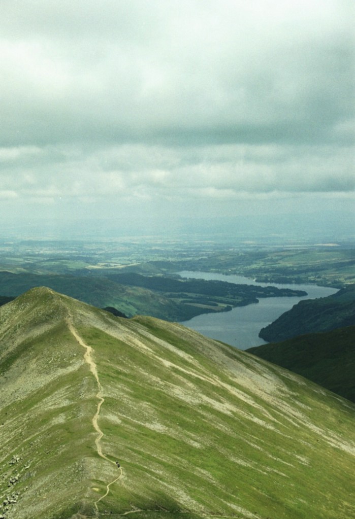
We followed the main path along Glenridding Common, and then started the zig zag climb up the slightly less challenging slope to the right, and eventually along the long straight path from Raise summit to the cairn at Whiteside Bank.
Looking back along the route from Whiteside Bank, with Ullswater beyond
Before I continue this reconstruction of what is now a somewhat ancient journey, a brief aside. A couple of days ago, I’m watching BBC News and up pops an article about the Patterdale Mountain Rescue Team trailing robotic legs. My eyes and ears were immediately alerted and for the next minute I watched how these carbon fibre leg braces, with some sort of battery attached, positively hurled the wearer up the hill paths. It seems that the number of call outs over recent years has escalated and the equipment allows the already stretched service the chance to get to their target more quickly and more efficiently, particularly as they also have to carry heavy packs. I couldn’t quite work out how they worked, not least because one would still be subject to lung capacity issues, but from what I saw they looked like the very fellows (as Billy Connelly once said) and may have to check them out for myself as the arthritis kicks in further.
What a beautiful sight – Helvellyn on the Beeb and in the safe hands of the volunteer rescuers
The associated message within the article was the significant increase in people rocking up in the wilds without the right equipment and then getting into trouble. Nothing particularly new in that message I guess (it’s an age-old issue) but from what I have seen recently on social media, it doesn’t surprise me. I have been getting lots more feeds showing people taking walks and hikes in remote locations and getting positive responses (check out Eddie Cheee in Scotland – he’s brilliant). I think they are great, especially when they show places I have known, but it’s almost inevitable that others will follow in their footsteps, many poorly prepared and equipped. And, when I have looked at what my kids were wearing when we climbed Helvellyn, I am the last to moralise on the subject. T-shirts and shorts! What was I thinking?
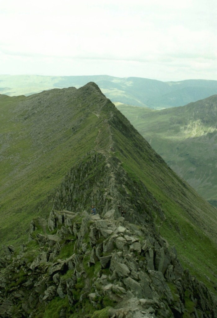
Back in the past, underequipped and irresponsible, we completed the next leg to the summit. This required trekking across the tricky ridge that would eventually lead to Lower Man (a distinct summit in its own right just to the north of the Helvellyn summit)
A random shot that could have been taken on the route towards Lower Man and possibly looking south-west towards Thirlmere, or north, or east-southeast, or, but honestly, who knows?
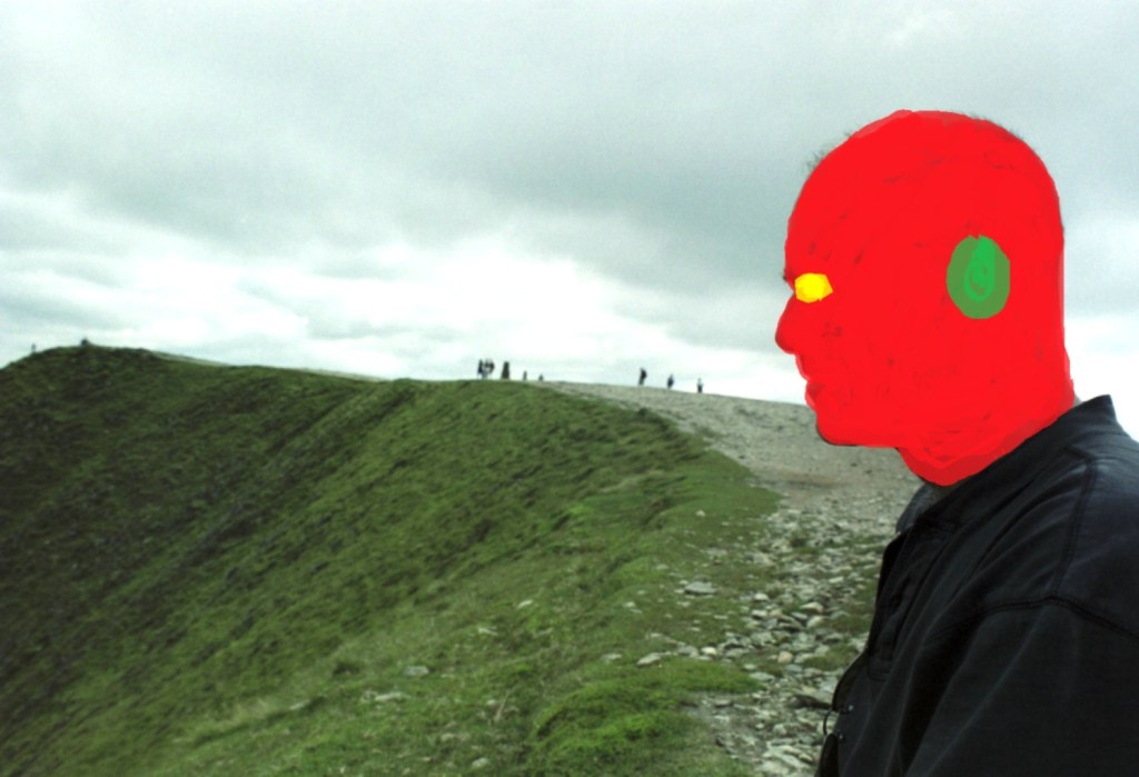
We eventually reached the top of Helvellyn, a relatively flat area of land but with the best views in town. I have some pictures of the kids looking suitably heroic (which of course they were), but for jolly good reasons (i.e. they definitely haven’t given me permission) here’s one of me to prove the event (heavily disguised of course as I haven’t given myself permission to post this into the public domain, primarily on the basis that my receding hairline was now in full retreat and the sideburns were entirely unnecessary).
Used for evidential purposes only but note that I for one was wearing something that could have kept out the rain for a few moments.
Suitably refreshed and slightly intimidated by the weather system pushing in from the direction of the Irish Sea, we made our move down. Easier said than done.
Hmm… could be trouble ahead. Looking south-west
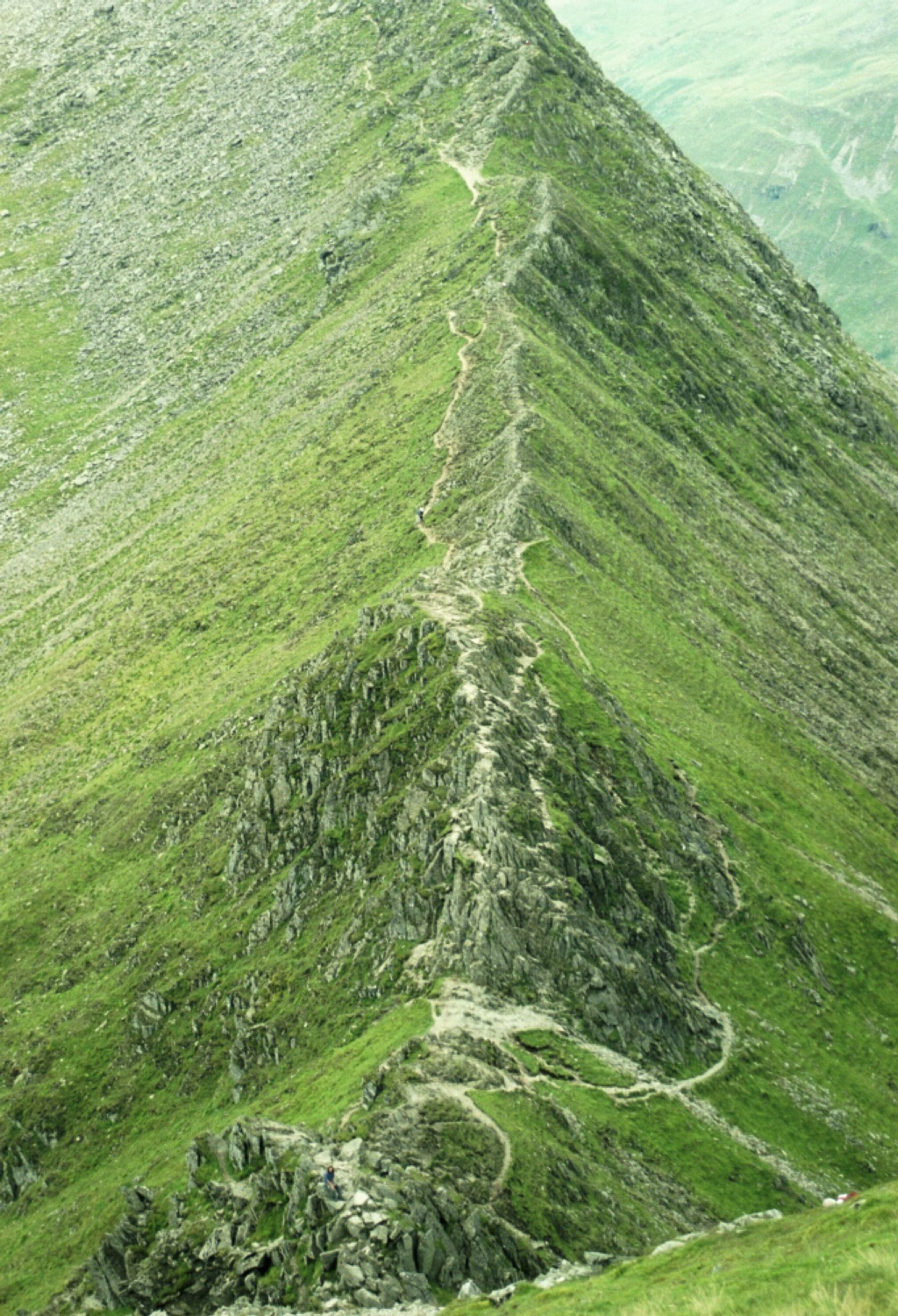
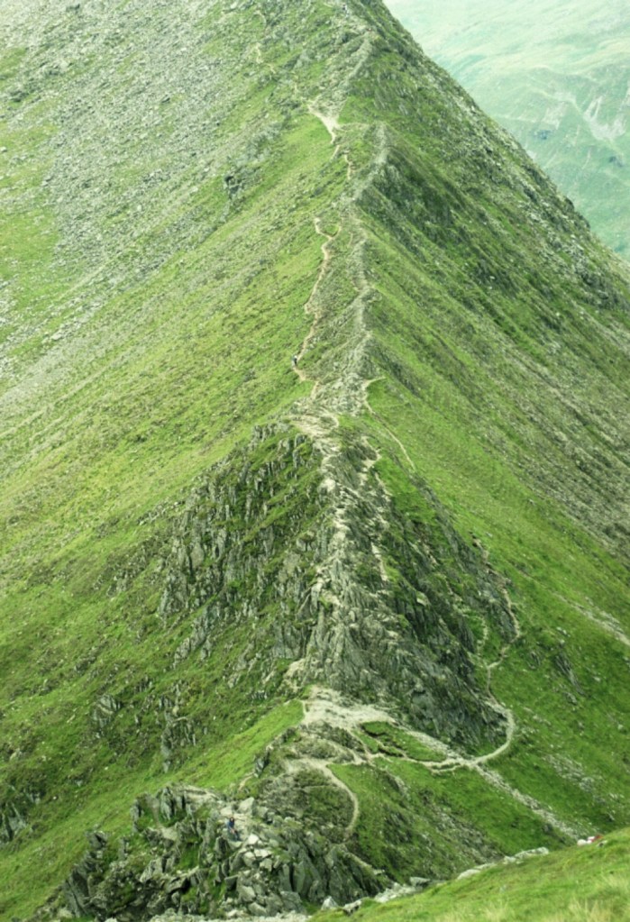
Anyone remotely familiar with Britain’s upland landscapes will know that Helvellyn is famous for its most distinctive feature. And here it is:
This is Striding Edge – no messing!
At the sight of Striding Edge, all jagged rock and with the land falling hundreds of feet away, potentially catastrophically, on each side, I recall suggesting a retreat back along the way we had come. It transpired that I was talking to myself. Both my children had left me at the top and were now clambering, skipping and jumping down and along the precipitous path towards, in my mind at least, almost certain referral to the authorities. I think I may have shouted some words of advice. “What the @*&% are you doing?” comes to mind, but it was probably more along the lines of “slow down and wait for me”.
A little blue dot at about 100 metres, and just to the left of the thin path, indicates my feral son. I can just make out three people to the right of the path clambering over the rocks. The whole scene just shouts, DON’T.
Striding Edge is a classic example of an arete (strictly speaking, being a French word there ought to be an ^ above the middle e, but you get the idea), a narrow ridge dividing two valleys, and brilliantly Striding Edge is the first image to be seen on Wikipedia when you search the word. As striking and visually impressive as Striding Edge is, it’s about 400 metres in length and although at times you can follow a safe’ish path, quite a lot of it requires clambering up and down awkward rock formations. Great fun if that’s what you’re after, but nerve wracking if you’re responsible for two minors (technically at least). My granddaughter, just nine, has recently been bitten by the climbing bug (nothing to do with me I should add), and from what I’ve seen of her on the climbing walls she’d boss Striding Edge.
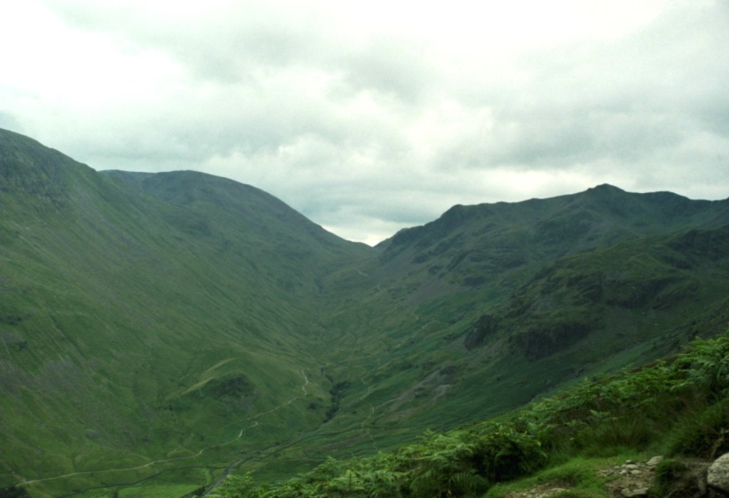
We did survive Striding Edge and eventually made it to the Hole-in-the-Wall, a dry-stone wall, unsurprisingly I suppose, where paths intersected and forming a boundary between the up and low land. I have a clear memory of arriving at this point and looking at the surrounding landscape. Maybe it was just a profound sense of relief that we had made it this far and were well and truly on the home run.
At Hole-in-the-Wall looking back up towards Grisedale Tarn (out of sight) and Fairfield Peak rising to the left, and Dollywaggon Pike to the right. BTW, I’m prepared to be contradicted on this if challenged.
We took the descending path over open country and covered the three or four kilometres back to Glenridding in less than an hour, and then on to the campsite for a last night under canvas. London and reality were calling.
Last evening on site and the weather on the turn
I started this by saying I had been ruminating on why I hadn’t climbed Scafell. The reason is simple. I haven’t been there yet, and to be honest, I’m not sure I will (from what I have heard it’s supposed to be tougher than Helvellyn), but if it happens or not it’s unimportant. What is important is that once upon a time my son, my daughter and I made an effort and reached the third highest peak in England. Hallelujah…
* A fascinating detail, particularly if you’re a Scot (I’ll say no more), when the Normans invaded most of what we think of as being Cumbria (and for want of a better description – other terms were available then), it fell under the governance of the Principality of Scotland. It did not feature in the Doomsday Book. By 1092, just 26 years after the invasion of England, William II, unable to resist the urge to invade, put paid to that. $£@%*&?’s!!!!!!
** In my old day job, I happened to manage numerous council blocks located in central London that bore the names of both Patterdale and Ullswater, along with other large blocks of flats named after other locations in the Lake District, many (having now looked at the map again) in the Helvellyn area. When they were built, just after the second world war, the lobby of each block had a large ceramic painting set on the wall that depicted the area it had been named after. From memory, by the twenty-first century all but one of these fine municipal works of art remained, the rest having fallen victim to refurbishment schemes or vandalism. I used to wonder what people living in these blocks must have thought of the daily reminder, as they passed through the lobby, that they lived about as far away as possible, physically, culturally and economically from the Lakes, and the uplifting images that they were confronted with. Many may not even have noticed. Some might have shrugged and cursed the irony, whilst others might have been inspired to jump on a train from nearby Euston station, and head north to explore.
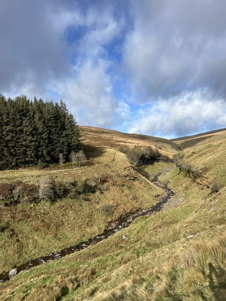
I was at the end of a three day, six “tops” haul, and with one to go. After a short walk from the village of Crazies to the top of Bowsey Hill in the Unitary Authority of Wokingham I had driven north on the old A4 Bath Road, turned left onto Burchetts Green Road, and then left again onto the smaller Honey Lane that formed the end of the Knowl Hill Bridleway Circuit, last encountered an hour earlier at Bowsey Hill. It occurred to me that had I put in a bit more effort into research before the day’s outing, I may have managed both “tops” on a single stroll on the Bridleway Circuit, but it was too late now.
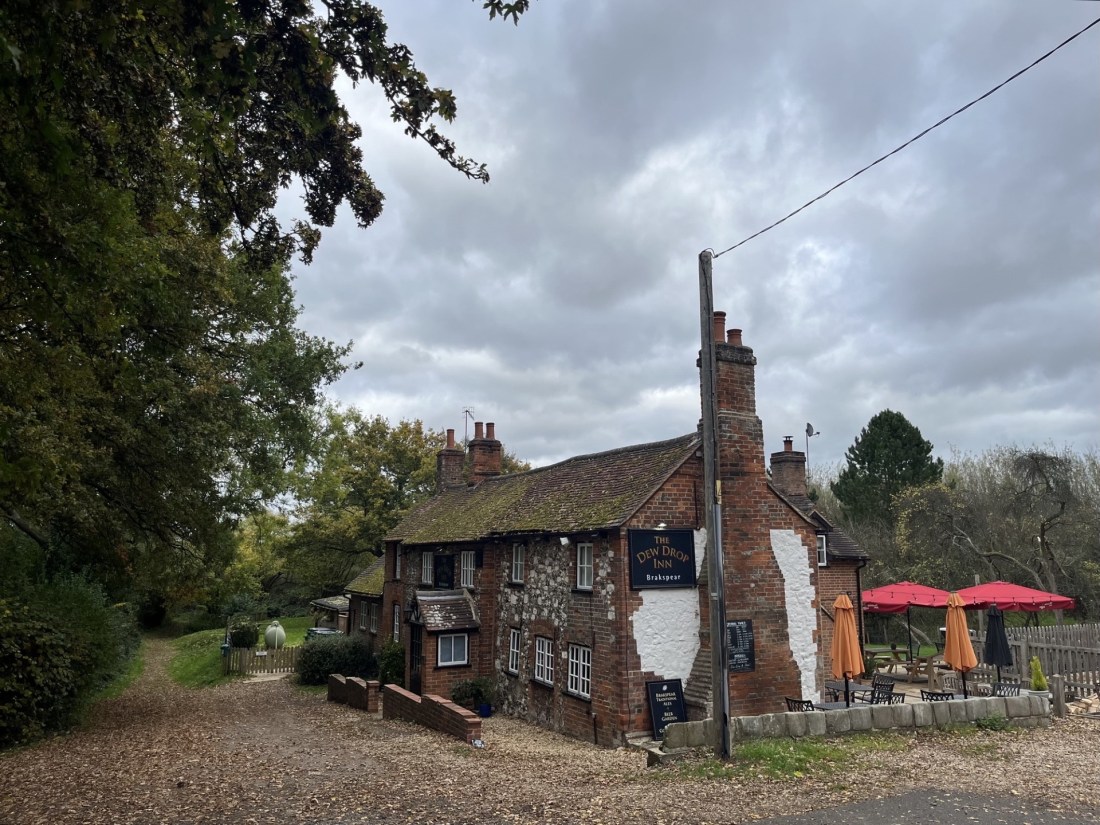
Honey Lane wound its way through thick woodland, skirting the northern flank of the Mitchel’s Wood plantation, before it took a sharp right and headed off north. I decided to continue west on a small track that abruptly ended at the ridiculously quaint Dew Drop Inn. I drove in and parked up. Being a Monday, the inn was shut, but that didn’t matter. I was looking at a pub that from its outward appearance hadn’t changed since it had either evolved, or been built, sometime in the 17th Century. I can’t remember if an Inn features in Humphry Clinker, but if it did, in my mind’s eye this is exactly how it would have looked. I think it’s fair to say that it’s only in the British Isles you’d find anything remotely like the Dew Drop Inn, hidden far from civilisation, in a nook in some woods, and serving (I certainly hope) warm beer and the fried and dried bits of pig’s skins (other less disgusting bar snacks are now available).
The Dew Drop Inn – Dogs and horses’ welcome
I realised that getting to the top of Ashley Hill was not going to be too much of a struggle, or that great map navigational skills would be required. So long as I generally headed in an upward direction the top would reveal itself eventually. I followed a path heading southwest, flanking the woods on my left. Looking down to my right, the edge of an estate that partially hid an enormous country house. Whoever lived in the house was hugely privileged. After all, they lived with the Dew Drop Inn at their back door. *
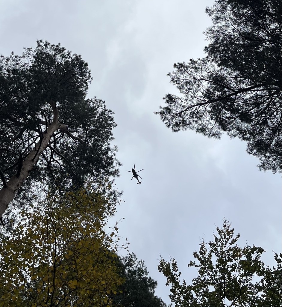
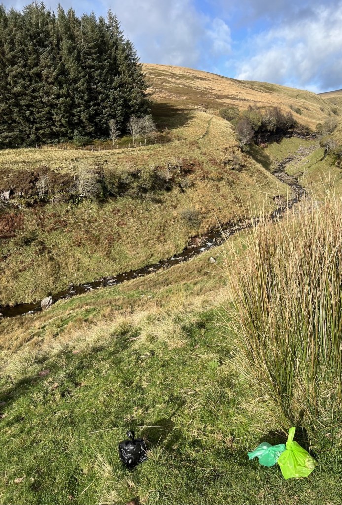
A footpath led upwards, so I took it. After about 50 metres another path headed right and along the level. Just after I took this option, I could hear the thwap, thwap of a chopper zoning in across the treetops. They may have been tipped off that an oik in a Ford Fiesta had parked up in the Dew Drop and were on a seek and desist mission.
Either the rotors had stopped rotating, or my camera phone is on spec.
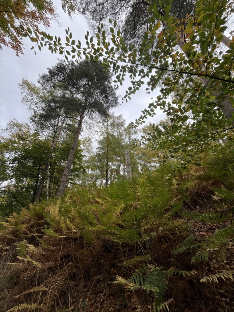
After the helicopter had passed over, I proceeded along the muddy path, with grand old trees towering above and clinging onto the last of their foliage.
The viewpoint from a fern’s perspective
Around a bend ahead two large mud caked dogs lunged into view, scarpering at high speed in my general direction. The troubled look on my face must have alerted their owners, who followed up closely noting my obvious distress, which wasn’t so much the immediate threat of death but more an aversion to wet and excitable dogs pawing at my fairly clean trousers. A couple of shouts and the dogs were under control. We stopped and talked for a minute. I commented that one of the dogs was a certain type, based solely on what looked like a similar dog owned by my brother. The mother and daughter, after a moment of merriment (which may have come with thinly veiled scoffing) dismissed my basic error and then, in some detail, explained the type of dogs they were in fact in charge of. It went entirely over my head, but they were nice people, and neither of the dogs attempted to bite me – always a bonus.
Further on I bore to the left and shortly afterwards another track headed directly up the hill. Up I went and reached a point that Peak Bagger suggested was the top. By the mere fact that the path continued up a further 50 metres or so I determined that they were a tad wide of the mark.
Peak Baggers point, but not quite the top
The top of the path opened onto a small plateau area, beyond which a high fence enclosed a large building of no determinate age, but which could have been called Foresters Lodge. I was at the top of Ashley Hill.
The unofficial, but my official, top of the county
I slipped quickly back down to the Dew Drop Inn on a straight path. Reviews of Mitchel’s Woods (for that was where I had trod) were rightly positive, though someone who probably hadn’t been in nature before merely observed “No toilets”.
I drove back along Honey Lane and then cross country, avoiding the M4 and M25 as far as I could, until I passed through Windsor and then onto Albert Road, bisecting the Long Walk. I briefly looked to the south and towards Royal Lodge, but there was no celebrity royal in sight, although the Uber Pizza Express delivery scooter heading from the direction of Woking piqued my curiosity. Ending up at Runnymede, last encountered about three years before on a day with the grandkids at Legoland, nothing seemed to have changed much, although I noticed an attractive cafe in one of the gate houses which I guessed post-dated the Magna Carta.
The argument goes that what happened here (obviously not in the cafe) in 1215 changed history and the relationship between royalty and the people. I’m not so convinced. It certainly changed the relationship between the landed Norman elite and their grip on the land itself, the ongoing legacy of which I had observed earlier in the day at Bowsey and Ashley Hills.
At the cafe the royal tea was orf, so I stuck with an Americano which came with one of those ubiquitous, clear cellophane wrapped Italian biscuits that, along with plastic drinks bottles, are competing to be declared the most universal and unnecessary environmental pollutants currently trending. Mind you, they are tasty.
PS.
Three days later, on the 30th October, a resident of Royal Lodge, in the Windsor and Maidenhead Unitary Authority area, and just a mile or so from where the Magna Carta was signed in 1215, had, under Royal proclamation, and as recorded in the House of Commons library and titled the Removal of Titles and Honours, been revealed to be nothing more than a commoner after all. As Adam Ant once warned, “Don’t you ever, don’t you ever, lower yourself, forgetting all your standards”.
*I later looked up the history of the Dew Drop Inn. Apparently, Dick Turpin may have visited a couple of times with his horse, Black Bess. So, when I read further articles, and particularly the piece below, I was bemused and confused:
“Opened in 1939 by Frank Painia, what started as a barbershop quickly grew into a well-known hotel and music venue, complete with a restaurant and bar. Listed in the Green Book, the guide for Black travelers in segregated America, the Dew Drop Inn is now considered a historic landmark.”
Needless to say, it took a bit of disentangling before I finally worked out that I was reading two completely different articles about two entirely different places, but at least now I knew.
I entered the back room in the bar of the Prince of Wales pub in Marlow where I was met by a man with a tea towel over his shoulders. “Good morning,” he said. I replied in similar vein, looked around and asked where I should sit. “At your table, sir,” whilst pointing towards the only table that had been equipped with china and cutlery. I felt like a complete clot.
The evening before (Sunday) I had checked in after a drive from Bristol during which I had climbed up to Liddington Hillfort (the highest point in Swindon), then locating the Water Tower on Park Lane – needless to say, the highest point in Reading. I was breaking the journey home, and on Saturday I had gone online to find a stopping point somewhere in the Thames Valley that wasn’t going to blow a massive hole in my budget. I hadn’t been hopeful. So, when the Prince of Wales in the centre of Marlow popped up and invited me to stay overnight for a mere £72, I could only assume there must be a massive catch. But what could a poor elder do?
I had arrived early in the evening and on parking up couldn’t help noticing that the place was heaving. I checked in and was shown out the door and then round to a couple of terraced Victorian cottages adjacent to the pub. As we walked up the short set of stairs, I was expecting to find that the facilities had probably not changed much since it had been built, but lo it was not so. An excellent, fully equipped warm and cosy room which said, your welcome.
Given the seething mass of humanity in the bar I decided to go for a scroll into town whilst there was still some daylight. Just being a stone’s throw from the High Street I was at the High Street in just minutes. Clearly an affluent town, I booked a pint at the Chequers whilst studying the menu. Ah! “Anything else, sir?” “Yes,” I replied, “a large bowl of your finest peanuts please, my man.”
After a slow pint and more peanuts than a man can eat (at £5 a bucket I felt compelled), I wandered back down the High Street and to the junction with Station Road, on the corner of which Amorino Geleto’s was still doing a roaring trade in ice-cream (I guessed). I can’t think of another town in the country where a fine Italian ice-cream emporium would be open at 8pm on a freezing cold and wet Sunday night in October. Nevertheless, I was now regretting the peanut dinner.
It was still quite early, so I decided to venture into the bar before heading back next door. The pub had almost completely emptied out, apart from four middle aged men, all with their eyes glued to the TV watching a sport that involved a procession of high-performance racing cars following each other around an illuminated futuristic track somewhere in a desert. Apparently, it’s called Formula 1, but it had nothing whatsoever to do with Jim Clark, Fangio or even Jackie Stewart. Each of the men seemed to be sitting as far away from each other as was physically possible, yet every so often one would pipe up and wonder about some knowledgeable detail relating to the performance of one or other of the drivers turbo, pitot tube injector rods, or was Hasslebackers steering a bit out, or if Strollburgers right off was showing signs of wear? They seemed to be talking a different language.
Eventually the “event” was over. Someone, who could have been British, but was born in one of the “territories” seemed to have won, and with that three of the men supped up and buggered off. The man who remained was the owner and we chatted for a bit whilst he tidied up, and I did likewise with the cold beer. He seemed to have a northern accent but had lived in Marlow for ten years and absolutely loved it. I said I could see the appeal and explained why I was staying over. I was getting older and falling out of love with day long drives. He was sympathetic, although I’m not so sure he would have been quite so if I had mentioned my quest to get to two nearby County tops the next day. He went on to say that in the whole time he had been in Marlow he had never witnessed a crime and was of the opinion that indeed, crime was non-existent. Fortunately I was able to confirm to him that in the three hours I had been in town I had neither witnessed, nor been a victim of crime, although having had a quick look in an estate agents window and seeing the cost of renting a flat in town, I could have said that some crimes go largely unreported. I didn’t of course and instead went to bed.
After taking my seat in the breakfast area the man with the tea towel over his shoulder asked me what I wanted for my breakfast and pointed at a large table set out with all sorts of breakfast options, including cereals, tinned fruit and various wrapped bread things. I was overwhelmed. All this for me, and for only £72. Suddenly, and despite the lack of a proper meal the evening before, my appetite vanished. “Ehm, oh, err. Just beans on toast would be fine.”
“Are you sure that’s all? I can do you eggs, bacon, sausages, black pudding, tomatoes and more eggs if you want.”
“Oh, okay,” I surrendered, “can you add a fried egg please.”
“Just a fried egg?” He looked down at me expectedly. “I also have, and can make you, hash browns, chips, mushrooms and veggie sausages if you’re that way inclined?”
I declined his further offerings despite the knowledge that I was potentially missing out on the deal of the year. “Suit yourself mate,” he said as he turned towards the kitchen. “You’re paying for it.” Yup!
Waiting for my beans on toast with one fried egg I became aware of some movement behind me. “Are you the manager?” A man was standing at the bar and looking at me. “No,” I said, and explained that someone would be back soon. The man was youngish, looked fit as a fiddle, with a bronzed face that suggested a recent holiday somewhere south of Nice and wearing a hoodie, trackie bottom combo that looked like it had been purchased from the menswear department of Harrod’s (assuming there is one).
My man returned to the bar shortly afterwards. The new arrival made his presence known. “Hi! I’m working on the house next door. Any chance I can park my van in your car park for the day?”
“Suit yourself mate,” my guy replied, possibly as impressed as I was by the immaculately turned-out builder. It really was another world, and I was about to leave it for reality.
Before I set off, I took a short walk down to the Thames, passing the Two Brewers pub where Jerome K Jerome had written some of Three Men in a Boat. It felt very familiar and I wondered if I had been here before but couldn’t place when, or with whom. I gazed across the river towards the huge weir and then at two regal swans that circled around a small landing ramp. Their almost loving interactions were both quaint and meaningful.
After walking down some well-appointed walled alleys I reached the remarkable two-hundred-year-old suspension bridge and then back to the High Street for a coffee before departure.
Marlow Monday morning blue
Sitting at a table in the sun I watched as Marlow woke up. Chelsea Tractors competed for pavement space, immaculately turned-out dogs were out walking their minders whilst a retired Major-General, with an ancient, gnarled stick, accosted a balaclava wearing scallywag on a black bike and making it clear that he must reverse ferret and return from whence he came (nearby Slough to be precise). Meanwhile, a group of workmen were having a late breakfast in the high-end delicatessen opposite. Strangely, the Amorino Gelato was closed, but as I took it all in, I couldn’t argue with my landlord’s observations the night before. Marlow really was a fine place.
I drove out of Marlow across the suspension bridge, which required some advanced driving skills to avoid contact with the brutal metal width restrictors. Judging by the array of colours smeared on the vicious panels, many people before had failed the test. To get to Bowsey Hill I headed south on the A404 and then west on Henley Road before swinging left onto Culham Lane. On my right I glimpsed the entrance to a large estate, with enormous and immaculately pruned hedging. The stunning grounds looked more French chateaux than English baronial, and really, I should have stopped to have a closer look. Instead, I carried on and shortly afterwards pulled up outside the Horns Pub in a place called Crazies Hill. The well-appointed Georgian looking country pub was closed for refurbishment. Never mind, it was too early anyway. I made a mental note that if, at some point in the future, I might want to explore the area further it could serve as an overnight stopping point, until later, after a quick look on the website, it was clear that a one night stay would probably cost three to four times what I’d paid at the Prince of Wales.
Crazies Hill Community Hub
The destination was just a mile or so south on Hatch Gate Lane. A short walk on a pleasant, soft autumn morning. After a couple of hundred metres, I came to a junction. Opposite sat a large well-proportioned house. Probably worth a couple of million – at least. More staggering though was that it was a mere gatehouse.
Gatehouse to heaven
Carrying on, now on a slight gradient, to the left occasional glimpses through the trees revealed a substantial pile of something created out of historic great wealth.
A glimpse of just your average mansion in these parts
To my right another large old country house lay in open grounds. A gigantic back lawn stretched along the side of the road and led up to woodland, where, at its edge, a solitary, empty bench sat looking somewhat forlornly back down on the estate. A seat of power, in an area where old power had once come to settle, and where no doubt a different type of power still finds intoxicating today.
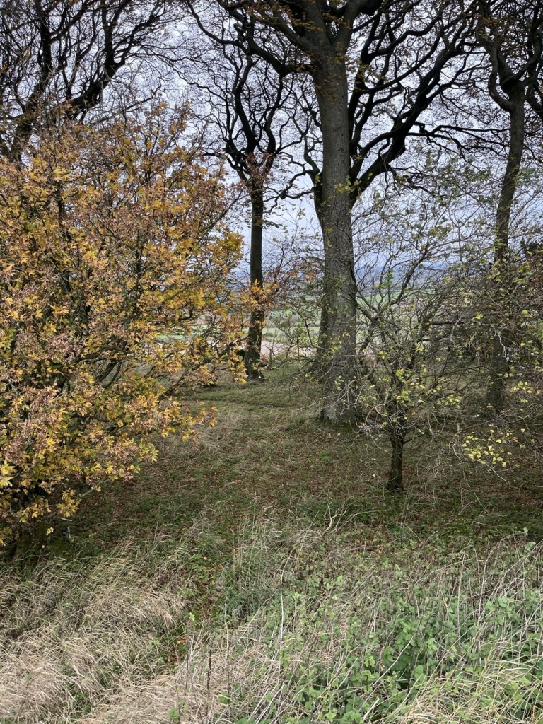
Beyond the lawn the lane began to wind upwards, with tall trees either side displaying their intoxicating autumn foliage.
Autumn colour scene
I reached what seemed to be the top of the hill. The road flattened out with a cluster of buildings huddling nearby. Looking to the southwest through heavy foliage I could see bits of Reading in the distance. For the people who lived here it would come with impressive views, albeit a significant part of it would be of Reading.
An attractive property in an exclusive part of the Thames Valley, with exclusive views of, err… Reading!
I wandered on for a bit, not entirely sure where the highest point of Bowsey Hill was until I reached the point in the road where it started to go down again. Just at that point, when I was about to turn and retrace my steps, three women, around my age, possibly slightly older, came into view, walking resolutely uphill and all equipped with modern lightweight walking aids. In seconds they had passed me by and were heading off down towards Crazies Hill. I decided to hang back for a moment just in case it might look to the casual observer that I had chosen to follow them.
Hanging back at the top
In the time it took me to hang back, a second tranche of maybe ten or so more resolutes came walking up from the same direction as before. Mainly older women, but with a couple of similarly aged men that formed the ranks of the 71st Berkshire Light Walking Pole Brigade who marched past in fine order, eyes forward and without breaking step, with only one solitary woman acknowledging my own solitary presence with a “hello”. I assumed they must have been under orders not to talk.
I thought it best to hang back a bit longer in case anyone observing thought that I had chosen to follow them. Am I alone when it comes to awkward situations like this, or am I naturally anti-social? Either way, and after a minute or so, it suddenly struck me that anyone observing now might think that I was behaving in an anti-social manner, I decided to head off back.
All clear on the road ahead – beech perfect
As I walked back down the road through the woods, I had only gone a hundred metres when lo and behold, coming back up the hill was the entire light pole brigade. As they passed the solitary woman (who was still in solitary mode) smiled and said hello again. The two men were now bringing up the rear. “Are you lost?” I managed to stutter. No, they said, they had just reached the limit of the walk and were heading back. It crossed my mind that maybe they had intended to reach the Horns Pub for lunch when someone had suddenly found out, halfway down the hill, that it was closed. Either way it all felt a bit Grand Old Duke of York’ish.
Which way did the army go?
The entire walk from Crazies Hill to the top of Boswey Hill had been along Hatch Gate Lane but at the top became Knowl Hill Bridleway Circuit, and whilst the road, and everything to my right was in the Wokingham Unitary Authority, everything to the left, including the massive pile behind the trees, was in the Windsor and Maidenhead Unitary Authority area.
Back at the car, and the Horns Pub was no closer to re-opening. I worked out the way to my next objective, Ashley Hill, in the Windsor and Maidenhead Unitary Authority, and set off on what turned out to be quite a complex journey around a place called Wargrave (the derivation seems to have nothing whatsoever to do with the obvious) and then north-east on the A4 Bath Road. About two miles on, at a left hand turning and emerging onto the main road in slightly dishevelled order, the rank and file of the old 71st Berks Light Pole, all poles still intact and no doubt heading, quick march, towards the Bird in Hand* at Knowl Hill, which I had passed moments earlier. Ah well, it’s all in a day.
* I have just had a quick look on the Bird in Hands website, and their doing rooms this coming Sunday for sixty quid! What’s occurring man?
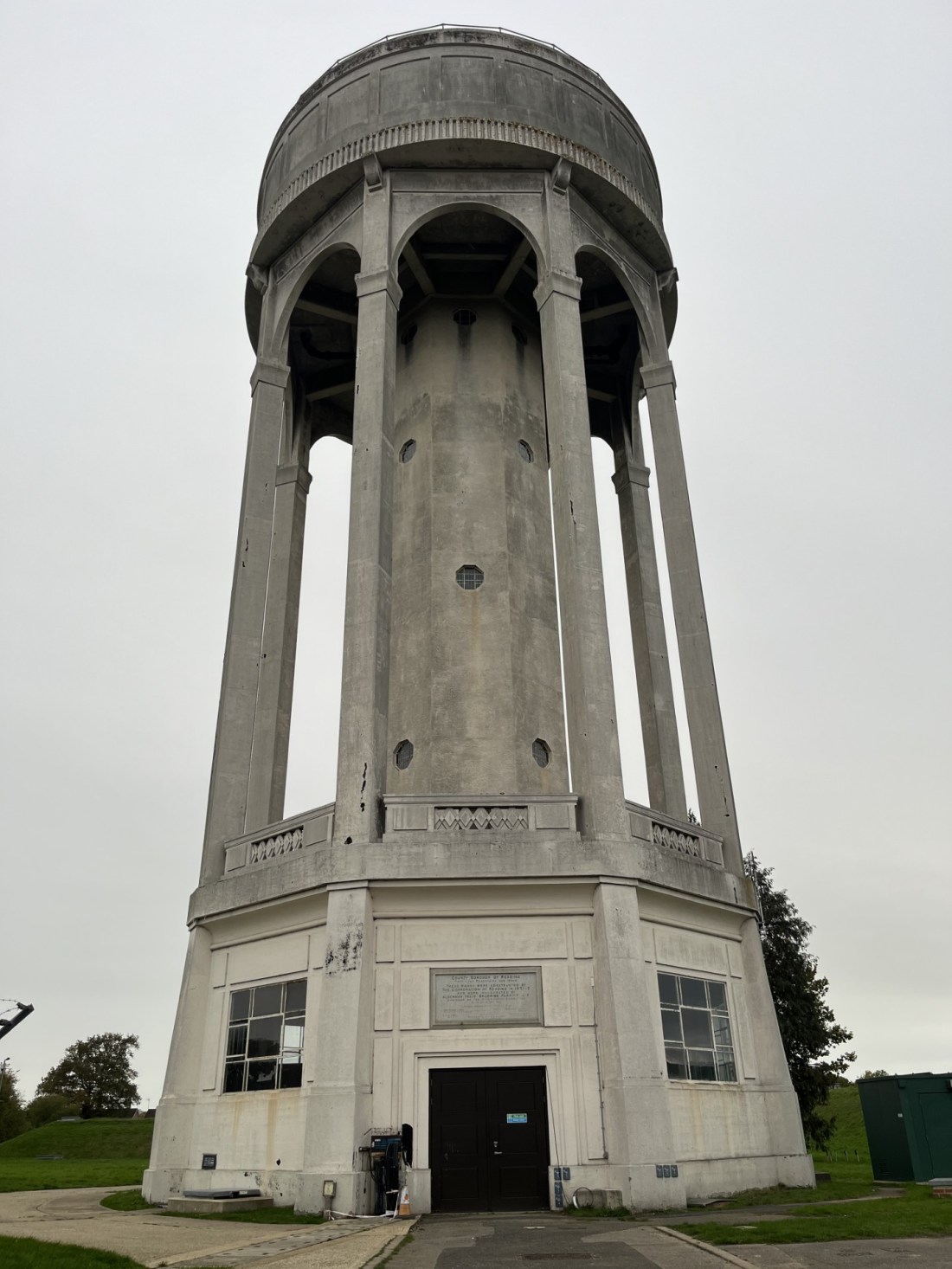
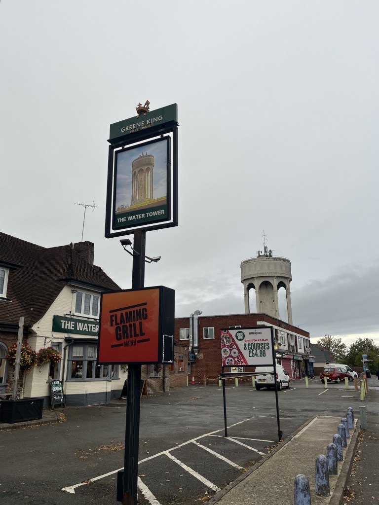
The highest point in the Reading Unitary Authority area is just past the Water Tower Pub and a row of shops on Park Lane, to the west of Reading and near Tilehurst.
Shame about the ale…
You really can’t miss it.
I stopped the car just down the road from the tower, having visited Liddington Hillfort, the highest point in Swindon, and was on my way to Marlow to spend the night to break a long drive back home. There you are – that’s it. Although of course the tower is not the physical land top of the county, just a manifestation erected on the highest spot. Opened in 1932, with an art-deco feel that also hints, perhaps in my head, at a Mughal architectural style, it’s an impressive thing.
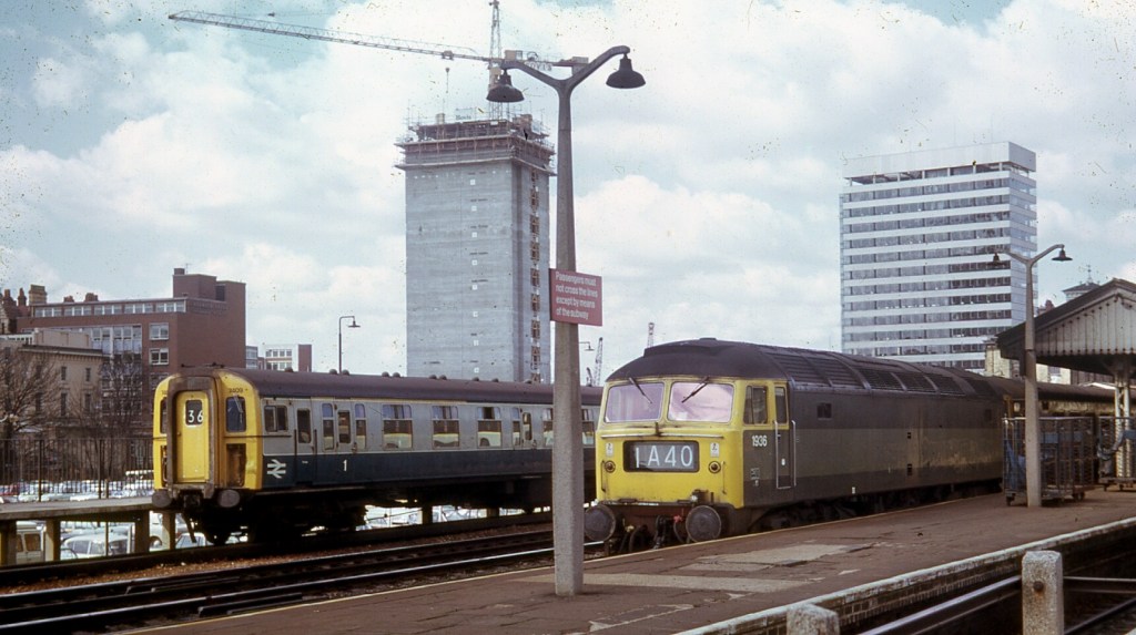
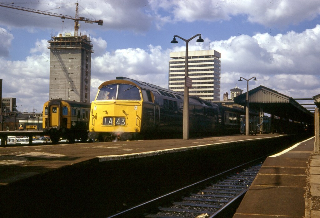
Anyway – that’s it. I’ve only ever been to Reading once before, and I think it was in 1972 when I caught a train from Paddington and then spent some hours on the platform jotting down train numbers in an Ian Allan trainspotter yearbook (look… we didn’t have mobile phones to keep us entertained). Here’s the evidence.
Still impressed by the quality of these photos, over fifty years on. A Wokingham local (I think) on the left, and a Brush Type 4 diesel electric in classic BR green pulling a Paddington train on the right. Many of these locos are still in service.
A mighty Western class 52 diesel hydraulic in standard BR (Monastral) blue on its way to Paddington. Magnificent but withdrawn from service just five years later ☹
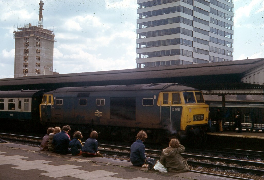
An Hymek class 37 diesel hydraulic heading West (all withdrawn within the next three years) and watched enthusiastically by a group of youths looking the wrong way, and who are about to be heading to hospital.
The M4 and its relationship with the Iron Age (conclusion – there is none)
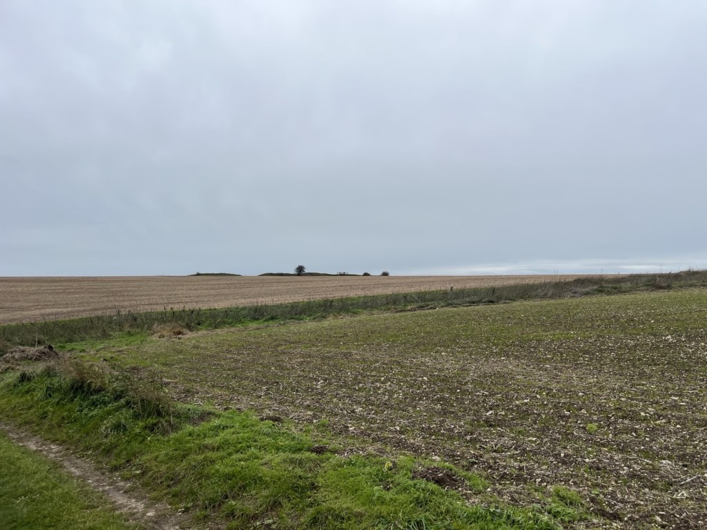
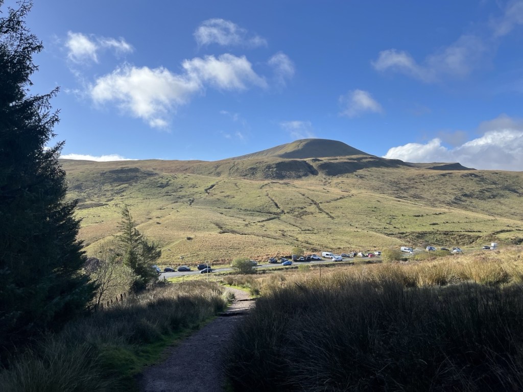
The highest point in the Unitary Authority of Swindon is Liddington Hillfort, resting low on chalk downland to the south of the town, and about a kilometre south of the M4 motorway.
I was returning from a weekend in Bristol, and the day before had managed to climb Pen y Fan, the stunning high point of Powys in Wales. Reaching Liddington Hillfort was, I hoped, going to be considerably less taxing.
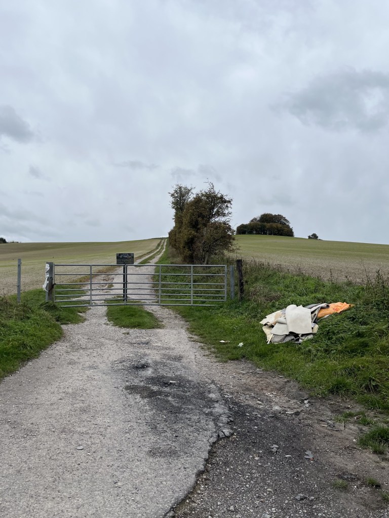
Coming off the motorway at junction 15, I drove south on Marlborough Road and then turned left onto The Ridgeway. After a minute or so I was able to get a glimpse of the low ramparts of the hillfort on the ridge to the south. I had managed to recce the area earlier in the summer, when I had run out of time to mount a challenge. Fortunately, this meant I knew there were no stopping opportunities on this stretch of road and so continued on until it met the B4192. Just at the junction a small lay-by allows parking for a handful of vehicles, but as my luck would have it, it had already achieved its full complement.
No worries sport. I turned right and just a short distance up the hill, on the right, was a small patch of hard chalky ground large enough for me to park up. The earlier scouting exercise had come in handy. With low grey clouds, and the promise of drizzle filtering in from the west at any moment, I left the car and found the start of the walk just a stone’s throw away. Sadly, although stone throwing with intent had probably last been seen here nearly two-thousand years ago, the practice of rubbish throwing still flourishes.
Carpet bombing on the fly(tipping)
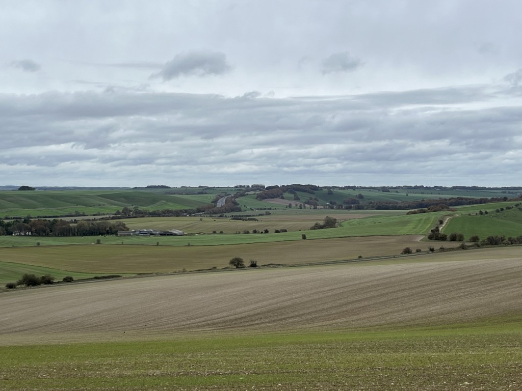
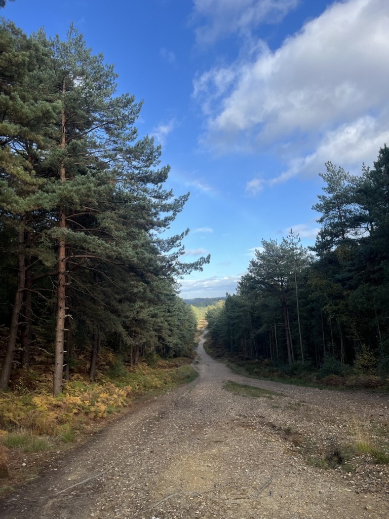
Through the gate and straight on the path that led up the slope, with a cluster of trees towards the top. I stopped for a moment to check that the car was still there. It was but of more interest was the view east and the M4 heading towards London.
Towards London – the M4 corridor
I passed by the small woods to the right and on, with a large field falling away to the south. Eventually a sign pointed north to a path around a large field leading to the hillfort, now visible on the nearby horizon.
The hillfort destination
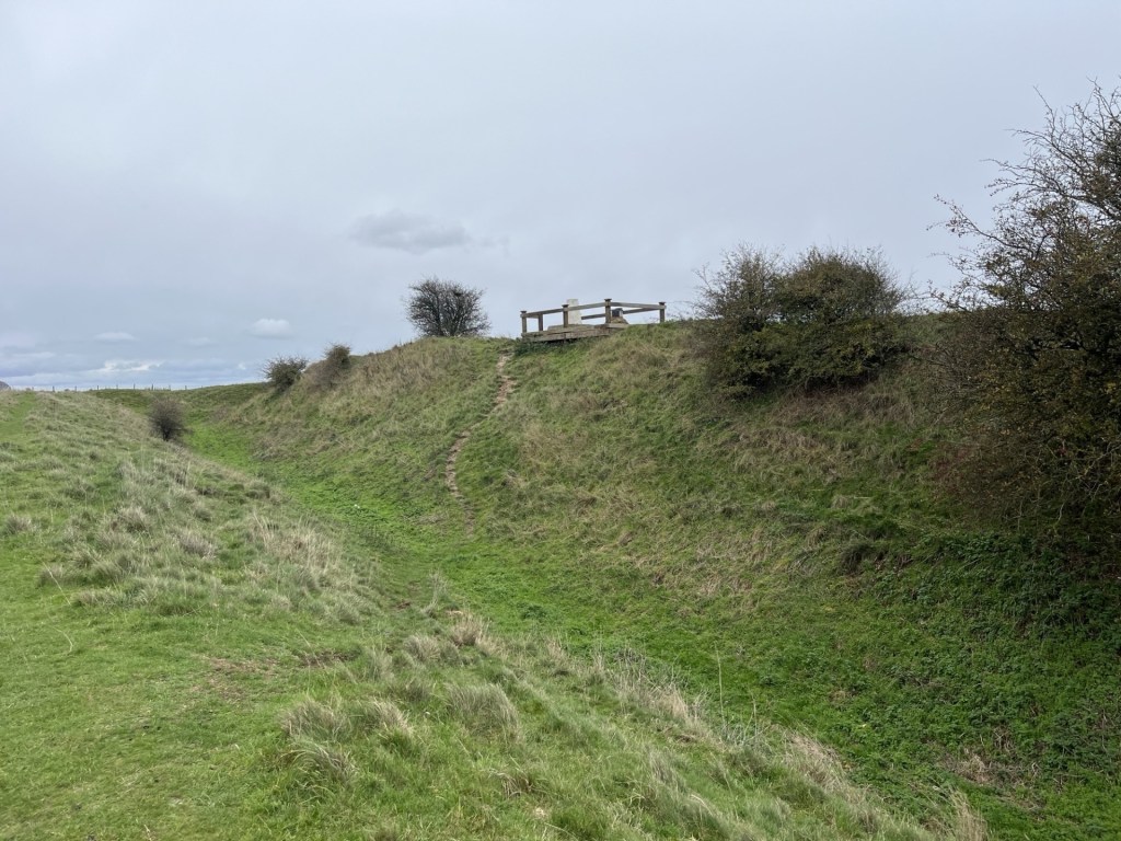
The path led to the end of the field, then through a gate and left along the top of another field and eventually back up towards the ramparts where a wooden construction could be seen on the top of the inner mound.
At the ramparts
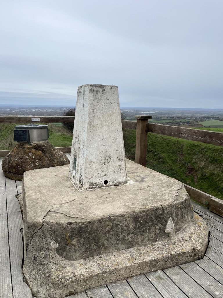
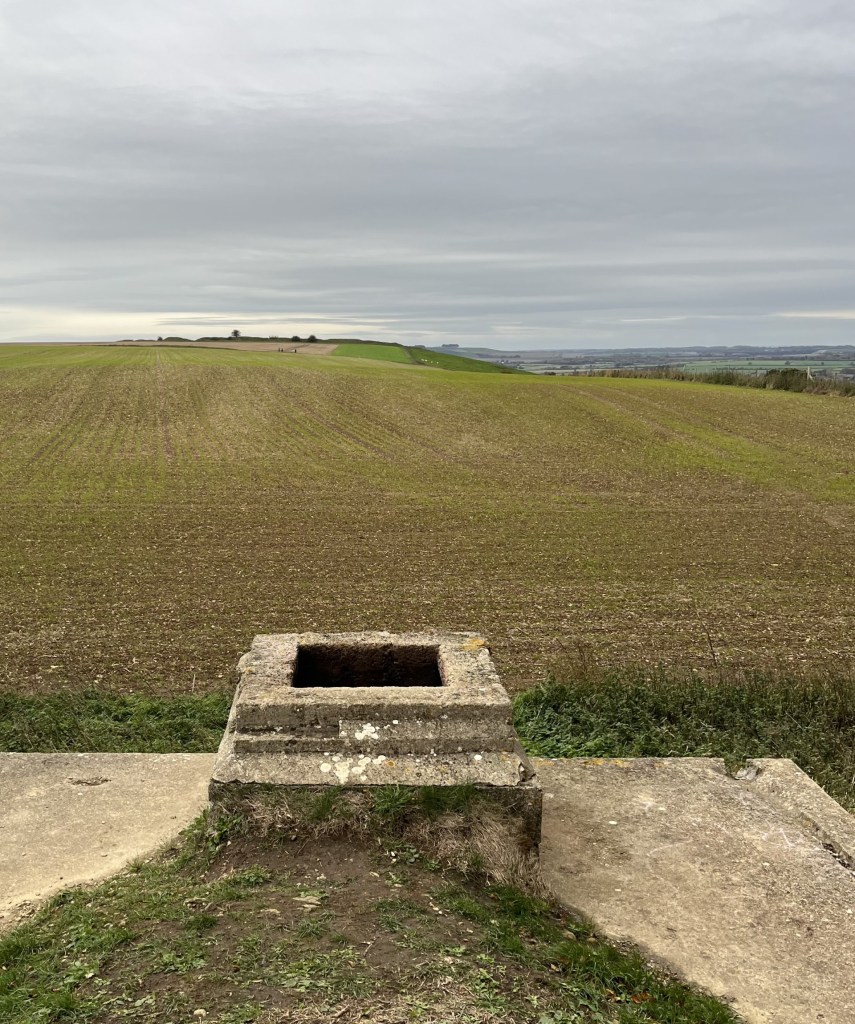
I flanked around along the top of the outer western mound before it descended into what would have been one of the main entrances. Here the ditch was at its deepest, but as chalk hillforts go, the parallel ramparts didn’t seem to amount to much. I passed in and then back along the inner rampart and up the small slope to the wooden construction, which was a mounting deck for a triangulation point (strange) and an underwhelming directional toposcope.
The raised Trig and beyond the confusingly disappointing toposcope, with Swindon beyond
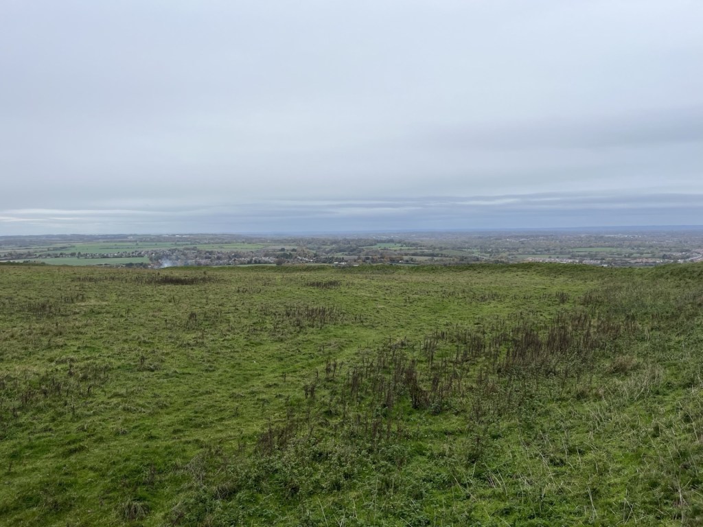
With the low grey cloud formation still threatening rain at any moment, I wasn’t going to hang about, but looking west across the large enclosure site something didn’t quite add up. Most, indeed all, iron age hillfort sites I had previously been to sit firmly on the top of the hills they are located on, using the natural contours to create the series of broadly horizontal ramparts and ditches that complete the structure, and with a relatively flat central enclosure (the nearby Uffington Hillfort to the east of Swindon, and coincidentally the highest point in Oxfordshire, is a perfect example of this).* Here the land fell away in all directions, down what was effectively the side of the hill. Indeed, a later check on the BGS Geology Viewer showed a drop of at least ten metres from the top entrance down to the north-west corner. Now, I’m no archaeologist but I do know this, when you haven’t a clue it’s probably best not to speculate. It was a mystery, nonetheless.
Falling away?
I left. Just for a moment, as I passed east of the wooden plinth, a teasing watery sun threatened to break through.
Here comes the sun (before it went again)
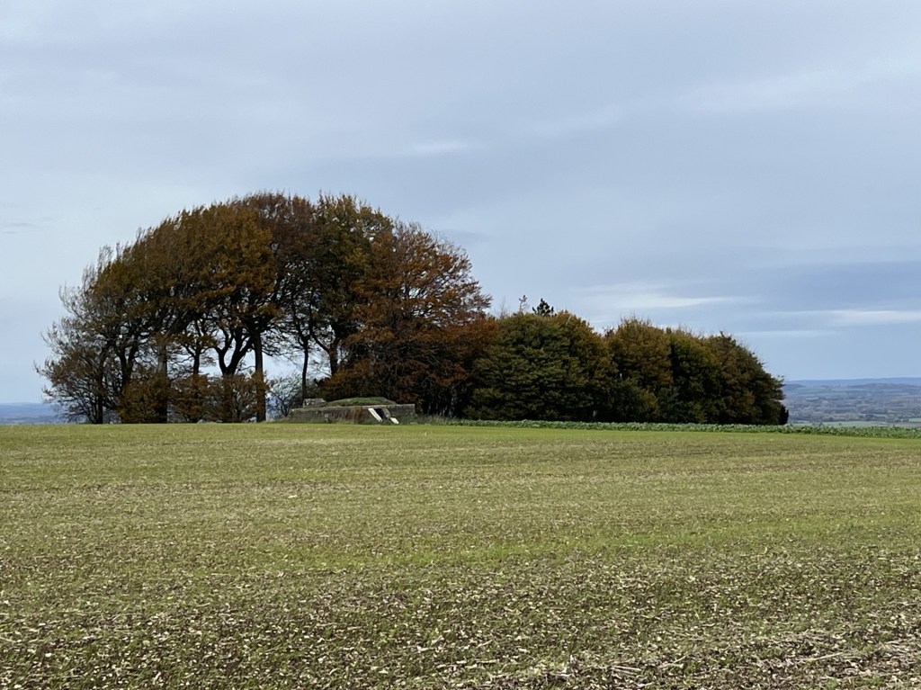
Heading back the way I had come I looked over to the small woods, now to my left, and noticed a low structure. Of course! When I had researched the area a couple of months earlier, I had noted a reference to some sort of bunker. And there it was. I diverted from the main track and followed the edge of a recently tilled field.
The Starfish Decoy Control Bunker lurking at distance
The obvious question that popped into my head was, what was it? Fortunately, my phone had a signal, and a quick enquiry told me that it was one of many built around the country during WW2. Starfish (SF) Decoy bunkers were used to light fires away from urban and industrial areas to mislead Luftwaffe bombers, who, I guess the hope was, would drop their load in the wrong place. With this nugget of information, I approached with a degree of curiosity. When I was a kid growing up in the 1960s me and my pals spent many happy hours playing war, making fires, smoking and throwing bangers around in an old concrete bunker in a field near a river close to home. Who needed the internet? **
Naturally the bunker required further investigation.
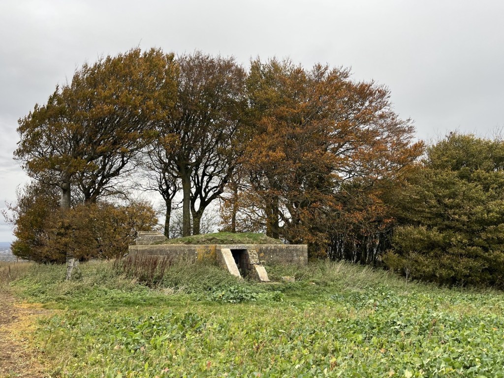
An investigative approach
With the obvious exception of missing blast proof doors, externally the structure appeared to be in relatively good condition.
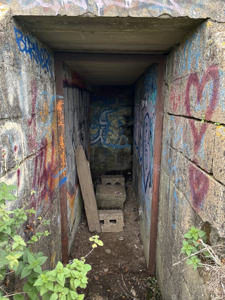
Looking in
I slipped through the entrance. Due to age, and a lack of understanding of local youth peer group culture, I was unable to translate the colourful graffiti. The concrete corridor led a few metres to the rear where two rooms led off to the left and right, with large rusting metal tanks sitting looking sorry for themselves. Whether they formed part of the original operational structure, or whether it was just something the landowner had dumped out of sight many moons ago I couldn’t say. Presumably because of the bunkers remote location, whilst a few beer and cider cans predictably littered the floor, I’d certainly been in a lot less salubrious WW2 bunkers and pill boxes.
Towards the light – Looking out
Back outside I thought it only correct to climb onto the grass covered roof. The view was only marginally better than at door level, but the outline of Liddington hillfort was on full display to the west.
Towards the hillfort. I felt confident I had discovered a new lay line.
From the roof I was able to look down into the woods, delightfully called Liddington Clump. I noticed that at various points within the small group of trees, discretely laid bunches of flowers had been deliberately lain. There is something similar near me, just set back from a road in woods at the edge of the local park. I’ve never looked too closely but have always assumed they were for much loved but departed pets. So, assuming the same here, when I later read that in fact the woods contained some natural burials – for humans, I wasn’t sure what to think. I’m pretty sure that on some sort of ethical, spiritual and/or humanist level I can see the attraction (maybe there’s a better way of putting that), but what would the consequences be if we all opted for a natural burial? A walk in the country near any urban setting would very quickly become a precarious totter through an ever-increasing open graveyard. Hmmm…. another moral quandary to occupy the mind.
Now, here’s the thing, and it needs to be told. I discovered the reference to the burial site in a quick search on the phone back at the car. I probably only glanced at the article for a few seconds, but it had registered. So, now, a couple of weeks on and wanting to find out a bit more, I have singularly failed to find any mention of a natural burial site at Liddington Clump. I have found a brief reference in a random comment on a post on Facebook that it is a memorial site for people and pets. The only explanation I can think of is, that there being an iron-age burial mound not far from the woods, and in some sort of mixed-up dystopian word jumble confusion, I’ve put too many one’s and one’s together and come up with fake news. It must be either that, or, and I am inclined to go with this theory, it was an involuntary AI search that led me up the woodland path. Either way, it had got me thinking about natural burials (which, for the benefit of doubt, are a thing); their implications, ethics and carbon footprint, and despite the latter being a justifiable reason, I think I’ll stick with the furnace.
In a similar vein, on-line information available on the Liddington decoy bunker, and indeed Starfish Decoy bunkers in general, is scant to say the least. I found a short article that gave a perfunctory description of their use, but no real explanation on how they were crewed and operated (I assume that gas or oil pipes radiated away from the bunker to where outlets would be lit for effect). A few weeks earlier, and completely coincidentally (a friend had sent me a fantastic short BBC documentary on YouTube about Swindon Town football club in the 1960s called 1963: Six Days to Saturday, which included some footage of the locomotive works, and…. oh, I’m straying badly here), I had read an article about bombing raids on Swindon. Surprisingly, given that the one thing everyone in the world knows Swindon for is its vast railway works (and XTC), it seems that the works survived relatively intact. Some surrounding houses were hit and sadly people did die, but apart from the odd unfortunate cow, the railway works were barely troubled by the Luftwaffe. There is no doubt about the fact that the decoy bunker at Liddington would have been placed there to keep the bombers away from Swindon, and very specifically the railway. To that end, it’s just possible that the tactic worked. Maybe one day some new information will emerge. Just as this was about to go to ‘print’ I came across a short YouTube video that followed a couple of modern day night raiders to the bunker, where they film the inside (see my descriptions above) and then leave, providing no more context than I have managed to offer up here. Quite why they filmed it at night is a complete mystery. It’s perfectly accessible at any time. But, and there’s a twist, just as they are about to leave, one of the participants drops off the roof, and (here’s the spooky bit) says they’re about to go into the graveyard!!!! What do they know that I thought I did, but now I don’t? The mystery continues.
Liddington Clump – The mystery continues
I left the bunker (“thank gawd” you shout) and returned to the gate at the end of the long path. Just past the gate the fly tipped mound had still not been cleared (bloody local councils are useless, aren’t they?), but miraculously my car was still in place.
Ten minutes later I was back on the M4 heading east and towards London. As I joined the motorway I glanced up to my right and could make out the ramparts of the hillfort. I must have driven past it over a hundred times and never noticed it. Half a mile further on and to my left, a familiar feature along the side of a chalk upland, where the side of the hill is distinguished by a crinkle cut pattern of indents that can only be explained by seeing them (just visible in the second photo to the left of the M4). Unlike the hillfort I had noticed these on many occasions before and now at last I understood their context within the M4 corridor. Never stop learning.
** In the interest of public safety, and to avoid the possibility of being sued, I strongly advise against allowing ten-year-old children access to matches, lighters, cigarettes and fireworks. It’s right that we have regulated these products to the extent that what I was able to get away with as a child is technically not possible today. When I look back I find it mind boggling that the so called straight up honest shopkeepers of old England would recklessly turn a blind eye to almost anything we wanted to get our grubby little mitts on (apparently, things are so much worse these days – or so you’d be led to believe if you spend too much time on social media – just saying).
My word. What a place! Sometimes you just get very lucky and remain eternally grateful for a while after (well, make up your mind – is it eternal, or just for a while?).
Pen y Fan is the highest point in the Unitary Authority of Powys. It’s the twelfth highest county top in the UK and the highest point in southern Britain after the magnificent Cadair Idris, eighty odd miles to the north.
Friday night with my daughter and her partner J in Bristol, checking weather apps whilst scoffing down an excellent take-away curry, and losing yet again at Catan. “So, are we looking to climb Pen Y Fan tomorrow?” J asks. “Yeah,” my daughter responded, “we’ve been talking about it for years.” That was true, not least because I had been nagging away about it for, literally, years (nine to be precise). Nonetheless, with conflicting forecasts, the certainty that there was going to be a brisk cold wind directly from the north, and in the knowledge that they had both done it several times before, I was prepared to be pragmatic. “I’m entirely flexible,” I added. “Maybe we just see how it is in the morning and if it’s not looking that good, we do something else?”
“We’re doing Pen y Fan dad. Get over it.” That was me told. I slept badly that night.
*
But, before we get there, I need to rewind and explain why climbing Pen y Fan had become something of an obsession for me.
Friday the 11th of March 2016, I was about to leave a hotel room in Weston-Super-Mare after a couple of days seeing my daughter and walking the local coastline whilst using up untaken annual leave. I had a plan for the day. Pop over the Severn road bridge, head down the M4 and climb to the top of Pen y Fan before driving back to London.
My phone rings. It’s my son and he sounds frazzled. My daughter in law’s waters had broken the night before, and far too many weeks before the baby was due. There had been no space in the local hospitals premature baby unit, so options as far afield as Liverpool and other points hundreds of miles away had been talked of before, finally, she was being offered a fifty-mile ambulance drive to St Mary’s Hospital in Paddington. It had been a hideously stressful night and just listening to the events had me shaking in my boots. “What can I do?” I asked. My son was reassuring. Everything was being done and there was nothing I could do but get on with my day.
After we ended the conversation, I wasn’t so sure, but rationalised that there really was nothing I could do. I drove up the M5 to Bristol and with the London option still weighing heavily on my mind, I shook it off and went west and then over the big bridge. I can’t explain why the need to climb Pen y Fan was so strong and why it had to be then. For one thing, the idea of climbing county tops had never entered my head and wasn’t going to for another eight years. Maybe I had seen a programme on TV about it, or just that visiting Bristol on a regular basis after my daughter had moved there had seeded my thinking. Either way, climbing a mountain, instead of going straight home and fretting around the house, felt like a suitable distraction.
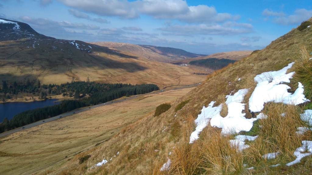
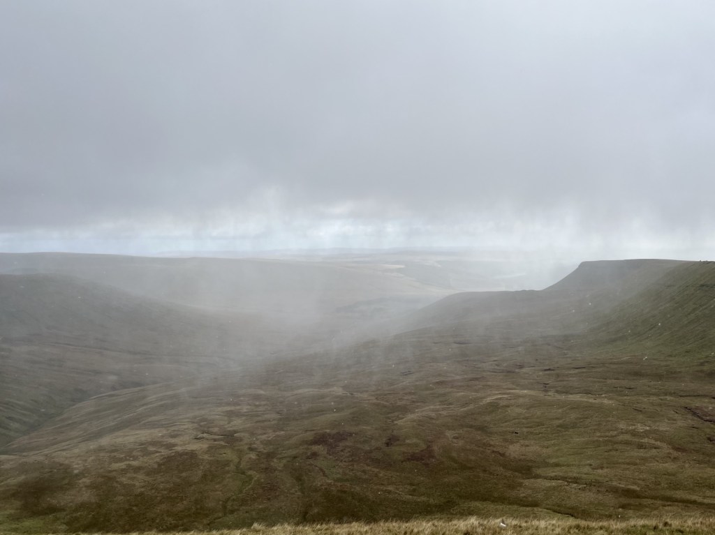
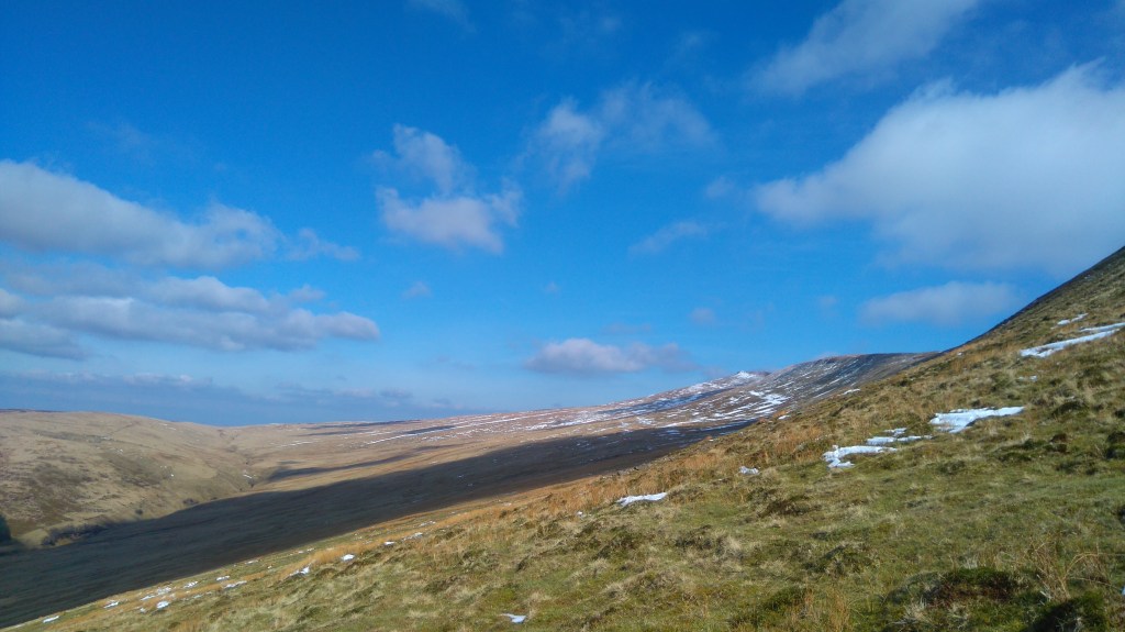
I drove up from Merthyr Tydfil and the valleys on the A470 and then into open countryside. The skies were cold winter blue, the land sparkling green. I had no idea what to expect, or pretty much where I was going, but sensing I was getting close I pulled up in a lay-by next to Beacons Reservoir, jumped out of the car and without any thought of whether or not I was in a good spot, or whether there was a more user friendly route to the top, I crossed the road, saw a footpath sign pointing over a wall towards open country, and was over without hesitation.
By the time I reached the first snow pockets I began to have doubts.
The lay of the land – March 2016
*
Back in the present, despite early morning rain the sun was making an effort to show off, and we bit the bullet. I drove (there is no significance in this other than if I read it again years from now, it will remind me that on the way back they both fell asleep) and instead of going all the way to Cardiff we headed off to Abergavenny before taking the majestic Head of the Valleys road west (my second experience of it in just over a month).
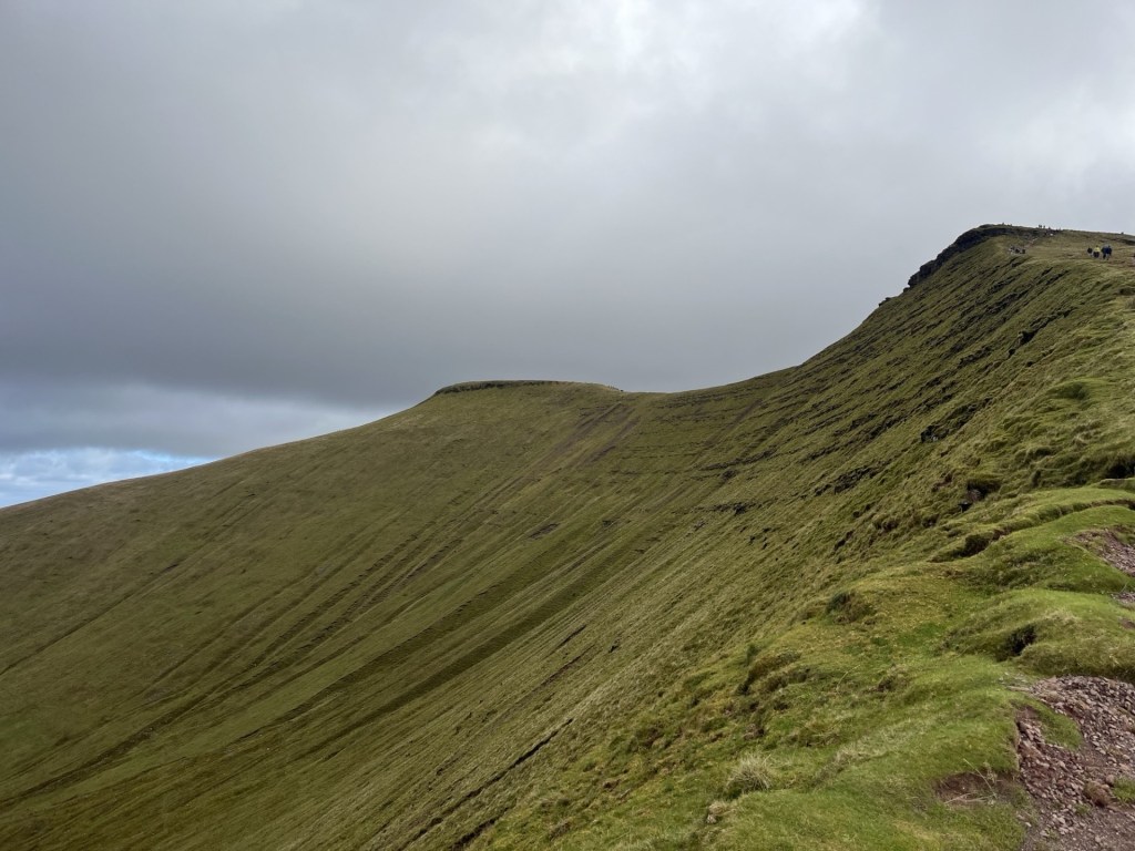
We arrived at the main National Trust car park and visitors centre at around 11:30, having passed the lay-by I had stopped at nine and a half years earlier. We were lucky to get a space and already streams of people were heading up and down the main trail which starts just to the south of the car park. Instead, we headed off on a flattish track (the Taff Trail) that took us north with the road and the impressive looking Fan Fawr mountain to the left, and a forestry plantation to the right. After a short while we were approaching the top of the pass where the A470 would start to descend towards Brecon, and past the Storey Arms Outdoor Activity Centre. This was the point where from now on the only way was up.
Looking west towards Fan Fawr. I was already panting Fawr air(no more puns.. Ed)
Due to the steep opening ascent, each faltering step started giving increasingly panoramic views of the surrounding landscape, particularly down the top of the Taff valley. The path underfoot was well trod and well-maintained, using slabs of the local stone, which, with the evidence of the alluvial waters in which they had formed millions of years ago indented on their surface, gave context to the surroundings.
After about fifteen minutes of this early lung breaker, we seemed to have reached a flatter section.
The kids, marching towards the top, or maybe not
For the first time it was possible to see to the top and a snaking path that headed directly (or possibly indirectly if you get my drift) to what I was assured was Pen y Fan. The only fly in the ointment, having made the initial effort to gain respectable elevation, was that the path was beginning to head back down. Don’t worry, I was assured, it only goes down a bit. Yeah, right!
Sometime later, and having lost considerable elevation, we crossed over a mountain stream.
Crossing the mighty Blaen Taf Farw
To the south it was possible to watch a stream of people gaining altitude on the main path from the car park. It seemed to me that they had only just about left the car park, confirming we had managed to lose most of the elevation we had gained in the first heavy lift. As I stood in the middle of the stream mulling over the meaning of life, my daughter and J seemed to be taunting me from the bank, taking photos as if I were some sort of endangered species (these have been deleted).
The paparazzi
Humph! Slogging on and straight up. Unremitting but at least the top was in view, seemingly quite close. There was a map consultation which I used as an excuse to slow down the ascent, and the truth was out. We were in fact looking at Corn Du, the slightly shorter twin peak to the east of Pen y Fan. Until now I had been putting one shaky leg beyond the other, head down and hoping it would all be over soon. Gazing now at Corn Du, a mere pretender, the little enthusiasm left in me started to ebb away. Even though it appeared to be in touching distance the stone path remained resolutely up. Don’t worry, I was reassured, Pen y Fan was just a short walk further on. It was time to trust in others, so on we (I) trudged.
Another 500 metres went by, and with almost no warning we were standing at a point where Pen y Fan came into view and the land to the north of the path dropped away dramatically.
The first sight of Pen y Fan, with Corn Du in the foreground.
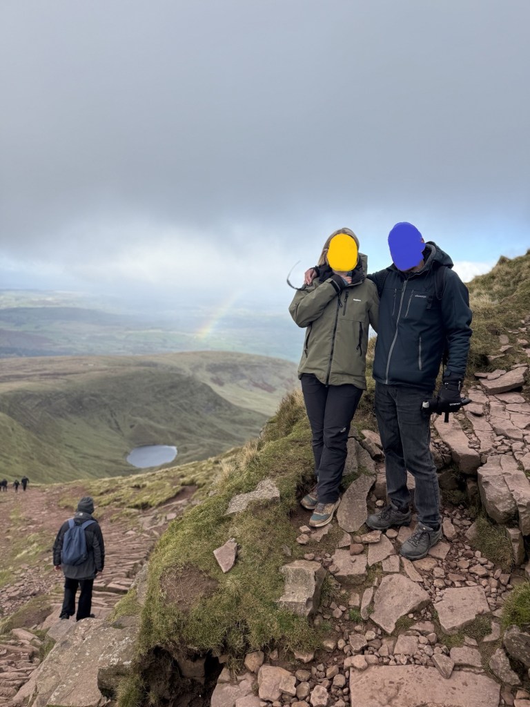
With this unexpected view, and the sheer drop down to a small corrie (the Welsh is Cwm) tucked under the mountain, a sense of validation began to return. That said, it took an age to complete the last 200 metres to the top of Corn Du. In my experience most mountains tend to ease off as you approach the top. Not here. Just short of the top of Corn Du we stopped and took the time to recuperate, take in the views and eat sandwiches. A rainbow had been developing far away towards Brecon. It was one of those days. Bright, very breezy but with scudding clouds menacing away directly from the Arctic. Time for some photos.
With the motivator on Corn Du with Llyn Cwm Llwch below
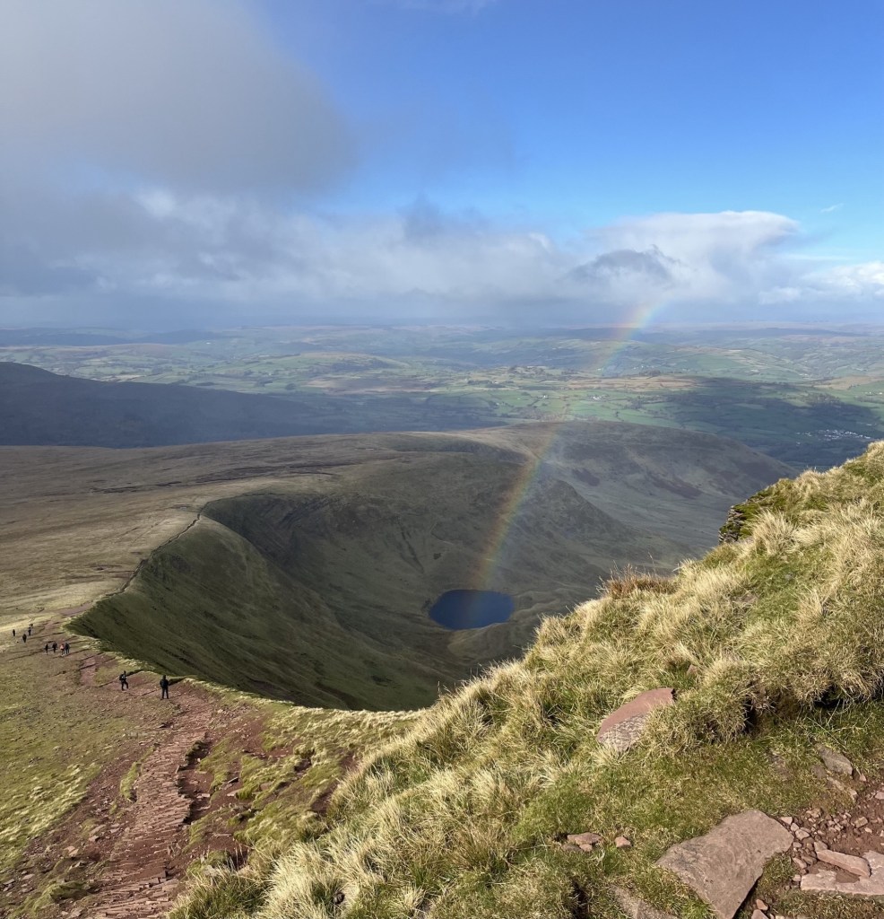
In the time it had taken to take this photo and grab another bite of cheese and pickle, the rainbow had suddenly shifted from what appeared to be the far distance to directly below, and almost magically issuing out and up from the corrie. Frantic scrabbling for phones followed by all around to grab the moment. A rainbow’s a rainbow – right? Ah! Not so….
This is not AI generated and no filters have been applied. Just physics
We carried on east along the high ridge, with plunging views to the north and a huge U-shaped valley disappearing to the south-east. J pointed out an abandoned reservoir further down the valley. Upper Neuadd Reservoir, empty for some years since faults had been found in the Victorian dam. J explained that they had climbed up from there a year or two before. It looked like a miniature wonderland but still showed as water bearing on the OS map. The views had me flipping out. Until we had reached the top of Corn Du, I hadn’t fully appreciated the landscape. It was a glacially shaped masterpiece, even more extraordinary in that it lies on a similar latitude to Luton.
Glacial delights and the remains of the Upper Neuadd Reservoir (left of centre)
Getting across the ridge and covering the 300 metres or so to the top of Pen y Fan was relatively civilised. A bit down and then a bit up. At the final up, as the increasingly violent northerly hurled itself across the rounded top, my game was up and finding a large stone slab, lay myself down on alluvial remains.
This sitting position is unique in nature.
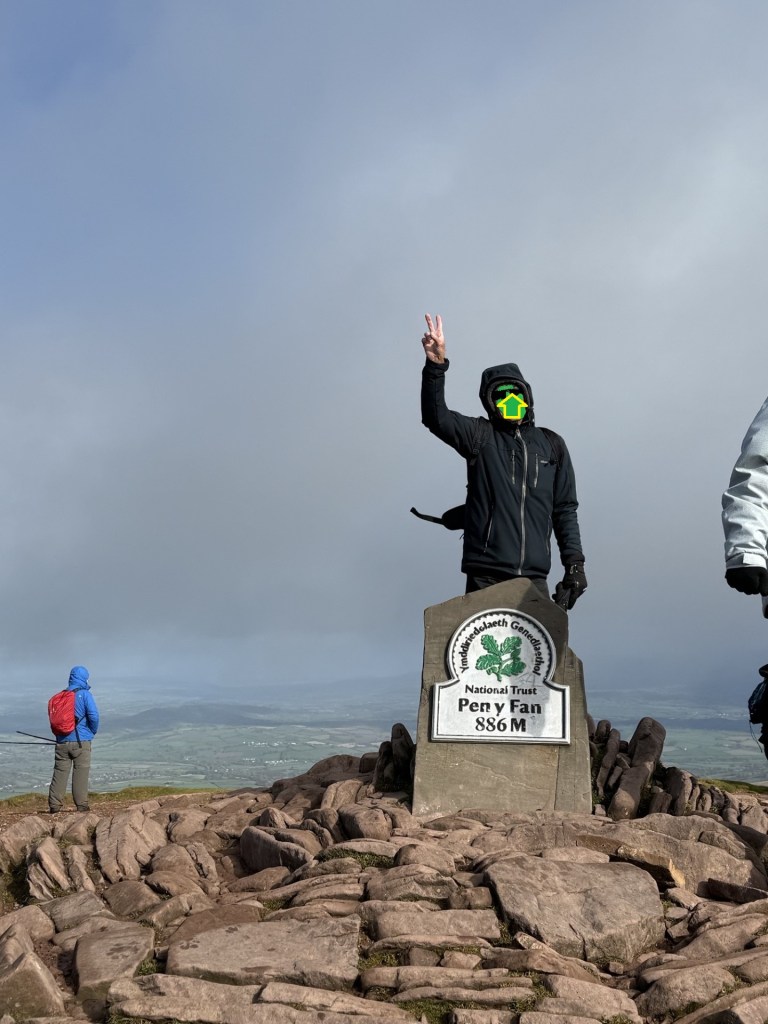
Once I had regained some composure, I crawled to the top for the obligatory victory photo (along with several dozen others doing the same).
Time’s up – now clear off.
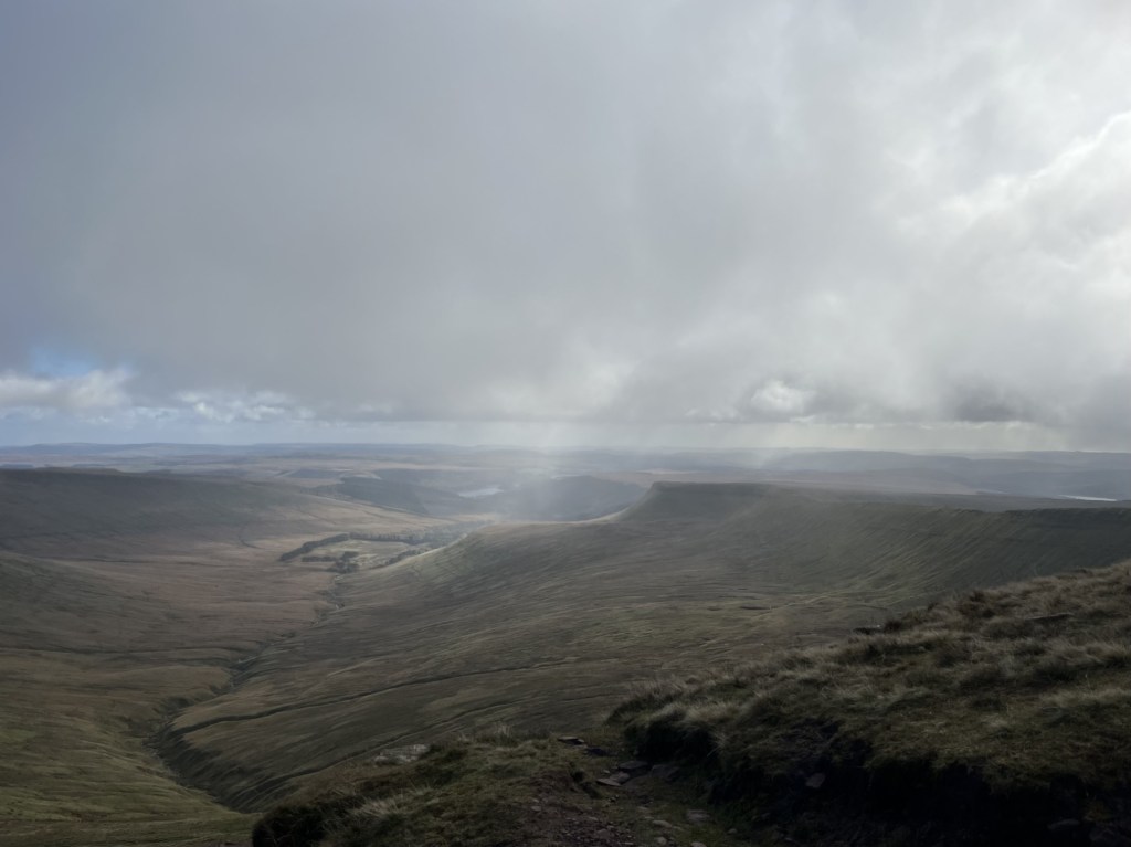
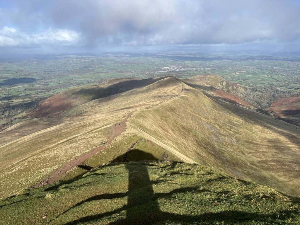
The views in all directions were outstanding. Powys is the biggest council area in Wales, and from what I could tell you could see most of it, along with most of the rest of Wales. More glaciated U-shaped valleys lined up to the east facing north.
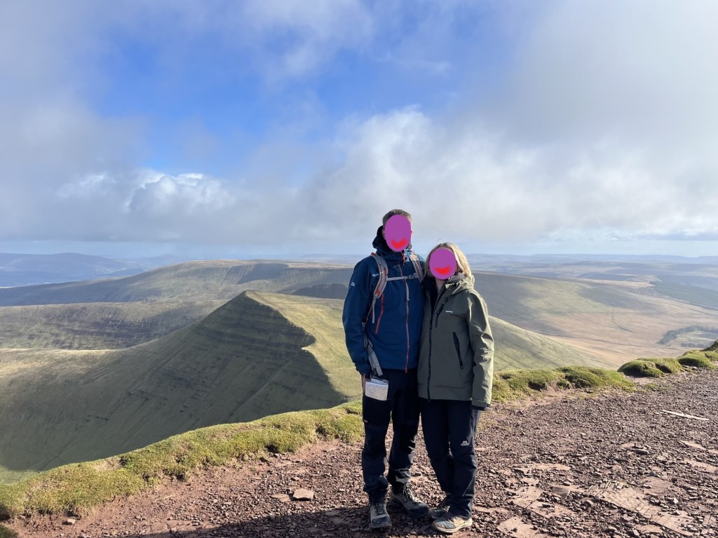
My compadres complimenting the unique landscape
Pointing towards Brecon and the whole of Wales, and 1500ft of elevation under the belt
After soaking up the moment we started back along the ridge towards Corn Du. An almost constant stream of people was moving in the opposite direction, and quite a few of them seemingly dressed for a different season. There is a Welsh joke and unprintable poem, that claims every Welsh person has been to the top of Pen y Fan. Obviously not true, but from the numbers making the journey it seemed to be a national ambition.
Instead of going back to the top of Corn Du we took the lower track to the south just below the summit. It was at this point, and just before we were about to emerge back onto another ridge, that the sun disappeared, the sky turned grey, and a furious hailstorm crashed in at too many miles an hour from the north. One look at the direction of assault was enough to tear lumps of skin off your face, and more than one other walker was reduced to tears. We hunkered down with our backs to the wind with just a few tufts of grass to give protection. It helped, and within a minute it was over. I stood and started to carry on walking. A mistake. As I emerged onto the ridge proper, a second and even more violent wave of ice bullets blasted into me. Having moments earlier sacrificed the relative security of the grass tufts there was no escape other than drift down the slope to the south. It made no difference and all I could do now was surrender to the moment. I stood with my back to the onslaught with hood up and completely accepting the conditions. I suppose knowing that it would be over in a minute or two helped, but in that moment, I don’t think I had ever felt so alive.
Counting hailstones
It went as quickly as it had arrived, and we took to the descent, observing the wreckage of humanity that had taken the full force and gathering their senses as they continued up. With a warm sun back in control it was a shame to be exiting the mountain, but you have to come down sooner or later. Halfway down a middle-aged man with some writing on his clothing trudged past us on the way up.
“I think that was Pen y Fan man,” J commented. Interesting, I thought, who was Pen y Fan man, I asked.
“Pen y Fan Dan. He climbs the mountain every day for charity.” *
As we approached the bottom of the path a beautiful waterfall plunged down to our right and begged to be photographed.
The view of the waterfall as it should have been
The view of the waterfall as it actually was. Boy oh boy! A picture can paint a thousand words, and in that moment I had none.
It was a last chance to look south and back down the valley. Nearly ten years before I had climbed over a wall and began a yomp straight up the side of the steep slope leading up to the ridge south of Corn Du. I had no structured plan other than getting to the top and then heading north. Despite the early cold it had warmed up, and I was having to de-layer. Whether I was sweating due to the weather, or my advanced state of anxiety, I had no idea, but one thing was for sure; I was beginning to wonder what on earth I was trying to prove. Patches of snow began to appear. I was about two thirds of the way to the top, breathing heavily but still intent on reaching the ridge when a ping went off on my phone.
“They’re in St Mary’s hospital now.”
I looked around. It was a beautiful spot, but the text was all I needed to bring me back to my senses.
The point of reality and return – Corn Du in the distance. March 2016
I believe in the meditative power of walking, but also in the adage that there’s always another day. Pen y Fan was going to have to wait.
I scurried back down to the car and three and a half hours later was parking up outside the hospital on South Wharf Road, Paddington. It was my first encounter with a pay by phone parking experience, during which, in torrential rain, I spent twenty minutes painfully navigating through to the eventual point of payment (it’s funny how this little detail has stuck).
My daughter in law was in the best of hands, my son was looking exhausted and of course there really was nothing for me to do, but I knew I had made the right decision. Days later my gorgeous granddaughter was born (it wasn’t easy either but that’s another story), and any thoughts of an immediate return to Powys were banished. But hey, there really was to be another day, and what a day it had been.
* Pen y Fan Dan doesn’t just climb the mountain every day, he’s often doing it three times a day, for charity. I’d say that’s impressive, so here’s a link to his fundraiser.
In answer to the question to myself at the start – Eternal, or memorable, just for a while? I won’t forget Pen y Fan, the views, the storm blast, the encouragement of my daughter and J, it’s significance to me as a grandparent and it’s shear glacial glory. I guess that makes it eternal.
Just in the nick of time, a last-minute arrangement to visit my daughter in Bristol for the weekend (before the clocks went back), and a last gasp chance to tick off a few more “tops”. Just as well because I was almost out of material.
The objective was Surrey Hill, the highest point in the Unitary Authority of Bracknell Forest. Two months earlier I had made an initial attempt. Parking up in Bagshot town centre I had walked up to St Anne’s Church on Church Road, at which point I decided to abandon ship. Not because of inclement weather, or because I was facing a massive ascent, but because, for whatever reason (how to put this?) I was experiencing a discomfiture that I can only ascribe as mild form of irritable bowel syndrome. Something that gets me from time to time, usually a mile or two into a walk, and guaranteed to stop play.
With no such excuse this time and having previously seen what little there was to see in Bagshot (I’m sure I must have missed the best bits), I parked just up from St Anne’s Church. The weather was cool but mainly sunny. I started north down Vicarage Road, which soon led to the start of the Swinley forest walk, where a sign warned of the catastrophic legal consequences of picking (stealing) fungi – a consequence perhaps of rampant foraging to supply the kitchens of nearby fashionable restaurants (presumably not including Woking’s Pizza Express). The track extended straight ahead, with dense woodland of birch and fir to the left and heathland to the right.
Vicarage Road – The start of the walk
After some minutes I wondered if the rest of the walk would be like this. Potentially a tad dreary and tedious. Fortunately, just as I was thinking this, the plantation to the left ended, with heathland ahead and more mature forestry creeping up low hillocks. It was still a question of keeping on keeping on the straight, but with the wider views and the late autumn colours my enthusiasm was renewed.
Keeping to a straight-ahead policy
Heading on up a slight gradient I eventually came to a junction. Wide tracks led off to the left and signage indicated mountain bike trails through the forest. I had planned on continuing along the straight path but now with an option on the table I chose to go south-west and up another straight path with more of a gradient and dense forestry drifting away to both sides.
Towards the end of the track the land rose sharply. As I prepared myself for the heave ho, a man on a mountain bike lumbered past. I said hello but understandably his response was muted as he panted away and concentrated on the task ahead. A minute later he was near the top – whilst old muggins was tiptoeing reluctantly up and trying to regulate my breathing.
Where the going got (a bit) tough.
On reaching the higher ridge I went right. Straight tracks led away in three directions and with extensive views to places miles beyond. This sudden increase in height had been unexpected, but worth the effort.
Looking east towards Sunningdale
Straight on, with heathland beyond a line of trees on the left and evidence of the recent rain on the ground. Autumn was throwing up seasonal colours, and all was good, until, without warning, the land fell away and down into a deep gulley.
The top of the ridge and towards the switchbacks
Down, down, down and then up, up and up, and then another short stretch before a second switch back and with fungi fringing the edge of the track.
I wasn’t tempted by the Fly agaric – I’d been warned. Doesn’t compliment Beef Wellington
After the two rollercoaster like descents, the track plateaued out as I neared the top. Another straight track through the forest disappeared east towards the horizon, and beyond this dells and hollows contoured the woods to the right, with a hint of a reservoir behind fencing to the left, a sure sign that I was nearing the highest point.
Another straight track going east towards Sunningdale, or maybe Ascot.
Stopping to look around I concluded that the highest point on what I assumed to be Surrey Hill lay around a hundred metres into the forest just to the north-east. There was no obvious path leading in its direction, though a barely discernible overgrown track gave some indication of a possible route through. I set off into the dense bracken and followed the track which I guessed had at one time been used by foresters to clear excess growth. This was all well and good, but as part of their worthy intentions they had covered the route with cut branches which at the time would have been firm and robust underfoot, but which now snapped and crumbled with every rotten and uncertain step I took. With dense vegetation on either side there was no escape from the terror of a twisted ankle, or worse, at each leg extension.
Autumn’s bounty exploiting the rotting track – goes down badly with fish
A tree, just the same as any other, but with less undergrowth surrounding it appeared, and I settled on the idea that this was the top. Hard to be 100% sure, but it was as good as any other spot.
Surrey Hill – the top – probably
I made my way back along the hazardous route, and with a sense of relief, emerged back onto firmer ground. Instead of returning the way I came I set off east, and downhill in the approximate direction of Ascot. I was able to look back and up through the trees to the top of the hill; the only spot where its height above the surrounding landscape was more obvious.
Surrey Hill. Looking back up to the summit
Ten minutes later and I was on the main track back to St Anne’s Church and twenty minutes later at the car, just as the first few drops of rain hinted at a lot more to come. I had thoroughly enjoyed the walk in the Swinley Forest. If it was on my doorstep I’d be wandering (or maybe cycling) through it as often as possible and would be expecting interesting sights as the seasons change (the odd adder, or eagle perhaps).
There was only one thing to do now. I had an ETA with a take-away curry and a game of Catan in Bristol to honour.
After five fascinating exploratory days in South, and south-west Wales, it was time to head home. I’d spent the last night in Cardigan, after climbing Foel Cwmcerwyn, the highest point in Pembrokeshire. Having checked into my accommodation I took a stroll along Cardigans attractive historic high street, then over the river Teifi and to the fine-looking Castle Inn.
So many old boozers have had their internal organs ripped from them, often resembling sanitised airport style cafes, that when you walk into one that looks like it hasn’t changed in a century, and hasn’t been illuminated up to the gunnels, it is barely believable. I ordered a pint and found a table and chair where, in an underlit snug, I could look out of an old window and across the waters.
It had been daylight when I had entered, but in the few minutes it had taken to purchase my beer and sit down the day had turned to night, and as if on cue the heavens had opened and rain was lashing down on the tidal swell. The movement of the dark water, where river and sea merged whilst gale fuelled rain pounded the surface, was mesmerising and I just sat and watched as behind me two young women caught up with their respective lives over pints of stout. In that moment all was right with the world.
I would have liked to have spent an hour or two mouching around Cardigan the following morning, but I had over 300 miles to drive and hadn’t taken the precaution of breaking the journey back. I was also planning to take a slight diversion from the main route and see if I could locate Tair Onnen, the highest point in the Vale of Glamorgan.
It’s highly likely that I took an entirely unnecessary long route along the lanes south and east of Cardigan, but I was in no rush, and it was almost traffic free quality countryside. I reached Carmarthen and continued down the A48 and then the M4. The blast furnace (now dormant) and steel works at Port Talbot dominated the view to the right for several miles. I once had a conversation with a friend about industrial buildings and brutalist urban landscapes. I think I was trying to suggest that there was almost always a strange beauty in nearly all things. She was having none of it and quoted some geezer who had famously (apparently) said something along the lines that if you see an ugly building, to save your soul, never look at it again. There is no doubt that Port Talbot, in any traditional sense, is as ugly an industrial stain on the landscape as you’ll find, but, like the tidal dance of the Afon Teifi, I have been mesmerised by it on the few occasions I have passed by. Today was no exception. If there had been a stopping opportunity, I would have spent some time trying to absorb it all, but there wasn’t and so I carried on south and then east to Bridgend, then leaving the M4 and rejoined the A48 towards Cowbridge. *
Past Cowbridge the land gently undulated, with large fields (mainly stuffed with maize), to left and right. At a point where the road began to rise and swung slowly to the left, then to the right, I was visualising my location and knew I needed to be pulling over soon. Moments later a lay-by appeared on the left and I duly stopped. Looking across the road, I could see the field, recently ploughed, that held the county top (a distinctive farm building sitting proud on the skyline).
7 metres below the high point, just to the left of the farm building pictured on the ridge
I already had a predetermined plan of attack, based on earlier close inspection of the site on Google maps. I would walk east along the footpath at the side of the road until I reached the end of the field, hope to find a footpath to the top, take a snap of the trig point and then head back the way I had come. I had factored in a 15-minute walk.
I got out of the car with the intention of getting my walking boots from the boot (English doesn’t make any sense sometimes), but before getting to that point I took a longer look around. As I surveyed the landscape and surroundings, bit by bit my confidence began to stutter. The most obvious issue was that the field appeared to be much larger than it had seemed on Google maps (which of course it blooming was). The road stretched away into the distance, as did the field. Based on the visual evidence it felt like any attempt would take at least 30 minutes.
I had also been under an assumption, based on what I had seen on Google maps, that there would be a pavement along the side of the road which would enable safe and swift movement. The reality on the ground was a sad disappointment. There was no pavement on either side of the road, and whilst there was a verge, it was lumpy, uneven and soaking wet. Essentially, given the flow of traffic, it was looking like an unexpectedly high-risk venture.
Stranded at the bus stop
Along with the distance and roadside dynamics, whilst it was a reasonably large stopping area, it doubled up as a bus stop, and I wasn’t too comfortable with the idea of leaving the car for too long.
Without any pavement, this, and the bus stop opposite, were hideously dangerous to access for any pedestrians.
There was one last and obvious disincentive. The weather. Even if I had been prepared to risk life and limb clinging to the edge of the highway, in the half hope of finding a path further down the road than I had originally anticipated and taking a risk that the car would survive unattended, the chances of making it without a serious soaking looked almost nil. I still had 200 miles to go, and I intended to do it dry.
Foresters Lodge bus stop. Two buses an hour!! Who for?
After reading the bus timetable (there appeared to be a reasonable service) I took another look around. I wondered how on earth anyone could access this and the stop on the other side of the road, without running the risk of serious harm. A thick hedgerow backed onto the stop and ran in either direction for twenty to thirty metres, and with nothing other than a rough strip of lumpy grass between it and the 60 mile an hour A48. It didn’t look like a location that would necessarily generate a lot of potential passengers, but if I was a parent and had a child who relied on the bus to get to and from school I would be freaking out every time they set off. I guessed that the only safe way to get to the stop would be by car (the irony).
As I returned to the car, a single decker bus shot by. It made no attempt to stop. To be fair I hadn’t hailed it, and the driver might have put two and two together vis a vis the stationary car, but how could he or she have known for sure? I drove off and was soon on the outskirts of Cardiff. A ring road took me north and onto the M4, where the traffic ground to a halt. I should have been able to get back the River Severn and across the bridge in just over thirty minutes, but it was well past Newport before the traffic began to ease. An hour and forty-five minutes to do the 33 miles. A couple of years ago the Welsh government managed to annoy a whole lot of Welsh people, and even more English people with no skin in the game, by reducing the speed limits in many urban, town and village settings to 20 miles an hour. Anyone would have thought the French had invaded. I’m not sure if the person who owns that expensive electric vehicle company chipped in but it’s exactly the sort of thing he would have.
I had just spent five days in Wales, avoiding where possible the M4, and by and large driving on rural A and B roads. I passed through many settlements of varying size and discovered that these pesky 20 mile an hour limits caused, well, they caused almost no inconvenience at all. There was one small town deep in the country where I did think that the speed limit extended an unreasonable distance but overall, I genuinely couldn’t work out what the fuss was about. Having lived in London when the 20 mile an hour limit was widely introduced, I am possibly more relaxed about it, but what a lot of hot air over almost nothing. So, having taken an hour and forty-five minutes to go just over thirty miles on Wales’s premier motorway, with no obvious sign of roadworks or accident, the irony that I had averaged just 20 miles an hour throughout was not lost.
I have strayed too far. What was the subject again? Ah, reaching the highest point in the Vale of Glamorgan. ** Well, I didn’t make it to the top of the county, but I could see it from the road, and that’s probably the best I could have done under the circumstances. Taking a look on Google maps I have since realised that there was another bus stop about 300 metres to the east at the end of the field. A sign on the opposite side of the road points to a footpath. Whether or not the path went to the trig point or just flanked the field I have not been able to determine, but what Google does show is that just over the brow of the hill, and facing south towards the Bristol Channel there is a large area of land covered in solar panels. A solar farm, I guess. I think I would have liked to have seen that. Oh well, another time (you’re kidding!). ***
PS. Just over a month on, and before I had finally finished off this account, I was flicking through the December 2025 edition of TRAIL – a climbing and hiking magazine that my daughters partner gets monthly. Towards the middle there’s a two-page feature called “High and Low’s – 10 of the most curious County Tops”. Apart from being flattened by the fact that the whole county tops thing seems to have gone stratospheric, more astonishingly I had done four of the ten referenced, including, and this really knocked me for six, the Hill with No Name – The Top of The Vale of Glamorgan, along with an image taken from an OS map. For copyright reasons I won’t quote the short article, but the author noted that annoyingly, there’s no public access.
* I prefer a quote I have found by Matt Haig which reads – “If you think something is ugly, look harder.”
** I have since discovered that apart from the Vale of Glamorgan, there is no such place as Glamorgan. That has come as quite a shock. The old county of Glamorgan, or, Glamorganshire, covered most of south Wales. When I was a kid, I remember watching, in black and white, and probably on the news, one of the most amazing moments in the history of sport. Never mind Leicester winning the Premier League in 2016 or Gordon Banks save against Pele, when Gary Sobers, the then captain of Nottinghamshire County Cricket Club, hit six sixes off Glamorganshire’s bowler Malcolm Nash in one over at Glamorgan’s ground in nearby Swansea, no-one in the history of cricket had ever seen anything like it before. And it was on TV! On the BBC! On terrestrial TV! And it was free! And it’s still on YouTube! Gawd bless yer Aunty.
*** Just in case you feel a bit let down by this account and need to know more about how to reach Tair Onnen – the main man – Richard Gower has provided this helpful guide (should have read it first – doh!), though according to TRAIL, it’s inaccessible!!!