Blagdon Hill Farm
242 Meters
793 Feet
24th April 2026
An Afternoon in the Mendips part 1: At the End of the Lane
The day had got off to an expensive start. I had spent the night in London at a friends and was aiming to be in Bristol to see my daughter by the end of the day. Time was on my side, and I figured that unless the roads were trouble I could knock off the three Unitary Authority tops south of Bristol and west of Bath.
High pressure had been sitting over the country. The sun beat down on London stone and streets as I headed south towards the Marylebone Road, and the slightly complicated junction at Baker Street that takes you west and away. With the intense light and the glare pinging off anything metal it took me a minute or so to work out that instead of heading south on Baker Street, I was instead heading south on Gloucester Place. No worries.
Except, as the lights changed at the Gloucester Place junction with Marylebone Road, I suddenly caught sight of the big red C sign, and instantly knew there was no escape. I’d tripped the congestion charge trap and there was no avoiding it. To be honest it wasn’t so much the fact that I was now foolishly out of pocket (and I didn’t know what the damage would be), but that at some point before the end of the day I was going to have to engage with my phone, and all the torture that might entail, in order to pay the fee.
On the Westway heading west, I noticed that most of Grenfell Tower was gone. Not all of it, but its demolition had escaped my attention, and it was obvious that the skyline had changed. It was nine years on, but it felt like it had happened yesterday.
Whilst the congestion charge was still in my mind, I stopped at Heston Service station on the M4 and set about trying to pay my penalty. After nearly creating an account to pay the charge for a large city in the United States, I eventually got to creating an account for the London charge. It should have been easy, but needless to say it wasn’t, and after fifteen minutes of having to come up with passwords, memorable dates, locations and maiden names, whilst the coffee got tepid and my hot pie went cold, my multiple attempts to register were eventually rejected and I was told to phone a number.
I phoned the number, desperate to speak to a human. That state of nirvana remained elusive as I sat in the sun clearly and loudly giving my verbal staccato answers to the AI machine asking me all the questions. Remarkably, after just five minutes, and with very few repetitions, I was told that I had succeeded in paying the charge and had learnt a very important lesson.
I was beyond Bristol by 2pm and heading south on the M5. At the familiar junction 21 for Weston Super Mare, instead of heading for the coast I went inland to Congresbury and then south, eventually making it onto the A368 Bath Road.
Here the road began to rise out of the Somerset Levels and east into the Mendip Hills. The village of Rickford and surrounding countryside looked magnificent and somewhere worth returning to in the future if the chance arose. A mile or two further on and I was in Blagdon, with its curious mixture of architectural styles, including a number of buildings, clearly old but not that old, sporting a cross between Tudor and Swiss chalet. Somehow it all worked though you could be confused into thinking you were anywhere other than the Mendips.
I stopped in the free carpark next to the Community Fire Station to get my bearings. Once that had been achieved, I set off and was about to turn right at the exit when I noticed an overdressed middle-aged man jogging up the hill and towards the car. I paused. Instead of running past me he slipped round the car and into the carpark. I looked right, with the intention of setting off, and another middle-aged man, overdressed of course, was jogging, this time down the hill. Strange activity anywhere, until it dawned on me that with the Community Fire Station just behind me, they were volunteer firefighters on a “shout”. If the weather keeps on like this, they’re going to be in for a busy summer.
Back on the road I headed up into the village and then south and up the multi-potholed Street End, that wasn’t an end, but which became Rhodyate (?) as it headed out into the county and hills above. After a few wiggles in the road, it straightened out and headed on up with a fine line of trees lining the side to the left. The road was called Two Trees, but something had clearly happened since it was named.
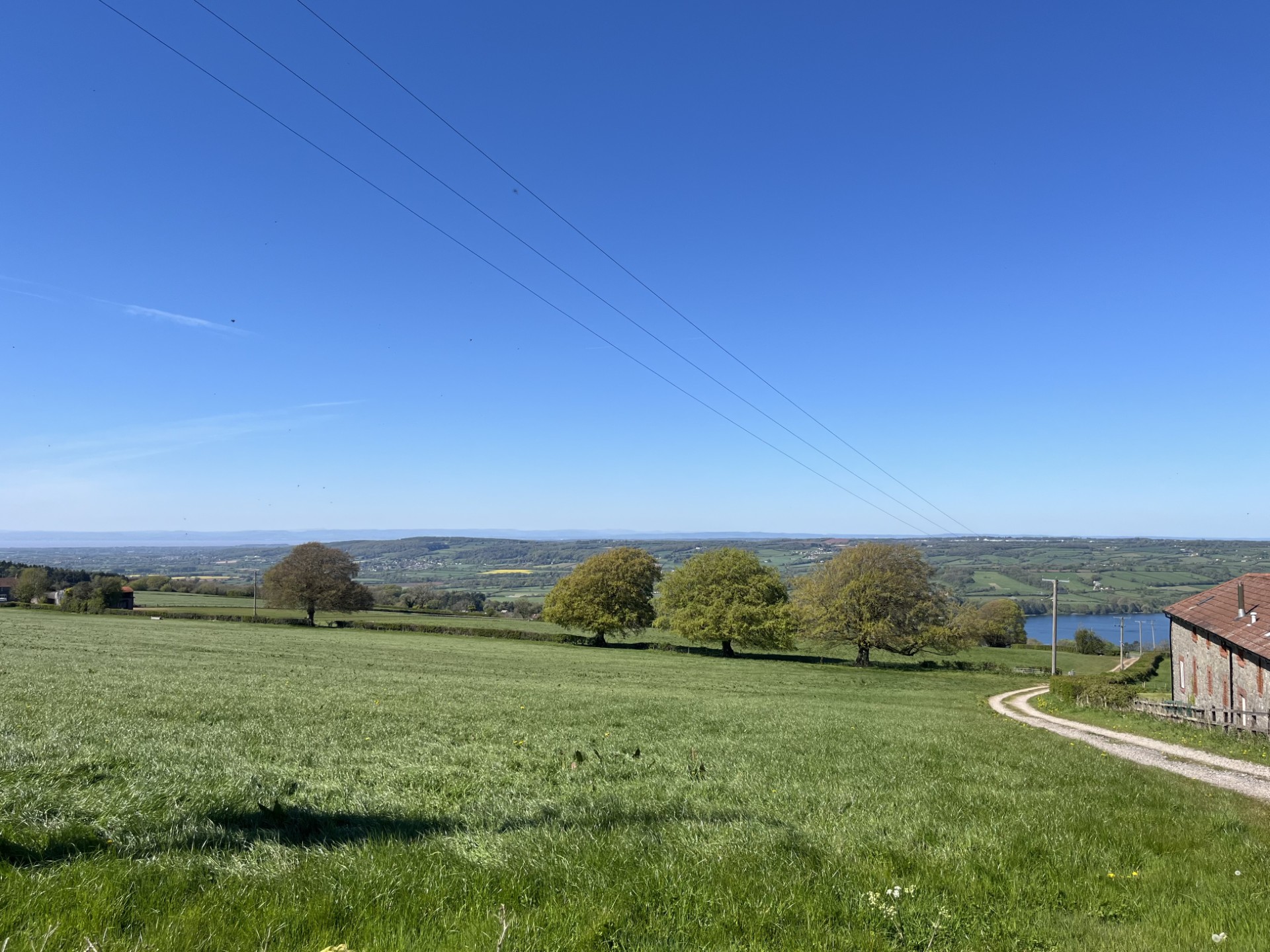
Turning left onto Leaze Lane I was close to the top. I drove on to the end, with fine views extending down to the Bristol Channel and Blagdon Lake. At the end of the road, I pulled up. There was no obvious parking space, and a woman, presumably from the nearby farm complex, was going through the recycling bins. I got out of the car to have a gander.
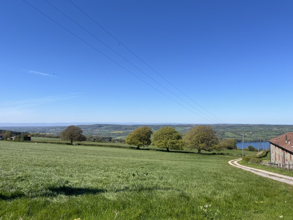
The view towards Wales and Sugarloaf (north by northwest) where this whole madness began
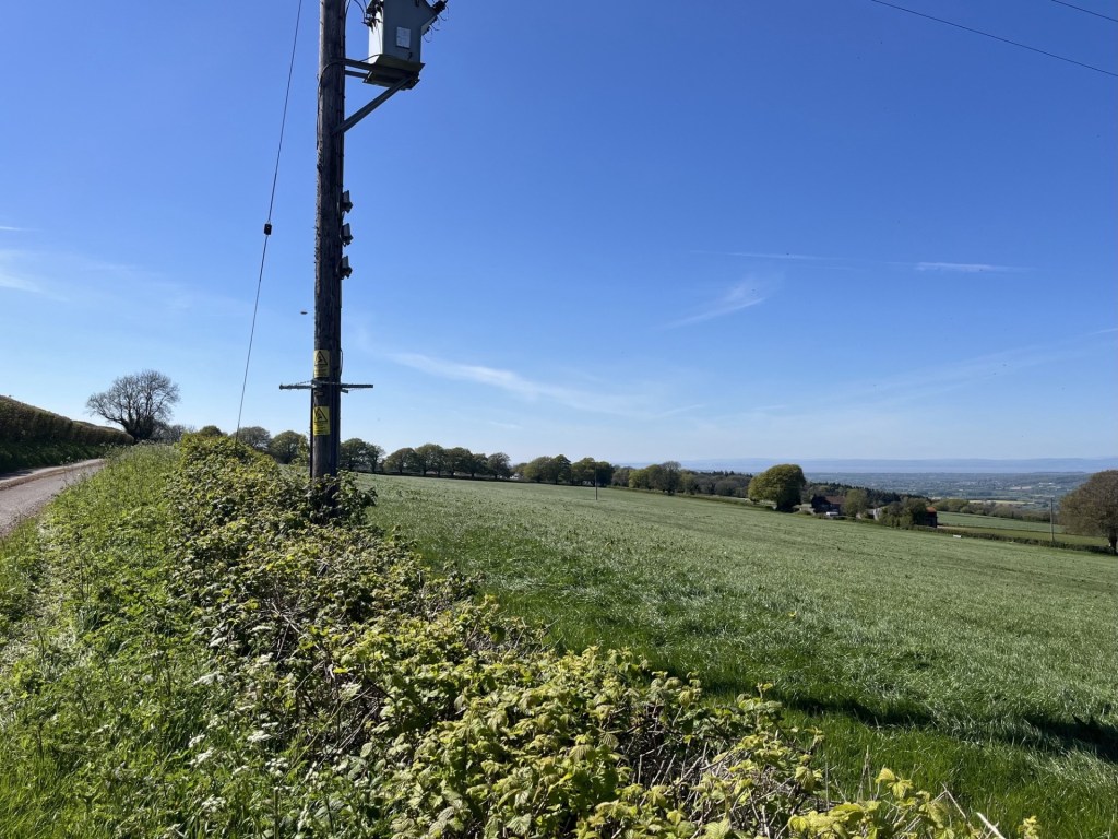
A lane headed south and continued up to the top of a rise. Whilst I understood that the top of North Somerset was at the edge of the field immediately in front of me, I wasn’t entirely sure where the county boundary ran, and whether perhaps I ought to go up the lane, just to be on the safe side. In the end, with nowhere to safely park for a few minutes (a Waitrose delivery could arrive at any time), and without wishing to worry the woman further (albeit she was probably used to strangers turning up to tick off the county top), I decided to turn around and leave. As it happened, and double checking later, I was in the right place, with the high point of 242 meters just to the right of the hedge 30 odd meters on from the telegraph pole in the photo below
Job done.
