Cresting the County – Medway (Unitary Authority)

Holly Hill

174 Metres

570 feet

6th May 2025

The Battle for Medway

I arrived at Ashford International station on a small train. On leaving the carriage, the intention being to catch an onward train to Paddock Wood, the early warmth of the day had dissipated. As I waited on the desolate platform, a cold wind from the north knocked the stuffing out of me. Poor old Ashford. Battered by Brexit and then Covid, the last of the Eurostar’s left from here some years ago, and they ain’t coming back anytime soon.

After twenty minutes, by which time my fingers had gone an unhealthy yellowy white, and I was pondering on the wisdom of the decision to do this journey, my onward train arrived. As it sped west through Kent, I read that today was the day that Reform UK succeeded the Tories by taking control of Kent County Council. Well, good luck with that, I thought, before reassuring myself that I was, at least, going to spend part of the rest of the day in the Unitary Authority of Medway, a chunk of the world on the south bank of the Thames that had once formed part of the wider Kent (the summit of which – Betsom’s Hill – I had reached on my very first outing nearly a year to the day before, and also before I had decided to include Unitary Authorities within the scope of these investigation). *

At Paddock Wood I changed trains again, and shortly I was heading north, with the river Medway to the right. This route was entirely new to me. Despite having lived in the South-East for much of my life, somehow this area had eluded me. And very pleasant it was too! The short train stopped frequently, and it struck me that at some point in the future a walk along the banks of the river from station to station would make for a productive afternoon.

I was excited at the prospect of passing through Maidstone, a town I knew nothing about other than last year their football team had made impressive progress in the FA Cup. On arrival, the prospect on show was pitifully disappointing. No sign of the town beyond the tatty old warehouses and poorly designed modern flats.

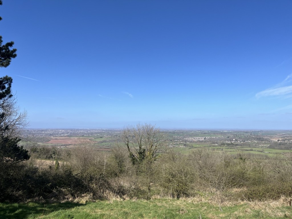
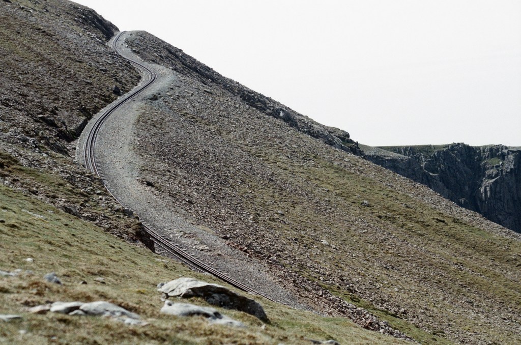
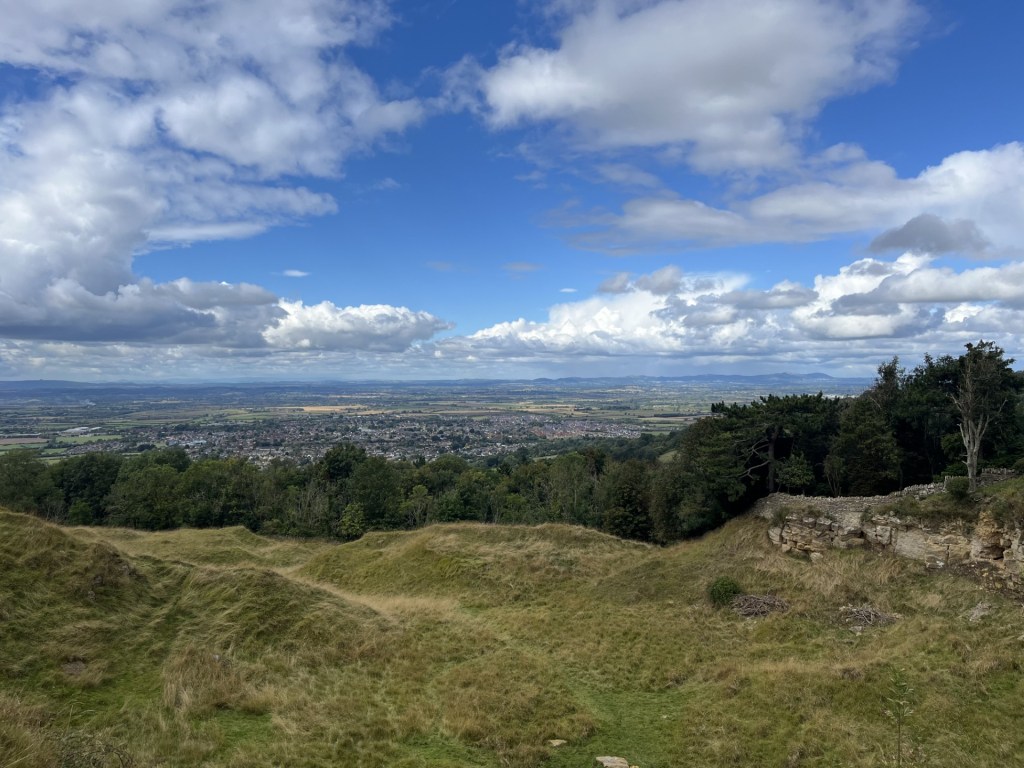
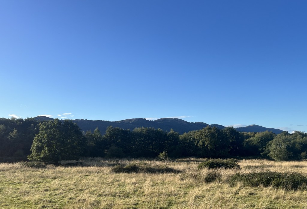
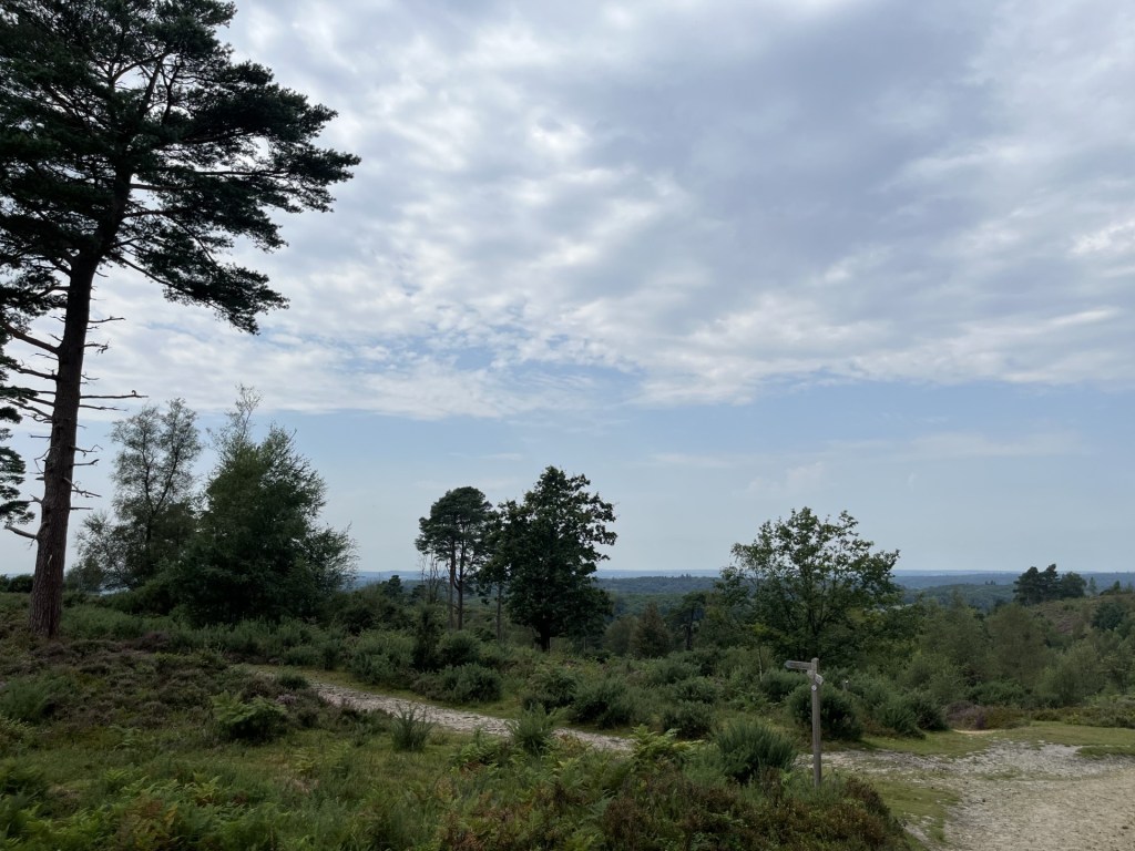
Heading north out of Maidstone and towards Snodland (my destination for the start of my walk), heavy industry flanked the line, although at a distance the ridge of the North Downs stretched away to the east.

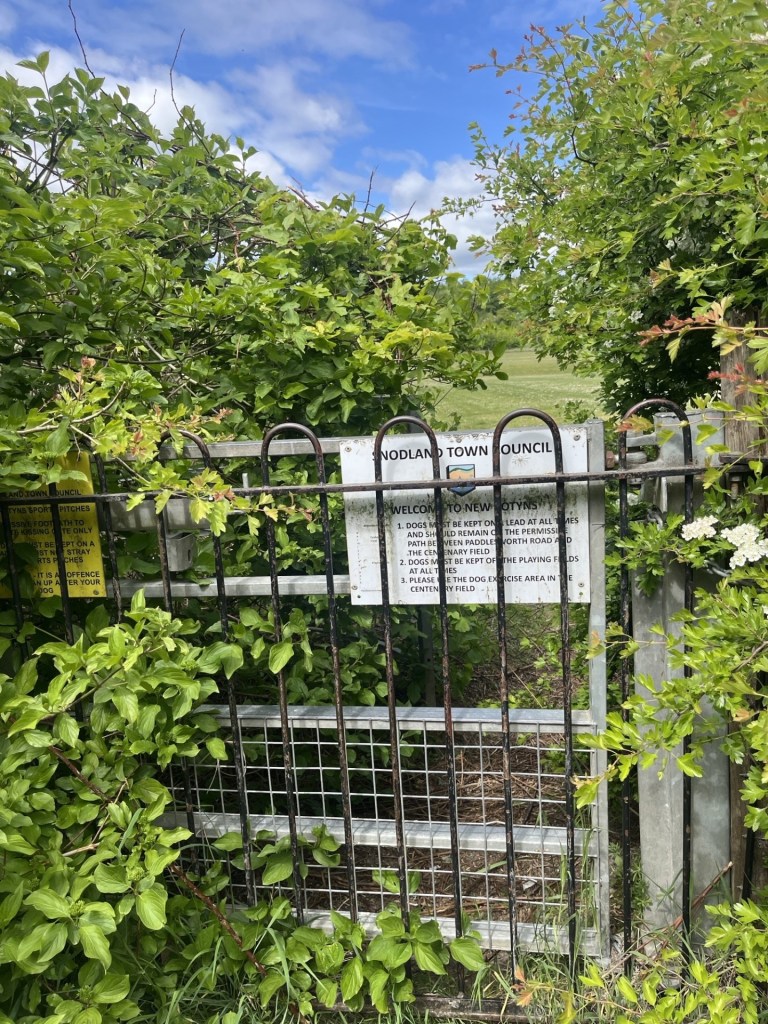
Snodland, for reasons I can’t account for, seems to crop up on the news, and on the sort of programmes made by middle aged male “has-beens” professing their love for our railways (I’m just jealous really). I had no idea what to expect as I left the quaint Victorian station and headed up a road leading west and towards the town. I had an Ordnance Survey map (OS Landranger 178) and had an idea of my route to Holly Hill, but I hadn’t expected to be taken over a depressing road bridge that spanned the miserably busy A228 road below.

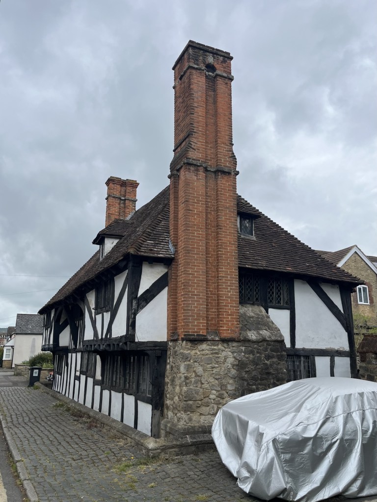
Having made it across the bridge, an even less inviting pedestrian path to the right (not a place you’d want to hang around in the dark) took me down to the start of the town, and a dead end which would, at one time, have continued to the station had it not been for its amputation by the A228. A few Victorian terrace houses, one having been a long-closed pub, lined the road on the left. A very impressive Tudoresque house stood to the right, with a very expensive car, covered to protect its identity, parked outside.

It was all downhill (or was it up) from here

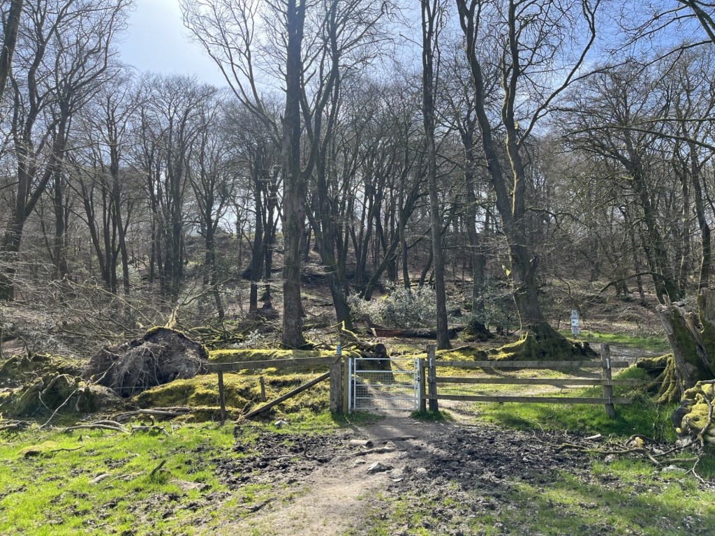
These few buildings aside, I’m afraid to report that the rest of Snodland offered up nothing of interest. I walked up the High Road into the town, crossing another main road, and then after a few minutes had reached the end of Snodland and was onto Paddlesworth Road. Almost immediately this narrow and very rural lane took me out of the urban sprawl. I knew from my map that at some point soon I would find a footpath on the right-hand side and momentarily got excited when I came across a fairly new and robust looking metal kissing gate, obviously intended for public access. Disappointing then to find it strapped up with heavy duty padlocks, and thoroughly overgrown. What had been the intention? I’ll never know.

Best laid plans

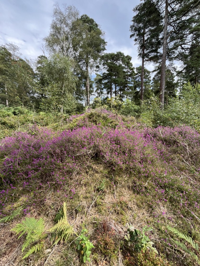
Further up the road, which, when a vehicle appeared, required one to back carefully into the hedgerow, a footpath sign to the right, and I was now off the road and following a straight chalk path up through the middle of a large field. Halfway up I noticed increasing evidence of broken pottery and other bits and bobs that indicated that at some time in the fairly distant past this area had been used as an early fly tipping site. Very Kent – now the beating heartland of rural desecration by organised crime.

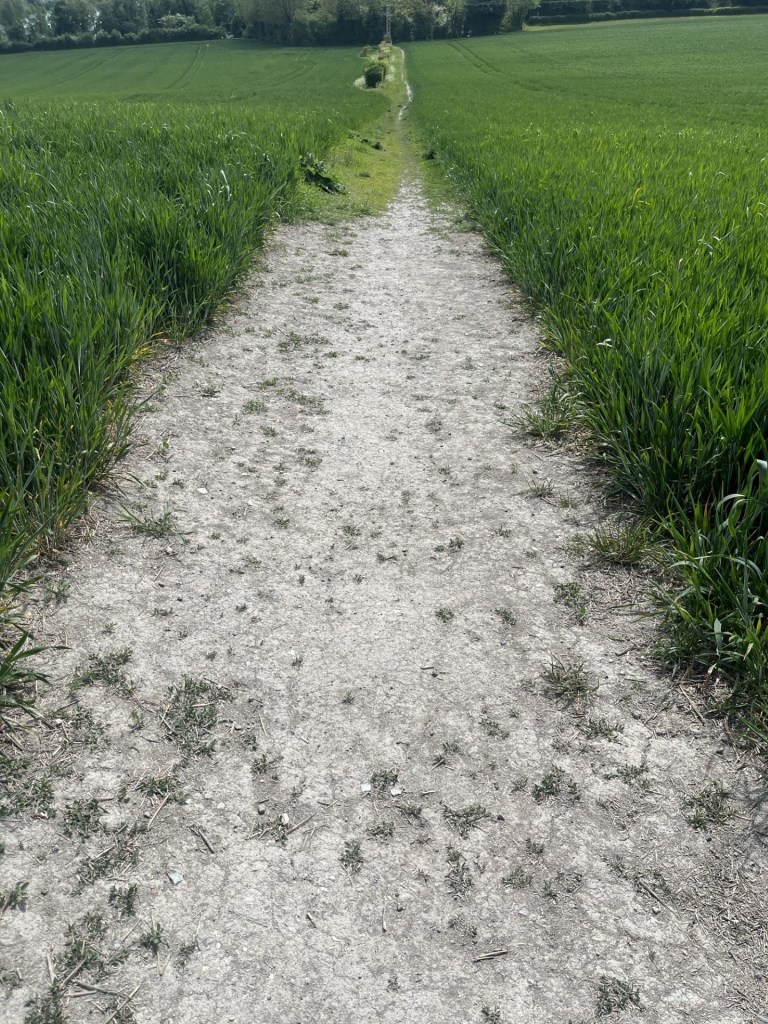
The old straight tip track

At the top of the field a wide track to the left, flanked on both sides by enormous, recently trimmed hedges, pointed me in the direction of my destination. The land ahead rose towards thick woodland and somewhere beyond that was Holly Hill. The track took a while to navigate, and the recently trimmed branches proved surprisingly awkward to traverse. To my right I could see a very solid green metal fence with pointy bits on top, clearly intended to protect people like me from the unknown danger that lay beyond.

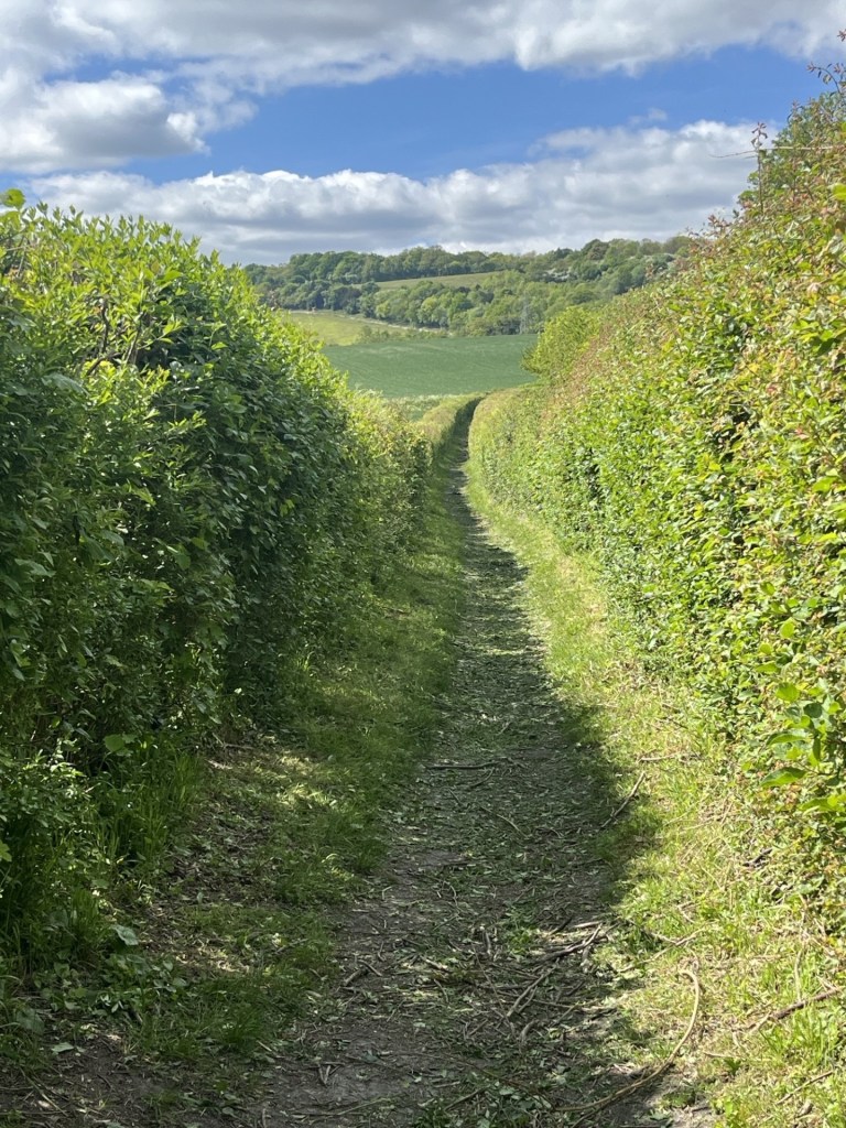
Beware of recently cut hedgerow because it’s sure to get you

Eventually I was free of the hedge track, and now on a more traditional country path with fields to my right. I stopped to take a look over the more traditional barbed wire fence. Beyond, and stretching for hundreds of metres, was evidence of what must have been a huge chalk quarry (or pit). I have a certain thing for chalk pits. My second year Geography degree dissertation in 1978 had been about the chalk quarries of south Croydon. I mean, you know, someone had to do it. And at times, whilst also trying to earn a few bob working in the electrical department of a now long-gone department store, it was quite enjoyable cycling up and down the steep terrain, with a camera and notebook, trying to figure out what was what and trying to formulate a suitable narrative. I even ended up being invited into a Coca Cola bottling factory on an industrial estate which occupied one of the old quarries, and being told about the danger to life and limb of their employees from the kids on the estate above who specialised in throwing rocks down into the quarry after school. This of course was a very long time before the internet and PCs. Academic research was confined to whatever the main Croydon library had to offer, which was probably more than I could have expected. Once I had written up my opus magna it had to be professionally typed up (and blooming well bound), at a cost that left me in debt for some years to come. Once submitted, that was the last I saw of it. It became the property of the University!! Huh! And there was no feedback, or indication on whether it had any merit.

Many years later I came across a small exhibition somewhere in Croydon, which seemed to me to cover some very familiar territory (if not the copyright of the University). It piqued my curiosity. Where had my dissertation ended up? I wrote to the University and asked if I could be sent a copy or at least have access to it. The reply came – they no longer had a copy! Huh – again! Along with all the effort, expenses and the £20 for the typing, I felt slightly robbed. Am I straying a thousand miles from the subject matter here? I’m over it now though. In 1980, and not to be caught out again by the typing scam, I obtained a cheap typewriter and taught myself to type. Never very proficient, and for many years I felt that all the effort had been a complete waste of time – until, well, until the modern world intruded and the keyboard was now the only thing on earth of any value. Bingo! Unintended consequences. **

Towards the Quarries

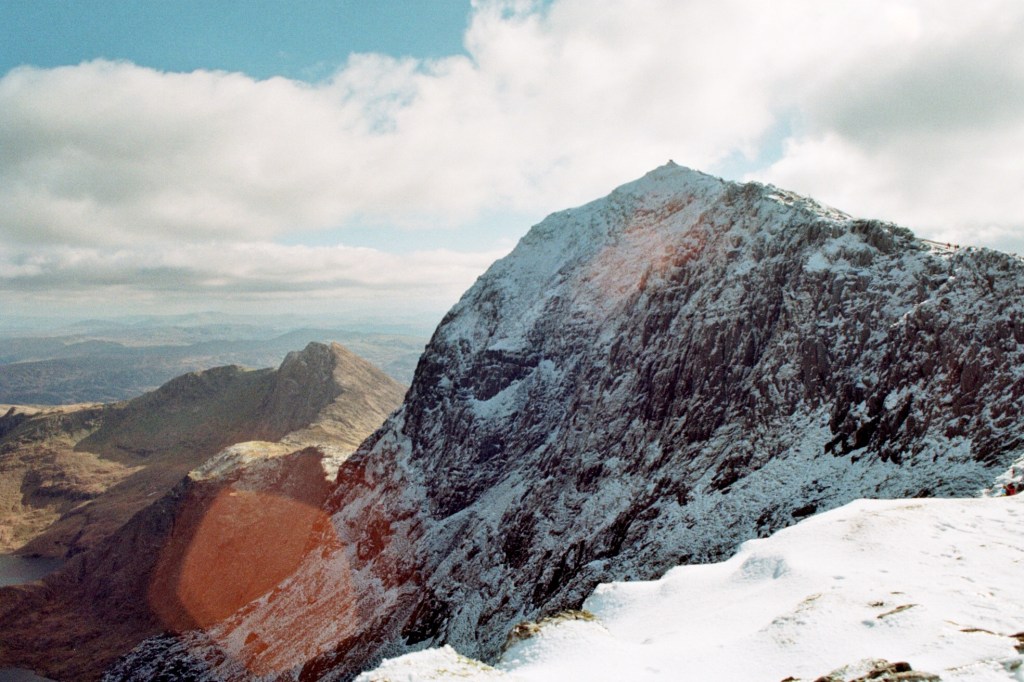
But none of the quarries on the scarp face of the North Downs in Surrey were on anything like the same scale I now saw before me. As I contemplated this scene I could hear the sound of excited dogs somewhere ahead. A kennel I suspected. A little ominous too. Carrying on up the path, I became aware of movement quite a distance ahead. A young woman was coming in my direction, being, from what I could tell, dragged along by a dog the size of an adult pig, and with the appearance of a Baskerville hound. It had already been the driest Spring on record, but the amount of slobber sloshing from this abomination’s mouth would have been enough to rejuvenate the driest of streams. There certainly wasn’t room for the both of us to pass and so; to give myself a chance, I climbed high up the embankment to my left and uttered a cheery “afternoon” as they passed. I assumed that the dog was a temporary inmate at the nearby kennels which were at the end of the path, but to the person, somewhere, who has created this breed, whatever it was, and to the people who purchase similar, please stop!

At the top of the path (just to confirm I survived the dog moment unscathed), a track led left and right, but I chose the gate directly ahead and a path that started to ascend up through some woods. To the right, an old derelict house sat in amongst the trees. A sign attached to a fence said Keep Out – Property of the Blue Circle Cement Company, which explained a lot. The path continued through beech and birch trees in the first flush of new growth. A teapot, naturally, sat wedged in the cleft of one of these trees. Art, a tiny house that tiny things lived in, or just fly tipping, it was hard to tell, but in truth it looked quite at home in the tree.
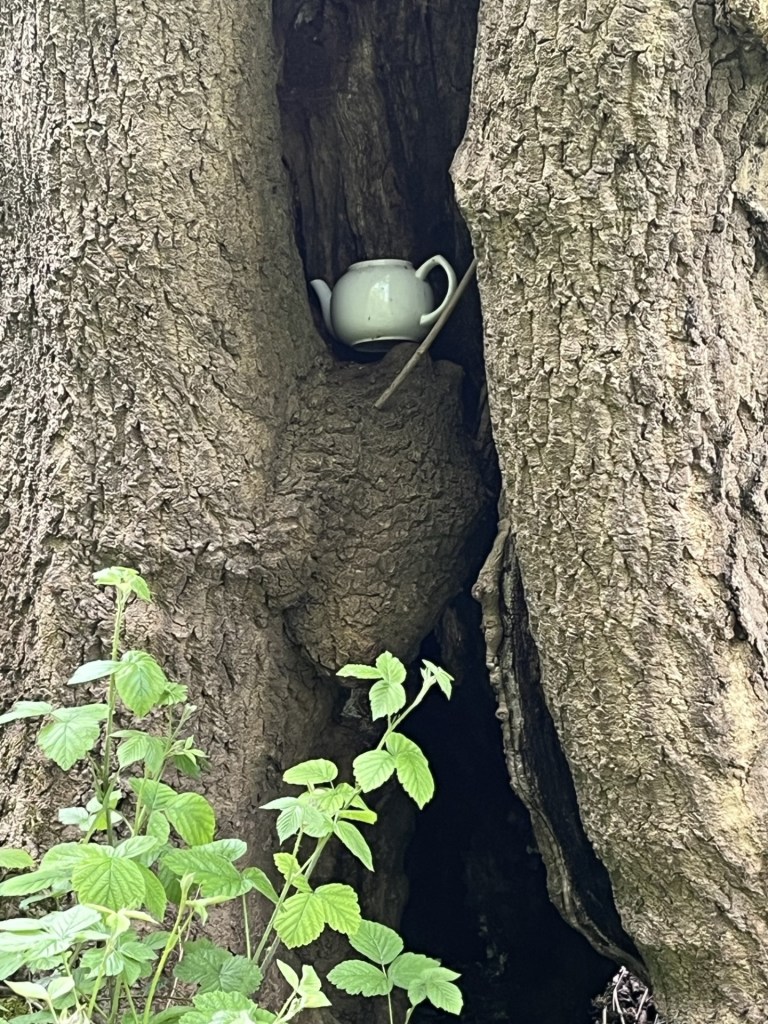
Brewing Up

At this point the path began to head downhill. Welcome to a degree, but with the caveat that all height lost meant more pain later. I emerged into a large glade, surrounded by pines and other varieties. A dirt road passed east to west, and a solitary dead tree stood in the middle of the glade sporting a large sign explaining that something was private property. Given that there was no sign of any fencing it was hard to determine what this instruction referred to, other than it might have been the dead tree. I had no plan to climb it.

I didn’t get the message

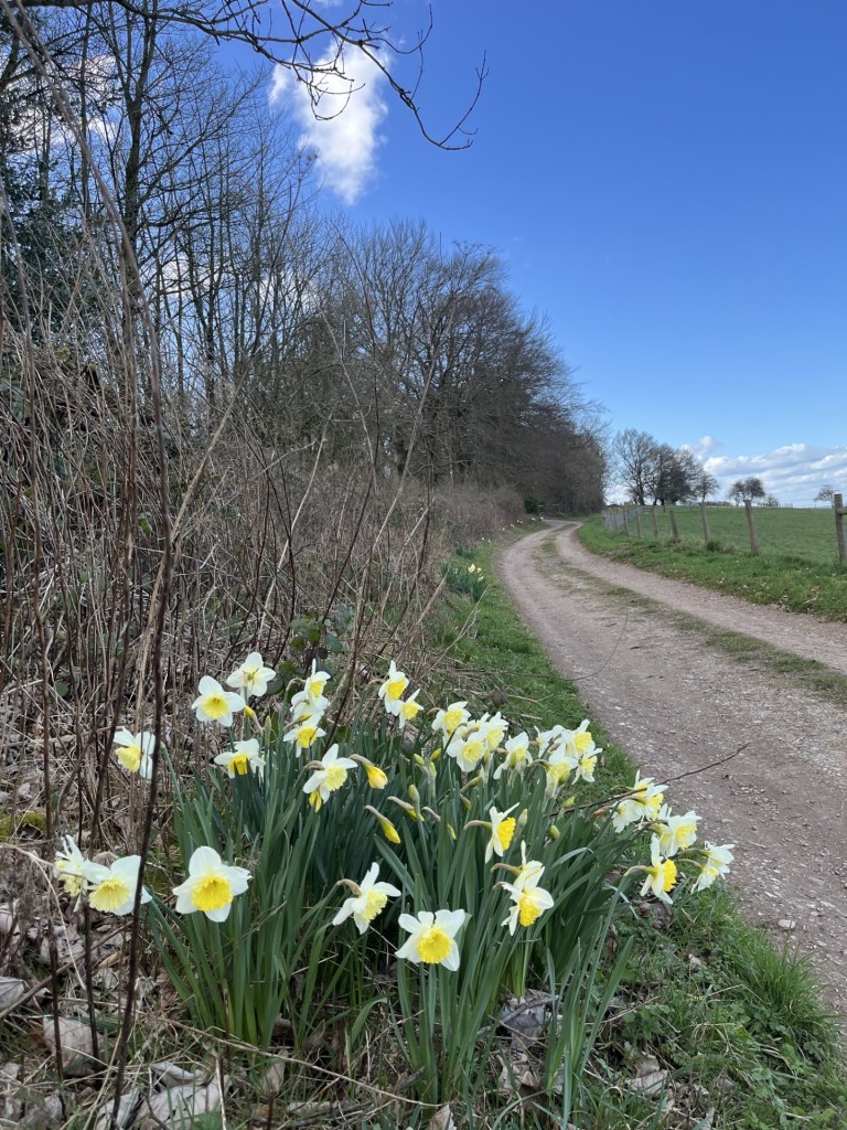
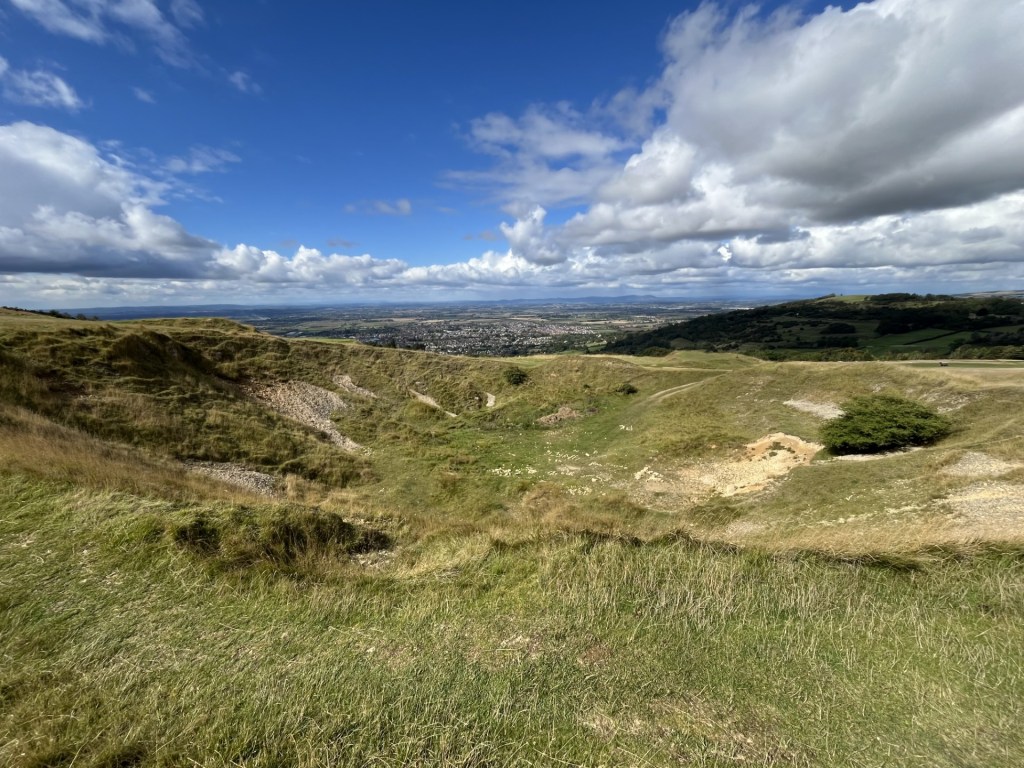
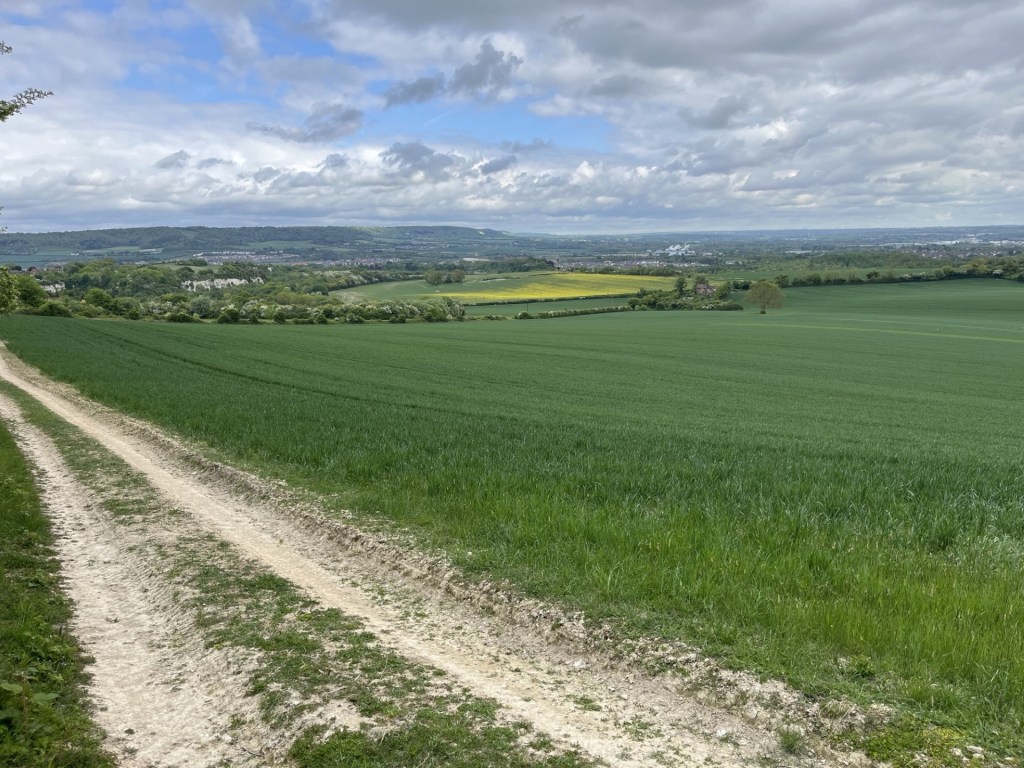
I chose to follow the track that ran westwards, and a while on did indeed come across a fence to my left, and a large field of scrubland that stretched up to the north. In places the last primroses of Spring clung to the edge of the track. Consulting the map, I could see that somewhere at the top of this open ground there was a footpath that led into some woods that emerged into bigger fields which would lead up to the top of Holly Hill, and so it was onwards and up.

Up the scrub and looking towards the Medway

It was a fair old hike to the top of the scrubland (for an old person anyway). Having reached the top, I worked around the dilapidated fencing and came across a similarly dilapidated stile. Anyone who does a bit of recreational walking in the country will know that slightly deflating feeling when coming across an unmaintained stile or gate. It was patently obvious that this location was rarely ever troubled by the public and had not been interfered with for some weeks, or months. Chest high nettles had grown with vigour on both sides. I considered going back down to find a better route, but that felt slightly defeatist so instead I took some minutes preparing to climb over; grateful that I wasn’t wearing short trousers. With a brave heart and hands held high I progressed purposefully and made it without incident.

Travelling in stile

Now I was in a small glade. The remnants of a path took me so far before evaporating in a jungle of more nettles and enthusiastic young brambles. The land ahead rose sharply up through dense woodland. Somewhere within this tangle of nature there was a legitimate route, but it was no use. I began to pick my way up as carefully as possible, trying not to brush skin on anything that represented a threat, which was everything. This was hard going and I’m not the nimble gazelle I once was. Trying to pick the least worst route took ages, and even the least worse routes involved repeated trouser snagging. This was a very short climb, but it took me about twenty minutes.

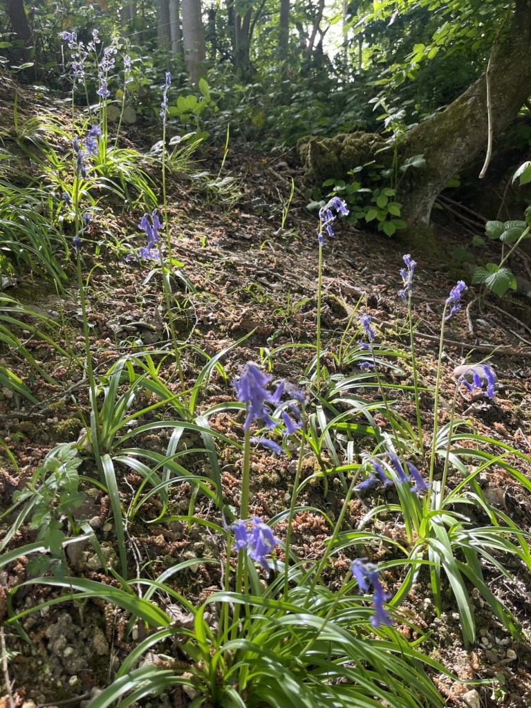
Don’t be deceived – These bluebells were lethal

At last, and to my great relief, I was out of the morass and standing at the edge of a large agricultural field. Disorientated, I had no idea where at the edge of the field I was and the map couldn’t help me, but I knew that heading north and keeping to the edge of the field would get me there eventually. A while on and to the right, another less than useless stile indicated where I ought to have emerged.

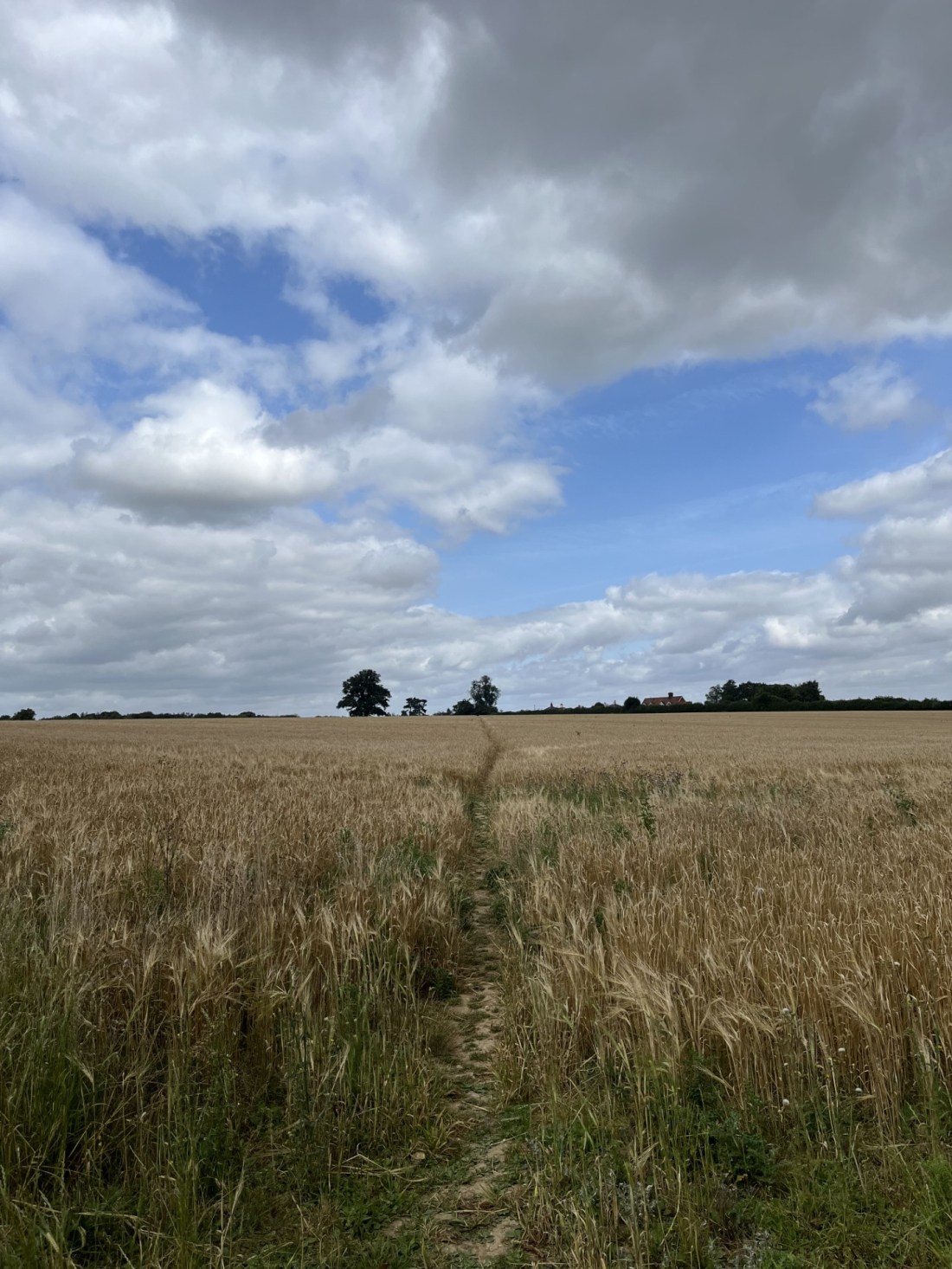
Somewhere in a field, somewhere still in Kent

Keeping to the edge of the field eventually I headed directly across rough ground and to a hedge line that I hoped was the top. It wasn’t. A settlement a short distance away confirmed I had another large field to go. By now I was certain of the objective. A large old tree stood on its own in the field beyond. I aimed directly at it, despite a minor uncertainty as to whether I was trespassing or not. Near the tree a large area of the field, about the size of two football pitches, had been turned over, for no obvious reason I could think of. I guessed that some sort of greening subsidy was being used to make something of this otherwise neglected field.

A few steps into Medway

To my north the field was lined with dense woodland, where, if I was to believe some of the literature online, the highest point in Medway lay just beyond the hedge line. The thing to note about this endeavour was that whilst almost the entire field area, stretching to the south, was in Kent, for reasons that simply can’t be explained, expect by the officer who plotted the boundary, the county line (not to be confused with County Lines – which is a completely different pursuit), makes a triangular shaped intrusion into the field. This Medway intrusion must be very confusing for the landowner and must lead to inter authority bureaucratic squabbling over incidents of fly tipping.

The Medway Unitary Authority salient (in orange). Kent/Medway boundary marked by dash/dot black line

I sniffed a bit along the hedge line at approximately the location that PeakBagger had indicated was the “top”,  to see if there was any sign of higher land within the woods, but it didn’t seem as if there was, and looking back at the field I had crossed, despite being something of a plateau, I was fairly convinced that the land past the tree, and where the field had been turned over, was marginally higher than anywhere else. ***

Somewhere, just to the right of the tree, the top

Having, one way or another, crested Medway UA, I certainly wasn’t going to battle back down the way I had come and already had an alternative route in mind. Back down the field a bit, and to the east, a decent enough gate led the walker into dense woodland, and as I passed into its embrace, I was back in Kent.

A short walk into the woods and the path split in two directions. One carrying on with the contour and the other falling away down a slope. At the junction I beheld a quintessential English country landmark. None other than a plastic litter bin overflowing with plastic bottles and dog shit bags. There was obviously a good reason for it being there i.e. the compulsion of a large minority of people to drop their drinks containers and dog shit bags on the ground, rather than the inconvenience of taking them home. So, cause and effect, some kind heart/s had installed the bin to limit the impact. Bless them, but poor sods too, having to come out here probably every day to empty, rinse and repeat cycle. Depressing really.

Where the path diverges. Dog shit marks the spot.

I opted on the downhill route, on the basis that it was downhill and I rather desired to get down sooner than later. Not as easy as it looked. Quite a lot of branches blocked the way. Not enough to prevent further progress, but I hadn’t done my stretching exercises in the morning. I was now.

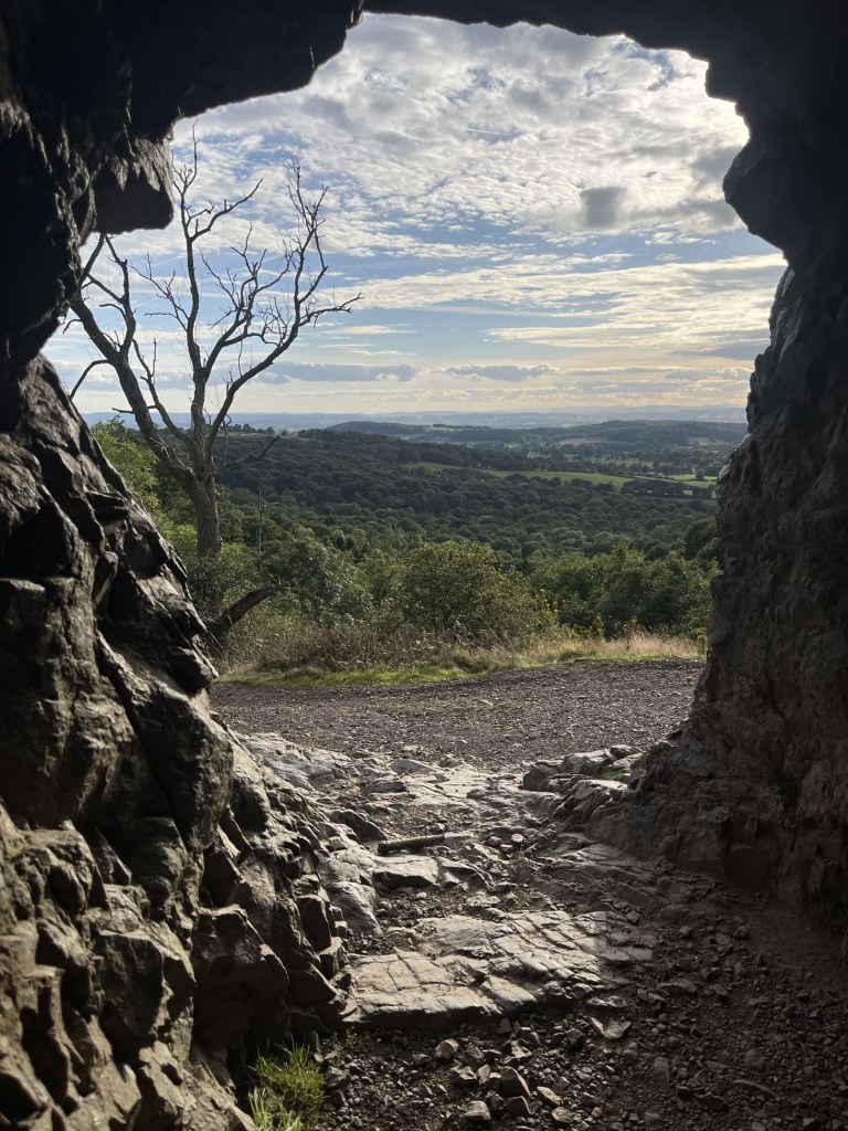
And then the trail took a much steeper dive. The ground was bone dry, but I was going to need to take some care. At this point I noticed what appeared to be lumps of iron sticking out of the ground, and they spoke of instant disaster. I also noticed to my left a rope that fell away along the side of the path. What was I getting myself into? It slowly began to make sense. The foot wide lumps of metal, hammered into the ground every couple of feet, were there, along with the rope, to aid the walker, or in this case, climber. In wet conditions I am certain that the metal steps would be extremely useful but covered in dry dirt and a lot of vegetation, they now made for an almost inevitable trip feature. I took the greatest care of going down, and it continued down for some minutes. Eventually, uninjured, the path exited the woods at a small road.

Believe me, every one of those steps hides a trip hazard

Walking up the road it soon bore to the right. It felt logical to follow it, but just to my left a footpath sign and a sturdy kissing gate invited more interesting countryside exploration.

The gate took some negotiating. It clearly hadn’t been used in a very long time, but once in the field, and having looked at my map, a footpath could just be discerned heading across the large, tatty field. Overgrown, largely with thistle type plants, this part of the stroll was particularly unpleasant, and I now regretted not having stuck to the road. Eventually this annoying part of the journey ended, with the path dropping back to the road through a thicket so thick that a machete would have come in handy.

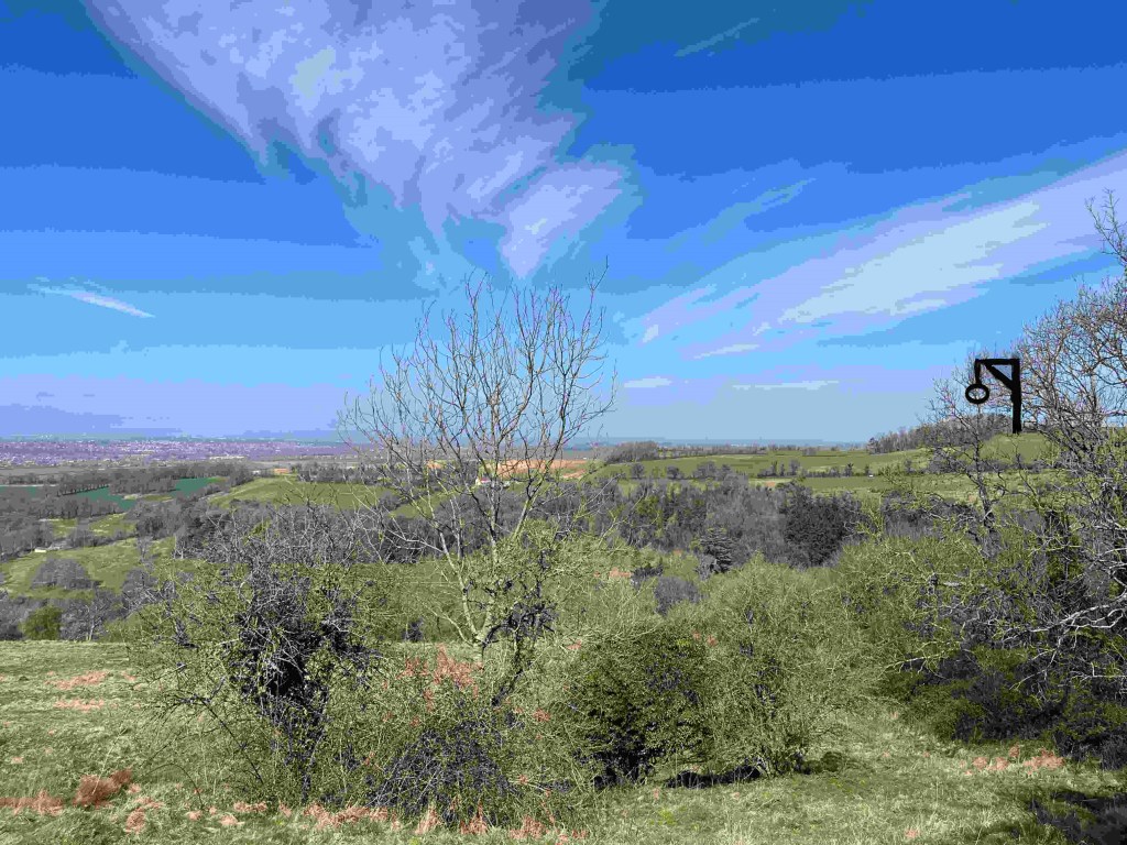
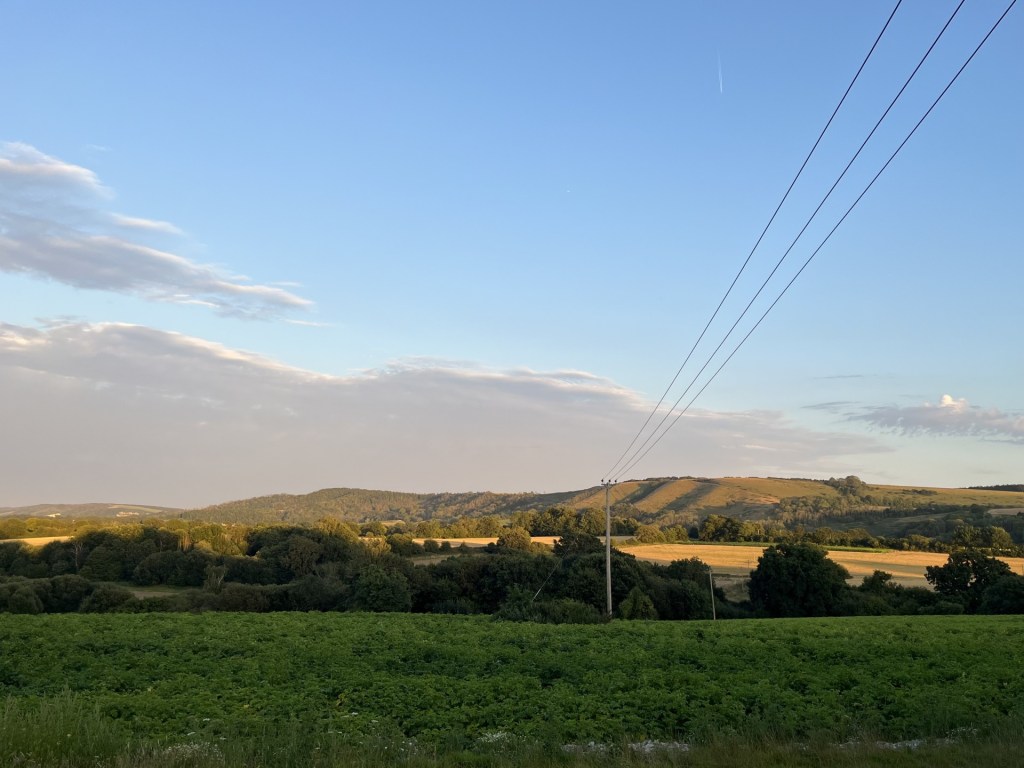
I followed the road for a while and occasionally looked at the views towards the north and east. Across the river Medway to the east and more evidence of vast chalk quarries hacked out of the North Downs.

Into the Medway

The road became more of a dirt track as it entered the top of the large field with dense woodland to the left. The track then turned downhill, heading southeast until reaching Ladd’s farm at the junction with the Pilgrims Way. The farm buildings, apart from long ago extensions here and there, remained remarkably, and you could say charmingly, unaltered since the 19th Century.

Ladd’s Farm

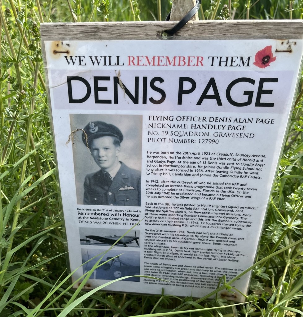
A small road (Ladd’s Lane) ran roughly south, almost directly opposite the farm, but a small sign pinned to a lump of wood at the side of the field opposite caught my attention. Another sad memorial to the dead of previous wars. This time, Denis Page, Pilot Number 127990, killed when his Mustang fighter crashed into the nearby field. He was just twenty!

This poignant story was counterpoised by the huge field opposite, where a yellow swathe of rape flowers lay like a carpet over the chalk, and where beyond a long low chalk cliff formed the base to a small community above.

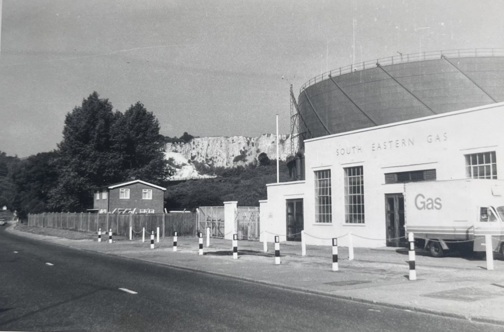
The artificial chalk cliffs of Halling

With the field to my right the lane started to head east and back towards Snodland. In the late afternoon, and apart from the odd vehicle coming out of Snodland, it made for a pleasant end to the walk. Eventually the fields gave way to the heavy-duty green metal fencing with pointy tips that I had encountered earlier in the walk. Clearly intended to prevent access to the huge old quarries and pits lurking beyond.

The road eventually reached an area called Holborough where, before reaching the A228, a large newish estate with pond features created on land reclaimed from the old quarries. As modern estates go it looked pretty good. A path headed south along the backs of older housing, which at least meant avoiding contact with the dual carriageway, and I was soon back in Snodland and then the station, just as a freight train pulled by a class 66 locomotive thundered northwards (sorry, it’s a niche sideline).

I had twenty minutes to wait for my train back to Paddock Wood, but that was okay. My son rang to touch base. When I explained the day he expressed some interest, which was kind! It had been an unexpectedly excellent seven mile walk in an area I knew absolutely nothing about, but which I now felt I knew a lot more.  

Snodland Station – next stop Paddock Wood        

* Medway Unitary Authority covers the area of Rochester, Chatham, Gillingham and the Hoo Peninsula. Some years ago, when I was a tad younger and fitter, I wasted some time on my bike sticking as far as I could to the coast, and if you are desperate for more of where this comes from these links will take you to the north.

** In a moment of extraordinary serendipity, as I was coming to the end of writing this account, I was also multitasking, having decided to reorganise my clothes draws. I started on the bottom draw, having completely forgotten what it contained, and having not opened it in some years. No clothes, but instead random “stuff” that included a plastic bag. I felt in the bag and the first thing out was a cardboard envelope, in which, and to my amazement, a draft copy of my dissertation. For the next hour I sat and re-read it. In parts it was naive, and in truth (I had had a very Comprehensive education) at times the spelling and grammar left a lot to be desired. I suppose I was only 20 years old at the time, yet despite these minor self-criticisms, it made for an interesting and informative read. At the end I considered that one day it ought to be possible to rejuvenate one of these old chalk quarries as a leisure water park. And so, when looking on Google maps and at the area to the north of Ladd’s Lane – St Andrew’s Lakes. A deep water “aqua” leisure park, built into an old chalk quarry some years ago. I had missed a trick!

Kenley Chalk Pit 1978 – Car free adolescence

*** This is the point that Peak Bagger claims as the top, and I believe they are correct. On the other hand, Peak Visor, which is another clever looking site, places the top of Medway a bit further to the north at a place called Round Hill, which, according to the BGS App, falls short by 10 metres. 

Cresting the County – Dorset

Lewesdon Hill

279 Metres

915 Feet

31st March 2025

The Eight Thousand and 39 Steps

Having spent the weekend with my daughter and her partner in Bristol, and having successfully claimed Hanging Hill in South Gloucestershire, rewarding myself with a strong coffee at the Swan Inn at Swineford, I drove south down almost vehicle free roads through Somerset, then east Devon and eventually into Lyme Regis in Dorset. A couple of nights booked in the Nags Head before heading back east to see friends in Portsmouth, then home.

After booking into my small room in the Nags Head and then having spent a couple of hours near the sea front trying the fish and chips and a couple of pints of the local ale, I set off up what felt like a 45% hill back to the Nags Head. By the time I arrived, panting and crawling over the threshold, with one of the patrons saying to me “have you been out there the whole time?” to which I had no answer, I flopped at the bar, rationalising that I desperately needed a small whiskey before bed. With fortification in hand, I took a seat whilst the last of the punters supped up and left. On gazing around my eyes fell upon a picture on the wall. It spoke of more optimistic times and for a moment I felt privileged to be in this space.

Toasting the man

Lewesdon Hill, Dorsets highest point, was a thirty-minute drive northeast of Lyme Regis. I decided on parking up in the village of Broadwindsor, located just north of the hill. As I neared the village, driving along the B3162, a stationary police car was parked up on the road ahead. I drew up behind but was waved on. Just up the hill, a second police car was pulled over next to what appeared to be an abandoned car, and a couple of officers stood silently by, with arms crossed.

I drove on and within a minute was parked up in a small close to the south of the village. The weather was perfect. Almost too perfect. I had no summer clothing so chose to leave my coat in the boot. The OS Explorer map (116) showed a route out of the village and straight to the top of Lewesdon Hill. It required walking into the village, which was fine because I needed a snack and guessed that the settlement was just big enough to support a shop. Fortunately, there was a profusion of old-fashioned signposts, and on each the words, Village Shop, as if it was the biggest attraction in the area. Maybe it was.

Surprisingly, being a Monday, the small community shop was open, although in truth it was rather lacking in immediately edible stock. Reluctantly, (I had walked in and so walking straight out would have been seen as a tad rude) I settled for a rather unappetising looking vegan sausage roll thing, made by a large food company that rhymes with “balls.” The shopkeeper was almost certainly delighted to see the back of it, but hey, needs must.

After procuring the snack and a cola, I walked back up to the White Lion Inn (closed Mondays) and headed west on err… West Street. A small house on the corner had a stone sign above the door that claimed Charles the Second had stayed there for a night in 1651. What it didn’t say is that he was fleeing from Parliamentarian troops after the battle of Worcester and escaped the village dressed as a woman. Just the previous day I had stood at the top of Hanging Hill in South Gloucestershire where, eight years before, a large force of his father’s military sustained appalling losses against a Parliamentarian army, taking the high ground before retreating.

Perhaps more interestingly, Broadwindsor also had a 17th Century vicar called Thomas Fuller who, apparently, often had his congregation in stitches. Who wouldn’t have wanted to live in a place which, whilst plague, and the warring elite ravaged the land, had a Sunday morning comedy club? I have an image of Paul Merton standing at the pulpit and drifting off into a flight of fancy, although having read a couple of Fuller’s “jokes” I think it’s likely that these days we would struggle to understand the nuance. By the time Charles the Second sought refuge in the village, Fuller was no longer the vicar, so missed the opportunity to crack a line at the King’s expense.  

West Street wound down a hill to a bend in the road (which headed on up beyond). A footpath sign pointed south and confirmed the evidence on my map. Passing between a handful of buildings the path crossed a sparkling stream before reaching a large gate, with fields beyond. So far, so good. The gate, of course, was locked. There was no sign to indicate why. I don’t get annoyed in these situations, but it happens too often these days and can be mildly disconcerting. I looked around to see if I was missing something and noticed a small track leading away to my right, following the stream and through some woodland. It felt a bit unlikely, but I was in no rush so decided to follow the path and see where it took me.

Which was about 200 metres. The path petered out as it became overwhelmed by marshy ground. A delightful spot, but for me it was back to the drawing board, which meant a retreat to the gate. I looked beyond the gate and eyed up the path that clearly led to the top. No sign of a bull. I looked at the map, which showed an alternative path, but which required beating back through the village. I looked around. No one was in sight, so without further thought I was up and over and then stepping boldly along the path.

From there on it was reasonably straight forward, although at another locked gate a sign pointed east towards an alternative route, which I duly observed. After twenty minutes or so I arrived at a gate that marked the entrance to the Lewesdon Hill site, managed by the National Trust. Ahead lay dense woodland, with a variety of mature trees climbing up the steep slopes towards the top.

The approach to the enclosure

Proceeding through the gate, a large, mounted sign provided information about the area, the flora, the fauna and that an Iron Age settlement had probably existed on the site. That this seemed to be any doubt felt odd. It seemed to be a perfect setting. The board also stated that Lewesdon Hill was “the highest, quietest and most remote place in the county”. From what I had witnessed so far it felt a little bit like stating the bleedin’ obvious, but I wasn’t complaining.

A few steps on and a second sign. Slate grey, with the image of a Spitfire flying overhead in the top right-hand corner. I anticipated a sombre story.  

In summary, on 15th March 1942, Jean Verdun Marie Aime De Cloedt, a Belgian in the RAF, in poor weather and with a faulty engine, crashed into the top of Lewesdon Hill. The commemorative board also mentioned that it was still possible to see the destructive path the plane had taken through the trees at the top. It felt like an unnecessary detail, but regardless it was a poignant tale. An intimate human story at “the highest, quietest and most remote place in the county”. Wars and hilltops. It was becoming a theme.

Chert stones that must have travelled down from above and onto the sandstone bedrock, scattered the path that headed south towards the top. Unusual, but would almost certainly have made this an attractive spot for early flint pioneers.

Within five minutes the path broke from the cover of the trees onto a heathy plateau and continued towards the only point that looked slightly higher than the surrounding topography. There was nothing of note to pinpoint the spot, but a hump of grassy earth seemed to be the place. I looked out to the south and towards the sea some miles away. Rays of sunlight swarmed through the large gaps between the trees. Looking down the steep escarpment the sun on the otherwise stark branches revealed the first, almost indiscernible, green blush of new growth.

From the top – Looking south southwest towards Morecombelake

Despite the delay in making progress at the foot of the climb, (due to the locked gate) I had made good time, and so after taking a few bites from the almost inedible vegan roll (cardboard wasn’t included in the list of ingredients, but I think it should have) I followed another path heading west and above the drop to the south. And a considerably steep and long drop it was too. Despite almost qualifying as a cliff, ancient birch and oak trees rose up from below, climbing and clinging on bravely to the thin earth. At some point it occurred to me that this was likely to have been the area where Jean Verdun Marie Aime De Cloedt’s plane had torn through the trees. I chose not to try and work out where.

Reaching the end of the plateau area another notice board gave more information, which must have made no impact on me at all, given that I can’t remember a word. A view opened out. The land fell away, but then rose again to the top of Pilsdon Pen, about two miles to the west, which even from a distance revealed features consistent with a hill fort.

West towards Pilsdon Pen

Scrambling down the north slope, on land recently cleared of larger trees, I was back on the main track which forms part of the Wessex Ridgeway and banked up to the right. The sound of a helicopter overhead intruded but tailed off as it headed north. Soon I was back at the entrance with the information boards, and after a quick look back set off across the first large field. I had noticed on the map that at the end of the field another path veered to the northeast and past Fir Farm. This was a more direct route back to the car and avoided having to negotiate the closed gate.

Objective Broadwindsor

By a large farm building I found what appeared to be the route, heading into some woodland. The noise of the helicopter should have long gone by now, but it was still audible, somewhere just to the north. Entering the woods, it was evident that the trail was little used. A sign had been attached to a tree, informing people like me that due to storms the previous year some of the trees were unsafe and walkers proceeded at their own risk. The sign itself was a year old, and I figured that the landowners would, by now, have taken the necessary action to make the area safe.

This was a lovely spot, a proper dingle dell. A low wall appeared ahead, with a nook cut out to allow the traveller to cross with ease. As I stepped over, something about its appearance had me confused. What kind of stone was this? I looked more closely. What I had thought was a stone wall was in fact a massive fallen tree, so embalmed in moss and lichen that it mimicked a human structure.

Not exactly sycamore gap, but art in nature nevertheless.

Carrying on down through the winding path the noise from the helicopter began to increase, annoyingly. Perhaps it was the military on manoeuvres, or a crop being sprayed with agent orange. Either way it was taking the edge off the afternoon. A bit further on and the path began to flank a track leading back to the farm. Looking ahead something stopped me in my own tracks. Through the trees and hedges, and about 200 metres further on, I could clearly make out the intermittent red and blue lights of a police vehicle.

In the 1935 film, The 39 Steps, Richard Hannah (Robert Donat), is on the run on a Scottish hillside when out of the blue (and out of all context given that Buchan’s novel was set before the Great War) a helicopter appears, hunting him down. Now, I should say at this point, nothing remotely interesting has happened to me for a very long time, although two evenings earlier in Bristol I had witnessed what might well have been a stolen motorbike being crashed at 5mph, and completely bizarrely, into a wall, before a car pulled up and swished the fallen rider away. Surreal. Nevertheless, and just for a moment, with the sound of the helicopter above, and knowing the cops were hovering somewhere just down the lane, my thoughts were suddenly hinting at the prospect of a manhunt! But who, and why? Was it fight or flight time?

Momentarily I engaged in mental research. Who was I? Robert Donat, Kenneth Moore, or, controversially, Robert Powell. I settled on Robert Powell, largely on the grounds that I had liked him a lot alongside Jasper Carrot in the TV show The Detectives. Now all I had to do was to get past the police checkpoint. Did I have my papers? It’s essential to have papers on you in these situations. I patted the inside pocket of my jacket. Hmm… would the Nectar loyalty card suffice? I was about to find out and started to walk purposefully towards the blues and twos.

I noticed that the police car lay beyond another vehicle and realised that I had reached the point I had passed in the car on my way into Broadwindsor. Whatever was going on seemed most particular. I reached the end of the drive and volunteered a “hello” to the two officers idly guarding the mysterious car. I think they may have said something back, but either way I wasn’t subjected to any stop and search, or interrogation, for which I was most grateful, although as I carried on along the road back into town, with the helicopter still bothering around above, I wondered whether the officers might have been a tad neglectful in their duties.

Back at the car I checked the app which had been recording the walk. 2.79 miles. 411 ft elevation gain. 670 calories. 8k steps. No more, no less. Oh, for 39 more! But never mind, for an hour or two, in a remote part of Dorset, which had once been the home of “Have I Got Sunday Morning News for You”, I had been away from the numbers.

Cresting the County – South Gloucestershire

Hanging Hill

236 Metres

781 Feet

30th March 2025

A Battle to the High Ground

A beautiful Spring morning in Bristol, and a few hours to spare with my daughter and her partner J, before heading south after a short but very enjoyable weekend visit. They were both aware of my growing interest in seeking out county high points and indeed had previously enabled me to the tops of Ben Nevis and Snowdon. Was there somewhere locally where a short walk could take us to another county top? Well, up until a few weeks earlier I would have said no, and time was too short to hop over to south Wales. But that was before I had discovered a new county (or so I thought).

In October 2024, when I had climbed Cleeve Hill, I thought I had ticked off Gloucestershire. As winter came and held me in the grip of my local area, I found a map of British Counties online and ordered it. When it arrived it was exactly what I had in mind. Very simple, with the key information, and massive. I bought a large piece of plywood and carefully mounted the map using double sided tape. Now, all I had to do was work out a methodology of categorising the high points (by height obviously, but also by geology, for no other reason than to complicate the process), and then begin to annotate it as and when a new cresting occurred. I should say at this stage that it’s become quite a complex beast, and I’m a while away from any annotation, but something happened a few weeks ago that radically altered the dynamic.

One of the joys of having a huge, mounted map is that it’s easy to look at and take in geographical relationships and direction. When it comes to looking at maps on my phone, or on a PC, my spatial/visual awareness seems to go out of the window. I guess I was just born too late but give me a map in the hand and by and large I feel like I am in control. Of course, I couldn’t fit this map into my hand, but when I was planning the weekend in Bristol I had sat down and looked at the big one to see what counties might provide opportunity, either on the way there, or on the way back. It all seemed straight forward, until err… until, just past Wiltshire (yet to do), appeared a county called South Gloucestershire. What the what the? 

South Gloucestershire wasn’t on my original list of counties, but sure enough it exists, as a Unitary Authority since 1996, and after the abolition of the previous authority of Avon. Whether or not including it in the itinerary is open to debate, but it was on my map and delivers all the services provided by Gloucestershire council to the north. It couldn’t be ignored and given that its high point was just a few miles to the east of Bristol, I offered up Hanging Hill as a short walk option before parting company.

We drove out of Bristol on the A431 (Bath Road), and just before the Swan Inn at Swineford turned left and along a track through a farm, pulling up at a small, very serviceable and free, car park set in a thicket of trees. You don’t get many of these for the pound these days, but without the need to have a ten minute confrontation with a pay by phone pay and display machine, I wasn’t complaining. J had done the research, and we set off east, past an old mill stream, and then into a large field with what appeared to be free range ostriches in the one adjacent.

Passing through a line of trees we entered another field, with the path then rising steeply until reaching another tree grouping flanking an ancient drover’s lane. The track, with steep banks on either side, continued up, but without being obvious, started taking us southeast, and away from our objective.

Steeply hollow

After plodding on up for nearly half a mile a path leading away from the track appeared to our left. Following a straight path we entered the seemingly exclusive hamlet of North Stoke. A road continued taking us east. A small red-letter box set into an impressive stone wall forming part of one of the more impressive buildings gave rustic charm. Continuing on and then left again past the modest but aesthetically pleasing St Martin’s church, we started to ascend another steep track that formed part of the Cotswold Way.

I should just say that, having stripped off various layers, and now down to my T-shirt, I hadn’t expected to still be climbing UP at this stage! I hadn’t really been paying much attention to the route and had assumed that we had parked quite close to Hanging Hill. I made my first inquiry whilst panting at each weary step. “Are we nearly there yet J….?”

Reassuring noises came back. Suitably reassured, I found a new lease and before too long (at least another half mile!) we reached a bench next to a gate leading onto a golf course. We were now on the Cotswold Way and that meant more walkers. A shame for me as out of nowhere an enthusiastic group appeared and colonised the very bench that, as we had approached, I had coveted over the previous two minutes.

We stopped, standing, to get our breath back (well, that’s what I was doing at any rate) and took in the impressive panorama looking west and towards Bristol, the Severn, and the Welsh mountains beyond. From the lie of the land, I assumed that we weren’t too far. “Are we nearly there yet J….?”

J consulted his phone. “Yup,” he replied. “That’s it just over there.”

Of course it was…

I looked north. The land fell away steeply into a valley and then rose again towards a clump of trees at the end of a ridge. Just over there, yup, about a mile just over there (as the crow flies). Now, I had all day, but it was a Sunday, and I hadn’t wanted to eat into too much of my hosts remaining hours before their new working week. If, at that moment someone had said that getting to Hanging Hill was going to take too long, I would have surrendered the task there and then, to return another day. But nothing was said and so we continued on, flanking a pleasant looking golf course to the right and woods to the left. At least now we were on the flat.

Just past an old farm building, in a fallow field, a collection of metal fantasy sculptures had been let out to rust slowly in the elements. I’m not necessarily a fan of “industrial” art, which I find somewhat contrived (I can’t find an emoji of Morrissey, but if one exists, insert here), but on this occasion I was suitably impressed. Something about the location perhaps, but also the aesthetic and the way the Grim Reaper with dog, and other Tolkienesque characters had been positioned pulled me in. I considered taking a closer look, but time was pressing, and the need was to move on.

Sculptures by David Michael Morse – Deceased 

The track continued up to a crest, with the golf greens now on our left. We headed northwest, still on the Cotswold Way. A delightful wood, covered in a carpet of thousands of wood anemones stretched out to our right. A suggestion to wander through these woods was vetoed. We appeared to be at the limit of our time window. The greens we passed seemed to stretch forever, and judging by the disastrous tee-shot swing (and hope) by a possibly hungover weekend golfer at the nearby tee, his game was going to be a stretch too, far.

Here the course ended and just ahead a gate beckoned us into a large field that vanished to the horizon, which was dispiritingly far away. By now there was a palpable tension. I’ll leave out the details, but entertaining the old man’s cranky new hobby had clearly run its course, and I had run out of credits. We had come too far to turn back. My own assessment of the land and the area suggested that we could make a dash back to the cars an alternative way, but for the moment it was important that I focused solely on apologising with conviction for my selfishness and trust for the best!

We crossed over the large field, a path clearly pointing us towards our destination. Minutes later, and to my overwhelming relief, we reached the trig point that marked the top of Hanging Hill. I was tempted to say we didn’t hang around, but sensibly we stopped and took a five-minute break. Hanging Hill? No idea. The next one to the north was called Freezing Hill. You get the medieval idea here.

Just hanging around. Trig points are handy things to rest on.

Just past the trig point, an information panel told us a bit about the Civil War battle of Lansdown, fought on this spot in 1643. With time pressing I chose to take a photo and read it later.

Limited information

This is not a history lesson, and in truth, as I found out later, neither was the information panel. * If we had had more time, it might have been possible to survey the scene and appreciate more the scale of the carnage that had occurred here four hundred years earlier. But the research would have to wait.

The killing field

The prerogative now was to get back to the cars as sharp and as shipshape as possible. We’d been out too long. The good news was that it looked like it was going to be all downhill from now on. Except we chose to set off northwest, heading away from where the escape vehicles were parked up. We trod carefully down a steep track through dense woodland, with the first signs of new growth all around. With continuing murmurings of discontent amongst some of the team, I quietly hoped the correct decision had been made. The track continued for, in my mind, too long, but eventually we spilled out onto a narrow road, and despite some hesitation decided to bear left and head west.

Marshfield Lane proved to be the win bonus of the day. Hardly a vehicle passed us, and progress was swift. A bank to one side of the road stretched for some distance, covered by hundreds of yellow primroses. Soon after we were passing the rather appealing looking Upton Arms in Upton Cheyney. No time though to contemplate the achievement over a coffee or cold drink. Onwards and downwards on Brewery Hill and then, at a sharp bend in the road, we followed the footpath directly down through a farm, then through a gate, and within minutes we were sitting in the garden of the Swan Inn at Swineford, the sun beating down and all was right with the world. 

Mothers Day at The Swan Inn Swineford

It had been a longer hike than anticipated, with an unexpected, almost continuous 700 feet of elevation from the start to Hanging Hill, and much tougher than expected. Just under five miles, but thoroughly worth it, and in the end we were all still friends.

* The battle of Lansdown hill makes for an interesting read. Not that you would necessarily have known it from the information board, which gave the impression that the Royalist forces inflicted a crushing defeat on the Parliamentarians (under the leadership of Sir William Waller). The forces appear to have been pretty evenly matched, with Waller’s troops dug in at the top of the ridge, his left flank at the trig point. A fuller account is provided in the link below, but in a nutshell, it was a long and hard-fought battle over many hours and into the night. With ammunition low, Waller chose to retreat to Bath in the dark of night. With ammunition low but having sustained severe casualties (not least to many of the commanding officers), the Royalist forces gave up the chase and set off to Oxford in disarray. It had been but a pyrrhic victory for the Royalists. The two sides met again for a rematch a week or so later at Devizes, where the Parliamentary forces were soundly beaten after Royalist reinforcements arrived in the nick of time. The losses at Lansdown Hill are speculation but the estimate is that on the Parliamentarian side, 20 troops died, and 60 were wounded. Multiply both those figures by ten to get an idea of the scale of the losses on the Royalist side, not to mention the high casualty rate amongst its senior officers (Wikipedia). It must have been a brutal and bloody affair, with deadly skirmishes taking place between infantry and cavalry in the woods that we had walked down through. Sobering indeed. 

After I read the fuller account of the battle, I was able to picture vividly what the calvary and infantry clashes in the woods above Marshfield Lane must have been like. Loud, close and very bloody. This very rarely happens to me at any historic battlefields, where it is impossible to imagine mass slaughter in a vast corn field. I also realised that, other than a superficial understanding of the English Civil War, I really knew nothing about it at all. Given not just the struggle, but also the fundamental principles involved and how it changed the world, within the week I had bought The British Civil War – Trevor Royle. With 900 pages I may come to regret the purchase, but without seeking out the highest point of this unitary authority, my ignorance would remain complete.

Just Hanging Around

Cresting the County – Hampshire

Pilot Hill

303 metres

938 feet

28th March 2025

Wild Life – Waking Up

The last weekend of March and the start of a new season. A trip to Bristol to stay a couple of nights with my daughter after a long, dour winter, during which the sun refused to remind us of its existence.

ETA in Bristol was 6pm, so I figured I would have enough time to chalk off Hampshire’s highest point on the way. When I think of Hampshire it’s the New Forest, south coast ports, and heathland environs stretching southwest of Surrey. I was surprised to discover then that its highest point, Pilot Hill, is far to the northwest, and not far short of Newbury and the M4.

I seem to have a knack these days of underestimating journey times, and so, after nearly three hours of picking my way up through the roads of the southeast of England I arrived at my chosen destination, the village of Ashmansworth, around two miles from the top of Pilot Hill, located to the northwest. Well, you need to start somewhere! As the morning had progressed, the main breaking news was of a terrible earthquake in Myanmar (aka Burma). A few people were thought to have died, but as the reports came in that was never going to be the final toll.

On the roads near Basingstoke, and then heading north towards Ashmansworth, I became increasingly aware of a high preponderance of Tesla cars. I may have just been more alert to their existence given the turmoil in the US in the previous weeks, but it did seem to be almost every fourth or fifth car.

As I drove into the village, and along the main road, something became clear. Every house was old, large and came with a lot of ground. There were very few vehicles parked on the road, but those that were appeared to be larger than the average. I guessed that the Tesla’s were parked indoors for their personal safety. Exclusive. I reached the end of the village and looped around the small green with its war memorial and then noticed, and balked at, a large, sculptured bush outside one of the houses. What looked like a cross between a bullfrog, Humpty Dumpty and the Witch Finder General, it had been shaped by someone with a vivid imagination, and a seriously sharp pair of clippers.

I drove back along the way I had come, and found a spot to park up. As soon as I did, an unsettling feeling caught me. It may have been imposter syndrome, but at that moment it felt more like intruder syndrome. I had every right to be there, but, given the environment, the many Neighbourhood Watch signs, the peculiar and slightly sinister, shaped bush, and having recently rewatched the Wicker Man (1973), I made an instant decision and drove out of the village, turning left onto a lane leading towards East Woodhay.

The road clung to the top of the chalk ridge and then, as it merged into woodland, started to head downhill. I figured going any further would be a mistake so stopped the car and reversed back a few metres, managing to park up on a patch of muddy kerb and as close to the adjacent bushes as I could, in the knowledge that one small clip from a passing tractor would be catastrophic. Opposite, a lane tracked west, marked by a sign that simply read “Charldown”. I consulted the recently procured OS map (Landranger 174) which confirmed a footpath heading more or less directly west towards Pilot Hill. Assuming I was at the correct spot I took the plunge.

The track, a bridleway, led gently upwards. Pockets of wild daffodils at their best flanked the verge to the right, and a mournful buzzard screeched through the boughs.

The Yellow Flanked Road

I passed Charldown, a large modern eco looking building, presumably built on the site of an older substantial house. Everything was very pleasant, quiet and, the new house aside, as tranquil as could be. Past the house the lane veered left, then dog legged to the right again and became more of a path, with woods to the right and a large field beyond a fence to the left. Breaking out of the woods the views north over open countryside stretched for miles. It was an unseasonal, brisk, bright afternoon, and not a pylon in sight (a testament perhaps to effective lobbying or the price of land). Red kites and buzzards swooped above, and then out across the north facing scarp slope. 

A woman with a dog emerged from a path to the right. We said our hellos and I asked if I was on the right track for Pilot Hill (I was fairly certain that I was, but don’t ever miss an opportunity to double check with the locals). There was a slight hesitation in her reply, but yes, yes, I was and should keep going. Validation enough I decided, although in truth I was thinking that I must be close.

Into some woods and then the path wound out and once again open ground fell away to the north. I continued for a couple of hundred metres. A jogger was approaching so I stopped to let him pass. More hellos as he passed. “Great view,” he spluttered. “Yes,” I agreed. And then, for the same reason as before, “I’m looking for Pilot HIll.” He smiled and carried on. I turned and looked down into the plain below. The fields fell away like a green carpet and seemed to converge outside a large red brick stately home. I looked at the map. Hmmm….

“I’ve looked on my phone.” I looked back up the path. The jogger had stopped at the entrance to the woods. “Pilot Hill is back up here and then through the trees to the south.” Needless to say, I was taken by the man’s generosity. He had stopped an activity that was clearly a passion to assist a complete stranger, and I shouted back my profound appreciation. “It was really nothing,” he said, before disappearing and leaving me wondering if he was called William. I was already beginning to work out that I may have gone too far and would have decided to turn back within a few minutes, but under the circumstances the man’s generosity of spirit meant a lot. I’ll tell you now, that in these overtly selfish times, and with a certain self-proclaiming king narcissist telling his worshippers that there has never been a better time to get rich (whilst global markets plunge into oblivion), these small acts of thoughtfulness need protecting, by regulation if necessary (oh no, woke talk).

If you’ve reached here from the east, you’ve gone too far

Doubling back, I found a short track through the woods and then a field stretching to the south. By now I knew that the top of Pilot Hill was somewhere in the large field to my left but chose to track along the top of the southern hill, which had sweeping views and was bathed in sunshine. At a point that felt about right I dipped back into the hawthorn thickets exploding with blossom, that divided the fields, and found myself looking over towards the trig point that I presumed marked the spot. Unfortunately, due to an annoying electrified fence the prospect of reaching it seemed unlikely. The fence, protecting a scrappy, uncultivated field, extended away to the southeast and eventually to a large metal gate. There seemed to be no hope, and I considered calling it a day, but decided that there was nothing to lose by heading for the gate and finding out, one way or the other.

Beyond the fence. So near, so far!

I ducked back through the thicket into the other field and continued the trek. The retort of shotgun fire somewhere down the valley, and fifteen to twenty pheasants of all creeds, faiths, genders and none, broke cover in front of me. School child error surely? Will they never evolve and learn?

I reached the gate, and to my surprise and relief found it open. There was no footpath sign, but a quick look round suggested that no one was going to notice and so set off in a northerly direction towards the trig point. A small act of trespass perhaps, but somehow necessary.

On approaching the trig point, two objects laying in my path made me wonder whether I had made the right choice.

Empty boots. Message or metaphor.

Had I missed a sign warning me that trespassers would be persecuted, or even shot? Mindful of the sinister topiary back at Ashmansworth, and now confronted with possible evidence of human sacrifice, I scanned the horizon to double check that there were no signs of a wicker man being erected.

Whatever had led to the abandonment of a pair of walking shoes, at the very spot you might think you would have needed them most, something else was bothering me. Whilst the trig point logically indicated the highest point, the land appeared to continue to rise towards the west. It could well have been an illusion, and the OS map wasn’t detailed enough to clarify, but my instinct was to keep going. Another fifty metres to the west and I considered that I was now higher than the top of the trig point and, I figured I was at the top of Hampshire. *

True Top?

Well done me then, but an image of the empty boots popped into my head. It was time to skedaddle. I wondered if I could find a way back to the main path by heading straight across the field to the top of the ridge but was it worth the likelihood of almost inevitable entrapment by electric fence or mantrap. Nope.

I went back the way I came. Heading back on the main path, and with the Pilot Hill field now to my right, protected by the electric fence. I looked up to the ridge at exactly the moment a roe deer stepped into the view and taking the high ground. It stared directly at me but didn’t move, which gave me enough time to slip the phone from my pocket and take a couple of snaps before it got bored with me and skipped off towards nearby woods and the electric fence.

Monarch of the Chalk

I was back at the car (it was still there and unscathed), within fifteen minutes. The walk had not been much more than three miles, but the peace, and diversity of wildlife, had been unexpected. I headed back to Ashmansworth, before setting off towards the M4. Whatever had happened to the bootless walker, someone in this community held the answer, and I’ll say no more about that. **

* Trig points are generally located at the highest point of land, but not always. The line of sight to adjacent trig points being the determinate.

** For the record, and because I have seen stuff about the online crime investigator community (web sleuths), who have nothing better to do than poke their noses into the despair of others, I wish to make it perfectly clear that any suggestion of a mystery attached to the empty boots is simply an act of creative writing, and bears no relationship to anyone living etc. Just saying!

For no other reason than seconds after typing up the joggers comment this popped up randomly on the 7000 plus tune iPod!

Cresting the County – Gwynedd

Snowdon *

1085 metres

3560 feet

Date/s:   1972? 2001? 16th May 2019 and 6th March 2022

Trains, Planes and Cafe Culture – One from the Vaults

Where do you start with Snowdon? Well, Llanberis generally, but other routes are available.

In the autumn of 1978, I was in my last year at a red brick University in the East Midlands, studying Geography. I lived in a small purpose-built room, in a purpose-built block, with nine other, not fit for purpose young male adults, a shared kitchen and bathroom, and the sound of punk and new wave painting the backdrop. In the third year an intake of new students had included a young man who I’ll call Dom. Everyone had hobbies of some sort, predominantly football and drinking as it happened, but Dom was a bit of an exception. Whilst unremarkable in many respects he was a fanatical rock climber. More worryingly he was also the only person still playing Tubular Bells, on repeat.

Often was the time when we’d return after a few pints in the cheapest bars in town and begin to climb the concrete staircase, only to be freaked out by Dom hanging directly over us as he shimmied up the walls in full kit. All outstretched limbs and magnetic rubber soled shoes. 

The winter of 1978/9 was one of the coldest in my lifetime. At the end of November, a wickedly cold period of snow, and then brutally low temperatures, embalmed the east of England in ice. A long-standing overflow pipe that wept water from the top floor led to a build-up of solid ice down the side of the block. Dom, never slow to miss an opportunity, laid his hands on a hose which, by running a slow trickle of water down the outside of the building, slowly increased the volume of frozen water to create an ice wall he planned to hone his ice axe skills on. Someone studying engineering eventually intervened, after assessing that if his artificial ice slope was to reach the required thickness for his ice pick, there was every probability of the house collapsing first.

Most weekends Dom would disappear with his friends to practise his art in nature. I don’t think any of us were ever told where he was going, and to be honest I don’t think we particularly cared, but he was always back on Sunday evenings. So, when one Sunday afternoon there was a knock at the front door, and whoever answered it was met by a journalist from the local newspaper and asking if Dom lived at the address, our curiosity was peaked. On being told that he did, but that he was not at home, the journalist was less than forthcoming and advised that we might want to watch the early evening news.  

And, sure enough, on the regional early evening news that night, all was revealed. A search had been going on all day for a couple of climbers who had gone missing on a massive cliff below the top of Snowdon. I think we were somewhat concerned. 

Some hours later, and late in the evening, Dom suddenly appeared in the kitchen. Consternation all round, but it was water off Dom’s back. What was all the fuss about? The day before he and a mate had made a start on one of the almost vertical 300 metre cliffs rising above one of the small tarns below. At some point in the late afternoon, and a long way up, a rope had failed, and he and the other climber had fallen a long way before being left to dangle on what was left of the rope, some distance above the base of the cliff. 

The night had drawn in, and then the realisation that there was no prospect of a rescue in the dark. The agreed solution was for one of them (I can’t remember who) to cut their rope and then climb down without any safety equipment to get help. Somehow or other this all panned out and early the next day the other climber was safely down, and they set off home. When Dom found out that the nations paparazzi had been trying to hunt him down, he was completely perplexed, finished his cup of tea and then went to bed (after a few finger pull ups from the second floor gutter for good measure). 

I have no such stories to tell, but I have climbed Snowdon in the more traditional manner, three or four times. My first visit to the top of Snowdon had taken place just six years before Dom’s adventure, on a summer trip in north Wales with family. I would have been 14, and yet to discover the interesting effects of alcohol, or the rarefied atmosphere of a provincial University and its less than bohemian, yet delightfully diverse community. My memories are slim, but one thing is for certain, we didn’t climb up. We took the train, had some snacks in the old cafe and then walked back down. Given that this was the first proper mountain I had been up, I may well have been left with a somewhat distorted understanding of what they offered. A train, a cafe and stunning views. All very Bavarian. 

I have what could be a phantom memory of climbing Snowdon many years after being at university, but for the life I can’t place it. I did spend some days in north Wales in early September 2001, and it could have been then. A day or so after, and having returned to London, I was ironing the afternoon away and contemplating the horrors of returning to work the following day. With the tele muted in the background, for no reason I can think of, I glanced up and watched as what appeared to be a plane smashed into what looked like one of the towers of the World Trade Centre. Thinking it was some weird afternoon disaster movie being shown on some dodgy TV channel I paid it no attention and got on with the job at hand. Looking up again some minutes later, it began to occur to me that all was not what it seemed, and I turned the volume up. Once the full enormity of what was happening had sunk in, I stopped ironing. So, it is entirely possible that at that moment, as I urgently collected the kids from their respective schools, any memory of climbing Snowdon a couple of days before was banished forever.   

Some years later, and with more freedom now that the kids had become more independent, I started to visit north Wales more often, either staying in Barmouth or Aberystwyth. There was always enough nature to keep me interested in and around these towns. However, in May 2019, I needed a major distraction whilst waiting on the outcome of the final mind bogglingly expensive and tortuous days of negotiations by a solicitor to buy the freehold of my, and my neighbours flat from a rogue freeholder (a distorted legal legacy from our feudal past). I slipped up to Aberystwyth and decided to take the hike. Anything to block out the never-ending flow of increasingly negative emails.

Driving up from Aberystwyth and through Blaenau Ffestiniog I was flabbergasted by the scale of the slate quarrying that had taken place over the centuries. If I hadn’t already had an objective in mind I would have stopped and spent the day exploring the area. 

I arrived at Llanberis and parked up. It all felt reasonably familiar to me, hence why I am pretty sure I had climbed it sometime between 1972 and 2019. It didn’t seem to be particularly busy, but there was one minor problem. Over the previous day or two I had developed a slightly debilitating pain in my right leg, between my knee and hip. This wasn’t a new issue and seemed to flare up from time to time, most commonly at precisely the wrong time. A year or two earlier I had set off on a spritely jaunt from Barmouth up the south bank of Afon Mawddach to Penmaenpool, but on the way back down the river, on the road to the north, my leg had seized up so painfully it took me nearly an hour to drag the throbbing knee gristle over the last half mile into town. At the time I genuinely thought my walking days were over, but the body’s ability to recover is a funny thing. 

Whilst I wasn’t going to let a bit of late morning leg pain put me off my plans, I was nevertheless just a tad mindful that if I had a repeat of the Barmouth debacle anywhere beyond halfway up the mountain, I might not have the resolve to make it back down. But, no worries, there was always an alternative if such would occur, and I went to make enquiries in the visitors’ centre. 

“Oh no dear, I don’t think that could be done, unless of course you book in advance.”

“OK. So, just to be on the safe side, could I buy a ticket back down for later?” I was at the old ticket office at Snowdon Railway Station, and had enquired as to whether, should I become disabled somewhere up the mountain, it might be possible to hop on a returning train. 

“Well, you can try of course, but you have to do it online.” That’s the sort of message that instantaneously causes me to go into a state of deep anxiety, along with an instant resentment towards the modern world. Nevertheless, if that was what needed to be done….

“Ok. What’s the website please?”

“Actually luv, you’ll probably be wasting your time. We’re so busy these days that you need to book months in advance.” 

Deflated, but grateful for the fact that the heads-up had quashed further unnecessary mobile phone induced internet curiosity and anxiety, I looked around the large shop, cafe and waiting room, and at the swathes of people holding walking sticks, crutches, or propped up by walking frames. It was obvious that the assistant was right. This was no place for the slightly enfeebled young at heart to be seen lurking. 

I seemed to instinctively know where to go (which again suggests another visit within modern history). Leaving the station I walked down Rhes Fictoria (needs no translation) and then started on the small road up through trees on the Llanberis Path. Again, it all felt very familiar, not least because I was reminded that the first half kilometre is a complete pig of a climb, so steep I was almost walking on tiptoes. As I rounded a bend, at a pace that if maintained would see me arriving at the summit sometime the following week, a poseur on a mountain bike slowly passed me by. We didn’t exchange greetings, on account that neither of us had the energy. 

And there, around the bend, just fifty metres on, was a cafe! I’d only been walking for ten minutes but the call of bun and coffee was too much. By now, in the crawling position, it still took me a while to get there. It was a busy little hub of activity, and there was just a suspicion that many of the customers had set off with good intentions but had surrendered at the first hurdle. I too came close, but that would have been shameful. 

So, on I went, continuing up the road until eventually turning left onto the path that headed southeast and gradually up. After a while, and looking towards the east, the sight of the gargantuan Dinorwig Slate quarry, rising hundreds of feet above Llyn Peris, a moraine blocked lake formed after the last ice-age, was breathtaking. Despite the utter devastation inflicted over two-hundred years by the roof hungry world on Snowdon’s neighbouring mountain, what should be an assault on the eyes somehow gets away with it. Not unlike a northern hemisphere version of Machu Picchu it once served a purpose, and now nature is slowly reclaiming the land. **

Dinorwig Slate quarry

Continuing up, the slopes rose to the east and slowly obscured the views towards the quarry, but a slight distance down the slope to the right, the narrow gauge vernacular railway track, that shadowed the path for most of the rest of the climb, made itself apparent when one of the trains (that I would be banned from riding on should I stumble and fall) cranked past and up. 

The climb was steady, only really problematic in places where it was necessary to stretch the limbs at low step features. The route worked up the valley with increasingly impressive views opening to the south and west. After three or four kilometres, and quite unexpectedly, another refreshment opportunity presented itself at a small snack shack. It hadn’t been in the plan but any excuse. It had turned into a warm day, so sugar, salt and liquid refreshment was becoming essential. In any case, a break to take in the view sitting on my backside, rather than on the hoof, was very welcome. 

After this point the angle of ascent began to steepen as the path swung to the east and on a more direct route up the valley slope. As the climb became a harder challenge, the reward was the increasingly pleasing views to the southwest, and the mystical slate blue, occasionally trout brown, waters of Llyn Du’r Arddu, a glacial tarn that sits on a plateau beneath the soaring cliffs that form the north face under the final ascent.  

Llyn Du’r Arddu

The path continued up, hugging the slope, with the tarn on permanent display to the west, and then eventually ducked under a small stone bridge supporting the train line. From this point on the main track was to the east of the line, and the view of the tarn now restricted. Slogging on south, and up, I was beginning to get a sense of height. Surrounding peaks were now to be looked down on, rather than up to. Continuing for another mile or so, the well-worn path presented little in the form of interest, although a particular feature of this zone was the extraordinary number of discarded banana skins (some of which may well become fossils in due course and in millions of years will create great confusion to geologists). 

At 1000 metres I suddenly broke cover from the bland slope, at a point where several paths met. Directly to the south was the craggy summit, with a line of human ants picking their way up to, and down from, the peak.

You have to imagine the hoards queuing at the top

To the east the land fell away hundreds of feet, worryingly, but spectacularly down to a beautiful tarn. A hazardous looking path zigzagged dramatically down the steep slopes and cliffs, and I thanked myself for not taking this route at the start of the day (it had crossed my mind as I had passed the busy car park at Pen Y Pass but had instead continued to Llanberis). Looking down the plunging cliff face below the peak, I momentarily thought of Dom, and shuddered. 

I can see for miles

This was the point which had made the whole experience worth it. Whilst not quite at the top the views in every direction were dreamlike, and I wondered briefly whether there was much point in carrying on. Of course I did, and with the path following the railway line for the rest of the walk I eventually reached the summit station, and the very modern cafe and visitors centre (the old pre-war café now long demolished).

Not far to the café now

Purchasing a coffee and sandwich in a space not dissimilar to your average motorway service station, but with a better view, I went out and sat on some steps, just taking in the vistas. It was a warm afternoon, but despite the altitude the number of flies and wasps was deeply dispiriting. As far as I could tell, such a gathering could only have been exceeded by Clive James’s outdoor dunny at his childhood home at Kogarah in suburban Sydney. A smell, similar to what you get if you have the bad luck of getting a face full of extractor outside a KFC or McDonald’s (and for the sake of any potential litigation, other big fast food brand frying smells are available) hung over the establishment and had clearly attracted every diptera in the Eryri National Park (sorry, I mean Snowdonia – see footnote). And not just flies. Hundreds of gulls swooped, in the hope of a quick snatch and grab, or just wandered around the perimeter picking off discarded rubbish but studiously ignoring the hundreds of discarded banana skins. 

Depressed by the scale of the human footprint just below the peak I took a quick look up. So many people were formed into a line winding up the hundred or so extra feet to the top, I rationalised that I’d done it before at some point and instead started my descent. Not long after, and with nothing particular on my mind, an almighty “whooshing” (old Welsh word) noise to my left, and in almost touching distance, the belly of a glider hurtled from below the ridge and then up sharply before disappearing out of sight. The whole thing lasted just a few seconds but I, and a few other witnesses, stood aghast wondering what on earth had just happened, and grateful that any underlying heart conditions hadn’t been accidentally triggered.

Despite my earlier concern about the durability of my right leg, it thankfully held up to the relentless impact stress on the largely stone stepped path. Relieved that I wasn’t going to have to resort to a dying swan act next to the railway track, I dug in and got on with the retreat. Back the way I’d come, and incident free. 

For six or seven hours of the walk I’d put any worries about domestic issue to one side, but back at the car the first thing I did was check my emails. Nada! 

The following day, the last of my short stay in north Wales, I drove up the northwest coast and circumnavigated the previously unexplored, and delightful Llyn Peninsula. I stopped at Aberdaron, a small village near the peninsula’s end and walked along the beach. There was no Wi-Fi signal of any sort, which was a curse and blessing in equal measure. Back at the village I grabbed a sandwich and cup of tea in a small cafe. The man serving asked what I’d been up to. I mentioned Snowdon. He knew it well, he said, and then explained he’d been up it numerous times, including three or four times on a bike (one time in snow). I should have been impressed I suppose, but I still had a lot on my mind. I asked him if they had Wi-Fi (the great equaliser). They did, and I took my drink and sandwich to a table outside and logged on.

I had been out of signal range for some hours, but I immediately registered a series of text messages from my neighbour pleading for me to read the emails. By now, and racked with anxiety, I opened Outlook, and the inbox was alight with emails. Judging from the jubilation being expressed in my neighbour’s emails, at long last (the whole process we had reached the end of a painful legal process (which had taken 18 long months – don’t do it unless you really must).

The good news was that we had finally gained the freehold. The bad news was that I was now broke. But the good news was that I could now get on and sell the flat, to address the now being broke situation. The bad news was that I would have to sell the flat. Oh well, as I looked out to sea, I realised that there could have been worse places to celebrate and commiserate at the same time. How many times did the lad say he’d cycled up Snowdon? Well, that was the last time I’d be attempting it either on foot, or by train. 

The phone pinged again. An email from our solicitor. “Congratulations, please transfer £X%@&ing1000’s of pounds by close of play!” Wails from Wales!

*

And so, it came as a bit of a shock when, in March 2022, and after two long years of lockdowns, I ended up staying with my daughter and her partner in a small cottage in a valley in the middle of a very rural north Wales, somewhere near Cerrigydrudion. It was so remote that at night, if a car entered the valley two miles away its headlights lit the roads and hedgerows like a 1940’s black and white film noir. I expected a knock on the door and two men in beige gabardine coats demanding to see my identity papers at any moment. The shock was that as part of the deal (it being in part a birthday treat), there was an expectation that a climb up Snowdon was required. “But,” I explained, “I vowed I would never go up Snowdon again.” Of course, and quite rightly, my feeble excuse fell quite literally on stony ground, and so on the morning of the 6th March 2022, I was back at the visitors centre in Llanberis. At least, I rationalised as I looked up to the snow covered peak, if my leg gives in this time, I had two young Sherpas to get me back down. 

We set off, and of course I’d forgotten again how gut bustingly steep the first half mile was. The route, of course, was the same as before, and before that and that, and despite the gloriously sunny day it was cold. Maybe it was the time of year, or maybe it was a consequence of Covid, but there was no sign of life at the halfway snack shack. Lynn Du’r Arddu was a challenging slate blue. No signs were necessary, but if there had been they would have said “Swim here – If you think you’re hard enough!” I assumed that the guy from the cafe at Aberdaron had already done it, before climbing up the rest of the mountain on his hands.  

The snowfield started at around 900 metres. A light dusting at first but gradually increasing in depth where the ground wasn’t fully exposed to the wind. By 1000 metres, and where the path emerged onto the col at Bwlch Glas, for the first time in my life I was high on a mountain in polar conditions. It was cold but the exhilaration of being at that location, there and then, and with my daughter and her partner blocked out any discomfort. I guess that if there had been the slightest of breezes it would have been a different matter, but we were lucky.

Compare and contrast (Spring 2019 above)

As we took photos and gawped at the magnificent views, I noticed my daughter and partner had started up a conversation with a couple standing nearby. It transpired that they were work colleagues from some time back. About the only time I have ever randomly bumped into an old friend was coming out of the tube at Tufnell Park station, so it seemed almost incredible that this was happening at 3000 feet on a mountain in north Wales; in winter. I was introduced to the couple, who were on their way back down after reaching the summit. I rather pathetically mentioned that at 64, and from what I had seen on the trek, I was almost certainly the oldest person on the mountain. But apparently not. They’d come up with one of their dad’s. He was 70. “Right. Where is he now?” I asked, embarrassed and somewhat deflated. “Oh, we left him at the top.” There was no hint of irony or further explanation. I looked towards the frozen summit. Perhaps, I wondered, it was a discrete form of assisted dying? I am sure I’m not alone in having an older relative say something to the effect that “if I ever end up like that just throw me off a cliff.” When it happened to me a couple of years ago, I had to explain that whilst I understood the sentiment, the consequences for me would be life in prison. However, being left at the top of a freezing mountain without walking aids? Hmmmm…. I haven’t had that conversation with my children…yet!

My daughter is waiting for me to say something. It can wait.

After parting company with the couple we carried on, following the line of the railway track, covered in snow and under maintenance. We reached the cafe, which was also closed. Fortunately, we had some bananas. We sat on the same steps I had sat on three years earlier, admiring the surrounding landscape and untroubled by any flies or the smell of hot fat. 

After a short break we joined the queue to the peak (resistance was futile), and not long after we attained the summit, took the obligatory photos and headed back down.

Near summit view towards the sea

I’d kept a careful eye on all the other climbers throughout, and at no stage did I see any man who looked remotely 70 years old. Curious?

Don’t leave me…just yet! We need to talk about it.

Despite my initial misgivings, climbing back up Snowdon in such invigorating conditions, and in good company, was wholly worthwhile. But I’ll never do it again! The kids left the next day, and I spent a couple of extra days staying in Barmouth. Someone had recommended taking a look at Cadair Idris, and despite still sore legs I made my way to Minffordd, a short drive from Barmouth. 

I could write another thousand words on my day on Cadair Idris, but that’s not the point of this exercise. At 2930 feet, it’s a long way from even being the second highest peak in Gwynedd, but from a purely aesthetic point of view it is a little gem of a mountain. A challenging walk with glorious examples of every glacial feature that physical geographers dream about (think roche moutonnee’s, but not for too long), and because of its solitary location, breath taking views in all directions, Cadair Idris is far more than worthwhile. A big thank you to the person who recommended it, and don’t tell anyone on Instagram.  

Cadair Idris. This view is for free

* Anyone who has had the endurance to read this far will almost certainly be concerned, positively or negatively, that I have stuck with the traditional English name, Snowdon, and not the traditional Welsh name Yr Wyddfa (Snowdon). There is an interesting (if you’re into etymology) discussion to be had as to what came first, and indeed what both these words mean. The English Snowdon is pretty straight forward. Don is “hill” and snow is – well pretty obvious. The first documented use of the Old English Snowdon was recorded in the 11th century – so, pretty old. Yr Wyddfa is a bit more ambiguous, and without walking into a linguistic minefield I have no understanding of, it either means a cairn or burial mound, or a high place. The use of Yr Wyddfa as a name for this place is recorded, but some centuries or two after the English version. Regardless, I have stuck with Snowdon on this occasion for the simple reason that the official name change took place late in 2022, some months after my last ascent.

I am 99% certain I will not be climbing it again, but if I do, and need to update this account, Yr Wyddfa it shall be. 

** As I was writing up this account a BBC news story popped up about wanton damage being caused by a large rise in people visiting, and recklessly exploring the Dinorwig Slate quarry. Unfortunately, in the process vandalism and damage was being caused to the historically important industrial heritage site, including buildings being set on fire. Arson aside, I’m not entirely sure where I stand on this. Given the centuries of industrial scale brutalisation on the landscape, trying to preserve its legacy in aspic feels somewhat ironic. No culprits were named, but the main driver had been identified. Instagram! 

Cresting the County – Gloucestershire

Cleeve Hill

330 metres

1083 feet

12th September 2024

Shower Dodging in the Rough

When I mentioned to the owner of the studio apartment I was staying at near Great Malvern, that I was hoping to visit Cleeve Hill near Cheltenham, he said that I might be able to park at the nearby golf club for a token fee. So long as it had nothing to do with the National Trust, with its diabolically shoddy pay by phone provider, I was happy with that.

Approaching in the car from Bishop’s Cleeve, I worked up through debris-covered narrow lanes, with the wind whipping through the dense tree cover above. Whilst the sun seemed to be winning the battle in the sky, I wasn’t entirely sure it was going to win the day, and as soon as I pulled onto the B4632, instead of trying to find the golf course I parked up at a handy layby, threw on the walking boots and headed straight for a gate immediately opposite Stockwell Lane. 

Ahead, numerous steep paths presented obvious options to the top. I didn’t fancy “steep” so soon into the walk, so took a more gradual route heading north, past a large old quarry to the left, and towards the golf club. 

I Dig A Quarry

Despite the ominous clouds scudding relentlessly from the chilly north, plenty of people were out taking a risk. At the golf club a wide path headed south and up. I had assumed that this was another area of chalk down land, but as I passed a huge crater, evidently another old quarry (unless it was one of the dastardliest golf hazards ever created), it was becoming clear that this was an area of limestone. Brilliant! I love limestone. Sadly, up until quite recently, so did garden centres, and as a result some of the country’s most picturesque upland landscapes were denuded on an industrial scale for the sake of our rock gardens. If we do end up returning the Elgin Marbles to Greece, maybe the next restorative approach could be returning our expropriated limestone pavements to the north Pennines.  

Tank trap on the 13th    

Past the bunker from Hades, I continued up to a ridge where a wide valley opened out. One of the golf greens stretched out below and the path tracked just above. Leaving the main track, I diverged slightly to the right, through an area of gorse and then to higher ground. I hadn’t realised it at the time, but I was already past the high point. It didn’t matter. The views were getting more impressive by the step. I descended again, with the golf green just to my left. I stopped for a moment to get my bearings. Over to the east I could see into a valley with a small town and significant church steeple. I walked on for a short while and stopped momentarily. Looking east again, the outlook had completely changed. The town and church steeple had gone, obliterated by an ominous looking downpour. 

Winchcombe no more

Despite the obvious threat from the sky, a three-hundred-and-sixty-degree scan seemed to suggest that for the moment the area was safe from attack. I continued. A single tree on the ridge above was an obvious target point. Double checking that it was still safe to proceed, a quick look east confirmed that the weather bomb had missed by a whisker.

I don’t think this sort of cloud has a name, but if it does, I expect it would be Run or Be F…….

I crossed another fairway, wondering who had the bright idea of putting a golf course on one of the most exposed points in the south of England. The single tree at the top of the hill, and the long view down to the Severn valley to the south-west, testified to how exposed to the elements the area was. You could shout “four” up here and it would be blown into the ether and beyond the intended recipient well before the ball connected with an unfortunate skull.

Lost balls under the Memorial tree

I reached the memorial tree, which was as good as its word. Cheltenham was below, but looking beyond it was just possible to make out the beginning of the Severn estuary and further to the west, the Black Mountains. Which was lovely, but then looking back in the direction of the wind and the Malvern Hills, it was obvious that the intensity of the rain raids was escalating, and that avoiding a cold soaking was becoming a priority. 

Resistance is useless. Head for the trees? The Malvern’s take a battering

Following a track back I headed in the approximate direction of the high point. It wasn’t entirely obvious where that was but keeping the route I had come to my right I figured that I was on track. Two to three hundred metres on, and after a slightly steeper section, I found the trig point.

The high point looking towards Cheltenham and the Severn valley

Just beyond the trig point was the second toposcope in two days, its centre missing and the bare stainless-steel base reflecting the ominous sky above. There must have been a special toposcope funding stream in these parts at some point because every hill seemed to have one, although the centre disc for this one seemed more likely to now be a unique coffee table top in someone’s front room.

“Pass the sugar love.” Cleeve Hill toposcope missing its “scope”

A group of golfers, seemingly undeterred by what was coming our way, stood on a nearby raised tee. One was holding out his hand and showing a ball to the others.

“See this ball,” he said. “It’s impossible to lose.”

The other golfers looked on, one scratching his chin. “I don’t believe it,” he observed.

“No, straight up,” the owner of the ball replied. “You can hit this into the longest grass, hundreds of feet off the green, and you’ll always find it.”

“How does that work then?” another of the group asked.

“So, quite simple really. It’s got this tracking system linked to the phone. All I have to do is follow the signal and Bob’s your uncle.”

“Amazing! Must save you a fortune?” the other acknowledged. “Where did you get it?”

“Well, that’s the thing. I found it.”

A short distance on from the county top, on the route back down the hill towards the road, stood a small stone commemorating seven young men from Canada and Britain who died when their bomber crashed at the spot on 26th August 1944. I later read that there had been an eighty-year memorial ceremony at the site just a few days before my visit. A BBC article interviewed the daughter of one of the Canadian crew who had died when his wife (her mother) was four months pregnant. It was poignant, but it was obvious that the visit, after so many years, and across the ocean, had been a significant moment. * 

Eighty years before

I sat a short distance above the memorial for a couple of minutes, but there was no getting away from the fact that the dirty big clouds to the northwest were on a direct trajectory, towards me! 

The descent took me down a steep and highly pitted area of ground which suggested either another quarry or area of significant slumping. A few minutes later I was back at the layby, just as the first large spots of rain began to fall. Moments later, and in the car, the heavens truly opened. 

As short walks go (just 2.5 miles) it had been entirely satisfying. I’d got lucky with the weather, but the stormy conditions had somehow elevated the views and enhanced the landscape. Whoever chose to site a golf course at over 1000 ft, on an exposed Gloucestershire heath, had been either foolish or brave. Other than flailing around on the local corporation nine-hole course in my teens and early twenties, where the motivation (to reach the bar before last orders), and objective was to complete the course without being completely crushed and humiliated, I’ve never been tempted by grown-up’s golf. Whilst many golf courses seem to possess the land, the one at Cleeve Hill integrates and complements the landscape without intruding. If I had been twenty years younger, and lived round here, well, I might just have…

* https://www.bbc.co.uk/news/articles/crrlkqkex0jo

Cresting the County – Worcestershire

Worcester Beacon

425 Metres

1394 feet

11th September 2024

In the Footsteps of Alfred Watkins – Part One

A couple of weeks earlier, whilst searching for the true top of Hertfordshire, I walked adjacent to a linear section of one of the Grim’s Ditches; iron age earthworks associated with the Chilterns area that still remain a mystery. I discovered that I still owned a fifty-year-old copy of The Old Straight Track, in which the author, Alfred Watkins, claimed, in 1925, to have discovered multiple ancient lines in the landscape. These were called ley lines, based on man-made and natural features, such as burial mounds, churches, standing stones, springs, and other features, which align on the land. I wanted to find out if he had a take on the Grim’s Ditches. He didn’t. I wondered perhaps if this was because they might have undermined his theories, but it’s more likely that he had little knowledge of them, being that most of his research was conducted in the Herefordshire area where he lived, and in particular the Radnor Valley. 

Having decided to rule out a late summer getaway to Greece, on the grounds it was going to be too much hassle and inflated prices that didn’t reflect the quality of the accommodation, I decided instead to book a few nights in a studio near Great Malvern, and go seek out some end of season county summits. Given that I was not going to be a million miles from Great Malvern, logic dictated that a walk in the Malvern Hills, and to the top of Worcester (or Worcestershire) Beacon, would make a good start. I packed my bags, threw in my copy of The Old Straight Track, took on a 48-hour grandparenting shift in Bedfordshire, then drove across the Midlands in torrential rain and arrived on Tuesday evening at my digs in the foothills of the Malvern Hills. It was mid-September and unseasonably cold. Wondering if I should have put a bit more effort into the Greek thing, despite the conditions, the late evening view of the hills had me smitten. 

After a solid night’s sleep I drove into Great Malvern and parked up just out of the town centre. I was anxious to get on with the walk, and after about 200 metres I realised I was still wearing trainers and not my walking shoes. There’s a difference. As I turned back towards the car park, I also remembered that I hadn’t paid for that either. It’s possibly a getting old thing, but I do need to pay more attention to detail. As it happened, and unlike some other locations I have visited recently, paying at the machine with a card, and without having to type in a load of detail, was a small joy. That said, the 1-hour, 2-hour, 4-hour and 10-hours options (where was 6 and 8?) left me having to select the 10-hour option, just to be on the safe side. At £4 it seemed a fair deal.

Re-shod, I trotted up the high street and soon arrived at the grounds of the Priory. I knew I had been here before, and had done a walk in the hills, but for the life of me I couldn’t remember when, with who, or why? Maybe it would come back to me as they day progressed. (It didn’t).

Given that I had 10-hours on the meter I felt I had nothing to lose by dropping into the church for a closer inspection. In the back of my mind I had a thought that it housed the original, or at least a copy of the Mappa Mundi.


Into the Priory

I stepped inside, avoiding the curious eyes of the volunteers, eager, no doubt, to pounce. I briefly took in the ceiling tiles and the stained-glass windows that an information board informed me had somehow survived the Dissolution. Another sign said that it costs £20 every 15 minutes to maintain the church. In 1541 locals raised £20 to buy the whole thing to replace their old, dilapidated church. There was no sign of the Mappa Mundi. *

I moved towards the centre of the building. As I did so I became aware of a small gathering at the far end, and a person of the church dressed in a gown, giving a service to a group of people. He was wired up and I was able to hear the reading. I had no idea what the message was, but I did pick up on the line “O ye of little faith.” Taking it as a cue I chose to leave and head instead for a higher place. 

The vicar (?) had obviously seen me coming and had slipped in what I took to be an ecclesiastic diss. Duly patronised, I left without further exploration and headed up to Bellevue Terrace, the holy cuss still ringing in my ears. I noticed that there was an abundance of greeting card shops, and as I headed north along the A449 another card shop boasted that it had been nominated in the Best Independent Greeting Card Retailer in the Midlands! Who knew? 

I had no specific route in mind, but figured if I continued along this road I would be able to walk the ridge from one of its northern entry points. Here, the A449 is the Worcester Road. Occasionally, between the grand Georgian and early Victorian mansions that lined the road to the right, tantalising views opened towards the Vale of Evesham. The people who built and lived in these imposing houses had certainly picked their spot. 

After half a mile or so I took a left onto West Malvern Road. The road went up here into the Cowleigh area (I knew it was the Cowleigh area because a sign pointed out that it was the Crowleigh Area), and after another half mile, on the left at North Quarry, a small car park and what was obviously a route to the hills. Starting up the path on the left I spotted a blue plaque on the wall of what appeared to be the last house in town, and dedicated to Alice Betteridge, the last donkey-woman of the Malvern’s. Rather than jumping to improbable conclusions, I figured that perhaps some more context was necessary.

The steep path headed back south, with a sheer drop to the left of what was obviously one of the huge quarries at the north end of these hills, now overgrown. After another half mile or so, the path began to level out, then a sharp right and it began to zigzag up through oak woodland. After twenty minutes or so I was suddenly out of the trees, the ridge opening out to the south, and down to the left Great Malvern and the priory, abbey, church, whatever, and where, no doubt, the faithful were still celebrating the earlier eviction of the heathen intruder.  

Heaven’s Above..

I had an option on the path here. Left, or right and back on north. I sat for a while on a stone and took in the view. Nearby, three young men in modern outdoor wear were discussing the view. One appeared to be in charge and was making encouraging noises to the other two about how they were getting a grasp on what they were seeing in front of them and how that translated onto the maps they were holding. And they were beginning to get it. I figured that it must have been part of a mobile phone detox project, and frankly I’m all in favour. I could see a train heading directly towards me along a straight bit of track, and beyond, Worcester. Time to get on.

I should perhaps say something about the weather at this point. It was bright and mainly sunny, which should have been good, but very unusually for this time of year an arctic blast was brewing up and, like Napoleonic troops in column after column, banks of clouds marched relentlessly overhead from north to south. One minute I was in sunshine and down to my T-shirt, the next rapidly re-dressing. Based on the years weather to date, how it hadn’t rained so far remained a mystery.

They came on, in the same old way

Following the path around the northern flank, with the tops of a hundred hills in every direction, a route up to the top of North Hill presented itself. It was clear at this point that I had missed a trick. If I had carried on past the North Quarry car park, I would have been able to start the climb of the granite ridge at its most northern point. Too late now. I pushed straight on up the steep bank, eventually arriving on level ground with Worcester Beacon directly ahead, and the ground rising again to the left and right. 

Looking south. Worcester Beacon – the main objective

Without giving it a second thought I went right, and up. At the top I looked over to the east where North Hill was obviously slightly higher. A minor detail, but for a purist it might have been important. The path then descended rapidly to a saddle where I sat for a while and watched a kestrel looking for its lunch. Already the views were of the highest quality. Far to the west I could make out the Brecon Beacons, and the unmistakable conical shape of Sugar Loaf (which my daughter, her partner and I had climbed in early May, and where the idea of scaling county tops had been kindled **). 

Having chosen to approach the summit from the west, as I started on the long drag up, the wind, angling in from the north-west began to tell. Layers were going back on, but it mattered little as the views towards Herefordshire, and Wales beyond, just got better and better. The granite ridge of the Malvern Hills runs precisely north/south, and similar but slightly lower ridges on similar alignments could be picked out to the west.

Approaching the summit the wind was beginning to blow a proper hooley. Clumps of grass were being driven flat to the ground and I was beginning to flag. Spotting a cave just above, and needing some respite, I clambered up a bank and entered. It provided little or no extra protection. I took a quick photo and fled. With the broken grey, blue, pink granite beneath my feet, I made the short drag to the top as quickly as I could.

A cold hole

At the summit I might as well have been standing in a wind machine set to max. A circular plinth, erected sometime in the 19th century, and honouring some monarch or other, who I am absolutely certain never visited this spot, marked the top. I stood in the gale for five minutes, watching, through steaming eyes, a group of four middle aged men take innumerable photos of each other. Wishing them to give up the land to allow me a brief second or two at the top, eventually I butted into the party and looked at the large circular toposcope (new word) on the top of the plinth. With my eyes still streaming, and feeling like a gate crasher, I had no time to take in the details except to note that Snowdon was 99 miles away, and in the direction where the wind was thwacking in from. With my hands and whole body shaking I took a photo, figuring I would study it in more detail later. When I checked it later it failed to pass muster, so you’ll have to make do with a couple of panoramas instead.

Having made it to the top I slipped over to the calmer east side of the ridge. Heading south, and with the wind less of a factor, this was walking for the sheer joy of it. The views in every direction were phenomenal. Bit by bit the paths began to descend, and aware that I would soon be losing these astonishing vistas, I sat for a bit above another abandoned quarry. Given the amount of excavation evident, closing these quarries some decades ago was probably for the best, otherwise the chance of there being anything left of the hills now would be remote. 

Looking to the south-east, something in the valley below caught my attention. I long, straight line in the landscape! Before leaving the accommodation in the morning, I spent a bit of time mugging up on Alfred’s Watkins understanding of the Malvern Hills area. Surprisingly there wasn’t a lot to go on, although he speculated on a possible ley line starting on a point on the ridge further south which aligning with a cave and a stone below, before disappearing west to an oak tree at Gospel Oak (not Camden’s), and then through two churches and ending at Aconbury Camp (you’ll just have to use your imagination unless you decide to disappear down a rabbit hole). ***

In search of ley’s

The observed long, linear ditch in the landscape, flanked by a line of trees (Watkins advocates strongly about trees and their relevance to ley lines), made me reach for the Ordnance Survey map. Had I discovered the yet to be discovered Malvern Wells/Bredon Hill ley? I immediately located the line on the map, represented by hatched marks. Incredibly, I could track back to the Hills and a starting point where a tumulus was shown on the ridge. Heading further east, beyond the avenue/ditch, the ley precisely crossed with a mediaeval bridge at Upton upon-Severn and ended (as far as I could tell) at the very top of Bredon Hill, some six or seven miles further east. The most extraordinary thing about this ley line was that between Upton upon-Severn and Bredon Hill, it exactly bisected the southbound Strensham service station on the M5 motorway! What otherworldly powers were at work when that happened? With the map flapping away in the wind, and with my mind blown even further, I took one last glance at the linear feature on the map. Huh! I looked again and sure enough I could make out some cryptic writing – dismtd rly. How could I have been so foolish? Or maybe (surely not), when the Great Western Railway built the line almost two hundred years ago, those working on the ground were more in touch with nature and……. (goes on forever). 

With these thoughts dancing around like fairies in what was now left of my brain, I wandered on and eventually reached the end of the northern section of the hills at Upper Colwall (essentially there is a northern third, a central section that ends at Little Malvern, and then a southern third that starts at British Camp and tails off a few miles further south beyond Hollybush). 

A road crossed my path at the saddle of the hill. I was still in the mood to explore further south, but every step in that direction would mean a longer shift getting back to Great Malvern. A sign indicating a cafe downhill to the west tempted me in that direction. On a lamppost a yellow AA sign directed travellers onwards to the National Collection of Michaelmas Daisies. I hadn’t the foggiest notion of what a Michaelmas daisy might look like, although daisies came to mind. It would either be very nice, or niche, or intriguingly maybe both. I headed on down towards a building that housed the cafe, and with nothing other than an invigorating cup of tea on my mind, reacted almost too slowly when the door of a parked car shot open. Being taken out by a stationary vehicle at this point in the journey would have been a tad disappointing, but somehow my body reacted sufficiently to avoid a painful impact. The perpetrator looked more startled than I felt, apologised profusely, and delightfully an incident of footpath rage was averted. 

Reaching the building, still slightly shaken, but grateful that I hadn’t been on a bike, it was disappointing to find the cafe closed. On the flip side, a sign on the window indicated that it hosted the British Society of Dowsers. Now, that was niche! Watkins, whilst not claiming that dowsing assisted him in any way in his search to prove the existence of ley lines, does, in his introduction, indicate an affinity with the ancient craft. It helps form the narrative that humans are intrinsically more in touch with nature and the earth than we understand, and that essentially, we have lost our ability to interact with nature in ways that our ancient ancestors were.

I am not going to suggest that I completely reject that notion. Things do happen, and well, you know! When I was around 15 years old, in the early 1970’s, one afternoon after school a few of us were hanging around on a green on the estate, aimlessly doing what aimless teenagers do. Nothing. A friend, Jim, was arsing around with a Y shaped stick. Shaking his arms around he claimed to have discovered an underground water source, which on closer inspection was a metal cover to a drain owned and managed by the local Water Board. Just at the point when his antics were running out of steam (i.e. everyone had lost interest), his wrists began to gyrate frantically, and the stick pointed in the direction of a manky stray dog that was approaching across the grass. “Leave it out Jim,” someone shouted, at just the moment when the dog, now just feet from him, stopped, cocked a back leg, and did his business. It was proof enough.  

With the idea of a refreshment now deeply embedded, I climbed back to the top and followed Old Wyche Road over the saddle and in the direction of the town. Not far on stood The Wyche Inn, so naturally I went in, bought a cola and a bag of crisps and sat in the warming sun. Refreshed, I set off north on the road back into town. More grand houses lined the right side of the road, and more old quarries kept appearing to the left. I hadn’t particularly relished the idea of the last leg, knowing that it must have been at least a couple or miles or more, but in what seemed to be a blink, I was at the outskirts of the town and with just a short distance to go. I looked between two large houses and across the Vale of Evesham. Whilst the sun still shone, a monster storm was tipping millions of buckets of water into the Severn valley. At such moments, and given the location, a touch of Elgar dancing in the air from one of the grand Edwardian windows might have been appropriate, but as I knew no Elgar, and all the windows were firmly closed it remained an enigma and the moment was missed. Alert to the danger I quickened my step, slid down an alley just as the edge of the storm arrived, and in the nick of time found dry sanctuary under the arch of a church door. The downpour was over within a couple of minutes. No dowsing was required.

Two hours on and I was walking across Castlemorton Common towards a local inn. I stopped and looked back towards the Malvern Hills. I’ve never been there, but something about the view reminded me of an African savanna. 

Castlemorton Common – AKA The Worcester Veldt 

In his quest to prove the existence of ley lines, Watkins frequently encounters rustic “locals” enjoying a pint of warm beer at country inns. In these moments they recount to him stories that he tentatively claims endorses his understanding of a nearby feature, such as some standing stones. Almost always the narrative begins with something like, “Of course, they’s do says around these ‘ere parts tha’ when a red moon rises over the Blattered Elm, the three Plastered Knights of Old Pishup do rise from the earth, climb up the walls of Cwm O’rbard Castle and there do take an ancient brew from the larst well of Uncertain Origin.”  Underestimate at your peril this type of verbal history. Watkins, keen to latch onto any old tale (sorry, fact), certainly didn’t.

On the drive back from the hills I had stopped at the inn to check if it was open, and more importantly, doing food. As I approached the front door it opened and out stepped a middle-aged man holding a pint of the local ale, wearing agricultural clothing, with long curly hair and beard, a ruddy complexion and a rollie between his left earlobe and sideburns. I entered the pub, which clearly hadn’t changed one bit in decades, and was told that they would be serving food after six, and that was fine by me.

As I approached the inn on foot, just after six, I was certain, and excited by the prospect, that if I stayed there for an hour or two it would only be a matter of time before one of the old locals (possibly even my man from earlier), in true Watkins style, would enlighten me on a local myth or legend. I entered at just the moment my man was leaving for the night. The pub was now half full, and everyone, builders, buyers, businessmen and women alike, were gazing intently at their mobile phones.       

After a satisfactory pint of Best and a hearty meal, it was time to head home. As I approached the door the woman behind the bar wished me goodnight, and then, as an afterthought added, “Oh, and sir, do mind the old stone on your way out.”

*

* Seems the Mappa Mundi is in Hereford Cathedral. Two days later I took a train to Hereford, found it to be a pleasing town, and spent an hour in the excellent cathedral library, where the Mappa Mundi can also be found hanging, more or less, intact.

Hereford is bottom left, just next to Crete

**  Sugar Loaf is the highest peak in Monmouthshire. But Chwarel y Fan is the highest point, which means that sometime in the future I will need to revisit Monmouthshire. Mind you, worse things can happen.

Sugar Loaf in May – Not the highest point in Monmouthshire!!!

*** Two days after the walk I had time to climb up to Herefordshire Beacon (British Camp), at the start of the southern section of the Malvern Hills. Not surprisingly it’s located in Herefordshire, and despite being quite high, is not the highest point in that county so I can’t claim it. But I would have kicked myself if I had not chosen to do it. The most spectacular Iron Age hill structure I have ever been to. As it was late in the afternoon, and with the sun setting, the views were mind bending. 

Beat that!

With a bit of time on my hands I walked south, and with Watkins alignments still troubling my imagination, I eventually located Clutters Cave (AKA Giants Cave). The area below the cave was heavily overgrown, with two green woodpeckers flitting between the trees. I had no desire to go rooting in the brambles for what he believed to be a sacrificial stone that formed part of the ley line. 

Alfred Watkins mate, being sacrificed a hundred years ago. These days it’s called sunbathing

I entered the cave and was immediately struck by a ghostly black handprint on the back wall. Clearly evidence of neolithic cave art, and I was surprised that Watkins hadn’t noticed or mentioned it back in 1924. Or maybe it was a Banksy? Either way, and whatever the explanation, I looked out from the cave, and with the dipping sun blushing the Welsh borderlands, I could easily see how it was possible to hang a mystery around the location, and speculate on a time when our ancestors navigated astral planes rooted to points, natural and manmade, on the landscape. 

It’s all in the mind, or is it?

A mile or so to the west, below the ridge, lies Eastnor Castle and park. Except it’s not a castle at all. It was built whilst Napoleon was meeting his match in Belgium. As there is no mention in any literature or works of art of Clutter’s Cave before this time, it seems pretty likely that it was dug out to form an estate folly. Sorry Alfred, but not all the leys align after all.

Cresting the County – Buckinghamshire

Haddington Hill

267 metres

876 feet

21st July 2024

Chilterns Two Peaks Challenge – Part 1

I’ve struggled to work out how to start this relatively short narrative. This is an account of how, in the middle of August I walked to the top of Buckinghamshire, and then Hertfordshire, in just over a couple of hours. But, for the sake of the purity of the project, do I separate these accounts or not? 

Whilst I’m working on how to square that circle, here’s something to think about. Trusting, or not, in information on the internet in respect of the accuracy of heights and locations will, I’m sure, feature somewhere.

I have decided to stick to two separate accounts. This is the account of a walk from my car to the highest point in Buckinghamshire. Having reached that point I then carried on into Hertfordshire. That slightly longer tale can be found here

https://wordpress.com/post/elcolmado57.wordpress.com/764

A couple of weeks earlier I had been contacted by an old work colleague suggesting a meet up in London. It had been some years and sounded like a good idea. I had suggested Wednesday 21st July and had made an arrangement to stay with my youngest brother in north London the night before. Unfortunately, the next day my old colleague had to cancel, and so I had an option of going straight home on Wednesday, or, oh yes, a short drive out of north London, then the M25 west and up the A41 and lo, two adjacent high points were available just west of Tring.

On the day it was a warm and sunny morning. I drove into the Tring salient on the A41, and then took a left onto the B4009 toward Wendover.* A mile or so on and a left onto St Leonard’s (a small lane heading up into the woods), and then just before Chiltern Forest Golf Club, a right onto a one way lane that, after a long and winding drive, eventually got me to the large car park at Wendover Woods (where your registration is filmed and you simply pay before leaving – nice!).

I’d opted for the T-shirt n’ shorts look for the day’s tramp, and after donning the walking boots I set off with a 1983 Ordnance Survey Landranger map, a bottle of water, sunglasses and a sun hat. I walked to the very modern and attractive restaurant/coffee shop, found my bearings and walked east and onto the exit road from the car park. Woods of mainly beech stretched away in all directions. After just a couple of minutes, and just before the barrier gates that released the cars that had paid, a break in the fence and a small track led into the forest on my left. A sign indicated that the full path was closed due to trees presenting danger, but that it was still possible to access the cairn. A cairn? Sounded impressive. I looked forward to the sweeping views across Buckinghamshire. 

A well-defined path wound through the woods, and then, there it was. Four large stones, three laying down and one standing stone in the middle and surrounded in every direction by trees and heavy undergrowth.

A gathering of stones

A metal plaque informed me that the stone arrangement marked the highest spot in Buckinghamshire and that it had been erected by the Royal Air Force for the local Parish Council in 1977 to commemorate an infamous event that took place that year.** Early June if I remembered correctly. The plaque bore alarming indentations that indicated it had been used for target practice at various points in the preceding years. I wondered if I should duck, just to be on the safe side.

Deep in the east woods. Feeling lucky punk?

The sun had disappeared, and I was beginning to regret not bringing a jumper, but it was too late now. I had the highest point in Hertfordshire to conquer next. I set off back through the woods to the road.

So, that was that – 1977 and, as Polystyrene noted, we were going mad. **

Tick

*   The Tring salient is an abstract concept that exists solely in my head. The problem with borders (there’s plenty of scope for further discussion but for the sake of the international order, let’s not), is that by and large they make no sense. If you were to look at a map of the Hertfordshire boundary, at its western limit with Buckinghamshire it should probably end somewhere around Berkhamsted. Instead, a finger reaches out to the northwest and ends beyond Tring in fields near, ironically, Folly Farm, just beyond Long Marston and deep in the Chiltern Hundreds (don’t ask!). Almost certainly some sort of mediaeval territorial land grab thing, but its mark remains.

** 1977 – It wasn’t all street parties. Happy days

Cresting the County – Hertfordshire

Pavis Woods? (Debate)

244.9? Metres

801 Feet

21st July 2024

Chilterns Two Peaks Challenge – Part 2 (in which I disappear down a worm hole of my own creation)

In part one, which is an essential read in the context of what follows, I spent at least, oh, five minutes getting from the car to the highest point in Buckinghamshire. That exhausting and definitive account can be read at

https://wordpress.com/post/elcolmado57.wordpress.com/796

Haddington Hill – Apparently the highest point in Buckinghamshire and the start of the next journey

After leaving the path from the woods, where the highest point in Buckinghamshire is marked by four stones and a reminder of monarchy, I headed east on a road that led out from the car park at Wendover Woods visitor’s centre. After a while I got a bit bored of walking on the road and noticed a path leading onto thick woodland. I had a fair idea of where I was and wasn’t too bothered if it led me slightly astray.

As soon as I stepped into the woods, I spotted a small deer grazing in a clearing just 20 or so metres away. By its size I suspected a muntjac, but at that moment it sensed my presence, looked up and then with a couple of skips disappeared deeper into the woods. In that moment I’d noticed a small tail. I’ve subsequently looked at images of deer on Google to see if I could identify the type (which I was pretty sure wasn’t a muntjac). In the end I couldn’t, but here’s a tip. Don’t search for images of red deer unless you want to see a lot of pictures of mainly men in camouflage gear, and holding high powered rifles, gloating over their trophies. Big guys!

The path soon rejoined the exit road, which in turn met with a B road (St Leonards) at Chivery Farm. I dithered for a while, trying to get my bearings, but after consulting with my 1983 Ordnance Survey Landranger map for the Aylesbury area, I decided to turn left, and after some 400 metres came to a bridleway on the right and heading east.

This was either the Icknield Way, or the Ridgeway, or possibly both? Breaking out of a line of trees a very green, grassed covered dry valley fell away to the left, with the only expansive view along the entirety of the walk. A dozen or so swallows swooped up and down the valley feasting on whatever was on the high protein menu that day. To the northeast the scarp slope of the chalk downs at Ivinghoe Beacon (an area well worth a visit) was just visible.

Towards Ivinghoe Beacon and the Tring salient (see Buckinghamshire)

Looking back and a large manor house, which had clearly been subject to a significant facelift. Two huge timber framed glass extensions protruded south from the main body of the older building. Quite how the developers managed to slip this past the Planning Committee will remain an un-researched mystery to me, but I could see the attraction.

Life from a window

This section with the views ended at a gate that led into more beech woods. The path through the woods was flat, although at times it was possible to make out the land falling away to the left. My objective was Pavis Woods, where the sources indicated the site of the highest point in Hertfordshire, just over the Buckinghamshire border. To get to Pavis Woods, I had to walk through Black Wood and then Northill Wood. In truth, with no obvious border, change in altitude, or tree type there was nothing to tell them apart. Except, where the path spilled out onto Bottom Road, a small lane that plunged down the scarp slope to the north, it was hard to miss the Crong Radio mast, which given its location and height, almost certainly makes it, technically, the highest point in Buckinghamshire. I’d never heard of Crong Radio and presumed it to be a hangover from the days of pirate radio, specialising in a sub-sect of music only known to a sub-sect of the nation’s youth. Instead, it turned out to be the local ambulance radio transmitter.

You have been warned

I left the radio mast to its important business and then passed a derelict breeze block building that could have served a variety of purposes over many decades but was now an ever-changing open air modern art gallery, to which someone had controversially commented CRAP. I wasn’t so sure.

Where Romanticism meets Expressionism

As I have mentioned, Northill Wood was essentially the same as Black Wood, and where Pavis Wood started it was impossible to tell, but the walk was pleasant enough. Just towards the end a walker approached from the opposite direction. The only one of the day so far, and judging by the kit, was taking on a tougher challenge than me.

As I arrived at the gate exiting the woods a horse and rider appeared on the other side. Due to  an ingrained inferiority complex, and the fact that the horses bearing was considerably more authoritative (big), I gave it and its rider priority. Beyond the gate was a road, and I figured that I had now left Pavis Wood. Which, given that the highest point in Hertfordshire was supposed to be in Pavis Wood, represented an issue. I went back into the woods and looked around to see if there was anything to mark the location. It was certainly the highest point at that point, but only by inches. And there was no marker.

Going back to the road, where, out of the trees it was a bit lighter, I got out the old Ordnance Survey map again. Something had been troubling me, and once I had managed to wake up the optic nerves and achieve some focus, I began to understand the issue. The perceived on-line wisdom was that the highest point in Hertfordshire was in Pavis Wood. The problem was that the Ordnance Survey map, unlike the map on the phone, showed the county boundary running along the middle of the road, which left Pavis Woods in Buckinghamshire. That said, further to the north, the boundary did bisect some of the woods. I studied the map as closely as I could. It showed a height marked at 244 metres in the field opposite, in Hertfordshire. 

I was baffled and confused. On one side of the road I was in Buckinghamshire, and stepping over to the other side I was in Hertfordshire, but whether I was at the correct spot or not was entirely debatable. At least I was out of the woods, and as the weather was overcast, cool and very windy, and I was only wearing a T-shirt and shorts, I was happier out of the woods for a bit, where the possibility of an occasional ray promised.

The appropriately named Shire Road went south, and wagering on a footpath that would take me in an arc to the village of Hastoe, I set off, looking left and right to see if there was any slight deviation in the lay of the land that might have indicated a high point.

It was pleasing to be out of the gloomy woods for a while, and after ten minutes of losing altitude, a footpath appeared on the left hand side of the road. A quick consultation of the map and I took it. The path followed the line of a high hedge that, according to the map, marked the line of Grim’s Ditch. I’d noticed on the map that some forty years earlier, presumably when I purchased it, I had marked out the route of a much longer walk I had taken when young and more energised. I remembered it well. A train out of London to Amersham and then west through the country and some villages until I turned back east at Redland End, and for a mile or two along another section of Grim’s Ditch, ending the walk at Great Missenden. At the time I distinctly remember stopping for a while, taking a couple of photos, and considering what purpose these earthworks might have served. Of course there was no way of finding out in those days, unless I was prepared to invest considerable time researching the issue at a public library, and looking back now, I’m pretty certain I didn’t do that. Today, within a few moments of tapping, I find that they are probably from the Iron Age and their purpose remains a mystery. I think it’s quite reassuring to know that even now we don’t know everything, but once you know they exist, and seen them on a map, a little bit of me is inevitably curious. *

After a couple of hundred metres the path was crossed by another, which angled north-east and back up across a large wheat field directly towards the village of Hastoe. As I walked up through the field it was clear that the land to my left rose to what appeared to be a higher point.

The old straight track to Hastoe

I reached Hastoe, turned left and along a rough road towards the heart of the village. To suggest it had a heart is probably an exaggeration. Hastoe was pleasant enough, but its handful of eclectic houses, set back from the road, and with a large complex of imposing redbrick buildings at the junction with two other roads, implied perhaps that at some point it had been part of a large estate, and that what was now a large and exclusive development had once served a different purpose.

I turned left again along Gadmore Lane and back towards Pavis Woods. The road rose steeply for a bit before flattening out on the approach to the woods. To my left was the far end of the field I had crossed, and through the hedge I could see that the land appeared to rise towards a thicket of trees. If I wasn’t actually standing at the highest point in the county, I was pretty sure that I had done my level best to circumnavigated it. Before plunging back into the woods, and largely due to an irrational worry that I had missed something important, I did some more Google searches. What is the highest point in Hertfordshire? The results only seemed to confuse the situation. Pavis Woods came up repeatedly, and one even put the point two or three hundred metres to the north, which unless I really was misreading the topography, just couldn’t have been true. I concluded that I was just wasting my time, and rather hoped that the signal on the phone would stop working. Pavis Woods, or at least the part of it that I was about to enter, was firmly in Buckinghamshire. The clumps of trees at the top of the field opposite were firmly in Hertfordshire.

The highest point? Who knows, it remains an enigma.

The walk back was along the same route. The weather didn’t improve but at least it didn’t rain. By the time I passed the sign pointing to the highest point in Buckinghamshire I had walked about six miles, which was more than I had expected when I had set out. With the cackle of gunfire wafting up on the wind from the ranges down in Wendover (Storm Lilian was beginning to make its impact), I enjoyed a coffee at the back of the attractive cafe at the woodland centre, where, if I had only known, I could have gone Ape at the nearest treetop facility. Hey, next time, maybe.    

Driving back south on the A41, the police had taped off the outside lane. A car had inexplicably driven straight into, and was wedged under at 90 degrees, the central barrier. It didn’t look to good, and I guessed that Crong Radio had played its part in the emergency response. Beyond the accident, and within moments, I was being overtaken by high powered vehicles hurtling on their way, nose to tail and far too fast.

*

A bit like the mystery of Grim’s Ditches (plural), I have subsequently devoted far too much time trying to pin down the exact location of Hertfordshire’s highest point. The well-known font of all on-line knowledge, Wikipedia, didn’t seem to hold the answer (it being a proponent of the Pavis Wood theory). Google maps definitely didn’t resolve it. The scale of my OS map was too small to drill into the contour detail but did at least have a clear 244 marked in the field with the clump of trees. But it still wasn’t conclusive. A tangential search, because I wanted to know for sure that I had been walking on chalk (it wasn’t obvious on the ground) took me to the British Geological Survey’s Geology Viewer. ** The viewer confirmed that the ridge was chalk (Lewes Nodular and Seaford Formations to be precise), but then I noticed, as I hovered the mouse arrow around the Pavis Wood area, that in the bottom left it showed not just the grid coordinates, but also the precise height at every point. This was a game changer. I moved the arrow slowly and in a circular motion around Pavis Wood and the field adjacent to Shire Lane. 245 metres was the maximum elevation, and indeed the map showed a height point on the road just south of the junction stating 244.9 metres.

I could still be wrong, but based on everything I have looked at, I am almost certain that the highest point is just beyond the hedge in the field on the Hertfordshire side of Shire Lane, and about 50 metres south of the junction with Gadmore Lane. And that’s a fact?

*  Curiosity. I was surprised to find on my bookshelves that I still had a 1970’s copy of the seminal 1925 book “The Old Straight Track” by Alfred Watkins, in which he propounded his theory on the existence of ley lines. Given that, 99 years on and there remains a mystery surrounding the linear Grim’s ditches, I wondered if Watkins had a take on them. He didn’t. They get a brief mention, albeit meaningless and without any context, in another book I have on the subject “Lines on the Landscape – Leys and Other Linear Enigmas,” by Pennick and Devereux -1989 (what was I thinking when I joined that book club?). Enigma indeed!

** If you want to know what’s below your feet, or whether your home is built on granite (good), chalk (hmmm) or mudstone (eerrr..!), the BGS Geology Viewer is, in my mind, the greatest thing on the internet. Geology aside, what it shows in terms of on the ground detail is extraordinary. It’s a worm hole worth a visit.

https://geologyviewer.bgs.ac.uk/?_ga=2.58458858.1363630663.1720815697-999374144.1720815697

Cresting the County – West Sussex

Blackdown Hill

280 metres

917 feet

13th August 2024

Roads to nowhere, and two short walks

When I decided to start visiting the highest points in each county, one of the reasons was to find places I had never been to before, and unless otherwise motivated, was extremely unlikely ever to do so and, with some luck, come across the unexpected. 

I live in East Sussex but spent most of my life in and around central and outer London. I often used to travel out, and know many towns, cities and the wilder areas of the north, Wales, Scotland and East Anglia, but despite its proximity, with the exception of the coastal zone, West Sussex has remained largely unexplored. 

Early August and the weather had been improving. I texted a couple of friends to see if they were up for a night or two’s camping the following week. Unexpectedly, almost immediately after sending the text the weather looked like it was going downhill again. Along with commitments, and cold feet (literally by all accounts), they couldn’t make it, and I put the idea out of my mind. 

Friday came, and I looked again at the weather ahead. Hmmm…. seemed to be suggesting that out of nowhere something of a heatwave was in the air. Within an hour I’d booked a campsite near Midhurst and within striking distance of Blackdown Hill, for the Sunday and Monday night. 

I arrived at the campsite mid-afternoon on the Sunday. The site was very basic, but the day was hot, and the situation pitch perfect. I planned on doing Blackdown Hill the following day, so in the meantime, with the South Downs just a mile or so to the south, there was, I hoped, enough time to get Beacon Hill (242 metres) at Harting Down then getting back for supper in the nearby pub. 

I drove the three or four miles to the National Trust owned car park, located at the top of an interesting winding road that came up from the valley below. I had already driven through two or three good looking villages and was beginning to get a feel for the area. It was going to be a satisfactory evening.

I parked up and could see the chalk path leading away to the northeast. Before I took it on, I checked the parking restrictions. The charge of £3 applied at all times. I didn’t have a problem with that and had even had the presence of mind of bringing some petty cash to use in just such circumstances. There was no machine, just a sign with a phone number to ring to pay the charge. Some years earlier I had through necessity, mastered pay by phone, when with no options available, and an absolute need to park in a rain drenched street in north London, I spent twenty minutes negotiating the endless auto requests for numbers, letters and hash-tags.

After dropping the credit card three times, entering the wrong numbers and being cut off twice, and by now soaked through to the skin, I had eventually logged my car to the system and paid. We’ve all been through this, so you know what I’m saying. Once is quite enough!

I rang the phone number, which looked familiar, but sadly it wasn’t the more widely known pay by phone service provider which I was familiar with (think famous drummer). A monotone automated voice that tried to sound like a human female proceeded to offer up a range of options based on whether, or not, I already had an account. As I had no idea if I already had an account, and because now I had forgotten all the presented opinions, I had to hang up and start again. Eventually I decided that I didn’t have an account and pressed the relevant key. Silence. “An account has been identified with this phone. Enter your PIN number to proceed.” 

This was the moment when the first indication of the life force leaving my body expressed itself with a resigned sigh. “PIN number? FF’s,” I mumbled, aware that other humans were occasionally returning to their vehicles. I forgot what to press if I had forgotten my PIN number, so I terminated the call for a second time and rang back. The day was still hot, there was very little cover, and I was beginning to think I’d made a bad decision.

Ringing back, I went through the same routine and eventually got to the key moment and pressed a button to say I needed a new PIN number. Instantaneously I was informed that a new number had been sent to me by text. I know that most people under the age of sixty can multitask on their mobile phones, and once upon a time I figured I was quite good at using new technology, but those days are long gone, and just the thought of trying to access text messages without accidentally terminating the call had me in a mild frenzy. Somehow, I managed the first step, found the text and the six digit temporary code, whilst at the same time listening to the automaton reminding me several times to enter the number. “Give us a chance,” I exclaimed, as if it was paying attention. I got back to the phone call and entered the first three digits but having forgotten the rest I had to navigate back to the text. Finally, having entered the full six digits, the monotone told me that I now had to enter a new personal number. I entered a number with a fifty percent forgettability factor. Once I had done this, I then had to start the entire process again from the point where I was now going to use my existing account. Somehow, I managed to remember the six digits I had just created and was in.

“Now enter your vehicle registration.” I suspected this was coming but had thought perhaps, given I had an existing account, it might have remembered this detail. A long, convoluted and instantly forgettable message followed which referenced the hash key several times. “Enter the first character of your registration number using the keypad.” Oh Lord, don’t ask me these questions!

I found the key for the letter C. “You have entered 2. 4 2 confirm with the hash key. 4 A press 1. 4 B press 2. 4 C press 3. 4 2 press 4.” What the f..k? I had no idea what these instructions meant and was now walking impatiently in circles. OK. So, it wants me to press a number. By process of elimination, I worked out that I needed to press 3. “You have entered the letter C. Press the has key to confirm.” Done. “So far your registration is C.”

“Yes,” I said, “It’s sodding C.” “If this is correct press the hash key.” I pressed the hash key.

“Now enter the second character of your registration from the keypad.” Having just about got my head around what I needed to do I did as I was told. Thankfully it was another letter, so I managed to move on swiftly (or as swiftly as the system allowed me to) to the next character, which was a number. But no, I had forgotten the essential update. “So far, your registration is C F. If that is correct press the hash key.” #lorks!

“Now enter the third character of your registration from the keypad.” The next character was of course number four. I pressed 4. “4 G press 1, 4 H press 2, 4 I press 3, 4 4 press 4.” My jaw dropped, I kicked some dirt, and issued forth an oath. 4 4F’sakes, what? 

After some minutes had passed, during which the sun had dipped a few degrees further to the west, I had completed my task. “You have entered C..F..1..5..R..T..D. If this is correct, press the hash key.” 

And of course, it wasn’t correct. Somehow the 4 had gone west, being replaced by a random 5. I was sorely tempted to just press the hash key and bugger off to Beacon Hill. But a nagging doubt. I figured it was probably around that time of day when the parking wardens pounced on late afternoon visitors who, like me, thought they could get away with it. But where was the option if it was wrong? Not there by all accounts. With a deep intake of breath and another kick of the dirt, I terminated the call and rang again, confident that despite the fact it was going to take another ten minutes, I now knew what I needed to do. At least I could still remember the PIN.  

Time continued to ebb away, but eventually I got there and pressed the hash key to confirm the registration number. “You have entered C..F..1..4..R..T..D. Using the keypad, enter the location of the vehicle and then press the hash key.” I knew this bit, and very quickly entered the six-digit location printed on the sign. “Now, enter the 16-digit number on the back of your payment card etc etc.” Yup, I knew this bit too, and because I wasn’t standing in a gale force wind, soaked through to the sink, I managed this bit effortlessly. 

“Enter the number of minutes you wish this session to last.” I’d forgotten this bit. It was a fixed tariff of £3 so randomly I entered 90. “Your session will cost three pounds. If you wish to proceed, press the hash key.” By now my wish to proceed was in serious doubt. I was aware that I needed to get back to the pub at some point before they stopped selling food. Given that it was a Sunday evening I rather doubted that it would be much past 7.30, and it was already half past five. I pressed the hash key.

“The session for your truck, registration C..F..1..4..R..T..D, parked at location 6..0..1..5..0..3 has started.”

“My truck?” I said it out loud several times, along with words that rhymed, and in front of a couple who, perhaps understandably, jumped into their car and made a hasty getaway. I’d had enough. The idea of going through the whole procedure again in the hope that I might be lucky enough to press the correct key establishing that my little Ford was a car and not a truck, was just too much to contemplate. I needed a bloody good walk. 

I set off along the track that led to my known destination. This was intended to be a scouting expedition. I would get to the top of Beacon Hill, and beyond, somewhere to the north, I would be able to see Blackdown Hill. Like the mountaineer who sits for several hours drinking cold beer in a Schloss studying the route they intend to use the next day as they scamper up the north face of the Eiger, I would quietly contemplate the contours and ridges that would need to be traversed if I was to make a safe and successful ascent of the sandstone massive. 

The walk along the chalk ridge was straightforward, and the views increasingly impressive as the land rose. Until, that is, it stopped being straightforward. Having strolled over a low summit I could make out Beacon Hill ahead. It wasn’t far, except to get there, the path dropped steeply down into a massive dry valley. It wasn’t too clear how far the path dropped as the route was surrounded by low hawthorn and brambles. No problemo! I started down. A couple of young women dressed in sporting gear approached slowly in the opposite direction. They were doing well but breathing heavily and covered in sweat. Despite the omen I continued, eventually reaching the bottom after a few minutes. The path had dropped the entire slope of the valley and now depressingly continued straight back up to Beacon Hill. 

There was no point in dithering, so I engaged the lowest gear and started the long trudge up. There are times when I genuinely hate walking chalk ridges, because too often, and without any obvious explanation other than the topography, the paths make you do this rollercoaster thing. On a hot day it is no fun. And by the time I eventually staggered to the top I was pretty vacant too. The short push up to the top had registered 250ft on my app, and there was no shade. 

But! What a view.

Our English Coast 2024

To the south, and maybe some twenty miles away, the sea. Portsmouth and the Isle of Wight clearly visible to the southwest, and large ships at anchor in the Solent. No sign though of either of the arguably (by me and others more in the know) wholly pointless aircraft carriers that will achieve nothing of any value, but whose cost eliminates any chance of us having a half decent defence force. 

Views extended east and west for miles along the chalk ridge, but much to my disappointment, any view of Blackdown Hill was obscured by the only copse of trees in the entire area. I sat down by the trig point (nearly 800ft) and a short while later a couple joined me. We exchanged pleasantries and agreed on the excellence of the location. Before they carried on, the woman said she had heard there had been a big decline in butterflies this year, and clearly identifying me as an expert, demanded to know if I knew why. Without missing a beat, I explained that it had been a very wet Spring and early summer and that had put everything back. I said that I had noticed the huge decline in butterflies in my garden this year. I think she was happy with my answer, and they bade me farewell. I don’t know if it was true, but it was along the right lines. I had been momentarily tempted to add that, of course, the underlying issue was global warming, but the truth was it was a lovely hot and sunny Sunday evening, so why bring down the mood. 

Half an hour later, and after another steep climb, this time up the west slope of the dry valley, I was back at the car park, and by seven back at the campsite and then at the pub. They served food till 8.30pm, on a Sunday night. The garden was full of customers, and with an exceptional view back towards the Downs, the low sun blushing the slopes, it was no surprise. 

Beer Garden/Garden Beer

I chose to eat in. It was cooler and there was no-one else there. Customers came and went from the bar. A group came in and one of the older men seemed to have spent the day monitoring radio communications to and from the harbour master in Portsmouth. At some point in the afternoon the Prince of Wales aircraft carrier (see above) had entered the harbour to dock, no doubt after having had some essential repairs carried out, again. This had required the closure of the harbour at short notice and had come as a surprise to the Captain of a Brittany Ferries ferry, who demanded to know why he and his 133 passengers were being denied access to the harbour. The story did have some amusing elements to it, but it seemed that after two hours, and whilst other boats and ships had been allowed to enter the harbour, the Captain of the Brittany Ferries ferry was apoplectic that he and his 133 passengers (I’m guessing mostly Brits) were the last allowed in. This produced a few guffaws from the man’s group of friends, but somehow the jingoistic undertow to the story left me a bit flat. At least, in my view, the ferry had some sort of purpose. Other than being anything other than a massive inconvenience, I fundamentally fail to understand what purpose either of the “royal” carriers serve. 

*

Day two. Baking by 10am. Whilst Beacon Hill was a fair height it wasn’t the highest point in West Sussex. I had looked at the map and figured that the drive to a marked car park at Blackdown Hill would take about twenty minutes. I set off and decided to grab a coffee and a bite in Midhurst. A genuinely ancient town sadly overwhelmed by endless traffic moving slowly up and down the high street. I was of course part of the problem.

I headed off on the road north towards Fernhurst, where I had factored in a right turn into deep country and onto the car park. At Fernhurst I made the turn and drove along luxurious lanes. At the junction with Highstead Lane the road south was closed for works. No worries, I was heading left, and north. All I had to do was keep going in this direction and I would soon be at my destination. 

At a Y junction, with a small green, I pulled up behind a couple of stationary cars. It took a minute to work out that the road I needed to be on was closed due to “shifting” road works. Several large resurfacing vehicles were parked haphazardly and men in high viz jackets wandered around, seemingly aimlessly. A guy on a vintage motorbike at the front of the queue seemed to be trying to elicit information from two of the operatives. They didn’t give any indication that they had any intention to engage with him. Another car pulled up behind me. I wasn’t up for an argument, which seemed to be all that the motorcyclist was achieving, but the older woman who got out of the car behind was able to establish that the road would be closed for a while and that we needed to drive across the green and towards Lurgashall where, she was assured, there were diversion signs. 

After driving over the green I soon arrived at Lurgashall, a very pleasant looking village with a pub on a large green. There was no diversion sign. I parked up and checked directions on the phone. All it showed me was to go back the way I had come. Obviously, Google maps hadn’t been informed of the shifting road closure. I went into the pub and asked if anyone knew how to get to Blackdown Hill. The people who knew only knew the route I had already come. I got back to the car and determined that I would turn left onto Blind Lane. Perhaps that should have been a bit of a giveaway. Just before I left, the older woman who had spoken with the guys back at the roadworks pulled up next to me. She had got to Lurgashall before me and had turned right, been taken around the lanes again and was now giving up. She had been trying to get to Blackdown Hill to meet her daughter but hadn’t a clue either, so her daughter was going to come to her. I wished her good luck and considered that her daughter would probably need it. 

I don’t want to talk about the next hour because, two weeks on, I’m still experiencing PTSD. Suffice to say it was a distinctly miserable experience in which the occasional diversion signs may or may not have had any relevance but certainly misled, and Google maps was as useful as the Mappa Mundi. Quite how I managed it, and it can only have been on instinct rather than navigational aids, I eventually found myself driving south through verdant forest along Tennyson’s Lane. Suddenly to my left a small car park appeared. I knew it wasn’t the place I wanted to be, which was a mile or so further south, but I’d had more than enough of the pantomime drive and pulled in. 

It was over thirty degrees Celsius but under the high canopy it felt cooler. A wide path headed south away from the car park, and without giving it any further thought, concluded that it was the way to go. I was immediately enchanted and after a couple of minutes on the hoof I had forgotten the anxiety of the previous 90 minutes. 

A fine white sandy path led me gently up through woods of oak and mixed conifers. After a short while occasional views opened to the southeast and the High Weald. Breaking out of the woods the landscape changed to sumptuous heathland, criss-crossed by footpaths. There was no need to check on directions. I continued to head south, past a large pond with dark peaty black water. Beyond, the path edged down a bit and then along an escarpment which dipped away steeply, and I guessed down to the car park I had originally intended to get to. I was just slightly relieved that on such a hot day I hadn’t had to climb up to this point from there. 

Close to the Edge

A few minutes later I was back on heathland, and then a thin line of tall conifers suggested I was now close to the highest point.

It was just a short distance before the path started to go down again and towards the Temple of the Winds, which I had assumed was the highest point (it wasn’t). I could hear children laughing and a dog barking just below. At the foot of the path an area opened out and I had reached my destination, clearly marked by a concrete plinth. I gravitated towards it and stopped. A small terrier type dog scampered up to me, barking furiously and just a foot away from my exposed right ankle. Having been bitten just under the eye by a similar creature when I was around eight years old, I was naturally cautious. The owner, clearly the mother of the two children enjoying their freedom, sat indifferently on the nearby bench. I was resigned to the fact that the anticipated quiet contemplative moment at the top was now illusory, but other than standing stock still had no response to the ankle menace.

“What should I do?” I pleaded, not wishing to offend, nor do the obvious, which would have involved my right foot and a high flying canine. The woman rose and started approaching, calling ineffectually to the dog to back off. 

“Sorry, he’s a terribly yappy little dog,” she quipped. I was tempted to agree but you can never quite tell how dog owners will react to understated sarcasm. 

After the dog was eventually under some sort of control I meandered over to the edge of the clearing and took in the impressive views towards the South Downs and beyond. It was a glorious day. 

South towards the Downs

It was time to move on. Whilst the spot implied that it was the highest point, I noticed that the land rose up through some trees to the west. I picked my way through the woods and eventually concluded that if I wasn’t actually at the highest point, there was nothing nearby to indicate  anything higher. I carried on through trees and then back onto open heathland where a bench presented itself and I sat for a bit and took in the enticing views west. If I was to carry on with the project, to climb to the highest points in each county, I was now going to have to take on some longer journeys, and at least ten of them were somewhere in the general direction of my line of sight. 

West and towards other peaks

It was time to head back. I noticed a small track leading through the gorse and heather heading north. Walking slowly, I picked my way along the path. I felt like a child, in a mysterious environment where everything I looked at was new. Would I find anything of interest? A snake or a lizard perhaps? I didn’t but did come across a small pond where a red dragonfly zigzagged around close to the surface. 

Eventually I reached a wider path that led east and back to a place I recognised from the walk up and a larger pool I had seen earlier. Just at the same moment the woman with the two children and the “yappy little dog” (not my words you’ll recall) passed by and because I was keen to avoid any further confrontation, I decided to sit by the pool for a while to allow a bit of distance. 

The sun shone through the tree canopy and gently dappled the dark pool. Every so often something or other broke the surface and after a while my eyes were adjusted enough to work out that the pond was teeming with newts, some venturing just below where I sat. It was time to test the capabilities of the phone camera. Every time I pointed in a particular direction, the water would break just out of shot. I could see that they rose almost vertically and when their mouth hit the surface, they turned on their backs, revealing their golden bellies before quickly disappearing again. I once walked along a tiny stream next to a field by a housing estate just to the south of Manchester on a sunny evening, when suddenly, in a small pool at a bend in the stream, a huge rainbow trout flipped over and revealed its effervescent golden majesty. The mere fact that a trout of any size could even exist in such a small pool was stunning enough, but that it was so big was nothing short of a miracle. I have never seen anything like it since, but something in the way the newts presented themselves in a similar, albeit a significantly diminished way, was still a thrill. I wasted about ten minutes, slightly mesmerised, trying to capture one of these moments but in the end had to settle for a couple of shots that if anything at all proved their existence.

The evidence

I got up. I’d had enough excitement for one day, surely? I headed back along the path I had come up. ** Another much smaller pond appeared on my left, with an emerald-coloured dragonfly on patrol. Maybe the camera could do better here. I crouched, and each time the dragonfly approached after doing its round I took a snap, having no idea if I was getting anything useful. On at least the tenth approach I noticed a reflected movement on the surface of the pond. The shape of a huge bird that, at first, I thought was a heron. I looked up, and very slowly, disappearing towards the west and the distant tree line, was what I could only conclude to be an eagle. It could have been a buzzard, but it was far too big and slow, and it certainly wasn’t a heron or a kite. Some white-tailed eagles have been established in the south, but the idea that this was one of them seemed unrealistic. But, hey! I should have just taken a shot at the surface of the pond at the moment I noticed the movement in the sky. It might have caught the reflection. Never mind. 

I carried on back across the heath, still enchanted by the terrain and the views. It felt like an environment where highwaymen may once have earned their living, but aware too that most of the area had been a private estate since the dark ages, which probably ruled that scenario out. Just before I reached the car park, I noticed a concrete structure, with a metal plaque and a coin slot. The plaque read “Please put car park charge and other donations in this collection box – Emptied Daily.” How quaint I thought, before slipping a couple of quid through the slot. Paid in a second. 

It took thirty minutes to get back to the campsite.  The countryside in this area is grade A plus. I passed through small villages and then back through Midhurst, where a Chinook helicopter rocked over the steeple. Back at the campsite I shivered through a much-needed bucket shower. The Chinook reappeared and impersonated a dragonfly, making several sweeps to the north, back over the campsite and then over to the Downs. It was hard to ignore the fact that a lot of dosh circulates in these parts, and if you needed any evidence of that, as far as I could tell almost every pub in every town and the smallest of villages, had survived austerity, Covid and recessions, and fortunately for me on those two amazing days were not only open Sunday’s and Monday’s but also sold food till late, both nights. At the pub that evening I watched as the Chinook either picked up or deposited troops on the ridge of the Downs. Perhaps the exercise involved transporting our entire army from one part of West Sussex to another. No worries though. We’ve got two massive vanity projects back in the harbour and the captain of the Brittany Ferries ferry is probably still waiting to get in. 

Painting by numbers

With the exotic countryside and proximity to the boating coast, it seemed obvious why this was such a desirable area to live, and also why the small number of other walkers I had come across left me with the impression that for people living locally there is no great desire to advertise it. Realistically I may not get many other opportunities to spend a bit of time here, but if I do, I’m pretty sure I won’t regret it. 

*  I later checked out Beacon Hill in a Wild Guide to London and the South East. A very short mention, which referenced an Iron Age fort that I had completely missed. It was the same walk I had taken and merely stated “This is a tough walk with a number of steep climbs.” Stating the obvious perhaps but maybe I should have read it before I left home. It failed to mention factoring in an additional 30 minutes to pay for your stay. 

** After returning home, and on the tenth attempt to establish the exact location of the summit, I concluded that it would have been deep in the woods, about 50 metres to the west of the path between the two ponds. So, I seem to have missed it by a small margin of error but given that most of the area is something of a plateau and roughly the same height, I’m not going back just to prove a point.