Mynydd Y Betwys – Penlle’r Castell
Metres 373
Feet 1224
8th September 2025
On the Road to Mynydd Y Betwys
I’d started the day in Chepstow and by the late morning had undertaken a short one mile walk to the top of Newport Unitary Authority (or County depending on your cup of tea). By the end of the day, I hoped to be in St David’s in the very south-west of Wales, an area of the mainland completely new to me.
South Wales is festooned with Unitary Authorities (also known as Principal Authorities in Wales – yeah, I know, I’m learning this stuff as I’m going alone). Twelve at least. From what I can tell most of these fall within the footprint of the old county of Glamorgan. Given my stay was just a handful of days I had to be realistic about what I could achieve. I plumped on one more on my way to Pembrokeshire.
Leaving Wentwood forest to the north-east of Newport I headed up to Usk, an attractive small Georgian town with its very own well designed but slightly incongruous, Victorian prison. Past Usk and in need of a refreshment, I stopped at the Chainbridge Inn on the banks of the River Usk, adjacent to its namesake bridge (built in 1906 and not a chain bridge!).
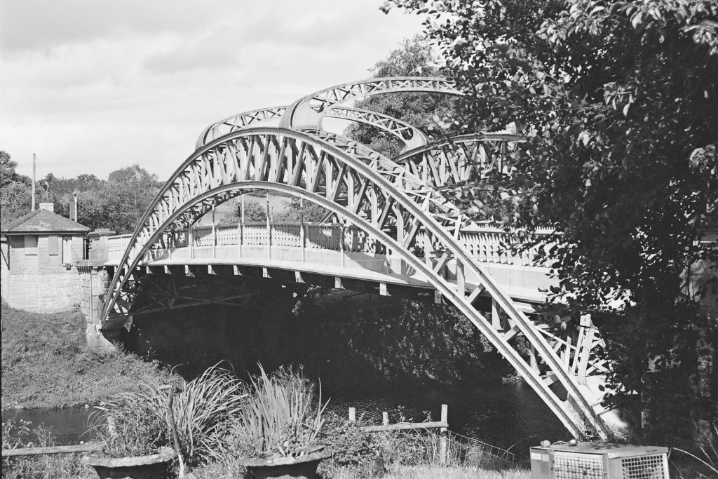
The chain bridge, in black and white. In colour it’s an oddly attractive pastel green.
Rehydrated I carried on to Abergavenny then onto the A465 and the revelation that is the Head of the Valley’s Road. I knew this road headed west but had no idea what to expect. As far as I knew the only major road in south Wales was the M4, which I’d vowed to avoid if I could. The first thing I noticed as I drove away from Abergavenny was the enormity of the rain that suddenly appeared from nowhere and within seconds turned the dual carriageway into a fast-flowing riverbed. The flash flood was so extreme that for the first time in my driving career every other driver slowed down to around 30 miles an hour and took extreme care (I know, I was shocked at having no-one diss).
After ten minutes or so the rains passed, and now in bright sunshine it was possible to get a better sense of the road, and to be fair, it was staggering. Obviously recently improved, the dual carriageway made its way upwards with hills and country to the north, and valley by valley, the old coalmining towns of fame to the south. Blaenavon, Abertillery, Ebbw Vale, Tredegar and then Merthyr Tydfil, just to name a few. This was an impressive and at times spectacular piece of infrastructure, which, it seems, had only been completed in May 2025. It was hard to imagine that not so long ago it would have been a two-way high road with an endless stream of open topped lorries lugging wood and various carbon-based minerals east to west and then south, beset by roadworks, traffic jams and all happening in black and white. If, and when, I come this way again, the A465 is the road for me. And, for context, if I’m to carry on cresting counties, I’m going to have to come back this way as several of the “tops” are on the slopes just to the north of the road.
Before we get to where we’re going with this account, there is something I need to say about Welsh road signs. And before I say it, I wish to make it clear that it’s my problem, no one else’s (coward!). * So far, it had been so good. What I mean by this is that by and large I had coped with the road signs, primarily because I was familiar with most of the names of the towns en-route. Welsh road signs (in case you’ve not been) are in Welsh and then English. The problem for any non-Welsh speaker is that it’s got to be one of the most impenetrable languages on the planet. I’ve been to quite a few European countries and despite not knowing the languages usually manage to get around fairly easily. Even in Greece, where a lot of the road signs appear in the demotic Greek alphabet, I can usually get a grasp of the look and sound to help me on my way. Sadly, and to my shame, I can’t say the same about Welsh.
Past Merthyr Tydfil I was instantly out of my depth (having yet to get my phone to successfully pair with the in-car audio system) as the road signs came and went without me having the time to fully digest their meaning (the Welsh appears first). To reach Mynydd Y Betwys, the “top” of Swansea and my chosen second “top” of the day, I first had to get to a place called Glynneath, about ten miles west of Merthyr. For the life of me I couldn’t get this to stick in my brain – and it’s an easy one! I had pulled off the A465 twice to check my location before eventually reaching the Glynneath junction. It wasn’t the name that helped me identify the junction but the fact that I had looked at the map so many times I was interpreting the topography and landscape rather than the signage.
Past Glynneath I was now on the A4109 heading up a steep hill and with the radiator grill of a huge articulated lorry looming close in the rear-view mirror. My little old Ford had no gear equal to the challenge and all I could do was metaphorically close my eyes, grip the steering wheel, and hope. Towards the top of this long drag I was eventually able to get clear of the maniac but for a minute or two I had felt like Dennis Weaver in the exemplary thriller Duel.
By now, the road signs had become irrelevant. I was driving by wire and instinct. I knew I needed to get to a place that started with a Y, followed by at least twelve other letters that could have been in any order, and I would never have been able to pronounce it. At one point the road forked in two and taking the left fork, I immediately decided to stop to get my bearings. I got out the phone and looked for the town which started with a Y and decided I had taken the wrong fork. As I put down the phone and set off, I checked the rear mirror (as you do) and there, parked up, twenty-five metres back, on the other side of the road, was the lorry. Don’t panic, it was just a film for forks sake! I made a swift exit onto the A4221. If I could just make it to Y……….. surely I’d be safe. **
The town beginning with Y was a place called Yynnwddsypondywynnagogo. No, of course it wasn’t. It was actually called Ystradglylias, a large town that I had never heard of before. And it wasn’t the only one. There were loads of them. Given that (unaccountably) 2% of my DNA is south Wales I’m ashamed of my ignorance of these places.
Anyway, past Ystradglylias I headed on down the A4067 (the main Swansea road), turned right into Pontardawe and then further inland on the A474. Lost again I pulled over and punched in the destination on my phone. I knew I was close but with my complete inability to absorb any of the information being presented on the road signs I might as well have been shooting at ducks in the night. Ok, so all I had to do, according to Google maps, was to keep heading north on the A474 and take the first left and then uphill for a mile or so and then… well, I’d check again then.
I took the first left onto a small road that headed down into a small valley. So far so good. I reached a municipal recycling centre on the right. The road continued west, but a sign, helpfully in English (No Entry), unhelpfully claimed that further progress was, if not illegal, then certainly not possible. Despite the wondrous progress made on the A465 I had been driving for over two and a half hours. The thought of turning around and trying to navigate another route now was a tad demoralising. Well, whatever was going to happened next, I could only try, and so long as the nutter in the lorry wasn’t coming the opposite way it would probably be okay.
Just past the prohibitive sign the road narrowed rapidly and then started tracking steeply up and around super tight bends. It reminded me of the sort of roads that in the 1970s, those of a sportier spirit drove small low bodied cars up as fast as they could just to find out how quickly it could be done and as a bonus appear on Saturday afternoon TV. But I wasn’t in a sporty mood and made every effort to reach the top in a record slow time, aware that at any moment I might be confronted by a large slab of concrete.
Coming towards the top a tiny wedge of land opened to my right – just large enough for me to pull over to check the view and how close I was to the edge.
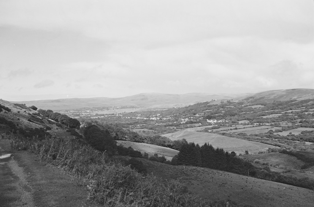
How Green was my Valley? Hmm… wrong film colour! The Upper Glyndach River valley
The road soon reached a plateau. Turning right I was now heading west on a straight road crossing moorland that offered up impressive views in every direction, and numerous sheep that hadn’t yet worked out sensible kerbside etiquette. The road descended again, this time into the Lower Glyndach River valley before ascending steeply again up to another plateau.
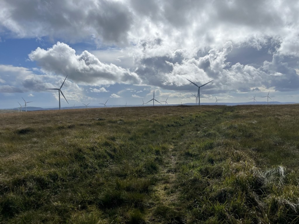
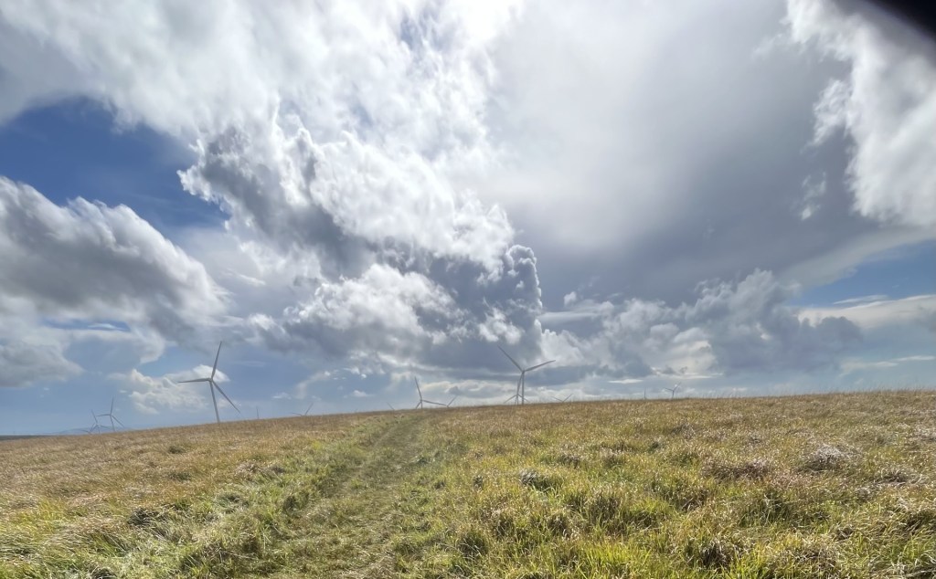
I pulled over again to appreciate the view, which now included an impressive set of wind turbines stretching away to the north.
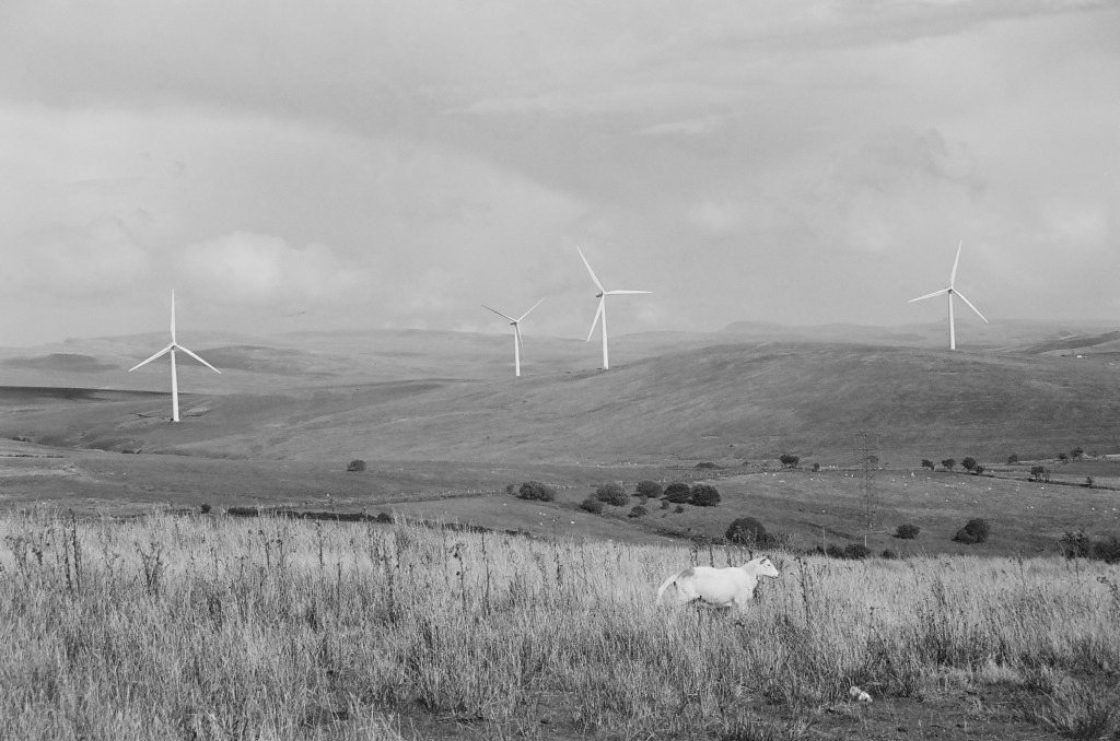
Wind mining and the noble sheep
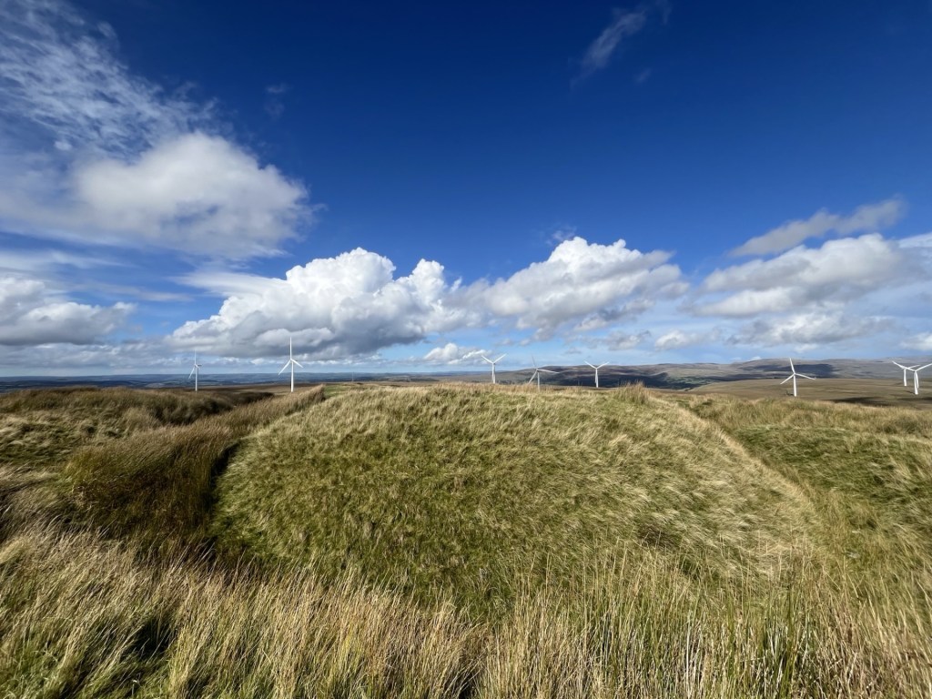
After the short stop the road curved round to the south-west. Wind turbines were popping up all around. An impressive sight, and no doubt an impressive site. A left turn (my mental map was now switched on and working), and the road continued around the contour until on the left a sliver of a stopping place that I had noted on Google earth presented itself. I wondered about the legitimacy of parking at this spot. Whilst there was no signage to indicate it was a passing point, and the road was reasonably wide; it remained a very exposed spot. I rationalised that the “top” wasn’t too far to the east and given that there wasn’t another vehicle in sight I locked up and set off up the slight incline across the boggy moor. If it hadn’t been such a dry summer the ground underfoot would have been a boot sucking minefield, but as it was it was sufficiently tolerable to make good progress. Sheep and turbines abounded at the top, which was no more than 100 metres from the road.
The approximate top – Mynydd Y Betwys
I knew to carry on for another hundred metres or so to reach the little treasure on the top.
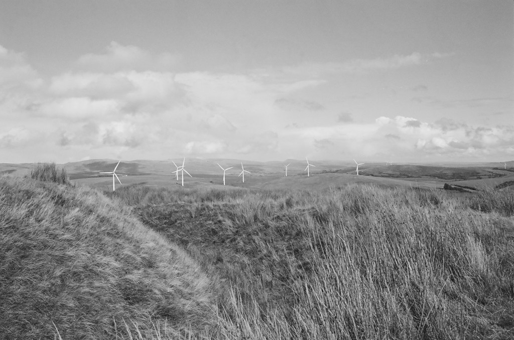
Even when I found it, it wasn’t entirely obvious, but slowly the low ditch and ramparts of Penlle’r Castell emerged. I had assumed it was an Iron Age structure but turns out it was more likely to have been a medieval stronghold of some sort. What exactly they would have been strongholding against wasn’t entirely clear (Knights tilting at windmills perhaps), but the views in all directions were remarkable.
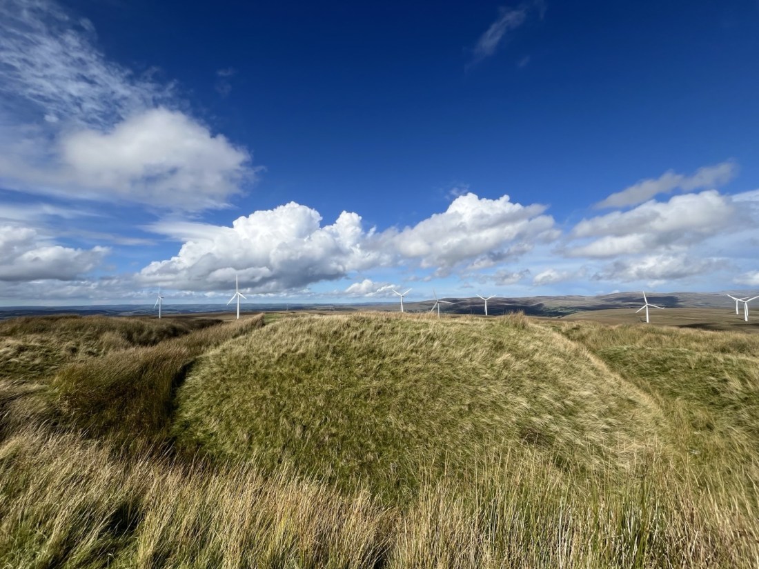
Penlle’r Castell looking north
Penlle’r Castell looking east and as it would have appeared in the 13th century
I skipped across the sphagnum, moorland grass and sheep offerings and back to the car. The wind was hammering in from the west, and the turbines were doing their job. I may have said it before but word from across the pond is that wind turbines are already old technology. Apparently, they are a waste of money, that there is no climate change problem to worry about and they are a blight on golfing landscapes (I’m sure someone once said the same thing about golf courses). Seems that there’s a new technology in town and it ticks all the boxes. Spelt OIL. It’s great to know they have our backs. ***
Big Wheels Keep on Turning, grouse moors keep on burning.
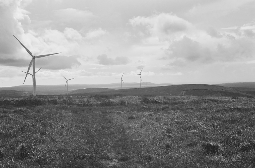
There were no plunging views from the top of Mynydd Y Betwys but you could see for tens of miles in every direction. A gem of a low peak where the energy of the movement of the earth and the seas is trying to turn the tables. It may be too late, but at least someone’s trying.
Can you tell what the forecast was?
I still had 70 odd miles to go in the day, and so it was a relief to find the car still there beyond the roadside ditch. And not a lorry in sight!
*It’s probably just as well that hardly anyone reads these accounts as I am sure if anyone did I would be in hot water over this observation.
** I didn’t see the lorry again and rationalised that the driver had stopped for the very same reason I had. English and lost.
***US oil companies generously donated $445million to Trump’s last election campaign! Who could possibly tell?
