Cresting the County – Wiltshire

Milk Hill

Metres 294

Feet 965

30th July 2025

Two Walks and a Migraine

It was Wednesday. I’d spent two nights in Bristol with my daughter at short notice and was now due to head home. However, something was in the air. Something that suggested I was about to have an unpredictable, intense and taxing experience over the coming weeks (accidents will happen). For the moment at least my brother was on the case. To break the journey back and buy myself a bit of me time before the storm broke, I decided to book a night in a room in Marlborough.

We were in the kitchen (my daughter and I), chatting away and about to go for a therapeutic walk when, for no reason I could fathom (it’s often that way), I spotted the first nondescript but telling sign of an oncoming migraine. Well, that instantaneously knocked the edge off the day! “Ready for our walk Dad?”

As the insidious black and white geometric pattern started to flesh itself out, I closed my eyes. My daughter had enough on her plate and here I was slipping into instant fug. Ten minutes later, against my better judgement and experience, I decided to throw the migraine into the metaphorical bin and put my boots on. “Let’s go.”

Without overdoing it we managed an interesting three mile walk through the Coombe Brook nature reserve and along the Bristol and Bath Railway Path, a fascinating combination of dells, glens, playing fields, open heath and industrial heritage. It will have to be done again when I’m not having to half close my eyes to keep out the light.

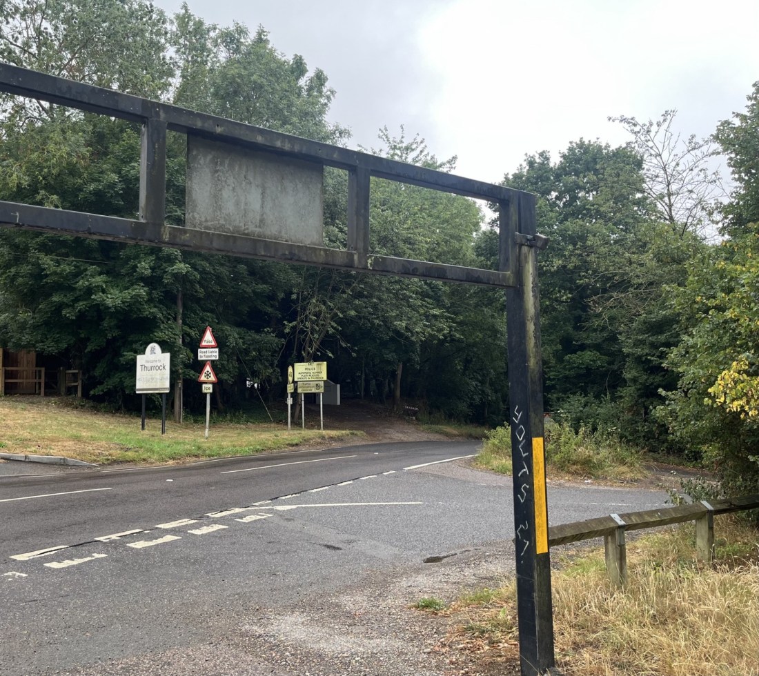
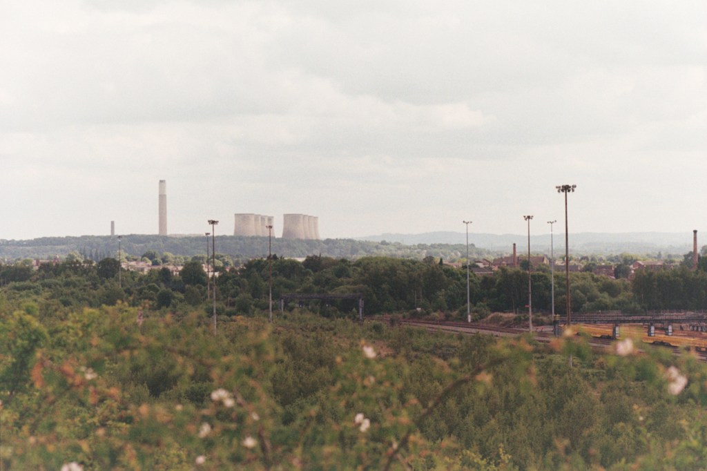
This new strategy seemed to have worked, for the moment at least, and I was feeling good enough to set off to Marlborough. We said our goodbyes and soon I was driving east towards Chippenham. Past Chippenham, which just seven weeks on I can’t remember a thing about, I carried on through Calne and continued directly east on the A4. I was heading for Milk Hill, the highest point in Wiltshire. I had done some basic research and noted that somewhere near to the site was a white horse carved into the chalk. And so, as I passed out of the small town of Cherhill and noticing what appeared to be something that looked like a white horse on the north-west facing slope of a range of hills, I assumed I was getting close. I stopped in a layby just past the town and got out to survey the scene.

The first thing I should say is that as white horses carved into chalk go, it was a bit of a disappointment. It looked more like a cross between a stunted giraffe and a starving hyena. It certainly lacked the surrealist brilliance of the truly ancient Uffington white horse I’d seen the previous September, or the starkly beautiful and anatomically accurate Bratton White Horse near Westbury (visited in 2023 but not in the county tops list).

The Cherhill white creature and, at the time, an unidentified interstellar communication device.  

Scanning to the right, along the ridge and unavoidable to the eye, a massive stone pointy thing thrust upwards. A commemorative structure of some sort, no doubt, but not necessarily what I had expected, unless it marked the top of Milk Hill. *

I figured that all I had to do was drive on a bit and eventually I would come to a turning to the right that would get me closer to the top (I had previously done a journey planner on Google where a small road ran a good way up towards the top of Milk Hill). I drove on but nothing materialised. I reached a roundabout at a place called Beckhampton. Things weren’t making any sense. I pulled over again and tried to re-orientate. I had another go at entering a route on the phone, and I was told to carry on east and then turn right onto a small road at West Kennett.

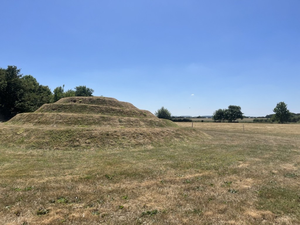
There always seems to be a complication when I’m trying to find these spots. I’ve concluded that the complication is me, and my increasing lack of engagement with new tech. I think this is in part because I don’t want to know everything. Knowing everything means there are no surprises. So, when five minutes on and a bit further down the road I noticed a familiar conical shaped hill just to the left of the A4 I was genuinely surprised and delighted. It had been many decades since I had last gazed at Silbury Hill, and there was time for another quick stop.

Silbury Hill in its original un-grassed state – as re-imagined

After a few minutes of contemplation (Why? Well, because when you see Silbury Hill you do have to wonder) I carried on to West Kennett and located Gunsite Road on the right which, according to Google, was going to take me to within touching distance of Milk Hill (check it out, the blue line takes you to within 300 metres). **

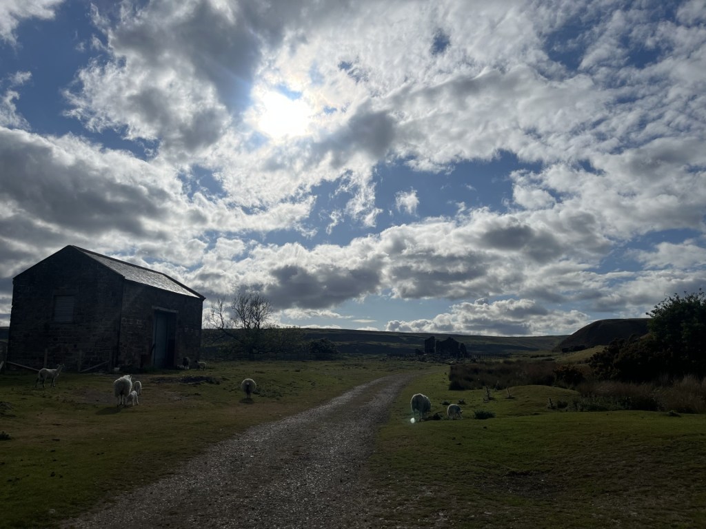
The narrow road headed south and slowly up. A large farm building emerged to my left, and then, just around a corner, a heavy metal gate blocking further progress. This hadn’t been in the script. I stopped and inspected the obstacle. Locked, along with a second metal gate just to the right where another road led away to the west! This was an unexpected blow, but it was obvious that I wasn’t going to be getting near the top on four wheels. Conscious of my delicate condition (I have occasionally had more than one migraine in a day), I turned the car around and headed back towards the A4. Just before reaching the end of Gunsite Road, I noticed a car parked up on a small patch of dry ground just off the road. I pulled in behind and spent a few moments considering my position. My body was weak, that was for sure, but I’d come a long way and doubted that I’d be back this way anytime soon. It was mid-afternoon. A bright sunny day, and not too hot. Sod it.

With my walking boots on I headed back to the locked gate and then onwards along a concrete road that continued south and gradually up. I had by now lost any concept of where the top of Milk Hill was, or even if I was on the right track. It was just a question of keeping on walking, and so long as I was going up, I stood something of a chance. Looking back, I noticed a small number of people dotted around an unusual hump in the landscape on an adjacent rise.

An old barrow. See **** for extra extraordinary information.

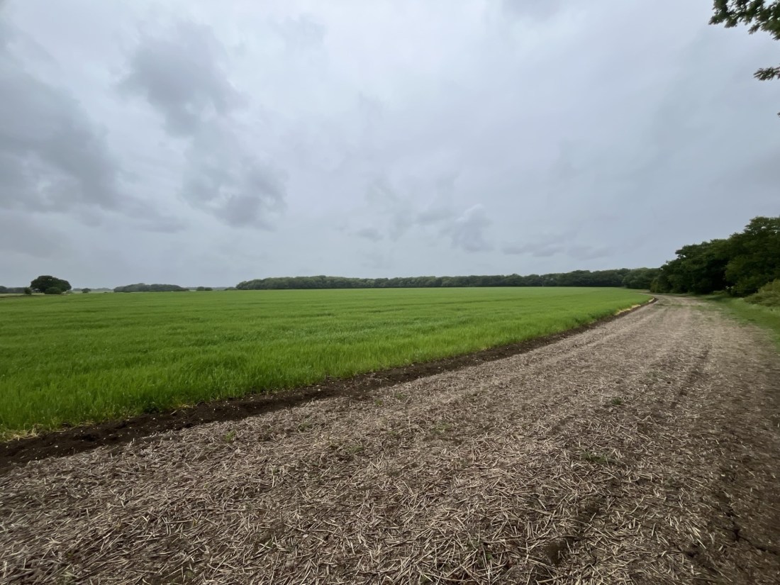
I had seen a sign earlier to West Kennett Long Barrow. Judging by the small gathering of people clambering over the mound I figured I was now looking at it and wondered if I had ever been to it. I’d certainly been to Silbury hill many decades before, but nothing came back to me to suggest I had been to the barrow. It was too far away now to divert me just so I could tick a box. I carried on along the concrete road, slightly out of breath, until it levelled off for a while and I reached an isolated barn structure where the road bore to the left. By now the landscape was opening out and I could see what appeared to be the higher ridge stretching east to west a mile or so further to the south. I had more than once toyed with the idea of calling it a day and retreating, but now the objective seemed to be tantalisingly close. I chose to go on.

The first sight of the higher ridge

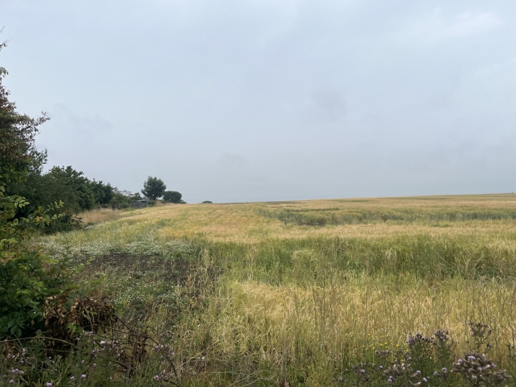
I expected at some point to find a path that would take me on a direct course but nothing materialised and at the next collection of farm buildings a sign proclaimed the land to be private property, whilst another claimed that CCTV was in operation to prevent rural crime. Whilst sympathetic to the farmers’ need to protect assets and knowing that rural crime is a blight, I hadn’t come this far (still with the threat of a migraine in the back of my mind) to be deterred by these notifications. Rightly or wrongly, I carried on, conscious that my progress/trespass might be being monitored. The road veered back southeast and continued up past huge fields to either side. Stopping to catch my breath I took a 360 look around. Far to the west, at least three miles away, and rising dominantly above the ridge, it was impossible to miss the enormous obelisk I had seen back at Cherhill. Well, that at least told me I had been entirely misguided in my assumption that it might have marked the top of Milk Hill. Despite all the gadgets I had become seriously disoriented and regretted not having an Ordinance Survey map to provide a degree of certainty.

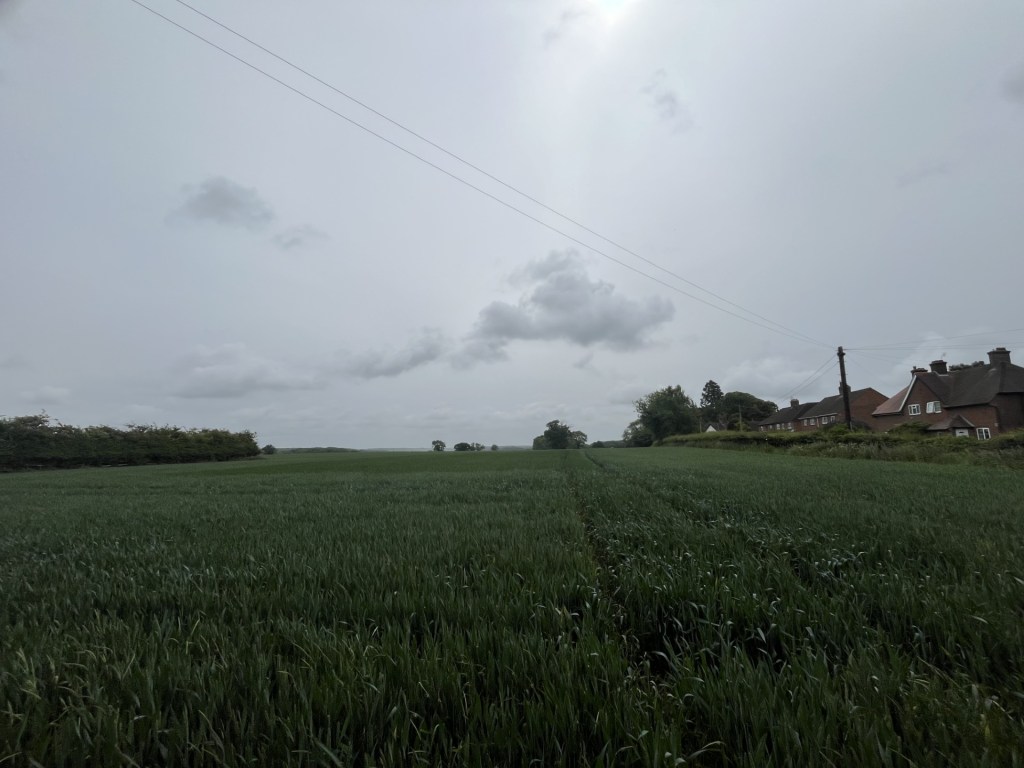
I ploughed on up. Towards what I hoped was near the top, the road intersected with another that led up a steep slope from a valley below. Using this road I soon reached a gate and an information board that hinted that at last I might be close to the top. A path headed directly south across a grassed field and towards some trees, with another cultivated field to the left. Precisely what was being cultivated was unclear to me, but I had little doubt I was looking at Milk Hill, with the highest point a hundred or so metres beyond the barbed wire.

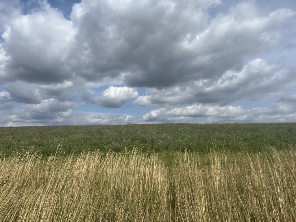
Here’s looking at the top – Milk Hill

Maybe somewhere a path led to the top, but from what I could see it seemed unlikely. I had done as much as I could, and frankly, by now I was more impressed with the magnificent and commanding views of the Vale of Pewsey opening to the south. I still had some reserves in me so carried on along the edge of the field until, with no white horse to be seen, I decided to stop. The reason for stopping was simple. Scattered randomly across the grass were a number of limestone boulders that made perfect seats. They looked entirely comfortable in these surroundings, but as I sat and took in the views, I was left wondering. Wasn’t this chalkland? ***

Unaccountable erratic’s

The landscape looked familiar, yet unfamiliar at the same time. I’d seen a view not dissimilar to this before and it slowly began to occur to me that about twenty years before, along with my son, we had been on these hills, having camped for a couple of days at nearby Pewsey.

I’d pushed my luck getting to this point and decided to abandon the idea of seeking out the white horse. I started back the way I had come. Back on the concrete track and looking west the outline of a huge ditch snaked along the top of the ridge and towards the horizon. Hoping to get a dramatic picture of what was clearly a man-made structure dappled in light and shade, I waited a while for the right combination of sun and shadow. As neither presented themselves and I was getting bored, I took a shot anyway, just at the moment a red kite swung into view. Despite this interesting moment, it remained a disappointing photo.

A disappointing photo of the Wansdyke and a rhyming red kite.

Down I went, now with three or four red kites circling the adjacent fields, and then passing the group of buildings with the CCTV. Happily, there was no one there with a pitchfork to challenge me. A movement to my left and a hare dashed out of some crops, stopped for a moment and then darted at immense speed into more crops. Hare coursing remains a significant rural activity. Those who do it would call it a “sport”. Because it’s illegal it’s not a sport, thankfully. How anyone might get a kick out of setting dogs on one of these stunning creatures is beyond me, but then again, I’m just a townie, so what do I know about the country ways, but it might have explained the CCTV.

As I approached the second solitary barn there was an odd but slightly disturbing thumping noise coming from its general direction. So far, apart from one large harvester in a distant field, I hadn’t seen anyone and whatever was going on inside the structure didn’t sound like it was being generated by a human. Being in Wiltshire, a county steeped in ancient mysticism and crop circles, I moved towards the structure, which was nothing more than a corrugated roof, some metal supports and a few bundles of hay. The knocking noises continued. Suddenly there it was, the source. A deer, quite large but type unsure and clearly startled, skipping around at the back, and trying to escape…. from me!

The poor thing was in a terrible panic. I stood still trying not to make the situation worse. Its problem was that it was trying to get under a corrugated panel and into the field beyond by throwing itself at the light, but its small downy horns kept hitting the metal sheeting and knocking it back. On the third or fourth attempt it eventually managed to hunch low enough and with a final, slightly sickening thud, it scraped under and vanished. For no logical reason I felt slightly guilty for the animal’s discomfort but rationalised that they were hardy creatures and probably found themselves in similar pickles daily.

Silbury Hill and West Kennett Long Barrow from Gunsite Road

I carried on down the road where, to my surprise, a car suddenly appeared coming up what must have been a subsidiary road. This was the moment I thought I would be challenged. But it wasn’t. The car carried on down Gunsite Road. **** Moments later two further vehicles were behind me. I moved over. This was all getting a bit too Southern Comfort for me, but whoever they were (farm workers knocking off for the day I guessed), they passed on by before pulling up a couple of hundred metres ahead at the locked gate, which they opened with ease and disappeared.

I reached the gate a couple of minutes later. It had been locked again, and I noticed that the bridleway sign, which had been upright earlier, was now on its side and lying in a ditch. Sometimes there’s no point in trying to rationalise things. The good news was that I hadn’t experienced another migraine, and the car was still where I had left it. I remembered to stop the walker App. Six miles!!! What had I been thinking? I collapsed into the driver’s seat. I had one night in Marlborough before what I knew were going to be exhausting and challenging weeks ahead. Despite the sudden onset of knackerdom I knew I had made the right call. I’d breathed in the heady Wiltshire air and seen its ups and grassy Downs, I was ready.

* The enormous monument was erected by the 3rd Marquess of Landsdowne (who he?), in honour of one of his ancestors. The Petty-FitzMaurice’s have been around a very long time, and one of them was even Prime Minister around the time the French were despatching with their own aristos. From what I can tell the 9th Marquess still sits, unelected but inherited, in the House of Lords.  

** As at the end of 2025, if you look on Google Street view you can see that the gate is unlocked and just inside the field several cars are parked up. Daytripper’s/hare coursers? Nearby a sign states, “private property”. One way or the other the landowner has since decided to secure the premises and this may be legitimate, but by locking the gate she/he has also blocked a signed byway (thus preventing onward horse travel).

*** It took a while and a lot of searching but I’ve since concluded that the erratic’s at the top of the chalk weren’t limestone but in fact sarsen stones. How they came to be there is unclear (see infinite theories on Stonehenge). The logical answer is by glaciation, but maybe human action too.

**** Well blow me down!!! I decided to see why Gunsite Road was called what it was called and came across this little article (which suggests it once led to a firing range). Just up the hill from the locked gate, going towards the long barrow, was the setting for the moment in Saving Private Ryan when the army officer and priest visit Mrs Ryan at her home on the plains of Utah to tell her three of her sons had died in action. A very moving scene.

https://www.sarsen.org/2019/08/gunsite-road-archaeology.html

Cresting the County – Thurrock (Unitary Authority)

Langdon Hill

Metres 116

Feet 381

2nd July 2025

There, or there abouts!

It was the last chapter of my East Anglian odyssey. Three days before (a Sunday) I had landed on a campsite in north Essex in a heatwave, found my way to the top of Suffolk the following sweltering day, and then the peaked Norfolk on Tuesday in perfect bright and breezy summer weather.

Today was Wednesday and after a long and tedious drive from Blakeney in Norfolk and having reached the twin peaks of Southend-on-Sea in warm drizzle, I was now heading west on the London Road, back into Essex and on towards the Unitary Authority of Thurrock. I don’t know why this large south-west chunk of Essex, now a Unitary Authority, is called Thurrock, but I have, on numerous occasions, called in for sustenance at Thurrock Services, on the M25 just north of the bridge. I’m just throwing that in to beef up the narrative, because the highest point in Thurrock is nowhere near the M25. 

To cut to the quick I left the A13 at Stanford-le-Hope and headed north on a country road (the B1007 to be precise). The road went up (which was a good sign) and at a junction with Old Church Hill a small car park presented itself on the left. I hadn’t researched this spot carefully enough. The precise location of the highest point had been ambiguous, but I sensed the car park was close and so pulled in.

Gravel Hill Wood car park

I stepped out of the car and looked around. My understanding of the precise location of the high spot was that it was on the other side of the road. The fact that there was a large sign proclaiming a welcome to Thurrock, suggested that it probably was. I locked the car and walked across the road, just far enough to put me past the Thurrock sign (the road itself happened to be in Essex, so no scope for confusion there then). There was an outbreak of signage at this point, warning of this that and the other but there was no evidence of a walker friendly path that might get me round to the back of the cluster of buildings laying between me and where I understood the high point to be. Looking back across the road my car sat alone, seemingly forlorn. It was early July, and from my knowledge of annual crime trends (crime peaks in July) my vehicle was probably more at risk than at any other time of the year. The thought of losing it, or its contents, at this precise moment overcame my desire to eke out a small peak victory and so I crossed back. The metal height restriction barrier at the entrance sported some graffiti that suggested it had been a sound decision.

Whoever Youth 21 were, I was evidently on their patch

I still wasn’t sure whether I had got close to the objective, and because the road continued uphill I drove on to where it reached an obvious crest, (passing the very quirky St Mary’s and All Saints church in the process). At the top I stopped in the car park of the Miller and Carter steakhouse, again leaving the car to have a quick gander. There were no sweeping views of Tilbury or Canvey Island. A large wooden structure confirmed this was the Langdon Hill County Park, but whether I was in Essex or Thurrock I was unable to say. I had done as much as I could. I may not have reached the exact highest point in Thurrock, but one way or another I was now, at least for a moment, at a slightly higher spot just above it, and I still had possession of my car.

The top of Langdon Hill, albeit it wasn’t Thurrock.

Cresting the County – Southend-on-Sea Unitary Authority

Heath Mount AND London Road

61 Metres

200 feet

2nd July 2025

Twin Peaks

The forecast was for persistent rain (the first significant precipitation in weeks) starting at 9am. So, when, half awake and in that contented slumber state, the first few heavy drops landed just inches above my head on whatever the modern version of canvas is these days, it was time to leap into action. It was 7am.

When I say leap, what I actually did was roll about for a few minutes in an effort to attach whatever bit of clothing was to hand to my body. Having eventually achieved a degree of decency I unzipped the tent flap and rolled out into the early misty morning day. Isolated large drops of rain landed all around, but it wasn’t yet the predicted downpour.

I rattled around for a bit, setting up the small gas burner, placing a tea bag in a mug whilst simultaneously pulling metal pegs from the rock-hard earth, and decanting various bits and bobs from inside my little mobile home and throwing them into the car boot. It’s surprising what you can achieve when suitably motivated.

Twenty minutes later, suitably lubricated and with all evidence of human occupation removed from the two-metre square patch of grass that had been my bed for the previous two nights, I set off towards the “facilities” for a quick wash and brush up. As I set off, coming in the opposite direction was the friendly woman who ran the site, and I had last seen when checking in. At 7.50 in the morning, and with no other evidence of life, naturally my immediate thought was “what have I done?”

“Good morning,” she said as we neared. “Good morning,” I replied, “ehm… have I not paid you?”

“No, no…. I mean yes you have, but I saw you taking down your tent and just wanted to thank you for staying with us.”

This doesn’t happen in real life. I was genuinely surprised, thanked her back and then got on with my day. Naturally the site received a 5-star rating some days later.

I was going home but had factored in two more “tops” on my journey back. The first was going to be Southend-on-Sea Unitary Authority, and then, closer to London, Thurrock Unitary Authority. It was going to be a long journey down through Norfolk, Suffolk and then Essex, but it was still early, and I was set on the idea of pulling over at the first greasy spoon (AKA diner) on whatever A roads I was going to be on, and getting stuck into a big breakfast and a large pot of tea.

I had a fairly good idea of the roads I was going to take and figured that something along the lines of the breakfast opportunity outlined above would materialise somewhere in the vicinity of the nearby town of Holt. As I approached Holt, the rain, which had stopped seconds after I had left the tent, began to show itself again, but before I knew it, I was beyond Holt with not a cafe in sight. Never mind, it would just be a matter of time before I came across a Happy Eater type roadside.

Time passed, as did countless fields, coppices and the occasional farm. I reached Norwich, which eased me onto a ring road not much shorter than the M25. Time continued to pass, as did countless fields, coppices and the occasional farm. I was now heading towards Ipswich, and so far, not a sniff of a mid-morning breakfast stop.

Under leaden skies that continued to threaten but not produce, I ploughed on south on the A140 and then, just west of Ipswich, on the A12 and towards London. It was late morning, and still not a hint of a roadside cafe or diner other than the occasional petrol station with their generic coffee brands and fast fat grab fests.

There’s always a moment in time when, despite the lofty principles, you have to admit defeat, and that came halfway between Colchester and Chelmsford. Apart from tap water and a small bag of mints, the longed-for breakfast had proved to be a dismal disappointment. With the adventure in Southend still ahead, I had to take an executive decision and pulled in at the BP petrol station just short of Witham. A sign just before the turning had indicated “services”, but (and at risk of legal action by the company in question), the ubiquitous global refreshments retailer outlet on offer suggested otherwise. Given I now had no option I shelled out some hard-won bucks for the soapy sludge they called coffee, and several more for a lump of stodgy dough that was shaped like a croissant. Out of the window, the long-awaited rain at last appeared. What an abject experience.

With “breakfast” now swishing around inside of me, I continued on to Chelmsford and then took the A130 directly south towards Southend. There had been one benefit from stopping at the “services”. I’d taken the opportunity to double check on my objective at Heath Mount. On previous checks I had not been entirely clear on the exact spot. I did another one of my random searches. The result on this occasion: “The highest point in Southend-on-Sea is London Road.”

London Road! What? I searched the London Road suggestion, and it was at least a mile away from Heath Mount. I went back to the source and read on. “Alternatively, and at an equal height, is Heath Mount.”

I had made an important discovery. An authority with twin peaks, although at just 61 metres perhaps twin flats was a more appropriate expectation. Either way I had found this out in just the nick of time. If I hadn’t discovered this till later, I doubt if I would have the enthusiasm, or indeed the life force enough to have returned. Looking at the two locations I decided to chalk off Heath Mount first, and by now had a pretty good idea where to go.

With the rain easing I pulled up on Belfairs Park Drive, a small cul-de-sac just off Woodside, another small road on an interwar estate just south of the A127, but nowhere near the centre of Southend, or indeed the sea.

On Belfairs and Woodside – the inspiration I am sure for many a suburban novel

At the end of the drive there was an entrance to some woods with occasional dog walkers entering and exiting. I walked into the appropriately named Belfair Woods and after a couple of hundred metres rationalised that I must have passed over the highest point, so returned to the car. There was no helpful sign to indicate it was Heath Mount, but I was satisfied that the first part of the mission had been accomplished.

Entrance to the Woods

The heady heights at 200 feet

Back at the car I checked my bearings and then set off, winding my way through unfamiliar streets until I reached the London Road (A13) where I turned right, eventually turning left into Tattershall Gardens and pulling over. There was another peak to conquer. I looked south and directly towards a grey smudge at the end of the straight road. Just a hint of the Thames through the drizzle. If it had been a brighter day, I might have been able to see the eastern tip of Canvey Island, but it wasn’t, so I didn’t (any excuse to slip in a Dr Feelgood reference). *

I walked back up to London Road. On the corner two children’s scooters lay abandoned on the greasy grass verge. Crime had reached a new low in these parts.

Within metres I was standing at the edge of Southend’s boundary with Essex and the town of Hadleigh. Other than a sign it would have been impossible to have distinguished between the two towns.

No ambiguity here

The back gardens of Tattershall Gardens backed onto a large field that largely sat in Essex. Looking south across the field the land appeared to be slightly higher at this point, sadly obscuring the estuary.

The rise of Hadleigh and towards the Thames

But it was Essex and the joint highest point in Southend was approximately somewhere on the pavement I was standing on and looking at a fenced off lump of wood that told a tall tale of some old tree or other being on this spot. There used to be a sign on the side of a modern building in Tavistock Square in London that stated, “Charles Dickens once lived in a house near this spot”. Someone with a sense of humour and objectivity had scrawled next to it “So what!” It was a well-made point and always used to make me smile. It’s gone now. I’m tempted to go back there one day and write on the same wall – “In memory of – So What”.

Maybe instead of a lump of wood commemorating a long-gone tree, a plaque on a large stone pointing out that this was the “joint” highest point in Southend might draw more interest. Just a thought.

So what?

I’d been to Southend-on-Sea several times over my life, mainly with the kids, but also on my bike. I had reached the end of the world’s longest pier (at least twice), and lost money in the arcades, so, on this bleak but humid day I had no desire to head down to the front. I still had one other objective for the day. The excitement of reaching the highest point in Thurrock Unitary Authority was rising and I needed to get going.

*I was going to insert the theme tune to Twin Peaks but having listened to it again for the first time in more than thirty years it’s far too mournful and depressing so here’s some Feelgood instead. Canvey Islands finest assaulting a defenceless French ville in 1976

Cresting the County – Norfolk

Beacon Hill – Roman Camp

105 Metres

344 Feet

1st July 2025

I see no ships

I knew I had landed in Norfolk when I drove past a large sign saying so, but which added that I was also entering Nelson country. It was, apparently, the hottest day of the year so far (so far there had been too many already), and had just reached the top of Suffolk at Great Wood. I was heading for Norfolk’s north coast and a campsite just outside the village of Blakeney, a place I knew nothing about.

Almost as soon as I entered Norfolk the scenery changed. Mile upon mile of heathland and conifers marked out the impressive Breckland landscape, which, prior to undertaking the high points challenge, I had assumed would be where Norfolk’s high point would be found. Apparently not.

I reached the campsite late in the afternoon and was offered the choice of two remaining pitches. One was next to the cleaning facility, the other by a hedge next to the nearby road. The appeal of being close to the toilets was enticing, but something told me to take the other option. After pitching the tent, I needed to take the opportunity of using the facilities, and as I approached in the baking heat, realised that I had made the right call. The septic tank might have been doing its best but there was no mistake – this was another type of county “high”.

In need of food, and having blown my options the previous evening, I walked into town. All I knew about Blakeney was that it was a great spot to see seals, but I had also just read that it had the highest number of exclusive homes in the UK that had been subject to charity lotteries through Omaze, a phenomenon that I simply can’t get my head around. In a town near me a huge modern oligarch type bunker was recently built on the site of an older family house. On completion it suddenly appeared on numerous feeds in one of these lotteries, going for £4m. Who would have thought we were in the middle of a housing crisis?

With the heat still pounding, I spent a while taking in the views around the creeks and then dived into the Kings Arms.

Up a creek

I had hoped to have sat outside, but understandably every seat was taken. It was like a sauna inside the bar. I ordered a meal and a pint and found a snug. The meal arrived within minutes and was as hot as the core of the sun. I had noticed a sign outside claiming that it was a Michelin star establishment. Based on the searing pile of mashed potato and molten gravy offered up, it wasn’t anymore. As I ate, more plates of food of mammoth proportions were being served up around the pub. Each delivery was met with a gasp of incredulity, or perhaps despair, by the customers, many of whom had already placed orders for desserts and were now regretting their enthusiasm. I managed to quell the burnt embers of what was left of my palate with another beer before heading on back to the campsite and promising to myself that I would make do with something from the nearby chippy the following evening.

The weather forecast for the following day was for a scorchio repeat. The night before my tent had been sited under trees and by a cool lake. There was none of that here on the exposed Norfolk field. So, when I woke up after a good night’s slumber, and hadn’t felt the immediate need to escape from an oven, it occurred to me that the weather had changed. And, on crawling out of the tent, it had. The sun was hidden behind low and intermittent clouds. A breeze was pulling in from the north-east and it felt that the sweltering heat had passed. After a couple of brews, it was time to head off to the day’s objective: Beacon Hill at West Runton.

I drove along the north Norfolk coast road, a satisfying journey through interesting looking towns, Cley next the Sea being the pearl. I stopped in Sheringham, ostensibly to grab a pie and a coffee. The best thing about parking up in Sheringham was that the car park serviced the North Norfolk Railway. As I was locking the car I heard the familiar rumble of a class 37 gunning up its distinctive diesel engine. I had my SLR camera on me and was desperate to get onto the platform to get some shots, but with all the flaffing around with bags and mobile phones there was no time to get there so I had to content myself with a quick snap on the phone from the other side of the tracks. 

The Class 37 leaving Sheringham – missing audio enhancement

The town was heaving and at the seafront the sun came and went behind scudding clouds whilst seahorses danced on excitable waves. It was a lovely day, but I was here to secure an interesting breakfast pastry. Walking back up the hectic high street, it became apparent that despite the huge number of food outlets, there was a homogeny common to most of our towns these days. It might just be me, but when the only options are fish and chips, and sausage rolls, we seem to have lost our culinary diversity. The problem was I couldn’t put my finger on it. Was I imagining some previous time that didn’t exist when it was possible to get pastries and tarts that consisted of more than just cheddar cheese and pork? * Either way in the end I had to settle for an average sausage roll from a local bakery. I retreated back to the station, grabbed a coffee nearby and watched the occasional engine moving up and down the line.

Classic diesel multiple unit action

Twenty minutes on and I was parking up on Sandy Lane, West Runton, and just above sea level. Beacon Hill is one of the few county tops that can be reasonably reached after starting any walk from sea-level. One of the few others is Ben Nevis, and here the comparison ends.

Confirmation I was in Norfolk

Some paths led away to the west and into woodland, but I knew that my objective lay almost directly up Sandy Lane and decided to go route one, rather than taking the risk of getting lost in the woods. It was a narrow road, and I had to keep my wits about me whenever a vehicle approached. Large Edwardian homes were set back off the road in dells and with extensive luxuriant grounds. Beyond the houses the beech and birch woodlands spread away on either side. After a kilometre or so I reached the brow of the hill and turned right on a track leading to a caravan site, opposite which was a sign for Roman Camp, the top of Beacon Hill. I read the information board which suggested that there is no evidence for any Roman activity at the site, and that whilst the location had seen some beacon like activity at various points in history, it all seemed a bit vague. A warning sign also warned of the risk of ticks. I was wearing shorts and now was now regretting I hadn’t brought my tweezers.

The top of Beacon Hill – and associated risk warnings

I walked across the flattened ground with its raised grass banking, and looked out to the north, past the trees and towards the North Sea. But there was nothing to see on the small segment of sea that I could see, so I carried on along the track that serviced the caravan site and gradually lost elevation.

No boats or ships to see through the trees and towards the distant sea. 

A couple of weeks ago (as I write), mass hysteria broke out on the beaches of Norfolk when a boat, whose crew were merrily rowing around the UK coast to raise money for charity, was wrongly identified as a vessel full of asylum seekers. Urgent Twitters were sent out by all and sundry, urging a Border Force intervention, and people gathered and marched along the beaches near Great Yarmouth to deter any landing. The local MP Rupert Lowe (ex-Reform, now Independent Witch-finder General) led the on-line charge (sorry – frenzy) and later had to apologise. Of course, this incident is no reflection on the people of Norfolk, the vast majority of whom would find this behaviour a tad indecent and recognise that the chance of a small rowing boat making it from mainland Europe to this coastline would be nothing short of miraculous. Horatio would have been impressed. I only mention this here because since I started this exercise, the xenophobic atmosphere has been escalating, and incidents like the one described here are becoming commonplace. Perhaps I should turn a blind eye, in the Nelson style, but…. Nah!

After a quarter of a mile, I picked a footpath down through the woods and heartland. A nice spot that you could spend some hours just chilling.

A better view

At the foot of the hill a lane headed back towards Sandy Lane with a field to the right. In that field I noticed several large horses. One, a bandy-legged large grey, was gazing at me from a distance. As I walked along the lane this particular individual followed my progress, either with menace, or simple curiosity. Getting closer it struck me that these horses, in particular the bandy-legged big white, were massive. I had realised that they were probably shire horses, but having only ever seen one or two in all my life, I was struck by their size.

Who you lookin’ at?

Outstared I moved on and was back at the car five minutes later.

Returning to the campsite and a quick brew, I legged it back into Blakeney. It was still relatively early, but I wanted to make sure I got to the chip shop before it closed (you never know these days). Guess what? It was closed. A sign indicated that it only opened early afternoons. WTF!!!! How bourgeois!

And so, it was back to the King’s Arms. The heat of the day before had gone so I was happier back in the bar but hesitant to order any more food. On a chalk board a parsnip, coriander and curry soup was being offered, with some bread, for just £7. After it had arrived and I had finished it off, I went to the bar. The woman behind the bar asked what I would like. “I just wanted to say that that was the best soup I have ever had.” And it was.

*A couple of days ago, while watching a TV drama, the main character was walking along a station platform. It must have been filmed a couple of years back because he passed by a closed up Delice de France. And it all came back to me. Once upon a time there had been a Delice de France in most towns, providing just a little bit more than the traditional bland. Now, from what I can see there are no more than a handful across the entire country.

Cresting the County – Suffolk

Great Wood

129 Metres

423 feet

30th June 2025

Hot Footing

The drought and high temperatures of early 2025 had been on-going for weeks, and the weather forecast for the coming days was something along the lines of “another heatwave”, “end of humanity”, “hotter than Athens”, “keep hydrated – unless you live in any of the regions that have run out of water”. You get the idea. I’m generally ok with high temperatures, but there’s something about heatwaves in England that can be stultifying.

Ten days earlier I had managed to spend a couple of sweltering weeks in Greece, where the cicadas sang and the sea breeze stole the heat. Those delights were not going to be available in the UK over the next few days so, with the great outdoors in mind, and a few basic necessities in the backseat of the car, on Sunday 29th June I drove to the village of Gosfield and pitched up under some trees next to Gosfield Lake. At that moment, under the shade, and with a wind from the lake, it was the coolest spot in Britain.

Water, water everywhere, but not a drop to spare

In the evening, I walked into town to seek food and drink from the local hostelry – The Kings Head. Naturally, being a Sunday they didn’t serve food (a tactical mistake on my behalf that required the purchase of three bags of peanuts to stave off disaster), and whilst I had thought when booking the site that I would be spending the night in Suffolk, judging by the accents in the bar (the lack of a soft rural burr was evident), a quick check revealed I had only managed to make it to north Essex.

My overnight stay in Gosfield was just a stepping stone on my journey towards Suffolk and Norfolk, where I hoped to capture the tops of both counties. Returning to the campsite from the Kings Head I noticed a huge old country house (Gosfield Hall) that displayed a variety of historical architectural styles. Once the home to several generations of Courtauld’s (textiles and central London gallery), many of whom now lay in the graveyard of the nearby St Catherine’s church, the rowdy shouting and screaming drifting across the fields betrayed its current status as a wedding venue. A big expensive wedding, in Essex, on a hot summer evening? The stuff of reality TV surely, but what would I know about such things?

Show me the way to go home

Back at the tent and the day-trippers had gone. When I had arrived the extensive site was occupied by large family groups enjoying the weather and surroundings. One family in particular, the one next to where I had pitched my tent, seemed to be very keen to advertise their presence by playing music, which could have been K-Pop for all I knew, at maximum volume through the car speakers and with all the doors open. I should state that these events took place nearly two months ago, but whilst I have been writing this account an email has just arrived from the campsite booking website saying that I haven’t yet reviewed Gosfield Park. I was certain that I had but never mind. What’s important is that had my noisy neighbours still been there on my return that evening, my review of the site would have been very different to what I probably wrote at the time – which was along the lines of it being a very pleasant location for a Sunday night and out of season, but that perhaps during school holidays it might be a different kettle of fish.

That night, as I slowly drifted off into a sleepless night, the souped up internal combustion engines of the local boy racers (presumably on their way home from the nearby wedding) filled the sweet summer air as they greased it up the small country road to the south of the lake; reminding me that the next day I would be in a different, and perhaps slightly quieter, county.

*

It was another scorching morning, and I was grateful for the shade under the old trees and the breeze from the lake as I took down the tent and decanted the site. I drove north along insanely quiet country roads, and at one point on a road I recognised from years before on a cycle ride out of north London, eventually arriving at the town of Clare (just over the border and into Suffolk). Thirsty, but also in need of a substantial calorific infusion after the disappointment of the King’s Head I stopped at the market square, grabbed some scram from the Co-op and took a short stroll around Clare’s blanched centre. I’d never heard of this place before, but it was an architectural gem, stuffed with houses and building going back centuries, with hardly any modern clutter.

After the regenerative input I carried on north, and again along tiny lanes that were almost traffic free. Arriving in the small hamlet of Rede, I parked up near All Saint’s church. The moment I stopped the air became suffocatingly hot. It didn’t seem like a lot but from the OS map (Landranger 155) that I unaccountably possessed, I had a three mile walk ahead of me. I was beginning to have second thoughts, but on the basis that it was extremely unlikely I’d be anywhere near here ever again I dragged myself out of the car with half a bottle of tepid water as my crutch.

All Saints Church – Rede. A handy sign proved invaluable

The church looked kind of interesting, so I ambled over to the grounds, aware that every eye behind the nearby cottage windows was probably on me. It being a church and yard, it was a peaceful spot. I walked along its northern flank, determined to remain in shadow, and became aware of frantic sounds from above. Looking up I could see several bird boxes tucked under the eaves, and every few seconds swallows would fly in and out. The noise of the hungry chicks inside was being amplified through small speakers set next to one or two of boxes. There are so many wrong things going on in the world at the moment, to see that someone had spent a bit of time providing nesting sites for these beautiful birds, and bringing their sounds to the ears of the occasional visitor restored a little bit of faith in humanity.

Bird songs of praise

I walked back to the road, turned right, and then almost immediately left onto a small road that quickly led into a large field. I flanked the northern edge of the field before hopping over a ditch into an adjacent uncultivated field where trees provided some cover. A large military aeroplane with one of those big radar attachments, circled above. A gate at the end of the field took me through a pasture where a sign suggested lurking horses. None were visible.

Another large field opened beyond the small coppice I had emerged from.

Target obtained – The Great Wood!

The path headed straight as an arrow towards what was perhaps the inappropriately named Great Wood. It was obvious where I needed to go, and the baking midday sun made it an imperative I got there as quickly as possible. Under normal circumstances the path should have been a doddle, but with the ground rain free for weeks, the numerous inch wide cracks in the earth required some careful navigation. On reaching the woods, the path continued around its flank to the north. Another field, protected by a wire fence, lay to my right. A sign indicated that it was being left to nature to encourage wildlife. It looked tatty but was clearly performing its designated function. Hundreds, if not thousands, of small white butterflies danced around in the air above the vegetation. These sorts of interventions in the countryside are controversial, particularly as we continue to import more and more food from the other side of the world, and, as evidenced this year, global warming is knocking the shit out of our crops. But, when you can see with your own eyes the astonishing fecundity of nature when we provide the necessary rebalancing habitat, you must be hopeful.    

A thousand small white butterflies – but you’ll have to take my word for it

A common brimstone butterfly, one of many gracing the Peloponnese two weeks earlier.

At the top of the field a huge construction site was generating some activity. An Anglian Water, pipeline and water storage facility the size of a football stadium. It’s infrastructure at least but whether it is too little too late, we’ll have to see.

Top Digger action at the water works

Flanking the works and along a path through shrubland I emerged onto a dusty road network, primarily servicing the construction traffic. From what I had researched the highest point wasn’t in the Great Wood, but directly opposite in a small thicket that sported a communication tower. Lots of warning signs warned of crossing the roads, and to be fair, I was duly warned. There was no point trying to explore further so I sat down on a plastic road barrier (which was bizarrely full of stagnant water that hinted at a mosquito breeding ground) and took a moment out of the sun.

Catching the rays at Suffolks highest point.

Looking at the map I could tell that there was an alternative route back to Rede and that at the end of this route the sign for a public house. It being a Monday, and it also being in the middle of nowhere, I had to accept that a cold soft drink at the end of the walk was unlikely, but it was incentive enough.

I wound back through the shrubby path and after a couple of false starts found the alternative path that took me through woodland to the south of the Great Wood. Despite the relative coolness of the glades, I was conscious of being slightly dehydrated. Emerging from the woods a track headed south-east along the edge of a vast field. Again, the heavily cracked earth made progress mildly treacherous, but eventually the track gave way to a metalled road, Pickard’s Lane. The lane continued into a complex of buildings that looked like a farm, but which seemed to be slightly more industrial. To the right a small field had been contoured and landscaped in an imaginative style, which included what looked like a miniature Glastonbury Tor.

East Anglia’s Avalon. If you’ve reached this point, you’ve gone too far.

A man was delivering some goods to the industrial building just beyond. If I continued along the lane, would I get back to Rede, I asked. No, it was private property (Pykards Hall to be precise), and I had to go back a bit where I would find a path heading north. The thought of any retreat by this stage was slightly depressing but it had to be done. Finding the path, I walked through more woods and eventually emerged at The Plough, which immediately spoke of bygone times and warm beer after a hard day in the fields.

The scene of the crime – The ex-Plough

Initial observations weren’t hopeful. As I suspected, being a Monday it appeared to be very much closed. And I wasn’t wrong. Indeed, it was so closed and devoid of any indication that a good beer, or other sustenance, could be procured that I had to conclude that the old Plough Inn was now very much a private home. I guess it didn’t surprise me too much, but it still felt like a rural murder had been committed. Why hadn’t this made national news?

Opposite the gutted remains of the pub stood a small and neat village hall. A woman with a small dog was sheltering under a nearby tree. As I passed, I said hello and asked her what had happened to the pub. She confirmed it had been closed for some years and was now a private home. Shucks! I thanked her and made for the car. As I passed the side of the hall, I noticed a flyer in one of the windows. A local character called Charlie Haylock was going to be doing a talk about the history of spoken English, at the hall on the 2nd of August, with proceeds going to the church. It might have been interesting, but I wasn’t going to be there, and I also wondered if I would have been able to sit through it without being reminded of Bob Fleming’s, Country Matters from the Fast Show, and not coughing out loud.

Charlie Haylock’s last gig

Walking the short distance back to the car, if Lee Van Cleef had stepped out from behind a post further down the road and spat a mouthful of tobacco into the curb, I wouldn’t have batted an eyelid. I opened the driver’s door to be met by an urgent escape of searingly hot air bursting out into the open, reminding me of the time I’d visited Ravenscraig steel foundry in the 1970’s.

I waited a few minutes before risking getting into the car. I guess I had enjoyed the walk, but it definitely hadn’t been the day to do it. I liked Rede too, though the murder of the pub had probably killed off the hamlet’s beating heart. Still, there was always the village hall and the occasional event, but you’d have had to be there, and it was time for me to vamoose. An ice-cold drink was calling from a faraway town

Cresting the County – Essex

Chrishall Common

147 Metres

482 feet

27th May 2025

The Only Way is Essex

I had been driving around the large and presumably ancient village green at Langley Upper Green for several minutes hopelessly trying to find a legitimate parking space. Not because every parking space was occupied; quite the opposite – there simply wasn’t anywhere to park. Despite my frustration I had to admire the fact that you could take in the sight of the green space without the slightest hint of painted metal and rubber. After several reconnoitres, I noticed a modern building with its own small car park located on the greens eastern flank. I parked up, searched high and low for any signs that might indicate a vehicle indiscretion and concluded it was safe.

I was at Langley Upper Green because, from what I could tell, it was the closest starting point to get to the highest point in Essex, and a spot called Chrishall Common. Half an hour or so before I had been to the top of Cambridgeshire, at the nearby village of Great Chishill. At 146 metres high, Great Chishall is 146 on the list of County and Unitary Authority tops. At 147 metres Chrishall Common is 145 on that same list (keeping up?). If that’s some strange symmetry, make of it what you wish. Or maybe call it a plateau. 

After weeks of drought and high temperatures, a gathering cold front was pulling low, grey but thinnish cloud in from the west and offering the possibility of rain. I pulled on a light anorak and set off across the green and towards the north-west corner, where I hoped to find a path into fields.

A gravel-based road ran along the north of the green, serving some houses on the northern edge, and then a handful of newer mock period houses ranged on the eastern edge. Not unattractive, and blessedly not gated off, but surprising given that I assumed the green had at one time been common land. Maybe it wasn’t. A look at a map from around 100 years earlier showed that the green then was about twice as large.

The green at Upper Langley – not yet gated

I found the path at the top of the green and then passed between two areas of land, possibly orchards that had been fenced off. This path led to a large field with a huge stack of hay, the size of a large building, that can be identified from space on Google earth.

Giant haystacks – The great Bale of Langley

A path flanked the field heading west and then a turn to the right and north and skirting another much larger field.

Sweeping up to the top

A stiff breeze brought with it spots of rain that threatened a possible deluge. It would have been very welcome, but never quite materialised. A large wood lay at the north of the field and stretched away several hundred metres to the west. As far as I understood it, the highest point in Essex was either in, or just beyond the line of trees. A path, identified by a post with multiple signs, led through the woods and into another field.

Every which way in Essex

If the highest point was somewhere in front of me, it was impossible to pinpoint it, and as far as I knew it could have been back in the woods. With the threat of increasing rainfall (which failed to materialise) I retreated to the southern field, and within fifteen minutes was back on the green.

Chrishall Common – The high point!

As a leg stretcher I quite enjoyed this short walk in a big flat landscape. Maybe the overcast conditions didn’t do it justice, and maybe it would be best enjoyed dressed to the max and traipsing across the fields in a February blizzard with the wind whipping in from the east.

A distressing discovery has emerged whilst writing up this account. Earlier in the year, and based on sound research, I had climbed to the highest point in Bristol at Cossham Memorial Hospital, Lodge Hill. So, as I was checking down the height information for this piece on the Peak Bagger list I noticed Bristol, but it was showing a different name!!!  What the what the???? Dundry Hill East! Dumbfounded, I did some searches and sure enough a recent article in Bristol Live explained that following a boundary change in 1949 Dundry Hill was quite a lot higher than Lodge Hill. Peak Bagger must have agreed and made the change. Finding this out means a lot of unpicking, but most distressingly requires another trip. Oh well, the joys.

Cresting the County – Cambridgeshire

Great Chishill

146 Metres

479 Feet

27th May 2025

Chishill for Life

I woke up in an hotel room in Cambridge, having chosen to break my journey home from North Yorkshire the day before. In the 16 hours I had been in the city not one person had tried to recruit me into the Communist Party, the Workers Revolutionary Party or the Russian secret service. I had, for once, to agree with all those doomsters who post on social media that the country really had gone to s..t.

Great Chishill, the highest point in Cambridgeshire, stands at 146 metres, and just so happens to be 146 on the list of County and Unitary Authority tops. Up until I researched this, I had assumed that the county with the lowest average land above sea-level was Norfolk, but several sites (including the Lord Lieutenant of Cambridgeshire’s own website) claim Cambridgeshire.  Cambridgeshire (according to my sources) is the flattest and lowest county in the UK, with an average height above sea level of not a lot and has the lowest point in the UK at a place caled Holme Fen, lying 9 feet below sea-level (about 40 miles from King’s Lynn, and the sea at the Wash). Just to complete the picture I was almost about to reveal that whilst Norfolk was not the county with the lowest average land height in the UK, its men were in fact the shortest, at an average of 5ft 6inches. This was revealed in 2016 by the Suffolk Gazette, apparently following “research”. Fortunately, I bothered to read beyond the first few paragraphs, which were convincing enough, until, in the fourth paragraph it stated the following:

“Researchers found the average man in Norfolk was only five feet six – while Norfolk women were also five feet six… wide.”

Call me old fashioned but at the time of writing I have refused (knowingly) to engage with any information provided by Artificial Intelligence. So, it was with some delight that when I checked back on this article, I noted that at the top of the feeds, the depressingly omnipresent AI Overview showed its “true” colours.

Nothing more needs to be said

But hey, I hear all one reader shout. What has any of this to do with the highest point in Cambridgeshire. Fair point. Let’s get back on track, literally.

Until 1895 Great Chishill was in Essex. The highest point in modern day Essex is a few miles away at a place called Chrishall Common. Standing one metre higher than its nearby, nearly namesake, Chrishall Common manages to come in at 145 on the tops hit parade. Judging by these statistics, when the inter-administrative prisoner exchange took place in 1895, Essex was clearly determined to hold onto its higher status. *

I left Cambridge mid-morning, drove south, and without too much difficulty drove into the small car park opposite the impressive St Swithin’s Church, Great Chishill; a large village with some impressive, thatched buildings on the approach.

The task was simple. Leave the car, walk south on Haydon Road, turn left onto Hall Lane and walk east until the highest point. There’s not a lot to say. I passed some houses on either side of the road until a well-resourced recreation ground and cricket pitch on the left. At approximately 300 metres into the walk, and again on the left, a field opened out. If you look on Google maps a pin drop titled Highest Point in Cambridgeshire, marks the spot. All of one person has rated it and left a review. Christian Goss – get a grip. This is not a 5-star site although I assume that the comment “Great spot, remember to take an oxygen mask though” was tongue in cheek. 

The highest point is somewhere in this photo

After a quick look over the field and being satisfied that I had reached the top of the county, I walked back to the crossroads and took a peek into the church grounds.

At the north side of the church, it was just possible, looking to the west, to get a view and a slight sense of height above other land, but to be fair it was marginal.

The sweeping vista to the north-west

The WW1 grave to Private Frank F Rogers of the Suffolk Regiment, who died aged 20 on 20th August 1916 carried the added poignancy of the additional gravestone to his older brother William, born in 1891 and who survived his younger brother by an incomprehensible sixty-nine years.

Brothers reunited

Just as I was leaving the grounds I heard a low drone coming from the west. Looking up, what appeared to be a Tiger Moth type biplane was slowly coming into view and began to circulate above the village before slowly turning back in the direction it had come from. On the way to Great Chishill I had passed Duxford Airfield. Duxford is part of the Imperial War Museum and sure enough (I checked later), for £209.00 (at the time of writing), you can go up in one of these WW2 training planes for 15 minutes. It’s impossible to escape the reminders of war.

Across the road and just before the car park a brick bus shelter offered shelter from the rain to the users of public transport, and a canvas for the imaginative. Most notably a remark, chalked into the brick – Chishill for Life. Several possibilities sprung to mind:

  • A local stonemasons motto promoting the health benefits of his or her trade
  • An errant resident whose crime resulted in a tag for life, limiting his or her movement beyond the village
  • A supporter of the local football team who, in a misplaced sense of place and aspiration, had attached their flag to the mast and won’t be turned – for ever!
  • The musings of an aspiring Steven Morrissey type, who’s seen the future and has accepted the brutal reality.
  • The last will and testament of a traveller who passed away waiting for the non-existent last bus out of town. I had noted a grave to the unknown traveller moments earlier.

Despite the damp but warm morning, I shivered at the thought of all the options above. There was nothing particularly exceptional about Great Chishill, nor was there anything particularly awful. It was entirely average, and I guess it was the thought of the very average for life that chilled me most. I drove out of town on Hall Lane as quickly as the speed limit allowed. Within a mile I was in Essex.

Chishill For Life – Be careful what you wish for

* None of the facts contained in this section can be verified 100% so take on board at your own risk.

Cresting the County – Leicestershire

Bardon Hill

278 metres

912 feet

26th May 2025

Above the Caldera

I was travelling from the Rosedale Valley in North Yorkshire, with the intention of spending the night in Cambridge. Five days earlier, on my journey north, and aiming for Nottingham, I had hoped to make an attempt on Bardon Hill in Leicestershire, but time was against me, so it had to be postponed. Earlier in the day, after eventually finding Stock Hill (the highest point in the City of York Unitary Authority area) I crawled south on the A1(M) and then the M1. It was a Bank Holiday Monday, and it was depressingly obvious.

When, over a year ago now, I started out on my quest to reach the tops of our counties, I was fairly confident that having climbed up to Old John in Bradgate Park (on at least two or three occasions over the years), Leicestershire was already in the bag. Bradgate Park lies to the north of Leicester and has a feel of a slice of lowland Scotland. I had first visited and climbed to the highest point (where the Old John folly adds a few more metres) in 1978, with my girlfriend. It had been a warm and sunny day when we caught a bus out of Leicester. Aww… a perfect picture, except, as we approached the summit, clouds rapidly began to gather. Within minutes the rain started to hammer down and all we had for cover was the small lintel of a door set into the tower facing away from the wind. The fun of the day quickly evaporated as the precipitation enveloped every nook and cranny, and as we slowly drowned in our light clothing, I was overcome by regret in my choice of activity in what was quickly becoming a seriously misguided attempt to impress (I was studying for a Geography degree – what can I say!). How did I feel? Inadequate. No worse. I could now empathise with King Lear:

Blow, winds, and crack your cheeks! rage! blow!

You cataracts and hurricanoes, spout

Till you have drench’d our steeples, drown’d the cocks!

You sulphurous and thought-executing fires,

Vaunt-couriers to oak-cleaving thunderbolts,

Singe my white head! And thou, all-shaking thunder,

Smite flat the thick rotundity o’ the world!

Crack nature’s moulds, an germens spill at once,

That make ingrateful man!

After the rain had passed so had the laughs. We traipsed off down the open slopes and back to the park entrance, where, to compound my juvenile insecurity, the last bus to Leicester had departed. There was nothing else to do but walk. On a road that may or may not have been heading back into Leicester a van pulled over, the occupants clearly having taken pity on us. My memory of exactly what happened next is hazy, but I do recall that by the time we got out we were nothing but relieved. Whilst the two men in the van may well have been acting out of charity; there had been an unsettling sub-text to their conversation that perhaps suggested another agenda. We eventually made it back into town and still wet through found sanctuary in a small pub where we dried out over a couple of wet ones.

But of course, for this account that story would have to be abandoned, because on double checking on the highest point in Leicestershire I discovered that Old John, whilst a significant and delightful high point, was overshadowed by the nearby Bardon Hill, just to the south of Coalville.

Leaving the M1 at junction 23, I navigated south and eventually parked up on Romans Crescent, a road passing through a pleasant newish estate on the edge of Coalville. I had previously researched the location on Google Maps and had taken a screen shot for reference. Despite the recent heatwaves, from what I could tell Coalville came with a rather troubling weather pattern of its own, where permafrost meets the temperate zone.

Fortunately, on the day I visited only warm drizzle filled the air. A short walk south and to an opening into a wooded area. The path extended further south with trees on the left and a wide field to the right extending slowly upwards. I had no idea what to expect on this walk. Despite having lived in Leicester for some years it had never registered that there was significant high ground to the north-west. I had read that from the top of Brandon Hill it was possible on a clear day to see the Malvern Hills, all the way to the south-west in Worcestershire. This seemed to me to be inconceivable, not just because Bardon Hill wasn’t exactly a mountain but because of the distance (around 70 miles at a guess). The other thing I knew was that at some point there was a quarry of some sort, but its extent remained unknown.

Just beyond the field – the boulders may have been a sign

With the field ending the path led into mature woodland, and just a short distance in a sign made it clear that something of interest probably lay ahead.

Oh! No, this is a sign. Well, you get the gist

The track continued and then an obvious upward path to the right indicated a steeper ascent. Continuing up through the woodland the gradient increased significantly, and after four or five minutes I was beginning to pant. The occasional dog walker passed by, going down. I was envious.

After maybe ten minutes the woodland began to retreat from the edge of the path, and slowly the land eased in its gravitas. The surroundings were now more heathland than woodland, with minor tracks leading away towards the quarry. I wasn’t too curious. There would be a view at the top I was certain. A large wooden bench and some smooth rocks presented a rest opportunity. For some reason I chose the rocks.

Resting point

After a few minutes I carried on up a short way to the top of the rise. A concrete structure sat to the right in some woods and the land beyond fell away. I had clearly reached the top.

The top? Obs…

Mission accomplished, I retreated to the bench and stone combo. A short distance to the left provided a partial view of the quarry looking north-west. I had expected to see something quite significant, but the size of the hole in the ground was far bigger than I had expected. Largely overgrown on its higher slopes I wondered if there were any items of a policeman’s uniform hidden in the undergrowth. If you are wondering why I was thinking this you’d be right to ask.

The view from near the bench

At the time of my visit there had been a national news story about a Leicestershire policeman whose helmet had been lost some twenty years earlier but had recently been found and recovered from a local quarry. He was delighted with the discovery but had no memory of how it was lost, or how it had ended up in the quarry. Quite why this was a national news story was bewildering. Perhaps Trump had lost his phone, or the Russian army was on a day off. Well, I reckon if you had lost your helmet on duty, you’d know about it and remember the moment. And if you couldn’t remember it, your colleagues would and would never let you forget. My best guess was that after a long shift on a Friday night, the squad had some down time where alcohol may have been consumed, and in a moment of abandon the helmet was disconnected from its appointed owner and hurled randomly in an unfortunate direction. Was I now looking down into the quarry in question, and at the scene of the crime? We will probably never know.

Back at the bench I concluded that I had fulfilled my obligation and so started my descent. About one hundred metres on, and another small path appeared to the left. Well, one more look wouldn’t harm. I reached the fence where the view to the west and south was more expansive than before. I looked up to the highest point. Hmmm…. It looked much higher than I had expected, and what was that feature near the edge? Ah! A trig point, and with that realisation an instantaneous sense of mission failure. The journey from York south had been painfully slow and I was keen to press on to Cambridge and some time to rest. But… and it was an important but, whilst I have contented myself with the notion that for various reasons I wasn’t always going to get to the very top of each county, falling a long way short, without adequate excuse, was inherently lame. Reluctantly, I was going to have to address the situation.

Trig warning – top left ☹

Back at the main path I trudged up to the bench and stone location, and then on to the point which I had previously considered the top of the hill. *

I noted that the path carried on, descending away to the right. I dutifully followed and after a short distance it began to rise again. About 100 metres on a large abandoned, graffiti covered building brightened up the overcast day.

The art of installation

The track meandered onwards, up and down, over rocks and through thickets. Not the easiest terrain. Emerging out of some woods, at last, I had reached the end of the journey. The trig point stood proudly ahead.

That’ll do

Clambering to the very top the view of the quarry was fully exposed, and despite its devastating impact on the hill, bleakly impressive. There was no sign of the Malvern Hills seventy miles to the south-west, but there was a battered information board, that by deduction must have been installed around thirty years earlier, given a reference (top left) to the “recent eruption at Montserrat, West Indies”. 1995 for the record.

An information board struggling to survive.

I moved over to the railings at the edge of the quarry. Looking down it was very obvious that it was still an on-going operation. The rock was volcanic, and the excavated material aggregate, something, when you think about it, we can’t do without. Once upon a time (570 million years ago by what I have read), a volcano had erupted and created the conditions which, an incomprehensible number of years later, allow us to extract the rock to build roads, support railway lines, and in more inhospitable parts of the country form the basis of paths and tracks that allow walkers and ramblers the opportunity to reach wild summits. No doubt soon after the eruptions stopped it would have been possible to stand on a lip of ground, much higher than today, and look down into the volcano’s caldera. Now I stood slightly aghast and looked down on a man-made caldera. It was overcast and grey, but on a sunny day, with its azure, blue lagoon, I suspected it would be of some strange beauty.

A large chunk of Leicestershire, now missing

I knew from an earlier check that this was not the only large quarry in the area. There were at least another two nearby. The Bardon Hill quarry produces 15% of the county’s aggregates. Whilst larger country’s boast much larger holes in the ground, by the UK’s standards, this is a big one and had been bolstering the nations infrastructure for around 400 years. Well, I’d found out a bit more about my land. I’d enjoyed the climb and what I’d found. If I lived locally I would be clambering up as often as possible (in the hope that on one very clear day I might just see the top of the Malvern Hills). Thirty minutes on and I was back at the car and soon after back on the M1.

An hour or two later, I was driving slowly into Cambridge from the north-west. No dreaming spires on show, but as I approached on Castle Street and looking directly ahead into the heart of the city, I conjured up images of Burgess and MacLean, Philby and Blunt (in no particular order). I turned left into Chesterton Lane, running along the north bank of the river Cam, arriving at the Arundel Hotel shortly afterwards. Parking up at the back and trying to fathom how I had managed to wangle a room here for £70 I soon found my way through to reception, passing a tall, lean fellow wearing a tweed jacket and carrying The Times, which carelessly enfolded a copy of the Morning Star. A woman was working in the office at the back, no doubt sending encrypted messages to Russia, Romania or the USA. She noticed my presence, smiled and approached the counter.

“Good evening,” she said. I smiled and thanked her. “Are you with the party sir?”

Momentarily taken aback I considered the question carefully. “No,” I replied, “just on my own.”

She handed me the keys, but as no further contact was made during my stay it can’t have been the correct response.

* “Top of the Hill” from the superlative album “Bandstand” by Leicestershire’s finest Family.

Cresting the County – City of York (Unitary Authority)

Stock Hill

43 Metres

141 Feet

26th May 2025

Drax Britannicus – All Roads Lead to York?

It took me three days longer than I had intended to reach the highest point in the Unitary Authority of York.

I had been heading north, with the intention of reaching the small village of Rosedale East, hidden in the seemingly forgotten but extraordinary Rosedale Valley in the North Yorks Moors National Park.

I had stopped for a couple of nights with my brother in Nottingham where, the day after Tottenham Hotspur had defeated Manchester United in the UEFA Europa League final, I had popped up to the highest point of the city at Mapperley. That night I explained what I was hoping to achieve over the coming days. It included what seems to have become an annual trip with my daughter and her partner J to a heritage railway. In this case it was to be the North Yorks Moor Railway. If there was time, we would also have a trip into York and take in the National Railway Museum (2025 is the 200th anniversary of the railways in Britain).

My brother piped up. “Do you remember when you took me there?” A vague memory began to form. I did, but only just. He reminded me that we had taken a train from Kings Cross, went to the museum, and returned to London the same day. He thought he was about ten years old, which meant that I would have been just fifteen! Well, I’ve checked and given that the museum only opened in September 1975 (50 years ago as it happens), I would have been at least seventeen and he, twelve. Nevertheless, it still surprised me that I had taken on the responsibility at the time.

I left Nottingham, and at Pontefract I dropped in to see my two Yorkshire based cousins where over two hours we caught up on a year’s worth of news, books and aches and pains. Suitably fed and watered I carried on up the A1(M). All I had to do was take a right at junction 44, and then by keeping to the A46 I would be able to tick off the top of York.

In the short time it took me to get to junction 44 I had seemingly forgotten the junction number and sailing merrily past it. Incomprehensible, but it wasn’t until signs for Thirsk and Ripon started appearing that it began to dawn on me something was amiss. I appeared to have been in a state of denial. Instinct eventually told me that I had shot my bolt, York was too many miles behind me now, and executive action was required. Leaving the A1(M) at last, I took towards Thirsk and then stuck to the A170, climbing up an improbably steep slope to the high ridge at Sutton Bank, before stopping at the excellent little town of Helmsley for some provisions. A text informed me that my comrades had reached the farm we were staying in. Good timing. According to the phone thing I was only 27 minutes away, and so texted back to say I would be there in a jiffy.

Past Kirkbymoorside I found the road that would take me as straight as an arrow to East Rosedale. At a place called Hutton-le-Hole I should have turned right (if only I had known!). Maybe I had been expecting to see a sign or something, or maybe I was just overwhelmed by the rough beauty of my surroundings, or maybe just at that moment a 4X4 had been trying to mate with the boot of my car, but for whatever reason before long I was driving along a barren moorland ridge with stunning views in all directions. Down to my right I could make out the Rosedale valley and I knew that at some point a road would appear that would take me down into the top of the valley and then the village.

Just past the Lion Inn on Blakey Ridge and sure enough the turning appeared. To my consternation a red sign stuck in the middle of the road stated that it was closed. A diversion sign pointed back the way I had come. Surely not!

When in doubt, “keep on going” is not my go to motto, but for whatever incomprehensible reason, on this occasion that is exactly what I did. Fifteen minutes later and I was doing a U-turn in the small town of Castleton (not to be confused with the pearl in the Peak District) and defeated, started to retrace my route.

Eventually, back at the closed road, I pulled over. My phone had been ringing. Despite every effort to understand how to execute a hands-off call in my car it remains a mystery to me. I suspect it must be broken. I called my daughter back. “Hmmm… no I wasn’t okay really. This road is closed, and I feel like a total dolt.” (Dolt is a medieval word now rarely used, so in truth that’s not the word I used, the actual being more Anglo-Saxon than polite Tudor). Don’t worry, she said, the road wasn’t really closed. They had used it.

Against my better judgement but now realising that to find another route was going to take at least another thirty minutes, I slipped past the sign as if I was under surveillance and headed along and then down the east side of the valley. And there it was. The road works! Fortunately, the boys from the black stuff had gone for the weekend, and there was just enough room to squeeze around the barriers. Against all the odds I had made it to the accommodation at just the moment the BBQ had started, and the bulk of the preparation had been completed. My lucky day!

The following day we took the slow train from Pickering to Whitby on the North Yorks Moors Railway. A spectacular route, but there were no steam trains were on duty. A month earlier one of them had sparked off a wildfire high on the moors, and the mile or so of destructive fire power was plain to see. Judging by the long-range weather forecast the chances of steam trains hauling passengers on the line will probably have to wait until the seasons end. A big shame for the heritage industry, but hey, for a while at least the kids would just have to get used to some diesel action instead.

Heritage Brush Type 2 at Whitby (built c1957 – we share the same birth year, which presumably puts me in the heritage category too).

Whitby was heaving, bright and breezy and perfect.

A nod to Martin Parr – Glorious Whitby

On the train back we agreed to head into York the following day.

We drove in and towards the National Railway Museum. Despite the early hour, we’d missed the chance to park nearby, having to settle instead for a more central location that charged Air Prk n Prk prices. In for a penny, in for £20 as they say, it looked like we were gonna spend the day. After an hour or two at the train museum, which naturally met expectations and which didn’t seem to have changed at all since 1975, we wandered into town. Busy, busy, busy, but looking good on an unexpectedly bright and squally day.

After passing the cathedral we slipped into the famous Shambles, and what must be something of a bull run for parents with pre-teen children. Every second shop was either an identikit sweet and fudge emporium or a Harry Potter merch crap shop (as I write the BBC are doing a York day on the radio, and by all accounts there are five!!). In horror we slipped out as quickly as we had slipped in. The last time I had been through the Shambles, sometime around 1981, it was certainly commercial but retained something of its mediaeval essence. I recall a quaint shop under which ran a Roman road, and the story was that from time to time the ghost of a Roman soldier could be seen walking through, at waist height! At waist height because the old road was a couple of feet below the current floor level. I was thinking about some fancy words to explain my position on ghostly spirits, but I’ll get on with it. I don’t believe in ghosts, but if I was to ever place credence on any ghost story at all, I’d have to give it to the torso of the Roman soldier, simply because of that quirky detail. Seriously folks, I’d rather see five Roman ghost shops than the H Potter exploitation outlets that have killed the vibe.

We carried on down to the Norman castle and back along the riverbank. Just before the Ouse Bridge crowds of drinkers and diners lined the embankment at Kings Staith. We stood outside the Kings Arms. The last time I had been here, in 1981, it would have been impossible to stand where we were now. Up from London with a friend who had no interest whatsoever in trains, but a keen interest in historic pubs (let’s be honest, all pubs), the only way to access the Kings Arms was from the adjacent street via the upper side door and clambering over sandbags. We ordered a couple of pints and went and sat at a table by one of the river fronted windows (see picture) where we gazed out as the Ouse gushed past us, just a foot or so under the window ledge. How exciting! Looking round one of us spotted a series of marks on the brick wall. They showed the levels the river had reached within the pub on previous flood occasions. We looked out at the raging torrent. Hmmm… it was still raining! It was down the hatch and away.

The Old Uninsurable – York

Given the Sahara-like conditions in Yorkshire since February, the chances of the Ouse flooding any time before this winter appeared remote but, on this occasion, we passed the Kings Arms and started to head back towards the car. At Museum Gardens we popped in for an ice-cream to find a Romano-British re-enactment taking place. We watched as nails were forged, leather studded, and wood worked. At the “how many different ways did the ancients invent to kill and main each other” three men dressed in full armourer’s garb demonstrated that the number of ways invented to kill an opponent appeared to be limitless. Slingers were in particular hideously murderous. A cohort of legionaries began to assemble. Twenty odd older men, dressed in combat wear and possibly slightly worse the wear from the mead, started to line up. It all seemed a bit amateurish, which of course it was, but the finely honed drill was observably messy and after some pushing and shoving tempers began to flare amongst the ranks. Voices were raised and one of Rome’s finest re-enactors came in for some rough tongue lashing from a couple of his colleagues. The air began to turn a different hue as some clearly audible Anglo-Saxon words were exchanged. Ironic I thought, given the circumstances. “Mummy, what did that man say?”

It took a few minutes to get themselves sorted out (I figured that it might have been a good opportunity for the Iceni re-enactors to have grabbed some of the abandoned weaponry and have seized the moment, but they too just looked on perplexed, cowed no doubt by a latent inferiority complex). Eventually, having calmed down, the troop marched off, a tad unsteadily, towards their starting point. The fun now over we too marched off in the opposite direction and across Lendal Bridge and back to the car.

Back at East Rosedale I had a short walk out from the farm complex we were staying at, up a low hill and to the abandoned site of the railway yards that served the nearby quarries. In the apartment a brilliant little book (Rosedale Mines and Railways by H R Hayes and J G Rutter) gave a fantastic account of the ironstone industry that had once dominated the entire valley. The signs of industry were still evident but unless you knew it was there, or that the railway had snaked north up to the head of the valley, and then back along the contour on the western flank, you would never have known that thousands of people had once lived and worked this remote valley.

The old quarry and sidings above East Rosedale – the very accessible trail extends around the entire valley

Monday morning had arrived and so had an annoying band of low cloud and slashing rain (we’d hoped for a walk before leaving). No point complaining, even a thimbleful of the wet stuff would have been welcomed by the farmers. I finished off a quick sketch of the view towards the west slopes (a faint line hints at the old railway). 

After breakfast in the pretty village of Rosedale we bade our farewells. My daughter and J were taking on the daunting journey back to Bristol and I was heading back towards York, and then onto Cambridge where I had secured an unfathomably cheap room in an hotel to break my journey back to the south coast. I was in no rush.

To get to York, all I had to do was retrace the route we had taken the previous afternoon on our return from our visit. I passed through Pickering and then Thornton Dale. As I passed out of Thornton Dale it occurred to me that it wasn’t a place I recognised. I pulled over and checked the map and discovered that for the third time at least on this short break, I had missed my turning. Up until quite recently I have had an almost unswerving confidence in my navigating abilities, to the extent that I have no satnav and am untroubled by the fact that my phone refuses to speak to me on the odd occasions I do try and set a route on Google.

Having worked out the revised route I set off along delightful country roads and mulling over whether I had at last reached the tipping point of short-term memory malfunction, before eventually meeting up with the A64 and heading south. Within five minutes the traffic ground to a depressing halt, it being a bank holiday Monday every second vehicle dragging a caravan. Every so often, when an opportunity presented itself, a car would peel off and head into a side road, clearly being assisted by their in-vehicle device. On the way back to East Rosedale the day before, J, who was driving, inexplicably pulled off the A64 and all of a sudden we were on a tiny track running between wheat fields. I suggested quietly that this departure from the main road felt wrong, but apparently the phone always found the quickest way. After a couple of minutes, and with no obvious sign of a major road in sight J pulled over. Seems that at the petrol station a mile or two back J, who had previously programmed the petrol station into the phone, had failed to reprogramme the route on filling up. Now the phone was desperately trying to take us back to the petrol station. The notion of AI leading us all a merry dance in a frantic attempt to assist had tickled me pink, and now, as the jam began thinning out, I was just content to wait it out. There was no obvious cause for the congestion other than the sheer numbers of people returning from the east coast to all other points north. It was only past York that the traffic began to move with a bit more purpose. I was getting close (oh, in case you’ve got this far, but had forgotten why you were here at all, I was still seeking out Stock Hill, the highest point in the City of York Unitary Authority).

I pulled off at the Askham Bryan junction and before long was driving along random lanes in what I considered to be a westerly direction. When I had planned to do this three days earlier, on my way up (you’ll have probably forgotten by now that I had missed junction 44), the approach to the high point would have been straight forward. A left turn off the A64 at The Buckles Inn and Bob would have been my uncle. Unfortunately, as the A64 is a dual carriage way, and there is no right turn from the east at The Buckles Inn, I’d had to come off a mile or so beforehand. Of course, I didn’t possess the necessary in-car tech to get me out of this labyrinthine pickle, but I knew that if I just kept driving with a left, left, left attitude I’d get to where I belonged. *

Sometime after leaving Askham Bryan I found myself driving through (from the west – eek!) Askham Richard. I was lost, and I swear that if anyone at all had been out on the streets, whether they were called Bryan, Richard or Louise, I’d have stopped and ask’d ‘em for directions. * *

In hindsight I believe the problem I had was that my destination was on an unnamed road, which meant that I was in a perpetual state of confusion. Somehow or other (luck I guess) eventually I was driving south on a small road that from what I could recall of earlier on-line research felt familiar. A small row of whitewashed cottages appeared on the left with fields in all directions. Fifty metres on and again on the left a side track and a large metal gate. I pulled over, knowing I had arrived. The gate was locked. I knew it would be. The track headed east and rose slightly to a higher point about a hundred metres beyond. A CCTV sign on the gate made it clear that whatever lay beyond was private property.

The Stock Hill access prevention scheme

I had been driving for what felt like hours so took a few minutes to stretch and take in the views. Despite the relatively flat vista to the west, the road heading south and back towards the A64, dipped away. Beyond low ridges, on the far horizon and on an almost ley line alignment with the white dotted lines running down the centre of the road, cooling towers and an enormous chimney, maybe ten miles away. I looked at the map on my phone (the one that seems incapable of talking to me when I try to set a route – or is it me?). Oh! There was no doubt about it. I had read loads about this place in Private Eye and seen documentaries about it too. Possibly one of the most controversial industrial sites in the country, Drax Power Station near Selby once burnt coal but now burns something called biomass. This “biomass”, from what I understand, consists largely (or possibly entirely) of imported wood pellets. In a BBC documentary two or three years ago, evidence was found that some of this wood was being sourced from irreplaceable primary (i.e. ancient) forests in Canada. The company receives huge state subsidies (billions of pounds) and generates a significant amount of our “renewable” energy. Mind you, that depends on whether burning wood is a form of renewable energy. Many claim that it is not, and that it would even be cleaner to burn coal instead. I don’t know, I’m not a scientist, but if I had to decide on whether to continue funding it, or letting it go for good (I don’t have to; it’s currently Ed Miliband at the time of writing), I’d probably let it go, and instead use the billions set aside for future funding to invest in genuine “green” industries for the Selby area. There… it’s out now, I’m a hippy.

The white lines point to Drax

In unrelated Drax news, in 2022 I stopped at the village of Corfe Castle in Dorset. A sign by the village hall had a picture of a vigorous looking young man, who purported to be the area’s local Member of Parliament.

Richard Drax was 64 when this photo was on show. I too was 64, and like most men of that age certainly didn’t command the same youthful visage

Until 2024, Richard Grosvenor Plunkett-Ernle-Erle-Drax was not only the Conservative MP for South Dorset (when remarkably he lost his seat to Labour), he is also the biggest landowner in Dorset and owns a large pad surrounded by the biggest wall in the county. He is the so and so in line of a very old aristocratic family that cemented their fortune through slavery, and are the last of the old slavers to still own large plantations in Barbados (having almost certainly also received huge sums in compensation after the abolition of slavery, of which we – that is the nation – have only just finished paying off the debt). Anyway, I digress. Richard Drax (as he likes to be known, and some say after David Cameron asked colleagues with posh names that might identify their privileged class, to shorten them), to the best of my knowledge, has nothing whatsoever to do with Drax Power Station, but if you were to imagine a science fiction, post-apocalypse, super polluting industrial conglomerate it would almost certainly be called Drax and owned by a dark lord of the same name. I have mused too far (to the left you might complain).

Back to reality. If you are keen to visit this location and wish to share the view of Drax power station, my advice is simple. Approach from the west on the A64. On reaching The Buckles Inn (a mid-20th century brick building that at the time of writing was temporarily closed) turn left, carry on with fields on either side and then stop at the first track on the right.

In order to keep up my newly found interest in the Civil War I was half tempted to seek out the nearby site of the Battle of Marston Moor but instead I drove off back towards the A64. Free… at last.

* https://www.youtube.com/watch?v=AhkGTZ5qOjw&list=RDAhkGTZ5qOjw&start_radio=1

** apologies for any copyright infringements associated with this appalling joke

Cresting the County – Nottingham (Unitary Authority)

Mapperley

134 Metres

440 feet

22nd May 2025

Wednesday Night/Thursday Morning

After the night before (when Spurs had beaten Manchester United in the UEFA Europa League Trophy final, and after I had chalked off Rutland and the City of Leicester), I had one more day in Nottingham and felt the need to visit its highest point. I say I felt the need, but that’s not strictly true. To be honest I was just slightly hungover. Nothing that I was regretting, but just that slightly off feeling that thankfully I hadn’t felt in some years. Either way my brother was working from home, and it was important that I got out of his hair (of which he is still blessed, and I am not).

I’ve been to Nottingham many times; on a couple of occasions in the 1970’s on day trips from Leicester to the Old Trip to Jerusalem and other hostelries, but many more times after my brother moved there in the late 1980’s. I have to say it never occurred to me that it had any land higher than the site of the castle (which remains one of the world’s biggest disappointments, especially if you’ve ever seen any Robin Hood films). For everything else you’ll ever need to know about Nottingham, and the engineering beauty (!) of Maid Marion Way, I can’t recommend enough Mark Steel’s – In Town – Nottingham on BBC. *

I had discovered that the highest point in town was a place called Mapperley located vaguely somewhere in the north-east. Dosed up on coffee I drove directly towards the city centre, which involved passing the Trent Bridge cricket ground. There were a lot of people mingling around but I didn’t put two and two together (probably a county match I mused), and carried on over the bridge, with the Forest ground to my right. I should say a couple of things about Nottingham Forest’s City ground (just to string this relatively brief account out a tad more).

I’ve been there a few times with my brother and sister-in-law over the years, but mainly during Forest’s leaner years. The first time I went was with a die-hard Brighton fan called Trevor. From memory it was the second leg of the League cup quarter final, on a freezing winter night in December 1978, and for the life of me I can’t remember what convinced me to go or (being that I was from Croydon), why he had invited me in the first place. This was about the time when Forest were about to make history and had the classic Brian Clough line-up. We took a bus up from Leicester and by kick-off we were in with thousands of Brighton away fans.

It was an exciting game. The Brighton fans were boisterous throughout, but in the end Forest were triumphant, and eventually we set off back to the station (the surroundings of which have changed out of all recognition in the intervening years: the delightful Victorian Bentinck Hotel pub, now a desultory Starbucks) with the thousands of others who had made the long journey from the south coast. And that of course is where they left us, and we had to make our way to the bus station, on our own, in the rain, and with Trevor refusing to zip up his coat and cover his blue and white Brighton and Hove Albion scarf, despite my whimpered pleas to his conscience. With the streets still crammed with celebrating Forest fans, I had never felt more exposed. Dirty, threatening looks, abuse and the possibility of violent intervention at any time convinced me that if we survived the night and escaped Nottingham unharmed, I would definitely not travel with Trev to a Brighton away game again. We eventually made it out of town on the late bus to Leicester, and I kept my promise.

The other significant moment, just outside the City ground, was some years later when walking along the river Trent footpath with my brother and their dog. We were the only people about until ahead of us a group of male athletes on a powerful jog headed towards us. As they closed in my brother speculated that it was the current Forest team, and sure enough, as they passed, I recognised one or two. “Morning lads,” came the heavily Glasgow accented greeting from the older man at the rear. On the 11th of June 1978, Archie Gemmill had scored the greatest Scottish goal of all time against Holland in the World Cup in Argentina. As a Scottish family living in the diaspora we had watched the game, more in hope than expectation. When Archie scored his wonder goal the roof nearly came off the house, and in many Scottish towns and cities there are still buildings with structural damage from the resultant seismic aftershocks. Scotland won the game, but it wasn’t enough to qualify for the knockout phase, but it didn’t matter. Archie was God, and he had just spoken to us.  

I drove further into the town centre and, without incident, managed to find myself heading north-east on St Anne’s Wells Road. I turned left at Ransom Road, simply on the basis that it headed upwards, often a useful clue in these situations. To my surprise the road rose steeply with interesting parks to the left and right. At the top I turned right onto Woodborough Road and eventually pulled up in the carpark of an Aldi to get my bearings. I was in Mapperley, and a quick check informed me that the highest point was just a short walk further to the north-east. The sign said I had two free hours, so long as I shopped in the store. It was going to be a risk, but I figured that the chance of parking up, not making a purchase and being caught, was low.

It was just a three-minute walk. The highest point seems to be at the rear of a bleak looking Victorian block of flats set behind some grim railings and gloomy woodland just opposite the busy and confusing junction with Porchester Road.

There was no helpful instruction for Right turners.

I passed on by. The oppressive heavy-duty railings continued to line the left-hand side of the road, behind which was what appeared to be a grass covered reservoir.

The grassy uplands of Mapperley

The highest point appears to be the back garden of this indeterminate bleak house

Walking back to the car I looked around at the most eclectic collection of buildings you could find in any place in the country. Mainly Victorian and early 20th century not one of them looked like the next, and without exception, other than a strange quirkiness, none had any architectural interest or value. It seems that high ground to the east of an industrial city does not a garden suburb make.

I’d chalked Mapperley off the list but still had a few hours to continue my Nottingham investigations. I had an objective. Something I had been aware of for some years but had not had the opportunity. I drove back into the centre, navigating tricky road layouts, past the castle and then west, eventually reaching the area of Toton an hour or so later. I parked up on a new estate and then headed into the Toton Fields Nature Reserve. After twenty minutes or so the rising land took me to a point I had hoped existed. I knew I was there because there were a few other people with cameras and binoculars looking down the slope to the west, and the noise below was distinctive.

I was overlooking the Toton marshalling and freight yards. A hive of railway activity with locomotives slowly moving north and south, vying for position. Every so often a long freight train pulling through. Immediately below two peripheral sidings were the final resting places for scores of redundant diesels, just waiting to be scrapped. In a way quite a moving sight but somewhat inevitable given our rejection of railways as a means of tackling our multitude of problems. But beyond, the activity suggested that whilst the rail freight business might be down, it wasn’t quite out. And the only reason I am talking about this at all is that the site contained the largest selection of Class 66 diesel locomotives in one place that I have ever seen (and they weren’t all red) **

A colouration of Class 66s.

The end of the line at Toton

I could have sat and watched the activity at the Toton yards for hours more, but it was time to go back to West Bridgeford.

I walked back south on the low ridge (which I guessed was artificial) and just as the yard was coming to an end, with my route out of the reserve to the left, I looked up. On the horizon, perhaps a mile or two to the south, the huge cooling towers of the old Ratcliffe on Soar power station reared above the low Nottinghamshire plain. It occurred to me that it might be the last time I would ever see it, it having been in my line of sight on hundreds of occasions since the mid 1960’s. Coal powered and out of date, it nevertheless always had an uplifting, cathedral like and overwhelming appeal. But, despite the unaccountable nostalgia, it must go and for the last time I took a photo.

Fair ye well Ratcliffe on Soar.

After navigating through the usual late afternoon urban congestion, I found myself driving back past the cricket ground. It was heaving, which was a surprise. The radio had been on and suddenly they had gone over to Trent Bridge for an update on the cricket! England v Zimbabwe one off test match. And at that moment I was there, but not. How could I have missed this opportunity? I reflected that I could have spent the day in the sun watching the great game, but then, just think what I would have missed if I had.

* https://www.bbc.co.uk/sounds/play/m001bgrp

** Red Class 66 locomotives have joyfully received a mention in at least two other Cresting the Counties (Rutland and Medway)