Station to Station – Up Walk to London Crowhurst to Battle

2. Crowhurst to Battle

17th April 2026

OS Explorer 124

Up Around the Bend

This was the second leg of my attempt to walk the line from Hastings to London (or at least the suburbs). Having walked the six miles from West St Leonard’s Station to Crowhurst the week before, this leg would be shorter, arcing from the station at Crowhurst, west, and then north and east back into Battle, and to some extent mirroring the path of the mainline running half a mile or so to the east. A view from above shows its Charles carton ear-like characteristics.
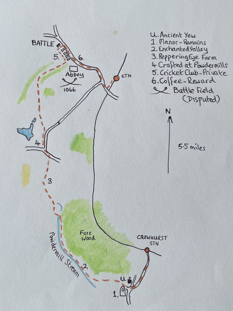
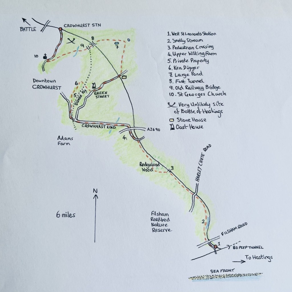
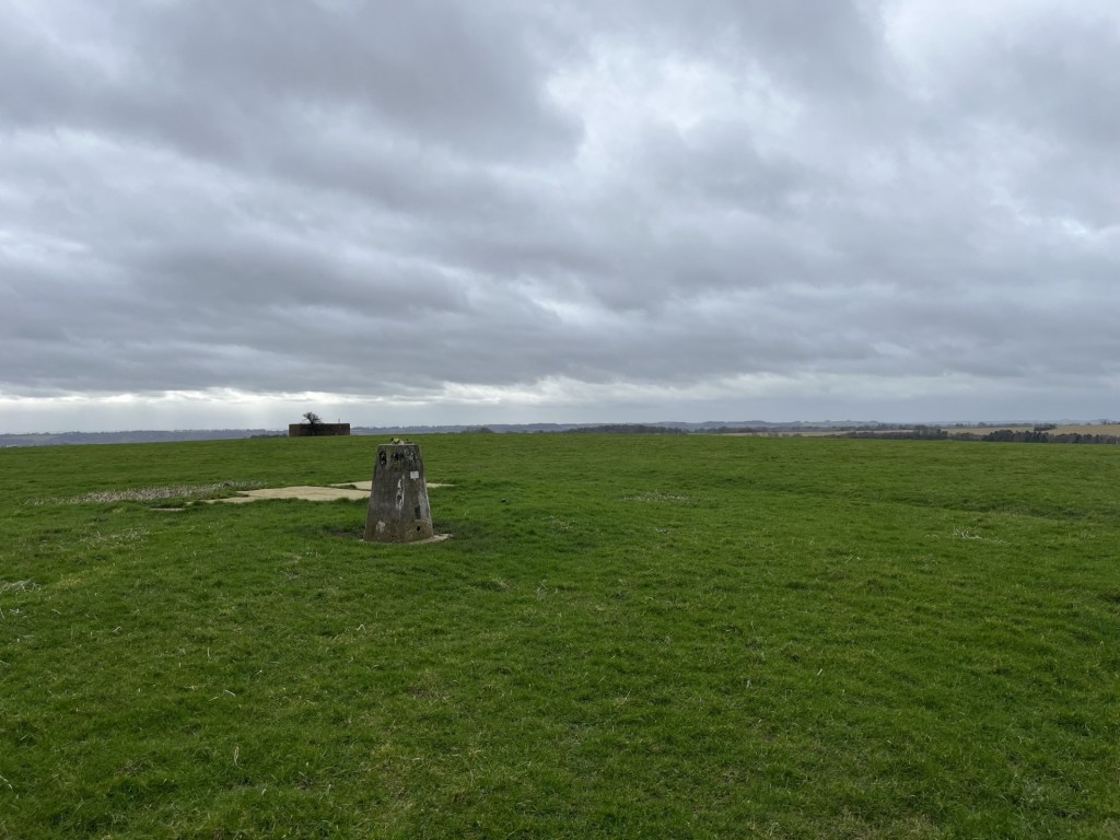
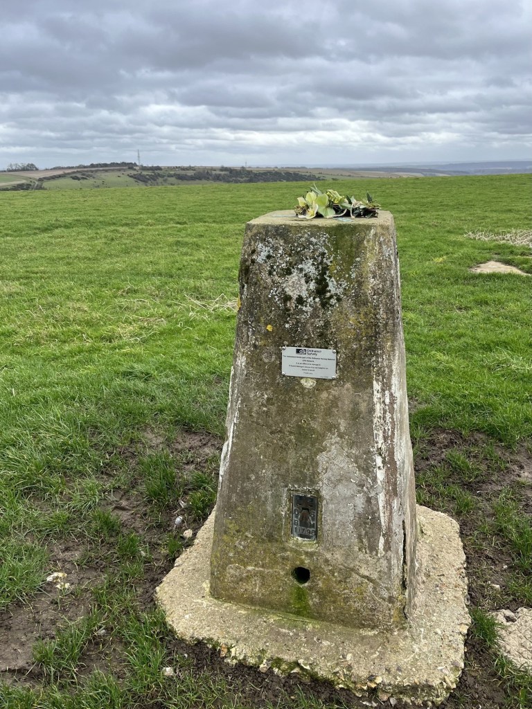
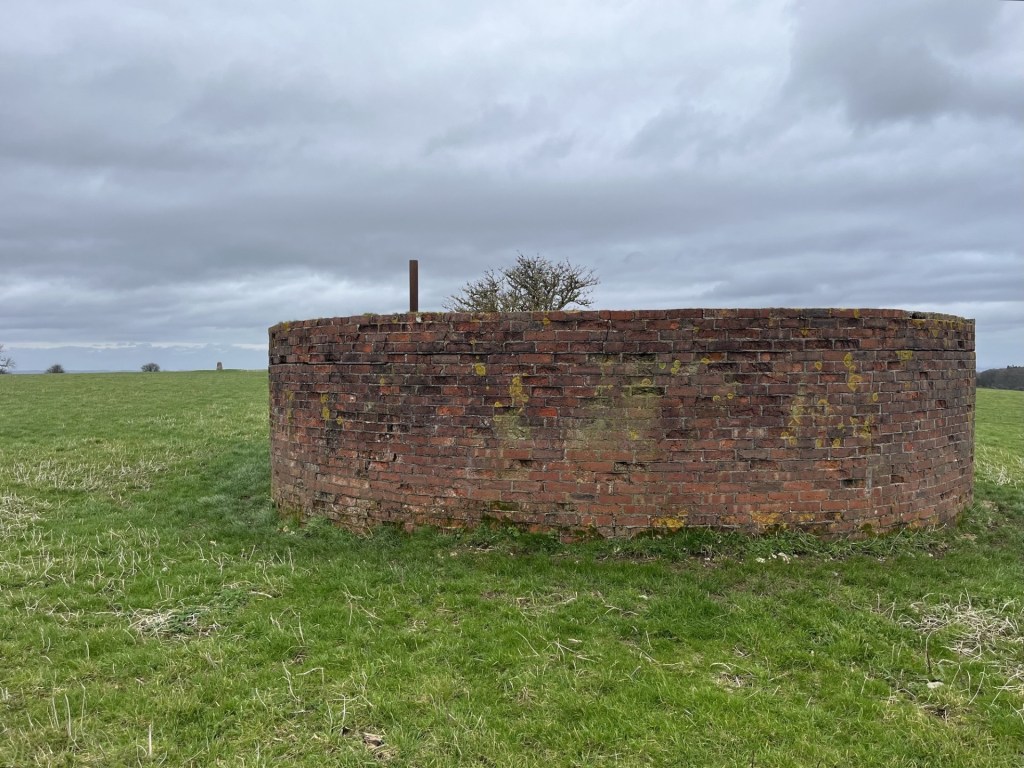
The Battle map

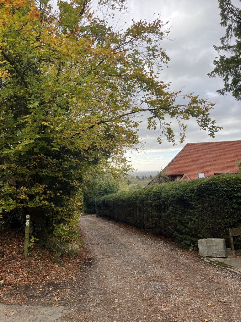
I parked up near Crowhurst station. Thinking ahead, as these locations get further from Hastings, I don’t fancy driving long distances for the sake of what is essentially a narcissistic leisure activity. Too many petrol miles to justify, but for the moment I can live with a few miles for a quick start.

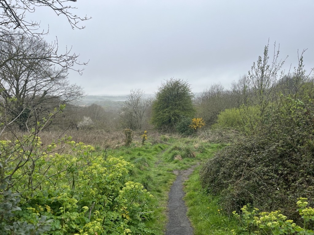
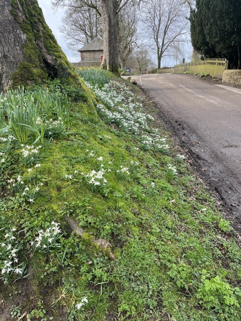
An option at the station could have been to go directly north and approach Battle from the southeast, but it looked a bit short on the map and as it was a glorious day I was up for a prolonged wander. Starting downhill along Station Road and passing an eclectic range of mid-20th century houses, the verge splattered with bluebells and primroses, I was full of positivity, which I can report from the outset, lasted for the next two hours.

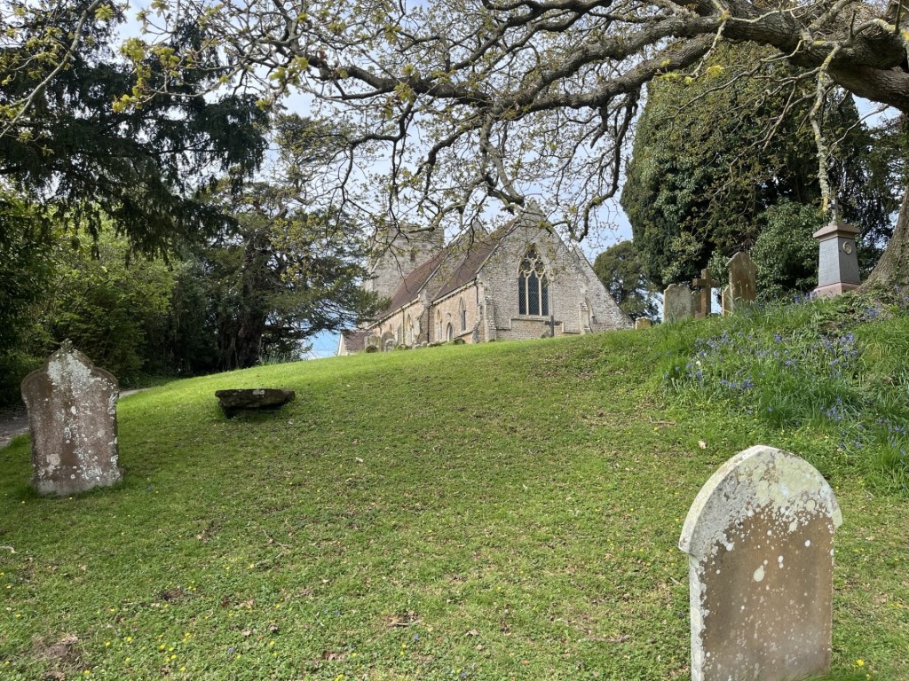
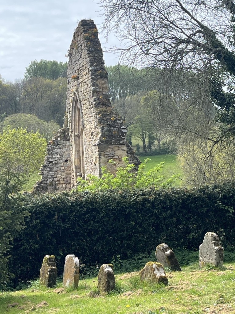
St George’s Church – from Forewood Lane.

And one of the reasons was because of this.
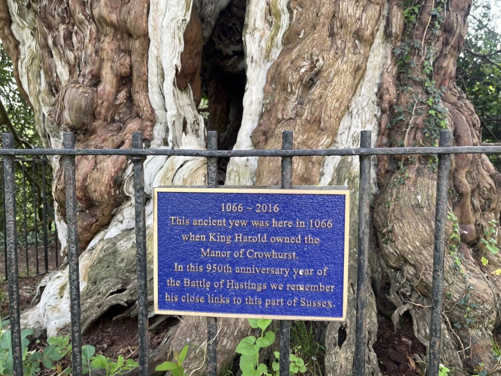
Ancient U

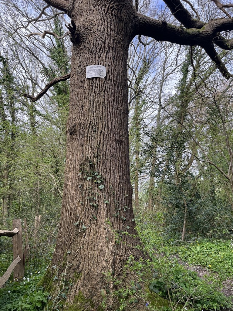
In the previous report (that would be number 1), I briefly mentioned that a hard core group of activists have, some might say heretically, argued that the Battle of Hastings in September 1066 did not happen at the official English Heritage site located in Battle (clues in the name I guess), but somewhere near Crowhurst (other “conspiracy” theories are available). I have an open mind on the subject, but in any case, the main point of interest in the graveyard of St George’s Church is its ancient yew tree (pictured above). Estimated to be 1300 years old it would have been a mere sapling at the time William marched his troops from Pevensey Bay (or Bulverhythe, or Hastings – take your theory pick), and up this, or maybe the next or previous valley. Whatever, it was there then and perhaps people then already marvelled that it was 300 years old.

Now this would be impressive (well it is but there’s a spoiler coming). Thirty odd miles to the north, in Surrey, there is a village called err… Crowhurst, just down the road from South Godstone. It has a church too. It too is called St George’s. I’ve never been there, but it has a yew tree that is thought to be 4000 years old. That’s 2000 years before the Romans arrived! I just don’t believe it but if true then our East Sussex St George’s church in Crowhurst yew tree is frankly embarrassing and unworthy of the blue plaque it sports. It is also important to be aware that if anyone happens to read this and feels the burning need to follow this walk, not to make the cardinal mistake of starting in the wrong Crowhurst. The following account will instantaneously become redundant and could lead to unintended consequences. (I just have to say this to cover myself and avoid potential litigation).

A yew trees view of Harold’s Manor house 

Having viewed the old log I returned to the road and turned right at the church gate, pursued by a black cat which shooed me off the premises. A few metres along I turned right up a signed footpath and onto a track between a handful of old buildings. About 100 metres and on the left the gutted remains of the old manor house, now incorporated by the surrounding buildings and making a pleasant walled garden.

The remains of Harold’s manor house, probably a later rebuild fashioned by a Norman baron.

The origins of this structure are a bit hazy. The “official” narrative is that it was built by a Norman in around 1250. And there is no reason to believe otherwise. Except, in the YouTube video about the disputed site of the Battle of Hastings, it gets a mention. How so? The suggestion is (and it does seem to be the case) that the then Earl, Harold Godwinson, later to be King Harold the second, had his own manor in the area, and that it might have stood on this very spot. Well, who’s to say, and I don’t know, but there is very little online information to be found.  Surprisingly, about the only small entry on the Historic England Missing Pieces Project is a photograph taken by the one and only Nick Austin, who, if you have read the previous account, will know, is one of the main heretical Battle of Hastings site sceptics!! And again, who am I to say? Just saying.

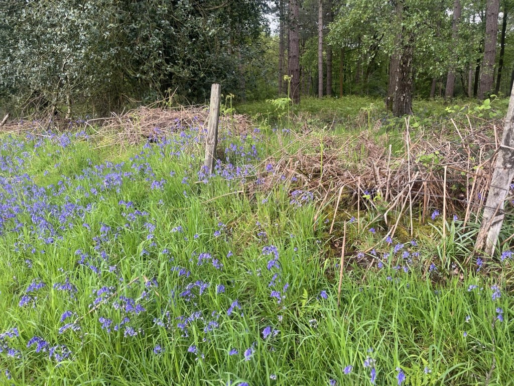
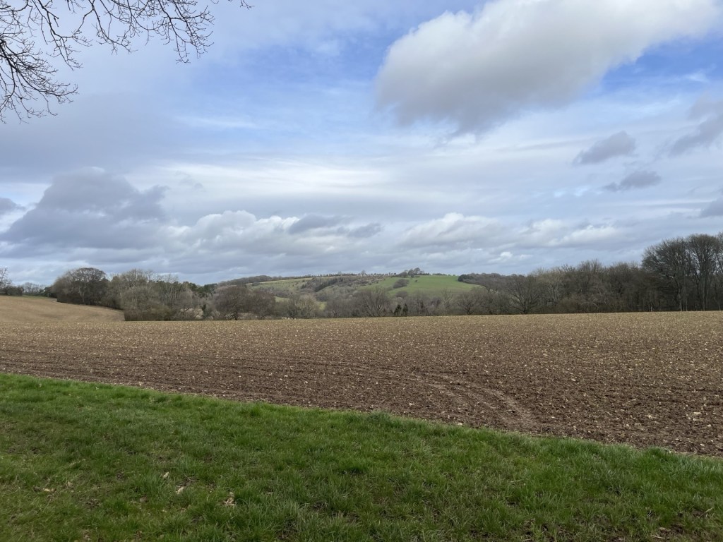
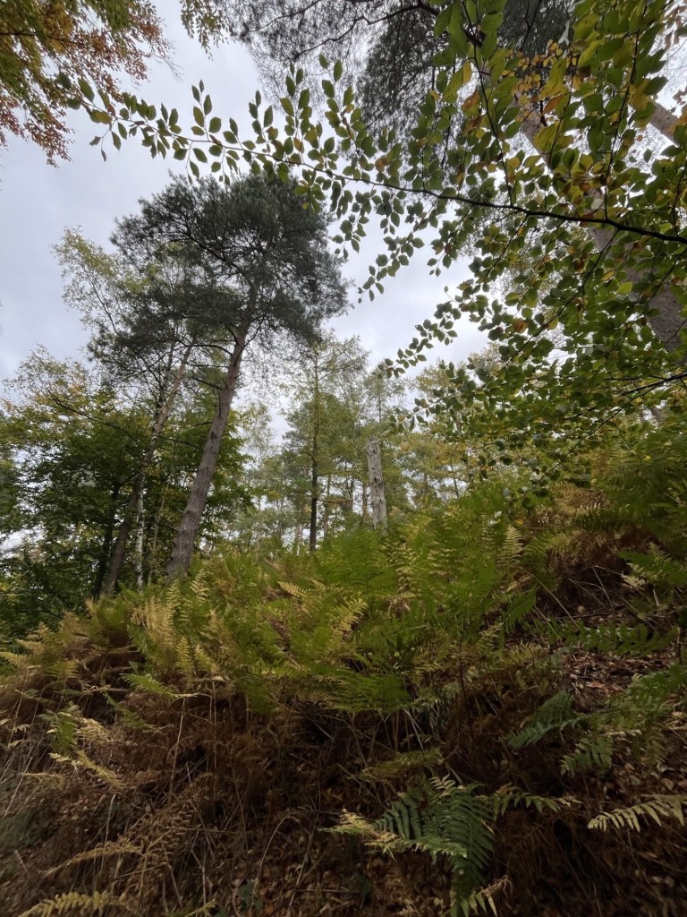
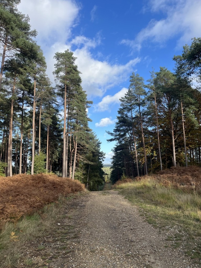
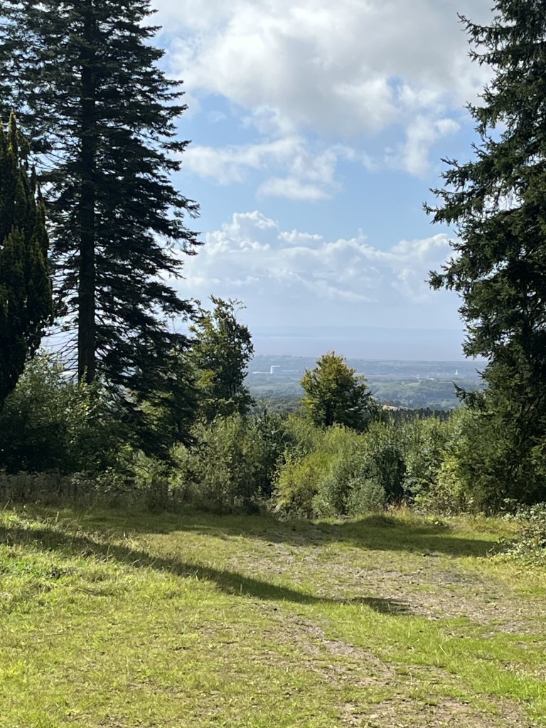
The track continued on through fields and directly north. The valley to my left looked impressive, with a very orderly group of trees at the top of the hills to the south.

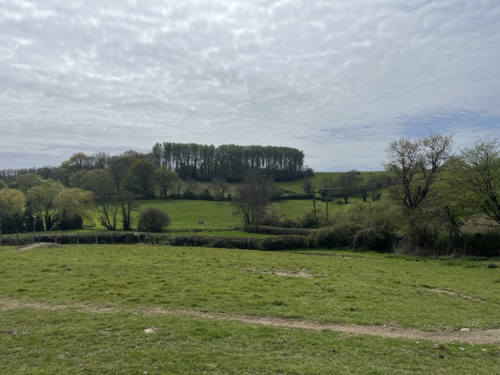
A regiment of trees crest the hilltop

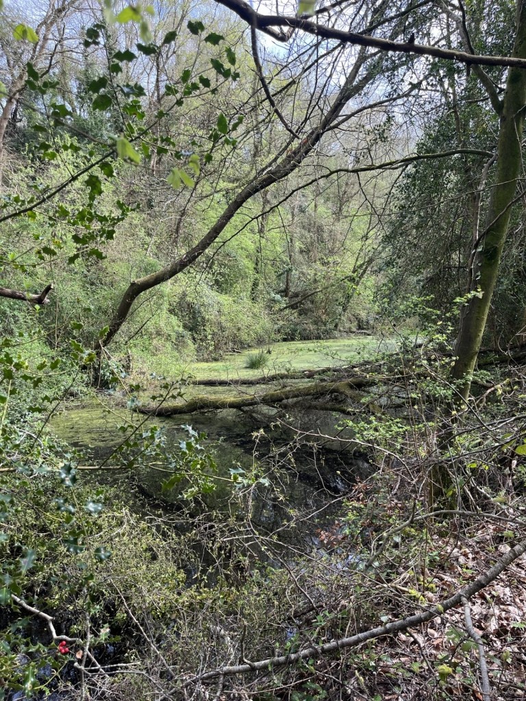
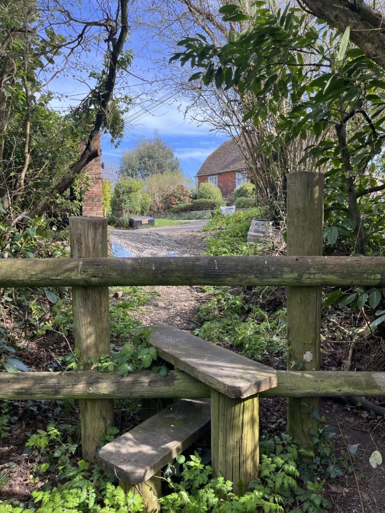
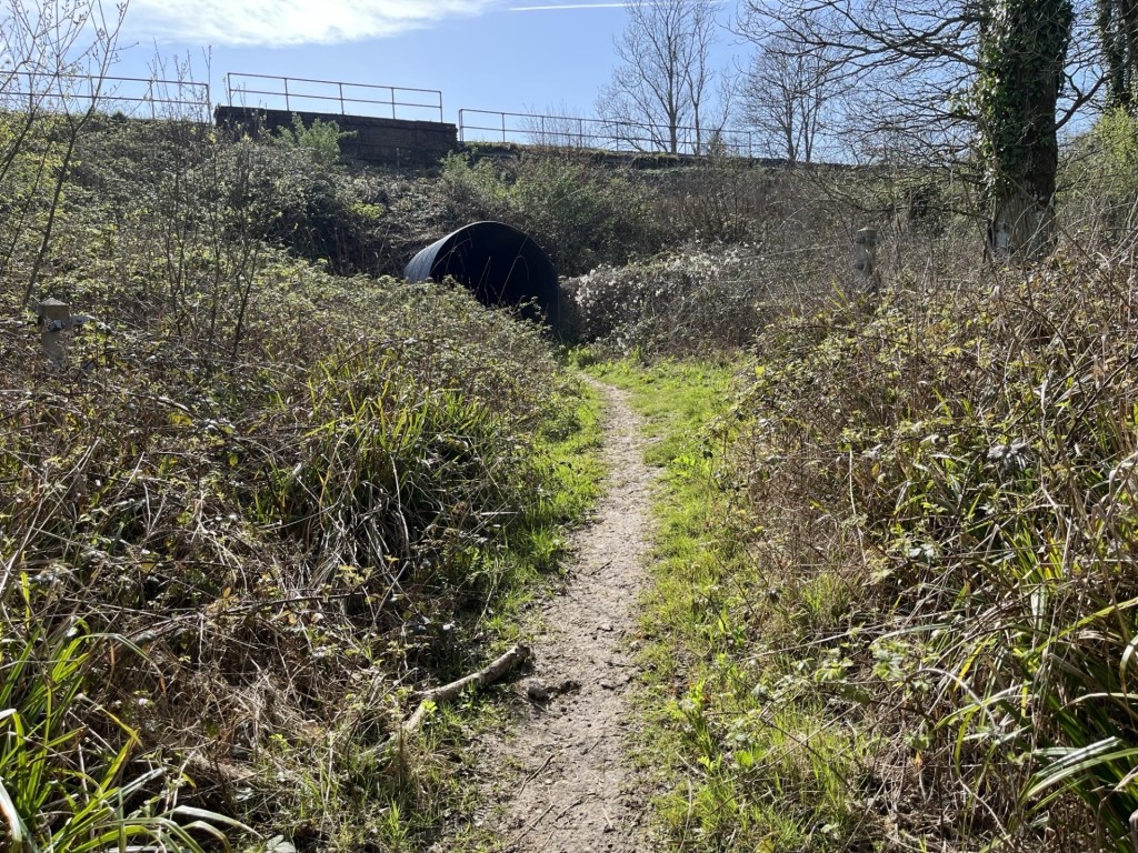
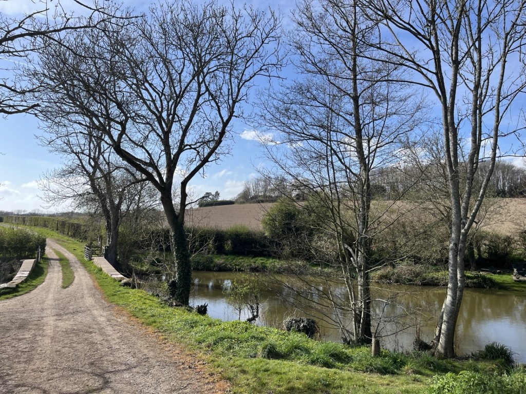
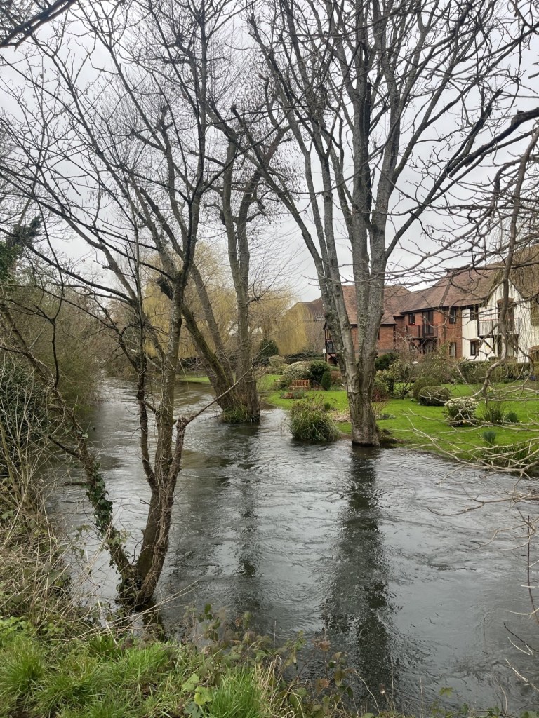
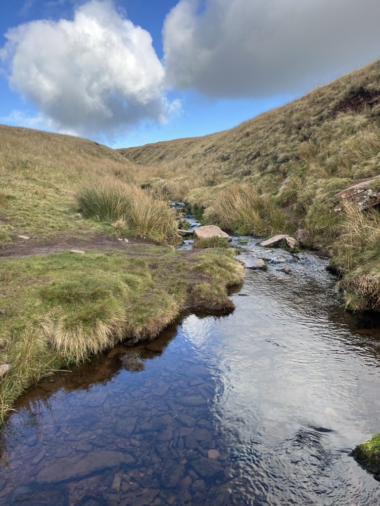
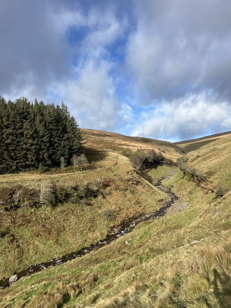
Passing through a gap in a hedge the track headed straight across a large undulating field and then down to a small bridge that passed over the western arm of the Powdermill Stream (western arm).
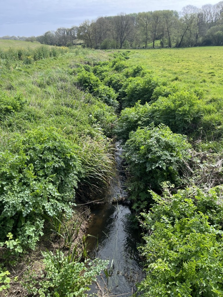
Powdermill Stream

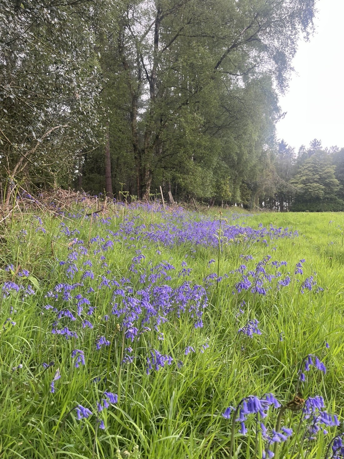
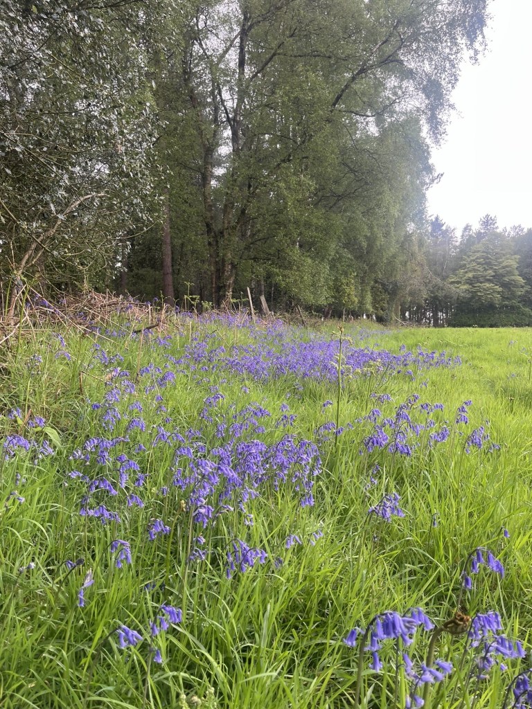
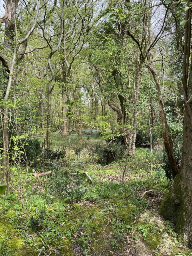
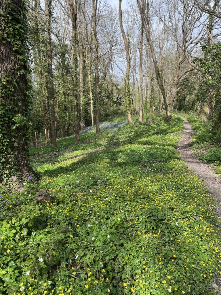
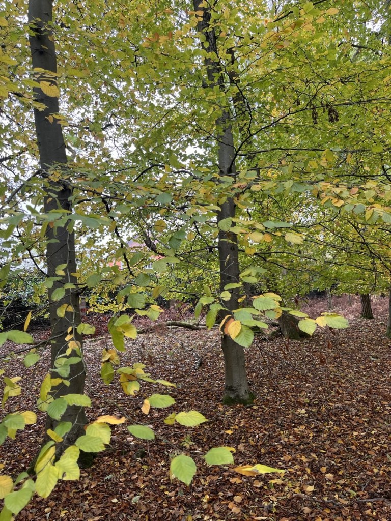
Footpaths carried on north on both banks. I chose the eastern bank and then over a style and into a wide, long meadow with the Fore Wood nature reserve to the north, looking spectacular with new growth peeking through and with the stream to my left.

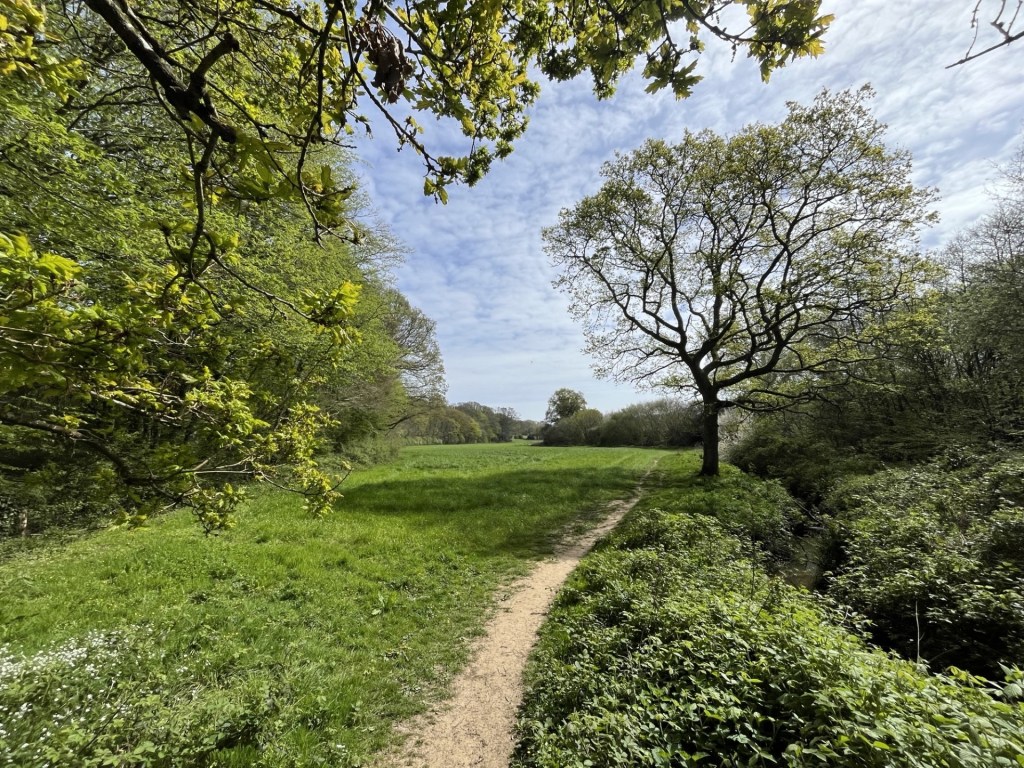
The end of the meadow – an enchanted vale

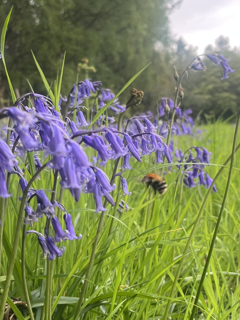
It felt like a small piece of paradise, and I was in no rush to reach the far side. Naturally, too soon I reached the end and now headed into the woods. A man with two large but passive dogs approached and we agreed that it was a beautiful spot. Bluebells and wild garlic disappeared up through the undergrowth in all directions.

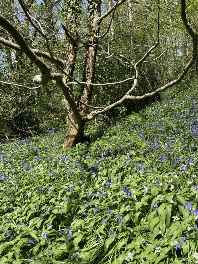
You’ll need to imagine the pungent smell from the wild garlic

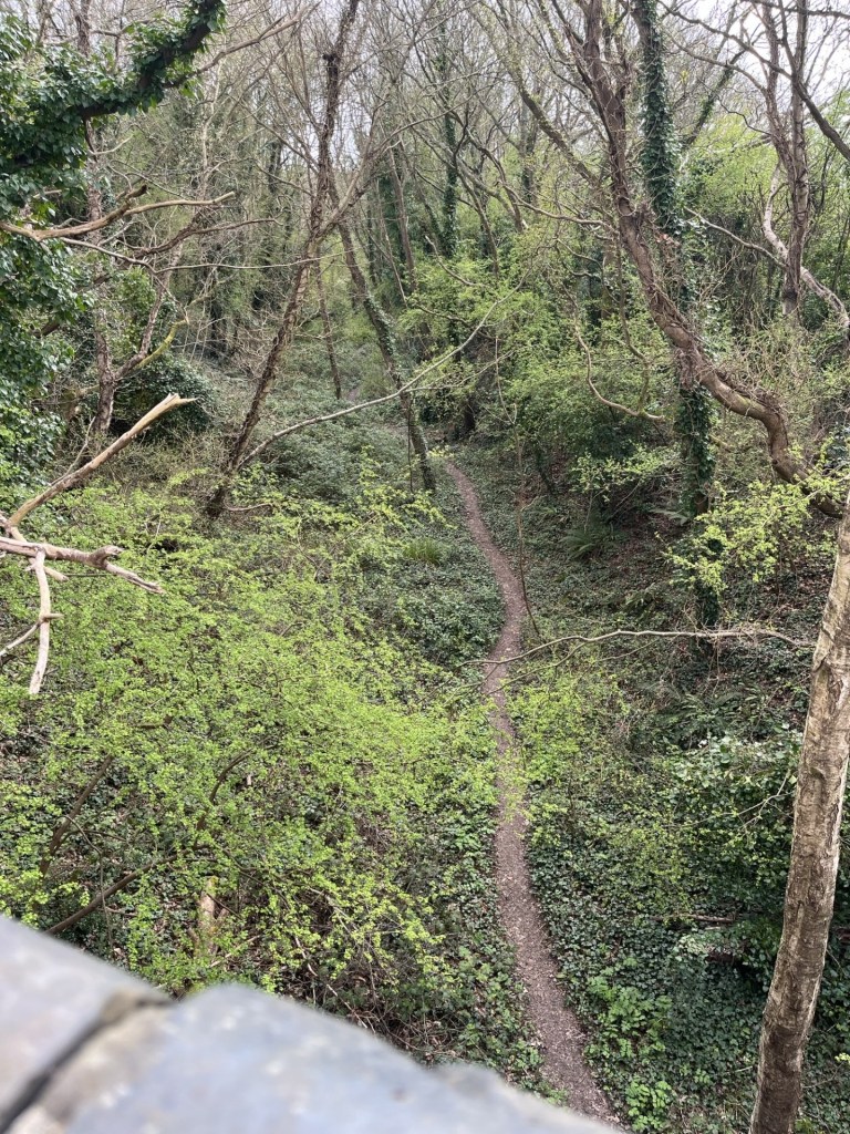
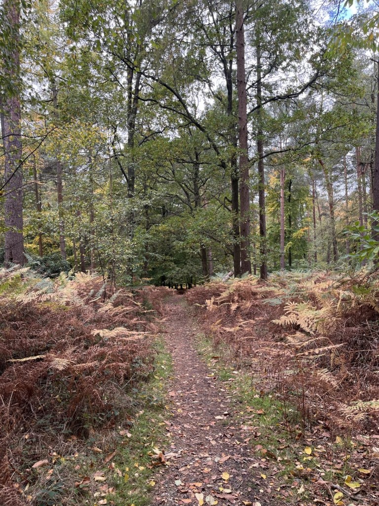
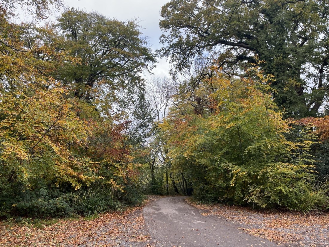
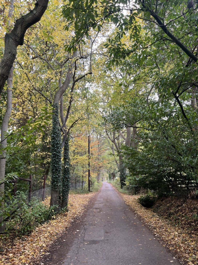
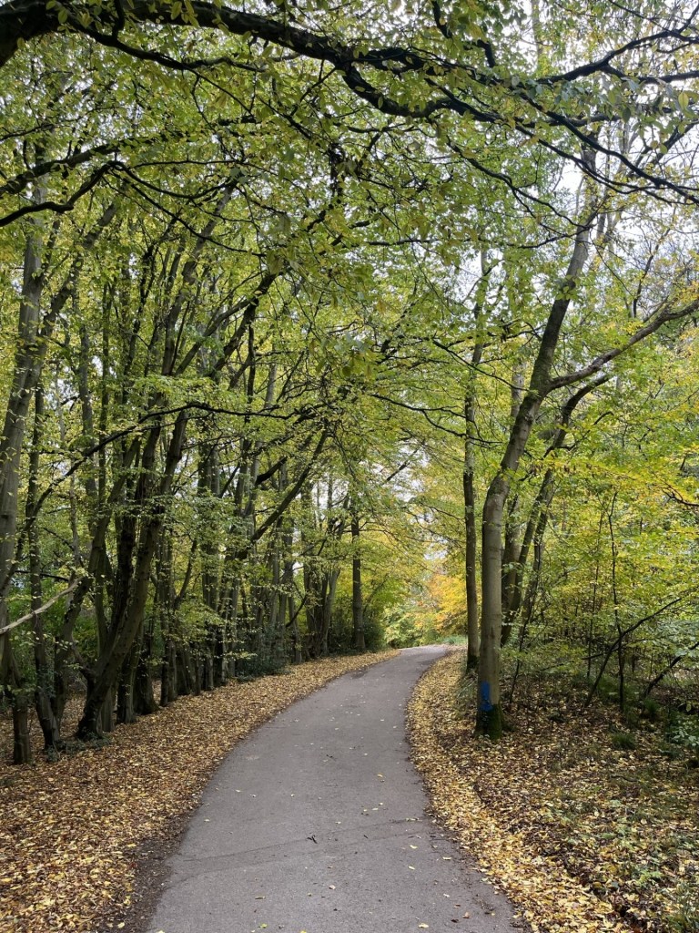
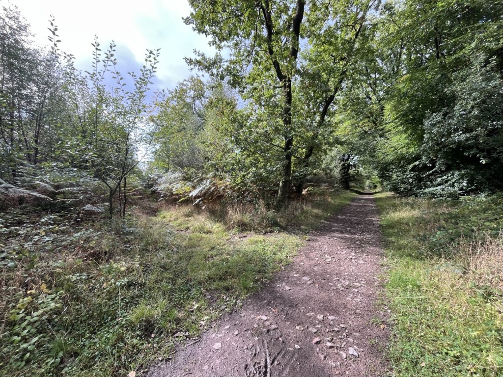
Continuing on a winding and undulating path through the woods and just to the right of the stream, surprisingly wide at this point, the idea that I was within a mile of Battle’s suburbs seemed absurd.

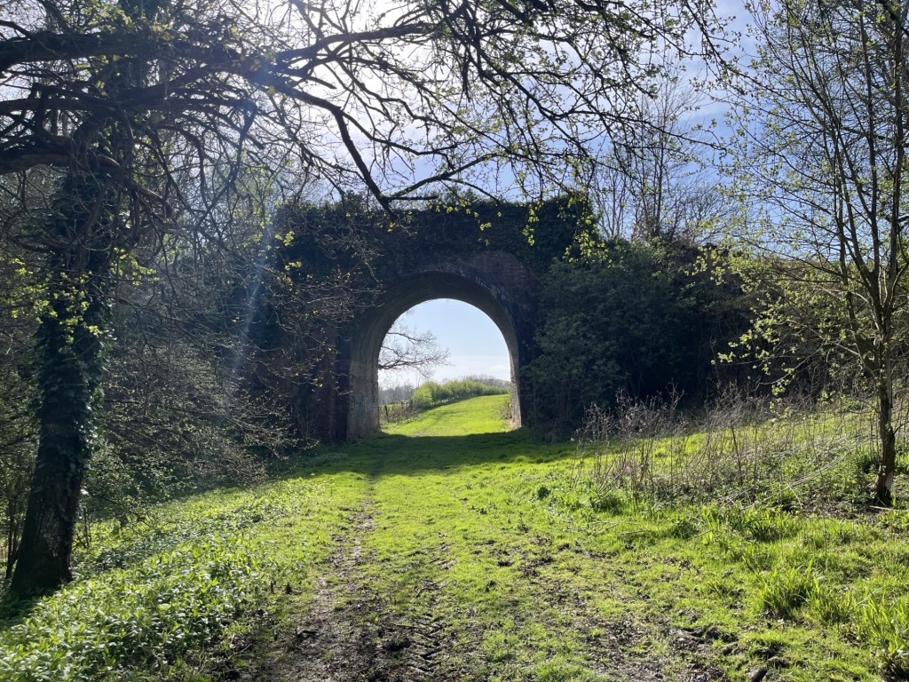
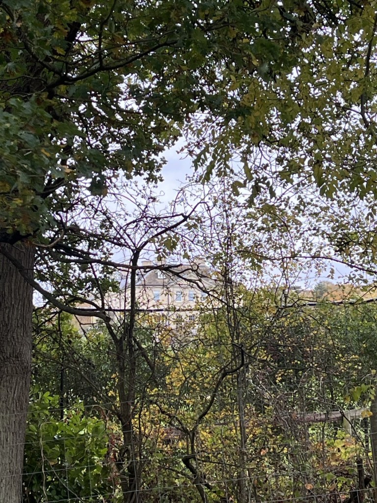
The path eventually spilled out at a bridge back over the stream, which I crossed and started up a bank that led to a small road. I should say that by joining the path in Fore Woods I had stumbled onto the 1066 Country Walk – Bexhill Link, and by turning right onto the road I was going to continue on this route for the rest of the journey (I think). A short walk up through more woods and I arrived at a large old manor house affair. I took the road to the right, moving north and headed back down into a glade which crossed back over the Powerdermill Stream, much wider at this point and where it felt like a mill might have once stood.

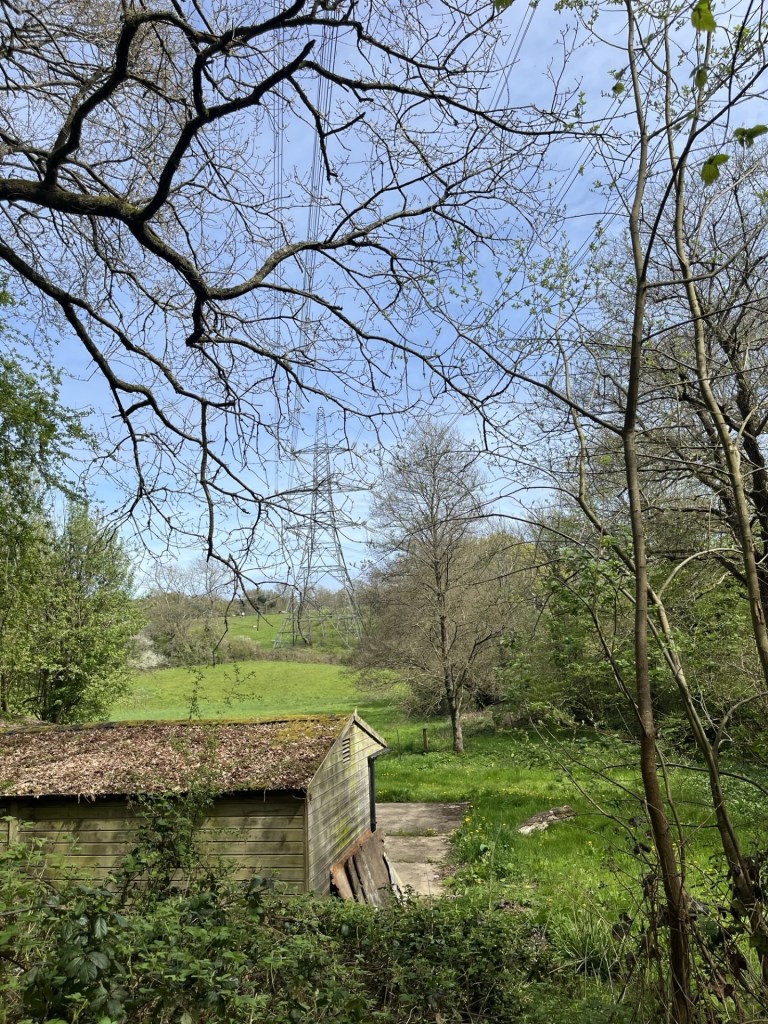
If you are ever lost, but presented with pylons and possess a map, you are found

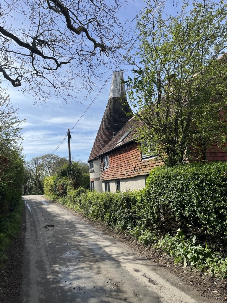
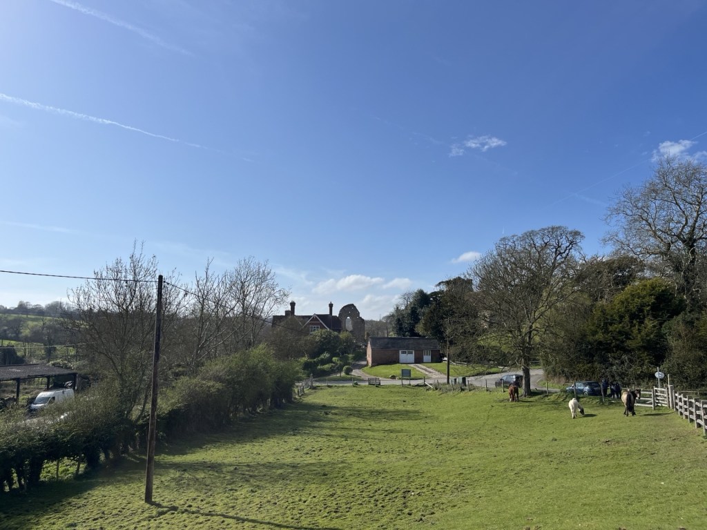
The road headed uphill again, with occasional large houses to the right. By now I was expecting to encounter urban sprawl at any moment, but instead the road wound down again and then through a cluster of old and new buildings that seemed to go under the collective identity of Peppering Eye. The background was to this nomenclature was unclear, but of course somewhere in the neighbourhood, nearly 1000 years ago, being peppered in the eye was definitely something to be avoided. This was a very chic location, with all the hallmarks of past and present affluence. Several buildings stood out but I was quite taken by the old oast house (or was it a windmill?).

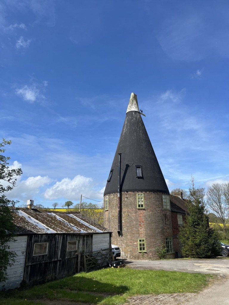
Interesting! Word, is trying to autocorrect oast to “oust!” So much for regional AI nuance.

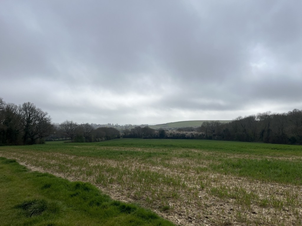
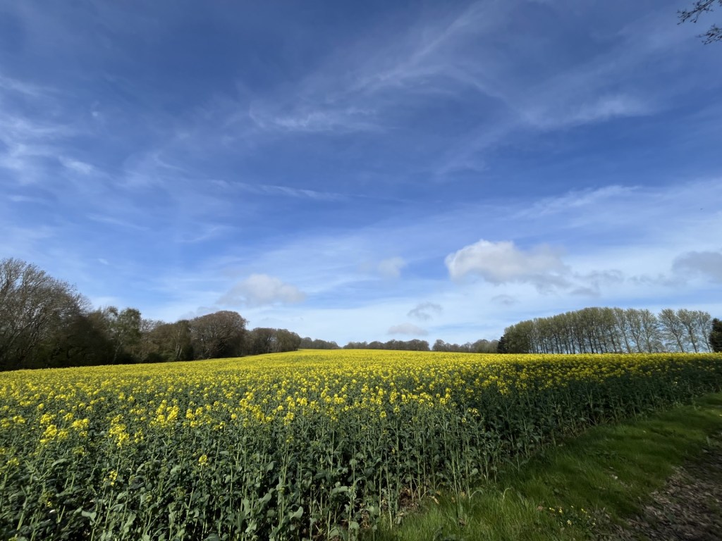
Beyond the buildings the road continued with heath type land rising to the right but across the valley to the left, fields of rape gloriously shining effervescent up the western slopes.

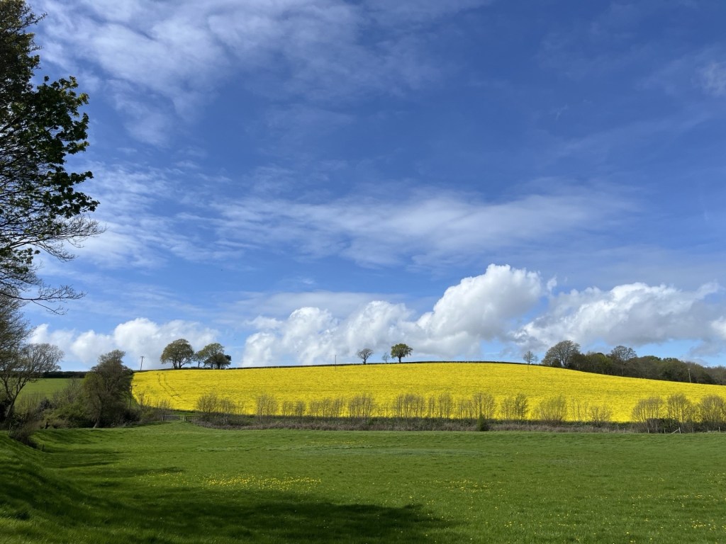
The definition of perfection

Guess what? It was now hot and I was down to my t-shirt, the first time this year and it felt joyous. I was in a place where, for just a while, I wasn’t thinking of or being troubled by my own difficulties (just life things) but more significantly, Donald Trump and his warmonger minions. I suppose for balance I should add the Iranians, Israelis, Hezbollah and the rest, but one way or another the recently self-released image of the Donald as Christ (no, sorry, as a “doctor”) had inflicted a new low point on humanity. 

Anyway, I wasn’t thinking about any of that when I reached the junction with Telham Lane and turned left. Just past the Telham Lane Borehole (I made a mental note to remember this place for when the tap water runs out later in the summer) I crossed over Powdermill Lane (B2095) and up onto a footpath above the road to the right and the expanse of the Powdermills Hotel on my left. Only I had been under the impression that it had closed some time last year. Seems it had but has reopened as Crafted at Powdermills. A massive new carpark and high-end sporting facilities, but also allotments and a slightly alternative feel amongst the 4 by 4’s and SUVs. Good luck to it.

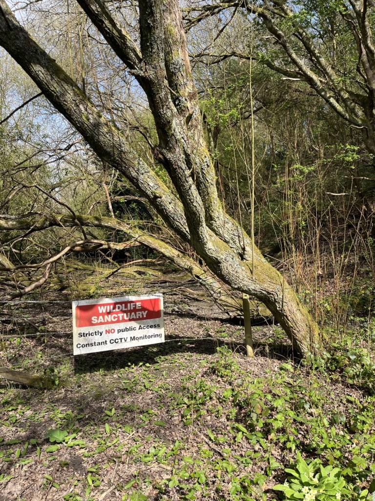
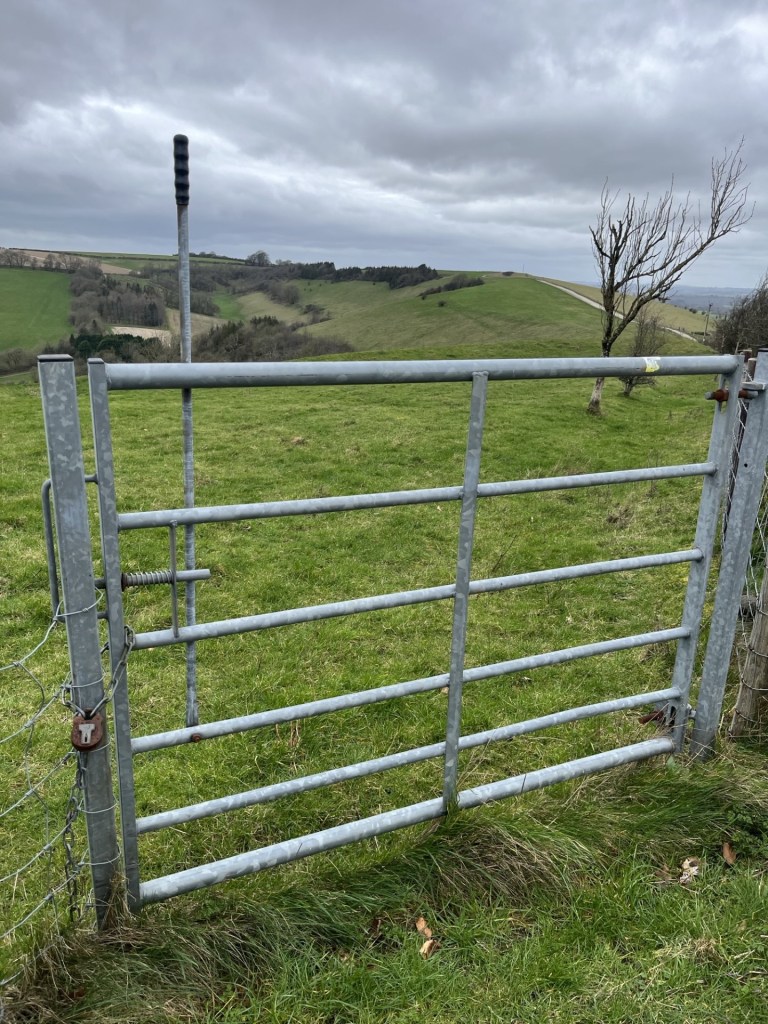
At the top of the path, I crossed the back road into the facility and back onto the path that led through some modern barns and then into fields. To my right a fence indicated private property, and as the path led back up another hill the landowner’s details emerged.

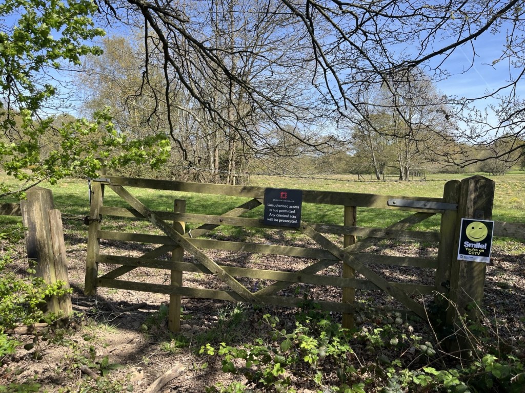
Smile…you’re on English Heritage CCTV

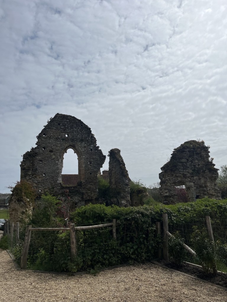
English Heritage! Holders of the flame. 1066 and all that. I stopped a moment and looked around for the CCTV camera. I wasn’t going to enter (I’d been before) but it did strike me as all being a bit absurd. If we take it as read that the land beyond the gate and fence was where the Battle of Hastings took place, why have we put a fee-paying barrier around it? Whilst the battle itself was a relatively small-scale affair compared with other medieval wars, and those beyond in the East, it can be argued that the result itself was one of the most pivotal in world history. The immediate impact of the Norman conquest completely changed the British Isles (England up to that point was considered a model of administrative modernity in Europe at the time), by imposing an entirely new and ruthless political and landowning class. As the centuries passed the spirit of Norman expansionism and its internal disputes between the landowning class and the monarchy slowly shaped the legislature and colonial ambition that was ultimately exported around the world, for good or bad. Had Harold’s army won the day it would have all been very different.

And so, this most important of sites, essentially a field with some impressive, but not valuable old ruins, can only be seen by shelling out £15 if you’re an adult and £7 for a child. I’d make it free. Magna Carta and all that (except that’s somewhere else).

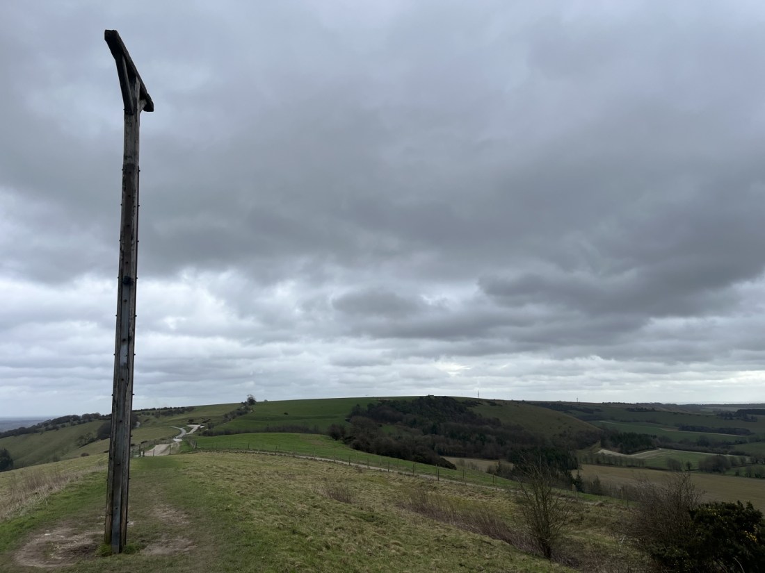
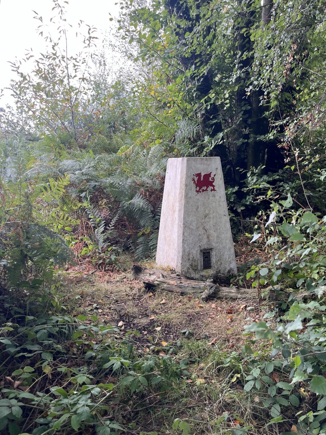
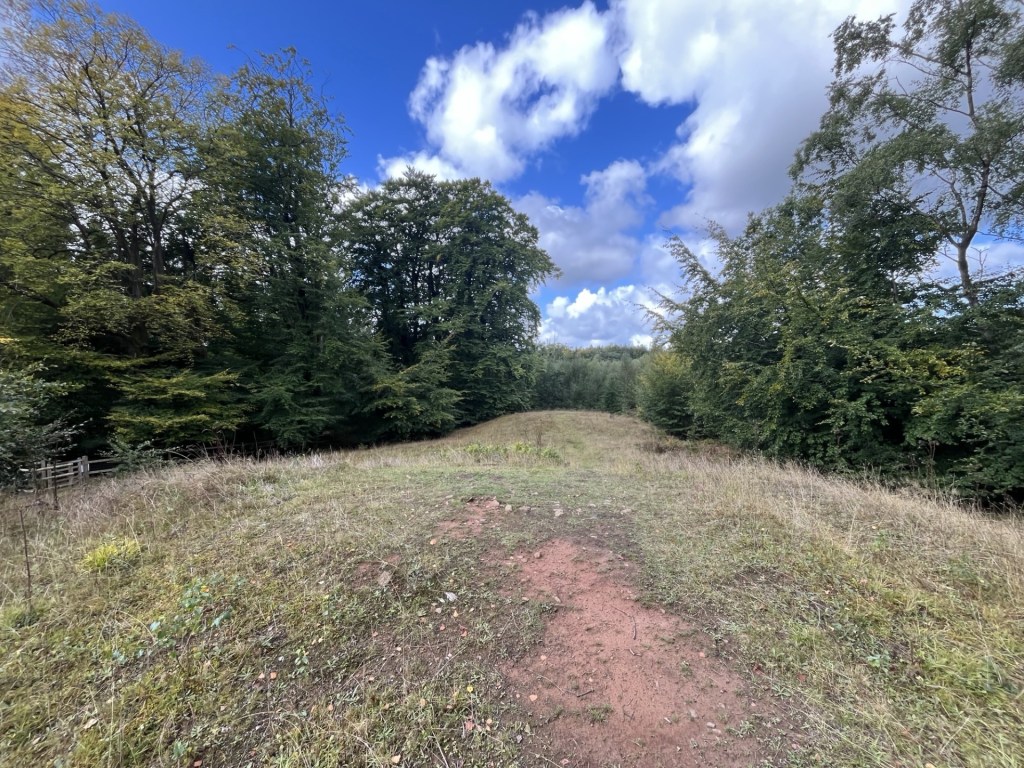
At the top of the hill a solitary Chestnut tree crowned the crown and framed by a blue sky with scudding clouds.

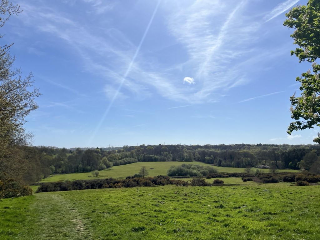
A look back on where I’d been

The track continued around the side of the Battle Abbey site and towards the end a small path edged around the backs of the High Street buildings with a cricket pitch on the left and warning signs that anyone not a member, but found using the nets, was trespassing. The message was clear.

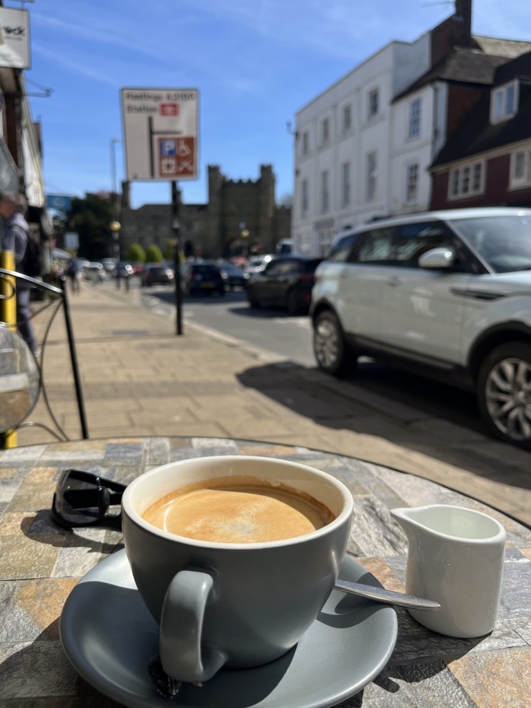
I followed a lane through to the High Street and with enough time to spare I stopped for a coffee at Bonnie’s Bistro. Sitting outside in the heeling sun, and with an endless stream of traffic for entertainment, I played a game of “spot the normal car”. It was only as I took the last sip that eventually an old-style Fiat 500 slipped by without having to slow down or navigate awkwardly to avoid lateral damage.

Within striking distance

Having dispatched the caffeine, I rounded the high walls of the Abbey, then down Upper Lake and right onto Lower Lake and to the slip road for the station.

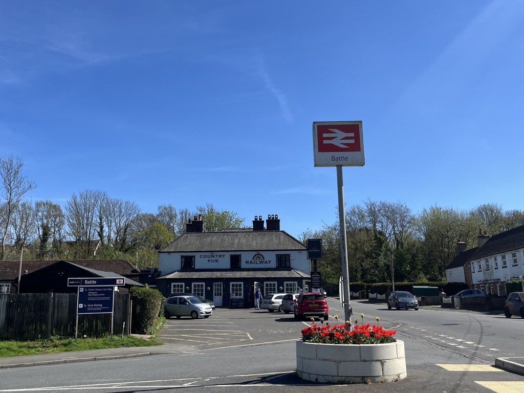
Turn left before the Railway Inn

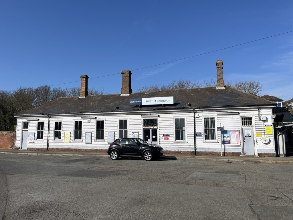
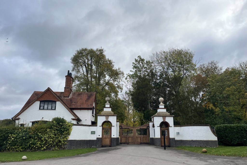
A short walk along the approach and the station presented overlooking a large carpark.

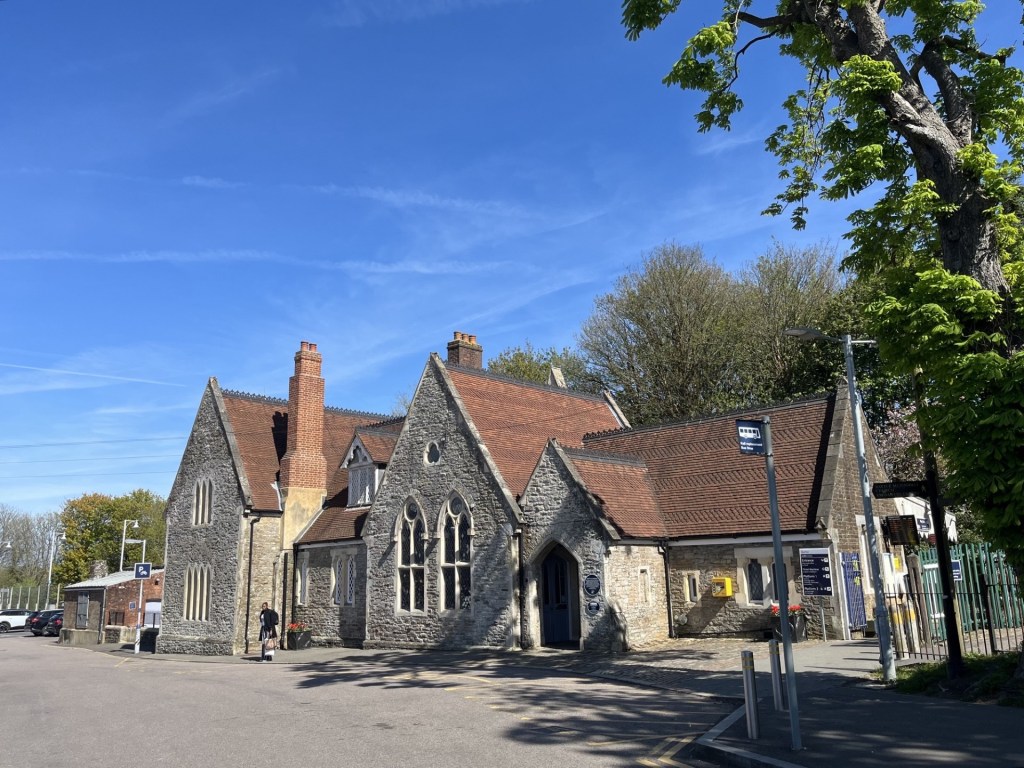
The station building
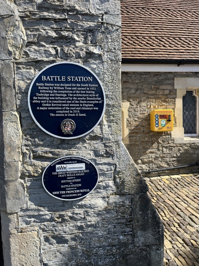
The plaque

A fine building with a plaque that confirmed it, but its fine rustic detail diminished by the sprawling car park laid waste in front.

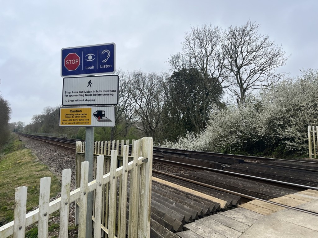
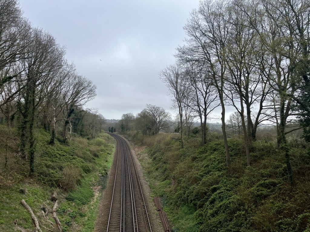
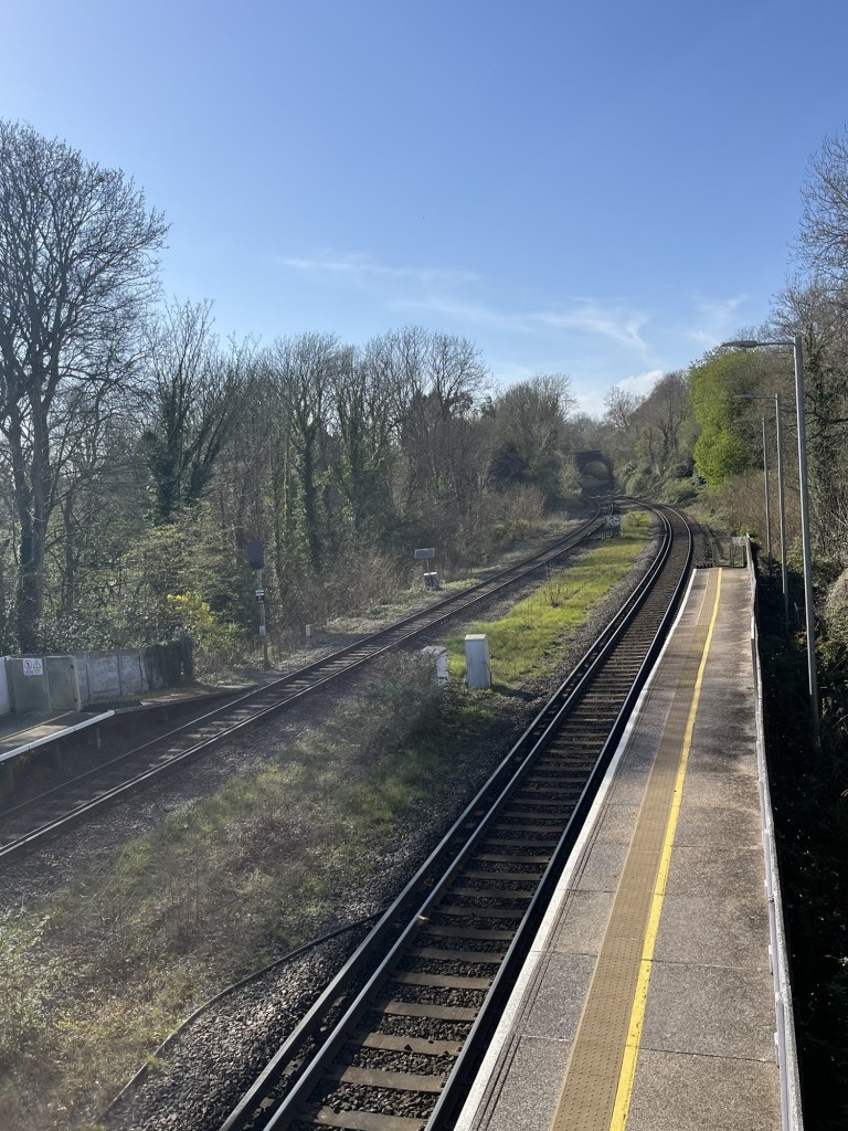
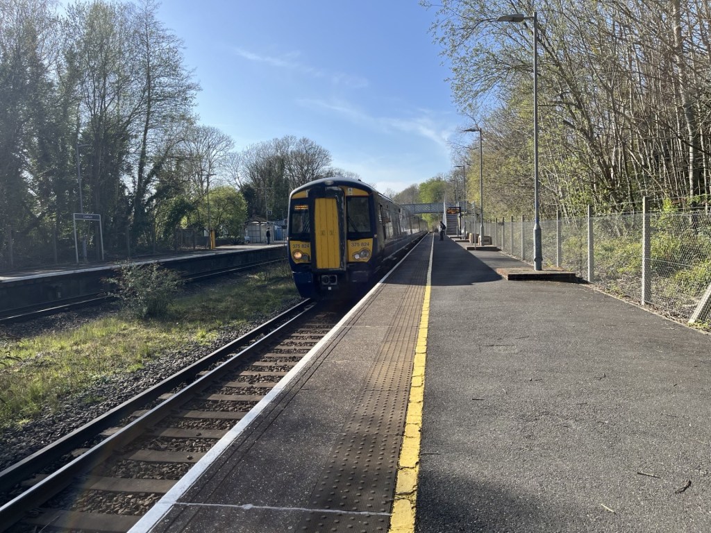
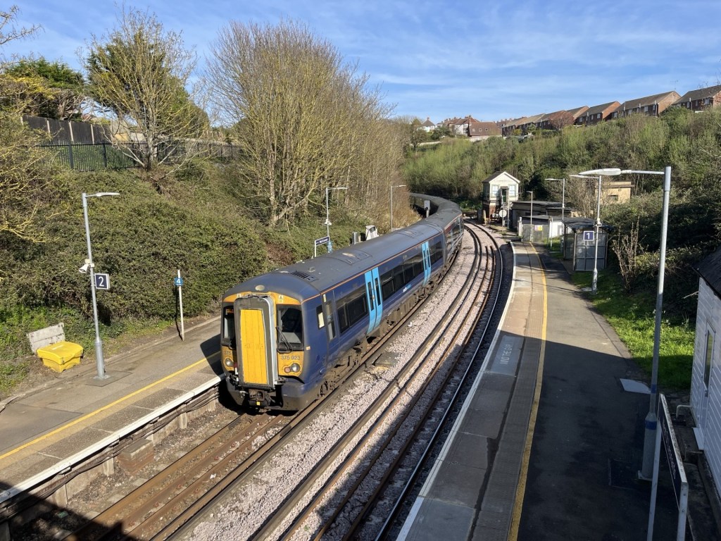
With a bit of time, I bought a single to Crowhurst, popped over the footbridge to the down platform, sat without peeking at my phone for ten minutes and looking down the line and at the trees instead, reflecting on what an excellent walk it had been.
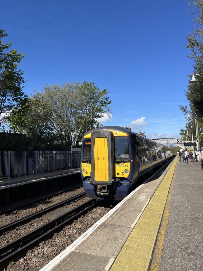
Crowhurst bound

Back in the car, the tune that accompanied me home seemed very appropriate. A top day.

https://www.youtube.com/watch?v=AB-2XnsRDhs&list=RDAB-2XnsRDhs&start_radio=1

Cresting the County – Solihull Metropolitan Borough

Meighs Wood

185 Meters

606 Feet

19th May 2026

Bluebells, leaks and Laybys.

From Corley Moor, the highest point in Coventry Metro Borough, it was just a short drive to Chapel Green, then a left down Fillongly Road and at a point in the road that bore a resemblance to my mind map of the area, a muddy layby appeared on the left and I pulled over.

A hundred meters ahead, on the other side of the road and beyond a hedge, a line of trees marked where dense woods met a large field. I climbed out of the car. This wasn’t going to take long. As I started down the road, a car pulled round the bend in the road to the south and abruptly stopped at a layby on the opposite side of the road. The driver’s door opened and out jumped a man who, without further ado, marched beyond the car and up to the hedge, where quite obviously he proceeded to have a leak. It might have been just at that moment that he saw me approaching on the other side of the road.

To protect his modesty, I naturally slowed my pace and pretended to look at something that might have been interesting beyond the trees on my side of the road. Whatever it was that I was interested in failed to hold my attention for too long and by necessity I continued in his direction. By now he had finished his essentials (at least I assumed he had, but I’m sure most of us – men – have been in that unsatisfying position of being desperate, only to be denied for some unaccountable reason), and had skipped back into his car. He drove on and I crossed over.

Just past the layby a gap in a fence gave access to the woodland, and just to the right another gap in a fence gave access to the north facing field. The field was cultivated, but a wide strip of land adjacent to the woods suggested some form of set aside, which I now understand to be a “cereal field margin”, land that is left uncultivated to encourage wildlife diversity. I’d heard of it but as far as I could remember, never actually seen it before. It looked great. I’m sure that there are arguments against such wokery, but it makes sense to me.

I walked towards the top of the field and along the edge of the woods. Ahead, spilling out of the woods and into the margin, a wave of bluebells in their prime. Quite a surprise given that all around me down south had come and gone already.

On the crest of a wave

I stopped and noticed a humble bee dancing between the flowers coronets and got down close to observe. Despite my close proximity, it had zero interest in me. Too fixated on task and outcome. I recently heard that a worker bee only lives a few weeks and, in that time, makes, creates, generates, just a fraction of a teaspoon of honey. No retirement, no pension, just a grinding few weeks contributing to the greater good before it’s all over. I can’t predict the future but with AI and the ever-continuing concentration of the world’s wealth by a small few, maybe there was some sort of metaphor evolving in front of me.

Inspecting the larder

I carried on a short distance. There was a gap into the woods. I entered, but only just. Somewhere around this point was Solihull’s highest elevation. Although Peak Bagger names the highest point as Meighs Woods, their own map seems to suggest the woods I was at were called Stocked Woods, and Meighs Wood was over the road where I had parked up. I looked back out and across the field. A leaden sky, but the forecast was for something different. Up until a day or so before the nights had been cold, and the days cool and stormy. By Friday that was all going to change.

The high point – Stocked Woods

I drove away from the layby. The destination was Much Wenlock for three nights. Whilst I had reached the highest point in Solihull, the road I took to get me back onto the M6 somehow managed to avoid contact with any of the town’s urban sprawl. Oh well, so it goes.

Station to Station – Up Walk to London West St Leonards to Crowhurst

Introduction and first leg.

1. West St Leonard’s to Crowhurst

4th April 2026

OS Explorer 124

I had been thinking about this for a while. I live in Hastings. The direct railway to London runs north by northwest up through the countryside of East Sussex, Kent and then Greater London. Apart from seeing it all through the windows of a train on the occasional trip up to London and back, many of the areas are remote, and not obviously places to visit unless you have good reason to. In a moment of enlightenment, I realised that I could investigate these places by starting out at a station en-route, walking a few miles to the next station, and then jumping on a train back to the start point.

That moment was about two years ago, and with lots of life issues occupying my time, it was filed in the “maybe sometime” folder. Until the 4th of April 2026, when I woke to see a fine mizzle varnishing the street outside, after a forecast that had promised fair weather. The opportunity to procrastinate was tempting, but I had been bogged down in a blizzard of family issues since the start of the year, and with only a small window to stretch my legs and shake off the moribund (in more senses than one), I grabbed a coat and set off for West St Leonard’s station, intent on starting the task by walking as close as I could to the main line towards the small village of Crowhurst, the next stop on the line.

Start to Finish – Follow the spine of the seahorse. Made with ancient recently rediscovered paper

The fine mizzle remained. I stood on the nearby road bridge that spans the Eastbourne and Victoria station line to the south.

The Bo Peep signal box and entrance to Bo Peep tunnel. Mizzleable

But first, a minor digression. This exercise should, if being a purist, start at Hastings station. Hastings and St Leonard’s (they used to be separate identities but are now joined at the hip and for the purpose of local government administration are known collectively as Hastings), are blessed by four stations. There used to be two more, one to the west at Bulverhythe called Glyne Gap Halt, which is long gone and now houses a retail park, the other, just to the west of the bridge I was standing on, and very first, was Hastings and St Leonard’s station, opened in 1846 (later renamed West Marina station). The remains of this important railway feature now rests peacefully under a huge TK Max.  

The four remaining stations are, from east to west, Ore, Hastings, St Leonard’s Warrior Square (my start point). Ore is situated high in the eastern suburbs and falls outside the orbit of this exercise, mainly because it serves a different route. The line out of Hastings to Ore heads off through a long tunnel dug into the sandstone and then delightfully across the marshes to Rye before terminating at Ashford. In recent years there have been calls for this single-track line to be upgraded to a High-Speed line from London. Whilst it would be great to have a fast train from Hastings to London, I think we can say that there’s more chance of the International Eurostar station reopening at Ashford before that becomes a thing. Ore has one distinction. Many confused travellers will have stood at Charing Cross or London Bridge stations searching in vain and then missing their train to Hastings because many of the Hasting’s trains don’t actually terminate at Hastings, but at Ore, a place almost everyone on the planet who isn’t from Ore, will never have heard of.

For anyone desperate or daft enough to follow in my weary footsteps, the correct place to start this sojourn would be at Hastings station. My first encounter with Hasting station (before it was modernised) was in 1980. After a Friday night session at a pub near to the bookshop I was working at the time, I boarded a train bound for East Croydon (or was it?) and sometime later was woken by a British Rail employee and asked to leave the train. Clearly it wasn’t one of the trains that went onto Ore. Somewhat befuddled, I dismounted the train to find myself on the platform at Hastings! Asking the group of attendants when the next train to London might be, they proceeded to crease up like the Cadbury’s Smash aliens (if you don’t know what I mean check them out online) and then told me it would be six in the morning. Exhausted, I looked across the platforms and could see the sign of a nearby hotel. Being after midnight, I rationalised that I’d missed my window of opportunity, and so instead tried to get some kip in the platform waiting room. Good idea? It should have been. Instead, for the next few hours a solitary gull perched on the adjacent bench and proceeded to squawk and screech its hideous call for the rest of my time. I caught the first train back to London and was the first in work that Saturday morning, but the gull had got to my central nervous system, and I swore never to return.

From Hastings station the options are to walk along the hilly and relatively indifferent back roads, or head straight to the seafront and then along the front for a mile to St Leonard’s Warrior Square station, set back a few hundred metres from the sea, and the locally popular Goat Ledge cafe. There’s no point trying to follow the line between the two stations because it’s buried deep down in a mile long tunnel. More on tunnels at another time perhaps – they matter here. 

St Leonard’s Warrior Square (originally Gensing station, opened in 1847) sits at the top of the bohemian Kings Road. Small independent shops are stuffed to the gunnels with miscellaneous everything ever made before 1980. The station itself nestles snugly between the Hastings tunnel heading east, and the equally impressive Bo Peep tunnel, that heads nearly a mile to the west, and under the old colonial affluence of St Leonard’s, with its Georgian, Victorian and Edwardian piles (some in the Scottish baronial style) chaotically scattered across the high ground above the seafront. Hilly roads take you up and down quirky streets where independent shops, some art galleries and more outlets selling junk and second-hand stuff (called brocantes here abouts), through to antiques, and a range of hospitable pubs and eateries can swallow an hour or two. If that’s not your bag, and you just want to get walking from Warrior Square to West St Leonard’s, head south to the coast and then west past the impressively art-deco (debate) Marina Court, along the front with the very early Georgian facade, The Marina Fountain public house (good music) and then right and up the hill on West Hill Road and a final left into St Vincents Road.

Anyway, I’ve done those legs many times, so let’s start. And yes, I must have forgotten that terrible night with the gull, because decades later I moved here.

Digression over. From the station I set off west on St Vincents Road, and to the junction with Filsham Road. To the right is a bridge over the tracks and good views back into the station and on the other side an arc in the track looping away to the northwest and London. I crossed over at the zebra crossing and joined the public footpath that heads down and then along the south of the line. To the left lies the large Filsham Valley school and its grounds. To avoid congestion, stay clear of this area mid-afternoon and chucking out time. 

At the bottom of the rise a became aware of a stream running between the track and the path. I smelt it before I saw it. From the stench I concluded that an unauthorised release may have taken place, and I quickly diverted from the path into the adjacent grass field, with woods climbing up to a ridge beyond. *

Beyond the field the path rose into the woods, and slowly back above the tracks. An elaborate footbridge allowed access over the line and to houses on the other side. Again, almost certainly a place to be avoided when the kids get out of school.

Vape Central before and after school

Another two or three hundred meters on and the path emerged onto the Harley Chute Road, and the second road bridge over the lines.

I promise the pictures get better – Harley Chute Road

The footpath continued on the other side of the road, but the view was instantly, and surprisingly, all country. 

Goodbye to the suburbs

Within minutes the sound from the streets had receded, replaced by the chirps and cheeps of Blue Tits and Robins, which occasionally darted in front and above. Wild garlic, occasional primroses, delicate white but unidentified white flowers and clumps of bluebells coloured the quickly awakening birch and hawthorn woodland. The path fell back down and gradually away from the railway before heading back up and to a foot crossing.

Sensible Instruction number 1: Cross without stopping

I didn’t cross but continued to the south where the path diverged quickly from the line and down. At a junction in a dell, I bore right and back up through the woods. With the railway some distance away, the path continued through delightful woods. The rain had finally stopped, and occasional patches of blue sky appeared.

The buffer zone – Marsh Woods

With the path heading on up and into a field, and then another, views opened to the south. A glimpse of the sea and the higher ground above Bulverhythe, which, I believe only exists because it was once the area’s landfill site, now being blended back into nature, and an area I ought to explore a bit further on my next visit to the nearby recycling centre.

Manmade

At the end of the second field, I emerged onto the Crowhurst Road (so I knew I must have been on the right track, although the actually track was back and passing under the adjacent road bridge).

A gull and a buzzard were fronting it up above the tracks. You’ll have to take my word for it

Taking the Crowhurst Road northwest past Upper Wilting Farm and then under Combe Valley Way, a wide direct new link road running between the north of Hastings and Bexhill but shamefully lacking a bike lane (there’s just no excuse). Crowhurst Road continued downhill, with the odd passing car, over a stream, before climbing again past Lower Wilting Farm to the right and then to the top of the valley before heading directly north and down.

Just at the point, where the road veers to the north, I crossed the old bridge and high above the long disused Crowhurst, Sidley and Bexhill railway. Below, through the trees and undergrowth, the evidence of a well-used footpath.

The old track

Past the sign to Adam’s Farm, and through the trees the view extended to the southwest and over the filter beds that can be seen for miles, and from day to day, depending on the weather, are either flooded or bone dry.

Adams Farm and the filter beds beyond

Continuing down the Crowhurst Road, and to the right, an entrance to the Crowhurst Nature Reserve took me back into nature and eventually to the bottom of the disused railway, which at this point was clearly never going to operate again.

Water and leaves on the lines

Keeping on through the heavily wooded reserve, any evidence of the old line had clearly gone. After a few minutes and a large tree ahead sported a sign suggesting that further progress was unwelcome.

Private property – Keep Out

A tad annoying, but with evidence of a well-trod footpath continuing beyond the old oak I quickly forgot that I had seen any sign at all and here the bluebells and primroses flourished.

Blooming Spring

Eventually my luck ran out. I had assumed that it would be possible to walk the entire length of the old line, but a large fence cut straight across the path. I tacked to the right, hoping that this was just a temporary glitch, but it wasn’t to be. Heading back down to the bottom of the cutting a much larger sign on the fence emphasising the private property angle and that CCTV cameras were deployed convinced me that there was no point continuing. Not least because although some vague tracks led on, the dense undergrowth was enough to dissuade me.

You shall not pass

I headed back along the fence and then spilled out onto a rough vehicle track. Unsure exactly where I was, I decided to go right, and towards a path marked on the map that hinted at an old bridge over the cutting. The noise from some sort of mechanical equipment became louder as I plodded up the track, and then just around a corner a small digger came into view, scrapping away at the track. Reaching the mini digger the operator in the cab switched off the engine and opened the door. I had expected to be given short shrift and be advised to retreat but I was wielding my Ordnance Survey map and led from the front. “Am I lost?”

The man smiled and we started a conversation. He had just moved into the amazing looking Tudoresque white cottage just beyond and was flattening the track so that the family car could negotiate the hazardous central hump. It seemed that they owned most of the surrounding land and I asked if that included the railway cutting. He confirmed they did, adding that I may have seen some warning signs. I wasn’t quite sure how to answer, but before I did, he immediately became my favourite person on the planet by proclaiming that he was going to take them all down!!! Liberating his own land for the rest of us being about the most enlightened thinking in an age when walls are going back up. He was a good guy, and I moved on towards the public footpath with a spring in my step. By the way, the digger was called Ken.

The foot path was to the right of the track and headed uphill, crossing the old line on a heavily vegetated brick bridge.

Looking down at the old line through the ivy

The path was something of a muddy stream and to make progress I grabbed the branch of a shrub, instantly feeling pain on the inside of one of my fingers. I didn’t think much of it until I took a quick look, and the red stuff was expressing freely down between my two middle fingers. Whilst slipping slowly back down the muddy path I somehow managed to manipulate a tissue from my pocket and squeeze it to the wound and realising in the moment that whatever the shrub was, it had managed to pierce the fleshy bit on both fingers.

At the top of the climb the path bled out onto another farm track. Taking a right the public footpath reappeared to the left heading up through more woods. This old track, presumably once a vital rural highway serving the small community of Green Street above, was also the conduit for a running stream, which made the whole track something of a quagmire. With my bleeding fingers, reaching out for additional support was not an option, so I tiptoed on up trying my best to avoid my boots being overwhelmed. 

Eventually I reached the top and over a stile leading to the small road through Green Street.

Narnia beyond the stile

The small cluster of traditional Sussex buildings felt like a lost community, hidden away from the nearby urban sprawl of Hastings. Neat.

Evidence of a past industry

With the flow of blood now mainly checked my focus was now on reaching Crowhurst Station and the next hourly train. I knew I was quite close, but also that the route headed away from the destination before tracking back.

The narrow road headed northeast and gradually downhill. At the foot of the descent the road crossed over the mainline, last encountered at Upper Wilting Farm only a kilometre or so to the south. At the far side a fine old building, built from large stones and more reminiscent of the North rather than old Sussex.

Unsurprisingly perhaps the bridge is called Stonehouse Bridge.

Looking north on the Stonehouse Bridge

The road lurched to the left and then began to climb back out to the northeast, but another track heading directly north and between two large fields full of yellow rape was what I plumped on. Within a minute I heard the sound of yapping dogs, quickly came into sight with their owner. Not only the first dog walker so far, but apart from the man operating Ken the digger, the only person I had met at all! The dogs were so small I think my modest size was intimidating enough and they behaved. A brief word with the owner, agreeing that it had turned out to be a lovely day, and I carried on up. After 2 to 300 metres the track was crossed by another. Beyond, to the right, the entrance to a small abode with land. I wasn’t entirely certain about my whereabouts in the field and decided to turn left and follow the track heading west. Another 200 metres across the field of rape and on the left a large pond surrounded by trees that brought a slightly continental feel to the land.

The view from the pond (which for some reason I didn’t record)

Carrying on down and eventually back into some woods, crossing over another stream. The path wound around and suddenly, ahead, the gaping mouth of a corrugated tunnel driven under the mainline. I was back on track, almost literally, but had to overcome the slight nervousness of the tunnel challenge.

Oh well, it had to be done

I’d missed the guided tour

Emerging back into the light I knew where I was. Some months earlier I had been here with a couple of friends (more shortly) where we had pondered on whether the derelict railway bridge that now rose in front of me, went over, or under the old Crowhurst to Bexhill railway. It took almost fifteen minutes for the three cleverest brains in the land to conclude that it must have passed over, or maybe under?

The correct answer is – over.

A large field opened to the right and towards some woods before heading down and with luxury yurts to rent in a field on the left. At the foot of the incline a small bridge over the eastern arm of Powdermill Stream, and then the path began another gradual climb, with a hill rising across a field to the right and a line of trees at the top.

Try to use your imagination here

Months earlier, with my two friends, we had ambled along this track, looking repeatedly across this field, pointing out relevant features and satisfying ourselves that we were in the right place. The right place being the alternative site of the Battle of Hastings in 1066. Some months earlier, one of my friends had mentioned to me that he had been watching a YouTube programme about a local activist group, led by Nick Austin, who passionately explained why the official site, at Battle, could not have been the site, and that the custodians, English Heritage, knew this but were too heavily invested in their asset to acknowledge any notion of an alternative site. Incredibly, given that I rarely watch anything on YouTube, I immediately knew what he was talking about because only the day before I too had watched the same programme (which for the life of me I can’t now locate). We agreed that at some point in the future we would visit the identified alternative location and see for ourselves. And that led to three of us standing in this field and satisfying ourselves that the evidence, based on the topography, was compelling.

But, since that short battlefield amble, I had delved further into the subject. There is indeed a wide-ranging debate amongst enthusiasts and historians about where the battle may have taken place. I have no intention of examining them here (it’s all on the Net) but the problem for the official site in Battle is, apart from the Abbey built by William some years after 1066, there has never been any physical evidence of a battle in Battle. The race is on to find some evidence, anywhere. There are at least two main alternatives. Where we had stood was one of them. Except that my further research, which included Nick Austin and his crew, seemed to suggest that their proposed site, err… lay about a mile to the north and on the other side of the mainline. How we had collectively managed to go to a completely different, random location, suddenly struck me as hilarious, but also astonished by the realisation that we had discovered a third possible site. If only we had found a medieval stirrup! The search continues.

The track headed on down into Bucklebridge Farm. Beyond I was just able to make out the ancient church and remains of an old manor house, thought to have once been owned by King Harold (though obviously not for long).

The old manor house and the church tower to the right

I emerged onto Station Road, quickly checked my watch and saw that I had nine minutes to get up the steep hill and to the station itself. I was surprised that I had managed to get to this point with a chance of the train, but as John Cleese once said it’s not the despair, but the hope. Legging it up the road, it occurred to me that it was much longer than I had remembered, but against the odds I made the ticket machine, was able to work out how to buy a single ticket back to West St Leonard’s on my first attempt, and then popped over the bridge to the down platform.

Looking north at Crowhurst station

Four minutes passed before the train rolled in and I, and the one other customer, left town.

One for the buffs 375 825

Minutes later and I was back at West St Leonard’s – with the train heading off towards the Bo Peep tunnel and the last leg to Hastings.

And away – to Hastings

Outside West St Leonard’s station and the mizzle had gone

A short drive back home but with the iPod on random, the sound of Weller seemed to encapsulate the day. I hadn’t heard it in years. Using all the tricks in his book the main man at his finest.

*A few days ago, and before I posted this, a reel popped up on my phone. I don’t look at reels, but from what I could see it was my local MP reporting a sewage outage into the Hollington Stream and posted on the 18th of April. In hindsight perhaps I should have reported my concerns after the walk, but clearly my nose hadn’t lied.

Cresting the County – Second Year Review – May 2025 – April 2026

I was listening to the radio recently and a woman was being interviewed about her project. The project, an original idea (if such a thing exists), was to try and eat the food of every country on earth, in London. That’s just short of 200 nights out, take-aways or gatecrashing cultural events. She seemed confident that she was going to be able to achieve her ambition.

From the Peak Bagger list of county and unitary authority high points in the UK there are, in total, 186. As the months have gone by it has become increasingly obvious to me that far from being the niche activity I thought it might have been when I started in May 2024, bagging these locations appears to be a mass participation hobby/sport/pastime/mission, whatever you want to call it.

Nothing confirmed this more than, whilst flicking through December 2025’s edition of TRAIL*, there was a two-page feature on bagging county tops!!! It featured ten very different types of locations, of which remarkably I had done four (if you include High Holborn in London which was on my original list but doesn’t feature in the Peak Bagger list – something I will need to explore further).

What was all this information telling me? Well, when I started off, I had no notion whatsoever that loads of people were already trailblazing the territory, some writing up their experiences (including at least one book) and others just doing it for the sake of doing it. I’m certainly not hung up about it, and in fact it has been useful to find out that others have already been before, but as I listened to the young woman explain how she was going about sampling all of the world’s cuisine without leaving London, I wondered if I had perhaps missed a trick.

It’s too late now, but I realised, in hindsight, that if I was going to start this all again, I would have done it differently. Instead of trying to get to the highest point in every county (and then with the compilations thrown up last year, unitary authorities as well), I should have targeted instead the county and unitary authorities second highest points. Try and find that on Google?

Overall, I think it’s fair to say that good progress was made. No big trips to the north, which just delays the prospect of me ever managing to chalk off the remaining big ones, but two excursions into South Wales proved fruitful and fulfilling, and in the process discovering the magnificent Head of the Valleys (the clue is in the name) dual carriageway, and eventually reaching the top of one of my now favourite spots anywhere; Pen-y-Fan. During the hottest of hot summers, I smashed East Anglia and was reminded how big an area of the world it is. Sadly, in March 2026 my father experienced life’s last great event and my focus naturally turned elsewhere. It may be a while before I get back into a rhythm, but just to keep my head above water I recently managed to visit two spots in the north Somerset area.

It would be remiss of me not to mention the huge elephant in the room, or on the moor, or in the suburbs. Local government reorganisation. In the last few months, details of potential frameworks for the reorganisation of counties and Unitary Authorities have slowly emerged. One such example is Essex. In 2025 I conquered the county top of Essex, and the Unitary Authorities of Southend-on-Sea and Thurrock. Job done. Not if these proposals go through. Essex will be entirely governed by five new Unitary Authorities. Suffolk, which was also ticked off in 2025 on a single outing, will now become three. My own county of East Sussex, along with Brighton and Hove and West Sussex, could become four or five new authorities. Whatever the outcome there will be at least one more top to visit in the historic Sussex area alone! I’m not sure I have the puff for that, but challenges change. The biggest challenge will not be for me, but for all the online sites, documents, maps, guides and books that will have to be amended, updated or just given up on.

And finally, there’s Bristol. I chalked off the top of Bristol last year, by visiting the Cossham Hospital site and surrounding area, the traditional high point of Bristol. Except, out of the blue, on my phone a link to a local press article appeared that explained new research had discovered that the true high point was East Dundry Hill, far to the south of the city. Given that the boundary change that created this scenario had occurred some decades before why had it taken so long for it to be recognised? To that end, Bristol remains outstanding, but at least I can say that I’ve reached its second highest point.

*In a sad twist of fate, having read TRAIL in full for the first time, and deciding that I would like to subscribe, days later I was told that the December edition was its last! These are difficult times but the demise of the written press can only make it worse (he says as he posts again online).

Cresting the County – West Berkshire Unitary Authority

Walbury Hill

297 Meters

974 Feet

23rd February 2026

A Little Trespass Never Hurt

Since my last outing (a long weekend in late October when I managed to chalk off five tops) a lot of “stuff” has been going on, and it is a long list. Greenland, Epstein fallout (on repeat), Tariffs misunderstood, Ukraine (US inertia continues), Andrew (see above – on repeat loop) and so much more. On a personal note, getting opportunities to travel have been severely limited. The weather for one thing (I wonder if we’ll look back in years to come and remember the incessant rain, cold and absence of sun), but also an elderly family member’s slow decline and on-going care requirements. Which prompted this very short getaway.

With a very small window of opportunity I made a last minute, value for money, two-night booking at a pub come hotel in Newbury. I won’t name it because it was pretty good to be fair, but my need for sleep was rudely interrupted on both nights, and I came away less equipped for my on-going commitments than I had been at the start. Shucks!

I chose Newbury, a small town just south of the M4 corridor between Reading and Swindon because it was near to Walbury Hill (and Slough – but that’s a future post), sufficiently close to where I had come from and where I needed to be on the Tuesday, and because, surprisingly I had never been there before. Going to somewhere I have never been before has been one of the secondary objectives of the County tops endeavour.

Arriving in Newbury early evening I had time to grab some food and relax over a couple of beers in local pubs. The first, The Lock, Stock and Barrel, located by the side of the river Kennett, was great, and the riverside terrace would be a must do in warmer weather. As it was, the river (a tributary of the Thames, and probably not much to look at most of the time) was a raging torrent, just inches from breaching the pubs defences. I asked a local couple if they had seen it so high before. The answer was a definite NO. The second pub, which will remain nameless, was shocking. Arsenal had beaten Spurs at the Lane 4 – 1. I expected Spurs to lose, and don’t begrudge Arsenal, but the boys were still pretty hopeless. 

I slept like a log, until at around 5am, when, with a monumental crashing sound, the bottle recycling team turned up to remove the pubs Friday and Saturday empties. Wide awake for a while until asleep again. At 6.30am an almost identical noise announced someone from the pub emptying Sunday’s empties into the recycling bin that had just been emptied a couple of hours earlier. Again, wide awake until sometime on. I know this for sure because I woke again an hour later when the sound of beer kegs being dropped from the back of the dray (a lorry that carries barrels of beer), was pretty much the final straw. I think I counted about 20 metal on padded concrete interactions before it eventually buggered off. 

Having been up with the larks, metaphorically, on three occasions, I gave up the fight. I had a task to complete after all. Before that I strolled into the town centre and then along the Kennet and associated canal. And very pleasant it was too, although for people living nearby, they must live in a state of high anxiety for half the year.

Where does all the water go?

I drove out towards the southwest, noticing that many of the dense hedges were well over two meters wide – something I haven’t noticed elsewhere.* Not a long journey but made longer by taking a wrong turn and inadvertently arriving at Ashmansworth, where a year or so ago I had stopped briefly to get my bearings before finding Pilot Hill, the highest point in Hampshire (see https://elcolmado57.co.uk/2025/04/12/cresting-the-county-hampshire/). I took some bearings and then made my way along the narrow but traffic free lanes to Faccombe, where I stopped to take some bearings. Faccombe boasted a handful of very large houses, a church and a big pub called the Jack Russell, which for some reason looked a bit out of place. I stopped in the carpark of the Jack Russell (to get bearings) and considered calling in for a coffee. However, being surrounded by an array of high spec 4 by 4’s and SUV’s (are these the same things?), all of them looming over my little Ford, I chose to pass on through, aware that if anyone were to ask me my views on fox hunting I’d probably be lucky to get away with just a slashed tyre. Instead, I took a short stroll to the village pond, then took a photo of a swath of snowdrops, with daffodils above.

The lanes were awash with snowdrops, and I am pretty sure the daffodils were out far too soon

The road continued north. I noticed to my right a view across a valley towards Pilot Hill.

Pilot Hill – a new perspective.

I took some more bearings and shortly afterwards arrived at a small unmarked muddy carpark where I put on my boots and stepped forth.

A rutted chalk track took me northwest. It felt like it would rain at any minute, but it didn’t, which was a relief. The hill boasts an Iron Age camp, but the evidence on the ground was limited, with just a few mounds indicating the structure. After half a mile, with a field to my left that contained the summit of Walbury Hill, I came to a large metal gate. I had read that access to the summit, which was on private land, could be gained at this point. Judging by the padlock and a sign that emphasised the private property, no public access angle, I figured there must be another access point further along.

Towards the summit, and a hint at the top of the trig point.

I carried on along the track, now losing elevation. Another 200 meters or so on another large gate, but sitting next to it a pedestrian gate, with all the hallmarks of hiking legitimacy. Except, again the private property sign and a rusty padlock that said it all.

The rusty padlock, an assertion of power and ownership? Combe Gibbet on the horizon

I was getting the message. At some point, maybe even still, the land was/is owned by the Astor Family. I couldn’t be bothered to do the research, but I knew that they had/still are, very, very rich. Original oligarch templates, I guess. Oh well, not much I could do about that, but to block access to the highest point in the whole of the southeast of England felt mean and petty. Maybe I had just missed a trick and somewhere, somewhere, there was a legitimate route (I later re-read the on-line blurb about Walbury Hill and realised that I had misread the bit about access from the main track – there was none).

The walk had been short and in a desperate need to keep stretching my legs (the last few weeks having largely consisted of sitting behind a steering wheel and watching the rain whilst stuck in traffic) I carried on along the track, across a minor road that fell away down the scarp slope of the chalk and towards the settlement of Inkpen. The track, part of the Wayfarers Way, an old drover’s route, headed up the ridge and to another high point. I couldn’t miss it. It had an enormous gibbet to mark the spot.

Combe Gibbet. Just so you get the message.

In 1676 George Broomham and Dorothy Newman had the unfortunate experience of having their mercifully dead bodies hoisted up and left to hang from the cross beam so that everyone could see what happened to murderers. So far, fair enough, given the nature of crime and justice at that time, except the only witness was “Mad Thomas” (no further details available). I make no further comment other than I’m pretty sure evidential rules have changed over time, and probably for the best (even though there are some people now emerging into the light who would be quite happy to turn the clock back).

I set off back the way I came, crossing over the road and passing between more substantial Iron Age ditches, workings, ramparts, whatever they may have been. The extent of the camp/fort must have been enormous, and given it was subsequently bisected by the later drover’s route, presumably served as a large enclosure for cattle and sheep – although that’s just a hunch.

Back past the padlocked pedestrian gate and eventually the larger locked gate, situated within striking distance of the summit. I’d already pretty much made up my mind, and having a quick look around to see that the coast was clear, I clambered over the gate and walked directly south across the pasture field. The clear outlines of foot traffic indicated that others had passed this way before. The topography was plateau-like, and I figured that I wasn’t going to be attracting attention.

The day before, in the now febrile atmosphere that is the Divided States of America, a young man, carrying a shotgun and some canisters, and one assumes not in his right mind (I have no idea), somehow managed to get into the grounds of Mar-a-Lago. With sad inevitability he was shot and killed by security. It all feels relentless and unsolvable.

I tried to keep a low profile as I approached the top

After about 200 meters I was at the trig point. Someone had placed a plastic wreath on top. I struggled to understand how it hadn’t blown away in the wind, but the spot had obviously meant something to someone. A metal plaque attached to the concrete structure (not seen on trig points I have previously visited) informed that the monument formed part of the Ordnance Survey National GPS Network and that it was an offence to damage it. Which seemed to suggest that there was some sort of signalling gadget embedded in the structure. Surely not! In any event the number 11798 is listed as Inkpen on my latest on-line find – the Trig Pillar Map. Life just continues to get better.

Please don’t vandalise this gift from a bygone age. It’s older than me!!

Next to the trip point was a small flat area of old concrete that served no obvious purpose. Except, on reading up on the site a bit later, back when there were only a handful of satellites (about two years ago I think, given the hundreds that Elon now fires up there every other day), live broadcasting of the horse racing at Newbury was made possible by men (I’m just guessing) in mustard coloured coats, pipe smoking and wearing heavy rimmed glasses driving an enormous signal mast to this point in order to transmit black and white, and then colour, images of the action to daytime television viewers and the punters in the bookies. On a windy wet day in winter, they must have been over the moon to have got the gig. There’s no need for it now, and from what I can see racing on daytime TV is not such a big thing. Anyway, it was a nice image to take away with me.

Further to the south was another interesting looking structure. I should say that it was probably only interesting to a niche audience, but I’m happy to count myself as part of it. On the basis that so far, no pellets had whizzed past my ears, I cautiously walked on. A low circular red brick building, capped off by concrete and with a pipe for ventilation peeking out the top. It could only have been a reservoir but had all the attributes of a WW2 pill box, except it lacked slit loopholes.

Note the traditional running pattern in the brickwork. No fancy Flemish bond needed here.

Back at the trig point I took a quick look around. To the east I could make out Pilot Hill. It’s said that Walbury Hill is the furthest point to be seen from the top of the Shard in central London (approximately 50 miles).** That seems highly improbable to me, although to be fair on the only occasion I went to the top of the Shard, the snowstorm was so bad that the furthest point seen was the roof of London Bridge station directly below.

2013 – I know, the Shardenfreude is not lost on me. The further point observed was the conning tower on the Belfast

It was time to hop back over the gate and make my getaway to the car. The carpark was still as muddy as it had been an hour earlier. A couple of guys with a farm dog on a quad bike, entering the nearby field, eyed me suspiciously. Maybe they’d had a call to intercept a trespasser. Ah well. On the subject of trespass, or more precisely, why it is that so much of England is inaccessible, The Book of Trespass – Crossing the Lines that Divide Us, by Nick Hayes, is an essential read.

I can’t tell you about how I slept that night back in the room. That’s because, thanks to the two drunken, off their cup’s young men in the adjacent room, I didn’t get any. 

The quest continues.

* In answer to the Google search “Why are hedges in Berkshire so wide?” There is none.

** On a related note, my daughters partner J, recently passed me a copy of the December 2025 edition of TRAIL – (The UK’s best-selling hillwalking magazine). Initially I flicked through it but then stopped and went back to the start. The articles were well written and interesting. An article titled the Long Shot, by Philip Thomas, really grabbed my attention. He explained that hypothetically, at 144 miles, the longest view in the UK was from the summit of Merrick, the highest point in Dumfries and Galloway, and the top of Yr Wyddfa (Snowdon), which we know is the highest point in Gwynedd (and Wales). It’s technically the longest view but for all sorts of atmospheric and technical reasons, it’s never actually been seen or more importantly photographed. The longest view that has been photographed is between a point in the Pyrenees and a point in the French Alps (275 miles).

A few pages on from this fascinating article (believe me), was another feature called Top of the World (mistitled I fear) which extoled the virtues of the County Tops challenge and listed 10 varied examples, some of which I had done.

Having immersed myself in the publication I decided that come the New Year I would start subscribing. When I mentioned this to J, he frowned and then told me that I was holding in my hand the last edition – ever! What a blow.

In the Long Shot article mentioned above, the author starts by referencing the Who’s 1960’s hit, I Can See for Miles. Nice touch, so why not?

Cresting the County – Windsor and Maidenhead (Unitary Authority)

Ashley Hill

145 Metres

476 Feet

27th October 2025

A Rise Before the Fall

I was at the end of a three day, six “tops” haul, and with one to go. After a short walk from the village of Crazies to the top of Bowsey Hill in the Unitary Authority of Wokingham I had driven north on the old A4 Bath Road, turned left onto Burchetts Green Road, and then left again onto the smaller Honey Lane that formed the end of the Knowl Hill Bridleway Circuit, last encountered an hour earlier at Bowsey Hill. It occurred to me that had I put in a bit more effort into research before the day’s outing, I may have managed both “tops” on a single stroll on the Bridleway Circuit, but it was too late now.

Honey Lane wound its way through thick woodland, skirting the northern flank of the Mitchel’s Wood plantation, before it took a sharp right and headed off north. I decided to continue west on a small track that abruptly ended at the ridiculously quaint Dew Drop Inn. I drove in and parked up. Being a Monday, the inn was shut, but that didn’t matter. I was looking at a pub that from its outward appearance hadn’t changed since it had either evolved, or been built, sometime in the 17th Century. I can’t remember if an Inn features in Humphry Clinker, but if it did, in my mind’s eye this is exactly how it would have looked. I think it’s fair to say that it’s only in the British Isles you’d find anything remotely like the Dew Drop Inn, hidden far from civilisation, in a nook in some woods, and serving (I certainly hope) warm beer and the fried and dried bits of pig’s skins (other less disgusting bar snacks are now available).

The Dew Drop Inn – Dogs and horses’ welcome

I realised that getting to the top of Ashley Hill was not going to be too much of a struggle, or that great map navigational skills would be required. So long as I generally headed in an upward direction the top would reveal itself eventually. I followed a path heading southwest, flanking the woods on my left. Looking down to my right, the edge of an estate that partially hid an enormous country house. Whoever lived in the house was hugely privileged. After all, they lived with the Dew Drop Inn at their back door. *

A footpath led upwards, so I took it. After about 50 metres another path headed right and along the level. Just after I took this option, I could hear the thwap, thwap of a chopper zoning in across the treetops. They may have been tipped off that an oik in a Ford Fiesta had parked up in the Dew Drop and were on a seek and desist mission.

Either the rotors had stopped rotating, or my camera phone is on spec.

After the helicopter had passed over, I proceeded along the muddy path, with grand old trees towering above and clinging onto the last of their foliage.

The viewpoint from a fern’s perspective

Around a bend ahead two large mud caked dogs lunged into view, scarpering at high speed in my general direction. The troubled look on my face must have alerted their owners, who followed up closely noting my obvious distress, which wasn’t so much the immediate threat of death but more an aversion to wet and excitable dogs pawing at my fairly clean trousers. A couple of shouts and the dogs were under control. We stopped and talked for a minute. I commented that one of the dogs was a certain type, based solely on what looked like a similar dog owned by my brother. The mother and daughter, after a moment of merriment (which may have come with thinly veiled scoffing) dismissed my basic error and then, in some detail, explained the type of dogs they were in fact in charge of. It went entirely over my head, but they were nice people, and neither of the dogs attempted to bite me – always a bonus.

Further on I bore to the left and shortly afterwards another track headed directly up the hill. Up I went and reached a point that Peak Bagger suggested was the top. By the mere fact that the path continued up a further 50 metres or so I determined that they were a tad wide of the mark.

Peak Baggers point, but not quite the top

The top of the path opened onto a small plateau area, beyond which a high fence enclosed a large building of no determinate age, but which could have been called Foresters Lodge. I was at the top of Ashley Hill.

The unofficial, but my official, top of the county

I slipped quickly back down to the Dew Drop Inn on a straight path. Reviews of Mitchel’s Woods (for that was where I had trod) were rightly positive, though someone who probably hadn’t been in nature before merely observed “No toilets”.

I drove back along Honey Lane and then cross country, avoiding the M4 and M25 as far as I could, until I passed through Windsor and then onto Albert Road, bisecting the Long Walk. I briefly looked to the south and towards Royal Lodge, but there was no celebrity royal in sight, although the Uber Pizza Express delivery scooter heading from the direction of Woking piqued my curiosity. Ending up at Runnymede, last encountered about three years before on a day with the grandkids at Legoland, nothing seemed to have changed much, although I noticed an attractive cafe in one of the gate houses which I guessed post-dated the Magna Carta. 

The argument goes that what happened here (obviously not in the cafe) in 1215 changed history and the relationship between royalty and the people. I’m not so convinced. It certainly changed the relationship between the landed Norman elite and their grip on the land itself, the ongoing legacy of which I had observed earlier in the day at Bowsey and Ashley Hills. 

At the cafe the royal tea was orf, so I stuck with an Americano which came with one of those ubiquitous, clear cellophane wrapped Italian biscuits that, along with plastic drinks bottles, are competing to be declared the most universal and unnecessary environmental pollutants currently trending. Mind you, they are tasty.  

PS.

Three days later, on the 30th October, a resident of Royal Lodge, in the Windsor and Maidenhead Unitary Authority area, and just a mile or so from where the Magna Carta was signed in 1215, had, under Royal proclamation, and as recorded in the House of Commons library and titled the Removal of Titles and Honours, been revealed to be nothing more than a commoner after all. As Adam Ant once warned, “Don’t you ever, don’t you ever, lower yourself, forgetting all your standards”.

*I later looked up the history of the Dew Drop Inn. Apparently, Dick Turpin may have visited a couple of times with his horse, Black Bess. So, when I read further articles, and particularly the piece below, I was bemused and confused:

“Opened in 1939 by Frank Painia, what started as a barbershop quickly grew into a well-known hotel and music venue, complete with a restaurant and bar. Listed in the Green Book, the guide for Black travelers in segregated America, the Dew Drop Inn is now considered a historic landmark.”

Needless to say, it took a bit of disentangling before I finally worked out that I was reading two completely different articles about two entirely different places, but at least now I knew.

Cresting the County – Wokingham (Unitary Authority)

Bowsey Hill

142 Metres

466 feet

27th October 2025

Pole to Pole

I entered the back room in the bar of the Prince of Wales pub in Marlow where I was met by a man with a tea towel over his shoulders. “Good morning,” he said. I replied in similar vein, looked around and asked where I should sit. “At your table, sir,” whilst pointing towards the only table that had been equipped with china and cutlery. I felt like a complete clot.

The evening before (Sunday) I had checked in after a drive from Bristol during which I had climbed up to Liddington Hillfort (the highest point in Swindon), then locating the Water Tower on Park Lane – needless to say, the highest point in Reading. I was breaking the journey home, and on Saturday I had gone online to find a stopping point somewhere in the Thames Valley that wasn’t going to blow a massive hole in my budget. I hadn’t been hopeful. So, when the Prince of Wales in the centre of Marlow popped up and invited me to stay overnight for a mere £72, I could only assume there must be a massive catch. But what could a poor elder do? 

I had arrived early in the evening and on parking up couldn’t help noticing that the place was heaving. I checked in and was shown out the door and then round to a couple of terraced Victorian cottages adjacent to the pub. As we walked up the short set of stairs, I was expecting to find that the facilities had probably not changed much since it had been built, but lo it was not so. An excellent, fully equipped warm and cosy room which said, your welcome.

Given the seething mass of humanity in the bar I decided to go for a scroll into town whilst there was still some daylight. Just being a stone’s throw from the High Street I was at the High Street in just minutes. Clearly an affluent town, I booked a pint at the Chequers whilst studying the menu. Ah! “Anything else, sir?” “Yes,” I replied, “a large bowl of your finest peanuts please, my man.”

After a slow pint and more peanuts than a man can eat (at £5 a bucket I felt compelled), I wandered back down the High Street and to the junction with Station Road, on the corner of which Amorino Geleto’s was still doing a roaring trade in ice-cream (I guessed). I can’t think of another town in the country where a fine Italian ice-cream emporium would be open at 8pm on a freezing cold and wet Sunday night in October. Nevertheless, I was now regretting the peanut dinner.

It was still quite early, so I decided to venture into the bar before heading back next door. The pub had almost completely emptied out, apart from four middle aged men, all with their eyes glued to the TV watching a sport that involved a procession of high-performance racing cars following each other around an illuminated futuristic track somewhere in a desert. Apparently, it’s called Formula 1, but it had nothing whatsoever to do with Jim Clark, Fangio or even Jackie Stewart. Each of the men seemed to be sitting as far away from each other as was physically possible, yet every so often one would pipe up and wonder about some knowledgeable detail relating to the performance of one or other of the drivers turbo, pitot tube injector rods, or was Hasslebackers steering a bit out, or if Strollburgers right off was showing signs of wear? They seemed to be talking a different language.

Eventually the “event” was over. Someone, who could have been British, but was born in one of the “territories” seemed to have won, and with that three of the men supped up and buggered off. The man who remained was the owner and we chatted for a bit whilst he tidied up, and I did likewise with the cold beer. He seemed to have a northern accent but had lived in Marlow for ten years and absolutely loved it. I said I could see the appeal and explained why I was staying over. I was getting older and falling out of love with day long drives. He was sympathetic, although I’m not so sure he would have been quite so if I had mentioned my quest to get to two nearby County tops the next day. He went on to say that in the whole time he had been in Marlow he had never witnessed a crime and was of the opinion that indeed, crime was non-existent. Fortunately I was able to confirm to him that in the three hours I had been in town I had neither witnessed, nor been a victim of crime, although having had a quick look in an estate agents window and seeing the cost of renting a flat in town, I could have said that some crimes go largely unreported. I didn’t of course and instead went to bed.

After taking my seat in the breakfast area the man with the tea towel over his shoulder asked me what I wanted for my breakfast and pointed at a large table set out with all sorts of breakfast options, including cereals, tinned fruit and various wrapped bread things. I was overwhelmed. All this for me, and for only £72. Suddenly, and despite the lack of a proper meal the evening before, my appetite vanished. “Ehm, oh, err. Just beans on toast would be fine.”

“Are you sure that’s all? I can do you eggs, bacon, sausages, black pudding, tomatoes and more eggs if you want.”

“Oh, okay,” I surrendered, “can you add a fried egg please.”

“Just a fried egg?” He looked down at me expectedly. “I also have, and can make you, hash browns, chips, mushrooms and veggie sausages if you’re that way inclined?”

I declined his further offerings despite the knowledge that I was potentially missing out on the deal of the year. “Suit yourself mate,” he said as he turned towards the kitchen. “You’re paying for it.” Yup!

Waiting for my beans on toast with one fried egg I became aware of some movement behind me. “Are you the manager?” A man was standing at the bar and looking at me. “No,” I said, and explained that someone would be back soon. The man was youngish, looked fit as a fiddle, with a bronzed face that suggested a recent holiday somewhere south of Nice and wearing a hoodie, trackie bottom combo that looked like it had been purchased from the menswear department of Harrod’s (assuming there is one).

My man returned to the bar shortly afterwards. The new arrival made his presence known. “Hi! I’m working on the house next door. Any chance I can park my van in your car park for the day?”

“Suit yourself mate,” my guy replied, possibly as impressed as I was by the immaculately turned-out builder. It really was another world, and I was about to leave it for reality.

Before I set off, I took a short walk down to the Thames, passing the Two Brewers pub where Jerome K Jerome had written some of Three Men in a Boat. It felt very familiar and I wondered if I had been here before but couldn’t place when, or with whom. I gazed across the river towards the huge weir and then at two regal swans that circled around a small landing ramp. Their almost loving interactions were both quaint and meaningful.

After walking down some well-appointed walled alleys I reached the remarkable two-hundred-year-old suspension bridge and then back to the High Street for a coffee before departure.

Marlow Monday morning blue

Sitting at a table in the sun I watched as Marlow woke up. Chelsea Tractors competed for pavement space, immaculately turned-out dogs were out walking their minders whilst a retired Major-General, with an ancient, gnarled stick, accosted a balaclava wearing scallywag on a black bike and making it clear that he must reverse ferret and return from whence he came (nearby Slough to be precise). Meanwhile, a group of workmen were having a late breakfast in the high-end delicatessen opposite. Strangely, the Amorino Gelato was closed, but as I took it all in, I couldn’t argue with my landlord’s observations the night before. Marlow really was a fine place.

I drove out of Marlow across the suspension bridge, which required some advanced driving skills to avoid contact with the brutal metal width restrictors. Judging by the array of colours smeared on the vicious panels, many people before had failed the test. To get to Bowsey Hill I headed south on the A404 and then west on Henley Road before swinging left onto Culham Lane. On my right I glimpsed the entrance to a large estate, with enormous and immaculately pruned hedging. The stunning grounds looked more French chateaux than English baronial, and really, I should have stopped to have a closer look. Instead, I carried on and shortly afterwards pulled up outside the Horns Pub in a place called Crazies Hill. The well-appointed Georgian looking country pub was closed for refurbishment. Never mind, it was too early anyway. I made a mental note that if, at some point in the future, I might want to explore the area further it could serve as an overnight stopping point, until later, after a quick look on the website, it was clear that a one night stay would probably cost three to four times what I’d paid at the Prince of Wales.

Crazies Hill Community Hub

The destination was just a mile or so south on Hatch Gate Lane. A short walk on a pleasant, soft autumn morning. After a couple of hundred metres, I came to a junction. Opposite sat a large well-proportioned house. Probably worth a couple of million – at least. More staggering though was that it was a mere gatehouse.

Gatehouse to heaven

Carrying on, now on a slight gradient, to the left occasional glimpses through the trees revealed a substantial pile of something created out of historic great wealth.

A glimpse of just your average mansion in these parts

To my right another large old country house lay in open grounds. A gigantic back lawn stretched along the side of the road and led up to woodland, where, at its edge, a solitary, empty bench sat looking somewhat forlornly back down on the estate. A seat of power, in an area where old power had once come to settle, and where no doubt a different type of power still finds intoxicating today.

Beyond the lawn the lane began to wind upwards, with tall trees either side displaying their intoxicating autumn foliage.

Autumn colour scene

I reached what seemed to be the top of the hill. The road flattened out with a cluster of buildings huddling nearby. Looking to the southwest through heavy foliage I could see bits of Reading in the distance. For the people who lived here it would come with impressive views, albeit a significant part of it would be of Reading.

An attractive property in an exclusive part of the Thames Valley, with exclusive views of, err… Reading!

I wandered on for a bit, not entirely sure where the highest point of Bowsey Hill was until I reached the point in the road where it started to go down again. Just at that point, when I was about to turn and retrace my steps, three women, around my age, possibly slightly older, came into view, walking resolutely uphill and all equipped with modern lightweight walking aids. In seconds they had passed me by and were heading off down towards Crazies Hill. I decided to hang back for a moment just in case it might look to the casual observer that I had chosen to follow them.

Hanging back at the top

In the time it took me to hang back, a second tranche of maybe ten or so more resolutes came walking up from the same direction as before. Mainly older women, but with a couple of similarly aged men that formed the ranks of the 71st Berkshire Light Walking Pole Brigade who marched past in fine order, eyes forward and without breaking step, with only one solitary woman acknowledging my own solitary presence with a “hello”. I assumed they must have been under orders not to talk.

I thought it best to hang back a bit longer in case anyone observing thought that I had chosen to follow them. Am I alone when it comes to awkward situations like this, or am I naturally anti-social? Either way, and after a minute or so, it suddenly struck me that anyone observing now might think that I was behaving in an anti-social manner, I decided to head off back.

All clear on the road ahead – beech perfect

As I walked back down the road through the woods, I had only gone a hundred metres when lo and behold, coming back up the hill was the entire light pole brigade. As they passed the solitary woman (who was still in solitary mode) smiled and said hello again. The two men were now bringing up the rear. “Are you lost?” I managed to stutter. No, they said, they had just reached the limit of the walk and were heading back. It crossed my mind that maybe they had intended to reach the Horns Pub for lunch when someone had suddenly found out, halfway down the hill, that it was closed. Either way it all felt a bit Grand Old Duke of York’ish.

Which way did the army go?

The entire walk from Crazies Hill to the top of Boswey Hill had been along Hatch Gate Lane but at the top became Knowl Hill Bridleway Circuit, and whilst the road, and everything to my right was in the Wokingham Unitary Authority, everything to the left, including the massive pile behind the trees, was in the Windsor and Maidenhead Unitary Authority area.

Back at the car, and the Horns Pub was no closer to re-opening. I worked out the way to my next objective, Ashley Hill, in the Windsor and Maidenhead Unitary Authority, and set off on what turned out to be quite a complex journey around a place called Wargrave (the derivation seems to have nothing whatsoever to do with the obvious) and then north-east on the A4 Bath Road. About two miles on, at a left hand turning and emerging onto the main road in slightly dishevelled order, the rank and file of the old 71st Berks Light Pole, all poles still intact and no doubt heading, quick march, towards the Bird in Hand* at Knowl Hill, which I had passed moments earlier. Ah well, it’s all in a day. 

* I have just had a quick look on the Bird in Hands website, and their doing rooms this coming Sunday for sixty quid! What’s occurring man?

Cresting the County – Powys (Unitary Authority)

Pen y Fan

886 Metres

2970 feet

25th October 2025

A Second Chance

My word. What a place! Sometimes you just get very lucky and remain eternally grateful for a while after (well, make up your mind – is it eternal, or just for a while?).

Pen y Fan is the highest point in the Unitary Authority of Powys. It’s the twelfth highest county top in the UK and the highest point in southern Britain after the magnificent Cadair Idris, eighty odd miles to the north.

Friday night with my daughter and her partner J in Bristol, checking weather apps whilst scoffing down an excellent take-away curry, and losing yet again at Catan. “So, are we looking to climb Pen Y Fan tomorrow?” J asks. “Yeah,” my daughter responded, “we’ve been talking about it for years.” That was true, not least because I had been nagging away about it for, literally, years (nine to be precise). Nonetheless, with conflicting forecasts, the certainty that there was going to be a brisk cold wind directly from the north, and in the knowledge that they had both done it several times before, I was prepared to be pragmatic. “I’m entirely flexible,” I added. “Maybe we just see how it is in the morning and if it’s not looking that good, we do something else?”

“We’re doing Pen y Fan dad. Get over it.” That was me told. I slept badly that night.

*

But, before we get there, I need to rewind and explain why climbing Pen y Fan had become something of an obsession for me.

Friday the 11th of March 2016, I was about to leave a hotel room in Weston-Super-Mare after a couple of days seeing my daughter and walking the local coastline whilst using up untaken annual leave. I had a plan for the day. Pop over the Severn road bridge, head down the M4 and climb to the top of Pen y Fan before driving back to London.

My phone rings. It’s my son and he sounds frazzled. My daughter in law’s waters had broken the night before, and far too many weeks before the baby was due. There had been no space in the local hospitals premature baby unit, so options as far afield as Liverpool and other points hundreds of miles away had been talked of before, finally, she was being offered a fifty-mile ambulance drive to St Mary’s Hospital in Paddington. It had been a hideously stressful night and just listening to the events had me shaking in my boots. “What can I do?” I asked. My son was reassuring. Everything was being done and there was nothing I could do but get on with my day.

After we ended the conversation, I wasn’t so sure, but rationalised that there really was nothing I could do. I drove up the M5 to Bristol and with the London option still weighing heavily on my mind, I shook it off and went west and then over the big bridge. I can’t explain why the need to climb Pen y Fan was so strong and why it had to be then. For one thing, the idea of climbing county tops had never entered my head and wasn’t going to for another eight years. Maybe I had seen a programme on TV about it, or just that visiting Bristol on a regular basis after my daughter had moved there had seeded my thinking. Either way, climbing a mountain, instead of going straight home and fretting around the house, felt like a suitable distraction.

I drove up from Merthyr Tydfil and the valleys on the A470 and then into open countryside. The skies were cold winter blue, the land sparkling green. I had no idea what to expect, or pretty much where I was going, but sensing I was getting close I pulled up in a lay-by next to Beacons Reservoir, jumped out of the car and without any thought of whether or not I was in a good spot, or whether there was a more user friendly route to the top, I crossed the road, saw a footpath sign pointing over a wall towards open country, and was over without hesitation.

By the time I reached the first snow pockets I began to have doubts.

The lay of the land – March 2016

*

Back in the present, despite early morning rain the sun was making an effort to show off, and we bit the bullet. I drove (there is no significance in this other than if I read it again years from now, it will remind me that on the way back they both fell asleep) and instead of going all the way to Cardiff we headed off to Abergavenny before taking the majestic Head of the Valleys road west (my second experience of it in just over a month).

We arrived at the main National Trust car park and visitors centre at around 11:30, having passed the lay-by I had stopped at nine and a half years earlier. We were lucky to get a space and already streams of people were heading up and down the main trail which starts just to the south of the car park. Instead, we headed off on a flattish track (the Taff Trail) that took us north with the road and the impressive looking Fan Fawr mountain to the left, and a forestry plantation to the right. After a short while we were approaching the top of the pass where the A470 would start to descend towards Brecon, and past the Storey Arms Outdoor Activity Centre. This was the point where from now on the only way was up.

Looking west towards Fan Fawr. I was already panting Fawr air (no more puns.. Ed)

Due to the steep opening ascent, each faltering step started giving increasingly panoramic views of the surrounding landscape, particularly down the top of the Taff valley. The path underfoot was well trod and well-maintained, using slabs of the local stone, which, with the evidence of the alluvial waters in which they had formed millions of years ago indented on their surface, gave context to the surroundings.

After about fifteen minutes of this early lung breaker, we seemed to have reached a flatter section.

The kids, marching towards the top, or maybe not

For the first time it was possible to see to the top and a snaking path that headed directly (or possibly indirectly if you get my drift) to what I was assured was Pen y Fan. The only fly in the ointment, having made the initial effort to gain respectable elevation, was that the path was beginning to head back down. Don’t worry, I was assured, it only goes down a bit. Yeah, right!

Sometime later, and having lost considerable elevation, we crossed over a mountain stream.

Crossing the mighty Blaen Taf Farw

To the south it was possible to watch a stream of people gaining altitude on the main path from the car park. It seemed to me that they had only just about left the car park, confirming we had managed to lose most of the elevation we had gained in the first heavy lift. As I stood in the middle of the stream mulling over the meaning of life, my daughter and J seemed to be taunting me from the bank, taking photos as if I were some sort of endangered species (these have been deleted).

The paparazzi

Humph! Slogging on and straight up. Unremitting but at least the top was in view, seemingly quite close. There was a map consultation which I used as an excuse to slow down the ascent, and the truth was out. We were in fact looking at Corn Du, the slightly shorter twin peak to the east of Pen y Fan. Until now I had been putting one shaky leg beyond the other, head down and hoping it would all be over soon. Gazing now at Corn Du, a mere pretender, the little enthusiasm left in me started to ebb away. Even though it appeared to be in touching distance the stone path remained resolutely up. Don’t worry, I was reassured, Pen y Fan was just a short walk further on. It was time to trust in others, so on we (I) trudged.

Another 500 metres went by, and with almost no warning we were standing at a point where Pen y Fan came into view and the land to the north of the path dropped away dramatically.

The first sight of Pen y Fan, with Corn Du in the foreground.

With this unexpected view, and the sheer drop down to a small corrie (the Welsh is Cwm) tucked under the mountain, a sense of validation began to return. That said, it took an age to complete the last 200 metres to the top of Corn Du. In my experience most mountains tend to ease off as you approach the top. Not here. Just short of the top of Corn Du we stopped and took the time to recuperate, take in the views and eat sandwiches. A rainbow had been developing far away towards Brecon. It was one of those days. Bright, very breezy but with scudding clouds menacing away directly from the Arctic. Time for some photos.

With the motivator on Corn Du with Llyn Cwm Llwch below

In the time it had taken to take this photo and grab another bite of cheese and pickle, the rainbow had suddenly shifted from what appeared to be the far distance to directly below, and almost magically issuing out and up from the corrie. Frantic scrabbling for phones followed by all around to grab the moment. A rainbow’s a rainbow – right? Ah! Not so….

This is not AI generated and no filters have been applied. Just physics

We carried on east along the high ridge, with plunging views to the north and a huge U-shaped valley disappearing to the south-east. J pointed out an abandoned reservoir further down the valley. Upper Neuadd Reservoir, empty for some years since faults had been found in the Victorian dam. J explained that they had climbed up from there a year or two before. It looked like a miniature wonderland but still showed as water bearing on the OS map. The views had me flipping out. Until we had reached the top of Corn Du, I hadn’t fully appreciated the landscape. It was a glacially shaped masterpiece, even more extraordinary in that it lies on a similar latitude to Luton.

Glacial delights and the remains of the Upper Neuadd Reservoir (left of centre)

Getting across the ridge and covering the 300 metres or so to the top of Pen y Fan was relatively civilised. A bit down and then a bit up. At the final up, as the increasingly violent northerly hurled itself across the rounded top, my game was up and finding a large stone slab, lay myself down on alluvial remains.

This sitting position is unique in nature.

Once I had regained some composure, I crawled to the top for the obligatory victory photo (along with several dozen others doing the same).

Time’s up – now clear off.

The views in all directions were outstanding. Powys is the biggest council area in Wales, and from what I could tell you could see most of it, along with most of the rest of Wales. More glaciated U-shaped valleys lined up to the east facing north.

My compadres complimenting the unique landscape

Pointing towards Brecon and the whole of Wales, and 1500ft of elevation under the belt

After soaking up the moment we started back along the ridge towards Corn Du. An almost constant stream of people was moving in the opposite direction, and quite a few of them seemingly dressed for a different season. There is a Welsh joke and unprintable poem, that claims every Welsh person has been to the top of Pen y Fan. Obviously not true, but from the numbers making the journey it seemed to be a national ambition.

Instead of going back to the top of Corn Du we took the lower track to the south just below the summit. It was at this point, and just before we were about to emerge back onto another ridge, that the sun disappeared, the sky turned grey, and a furious hailstorm crashed in at too many miles an hour from the north. One look at the direction of assault was enough to tear lumps of skin off your face, and more than one other walker was reduced to tears. We hunkered down with our backs to the wind with just a few tufts of grass to give protection. It helped, and within a minute it was over. I stood and started to carry on walking. A mistake. As I emerged onto the ridge proper, a second and even more violent wave of ice bullets blasted into me. Having moments earlier sacrificed the relative security of the grass tufts there was no escape other than drift down the slope to the south. It made no difference and all I could do now was surrender to the moment. I stood with my back to the onslaught with hood up and completely accepting the conditions. I suppose knowing that it would be over in a minute or two helped, but in that moment, I don’t think I had ever felt so alive.

Counting hailstones

It went as quickly as it had arrived, and we took to the descent, observing the wreckage of humanity that had taken the full force and gathering their senses as they continued up. With a warm sun back in control it was a shame to be exiting the mountain, but you have to come down sooner or later. Halfway down a middle-aged man with some writing on his clothing trudged past us on the way up.

“I think that was Pen y Fan man,” J commented. Interesting, I thought, who was Pen y Fan man, I asked.

“Pen y Fan Dan. He climbs the mountain every day for charity.” *

As we approached the bottom of the path a beautiful waterfall plunged down to our right and begged to be photographed.

The view of the waterfall as it should have been

The view of the waterfall as it actually was. Boy oh boy! A picture can paint a thousand words, and in that moment I had none.

It was a last chance to look south and back down the valley. Nearly ten years before I had climbed over a wall and began a yomp straight up the side of the steep slope leading up to the ridge south of Corn Du. I had no structured plan other than getting to the top and then heading north. Despite the early cold it had warmed up, and I was having to de-layer. Whether I was sweating due to the weather, or my advanced state of anxiety, I had no idea, but one thing was for sure; I was beginning to wonder what on earth I was trying to prove. Patches of snow began to appear. I was about two thirds of the way to the top, breathing heavily but still intent on reaching the ridge when a ping went off on my phone.

“They’re in St Mary’s hospital now.”

I looked around. It was a beautiful spot, but the text was all I needed to bring me back to my senses.

The point of reality and return – Corn Du in the distance. March 2016

I believe in the meditative power of walking, but also in the adage that there’s always another day. Pen y Fan was going to have to wait.

I scurried back down to the car and three and a half hours later was parking up outside the hospital on South Wharf Road, Paddington. It was my first encounter with a pay by phone parking experience, during which, in torrential rain, I spent twenty minutes painfully navigating through to the eventual point of payment (it’s funny how this little detail has stuck).

My daughter in law was in the best of hands, my son was looking exhausted and of course there really was nothing for me to do, but I knew I had made the right decision. Days later my gorgeous granddaughter was born (it wasn’t easy either but that’s another story), and any thoughts of an immediate return to Powys were banished. But hey, there really was to be another day, and what a day it had been.

* Pen y Fan Dan doesn’t just climb the mountain every day, he’s often doing it three times a day, for charity. I’d say that’s impressive, so here’s a link to his fundraiser.

https://www.justgiving.com/team/penyfan365

In answer to the question to myself at the start – Eternal, or memorable, just for a while? I won’t forget Pen y Fan, the views, the storm blast, the encouragement of my daughter and J, it’s significance to me as a grandparent and it’s shear glacial glory. I guess that makes it eternal.

Cresting the County – Bracknell Forest (Unitary Authority)

Surrey Hill

130 Metres

425 feet

24th October 2025

Straight tracks and Switchbacks

Just in the nick of time, a last-minute arrangement to visit my daughter in Bristol for the weekend (before the clocks went back), and a last gasp chance to tick off a few more “tops”. Just as well because I was almost out of material.

The objective was Surrey Hill, the highest point in the Unitary Authority of Bracknell Forest. Two months earlier I had made an initial attempt. Parking up in Bagshot town centre I had walked up to St Anne’s Church on Church Road, at which point I decided to abandon ship. Not because of inclement weather, or because I was facing a massive ascent, but because, for whatever reason (how to put this?) I was experiencing a discomfiture that I can only ascribe as mild form of irritable bowel syndrome. Something that gets me from time to time, usually a mile or two into a walk, and guaranteed to stop play.

With no such excuse this time and having previously seen what little there was to see in Bagshot (I’m sure I must have missed the best bits), I parked just up from St Anne’s Church. The weather was cool but mainly sunny. I started north down Vicarage Road, which soon led to the start of the Swinley forest walk, where a sign warned of the catastrophic legal consequences of picking (stealing) fungi – a consequence perhaps of rampant foraging to supply the kitchens of nearby fashionable restaurants (presumably not including Woking’s Pizza Express). The track extended straight ahead, with dense woodland of birch and fir to the left and heathland to the right.

Vicarage Road – The start of the walk

After some minutes I wondered if the rest of the walk would be like this. Potentially a tad dreary and tedious. Fortunately, just as I was thinking this, the plantation to the left ended, with heathland ahead and more mature forestry creeping up low hillocks. It was still a question of keeping on keeping on the straight, but with the wider views and the late autumn colours my enthusiasm was renewed.

Keeping to a straight-ahead policy

Heading on up a slight gradient I eventually came to a junction. Wide tracks led off to the left and signage indicated mountain bike trails through the forest. I had planned on continuing along the straight path but now with an option on the table I chose to go south-west and up another straight path with more of a gradient and dense forestry drifting away to both sides.

Towards the end of the track the land rose sharply. As I prepared myself for the heave ho, a man on a mountain bike lumbered past. I said hello but understandably his response was muted as he panted away and concentrated on the task ahead. A minute later he was near the top – whilst old muggins was tiptoeing reluctantly up and trying to regulate my breathing.

Where the going got (a bit) tough.

On reaching the higher ridge I went right. Straight tracks led away in three directions and with extensive views to places miles beyond. This sudden increase in height had been unexpected, but worth the effort.

Looking east towards Sunningdale

Straight on, with heathland beyond a line of trees on the left and evidence of the recent rain on the ground. Autumn was throwing up seasonal colours, and all was good, until, without warning, the land fell away and down into a deep gulley.

The top of the ridge and towards the switchbacks

Down, down, down and then up, up and up, and then another short stretch before a second switch back and with fungi fringing the edge of the track.

I wasn’t tempted by the Fly agaric – I’d been warned. Doesn’t compliment Beef Wellington

After the two rollercoaster like descents, the track plateaued out as I neared the top. Another straight track through the forest disappeared east towards the horizon, and beyond this dells and hollows contoured the woods to the right, with a hint of a reservoir behind fencing to the left, a sure sign that I was nearing the highest point.

Another straight track going east towards Sunningdale, or maybe Ascot.

Stopping to look around I concluded that the highest point on what I assumed to be Surrey Hill lay around a hundred metres into the forest just to the north-east. There was no obvious path leading in its direction, though a barely discernible overgrown track gave some indication of a possible route through. I set off into the dense bracken and followed the track which I guessed had at one time been used by foresters to clear excess growth. This was all well and good, but as part of their worthy intentions they had covered the route with cut branches which at the time would have been firm and robust underfoot, but which now snapped and crumbled with every rotten and uncertain step I took. With dense vegetation on either side there was no escape from the terror of a twisted ankle, or worse, at each leg extension.

Autumn’s bounty exploiting the rotting track – goes down badly with fish

A tree, just the same as any other, but with less undergrowth surrounding it appeared, and I settled on the idea that this was the top. Hard to be 100% sure, but it was as good as any other spot.

Surrey Hill – the top – probably

I made my way back along the hazardous route, and with a sense of relief, emerged back onto firmer ground. Instead of returning the way I came I set off east, and downhill in the approximate direction of Ascot. I was able to look back and up through the trees to the top of the hill; the only spot where its height above the surrounding landscape was more obvious.

Surrey Hill. Looking back up to the summit

Ten minutes later and I was on the main track back to St Anne’s Church and twenty minutes later at the car, just as the first few drops of rain hinted at a lot more to come. I had thoroughly enjoyed the walk in the Swinley Forest. If it was on my doorstep I’d be wandering (or maybe cycling) through it as often as possible and would be expecting interesting sights as the seasons change (the odd adder, or eagle perhaps). 

There was only one thing to do now. I had an ETA with a take-away curry and a game of Catan in Bristol to honour.

Cresting the County – Newport (Casnewydd) County Borough Unitary Authority

Wentwood Forest

Metres 309

Feet 1013

8th September 2025

The Hidden Trig

The last heatwave of the summer had come and gone. I seemed to have missed most of the August one, driving between home, hospitals, care homes and petrol stations but the personal hiatus had calmed down. Before winter set in I decided to head off somewhere new and seek out some more county tops if the opportunity arose. Hmm… but where?

Sunday the 7th of September and I’m to the south of London, heading west on the M25. The day before I had booked a room for the night in Chepstow, just over the big river and just inside Wales. I had plumped for three nights in the extreme south-west of Wales, but the idea of taking that journey on in one day felt a bit too ambitious.

I had only been on the motorway for ten minutes before the almost inevitable slow down. It was still early on a Sunday morning but the M25 has a knack of buggering up your day at any time it wants to. As the stream of traffic plodded along under the scarp slope of the North Downs, at around twenty miles an hour, ahead I could make out the figure of one of our new breed of “patriots” standing on a footbridge, with a balaclava over his head and waving a St George’s flag at the passing motorists. It was a warm day. The window was down, my right arm shooting the breeze and with Cerys on the radio playing sweet Sunday morning melodies. And this “proud” boy had just gone and crushed my karma. In that moment, and just seconds before I passed under the bridge, my right arm made an entirely involuntary movement of the Churchillian variety. I doubt he saw it, waving as he was to someone who had honked, I assumed in support. Sigh… 

Four hours later, and what felt like an over exposure to footbridges sporting St George’s flags (I should say, for balance, that the Women’s Rugby World Cup was on and England were the favourites), I drove over the River Severn at close to low tide, entered the Principality and fifteen minutes later was checking in at the Beaufort Hotel in Chepstow, a town I had passed several times before, but had never peeked.

With the sun beginning to sink I took a walk down to the River Wye. The Chepstow side (Wales) was flat and nestled in a large curve in the river. On the opposite side of the river (England) an impressive limestone cliff reared up. A hole in the cliff was explained away on a noticeboard as being used for different purposes over the centuries, including storing dynamite. Nothing explained away the huge Union Jake chalked onto the surface of the rock just to the right of the hole, but refreshingly it had nothing to do with recent “disturbances”. The tide was still going out, the dirty brown river thundering along and generating a mass of swirling eddies. Not too far downriver the Wye meets the Severn. It crossed my mind that if an opportunity arose in the future, I’d want to see the Severn bore. Looking around, the Castle took me by surprise and as castles go, it was the business. The rest of the town was an interesting mix of Georgian, Victorian and the occasional 1950s concrete misfire. Back in the Beaufort and a quick pint before bed Motorcycle Emptiness by the Manic Street Preachers issued from the speakers at a satisfactorily loud level. I was being welcomed to Wales, and I wasn’t complaining.

Monday morning and a coffee outside the Ugly Mug Cafe whilst planning my routes for the day. Until the construction of the first Severn Road bridge in 1966, the high street in Chepstow was the main road between England and South Wales. The road through the town is a bog standard small town road, but half way up it narrows to one lane as it passes through the medieval town gate, set into the defensive wall. Trying to imagine what it must have been like here before the construction of the bridge and M4 was enough to make the brain hurt. The ultimate destination was to be St David’s in Pembrokeshire. Still a long way to go but I had all day, the sun was still smiling, and so far, I hadn’t seen a St George’s flag. I wove out of town on the B4293 and then the B4235. (I had an uncle, no longer with us, who had the remarkable ability of being able to describe almost any journey to any destination – particularly if it ended in Scotland – by naming each and every A/B and M road on the route, and the exact locations where one became another. If you’d driven to his house from Cape Wrath, it would be time to go home by the time he’d explained to you in detail the way you had come in the first place – Scotch Corner often featured).

I was heading west to Wentwood Forest and the location of the highest point in the Unitary Authority – also referred to as a County Borough – of Newport (which would explain why its football team is called Newport County AFC). Wentwood Forest lies at the authorities’ north-eastern limit and on the boundary with Monmouthshire. The drive up from Chepstow was pleasant and almost traffic free. I wasn’t entirely sure where I was going to end up but as I drove in the general direction of the forest, I met the Usk Road, and a sign pointing back east to the Cadeira Beeches car park. Parking up I checked the phone and was satisfied that it would do. An information board explained that the forest was unique and one of the oldest ancient woodlands in Wales.

Setting off on a wide track to the west of the car park, all I needed to do was keep on going. The track rose gently. A car approached from the opposite direction, which suggested I could have driven closer to the top, but I needed the stretch.

After about a kilometre the track bore to the right. A few metres on a sign pointed into the woods and to Wentworth’s Ancestors? These were two low Bronze Age burial mounds lying in a small clearing in the woods.

The view from one Ancient (me) to another

I climbed to the top of the larger mound. It took three seconds. A moment to ponder what it all meant, but no answers came. Back on the track and what was indeed a road quickly deteriorated into a muddy puddled quagmire that would have certainly swallowed up my little Ford. I’d made a sensible decision.

The track met an unnamed road which I crossed and then into a large carpark with just one vehicle, looking slightly vulnerable. A wide track led on west, but I chose to take a smaller path just to the south, on the basis that it, rather than the track, appeared to continue heading gently upwards.

On the drive up there had been a point near where I had joined the Usk Road where a dramatic view had opened to the north towards the Brecon Beacons and most obviously Sugar Loaf, the distinctive peak that was responsible for all this endeavour in the first place (requires reading the introductory premise). Whilst the walk in the woods was nice, given that I was near the top of the hill, it was a slight disappointment to realise that there wasn’t going to be a similar view at some point. I guess that every tree is sacred, but still!

Another 100 metres on and a communication tower to the left, a good sign at any location that the top is nearby. The path was wooded on both sides and after another 200 metres I sensed that I must have been near, or at the top. I knew that a trig point was somewhere in the neighbourhood, but it wasn’t obvious. Scanning the surrounding thickets I eventually picked out what looked like something of a track leading into the woods just off the main path.

Left turn to the top

It wasn’t immediately obvious but having discovered the indistinct path I took the bait and then, stooping below the brambles, took careful steps through the undergrowth. Every so often flattened vegetation indicated others had recently passed through. Other Crest hunters, it seemed, had been here too.

Within a minute or two I emerged into something of a clearing and there it was. The concrete trig point, painted white and with a red dragon to boot.

The trig in the woods

Any hope of a view here was dashed. The thickets and low trees continued into the distance.

A restricted view

That said it was a serene spot, and the painted trig point an interesting feature. I have an old friend who spent much of his youth growing up in Newport. I sent a photo of the trig, asking him if he could guess where I was.

There was nothing more to do but return the way I had come. I was slightly relieved to emerge onto the path unseen by anyone else. It might have looked a bit odd. The big car park had gained another three or four vehicles in the time I had been to the top, and dog walkers were heading off in various directions. 

Just past the Ancient’s I noticed a break in the tree line and the entrance into what turned out to be a much bigger clearing than anything so far. Sun was occasionally breaking through the clouds. Walking down into the clearing a view of Newport, the Bristol Channel, and far beyond the north Somerset coast, shimmered between isolated tall pines. I stopped for a while to take it all in.

Glimpsing the county

I set off back to the car park, scanning between the trees for just one inch of a view to the north, but it never came.

Back in the car and taking off my boot, a ping announced an incoming text. It just said “Wales?”

I texted back. “If I said no? Well… yes. One-point smart arse.”

Perhaps unsurprisingly, a month on and he’s not replied.

The walk was just two miles, but this was a nice spot, and deeper into Autumn the trees will radiate here. Just a few miles to the west lies Blackwood, the home of the Manic’s. Sorry, any tenuous excuse!